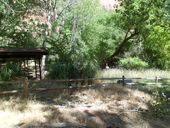
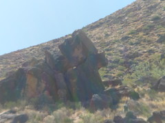
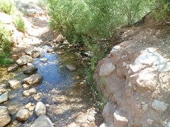
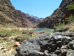
The warning sign is very clear: “Down is optional. Up is mandatory”. I was determined I would get to the Colorado River and back, within one 24-hour time period. There are things one can do to make that happen- drink the water that is available at three locations along the way, soak the shirt and hat, copiously. (Women can do this, discretely, and most of us men are gentlemanly enough to turn ourselves away). Lastly, take advantage of the four rest houses and numerous rock overhangs that provide shade.
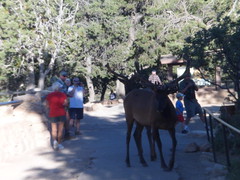
I set out from Mather Campground at 6:30 A.M., on Wednesday, the “Longest Day” of the northern year. Greeting several of us at the trailhead were a pair of elk.
The little boy on the right was my steadfast friend on the first 1/2 mile of the hike. Then he fell back to rejoin his father.
There are 21 more photos in this post. Bear with me.
I started off in earnest at 7:00 A.M.
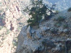
The top layers are Kaibab and Toroweap Limestone, respectively. Toroweap makes the sheer wall one sees just below the surface.
A few big horn sheep were keeping us company during the first half mile. There were also mule deer, which were a lot more skittish.
We pass through two windows within the first mile of the trail. Next are two views of the Toroweap Limestone wall.
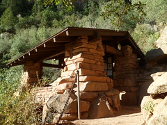
Not far away, I spotted the 1.5 Mile Rest House. This is very welcome in the afternoon! Below is a close-up of the rest house. Those at 3 Mile, Indian Garden and Pipe Creek are quite similar. Water is available at the first three, and all four have toilets.
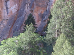
Below 1.5 Mile, there is a solid layer of Coconino Sandstone.
As I neared Indian Garden, an NPS helicopter landed. This appeared to be a wild animal transfer of some kind. The ranger had his tranquilizer gun out, so it may have been a mountain lion, which would not have been welcome at Indian Garden Campground!
The Colorado Plateau is largely desert, at its lower elevations. Indian Garden offers a lush oasis, for about 1 1/2 miles, along Garden Creek.
Above, Undivided Dolomite and Mujav Limestone are your hosts, heading from Indian Garden to Devil’s Corkscrew. This rock layer is from the Cambrian Era.
Garden Creek remains a friendly helper, for about a mile past Indian Garden.
Devil’s Corkscrew is a mixture of Zoroaster Granite, Nankoweap Sandstone and Gardenas Lava. Dox Sandstone makes up the bottom layer, where one gets to Pipe Creek. This is a 2.5 segment of extreme desert, with triple digit temperatures in the afternoon. Be fit, or turn around!
I took this from underneath a rock overhang, along the Corkscrew. This postpile is of Dox Sandstone.
The emergence of Pipe Creek, and the presence of blue dashers, signal that the river is close by. I tried to encourage a couple of ladies to keep going the last mile or so. Apparently, they’d had enough. A man who came by while I was at Pipe Creek Resthouse said he saw them soak their shirts and head back towards the Corkscrew. I never saw them after that, so they made it out. Always follow your gut, in these situations.
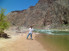
At 11;30 A.M., I reached the Colorado River, at Pipe Beach. The rock you see along the north bank is Bass Limestone and Vishnu Schist. This is all the legacy of Pre-Cambrian Earth, when everything lived underwater.
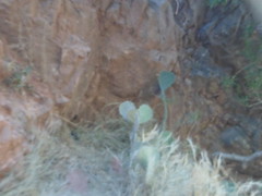
I rested, had lunch and soaked my feet at Pipe Creek Resthouse, after chatting with a couple who were kind enough to record my presence (above), and taking their photos, in turn. It took from 12:15 to 6:38 P.M. to return from the river to the rim. There were confirmations along the way, and I was constantly reminded that I would be just fine. One of those was a heart-shaped prickly pear cactus.
Here are the Navajo Sandstone and Toroweap Limestone layers, in late afternoon.
I had the good fortune to meet up with three people from Tusayan, when I got to 3-Mile Rest House. They pretty much stayed with me the rest of the way. It was their first Canyon hike, and two of them said it would be their last. I would be surprised if that were the case. Cooler weather brings a much different Grand Canyon experience.
I cannot say enough good about the rangers. These are among the hardest-working young people I’ve ever seen. They keep very close watch on hikers, and will be the adults in the room, when one’s judgment gets cloudy. I got through the Longest Day by following their guidelines. Though traveling rim to river and back on foot is discouraged, it can be done- if one is in good shape, takes his/her time and stays hydrated.
I had not been in the Grand Canyon since Penny and I went in June, 1981. We slept in the open that night. In 1983, we went for a day trip to the North Rim, but only went about a mile on the North Kaibab. We took Aram along the Rim Trail in 1996.
About a month ago, I read about the Alzheimer’s Association having a Longest Day campaign, to raise awareness on the plague of dementia. I didn’t have the money to formally register for the event, but decided to do a hike along the Bright Angel Trail, to make a statement, and maybe better-off people would feel like chipping in, on their own.
So, Tuesday afternoon, I headed north, through Williams and Valle, to the South Rim. Williams is the southern terminus of the Grand Canyon Railroad, a narrow-gauge system that also goes to the South Rim, ending at Bright Angel Lodge.
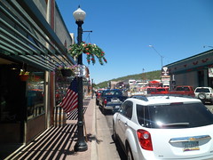
Here are a couple views of Williams.
Williams was named for Bill Williams, a roguish mountain man of the mid- Nineteenth Century, who is also the namesake of nearby Bill Williams Mountain, which I plan to hike over Labor Day weekend. His name extends to a river which flows from this area into the desert between Wickenburg and Kingman, eventually meeting the Colorado River, south of Lake Havasu City.
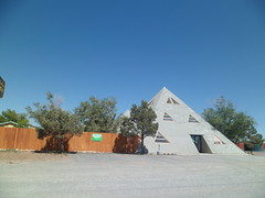
After a nice cup of joe at American Flyer, I headed on to Valle, home of Flintstones’ Bedrock City- a nice diversion for families with very young children. The outfitters’ supply store in Valle is made up of two pyramids.
The area from here to Tusayan varies between grassland and pine forest, but mostly has the former.
There are occasional buttes, like this one just north of Valle.
I got into Tusayan, the service town just southwest of the park, and purchased a few more necessaries, like granola for breakfast and ice for the cooler. Then, it was off to the campsite. Like South Carlsbad State Beach before it, Mather Campground was full. I took my reserved spot, at the tail end of the grounds and jerry-rigged my rodded tent, using twine and string. It served its purpose and any snickers were kept to a dull roar. NOTE TO SELF: Pick up some tent rods next week, before the three-day camp-out.
Here are a few shots around the Mather Campground area:
It’s dry here, so the ponderosas need all the help they can get.
At 6:30 PM, Ranger Kim gave a talk on the area’s wildlife.
At 7:15, one of her subjects introduced herself.
I arrived at Mather Point, the site of my evening photo shoot, around 7:20. Here is what awaited.
This is Kaibab Limestone, the topmost (for now) layer of the Grand Canyon.
Here is a formation of Navajo Sandstone.
Various Coconino and Toroweap (Limestone) formations bid farewell to the Sun.
This ominous looking creature is an outcropping of Kaibab Limestone.
Coconino Sandstone and Hermit Shale in twilight were awe-inspiring. These sights evoke my bird fantasies.
Sunset at any of the overlooks is a must-see. Now, for the piece-de-resistance.
This is one of the features that made me fall in love with this canyon. Next, I will present some of the others.
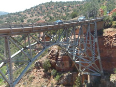
I went to Sedona today, on a whim. In 1983, Penny and I climbed a mountain called Wilson Mountain. It is about 1.7 miles northeast of Sedona proper, just across a span called Midgely Bridge.
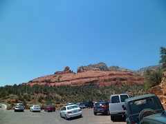
This being Father’s Day in Sedona, of course I parked by the side of the road.
The majestic red rocks of Sedona speak for themselves. I will not interrupt.
Wilson Mountain trail itself wends away from the red rocks and is a sun-drenched, rugged high desert mountain hike. For this reason, as I had started late, due to a morning some commitment, I stopped at the saddle and leave the crest for another time. I did this with some nudging from the angel on my shoulder. She indicated she would not be happy with me if I over-stressed myself. That would have made two of us.
Still, it was a fine 5.4 mile round trip, and took me through some amazing country.
Above, one can view Oak Creek Canyon from the trail.
This rock formation lies midway up South Wilson Mountain
The flowering agave, below, is the tallest I’ve seen.
Here is what remains for me to explore here, on a slightly cooler day, maybe in early November.
After retracing my steps down Wilson Mountain trail, I looked down a bit at the coolness of Oak Creek and its canyon.
While I waited my turn to view Oak Creek at the overlook, a family from the Caribbean made a short video. As a token of gratitude for my waiting, the father of the family took this:
This was a fine Father’s Day, topped off with a Tuscan Tuna Salad and Mango Frappe at this fine establishment:
Canyon Breeze’s back patio gives a lovely view of the red rocks, while one savours its delicacies.
I had the opportunity to see and savor the Gulf of Mexico twice today. After saturating my senses with SPI’s Birding Station and Wildlife Sanctuary, I headed across the road to the city’s Andy Bowie Beach Park. The basics are all here- rolling dunes, vegetative windbreak, a roiling surf and strong undertow- but with a shallow sea level, as far as five miles out. This gives the surf a sandy, brownish tinge. It doesn’t feel gritty, though. Truth be known, I was glad to be back in the water. It has been 21 years since I was last in the ocean- that was in Korea. I’ve been around it, in SoCal, Massachusetts and New Jersey, but to put on a swimsuit, beach shoes and full-body sunblock- not since 1991.
So, on Thursday afternoon, I went to a swim shop, and got two new swimsuits, and beach shoes. Friday morning (5/25), I was one with the surf, for thirty five or forty minutes. Then, I walked along Bowie Beach for about 1 1/2 miles, just letting the surf do its thing on my feet- perfect. The Gulf is a comfortable 75 degrees.
Here are some things I saw at Bowie Beach.
The dunes here are well covered, a good plan to avoid erosion.
Here’s a casualty of a short attention span.
The tide was slowly coming in.
These condos are a risk for a low-lying, hurricane-prone island, but are better-built than some of their predecessors.
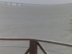
I took this shot of the South Padre Island- Port Isabel Bridge, from Pier 19, at the island’s southern tip.
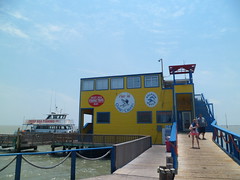
Here’s Pier 19, where I indulged on more seafood enchiladas.
Across the narrow channel from South Padre’s own southern tip, is Boca Chica. The peninsula is about four miles, north to south, and ends where the Rio Grande empties into the Gulf. Part of me wanted to see this, but when I got there, it was thirty minutes until sunset, and security concerns kept me back.
I still got to see Boca Chica’s rather primitive and captivating beach.
Boca Chica’s dunes are more highly sculpted than those of South Padre.
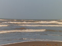
The surf towards sundown was every bit as feisty as earlier.
I was able to get a shot of the Rio Grande, about three miles shy of its confluence with the Gulf. Across the river is an area once known as Bagdad, Tamaulipas.
A sidelight to the story of this border region is the last battle of the Civil War, fought AFTER Robert E.Lee surrendered at Appomattox. Tejano cotton traders, led by Santos Benavides, defeated a force of Union regulars at Rancho Palmito.
In between the two beaches, I spent two hours in the delightful town of Port Isabel. Its treasures comprise Day 8, Part 3.
As I headed south on Thursday afternoon, my intention was to go into Brownsville, get a room, and check out the mouth of the Rio Grande at Boca Chica. Sometimes, the angel on my shoulder can gently get me to change direction. When I got to the turn-off to South Padre Island, a whisper told me to turn left and go over the bridge. I did so, and was rewarded with an affordable motel room at Island Inn, and visits to both the western, or Laguna Madre side of the island, and to the eastern, or Gulf side.
South Padre Island was detached from the rest of the barrier island by the dredging of Port Mansfield Channel in 1964. It’s relative isolation spurred economic development as a beach resort. The presence of condominiums along the Gulf side increases the risk of hurricane-induced damage, both to the structures and to the sand dunes that lie in from the shore.
The island is nonetheless captivating, though, and I spent about an hour Thursday afternoon , and two hours on Friday morning, taking in the SPI Birding Station and Wildlife Sanctuary and its attendant boardwalk, which takes the visitor out onto platforms overlooking serene Laguna Madre, on the bay side of the island.
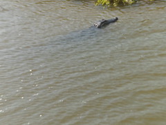
Birds, fish, crustaceans and four American alligators, may be seen below the boardwalk, at work and at play.
The facility is a five-story wonder.
Here is a view of the Boardwalk, which juts out into Laguna Madre. There are 7 viewing platforms and 8 sections of Boardwalk, overlooking both bay and marsh.
Pintails like both marsh and bay.
Alligators have found their way to South Padre. A family of four is here now, with more eggs preparing to hatch.
Great blue herons, gallinules and egrets top the list of shore birds who enthrall birders by the dozens.
The glistening bay may be appreciated, both at eye level, and from the fifth floor lookout.
With all of South Padre Island’s natural wonders, the greatest and dearest wonder is the strength of its people. The community has organized a Memorial Park, just north of the Birding Station. Great local leaders, and lost youths, are commemorated here.
Among the fallen, Alyson Marie Knight, 18 at the time of her passing, stood out to me.
I trust the people of this beautiful island may always have Alyson’s stars to hold.
Next, Day 8, Part 2, Andy Bowie Beach Park and Boca Chica
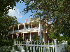
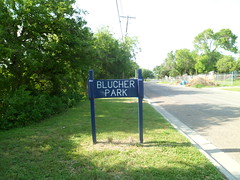
Corpus Christi has made a concerted effort to preserve the semi-tropical forest in its midst, thanks largely to George Blucher. He was a son of Felix von Blucher, an early settler of the Corpus Christi area, and with his siblings, managed his father’s ranch and coastal properties, until his own passing in 1929. His house is still maintained as a Bed and Breakfast and is registered with the Texas Historical Commission.
The park is across the street from the B & B. I post these photos, without further comment, so that you get a sense of the serenity, even in the midst of a busy neighbourhood.
After this delightful walk, I headed south on US 77, towards the Rio Grande Valley. Along the way, I passed through the countryside that was home to John G. Kenedy, the benefactor to Corpus Christi’s Catholic diocese. His ranch is a Texas Historic Site, near Falfurrias.
Here is a glimpse of the area. It’s known as the Wild Horse Desert.
Now I got to experience a bit of Texas’ other wild side. I had no idea what to expect when I got to Pedernales Falls, except that there would be more bus loads of kids, which, as I said earlier, suits me just fine.
The bucolic nature of Johnson City gave me a sense of peace and dignity that one looses in even the finest of cities. It’s no wonder such a hyperactive man as Lyndon Baines Johnson could actually clear his head here.
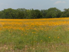
I was greeted by the wildflowers which so inspired Lady Bird.
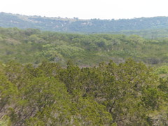
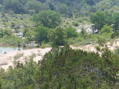
The broad reach of the Texas Hills dispels the myth of “Big Flat’.
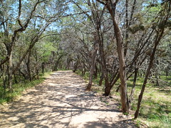
I set off down this path, towards the wonderland created by wind and water.
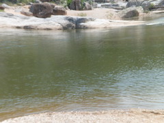
This is what brought peace to one of the most tortured minds of the Twentieth Century.
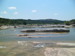
I will let the following photo montage speak for itself.
The limestone does get quite slippery for us humans, but flowering plants know how to get a grip.
Never doubt, though, the power of water to dig its own hole.
By the time I got to the Falls area, the high school kids were on their way back to the buses. So, I had Mother Nature’s energy pretty much to myself. It’s days like this that kept me on track with my overall purpose of showing the real beauty of Texas to that portion of the world that shares my life.
Next, Johnson City and Luckenbach.
This sweet morning set me to thinking about replenishing my own beach wear. That would be done later, in South Padre Island.
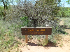
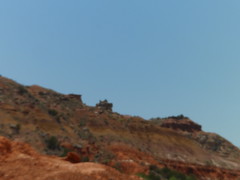
Yesterday, I went to America’s second longest canyon- Palo Duro, about nineteen miles south of Amarillo. You can see photos of this marvelous place at http://www.palodurocanyon.com/. They are copyrighted, so I can’t show them here. I had a great time walking along Paseo Del Rio, which goes along the Prairie Dog Town Fork of the Red River. At a place called The Sha-la-ko (Rain Maker), I felt a very strong vibration, for about a minute or so. This spot is a vortex, much like several places in Sedona, and a few in Prescott.
I also hiked to the base of Lighthouse Peak, another striking landmark. The heat kept me from going to the top, which is probably a sign of encroaching wisdom.
After stopping at the Trading Post for a sports drink and some soft-serve ice cream, I picked up a silver wind chime for one of my generous hosts, and headed to the city of Canyon, and the humongous Panhandle Plains Historical Museum.
The security guard told me that only 2 % of the museum’s collection is on display, at any given time. I learned a great deal about the Battle of Palo Duro, where Col. McKenzie’s forces fought to a draw against a combined force of Kiowas, Comanches and Southern Cheyennes, led by Quanah Parker. Chief Parker never surrendered, but made his peace with the whites, and led his people into a settled life of farming. I will have more about him in my next post.
I caught up with @texastidbits around 6:30 PM, at one of his frequent haunts. I got to meet a few of his friends this time. The girl he calls “Freckles” heard my story, surprised that I was out and about, after having been widowed. Truth is, though, Penny and I lived much the same life, before her illness. Around eight, I headed out of Amarillo and got as far as Childress, 106 miles southeast, before running out of steam. For some reason, the motel people were on edge, and very wary of my being alone and casually dressed. I got a room anyway, and rested for the night, before moving on towards Fort Worth.
Wednesday night began my second visit to Enid, OK. As before, my purpose was to connect with @plantinthewindow. It took me a while longer to get from Guymon, where I had dinner at Yesterday’s, a Fifties-style diner, to the new wildcat oil drilling capital of the Southwest. I found one of the results of the wildcatting: Few rooms at the inn, any inn.
I found the last available room in Enid, at midnight, and gladly took it.
The next morning (Thursday) I met up with John, and went first to Enid’s landfill (below),
then to breakfast and on to the Gloss Mountains, so-named because of the glossy gypsum that used to cover the tops of the buttes. It has mostly worn away, and now shards of gypsum are ubiquitous on top. This was a first hike for John’s newly adopted dog, Cabella.
This area is close enough to both Enid and Woodward, yet we had few other fellow hikers on Thursday morning. I know- most people work. That just gives me more incentive to stop and smell the flowers.
The “gloss” may be discerned, as well:
Above right is a small cave. There are many caves in an area just to the west of here.
Another interesting enterprise in Enid is Johnson’s Jewelers. The business began in the 1940’s, and is now operated by its second set of owners. The establishment is focused not on fine jewelry, per se, but on what the earth has provided us directly.
Fossils, arrow points and geodes abound. A favorite is the barite rose, Oklahoma’s state rock, so called because of its reddish hue and flower-like ridges. We each picked up some items to give to deserving friends and family. Here are some scenes from the store.
Before closing, I must tip my hat to downtown Enid.