What’s The Point?

2

August 22, 2023- The robust cat sat in my carport, right by the hatchback, and looked at me, as if tho say: “Have you thought this through? Are you sure you want to go up to the South Rim?” It was raining lightly, which was one reason why the cat was sitting in that dry spot. I had, however, looked at the weather forecast for Grand Canyon, and saw PC (partly cloudy).

So, northward I went. Stopping at my Williams favourite, Brewed Awakenings, I fueled up with a Light Wrap and coffee, then headed up to the Park, an hour away from downtown Williams. The first hour or so of my shuttle bus ride/walk was quite pleasant. I took these shots of the Bright Angel Trail, from Trailview Point, just to the west of the Bright Angel.

Bright Angel Trail, seen from the west.
More of the Bright Angel Trail, from the west.
Approaching rain, from Trailview Point

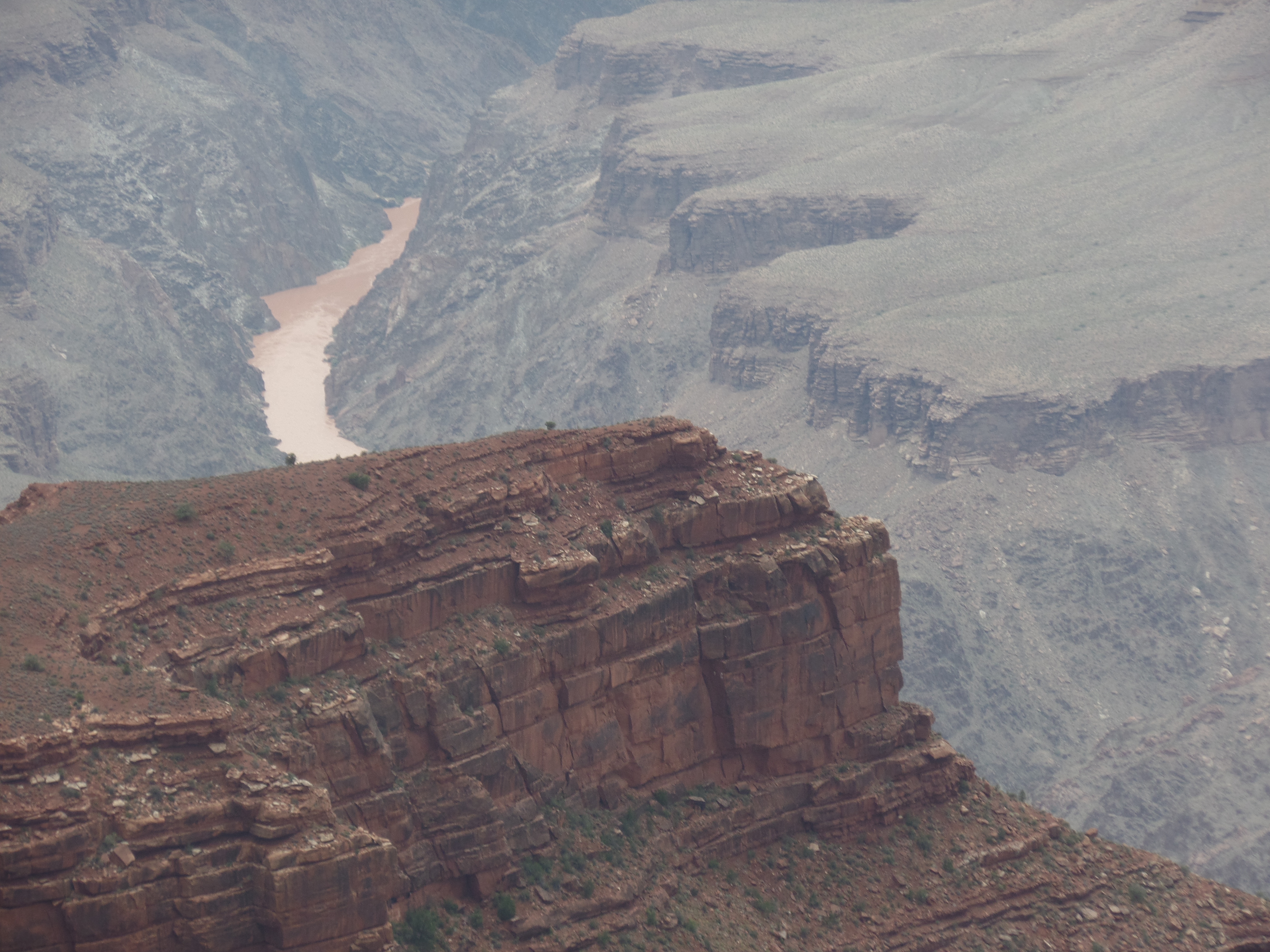
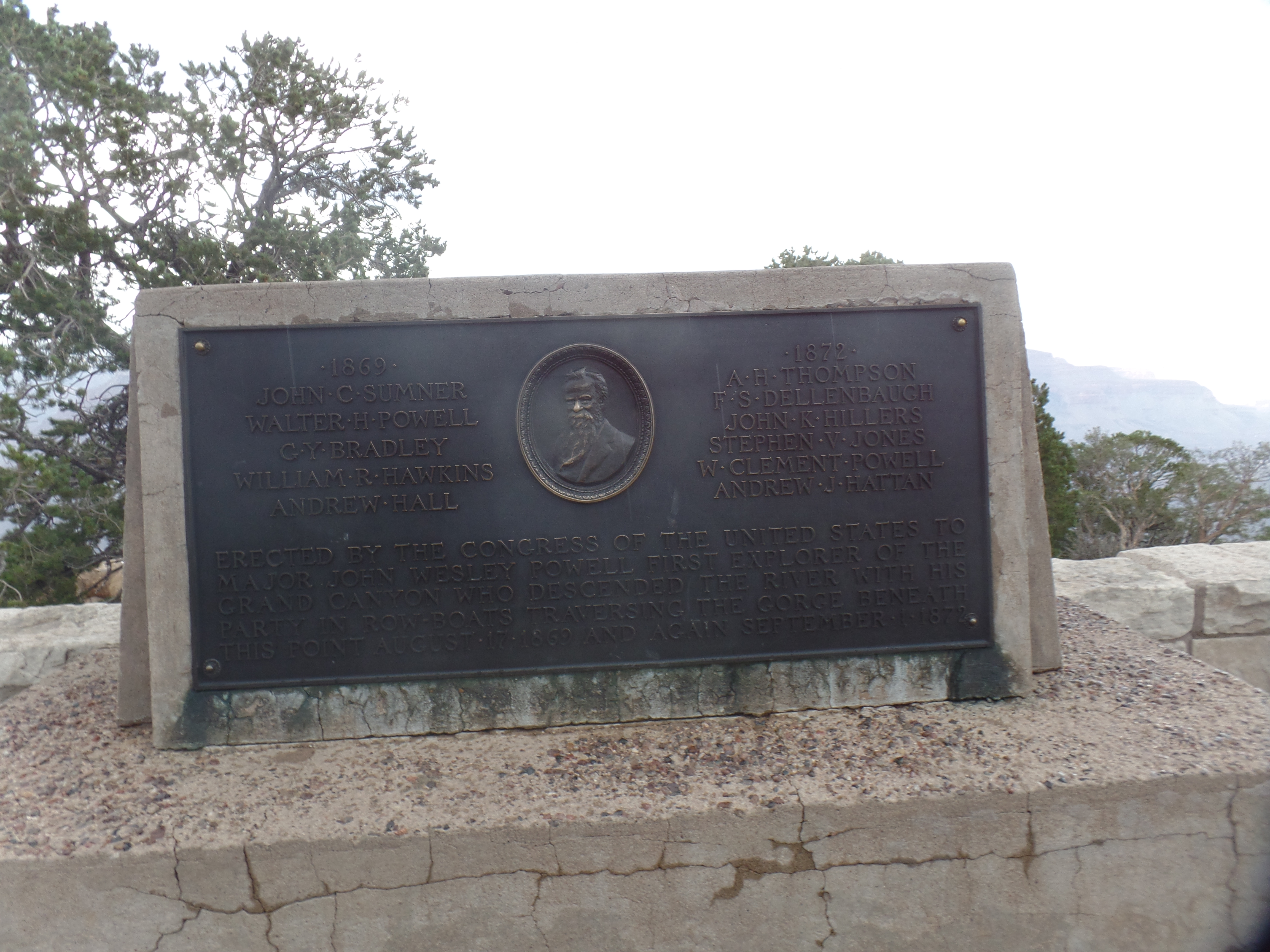
I got back on the shuttle bus and headed to Hopi Point, from where I planned to walk back towards the JW Powell Memorial and Maricopa Point. I got in these shots at Hopi.

Hopi Point and the Colorado River below.
Approaching storm, from Hopi Point

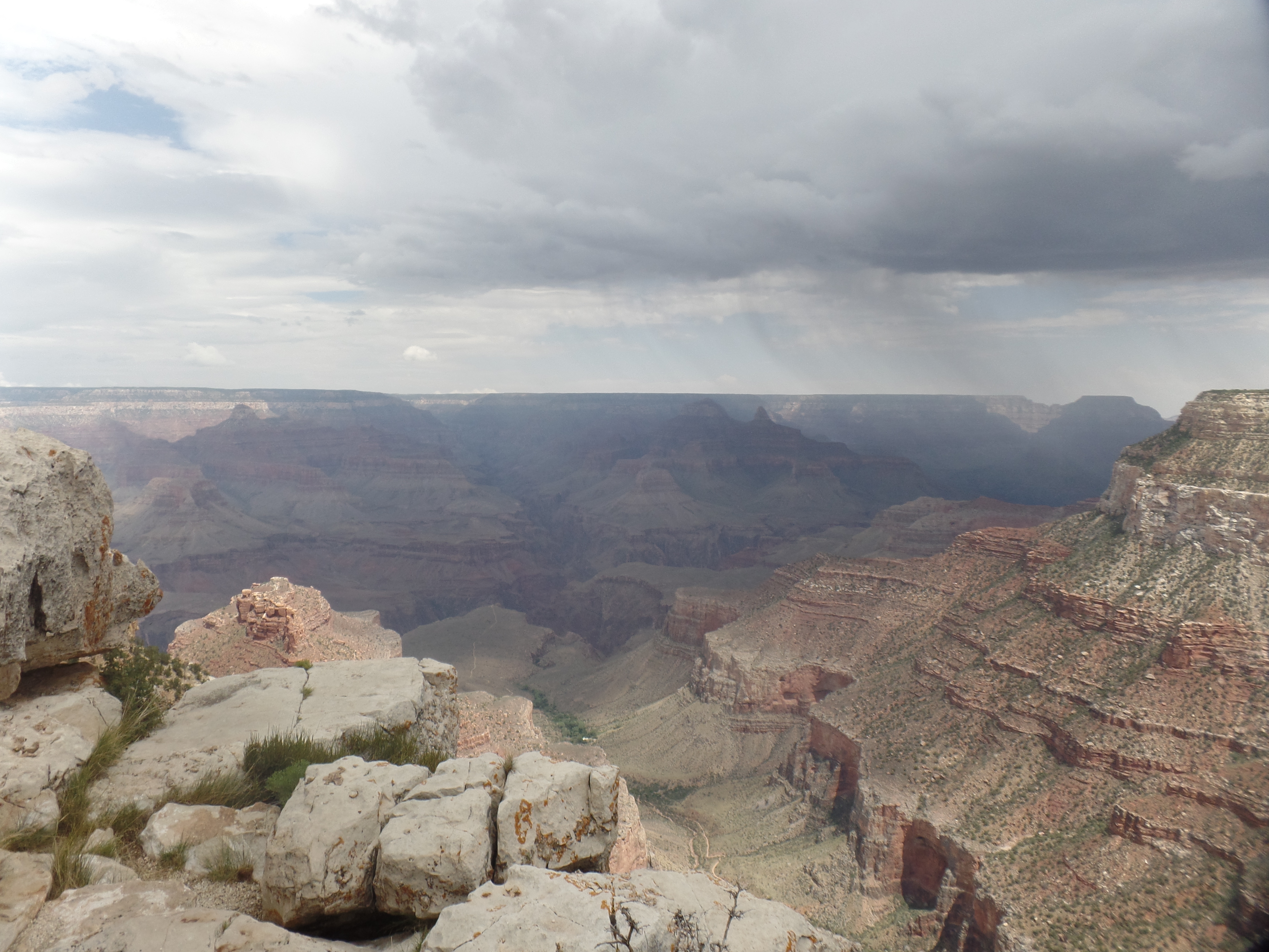
I walked the short distance from Hopi Point to the Powell Memorial. It was then that lightning flashed in the east, a bus driver told me that we would all be evacuated from the Hermit Sector (the near west segment of the Rim Trail, which I had planned to explore in its entirety) and I found a spot to wait for an empty bus, as his was full. In about ten minutes, one arrived and took a bunch of us back to the transfer station. I went into Bright Angel Lodge and had a leisurely lunch, then returned to the transfer point and waited with about sixty other people, for the lightning danger to abate.

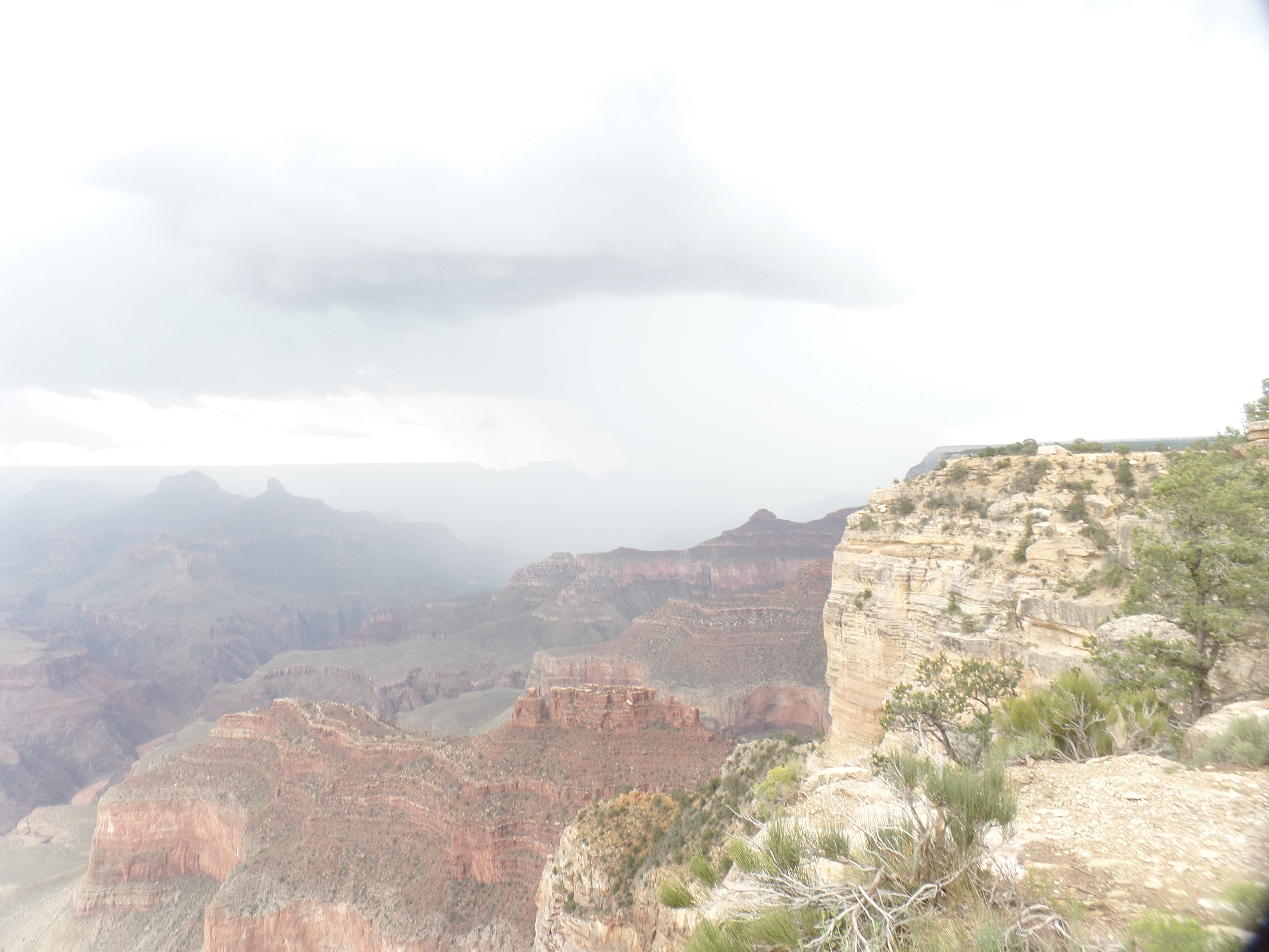
After about forty minutes, the storm was judged to have let up, and we went back towards Hermits Rest. I got off at Maricopa Point, walking about 200 yards, to these scenes.

Trailview Point, from Maricopa Point
Colorado River, from Maricopa Point
The defunct Orphan Mine (copper and uranium) was just below Maricopa Point. It is marked by this memorial.

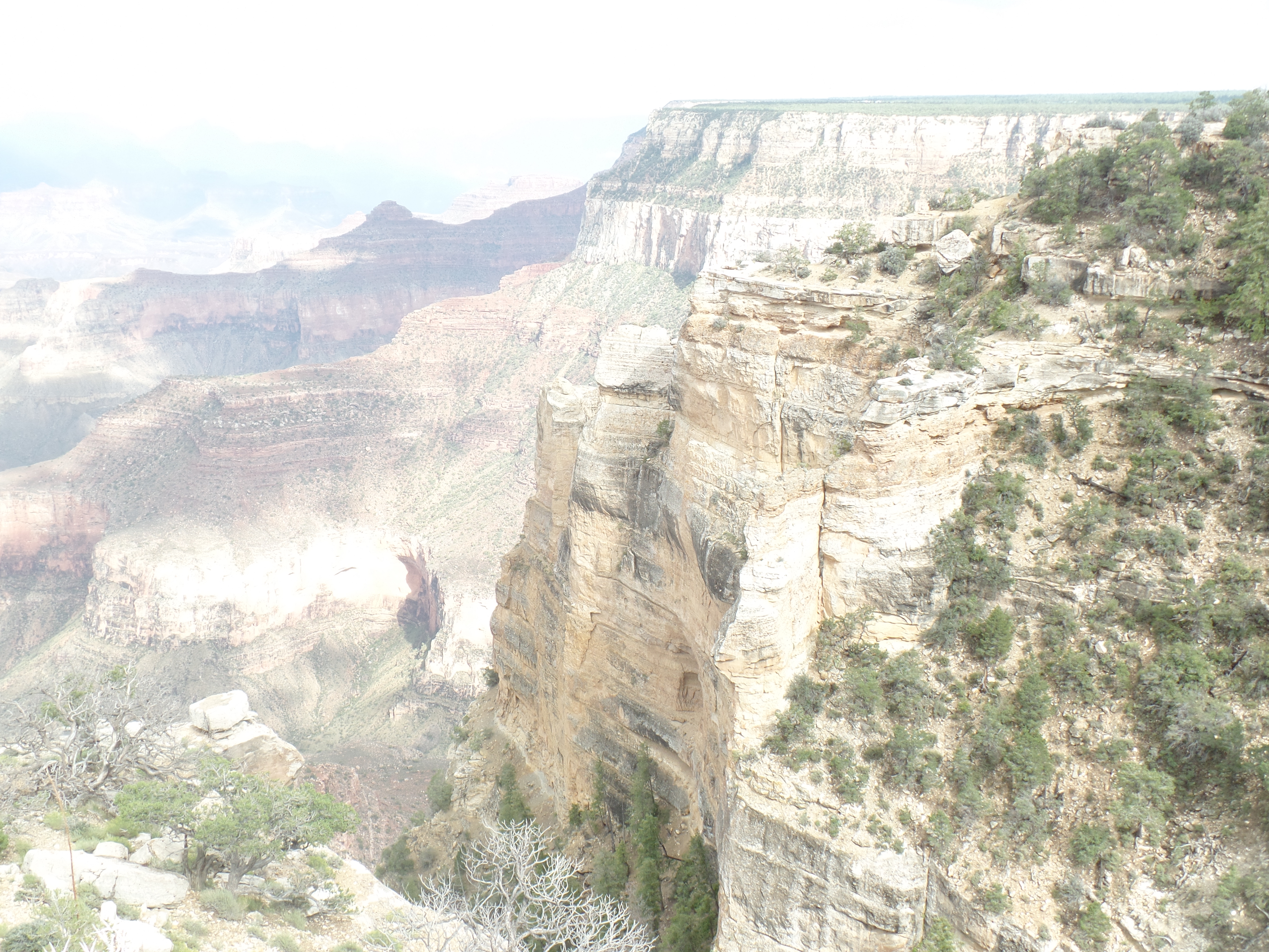
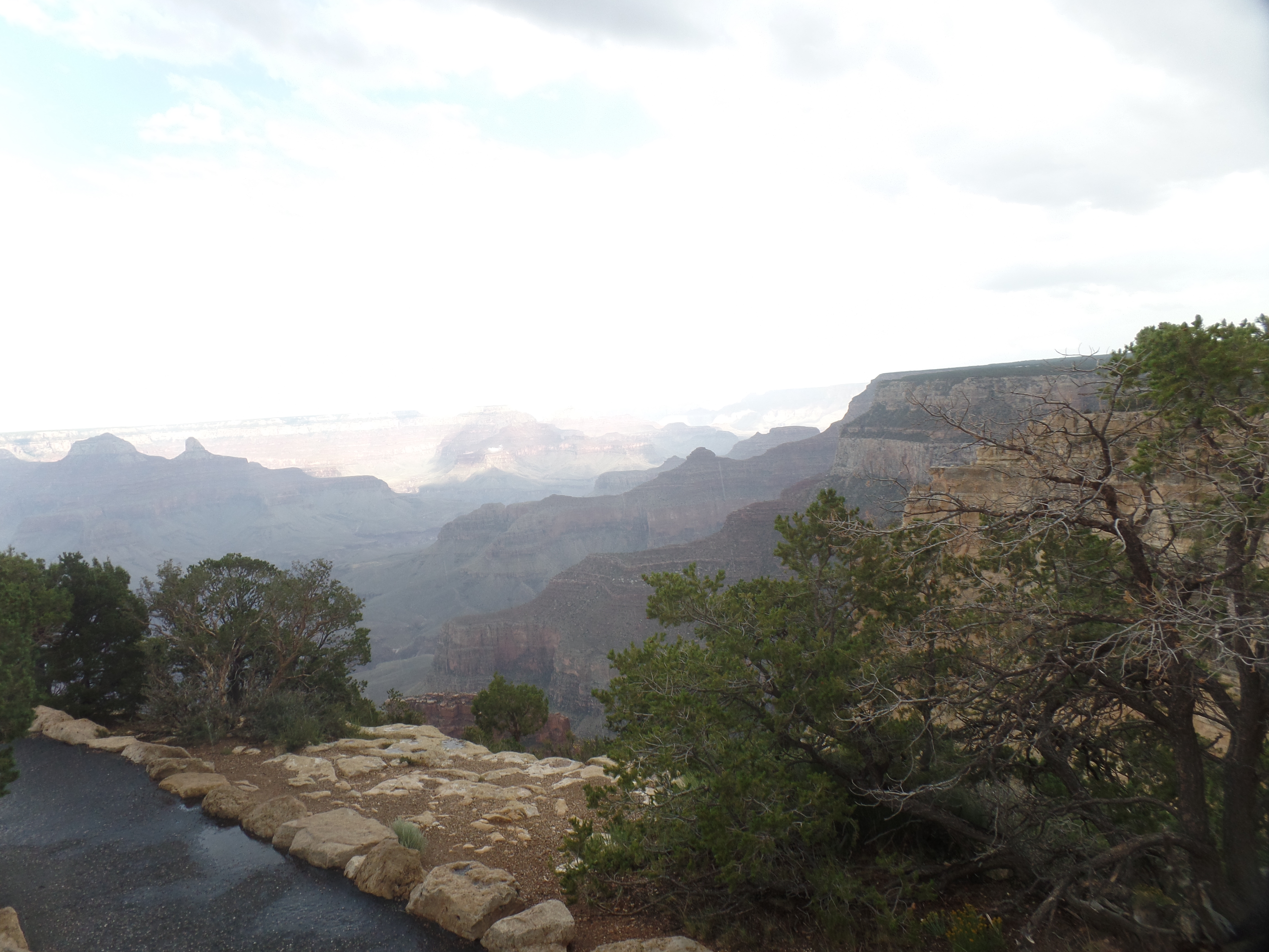
As it was still not raining again, yet, I walked the .9 miles from Maricopa to Powell Memorial.

Plaque memorializing John Wesley Powell, first American navigator of the Colorado River, in the Grand Canyon.
View of canyon, from Powell Point

Once I got this shot off, the rain began to return, and we were evacuated a second time. I commiserated with the shuttle driver, as it must be quite frustrating to have to repeat an evacuation, only an hour after the first one was lifted. Needless to say, it was time to head for the car and towards home base.

There was a slight hitch in that, as well. The road back to Williams goes through Tusayan, and that little tourist village was flooded. The county sheriff had a road block up, which put those staying in Tusayan, Valle or Williams-or who were scheduled to fly out of Grand Canyon Airport, in a bit of a pickle. For me, it meant driving back by way of Cameron and Flagstaff, which I did. On the way to Cameron, I saw one thing we on the Hermit Sector missed: A huge pile of hail had remnants at roadside, from Mather Point, east to Desert View.

Let it not be said that this year’s monsoon was a total bust.

Everyone’s Big Hole

0

December 23, 2019, Grand Canyon Village-

The Centenary of Grand Canyon National Park is drawing to a close.  So, naturally, the combination of  time to spare and my daughter-in-law’s visit led to us going up to the South Rim, this morning, and spending the day, walking along the paved Rim Trail, from Mather Point to Maricopa Point.

We had spent last night in our respective rooms, at the comfortable America’s Best Value, in Williams.  The high point of yesterday was a visit to the Scheinlen-Pena family, in Paulden (of whom, more tomorrow).  After being warmed by thick, nutritious soup and salad, we headed to Williams, so as to not spend time going back over the same route, this morning.

The Grand Canyon seemed to strike Yunhee in a way similar to the impression it first makes on others:  It’s almost incomprehensible in its size.  Of course, photos don’t do it justice (though I’ll post a few, anyway.)  The best thing to do here is to choose a few spots where the magnitude of the place can be somewhat encapsulated.

So, here are four such interludes:

Mather Point- An introduction to the Canyon, for many, as it is near the Visitors’ Center.  Yunhee opted out of the 22-minute intro video, in favour of direct contact with the view from the Rim.

SAMSUNG CAMERA PICTURES

Yavapai Point:  Here is a view of a cave that would seem to be a rock climber’s dream and probably something on which I’d pass.

SAMSUNG CAMERA PICTURES

Along the Rim Trail, just shy of this village:  There is a fairly new display, all along the Rim Trail, which shows stone that is from increasingly ancient layers of rock.  This Dox Sandstone dates from one billion, one hundred thirty million years ago.

SAMSUNG CAMERA PICTURES

The El Tovar Hotel:  Grand Canyon Village, being home to some, and a welcoming host to countless others, does holidays up nicely!

SAMSUNG CAMERA PICTURES

Kolb Brothers Studio:  Here is a place that’s both historical and full of artistry.  The brothers were photographers here, alternately in conflict and grudging cooperation with Fred Harvey’s Lookout Studio, from 1901-1976.  Today, both the Lookout Studio and Kolb Brothers Studio are gift shops and prime places from which to view the Canyon,

SAMSUNG CAMERA PICTURES

as well as the Village:

SAMSUNG CAMERA PICTURES

Near Hopi Point:  Crevices always interest me, though not to the extent that I’d try to straddle one.

SAMSUNG CAMERA PICTURES

Near Maricopa Point:   The Canyon is evolving, and that means there will be collapses along its many walls, as well as continued uplift.

SAMSUNG CAMERA PICTURES

Next year will bring a few more visits to Everyone’s Hole:  A jaunt from Maricopa Point to Hermit’s Rest, on the west side of South Rim, in late March and a hike on the Uncle Jim Trail, North Rim, on what would have been my late Uncle Jim’s 86th birthday, June 3.