Journey 3 Gets Moving

2

August 31, 2023, Cortez- The Super Blue Moon is playing peek-a-boo, thanks to the intermittent cloud cover in the eastern sky. I am here in Colorado’s anchor to the Four Corners region, having just enjoyed a dinner in my favourite restaurant in town: Farm Bistro.

Setting out from Home Base, after running someone to a doctor’s appointment, I encountered no obstacles or diversions, on what is now a familiar route. The greatest part of the journey goes through the Navajo Nation. Like many areas of the country, Dinetah is gradually seeing an uplift in its infrastructure, while other segments of that framework remain challenging. Communities that were once food deserts, like Dennehotso, Shonto and Teec Nos Pos (“teese naws poss”) are seeing a resurgence in dry farming techniques and have clean, modern convenience markets. The highways are in fairly good shape, but highways need constant repair and attention, anywhere in the world. Running water, electricity and wireless fidelity have a ways to go, before becoming universal. I am always at home, in either the Navajo Nation or Ute Mountain Tribe, and always show respect for the privacy and dignity of the people, as should be done anywhere.

Cortez, is as ever, a welcoming, full-service community. Farm Bistro, where I have dined several times, has a bustling and friendly staff-working extra hard to serve the unexpectedly early Labor Day crowd. Looks like a four-day weekend is afoot.

NEXT: Across southern Colorado and up to C-Springs

J.R.

8

August 30, 2023- On the patio of a coffee house, in Ocean Springs, MS, in early 2015, the bearded sage talked of his Golden Circle-an area between Knoxville, TN and Sylacauga, AL, where he preferred to do his exploration-finding hidden gems in places he’d visited countless times before. He loved his caves-as places to wander, and his waterfalls, as places to sit and wonder. He urged me to develop a similar relationship with my own chosen Home Base, as “traveling far distances can get old”.

J.R. Cline’s idea of a long journey was a drive to New Orleans, a city he loved passionately. He took his last several trios there in his motor home, on occasion taking along the son of his closest friends-and of course, his faithful dog went everywhere with him, until the animal died. a few years back.

I saw Ralph, as his close friends called him, a couple of other times, within the bounds of the Golden Circle, once in Cleveland, TN and once just outside Knoxville. He touted what he called “Pig Wings”, white pork loin formed the way one would prepare “boneless chicken wings” and deep fried. I later had them, somewhere in Texas, and found them as tasty as their avian counterparts, though both he and I cut back on our consumption of fried foods, a few years ago. He loved his family in Knoxville and his adopted family in Sylacauga, equally well, spending his final days with the latter.

J.R. left this plane a few days ago, and left us all with the fondest of memories. On the way back from Massachusetts and Pennsylvania, I will put in a visit to his beloved Rock City, in Chattanooga, in his memory and seek to offer condolences to both families, hopefully in person. I might even cheat and nibble some Pig Wings, at that place near Childersburg, Alabama.

J.R., having greeted us a few days ago, “from the ether”, let me wish you an amazing solo flight in the Great Beyond. Your life here was amazing; thanks for sharing.

Humanity Isn’t Minimized

4

August 23, 2023- In August, 1974, a family visiting from Montreal had taken a cabin at a resort, in western Maine, where I was working for the summer. A fire was built in the hearth, then thinking that it would be secure and burn itself out-in the hearth, the family went to bed. At 2 a.m., the older daughter, 13, smelled smoke and got her parents and sister up and out of the cabin. I was one of the volunteer firefighters who did the best we could to extinguish the fire-and did keep it from spreading. Many of the other crew members were year-round residents of the village. Their own homes would have been at serious risk, in short order, had the blaze spread.

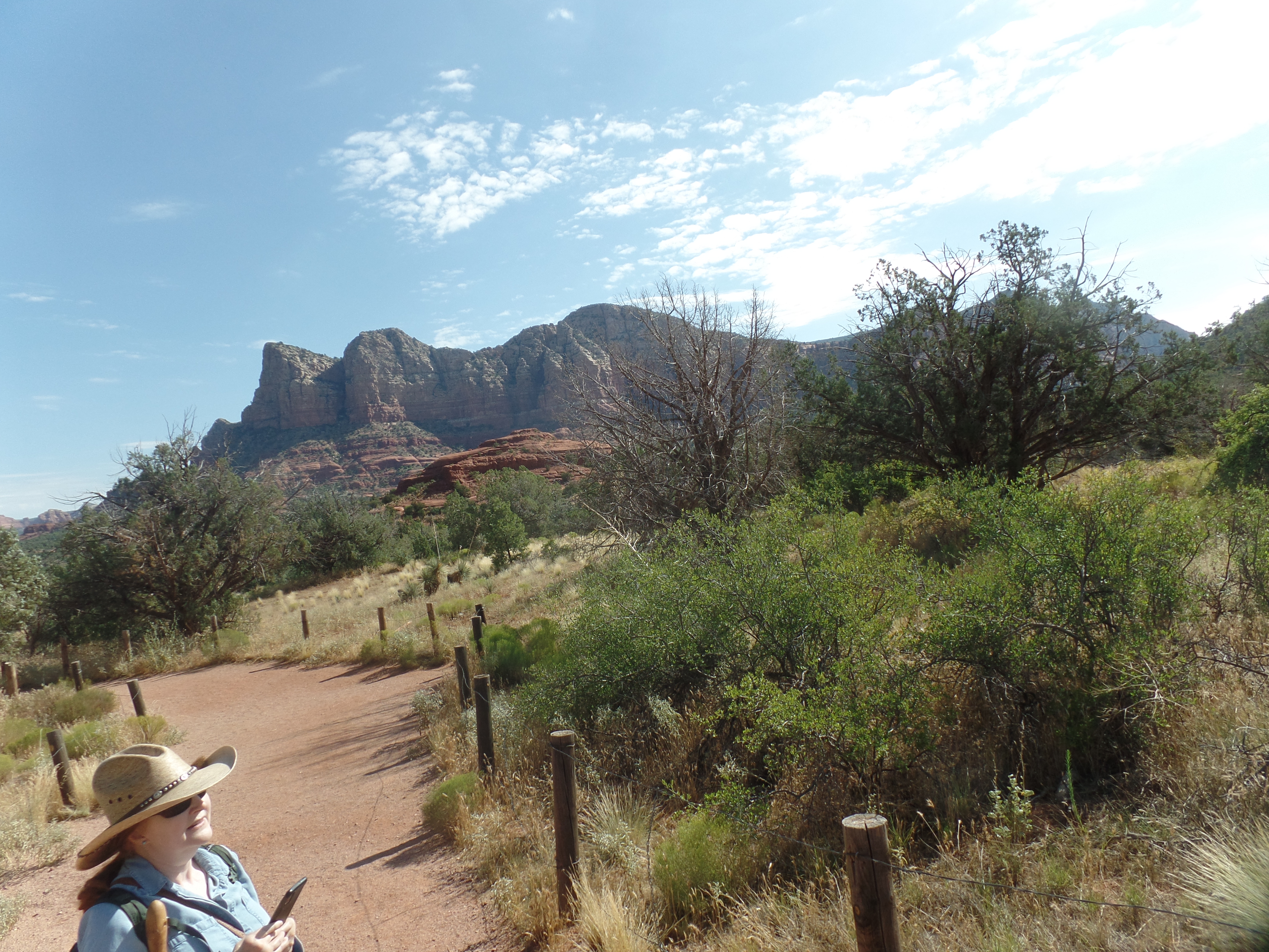
Tusayan is a small town, of about 6,000 people, most of whom work in service industries connected to Grand Canyon National Park’s South Rim. There are also those who serve the servers: The Coconino County Sheriff’s Substation, the Grand Canyon Unified School District and the Town of Tusayan’s government.

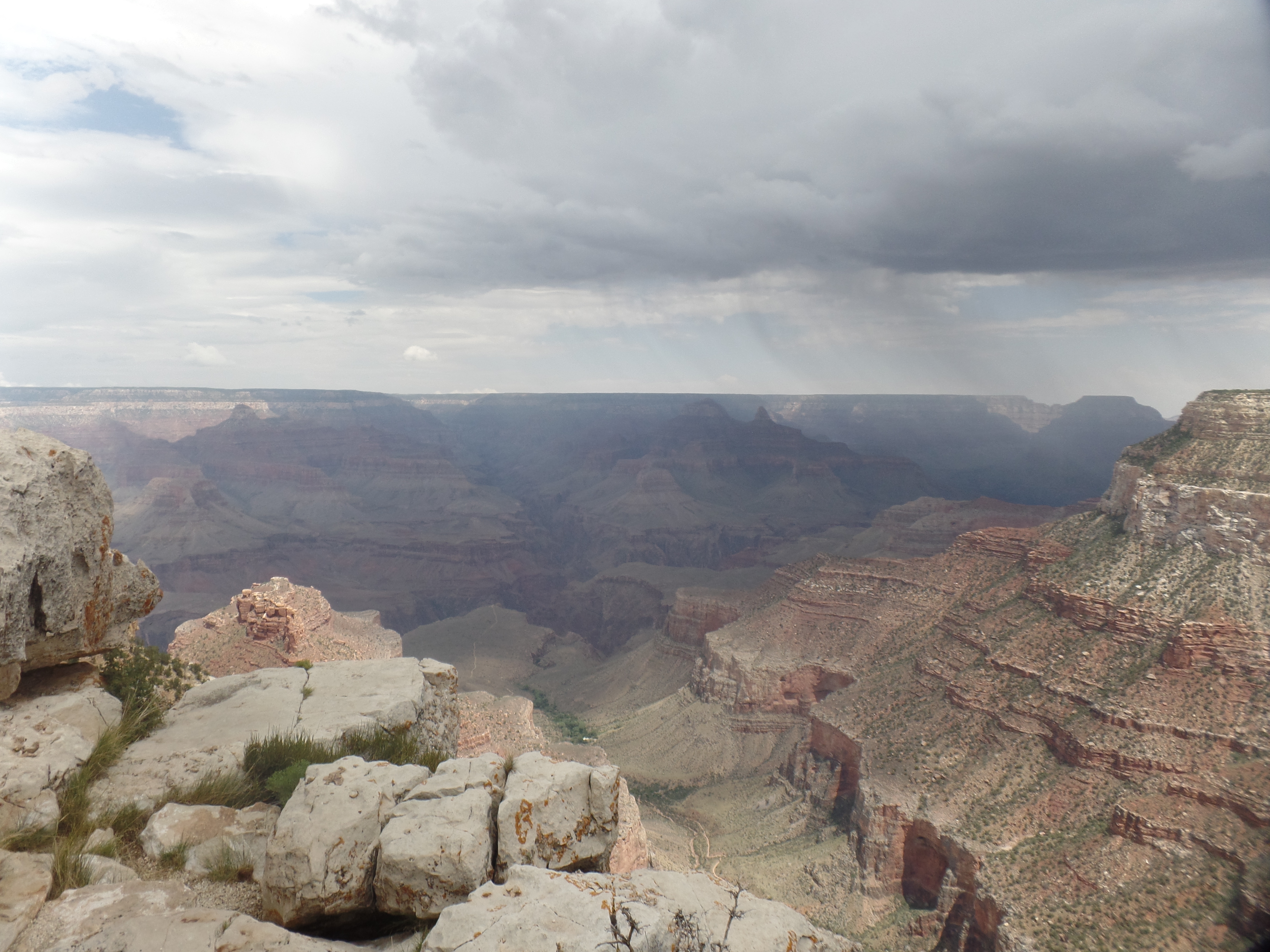
Yesterday, much of the town’s populace, and many visitors, were evacuated, due to unusual flash floods. While clean-up will take time, and there is an ongoing threat of more rain, through Friday, the main road-AZ Highway 64, has been re-opened, from the South Rim’s entrance to Williams. The eastern section, from the entrance to Cameron, did not need to be closed, though in taking that road last night, due to a commitment at a school in Prescott, today, I noticed that a severe hail storm had struck the eastern part of South Rim, earlier in the afternoon.

This is yet another in a series of wake-up calls for the tourism industry, and for travelers in general, that the places being visited are inhabited by people who are essentially the same as those who have left their homes to take a rest, be served or to just enjoy a change of pace from home sweet home. Lahaina is the largest, and worst, such tragedy, in a series spanning several years. Gatlinburg, Big Sur, Talkeetna and dozens of small forest encampments all over the continent-and across the globe, have seen fire and flood drive those involved in hospitality lose house and home.

There are many reactions to a tragedy in a vacation-oriented area, as I discussed last week. It has been reported that at least one tourist raged about his dinner reservation being canceled by the Lahaina fire’s burning down the restaurant. We are all on a journey away from self, and towards seeing “all humanity created from the same stock”, as Baha’u’llah wrote in a prayer, 150 years ago. Some of us have, in all sincerity and from a place of generosity, gone to the suffering area and purchased a vacation package, thinking that THIS is the way to help the people in the afflicted community know that the world stands with them. Others have sent large supplies of goods, often without checking as to what is actually needed. These are good-hearted people, who have just not taken the time to hear from the victims themselves, or from their spokespeople. Thus, some want to go to Maui, anyway. Others will go to Tusayan, and expect that business as usual has resumed, because the highway is open. The clean-up will continue, for some time.

Humanity isn’t minimized by where someone lives, or by which economic group they occupy. Yes, paying for a service does mean that one gets a product for one’s money. It is also true, in this age when nearly every place on Earth has something of interest to offer, that we are all both visitors and visited, servers and served.

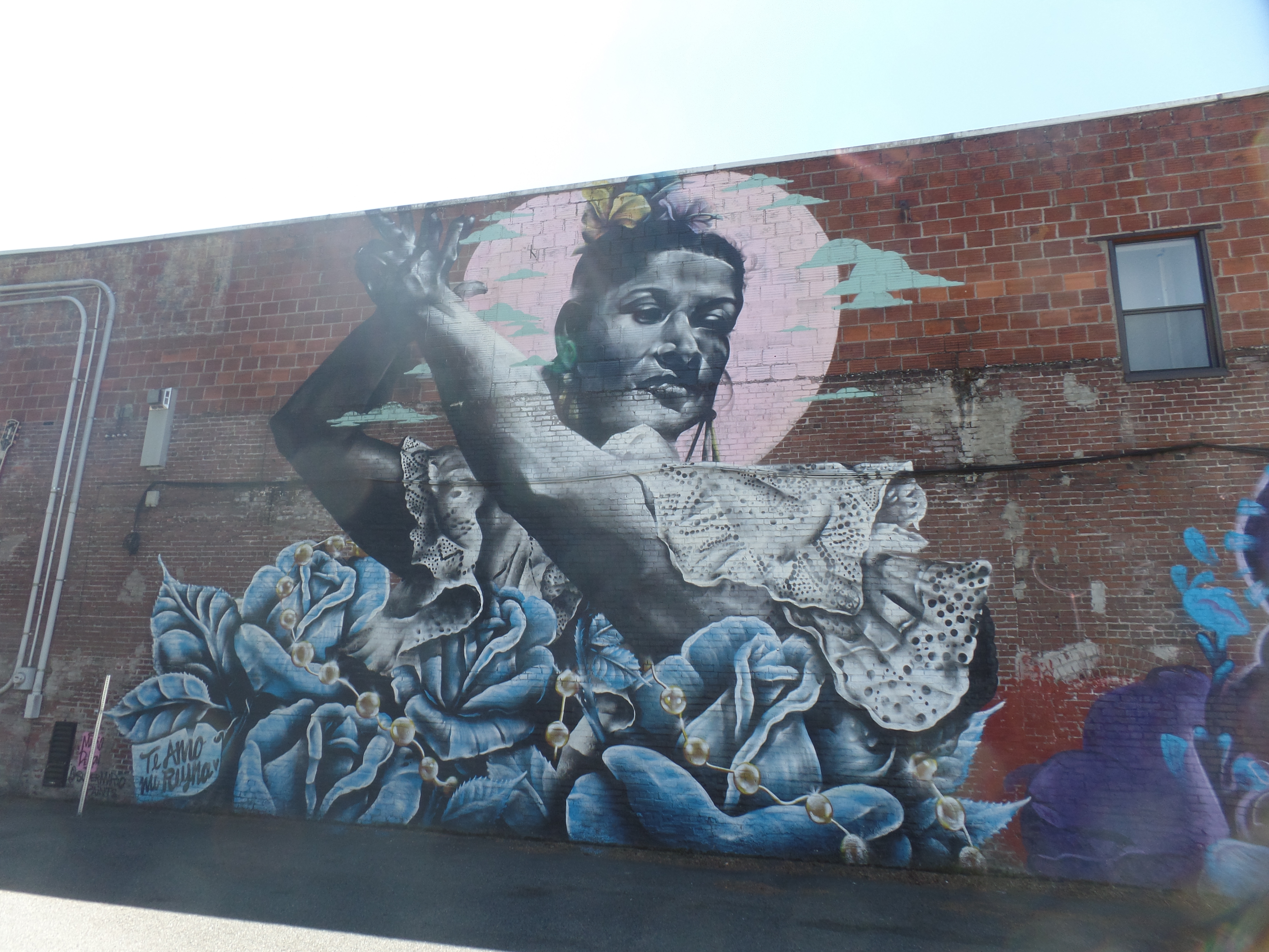
I find that it is the deep connecting with those who live in a community, that makes visiting the locale worthwhile in the first place.

What’s The Point?

2

August 22, 2023- The robust cat sat in my carport, right by the hatchback, and looked at me, as if tho say: “Have you thought this through? Are you sure you want to go up to the South Rim?” It was raining lightly, which was one reason why the cat was sitting in that dry spot. I had, however, looked at the weather forecast for Grand Canyon, and saw PC (partly cloudy).

So, northward I went. Stopping at my Williams favourite, Brewed Awakenings, I fueled up with a Light Wrap and coffee, then headed up to the Park, an hour away from downtown Williams. The first hour or so of my shuttle bus ride/walk was quite pleasant. I took these shots of the Bright Angel Trail, from Trailview Point, just to the west of the Bright Angel.

Bright Angel Trail, seen from the west.
More of the Bright Angel Trail, from the west.
Approaching rain, from Trailview Point

I got back on the shuttle bus and headed to Hopi Point, from where I planned to walk back towards the JW Powell Memorial and Maricopa Point. I got in these shots at Hopi.

Hopi Point and the Colorado River below.
Approaching storm, from Hopi Point

I walked the short distance from Hopi Point to the Powell Memorial. It was then that lightning flashed in the east, a bus driver told me that we would all be evacuated from the Hermit Sector (the near west segment of the Rim Trail, which I had planned to explore in its entirety) and I found a spot to wait for an empty bus, as his was full. In about ten minutes, one arrived and took a bunch of us back to the transfer station. I went into Bright Angel Lodge and had a leisurely lunch, then returned to the transfer point and waited with about sixty other people, for the lightning danger to abate.

After about forty minutes, the storm was judged to have let up, and we went back towards Hermits Rest. I got off at Maricopa Point, walking about 200 yards, to these scenes.

Trailview Point, from Maricopa Point
Colorado River, from Maricopa Point
The defunct Orphan Mine (copper and uranium) was just below Maricopa Point. It is marked by this memorial.

As it was still not raining again, yet, I walked the .9 miles from Maricopa to Powell Memorial.

Plaque memorializing John Wesley Powell, first American navigator of the Colorado River, in the Grand Canyon.
View of canyon, from Powell Point

Once I got this shot off, the rain began to return, and we were evacuated a second time. I commiserated with the shuttle driver, as it must be quite frustrating to have to repeat an evacuation, only an hour after the first one was lifted. Needless to say, it was time to head for the car and towards home base.

There was a slight hitch in that, as well. The road back to Williams goes through Tusayan, and that little tourist village was flooded. The county sheriff had a road block up, which put those staying in Tusayan, Valle or Williams-or who were scheduled to fly out of Grand Canyon Airport, in a bit of a pickle. For me, it meant driving back by way of Cameron and Flagstaff, which I did. On the way to Cameron, I saw one thing we on the Hermit Sector missed: A huge pile of hail had remnants at roadside, from Mather Point, east to Desert View.

Let it not be said that this year’s monsoon was a total bust.

Light Matters

2

August 17, 2023- There were two shades of light, on two large rocks which are within a mile of one another, on Sedona’s southeast corner, near the Village of Oak Creek. Bell Rock and Courthouse Butte are close in proximity, yet cast different vibrations: Bell has a spiritual air, almost like it invites reverence. Courthouse, true to its name, is imposing, authoritative.

Bell Rock
Courthouse Butte, in background

As you might guess from the above, today was a day for my hiking buddy and me to head to Sedona. The focus was primarily on getting different perspectives on Bell Rock, and we did that, by walking along the western side of the iconic sandstone formation. Light matters, throughout the Southwest.

Bell Rock, from the north
and from the west.
at the lower level
and the upper level.
Finally, a west view of the entire edifice.

With this turning out to be the hottest day of the week, we took our time getting back, and went on a gentler trail. Plenty of iced tea awaited, at Miley’s Cafe, in Oak Creek Village, to supplement our own plentiful supply of water. The food is also wondrous there.

Another plus is that August is shoulder season in Sedona, so the crowds, especially on weekdays, are far thinner than at other times of summer-or the rest of the year, for that matter. Monsoon rains have kicked in this week, finally, and a Pacific hurricane may well send its remnants in our direction, as well. It’s a rather good Home Base month!

The Bottom of The Top

2

August 16, 2023- As a five-time hiker of the Grand Canyon’s Bright Angel Trail, from rim to river and back, I can attest that there is no appreciation of the bottom, without the top, and vice versa.

This afternoon, I completed reading “PrairyErth”, William Least Heat Moon’s “sequel” to his account of a back roads ramble around the United States, entitled “Blue Highways”. The latter took in travels through 38 states. The former concentrated on one county, in Kansas, which was one of the ten contiguous states he didn’t visit the first time. Mr. Least Heat Moon’s style is consistent, covering all bases of an area, telling anecdotes of his encounters with Man and Nature, weaving details of history, sociology, biology and geology into each chapter-in both books. The micro reflects the macro.

The writer, named for his having been born during a New Moon, entered the words of this post’s title, in the final chapter of “PrairyErth”, in the course of describing a walk which he and a friend took, tracing as best they could the route taken by the Kansa (Kaw) people, when those who gave their name to the state were removed to Oklahoma, in 1872.

He christened the base of a small, but steep, hill in the west of Chase County, as “the bottom of the top”, and thus connected beginning with end, east with west, north with south. Stephen Covey, many years ago, did the same in his life coaching book, “The Seven Habits of Highly Effective People”: “See the end in the beginning”.

Continuity and connection have been essential in my own approach to life, for at least forty years-and probably longer, on a subliminal level. Leaving someone out, not seeing a task through to its completion or omitting a detail have been foreign to my thinking, often to an extent that has been maddening to those around me-and sometimes to me, as well. Dr. Covey’s book helped, in teaching that planning things ahead of time can help enormously, with regard to remembering details-and so I have made that second nature-at least in the past fifteen years.

The first part of anything signals the nature of the last. The bottom is essential to the top. The converse of these is also true.

Not Beaten by The Heat

2

August 13, 2023– The water shimmered and there were a couple of families overlooking the lake, at Site Six, where there is a replica of Split Rock Lighthouse, which commemorates the sinking of the Edmund Fitzgerald, each November 10. The vessel sank into Lake Superior, in an early gale, on that date, in 1975, and all on board drowned.

This was one of those unexpected tragedies that, in today’s world, might have generated a host of conspiracy theories, but was simply the result of a natural event that occurred out of its “usual” season. This is something to keep in mind, as the tales of state terrorism begin to find their way into the media (and they are already surfacing), with regard to Maui.

Let’s get back to reality, though. It was 109 F outside, as I took ten minutes each, at two locations along Lake Havasu’s eastern shore, to look things over, for the first time since 2011. After taking a photo of a Mexican family, at their request, I got a few shots of the lake, at Site Six. (Each of the boat launches in Lake Havasu State Park are numbered.)

Site Five, from Site Six, Lake Havasu State Park
Jet skier, off Site Six, Lake Havasu State Park
View of Havasu Lake, CA, the seat of the Chemehuevi Nation.
Split Rock Lighthouse replica, Site Six, Lake Havasu State Park

Having kept myself sunscreened and my head & neck covered, it was time to find a parking spot, near London Bridge, walk down to English Village and enjoy a bit of ice cream. The bridge was brought here in sections, by the founder of Lake Havasu City, Robert McCulloch, a power tool executive, between 1968 and 1971. It consists today of the original masonry of the 1830 version of London Bridge, reinforced in concrete.

View of balustrade along London Bridge, Lake Havasu City
London Bridge, Lake Havasu City
Southwestern Arch, London Bridge, Lake Havasu City
Base of southwestern arch, London Bridge, Lake Havasu City

Having spent a total of fifteen minutes in the heat, divided into two segments, I finished the small salted caramel cone and headed back towards Home Base. Traffic was light, and I briefly considered stopping at Seligman, either for a short nap on the side of the road, an early light supper at Westside Lilo’s, or both. Spotting three men carrying a gas can, along the side of the offramp, I opted for neither one. One of the men went with me to a gas station, filled the can, and was transported back to the vehicle with the empty tank. I drove the rest of the way to Prescott, feeling no need for either a snooze or a meal along the way. I got both, once back in the apartment.

Lake Havasu seldom, if ever, gets unruly. Its large and beautiful counterparts in the Upper Midwest and central Canada, though, have a different story to tell.

Vacationland Burning

11

August 10, 2023- Lahaina was a royal city. Kamehameha I established his palace there, in the 1802, seeing its value as a central location among the Hawaiian Islands. It was quieter and less subject to visits from rowdy foreigners than was Honolulu.

Lahaina was a whaling port, after the capital moved back to much larger Honolulu. It then built a fort, to protect itself from those same rowdy whalers and sailors who were nonetheless the source of its income.

Lahaina will now decide when and how to rebuild. Fire came, in the midst of Hawai’i’s Big Dry, stoked by one of the furthest traveling major hurricanes, ever: Dora,which started off the Pacific coast of Mexico, passed well south of Hawai’i- while sending gale force winds north to the islands of Hawai’i and Maui, and is now on track to brush Wake Island, albeit as a tropical storm, by the middle of next week. My concern rises for the low-lying Marshall Islands, lying as far to the south of Wake as Hawai’i lies to the north of Dora’s recent track.

Serving those who come to recreate, relax, “vacate” is often a thankless job- and one which depends, as much as any walk of life, and more than many, on the good graces of Mother Nature. It falls to the character of those being served, as to how much appreciation is shown. In times of tragedy, especially when the tourist, the traveler, the surfer, the diver, the hiker, the casual visitor are joined at the hip to those who have made their home in a place of paradise, there is an awareness of just how connected we all are-and of the fact that there is no one class that really rises above the rest, in terms of privilege and protection. Everyone’s pants go on one leg at a time.

I make my home in a salubrious place, which has seen its share of natural calamity. Prescott’s version of Front Street, Whiskey Row, has burned to the ground, twice, and came close a third time, in 2012. I watched that last one play out. We have had ravaging fires, many times, which have come close to the densely-populated areas of town. The worst, in my lifetime, was Yarnell Hill, which took the lives of 19 wildland fire fighters, just ten years ago.

Lahaina now takes its place among the paradises that have suffered Nature’s wrath: Pompeii, Krakatao, Angeles City, St. Pierre, Montserrat (where Plymouth is still off-limits), Galveston. There are places that were pounded, though not sundered: The entire Indian Ocean basin and much of its Rim, in the great tsunami of 2004; Grand Bahama, in 2019’s Hurricane Dorian, Guam, this past Spring and Haiti, more times than one can count.

Lahaina was a palace town. Lahaina was a whaling town. Lahaina was vacation land. Lahaina now lies in ashes-and has the love and support of every good-hearted soul.

A Mountain Route Towards Second Home

4

July 27, 2023, Carson City- One of my favourite chain eateries, of which there are few, is Black Bear Diner, which started in the city of Mount Shasta, CA, in 1995, and has now expanded throughout the western half of the U.S.

It was at Grants Pass’s Black Bear that my day got revved up. The counter crew, like crews in most restaurants, are a well-working team. A lovely, perky young lady at the register told me it was her first day-and I noticed that the rest of the crew was solicitous and helpful towards her. She is likely to have a good run there. The food was excellent, as always.

Mount Shasta itself was prominent during the first part of my drive towards Carson City. A first time visitor to the area stopped at the western vista point, off I-5, just after I got there and asked what mountain that was. She proceeded to take several snaps of the peak, from different vantage points. I was happy taking one, from there.

About an hour later, heading towards Reno, on the Lassen Highway, I stopped at another “Vista Point”, to find that Mount Shasta was pretty much hidden from view by the tall pines. Lifting a bit of litter from the stop, because Mount Shasta is just majestic and doesn’t need our trash in view, even from thirty miles away.

Mount Shasta peeks through the pines, taken from the south.

There was no time to make a stop at Lassen peak that would have done it any justice, so I turned left towards Susanville and Reno. The damage done to the forests on Mount Lassen’s northern and western flanks, and in the mountains near Susanville, is heart-wrenching to see. Thankfully, fire has spared this area so far this year, but it’s unfortunately very early yet. In the intermediate future, one of my sojourns will entail a three-day stay in one of the cabins at Lassen Volcanic National Park.

In my heart, with Prescott my primary Home Base, there are several others-Carson City chief among them, that very much feel like home. That’s as it should be. I settled into the small America’s Best Value here, and spent about two hours visiting with Michele, very much like a sister, at Betsy’s Big Kitchen, a rather nice in-casino establishment, serving sizable portions of fine comfort food.

My main reason for being here will happen tomorrow, as a Munchkin takes the stage.

Denial Gets A Comeuppance

4

July 26, 2023, Grants Pass, OR-

I was told, some time ago, that the homeless community along Washington State’s southern tier had been removed, by sending the lot across the Columbia River, to Portland. Being skeptical that this is even something that could be pulled off, without a whimper from a city that was already choking with a large unhoused community in its downtown and other neighbourhoods, the last time I visited (2015), I went to Vancouver (WA) this morning, after checking out of the motel in Kelso.

Vancouver, not to be confused with the much-larger city in British Columbia, has a lovely park along the Columbia River, and pleasant, clean downtown and uptown sections. It also has the manicured Fort Vancouver, a well-maintained National Park site, whose historic homes are leased to residents and businesses. Living wherever they can put up tents, usually in nooks and crannies along the Columbia, are the remnants of the unhoused community, admittedly smaller than those of Portland, Seattle or Tacoma, but in Vancouver, nonetheless. Denial of a problem will never make it go away. Whoever passed that information along to people down at my Home Base, in Prescott had probably not been to Vancouver.

I took a walking loop to the banks of the Columbia, then around to Esther Short Park, after first enjoying a vanilla latte at Brewed, a small, but efficient coffee shop, combined with a bar and small bakery, on Main Street. Not far from Brewed, there is a parking lot with murals on two of the walls.

The Skagit, Yamhill, and other nations, have not lost their dignity.
Nor, for that matter, have the Hispanics who come here for agricultural work.
The African-American community here seems small, but holds its own.
Columbia River, at I-5 Bridge, Vancouver.
“Boat of Discovery”, commemorating the visit here, by Captain George Vancouver’s fleet.
A long wall emanates from this plaza, honouring veterans of all “foreign” conflicts, from the War of 1812 to Iraq and Afghanistan.
Clock Tower, Esther Short Park. The park was being readied for a special event, when I happened by.

Having a couple of errands to do, across the river, I gave myself an hour to explore Fort Vancouver. The post was established to safeguard U.S. control of the mouth of the Columbia River-with .British, Russian and Spanish claims not fully resolved.

Here is the flag staff, in the midst of the parade ground.
This was a serious parade ground!
Grant House, intended for use by Ulysses S. Grant, when he was stationed here, in the 1850s. He never lived in this mansion, on Officers’ Row.
Here is a view of the Enlisted Barracks, south of the Parade Grounds.
These cannons were replicated, from descriptions of the originals, by local high school students, from 1990-92. They are owned by the City of Vancouver, which supplied the materials.
This was the residence of General O.O. Howard, the post commander from 1874-80.
The Artillery Barracks-It struck me that this could house a lot of people.
Non-commissioned Officer’s Housing
Marshall House, home to General George C. Marshall, during his duty here, prior to World War II.

This pavilion honours the Chinese diaspora to Oregon and Washington. Chinese immigrants faced horrific treatment in the Pacific Northwest, during the late Nineteenth, and much of the Twentieth, Centuries.

After leaving Vancouver, I made my way across the bridge to Portland, getting my Pastini fix, with a late lunch at the Italian food chain’s Northeast Portland branch. Then, it was time to locate and purchase a new adapter, to house my photo SIM card and post these and other scenes. It took me all over North Portland. At one point, I stopped in front of a crosswalk, so that a young lady could cross. One would have thought I had held up the President, for the insistent beeping from behind me. The lady shot a dignified, but definitely disapproving, glance at the impatient motorist and gave me a gentle smile.

The shop I eventually found was a Best Buy, on the far northeast side. Its location afforded a fairly lightly-trafficked way out of Portland, so I missed all but a small amount of rush hour. Still ahead, however, was the large influx of participants, family members and spectators at the Junior Olympics, which I learned was being held in Eugene, Springfield, Albany, Corvallis and Roseburg. All of those cities’ accommodations were either occupied or were priced exorbitantly by the Law of Supply and Demand. After gassing up in Eugene, I made my way down to Grants Pass, and got a reasonably-priced overflow room. My last thoughts of the day, though, are wishes for the kids to be successful at their sport-and more importantly, to have a good experience.