Three Bridges

4

October 8, 2019, Blanding-

In the summer of 1981, I was coping with what turned out to be a short-term derailment in my private life.  What worked for me was a week’s sojourn in southeast Utah, with visits and hikes in Capitol Reef National Monument and Natural Bridges National Monument.  I came upon the latter, serendipitously, going in with a skepticism as to how it would measure up to more well-known places, such as Arches and Canyonlands.

The rangers on duty at the time were among the most enthusiastic workers I’ve seen, cheerfully stating that I would find the Monument equal to Capitol Reef, certainly, and as challenging a series of hikes as any at Arches.

On that trip, I camped overnight and hiked a nine-mile loop that took in all three bridges.  This time, still tired from Goosenecks, I opted for one hike to Sipapu Bridge, and checked out the other two, Kachina and Owachomo, from short-trail overlooks, saving their trails for another visit.

Let’s get back to the difference between a natural bridge and an  arch.  The only difference, between bridges and OTHER types of arches, is that bridges are created by a body of water actively eroding the rock. Other arches are created by wind erosion, as well as flash flooding.

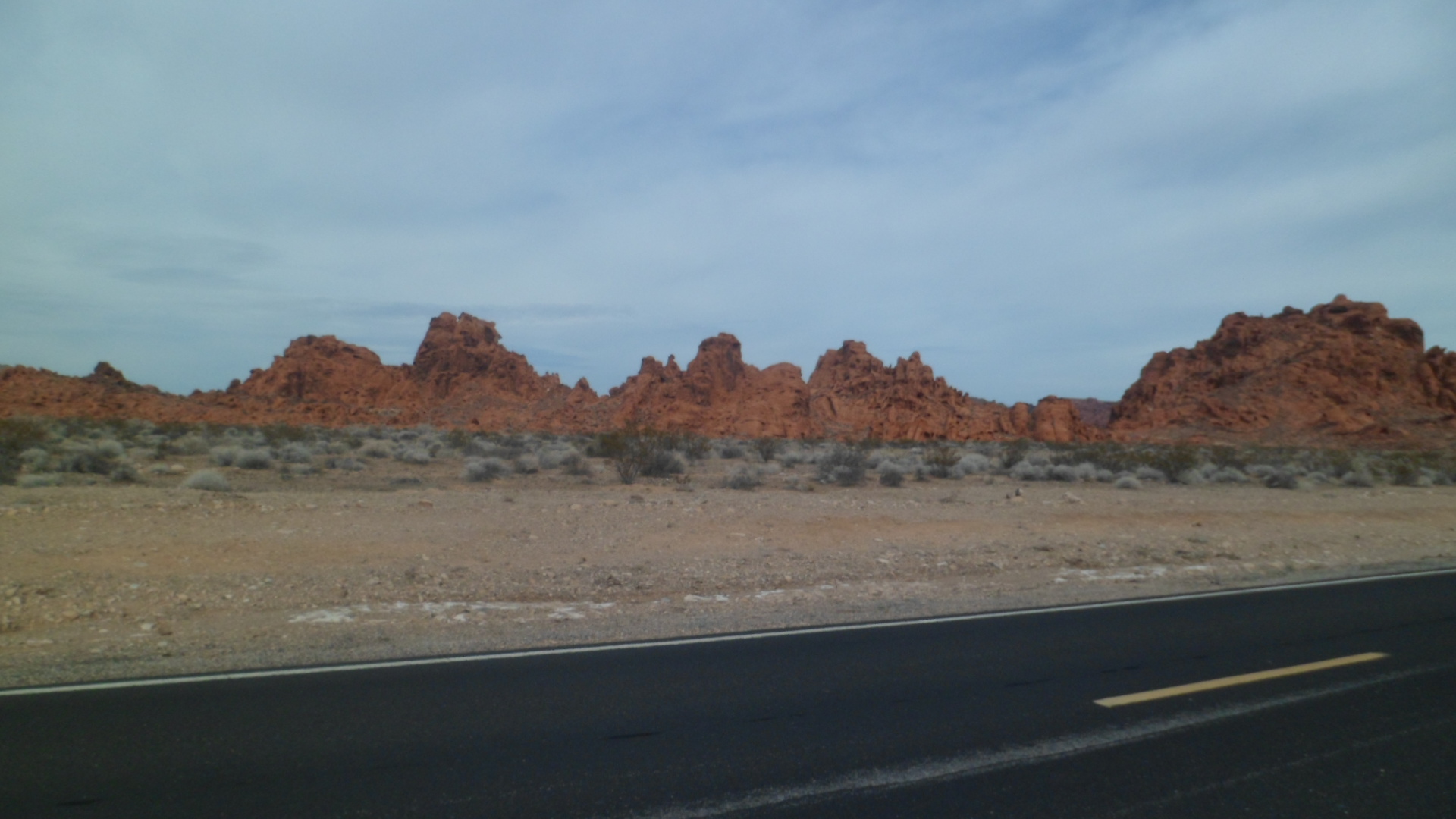
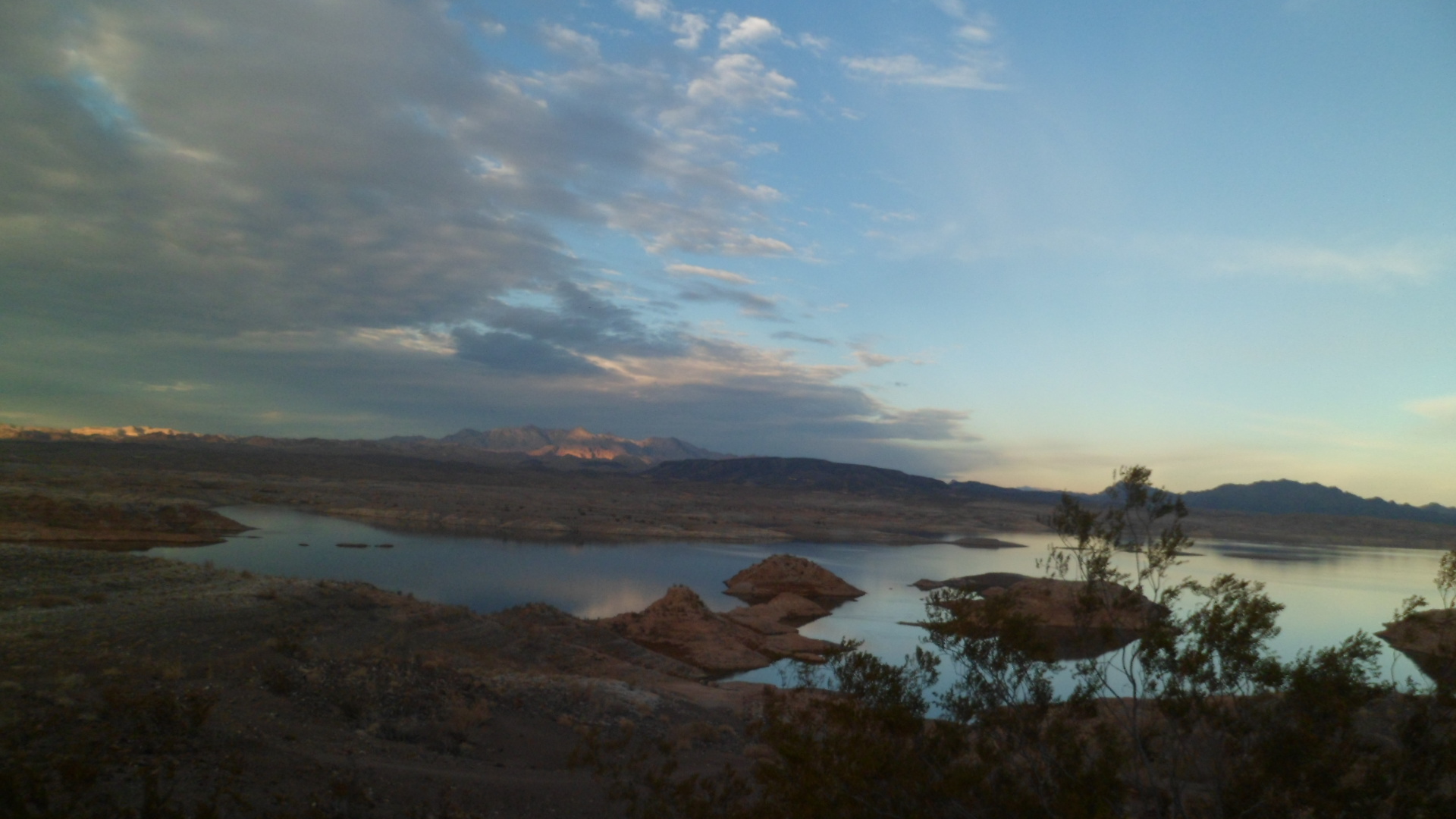
So, here goes-a flash flood of photos.  First, from the Canyon View overlook, which gives an introduction to the type of sandstone from which the arches, which became the bridges, were carved.

SAMSUNG CAMERA PICTURES

SAMSUNG CAMERA PICTURES

SAMSUNG CAMERA PICTURES

SAMSUNG CAMERA PICTURES

SAMSUNG CAMERA PICTURES

SAMSUNG CAMERA PICTURES

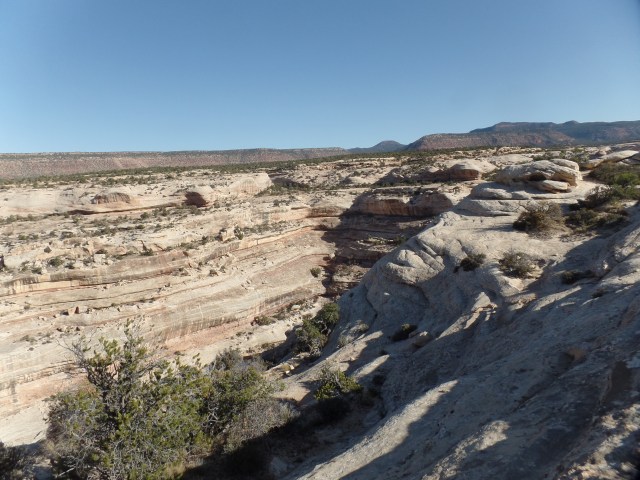
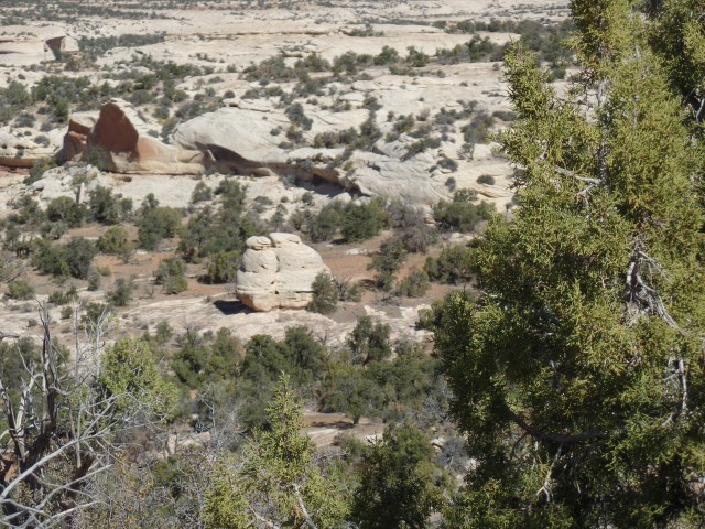
Note that some of the same sky islands that are found at Goosenecks, and elsewhere in this area, are found here.

SAMSUNG CAMERA PICTURES

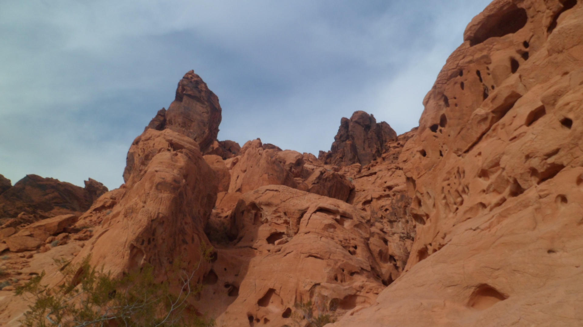
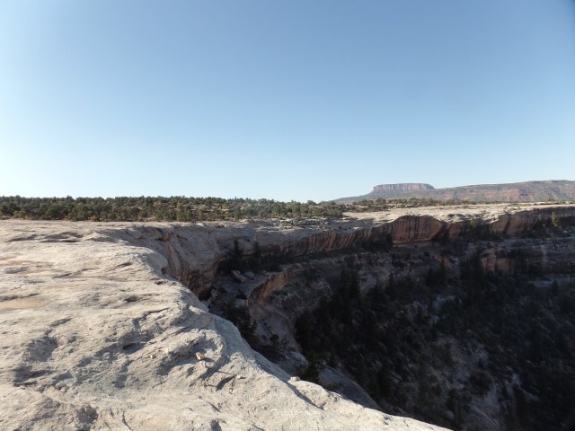
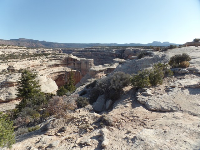
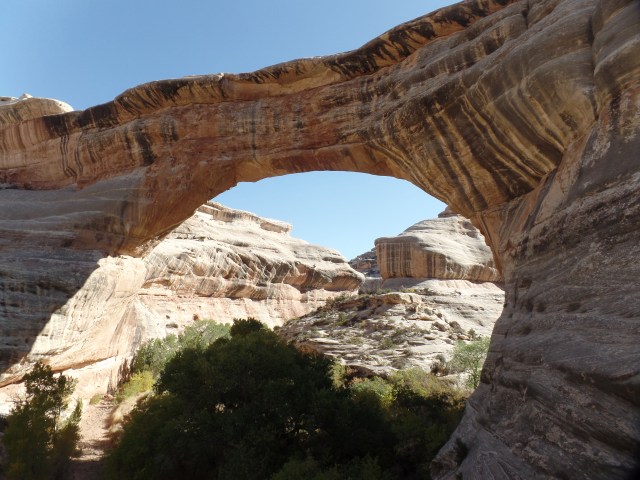
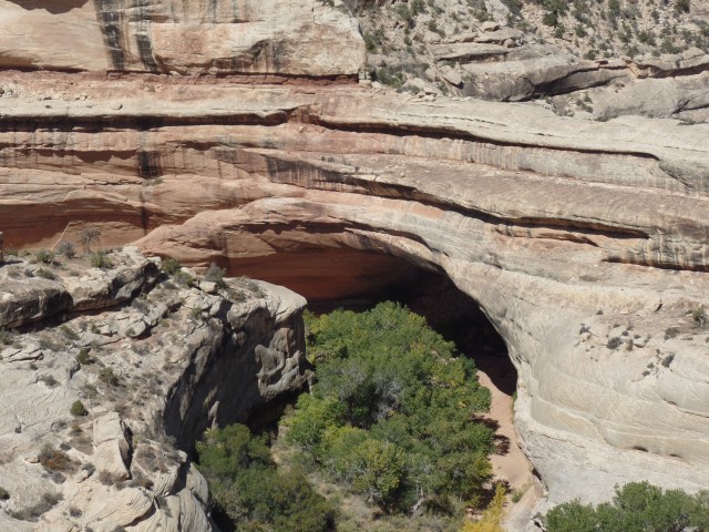
A first view of Sipapu Arch is found at an overlook, 1/4 mile from the trailhead.SAMSUNG CAMERA PICTURES

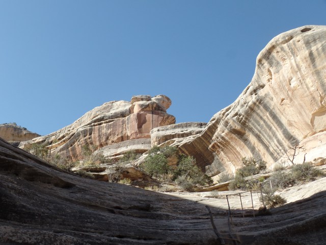
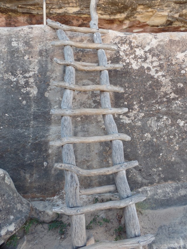
Now, it was down the trail, with the help of some rails and log ladders.

SAMSUNG CAMERA PICTURES

SAMSUNG CAMERA PICTURES

Lichen is also ever at work, turning rock back into soil.

SAMSUNG CAMERA PICTURES

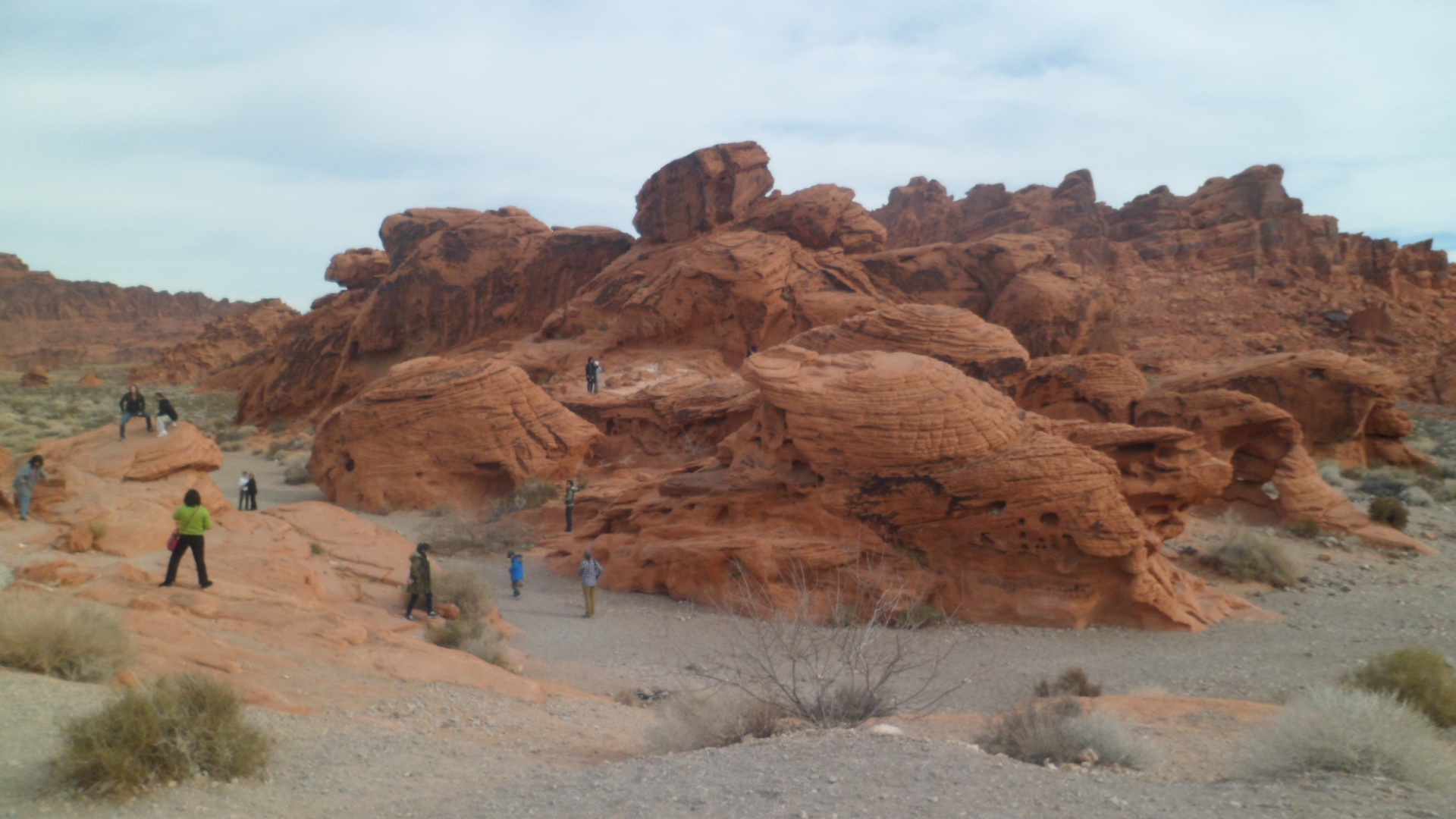
After three log ladders and several stretches of railing, I was close to Sipapu Arch.  Sipapu is a Hopi word, meaning “place of emergence”.  I can imagine how it would have felt, to have this structure towering overhead, when climbing out of a subterranean refuge.  For the record, the Hopi regard their actual Sipapu as being near Indian Gardens, in the Grand Canyon.

SAMSUNG CAMERA PICTURES

SAMSUNG CAMERA PICTURES

SAMSUNG CAMERA PICTURES

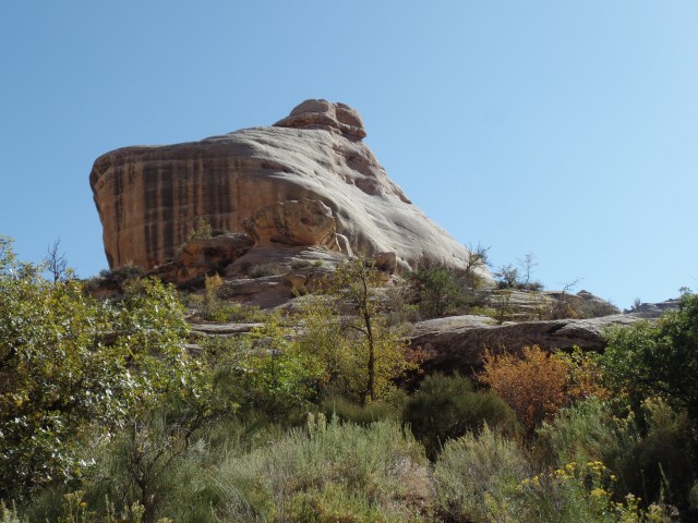
From long ago, and a galaxy far away, comes Jobba the Hutt, keeping an eye on things.

SAMSUNG CAMERA PICTURES

After absorbing the energy of being under the bridge, it was back up the ladder to further exploration.

SAMSUNG CAMERA PICTURES

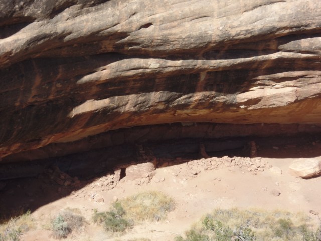
An interlude, between Sipapu and the Kachina Bridge overlook, is a view of Horse Collar ruin.  There appear to be two groups who built kivas here:  A circular kiva was built by people of the Ancient Puebloan culture, related to the Hopi, Zuni and Keresan nations of today.  A square kiva was built by people of  the Kayenta culture, associated with Hovenweep ruins, which are about 40 miles from Natural Bridges.  More on Hovenweep, in the next post.

SAMSUNG CAMERA PICTURES

SAMSUNG CAMERA PICTURES

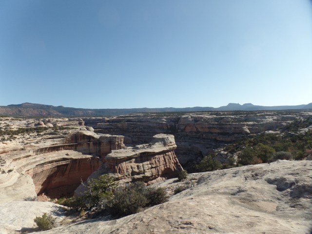
The overlook for Kachina Bridge shows it to be the widest of the three.  First, though, note the sandstone twins.

SAMSUNG CAMERA PICTURES

White Creek, which cuts the bridges, is still very active here.

SAMSUNG CAMERA PICTURES

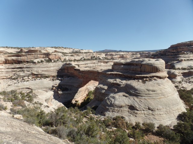
Owachomo Bridge, visible below, is the narrowest of the three, being nine feet thick at its strongest point.

SAMSUNG CAMERA PICTURES

Natural Bridges is adjacent to Bears Ears National Monument, a place whose existence is somewhat controversial.  The butte for which the Monument is named is visible from the turnoff to the Visitors Center for Natural Bridges.  The butte is sacred to Dineh and Ute people.

SAMSUNG CAMERA PICTURES

In truth, I wanted lunch, more than anything else, so heading to this small tourist town was a priority,  over two more hikes.  Those give me an excuse to come back to Natural Bridges, though, which is a pretty good thing.


The Road to 65, Mile 37: Visions of Mars

8

January 4, 2015, Valley of Fire, NV-  I checked my social media messages this morning, and found a post which compared the temperature on Mars with that in Minnesota.  Mars was reportedly warmer today.

I was reminded of our nearest planetary neighbour, once on the trails at Valley of Fire State Park, between Moapa and Overton, NV, northeast of Las Vegas.  As you will see further on in this post, red soil abounds there.

I started the day with a hearty breakfast at Comfort Inn, joined by a family who were driving to Colorado, from San Francisco.  They will have clear weather for their return, which is gratifying.  After tooling around Vegas,unsuccessfully, in search of a Wells-Fargo branch, I just bit the bullet, paid the ATM fees and headed up I-15 to Moapa and the park.

SAM_3601 I shortly came upon the reason for the park’s name.

SAM_3606 The Beehives are well-named, in more ways than one.

SAM_3608 Balancing Rock, near the Visitor Center, reminded me of a similar formation at Garden of the Gods, in Colorado Springs.

SAM_3625 SAM_3630 The otherworldiness of the Southwest is in full voice, in Mouse’s Tank, so-named for an outlaw who hid out in this canyon.  The westernmost Ancient Puebloans also settled here, in the 800’s.SAM_3641 SAM_3657 SAM_3660 The Tank itself was empty today.SAM_3667 Life in the Great Basin is always a balancing act.SAM_3670 I came next upon Rainbow Vista, so named for the striated Aztec sandstone found there.SAM_3684 The trail goes through a narrow, rough wash, to end with a gaze upon Fire Canyon.

SAM_3689 SAM_3690 SAM_3693 The apex of the journey into Valley of Fire was at White Domes, a mass of limestone and gypsum.SAM_3698 SAM_3699 Several distance hikers were in this area today.  Someday, I will be back and share their experience.  On the way back towards the Visitor Center, I caught a few glimpses of the blend of colours.

SAM_3705 Seven Sisters, a sandstone formation just south of the Visitor Center, is a popular picnic spot.SAM_3720

Near the East Entrance to the park, a memorial is set up to honour Sergeant John Clark, who perished here in 1915, while en route from Bakersfield to Salt Lake City.SAM_3731 Lake Mead National Recreation Area abuts Valley of Fire, to the southeast.  Its terrain has less of the Aztec sandstone and more limestone and gypsum.SAM_3740 The lake may be down, but it’s far from out. The scenery is still inspiring, especially around sunset.  I enjoyed several stops along the North Shore.

SAM_3750

SAM_3753 Sunset hit its true magnificence as I came upon White Hills, AZ, and Rosie’s Den Cafe.

SAM_3756 Rosie’s is another amazing serendipitous find.  A homey, relaxing spot, with well-prepared food and engaging waitresses, it’s perfectly positioned between Hoover Dam and Kingman.  A plus is that one of the waitresses is also a baker.  Tracey’s no-sugar added cherry pie hits the sweet spot, of the palate, that is.

One caution, being in a rural community:

SAM_3758

JK.  White Hills has a competent volunteer fire service. The stuff of holidays was still well in evidence.

SAM_3759 Rosie’s is definitely cracklin’.

SAM_3760