December 31, 2016, Chula Vista- I am taking the readership on a brief journey back, with one photo from each month, that sums up the month, for me. So, let’s begin.
January-
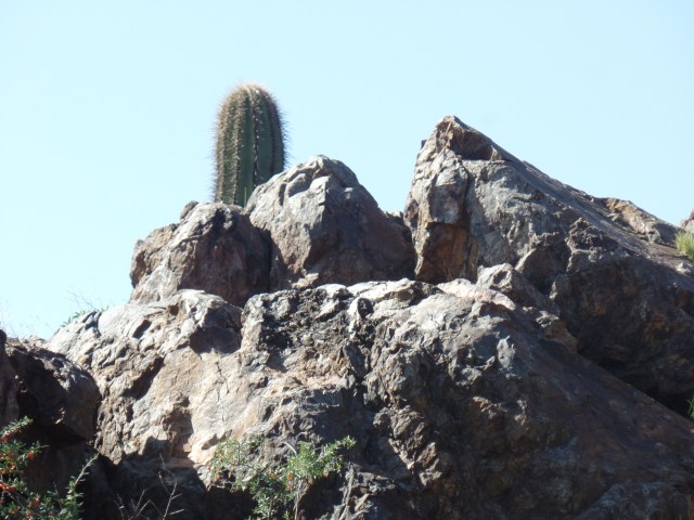
Pharaoh’s Face, with a barrel cactus keeping watch, south of the Agua Fria River, Black Canyon City
February-
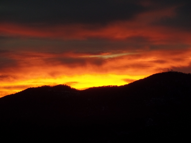
Sunset, over Goldwater Lake
March-
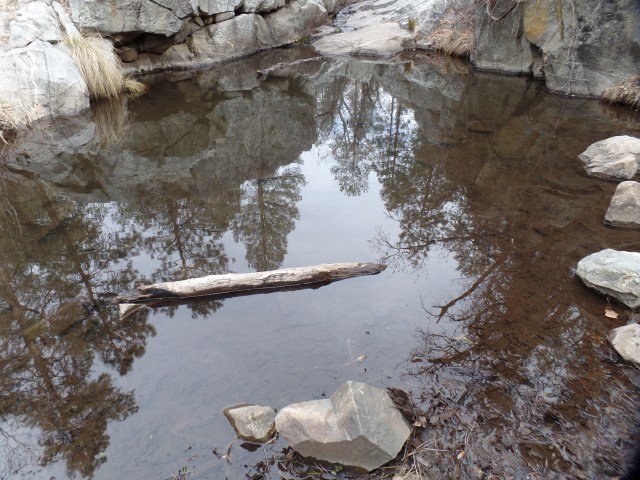
Small pond, Banning Creek, northwest of Goldwater Lake
April-
Quartz Mountain, north of Copper Basin
May-
Granite Mountain, Prescott
June-
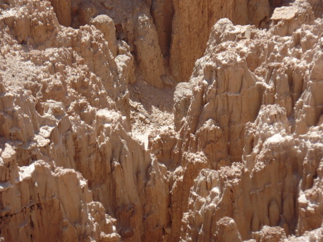
Cathedral Gorge, Pioche, NV
July-
Lake Redwine, Newnan, GA
August-
Kayla Mueller, who was killed in Syria. This is not my photo, but symbolizes the month of August, as I took no photos of my own, and the sacrifices of some Americans, in the fight against terrorism became front and center.
September-
View of Santa Maria Mountains, from Juniper Mesa
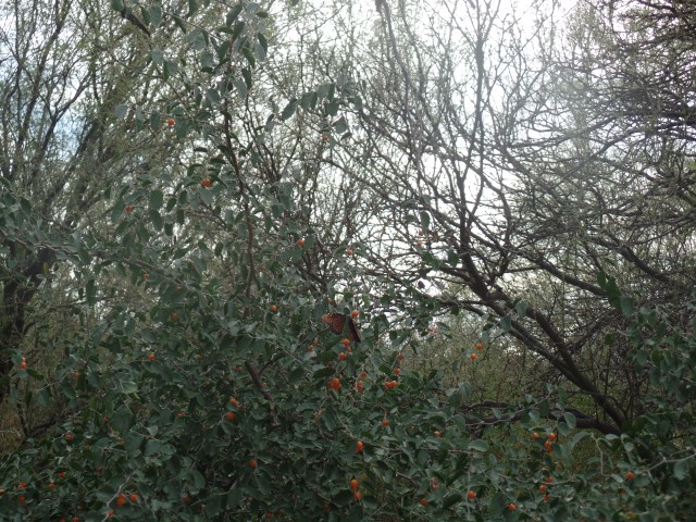
October-
Monarch butterflies, in Agua Fria watershed
November-
Agua Fria Fort, off Little Pan Trail, Table Mesa region
December-
White Christmas 2016, Prescott
So went the Year That The Common Man roared and I continued to explore.
March 13, 2016, Prescott- “It is not yours to keep, this ever-changing trail”- Laura and the Killed Men, “The Ever-Changing Trail” (All rights reserved, Laura Kepner- Adney and Sam Golden, 2015).
I sat, joyfully, in one of my favourite evening live music venues, The Raven Cafe, and listened to this Tucson country-folk band’s first set. The line above is from their a capella set closer.
They excel with instruments, also.
Include the video, as it happened that the evening was a fine counterpoint to two hikes I took this weekend, on Prescott Circle Trail. Yesterday afternoon, the spontaneity of which I wrote, a few posts ago, kicked in. I accepted the urge to do a “fill-in-the blank” hike, to the top of Badger Peak, which is circumnavigated by Section 7 of the Circle. The peak is also called “P” Mountain, owing to the large white first letter of my adopted town’s name.
Here are some scenes. The first two were taken from the access road, to which I transferred from Prescott Circle, at the half-way mark to the summit.
View from road leading to Badger Peak summit
View of Government Canyon spur, from Badger Peak access road
Communications Towers, Badger Peak summit
P is for Prescott, Badger Peak summit
View of Watson Lake, from Badger Peak summit
The third photo shows a communications station, atop the peak. The white circular arrangement is the top of the P. There is no access to the arrangement, in its entirety, without permission of the Yavapai Nation, which owns the mountain. The final photo shows Watson Lake and the Granite Dells, from the summit. This hike was four miles, round trip.
This afternoon, a friend, who had wanted my help with a remodeling project, postponed it until next week. This gave rise to spontaneous hike # 2: Segment 5 of the Circle. It is a ten-mile round trip, something I’ve not done during the Fast.until today. I was inspired in this by another friend, who is both older and physically smaller than I am, and who hikes and runs during this time period. So, out of my comfort zone I went- with enough water on which to fall back, in the event I felt weak. As it happened, that was not a problem, as the air was cool this afternoon, and the Sun was hidden by clouds, most of the time.
This segment goes from a point south of Upper Goldwater Lake, around the south and west shores of that body of water, above the west shore of Lower Goldwater Lake, which is closed to the public and through Prescott National Forest, to White Spar Campground. This hike was ten miles, round trip. Sitting here tonight, I feel refreshed and focused.
Here are some scenes of Segment 5.
Trailhead sign, Prescott Circle Segment 5
“Tree-pod”, south of Goldwater Lake
Note the “Tree-Pod”, on the right.
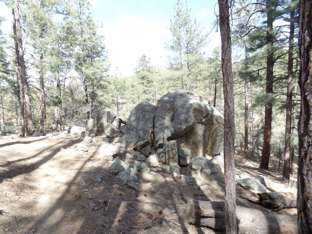
Gray granite boulders, south of Goldwater Lake
South shore, Upper Goldwater Lake
Pair of daisies, Prescott Circle Trail
Memorial to Yarnell Hill Firefighters
On the left are a pair of daisies, seen along the way, above Lower Goldwater Lake. The heart-shaped stone memorial, on the right, is dedicated to the 19 firefighters who died at Yarnell Hill, in June, 2013. It is atop a ridge, 1 1/4 miles southeast of White Spar campground.
View from Monument Ridge, south of White Spar
Trailhead, White Spar Campground
The Sierra Prieta range can be seen from Monument Ridge. On the right, is the trailhead at White Spar Campground. I spent only ten minutes, resting, at this very full facility. There were 2 hours’ back journey left.
On the way back, I stopped for several minutes at this lovely nook, Banning Creek.
Small pond, Banning Creek
Small pond, Banning Creek
There had been a fair crowd here, when I was headed towards White Spar. When I returned, only one lone bicyclist and I had the place to ourselves- and he was about to leave. I saw very few other people, the rest of the way, until I got back to Upper Goldwater.
Now, with the next two weekends booked, I will wait until April to take on the next segments of Prescott Circle- unless things get canceled and spontaneity calls.