The Road to Diamond, Day 296: Picture Stones and A Watchful Wolf

0

September 19, 2025, Visby, Gotland-

Today’s festivities will be shared in two parts, as some photos are on the iPhone gallery and the cable for my phone doesn’t quite connect to the Lenovo.

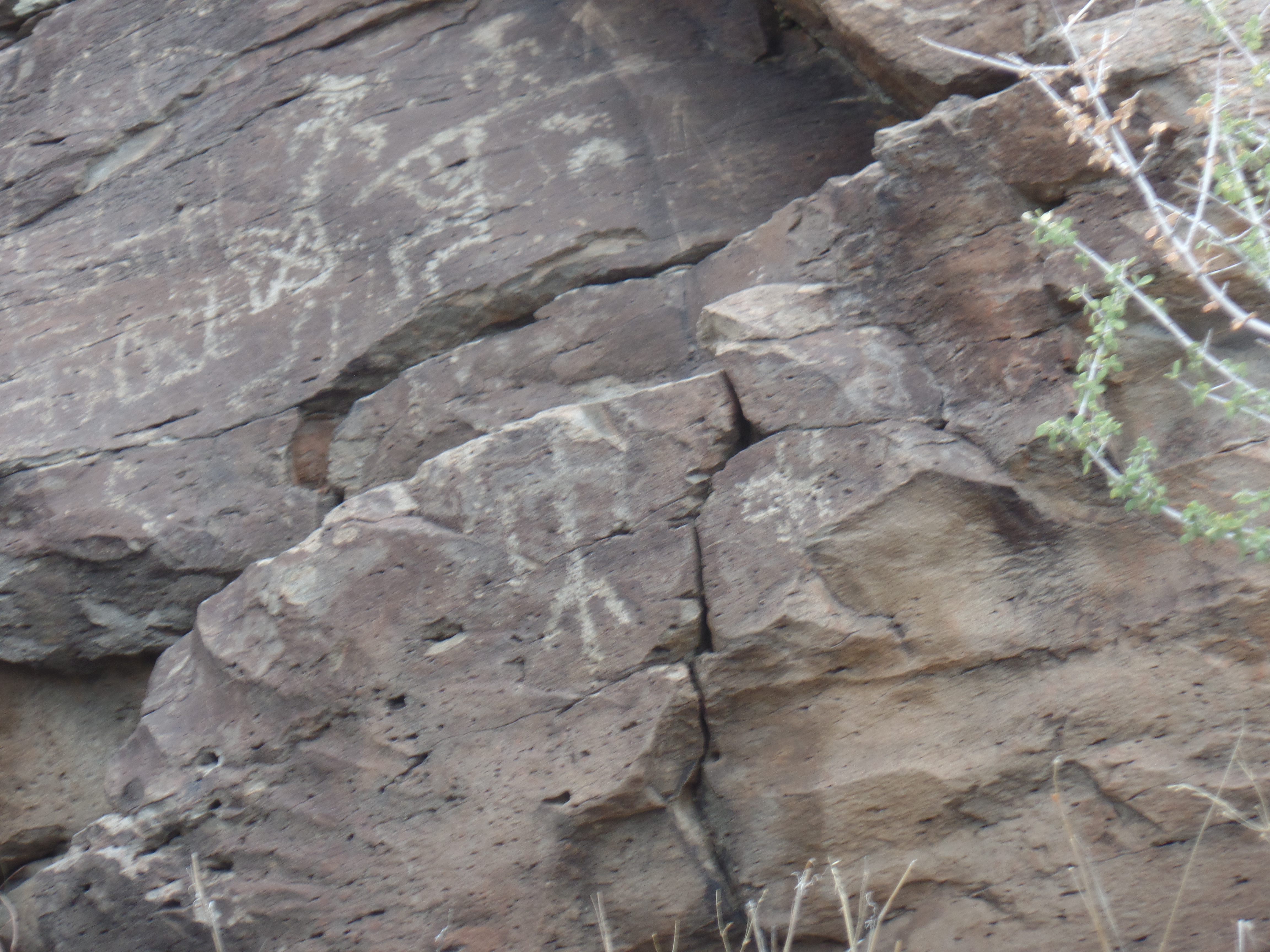
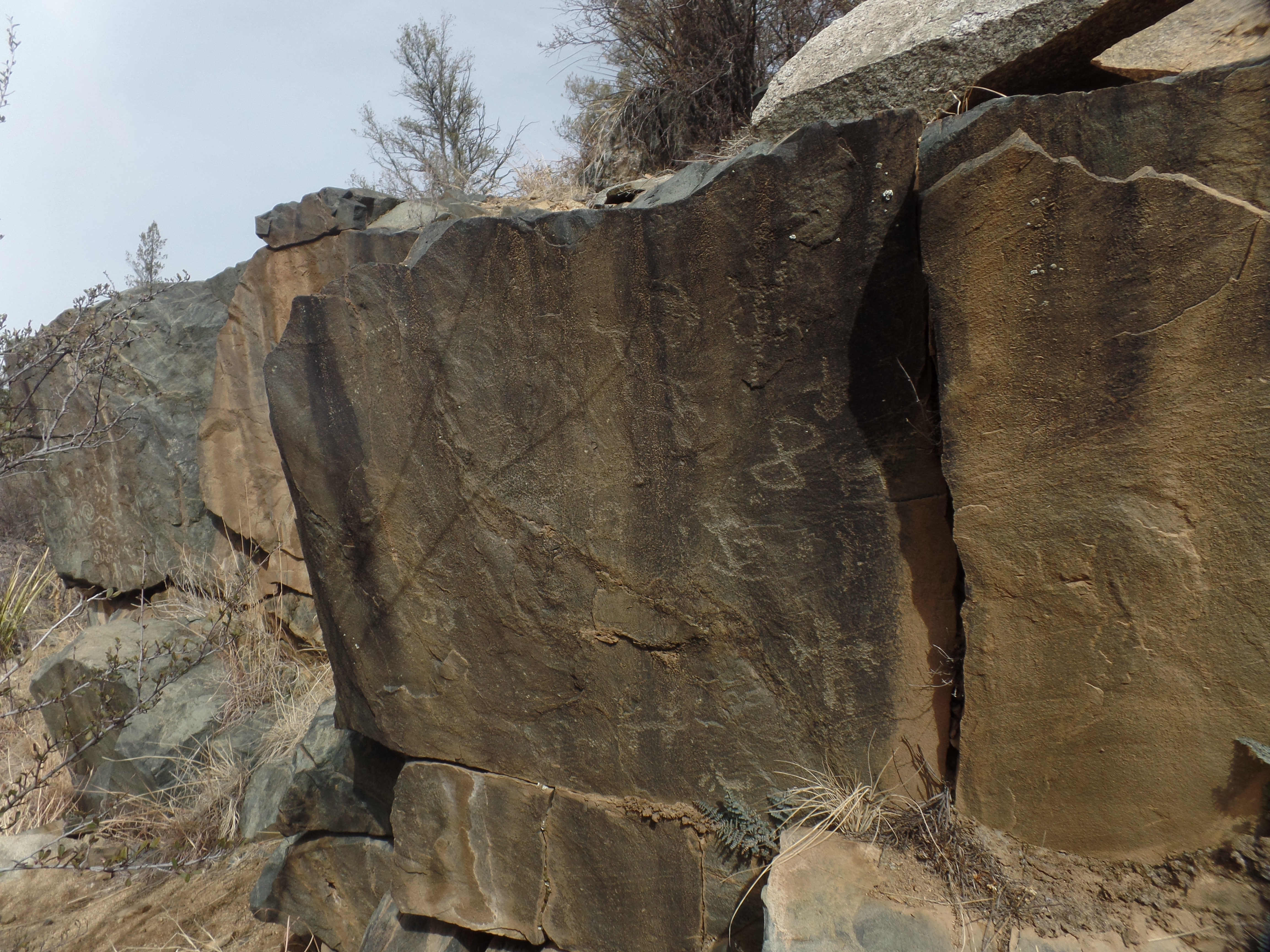
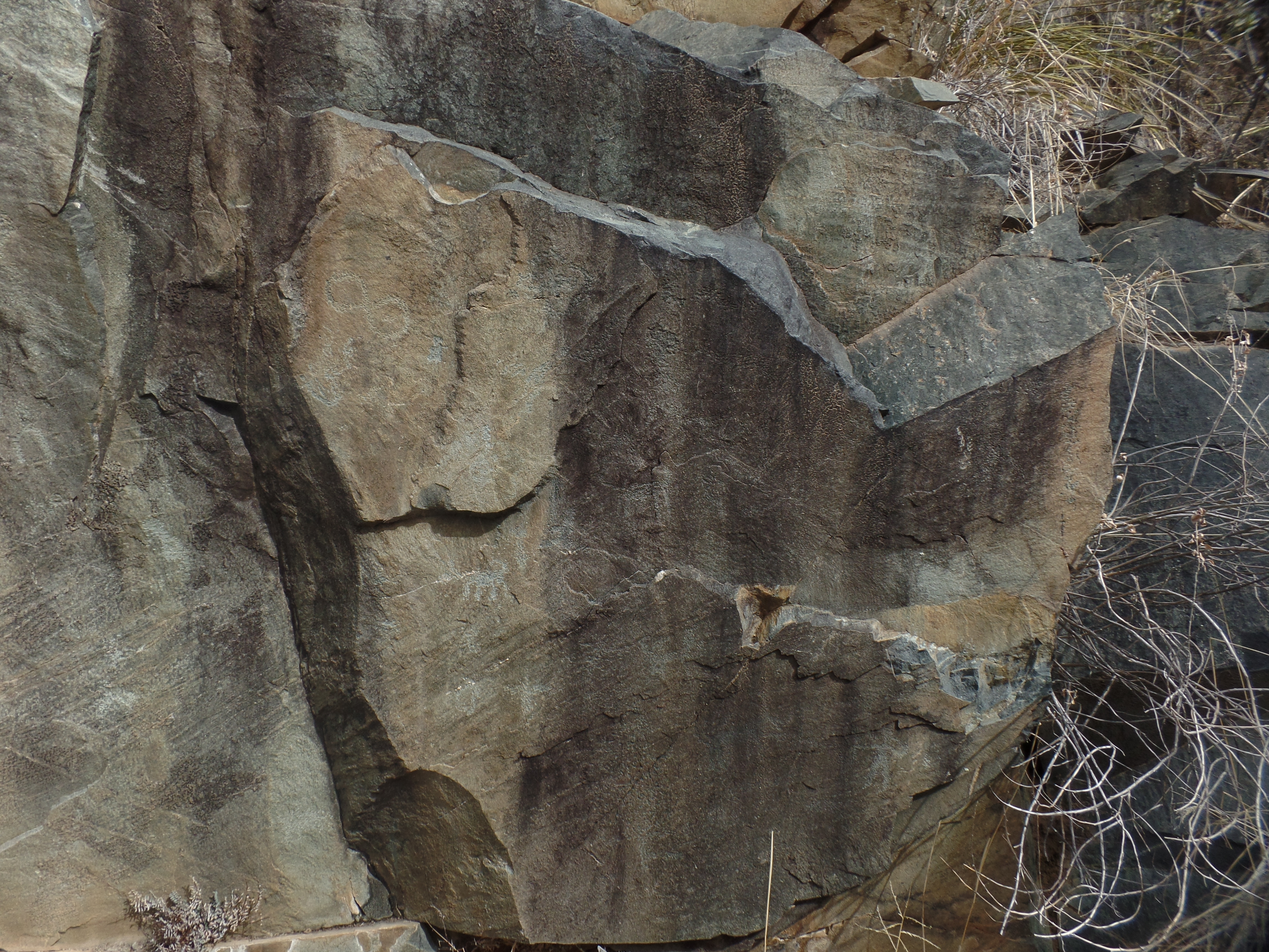
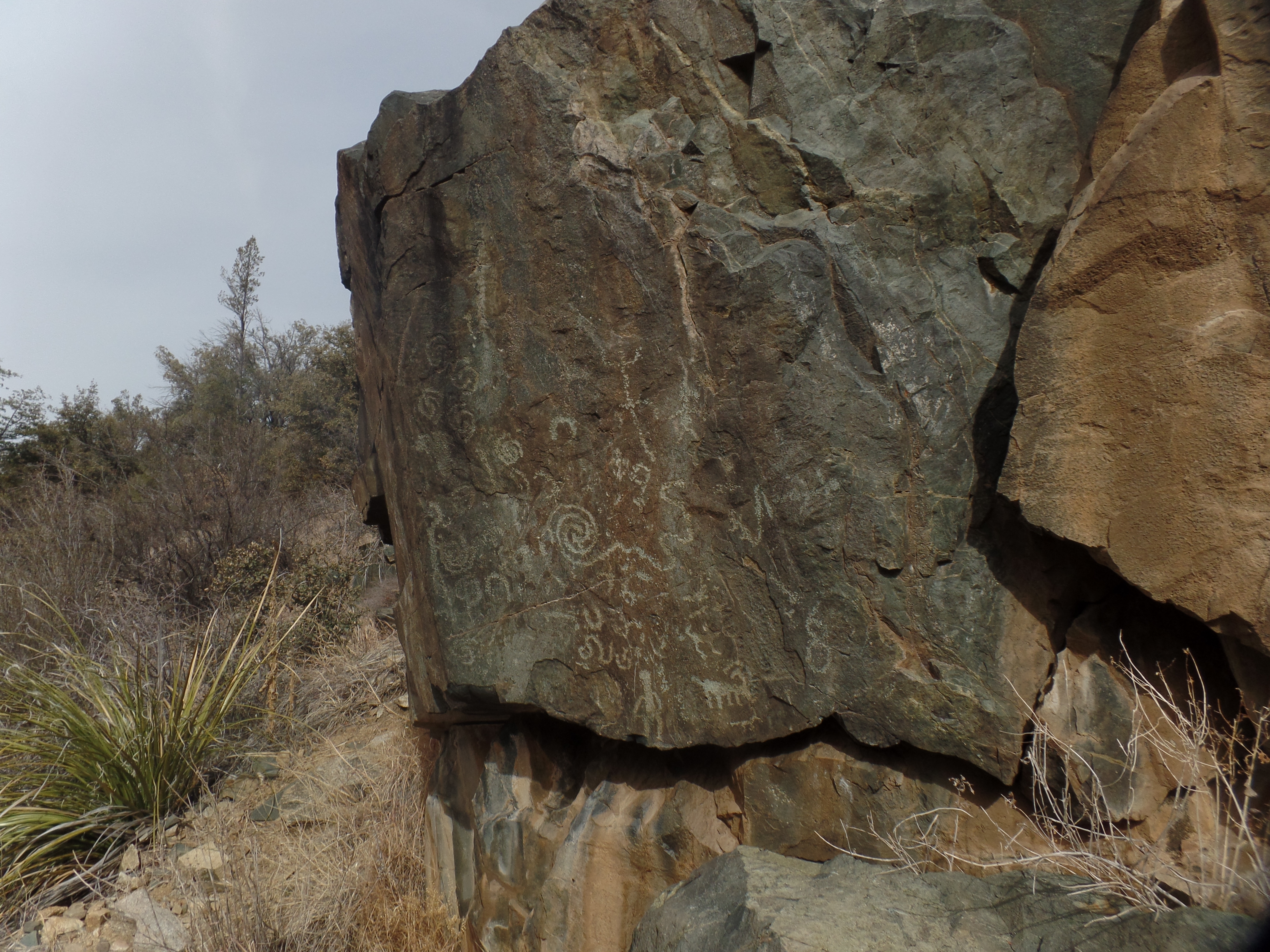
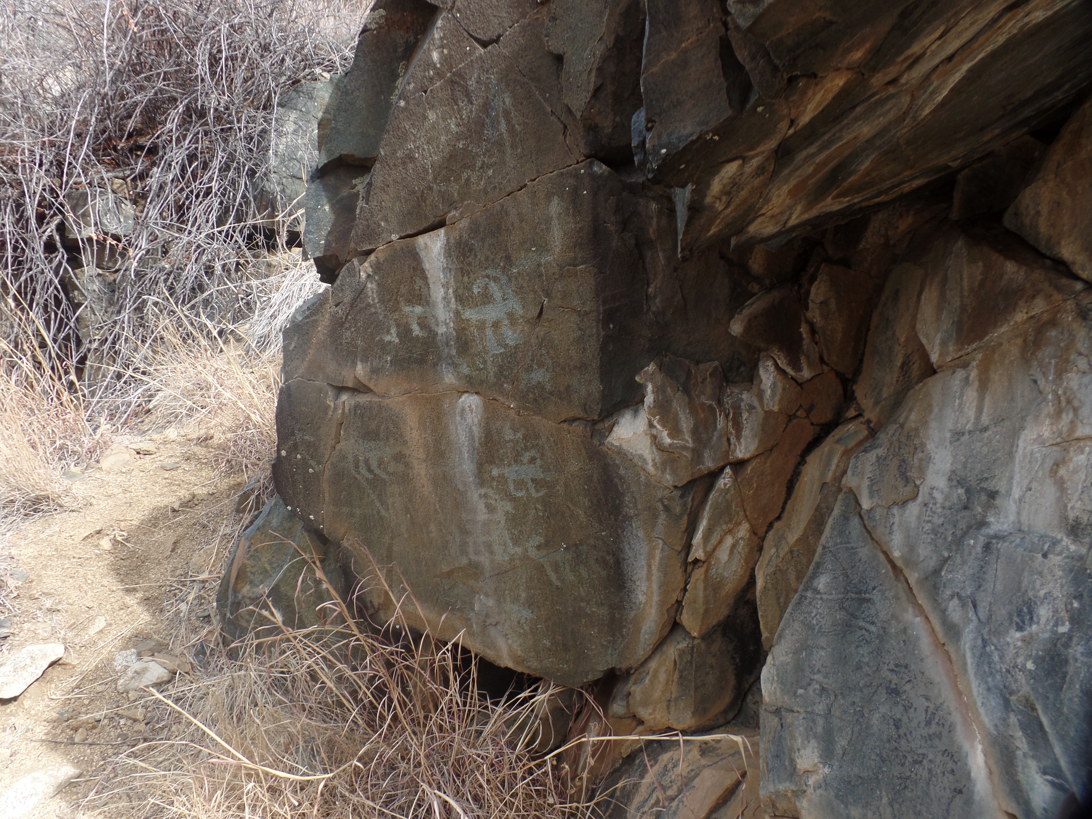
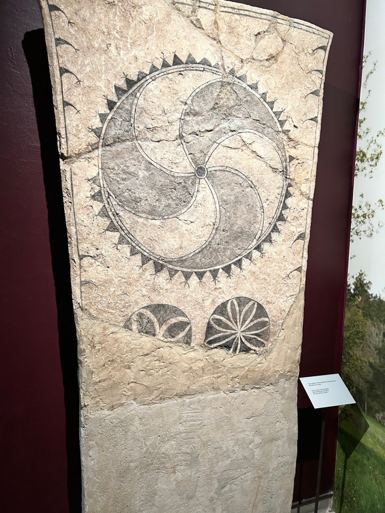
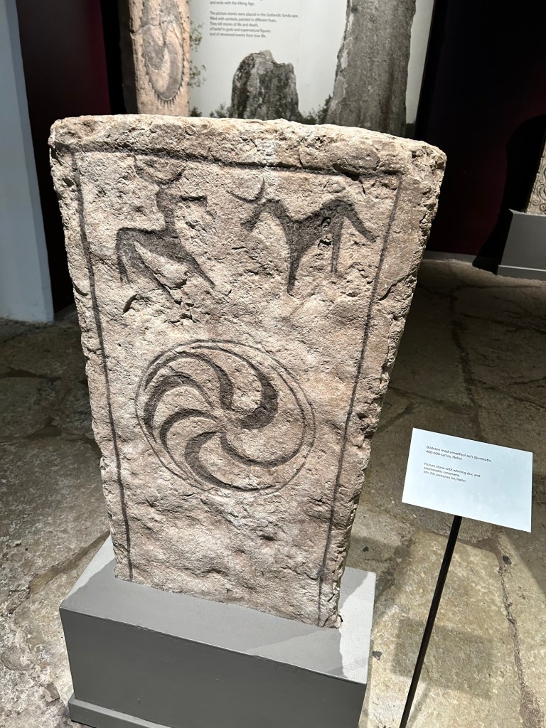
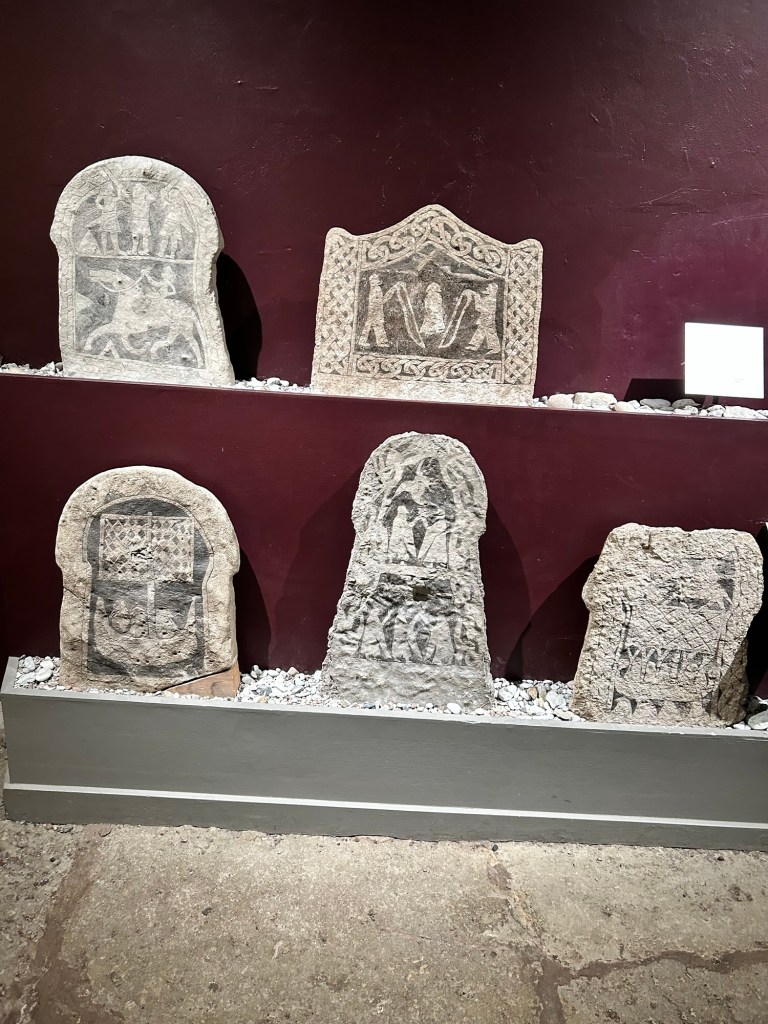
Sharing is caring, regardless, so let’s take a look at Gotland Museum. There are four floors, each with two or three galleries. Floor 0 is where we enter, pay admission, check out the bookstore and spend time with Gotland’s unique Picture Stones.

Many picture stones were originally painted with red, yellow or blue pigment. Most have lost the pigmentation, over the centuries.

The standing stones are all over Gotland and its northern offshore sibling, Faro (not to be confused with the resort city in Portugal’s Algarve). See gotlandpicturestones.se

Here are a few scenes of that gallery.

This came from the early Christian era, most likely commissioned by someone looking to protect his farm.
The pinwheel also is a
harbinger of good fortune.
This tells the story of a horse and a deer.

This one has a sensor, which fills in the colours when someone approaches.

There are several others in the gallery, but here is a tableau of some smaller reproductions from around Gotland.

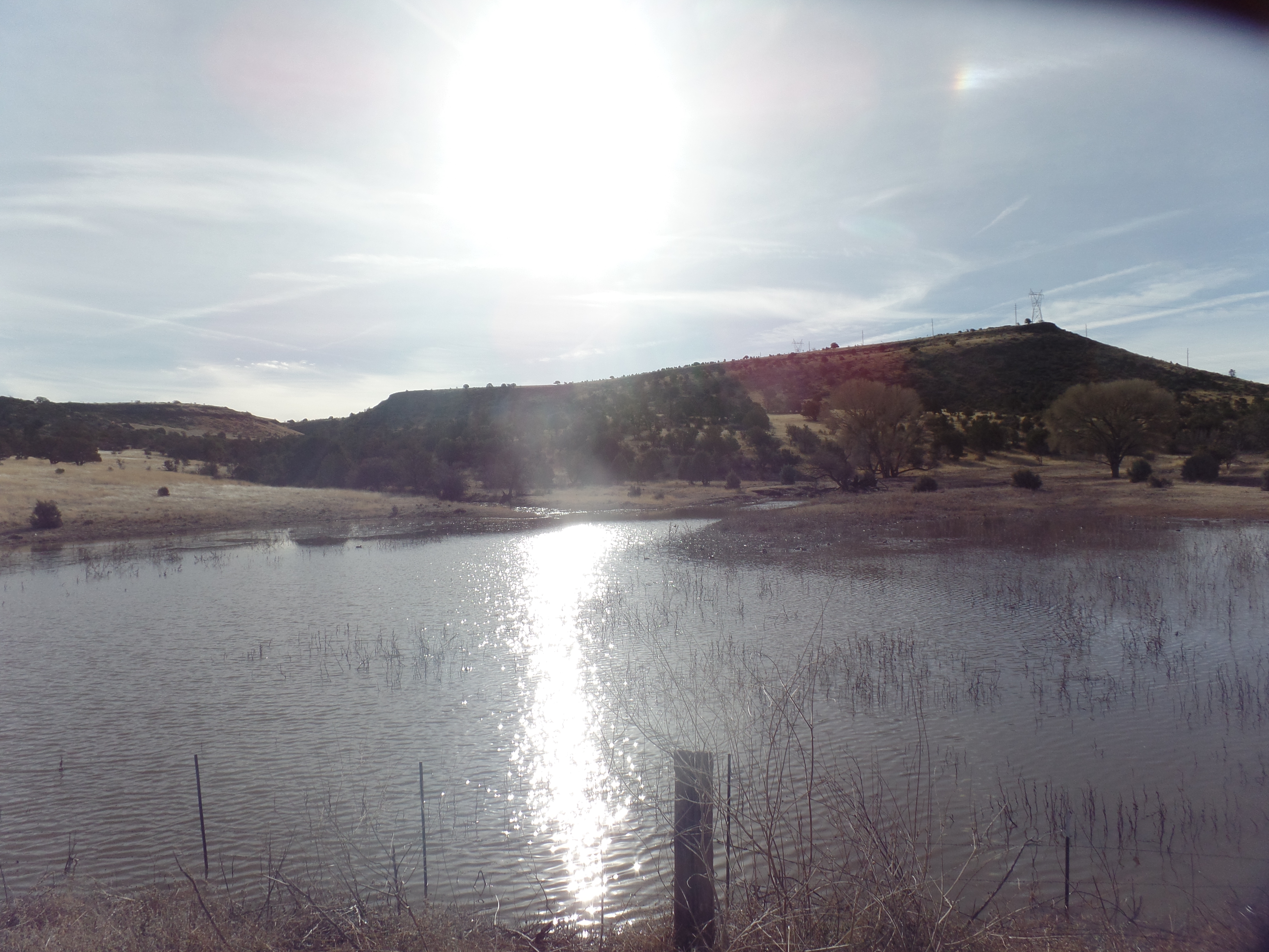
Up to Floor #1, we find The geology of Gotland. It, like the rest of Scandinavia, was once buried under ice. As the glaciers retreated, the Baltic Sea filled in, while islands like Oland, Aland, Bornholm and Gotland remained above water, being the tops of small hills.

Sandstone and limestone predominate the gently rising, but mostly flat landscape. There are some forests, but Gotland is still mostly farmland.

Floors 2 and 3 feature the history of Gotland and stories told by local children and youth, respectively. The historical part begins with a Norse creation story. Odin, representing the Sun, brings the world to life. He and other deities guide people in the ways of right living. All the while, the ravenous Wolf watches and waits. At the end time of Ragnarok, the Wolf will swallow Odin.

On that cheerful note, the story of Gotland proceeds, through its early days of increasingly successful farming, the Viking Era, Hanseatic League and incorporation into the Kingdom of Sweden.

It was during the Hanseatic period that the wall encircling Visby was built. At the East Gate, all peasants wanting to sell produce at Visby’s market had to pay a toll. Those trying to sell elsewhere were fined pr flogged. This was the stricture of the manorial system.

On the third floor, there are both paintings and recorded stories by Gotland residents.

The painting above shows the juxtaposition of hillside Visby with the sea.

The museum was founded in 1875, by Per Arvid Save( pronounced SAH- vay) and the Friends of Gotlanf, with the aim of preserving the island’s rich heritage and sharing it with the world. Dr. Save encouraged the farmers and fishers of Gotland to safeguard the picture stones they found about their homes and nearby lands.

Next, I will visit the ruined churches of Visby’s centrum, with the help of my laptop.

The Road to Diamond, Day 120: Williamson Valley

2

March 28,2025- We came upon a small set of petroglyphs, whilst looking for the trail to an even larger display, in Williamson Valley, a horse-breeding and ranching area, northwest of Prescott. The area between the ranches and the looming presence of Granite Mountain was once a prime hunting and farming area for the Sinagua people, who predated the Yavapai-Apache.

Petroglyphs along trail in Williamson Valley

The area experienced glacial activity around 20,000 years ago, and as the glaciers retreated, granite and limestone boulders were left behind, creating astonishing landscapes like the Granite and Willow Dells. Here, at the foot of Granite Mountain’s east face, the scenery is every bit as breathtaking.

Lichen-covered granite boulder, Williamson Valley
Boulder field, with juniper trees, Williamson Valley
Granite boulder field, Williamson Valley

We ended up not finding the larger collection of petroglyphs. That trail has been determined, though, and will be the focus of investigation, in the not too distant future. Williamson Valley’s trail system rivals that of the Granite Dells.

Salida Gulch’s Legacy

0

February 23, 2024- The images are still clear, after so many centuries: Big-horned sheep, dogs and dancing figures, presented in a small rock outcropping, possibly selected by the Huhugam people who once lived here, at the northern end of their realm, because of the smooth surface area of the slate.

My hiking buddy and I came here this morning, and found the petroglyphs, for which we had been searching for close to ninety minutes. We had gone up and over Salida Gulch, coming close to its junction with Blue Ridge Trail, then heading back towards the trailhead from which we started. About two miles further, there the images were, calling to us from a bygone millennium.

Infinity, a dancing figure and pronghorns- Salida Gulch Trail
Big-horned sheep and mystical symbols
Dancing figure, big-horned sheep spirals and possible snakes
Multiple big-horned sheep and what appears to be a mountain lion

This sort of find is one of the things that make hiking in the Southwest so very rewarding. The glacial residue, by itself, is another. Rocks and boulders are everywhere, along the paths carved by glaciers during the last great Ice Age. Here is a standing stone, reminiscent of Carnac, or Easter Island.

Another “sentinel”, left by glacial retreat.

There will be more such scenes, as March and April play out, here in Home Base I.

The Captain’s Trail

2

February 3, 2023-

Early morning at Watson Lake

It is Hiking Buddy’s birthday, so what better way to mark the occasion than for us to take in an unvisited trail, above Watson Lake. The approach to most trails on the east side of the lake lies in walking a 1/2 mile each way on Peavine Trail, a converted rail bed. This quotidian part of any hike has its own magic, depending on the time of day, as shown above.

Our jaunt was primarily concerned with Captain’s Trail, a fairly short walk up into the southern reach of Granite Dells. Fortunately, it is a loop trail, connecting with Easter Island Trail, which we did the last time we were here. Here are a few scenes of the robust rock formations, left us by glacial action during the Pleistocene Era, aka The Ice Age.

Looks like a family meeting, Captain’s Trail
Signs of an early Spring, Captain’s Trail
Folded serpent’s head, Captain’s Trail
Standing granite slabs, Captain’s Trail
View of Watson Lake, from Captain’s Trail

A birthday lunch at Wildflower Bakery capped the morning, before we had to head off to our respective errands. I got a much-needed haircut, deftly carried out by the manager of Fantastic Sam’s, with my regular barber temporarily out of commission. I would rather have done this, before our hike, but life is not always neat.

It is always enjoyable, to get on the trail with Akuura- and with so many trails in this area, not to mention Sedona, it ought to be a wondrous Spring.