A Healing Place In Home Base

2

April 28, 2023- The images have faded, over the last eight hundred or so years, but their messages still find their way into the psyches of the attentive and intuitive. A ring of seven petroglyphs summons the spiritual energy of those who drew them, and of their descendants who have also gone on.

Hikindg Buddy, Akuura, and I sat atop Solstice Mesa, from which one may see all of the area’s mountains, hills and buttes. Having long wanted to find a space where I might honour the solstices and equinoxes, and of finding at least one kindred soul to join, who was not lost in judgment of me-as people in Sedona and Paulden have become, the Universe arranged both. Here are a few scenes of Prescott Lakes, where the mesa is located.

Panorama Trailhead, Vista Park
Volcanic outcropping, Vista Hill
Petroglyph Point, Solstice Mesa
Message from our ancestors.
Set of ancient messages
Wheel in motion
Angel, or birdman?

We sat and talked for quite a bit longer, at this spot. It was just a much more assuring vibe-reminiscent of Airport Mesa, in Sedona, but without the crowds and the hubris of some of the locals. I guess the most important element is that Solstice Mesa is the long-sought center, in Prescott’s wheel- with Mingus Mountain (east), Wolverton Mountain (south), Thumb Butte (west) and Granite Mountain (north) as its spokes.

Ms. Colter’s Long View

2

April 22,2019, Grand Canyon National Park-

No visit to this most spectacular of Mother Nature’s North American wonders is complete, without due honour being paid to the incomparable figure of Mary Elizabeth Jane Colter.  One of the few female architects of her time, Ms. Colter was a driving force in the building of structures that well served the U.S. National Park Service, the Santa Fe Railroad and the Fred Harvey Company-which was a major concessionaire to both entities.  Her buildings have withstood the test of time and uniformly add luster to the communities in which they are, or were, found:  Winslow, AZ (La Posada Hotel), Harvey House (now Imperial Western Beer Company), in Los Angeles’ Union Station, La Fonda Hotel, in Santa Fe and the majestic, but now defunct, El Navajo Hotel, in Gallup, NM.

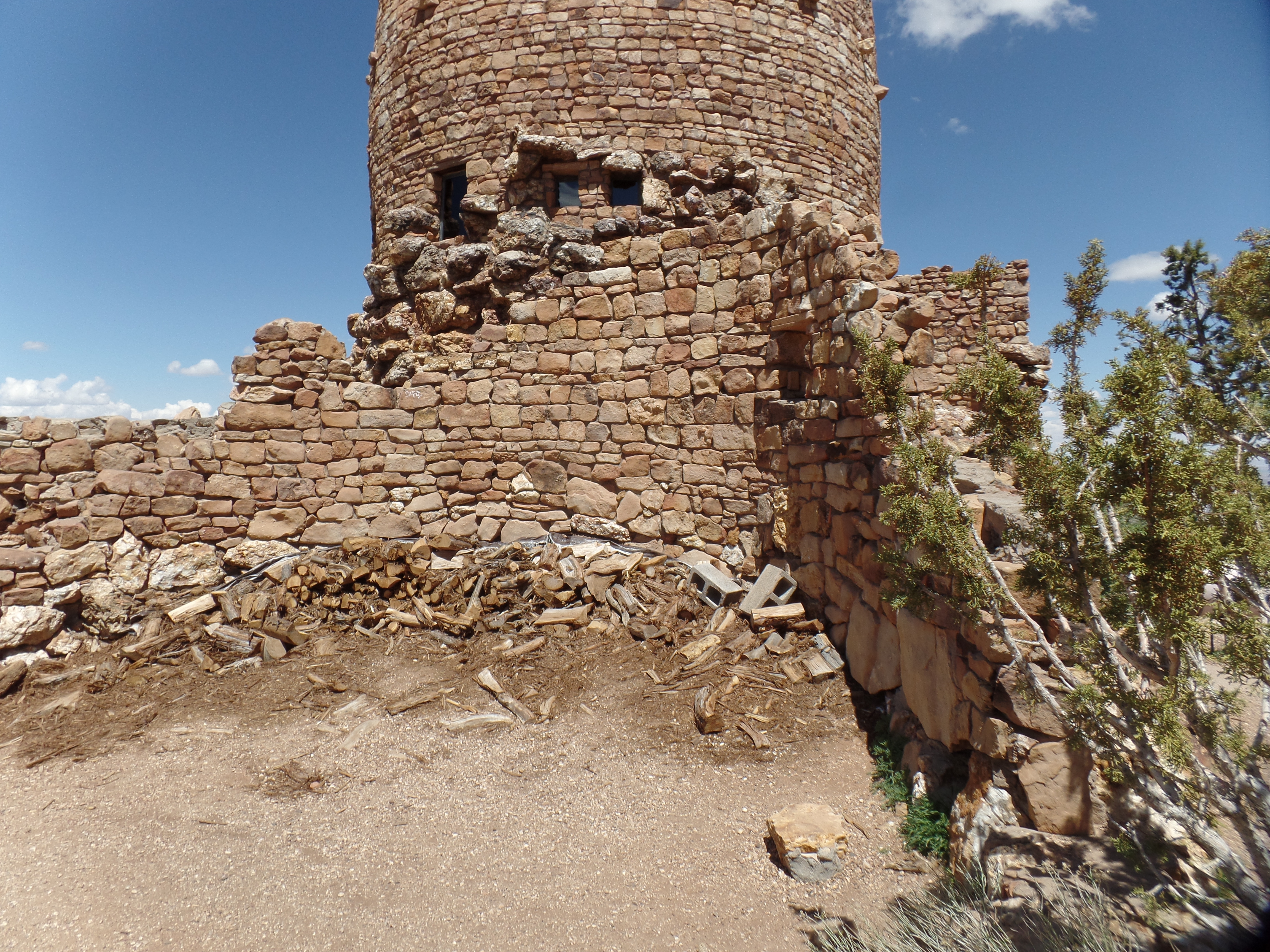
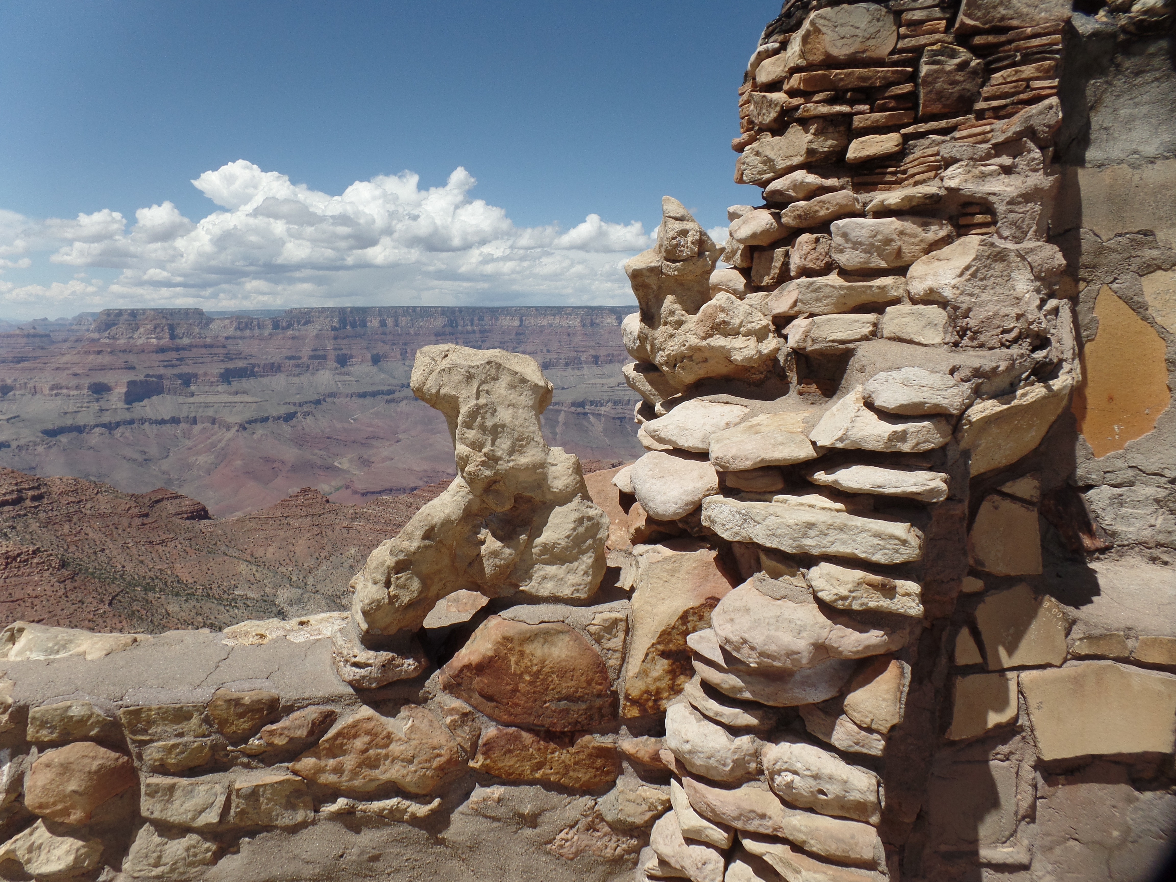
Mary Elizabeth’s most enduring body of work, now listed as a National Historic District, lies in the magnificent buildings which she designed and built, along the Grand Canyon’s South Rim and at the bottom of the Canyon itself.  These include Bright Angel Lodge (in which Penny and I stayed, in 1983); Hopi House,Hermit’s Rest and the arresting Desert View Watchtower.

SAMSUNG CAMERA PICTURES

There are cracks and breaks actually included in Ms. Colter’s design.  She also placed a seemingly demolished brick wall, on the Tower’s south side- perhaps as a wind break.

SAMSUNG CAMERA PICTURES

The views from each level of the Tower are second to none. Below is a view of Venus Temple.

SAMSUNG CAMERA PICTURES

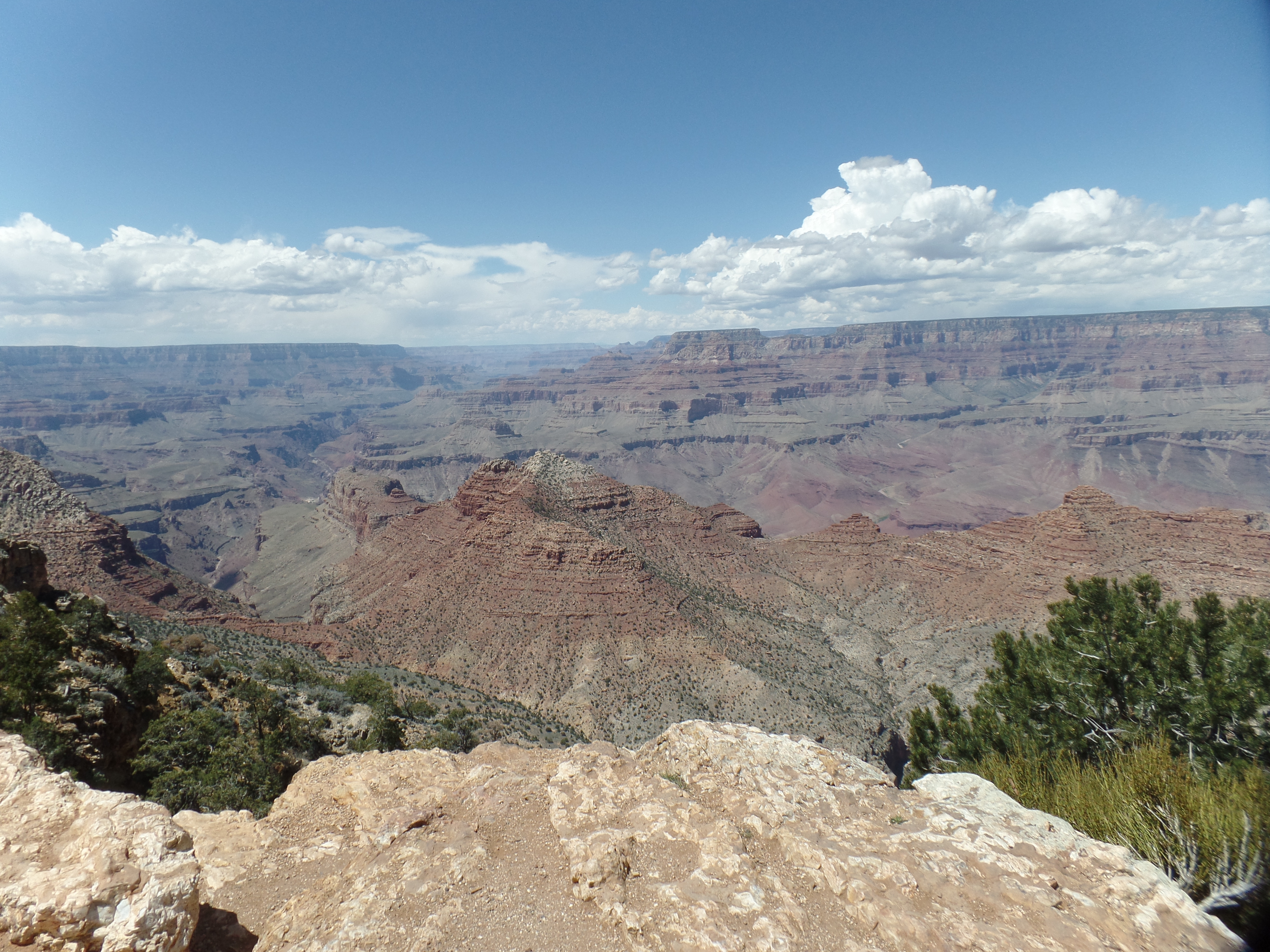
The area west of Desert View constitutes the Inner Gorge of the Grand Canyon, and features many of the “Eastern” and “Egyptian” formations, named for Indian and Egyptian mystical figures.  The Colorado River itself, though, is never far from focus.

SAMSUNG CAMERA PICTURES

For that matter, neither is the North Rim, which will be the focus of a second Grand Canyon visit, in late summer, in this year of the Park’s centenary.

SAMSUNG CAMERA PICTURES

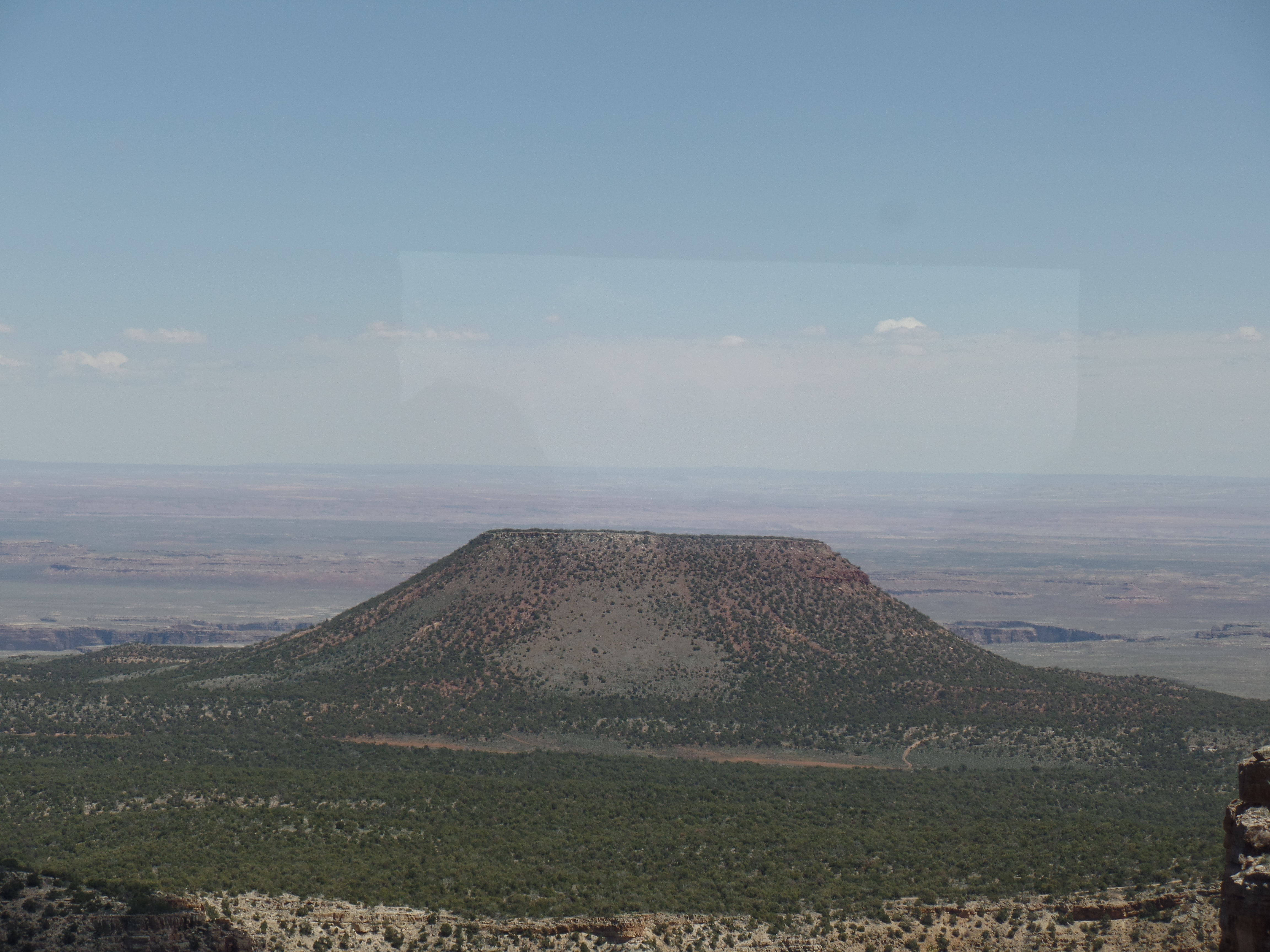
Temple Butte, seen below, marks the eastern end of the Canyon’s rim.  From that point, eastward, lie the Navajo Nation and the Painted Desert, itself a defining feature of the Little Colorado/Puerco River Basin.

SAMSUNG CAMERA PICTURES

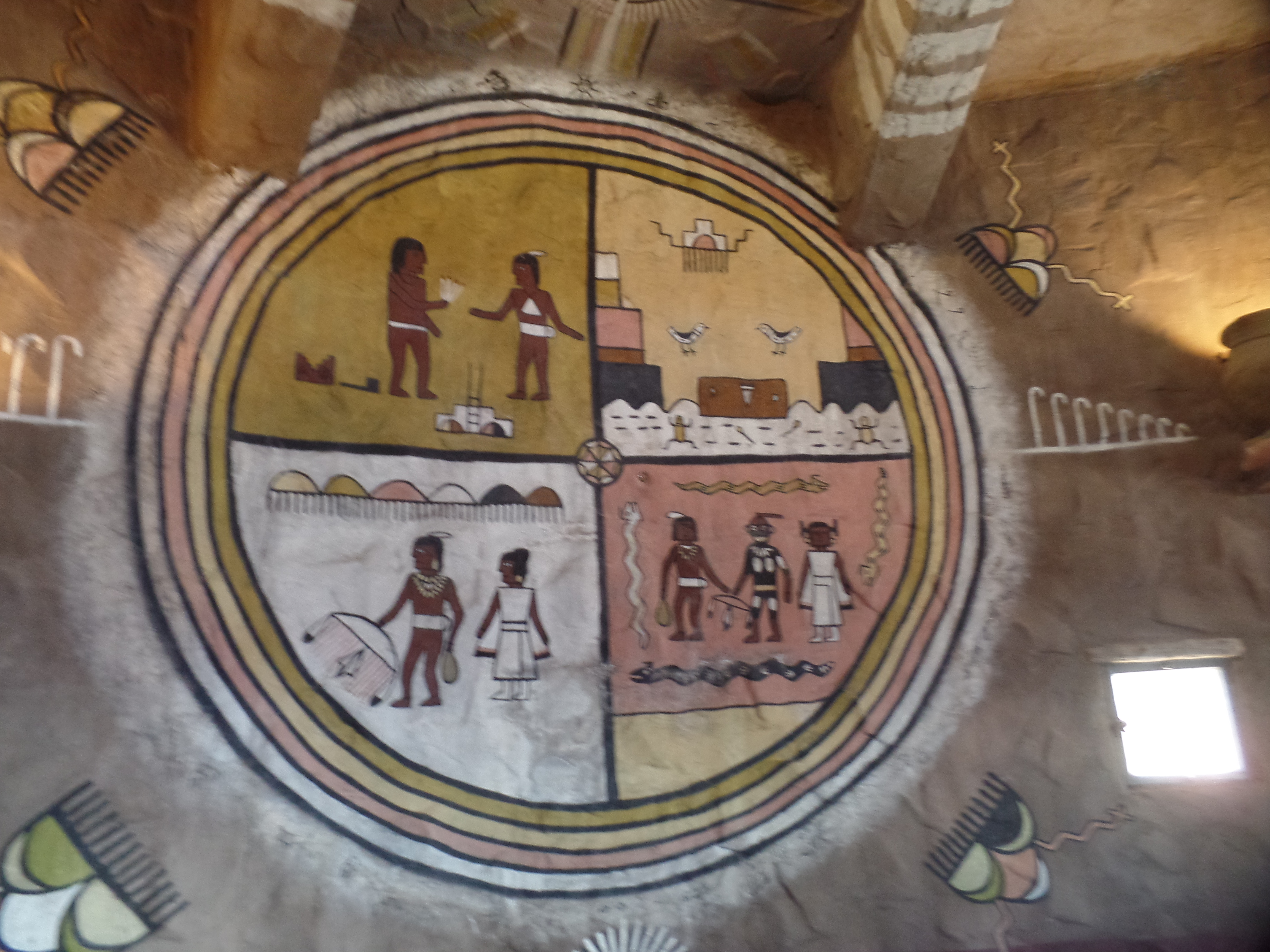
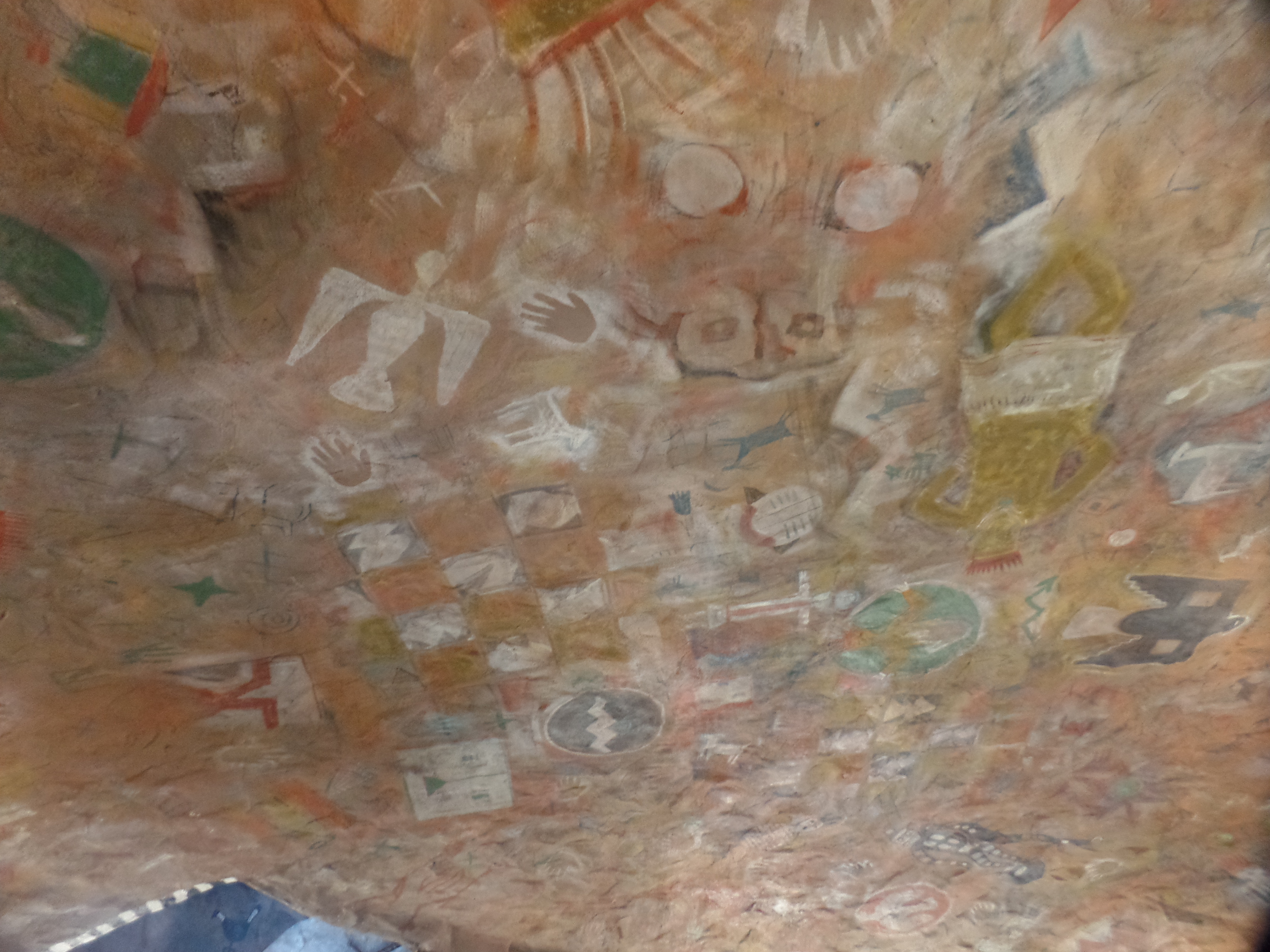
The interior of the Watchtower is no less captivating. Ms. Colter was enthralled from childhood with Native American art and lore, starting with Lakota Sioux drawings which she obtained from a friend, whilst living in St. Paul.  After goong to work fro Fred Harvey Company, that interest quickly extended to the art of the Dineh, Zuni and Hopi.

The panels below illustrate some Hopi spiritual concepts, painted by master artist Fred Kabotie, a key collaborator with Ms. Colter, in the course of her building decoration.

SAMSUNG CAMERA PICTURES

SAMSUNG CAMERA PICTURES

These stairs were likely used by Mr. Kabotie, during his time as the Watchtower’s caretaker.  Now, they are a simple decoration.

SAMSUNG CAMERA PICTURES

Animals being a major element of Hopi and Dineh culture, figurines have been carved and left in conspicuous places.

SAMSUNG CAMERA PICTURES

SAMSUNG CAMERA PICTURES

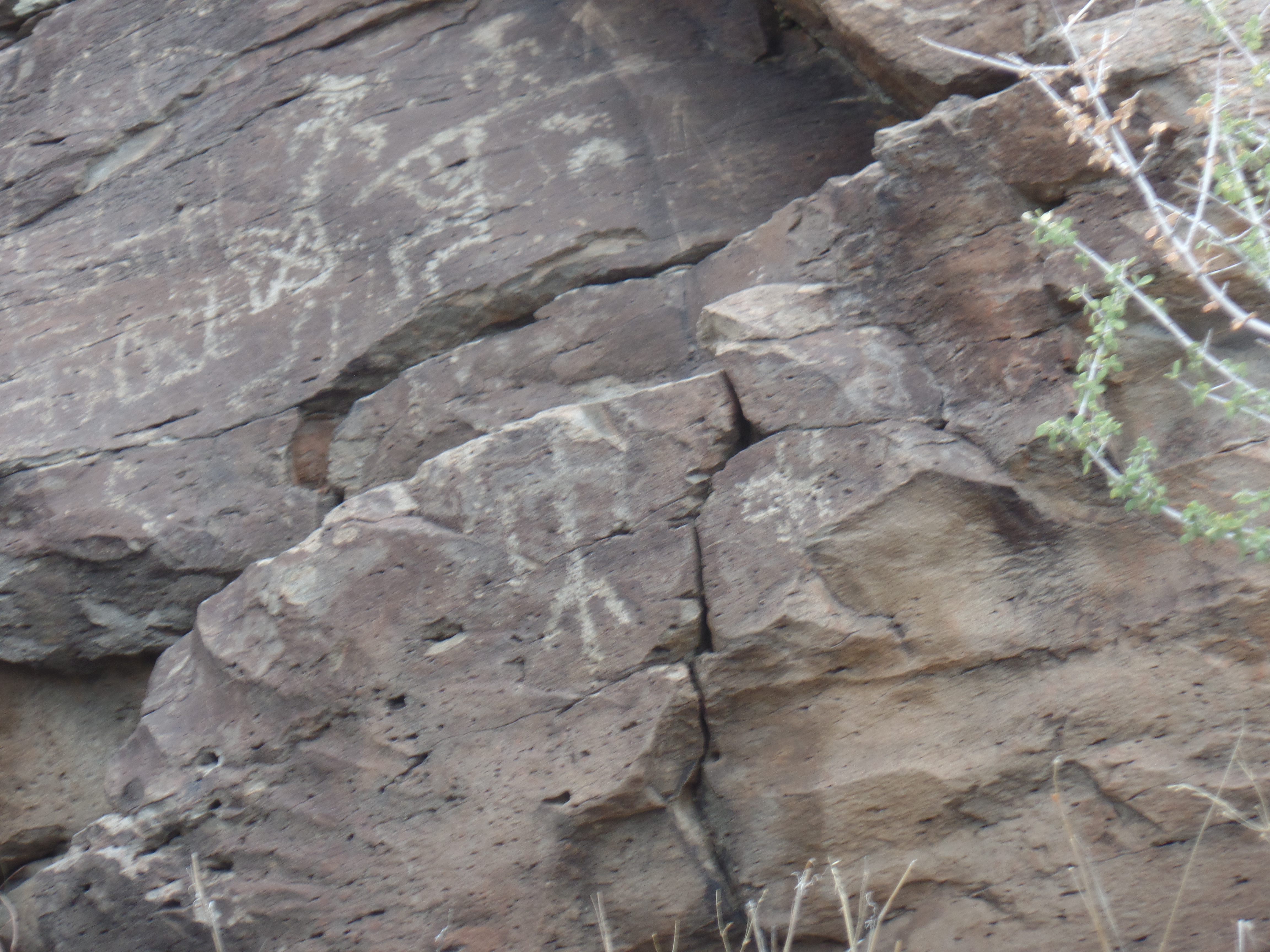
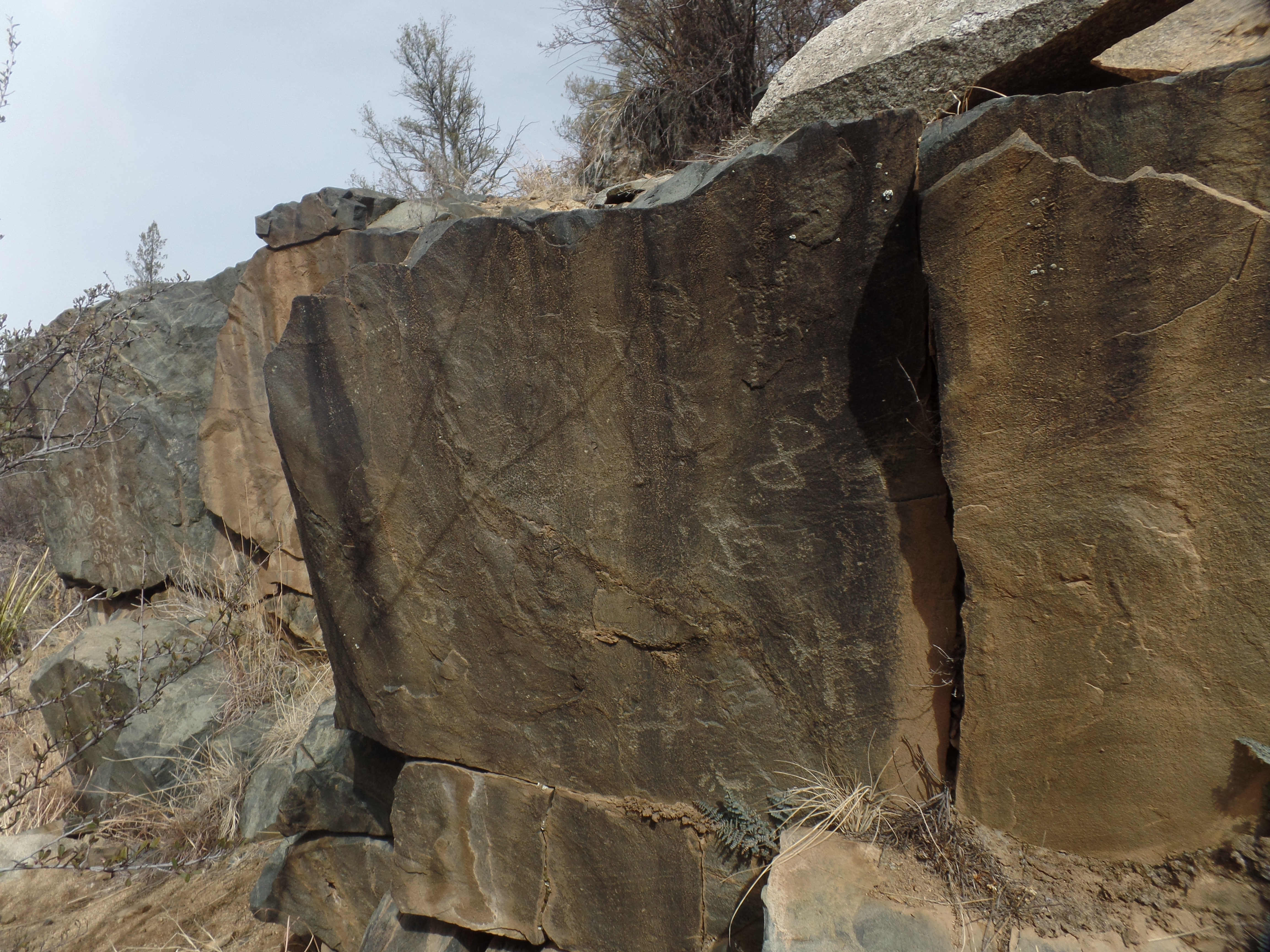
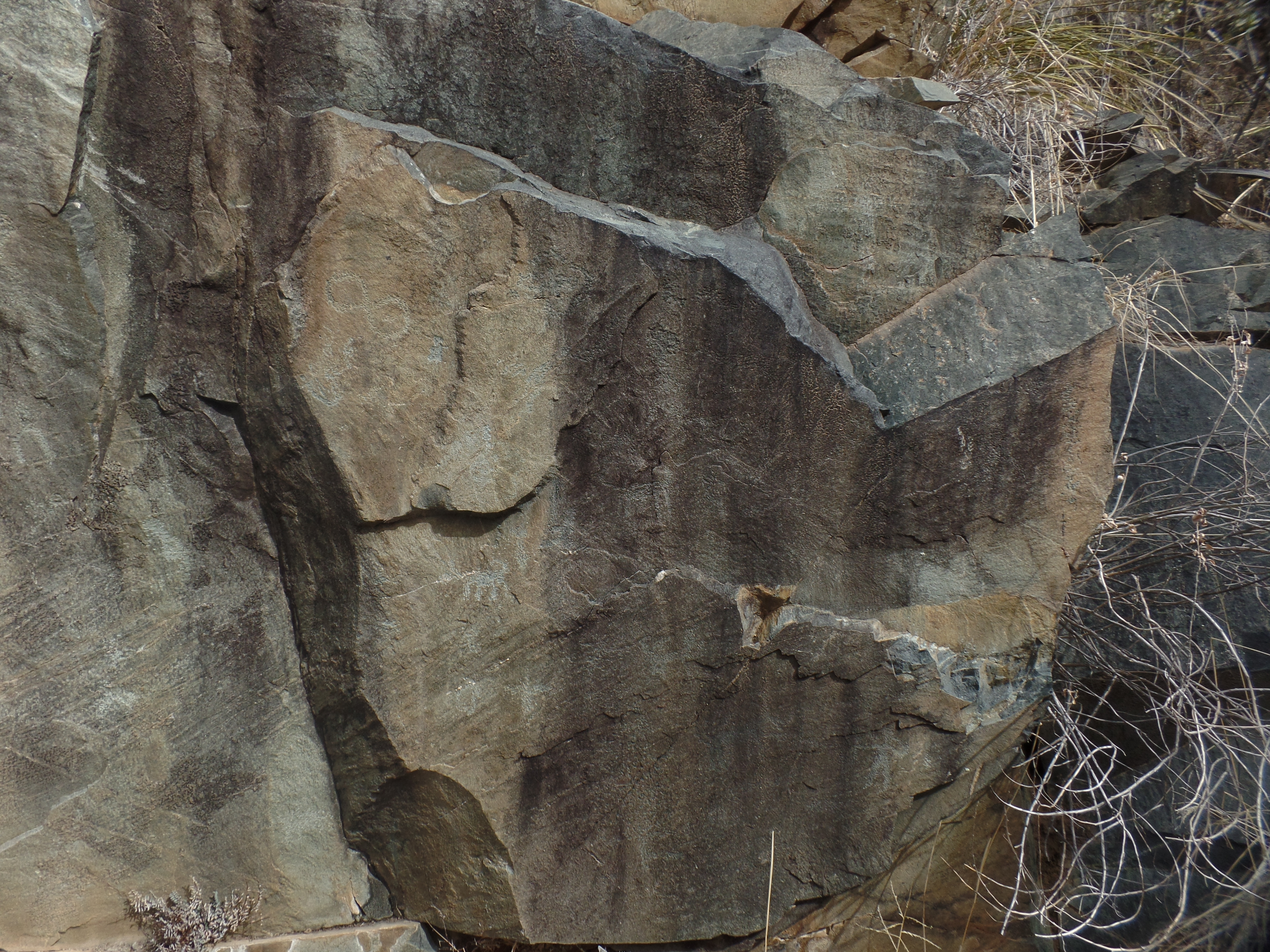
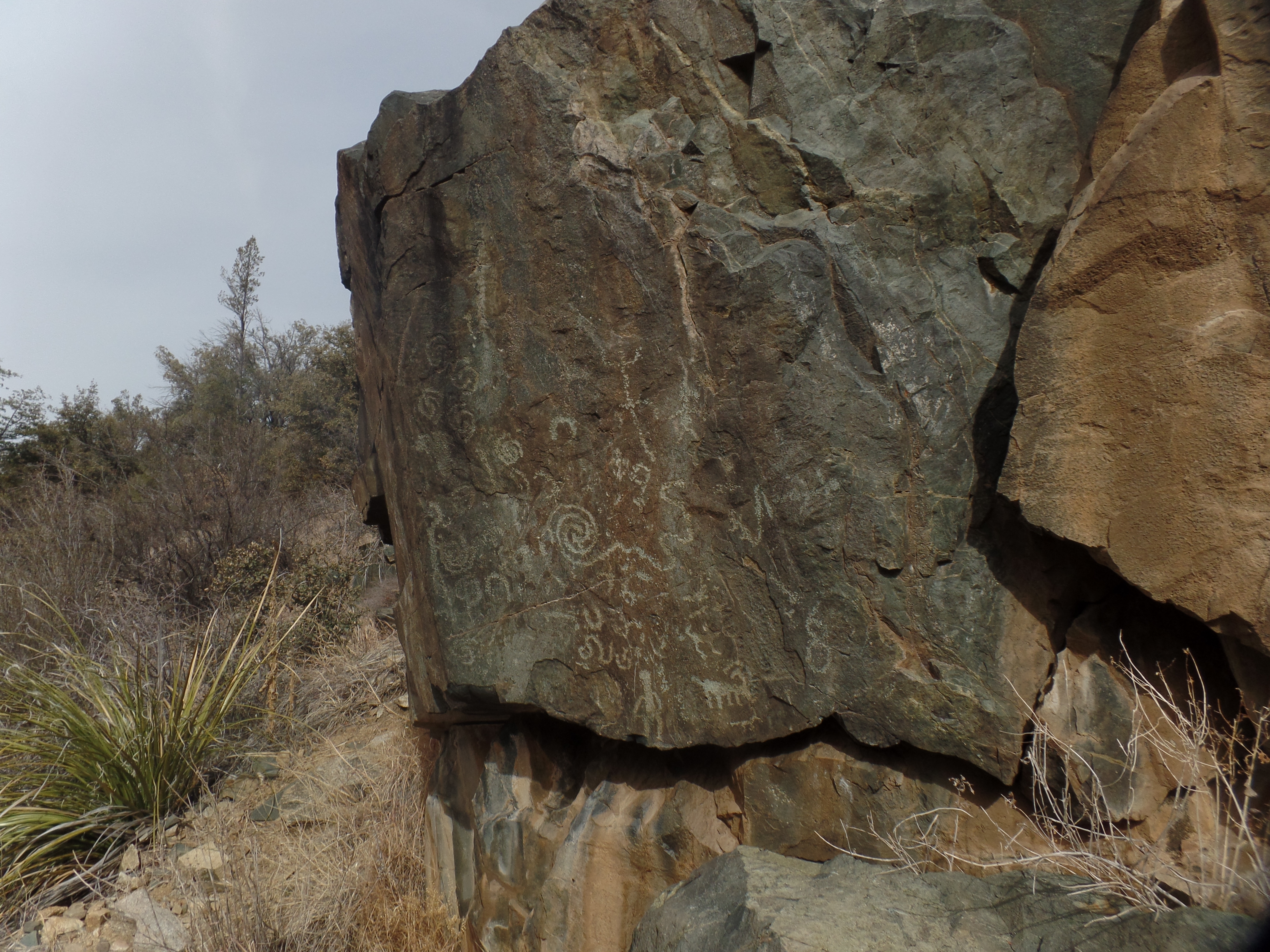
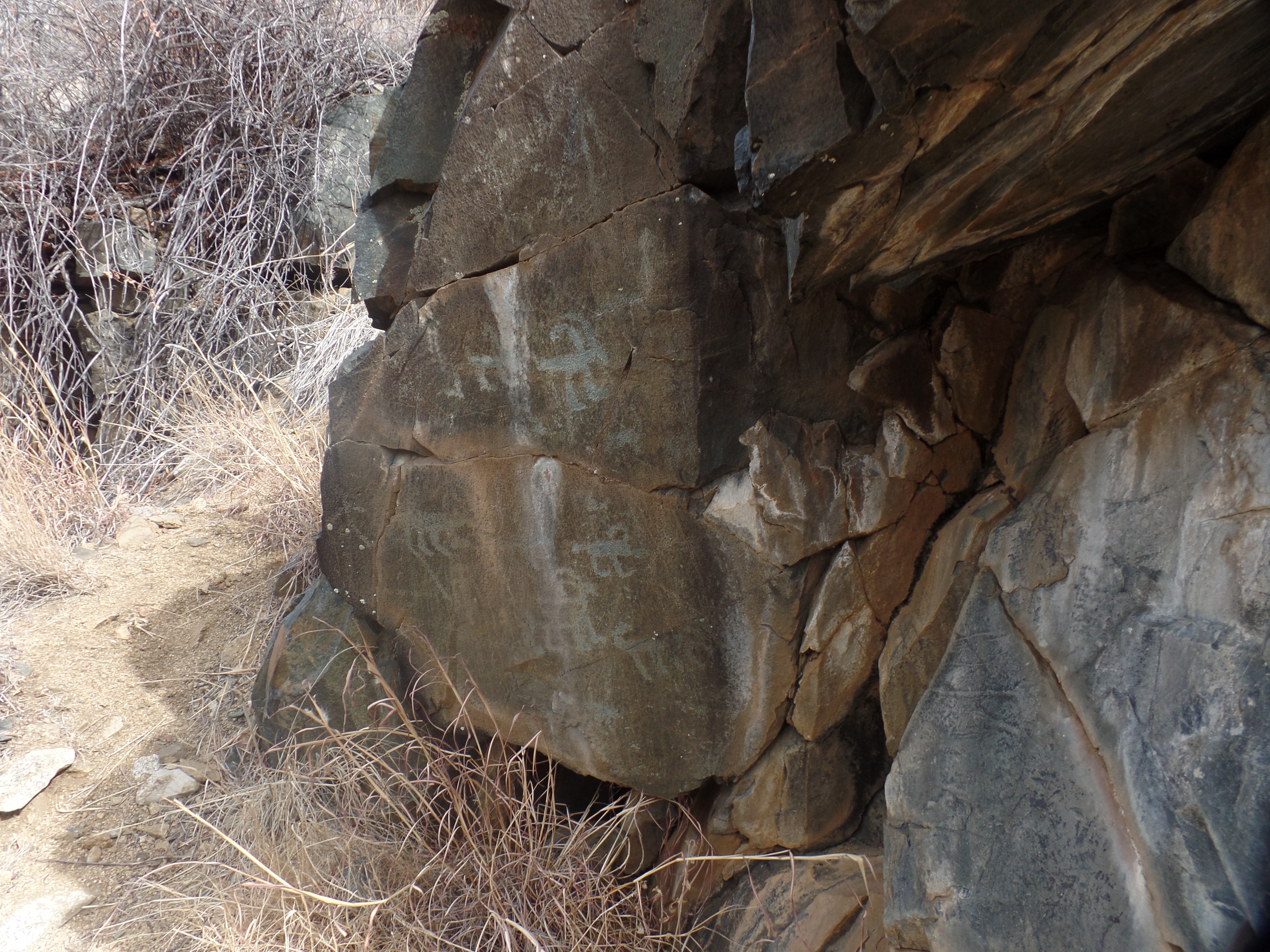
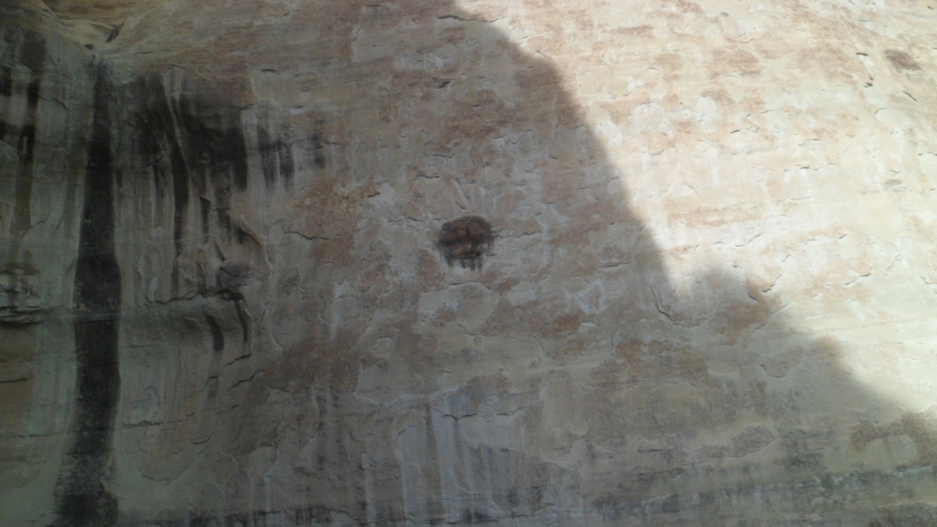
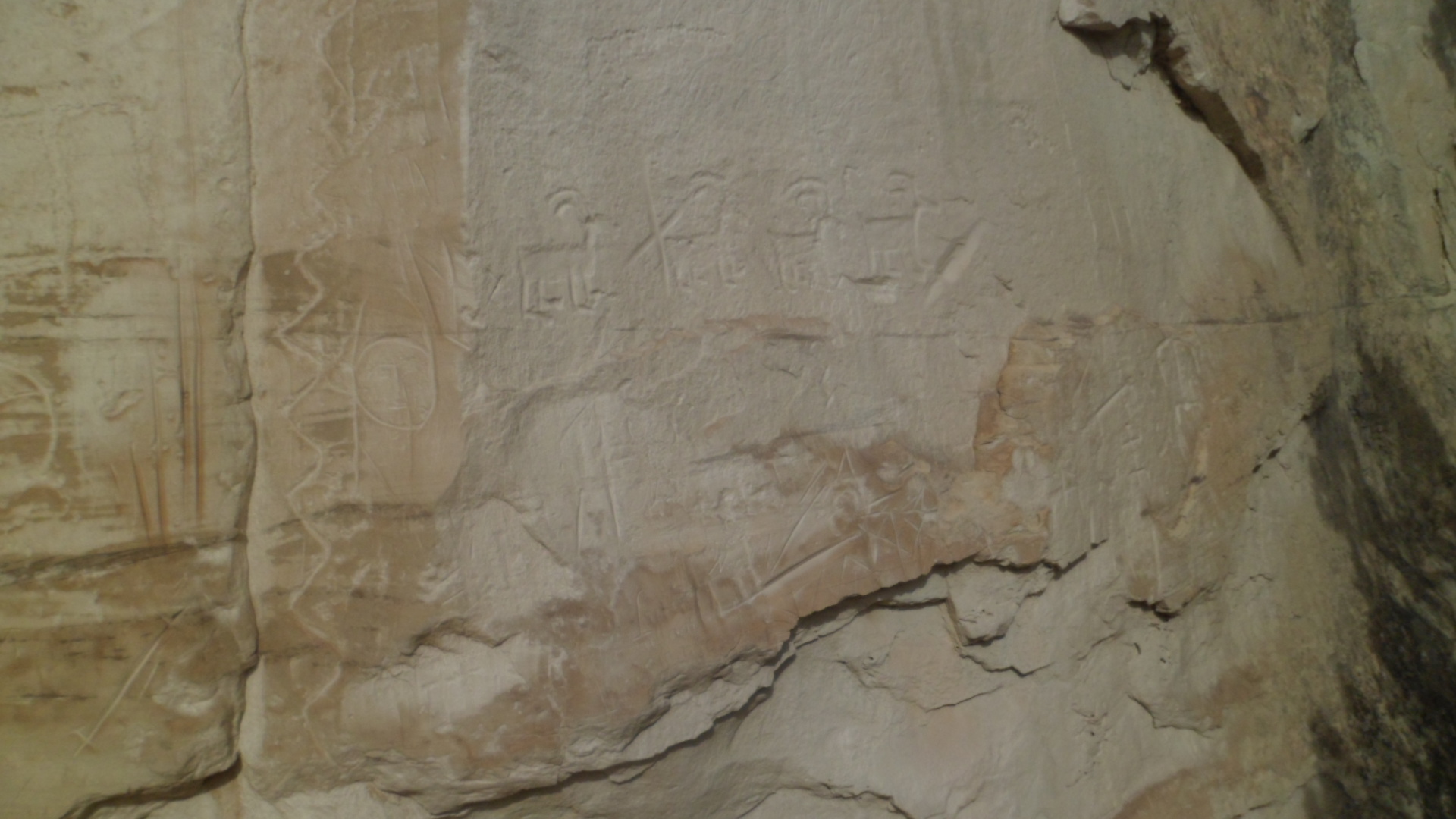
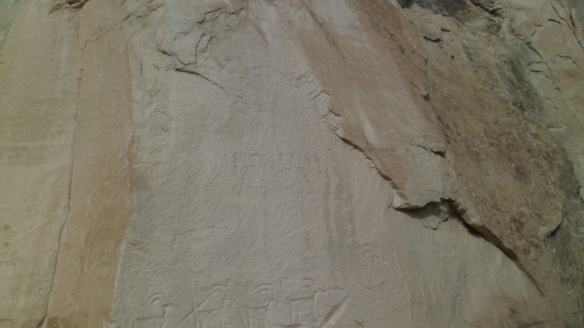
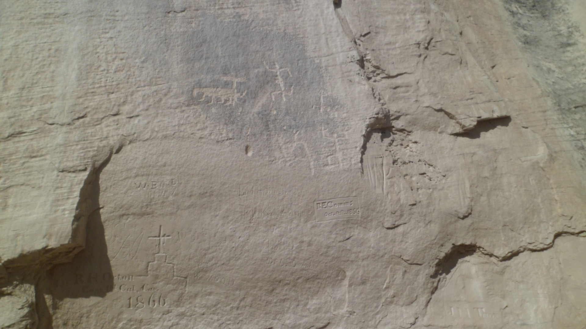
So, too, are pictographs, drawn here by Fred Kabotie  and his associates, but found in many places in the Southwest-and around the globe, as remnants of  ancient cultures. Pictographs are drawn rock art, as opposed to petroglyphs, which are carved into the stone.

SAMSUNG CAMERA PICTURES

The ceiling of the Watchtower is the one place where Ms. Colter let her associates run riot with colour painting.  The idea was to represent the fullness of the Universe.

SAMSUNG CAMERA PICTURES

It is from the third floor of the Watchtower, that images such as this may be gleaned.

SAMSUNG CAMERA PICTURES

From here, I headed a bit further west, to Navajo and Lipan Points, getting further perspective on the Inner Gorge. The formations in the foreground are of Redwall Limestone and Supai Group of sandstone deposits, from the Pennsylvanian Period (332.2-289.9 million years ago).  This scene is from Navajo Point.

SAMSUNG CAMERA PICTURES

Redwall Limestone, (340 million years ago), is prominent, as the Canyon rises up to its Inner Gorge temples.

SAMSUNG CAMERA PICTURES

Here is a zoomed view of the Watchtower, from Navajo Point.

SAMSUNG CAMERA PICTURES

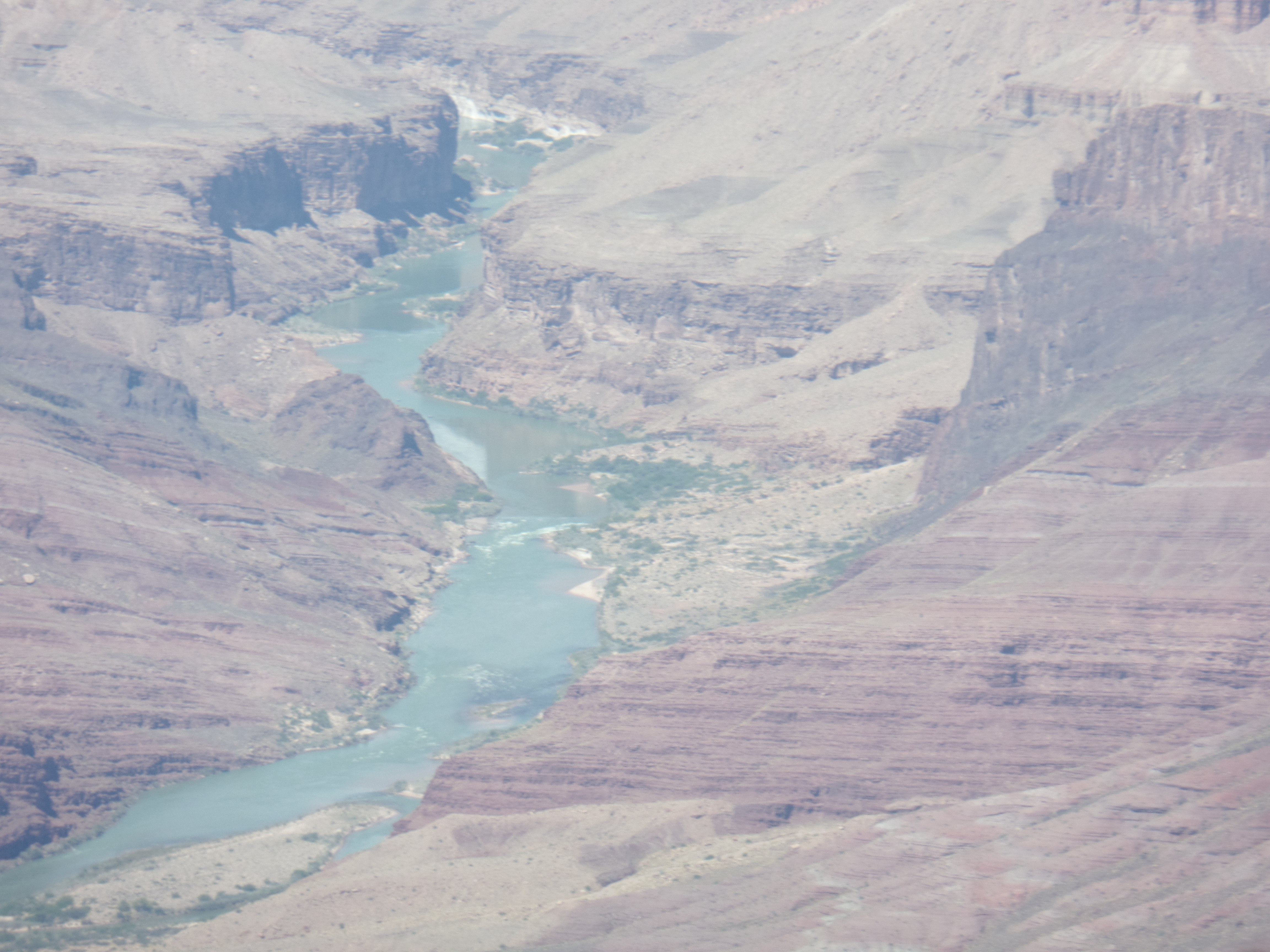
Also from Navajo Point, is a glimpse of what makes rafting the Colorado such an enticing experience for many.

SAMSUNG CAMERA PICTURES

As I reached Lipan Point, I found this to be the last scene from my present SIM card on the Samsung.

SAMSUNG CAMERA PICTURES

So, my trusty cellular was pressed into service.  Lipan Point, which juts headlong into the Inner Gorge, gives the area a compressed quality.  Don’t let the appearance of compactness deceive you.  The Inner Gorge is 18 miles across, at its widest point.

20190422_140711[1]

20190422_140715[1]

20190422_140718[1]

Here one sees the Kaibab Formation, the present “top” of the Grand Canyon, at the North Rim. 22 miles from Lipan Point, as the condor flies.

20190422_140820[1]

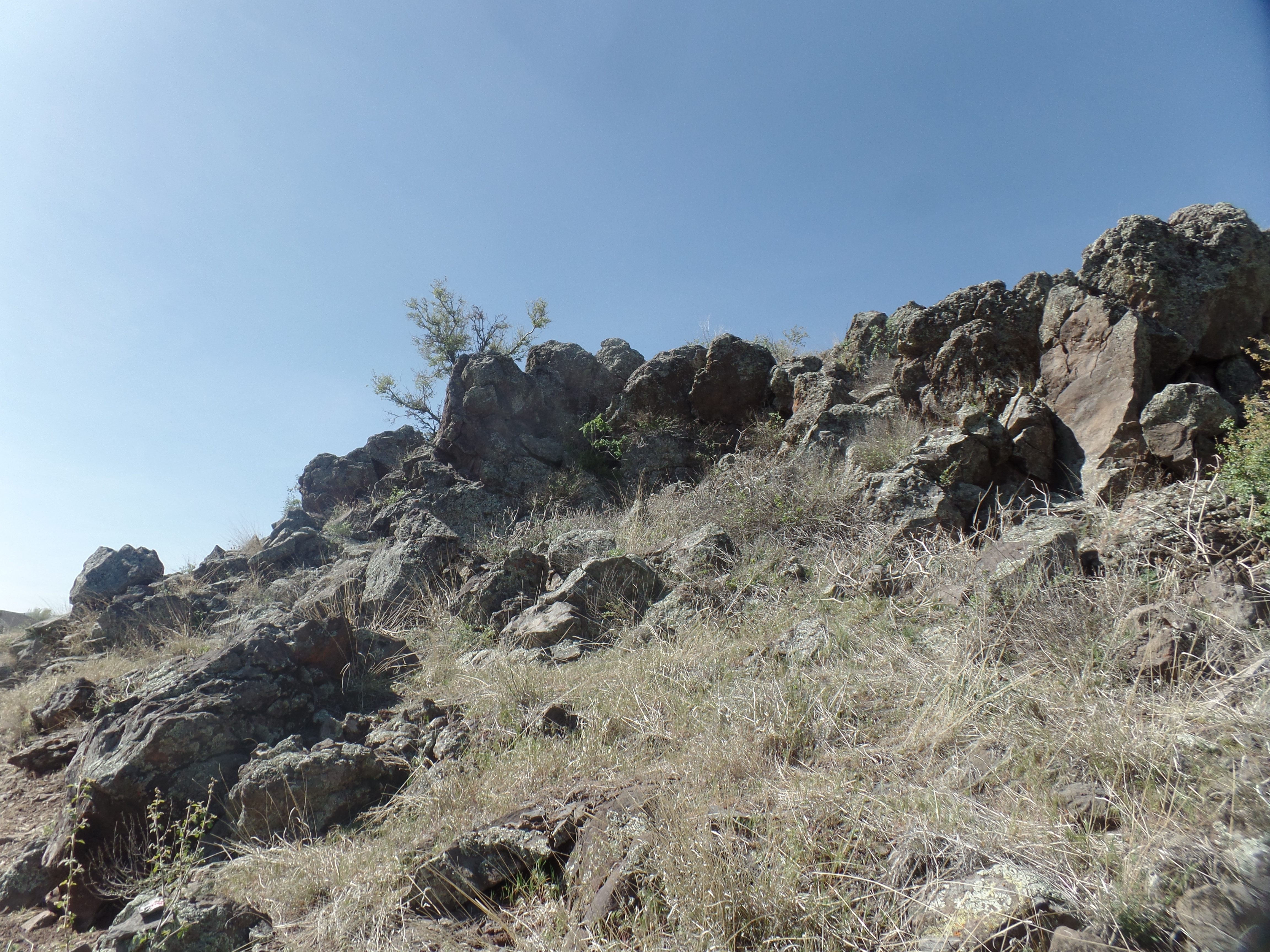
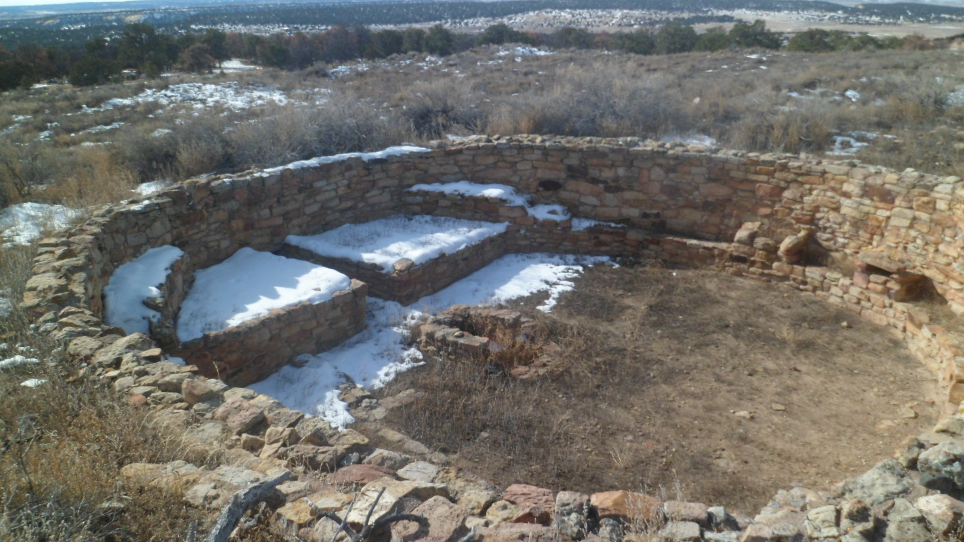
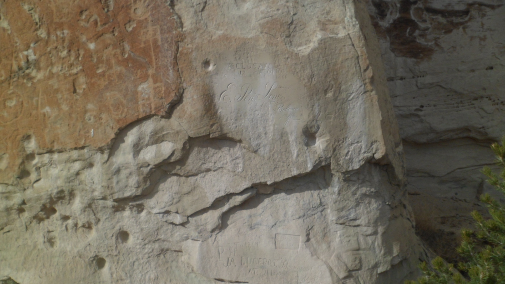
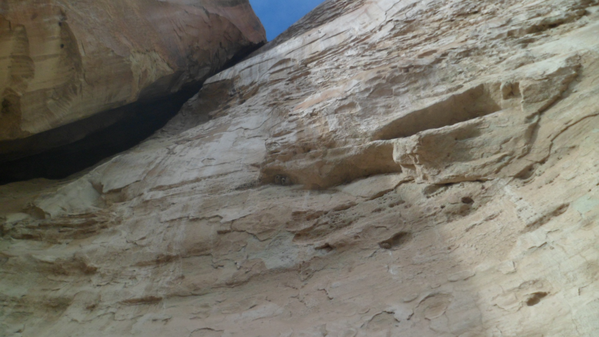
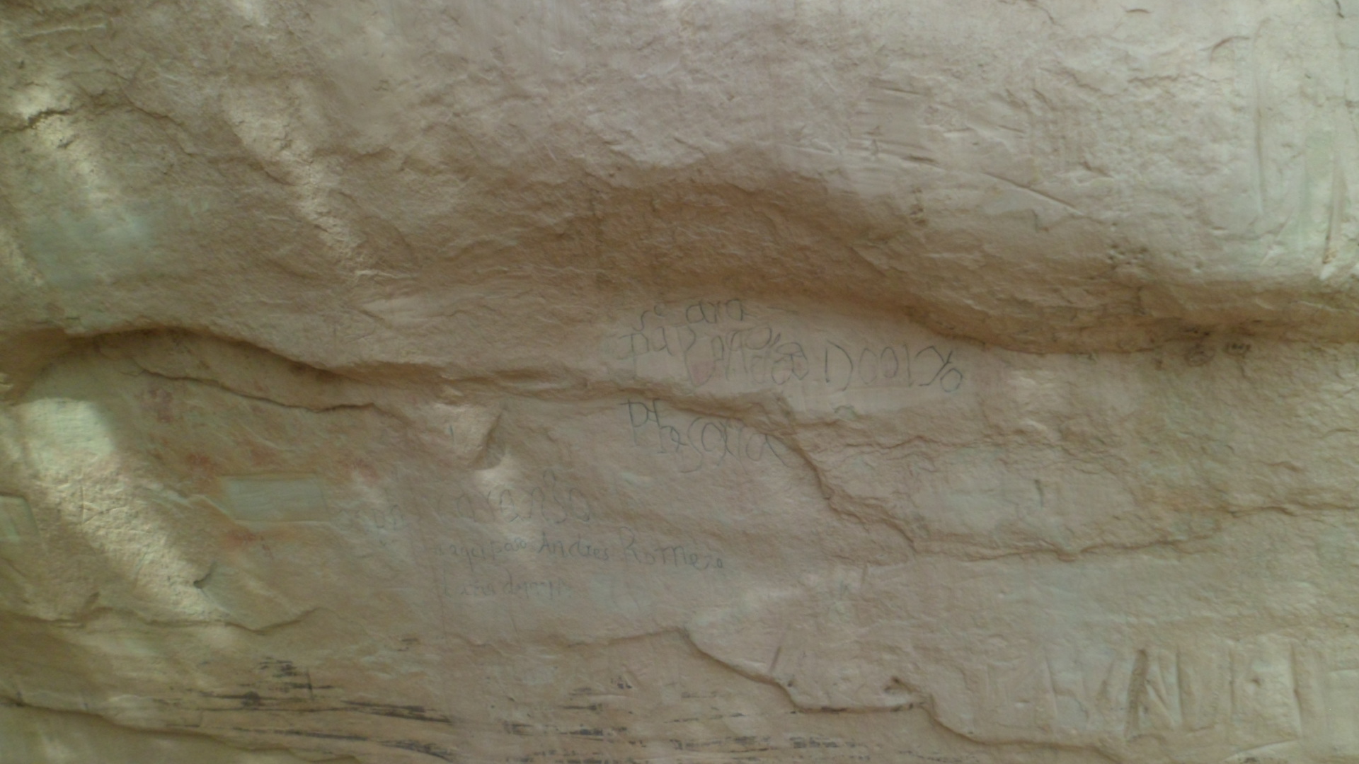
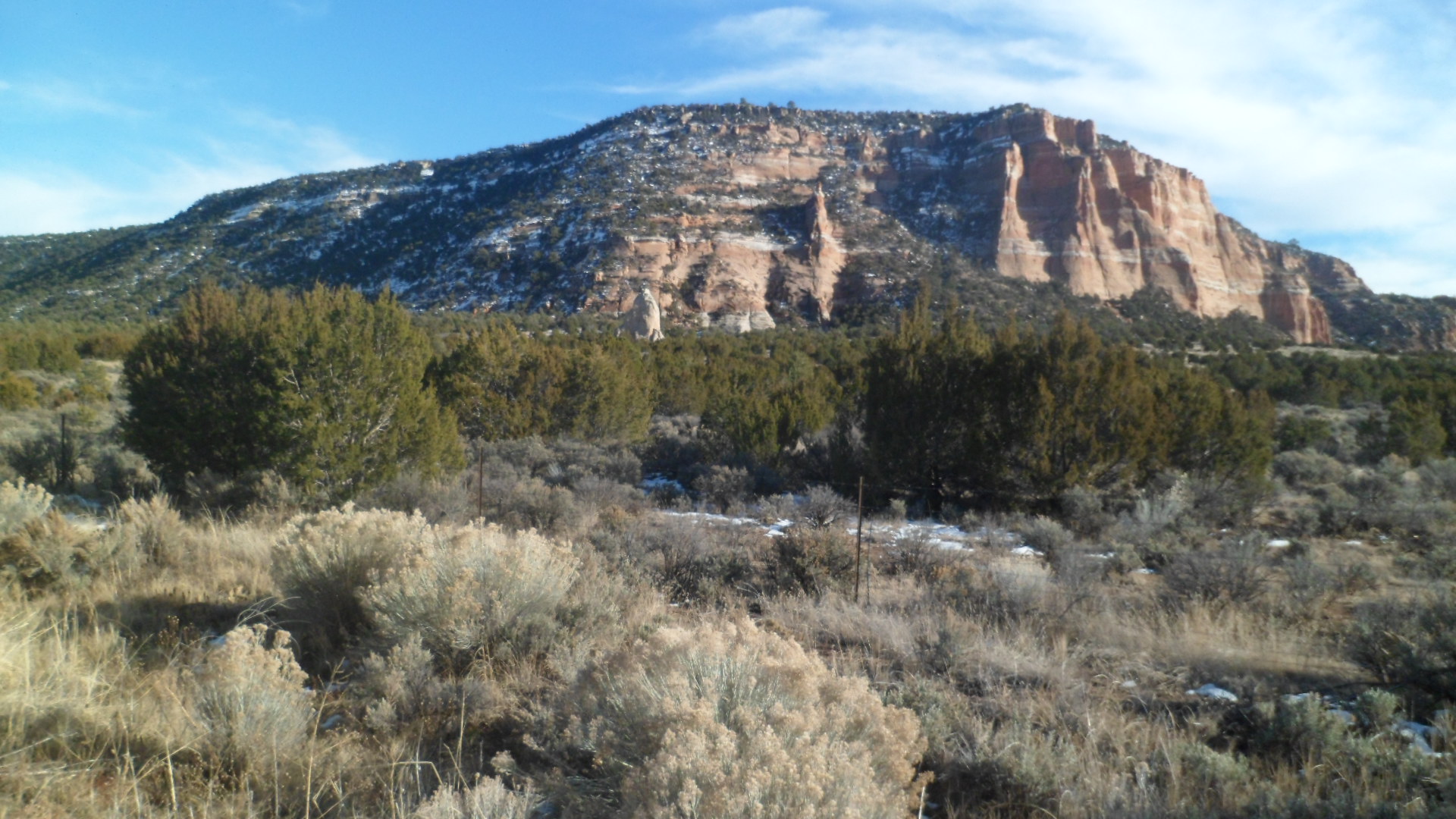
From Lipan, I drove into the forest a bit, for a look at Tusayan Ruin, a Pueblo II ( 900-1150) settlement which appears to have lasted well into the 13th Century, in the midst of Pueblo III cultures.

20190422_142401[1]

20190422_142516[1]

Here is a communal gathering place, perhaps for spiritual activities.

20190422_142523[1]

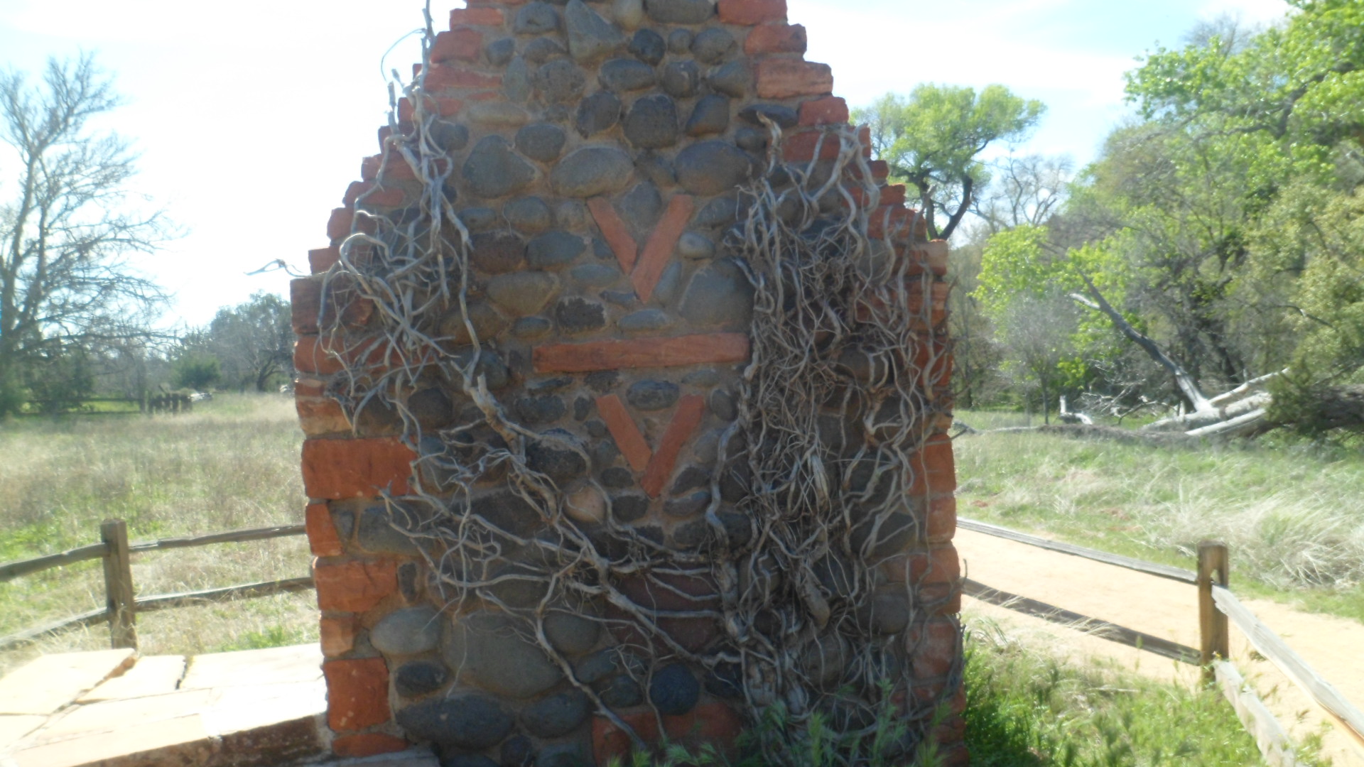
This  space appears to have served as an apartment for one of the larger families.

20190422_142707[1]

The people who lived at Tusayan likely intermarried with those of the Pueblo III culture, who had moved into the area, from the northeast, towards the end of the 12th Century.

My daylong venture along the two great gorges of the Colorado River system came to an end, but not my appreciation for one of the finest talents, of the Twentieth Century,  in southwestern architecture.  Mary Elizabeth Jane Colter surely rates on par with Paolo Soleri and Frank Lloyd Wright, in terms of contribution to the public square.


The Road to 65, Mile 114: V Bar V

9

March 22, 2015, Montezuma Well-  Today would have been my father’s 88th birthday.  He’s been gone from us for 29 years now, but the wisdom of the man resonates still.  A lot of that wisdom, I am convinced, was passed down through the faded, but still perceptible, knowledge of our Penobscot ancestors.  I am ever drawn to Native American perspectives on matters, perhaps because of this.  Having lived among the Navajo and Hopi people for several years, I have internalized many of these perceptions.  I visited some long-time Baha’i friends this afternoon, in this quiet community, north of Camp Verde and along the tributary of the Verde River that is known as Wet Beaver Creek.  My friends, a Navajo man and his wife who is of European descent, and their elder daughter, greeted me at their home just west of  Montezuma Well National Monument.

 SAM_4612

After a light lunch, three of us went over to V Bar V Ranch Historical Site, which is maintained by the U. S. Forest Service.  Today was the second Archaeology Discovery Day, at this site.  There were several booths, as well as the permanent ruins of the ranch, from the 1880’s and several petroglyphs, which appear to be of the Beaver Creek Style, dating from the 12th and 13th Centuries, A.D., and associated with the people known commonly as Sinagua or, to their Hopi descendants, Hisatsinom.  In this style, animals and people are often depicted together- either as prey/predator or as observed and observer.

On the way in, we encountered the ruin of a chimney and fireplace, virtually all that is left of the ranch that that once dominated this area.  There is a former ranch house, now used as rangers’ offices, at the north end of the site and next to it, a Visitor Center.

SAM_4617

SAM_4614

We were first pleasantly greeted by a lilac bush.

SAM_4615

The importance of agriculture, then and now, was highlighted by a table which featured traditional plants and seeds of the area, including white and blue corn, and various beans and squash.  Brown native cotton was also on display.  We were each given several packs of heirloom seeds.SAM_4620

Each sherd of pottery found in the area is kept in a dignified manner.  Each piece is treated as representing the energy of the person who fashioned it, many centuries ago.  It was explained to us that many modern Native American officials a re now more interested in oil and mineral royalties, and the pursuit of corporate wealth, than in maintaining traditional languages and cultures.  The preservation of archaeological sites, then, is, ironically, entrusted to the Federal government.

SAM_4621

The petroglyphs themselves, and the way the sun hit an area near a crack in the rock face, drew the largest crowds..

SAM_4624

SAM_4628

SAM_4630

SAM_4630

SAM_4634

SAM_4636

SAM_4639

SAM_4642

Globemallow were in full bloom.SAM_4646

There was a spear throwing contest, using an atlatl.  None of us were immediately adept at it.  I would need several hours of practice, in order to properly use the instrument.SAM_4648

Many other wilderness survival tools were on display, including several fishing implements and hunting snares and traps.SAM_4652

As ever, my outing got an affirmation from the spirit realm.  There were several heart-shaped rocks along the trail.

SAM_4650

I was well-impressed by the site and the various displays, which offered a wealth of explanations to young and old alike. This was a fine way to offer an homage to my father.

site, which is now used as a ranger station, by the Forest Service.

The Road to 65, Mile 23, A Very Full Solstice, Part II: Passed by This Place

7

December 21, 2014, Socorro- I encountered two sets of people, atop Atsinna Pueblo, on El Morro.  One was a worldly, sophisticated couple, who showed mild interest in my observations, before  heading off to more intriguing things.  The others were grandparents and grandson, who had several questions about the nature of the settlement, and whether the Zuni were related to the Puebloans who lived in Atsinna, before the Spanish came.

These chance encounters set me to thinking;  What message, in picture and word, was each person who left his/her signature on Inscription Rock, trying to convey?  How has each been received by those who have seen these messages since?

Before addressing that issue further, let’s have a look at what we found yesterday, at Atsinna.

SAM_3293
SAM_3296

SAM_3294SAM_3299  The area that was once farmed, below, is now home to junipers and a few Ponderosa pines.

SAM_3300

Snow and ice have given the Headland Trail a rest for several months.

SAM_3302

I turned around and headed to Inscription Rock, for a new look at some old friends, from thirty-one years ago.  Here some of the better examples of each period’s messages to posterity.  Can you see any resemblance to Mount Rushmore, above the lichen-created heart?SAM_3308

The next three frames show the natural pool, created by runoff and preserved by an artificial dam, and the striation caused by mineral absorption.SAM_3311

SAM_3312

SAM_3314  Next, are inscriptions by Puebloan peoples, Spanish explorers, and Americans headed west.

SAM_3318
SAM_3319
SAM_3320

A pair of Cliff Swallows also leave their mark, in the form of nests, barely visible under the slight overhang.SAM_3322SAM_3325SAM_3328   SAM_3329SAM_3330 SAM_3334SAM_3339 How many signatures and petroglyphs can you discern?

I spent a few minutes driving around Zuni Pueblo, but with all shops closed on Sunday, and my own practice of not taking photos inside a Pueblo village, I leave you with these two views of nearby mesas, which are sacred to the Zuni.

SAM_3344

SAM_3346  I continued on to dinner, in Magdalena and a restful sleep, in Socorro.  NEXT UP:  Mile 24- Bosque del Apache National Wildlife Refuge and Fort Craig National Historic Site.