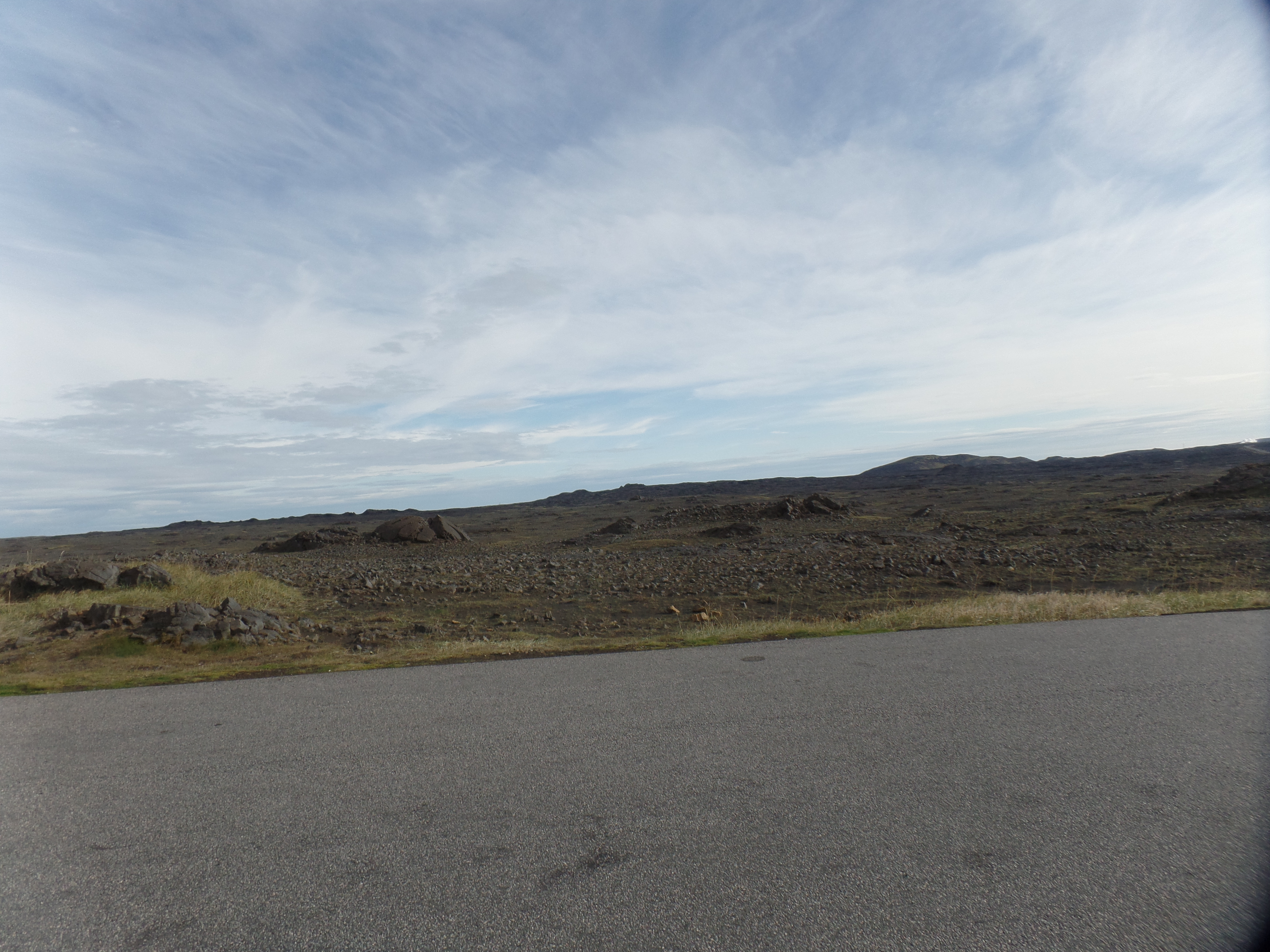
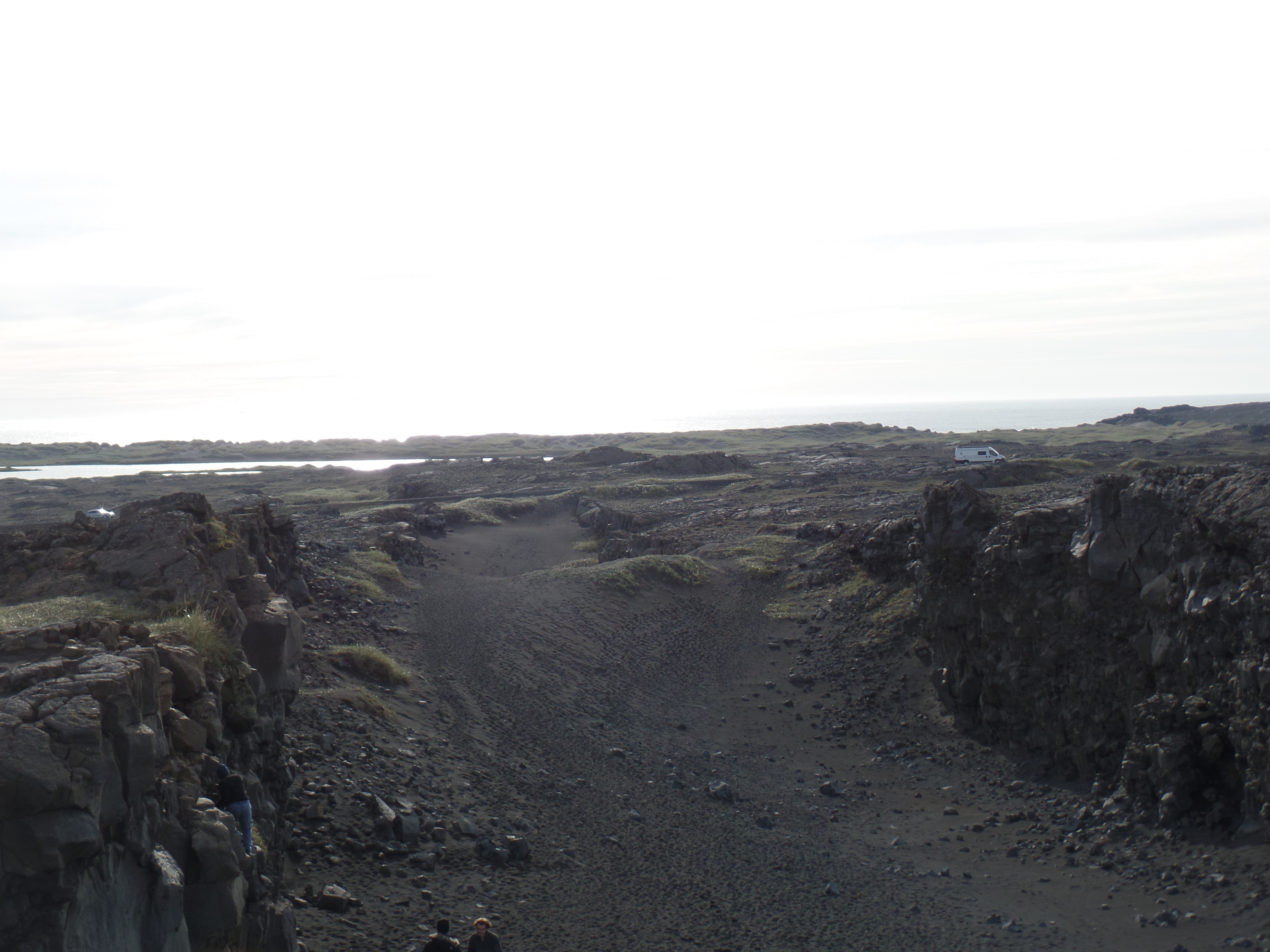
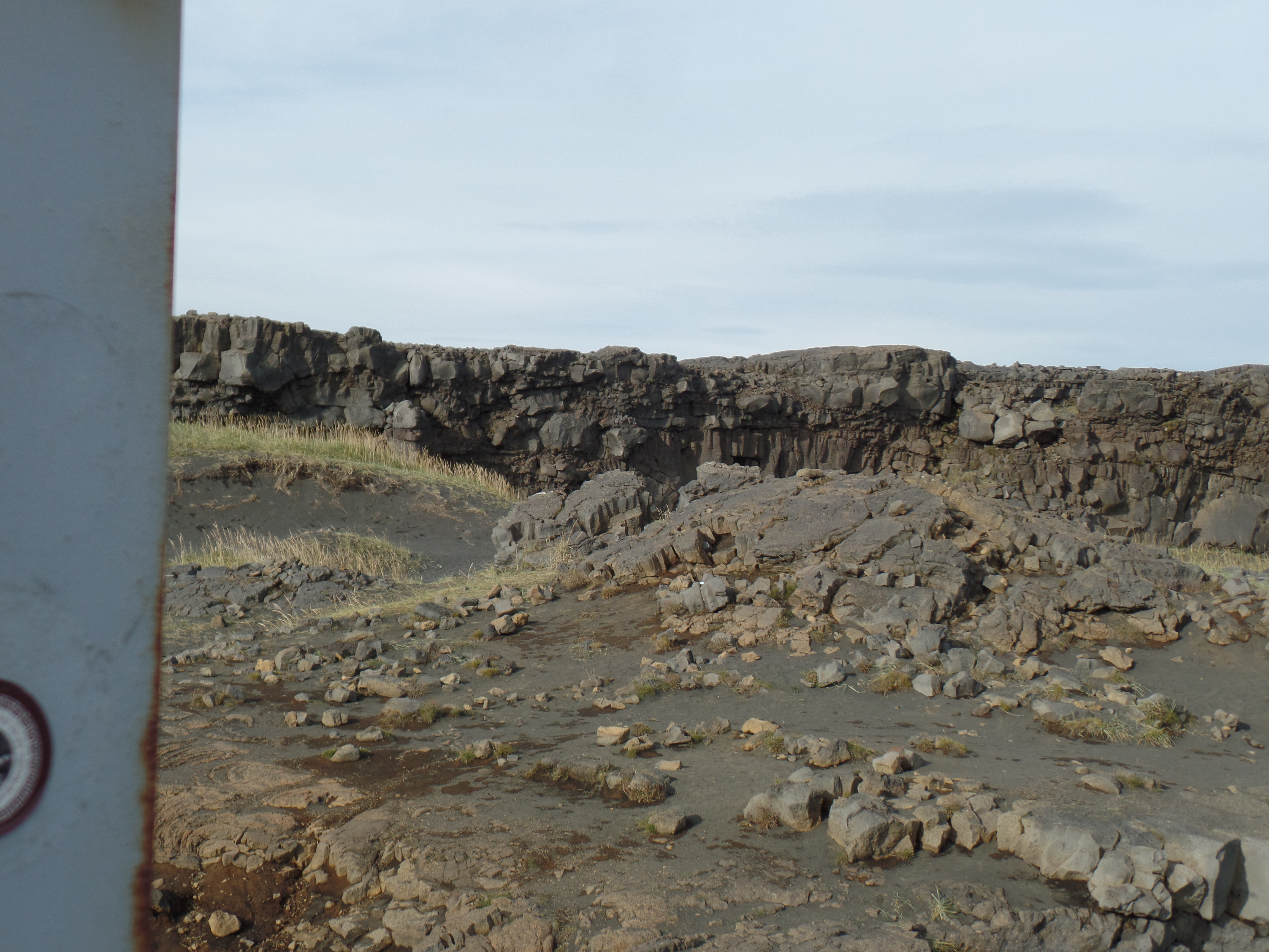
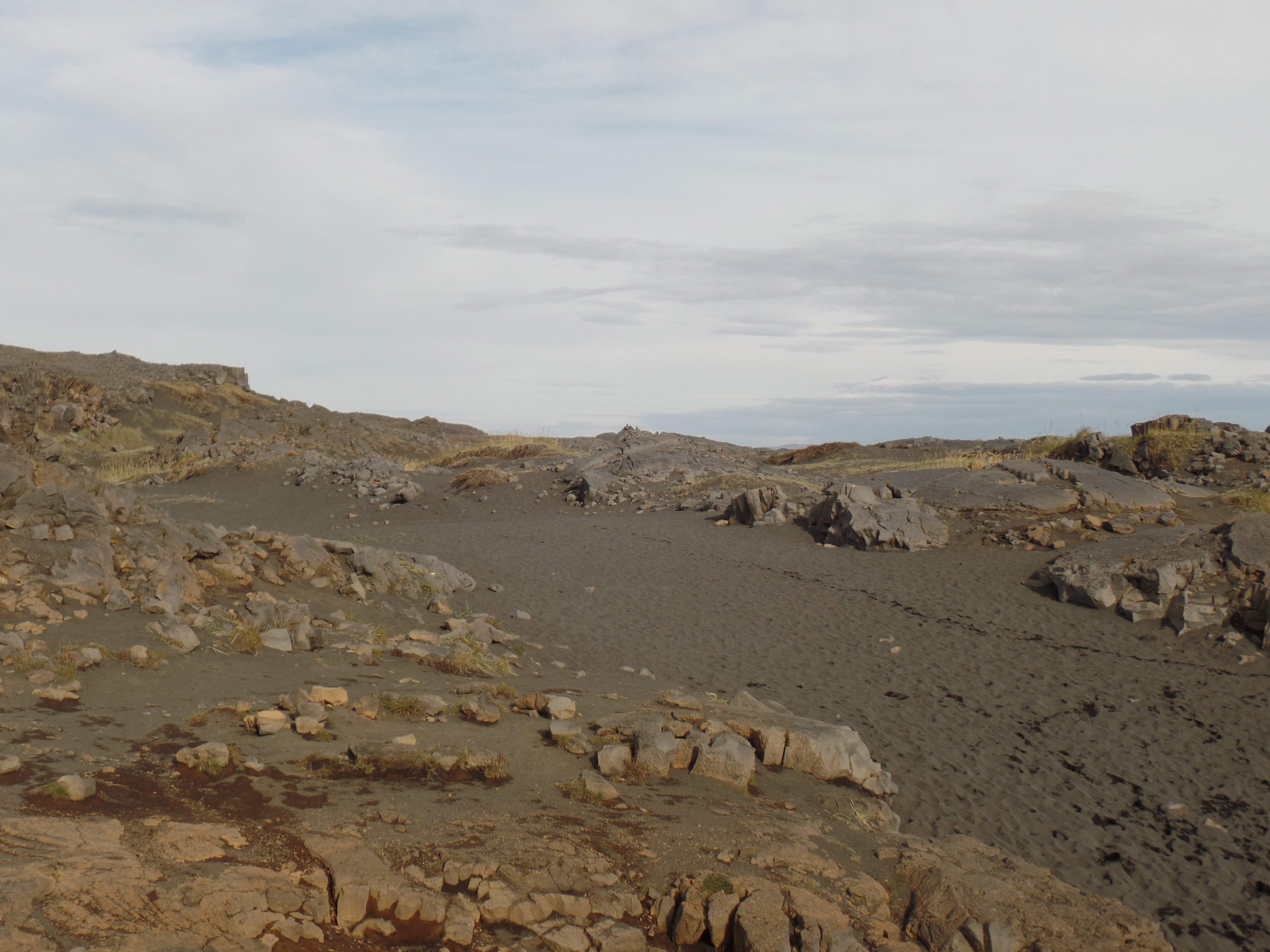
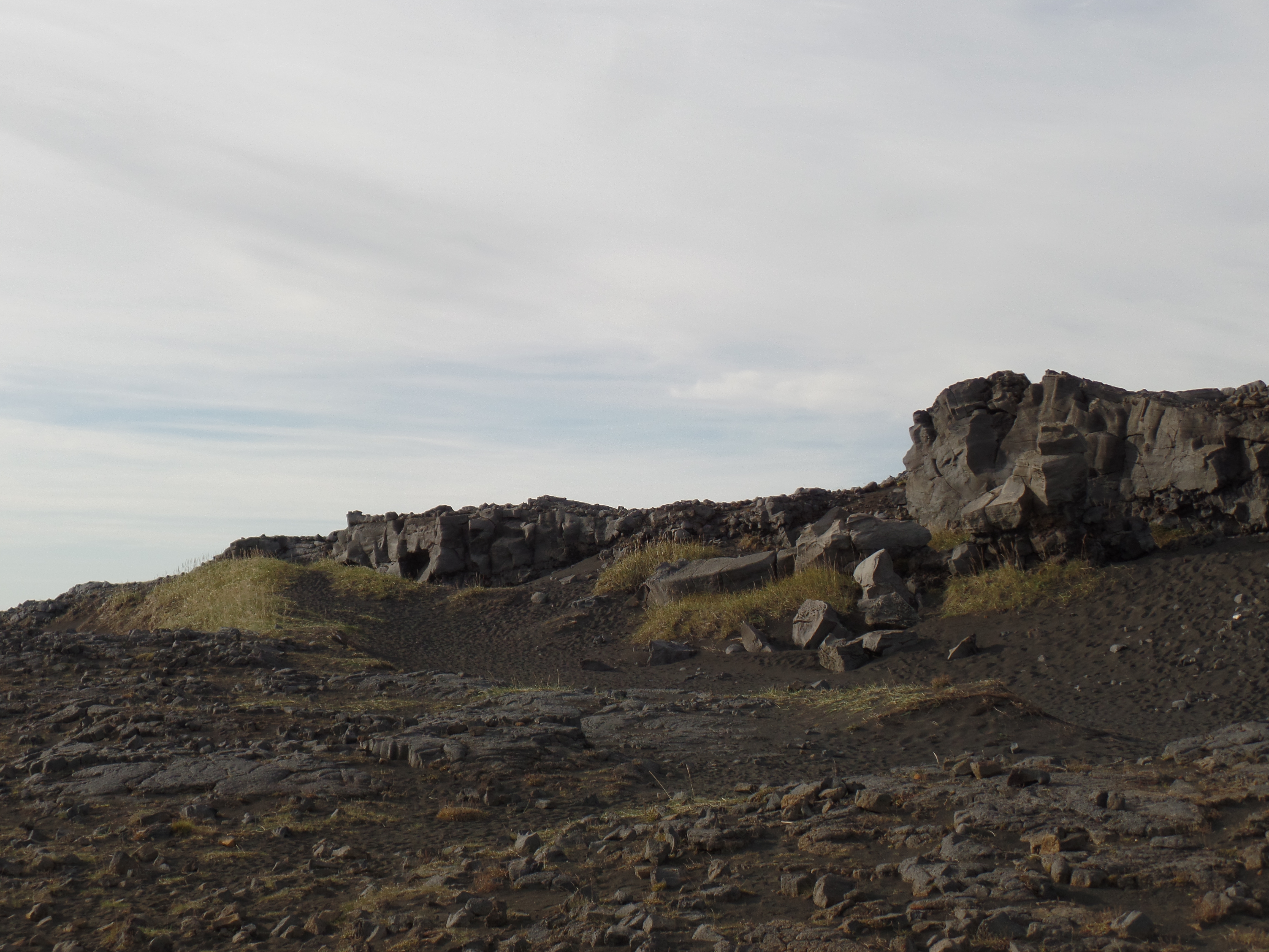
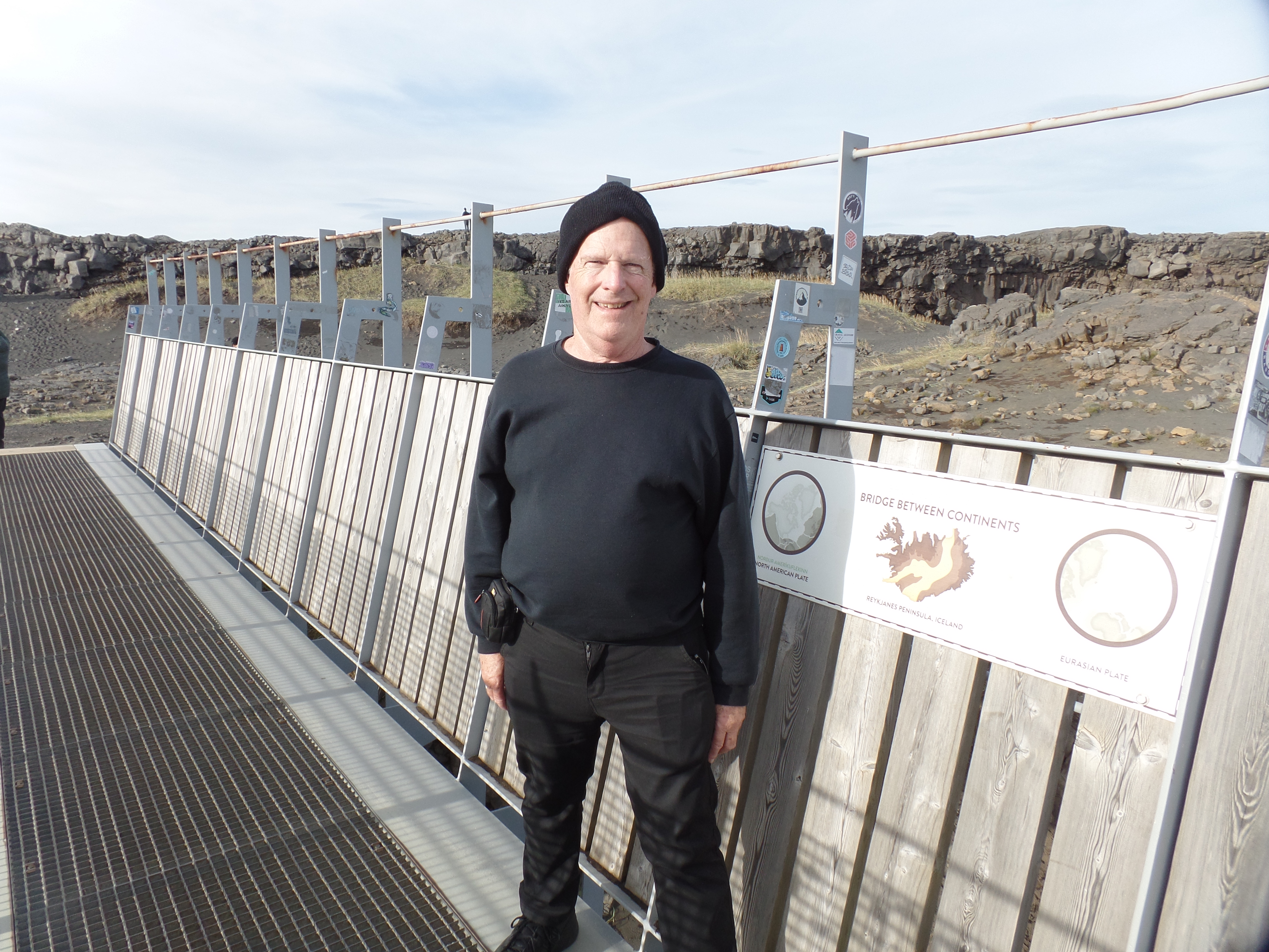
September 12. 2025, Keflavik, IS- It was rather fortuitous, that today should be the day that I was able to visit the European-American Continental Bridge. Here, near Iceland’s southwestern tip, two tectonic plates are separated by a now slight gap, called the Silfra Fissure, which is widening by a few centimeters each year. Eventually, there will be even more distance between the two continental shelves. https://perlan.is/articles/tectonic-plates-iceland
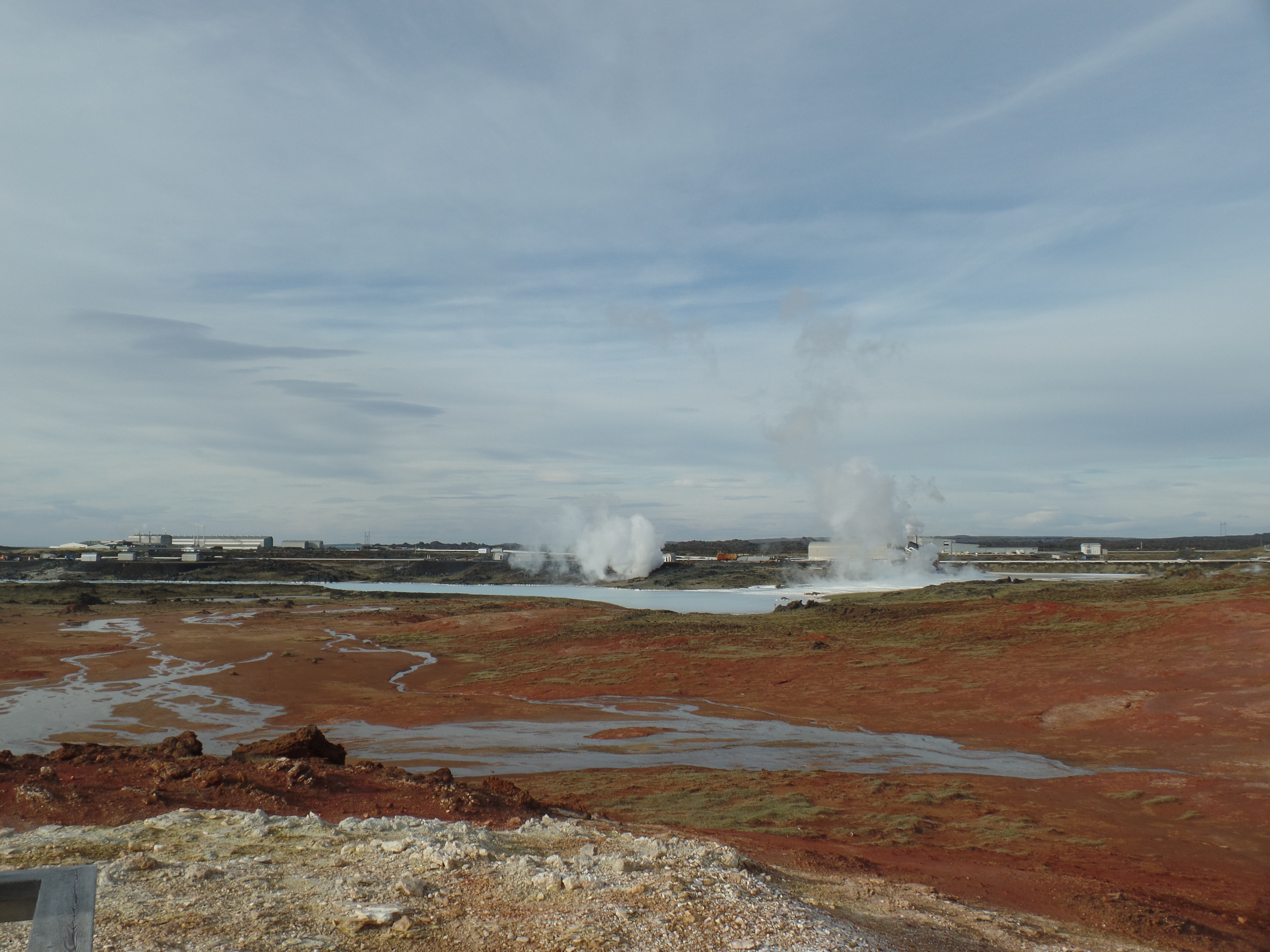
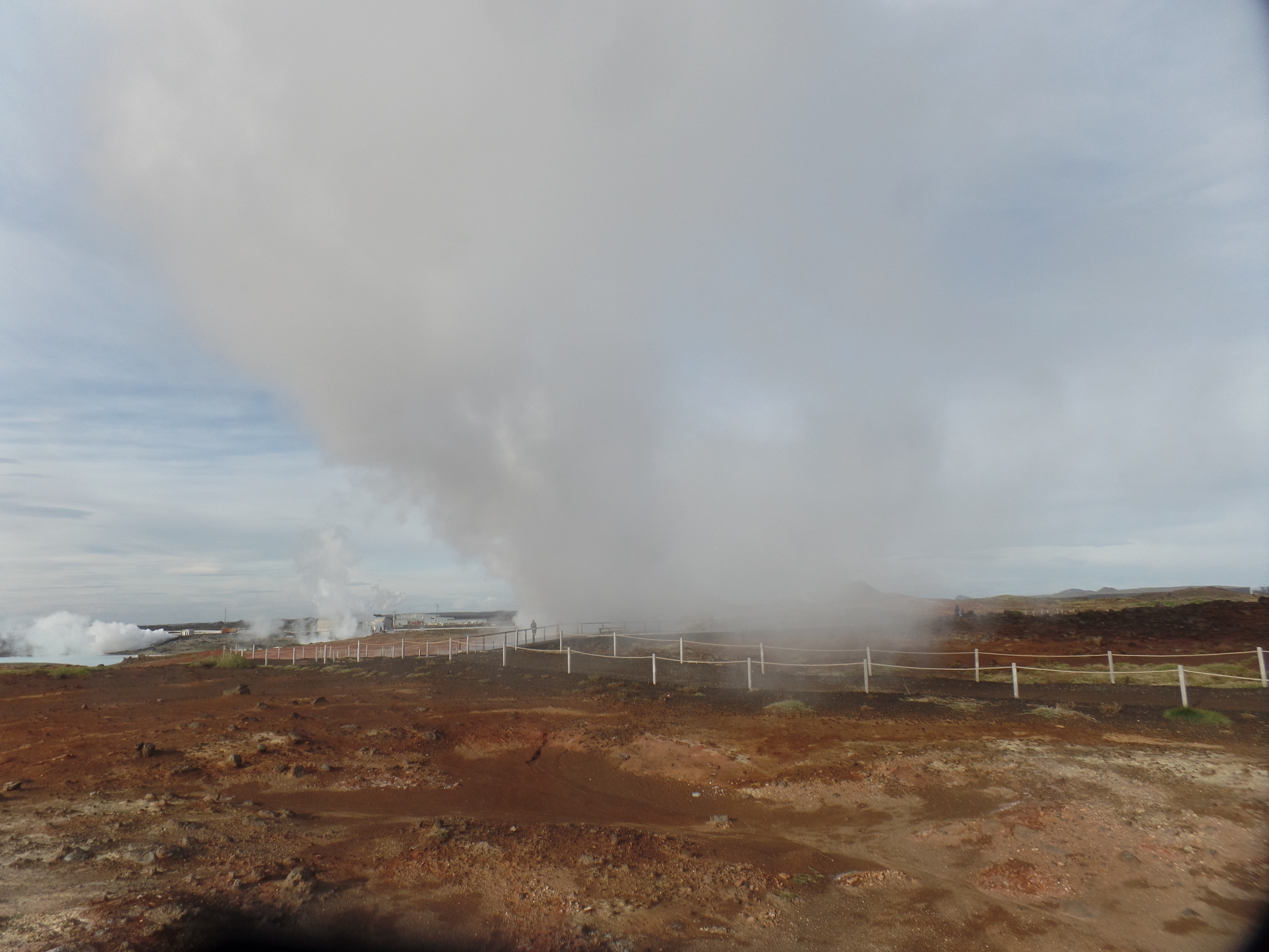
I engaged the services of a local gentleman, in bridging the gap between my hostel room in the Keflavik suburb of Kellir and Pingvellir National Park, where both the Bridge and active, free-flowing hot springs are located. Here are some scenes of the park:
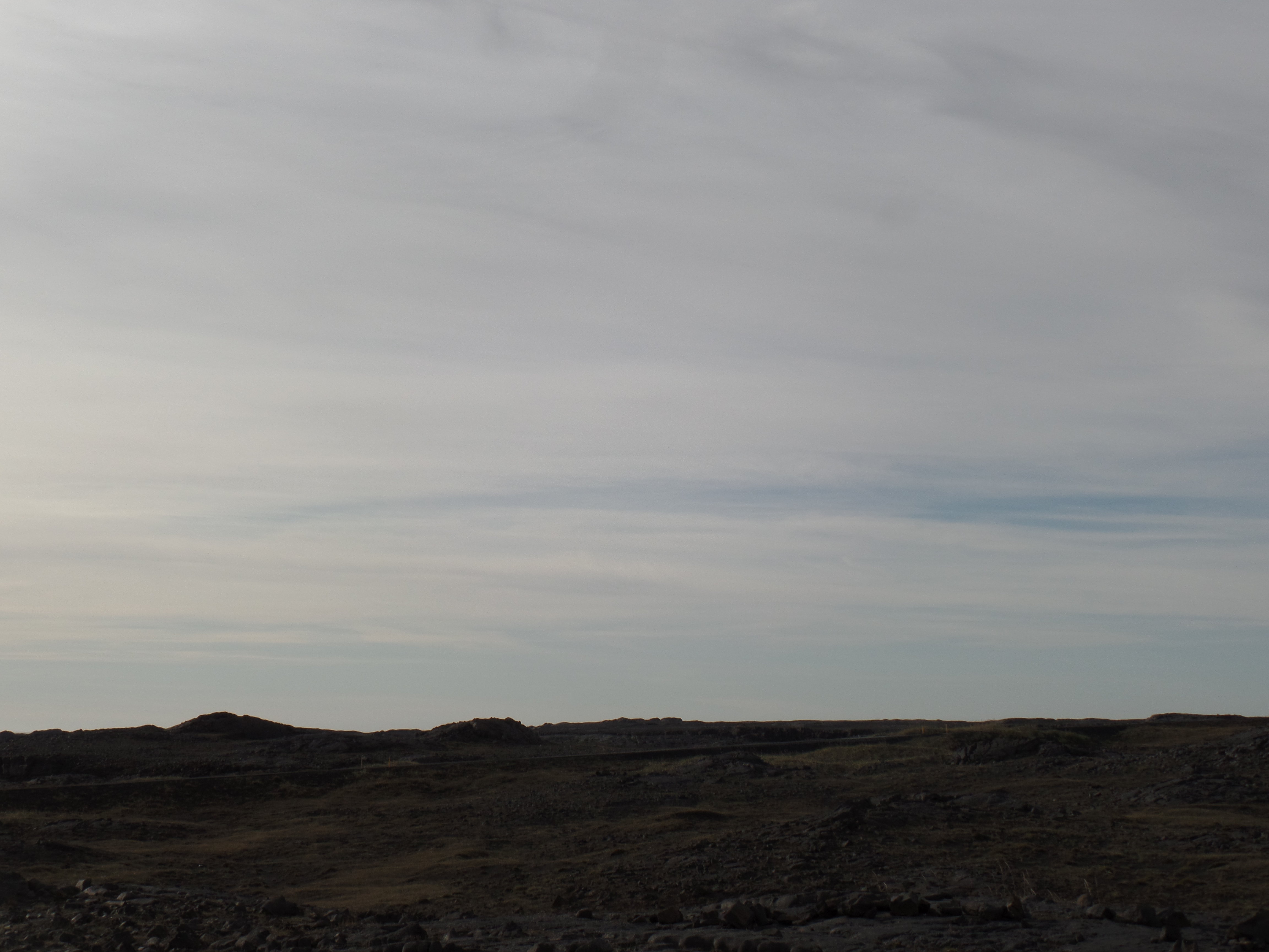
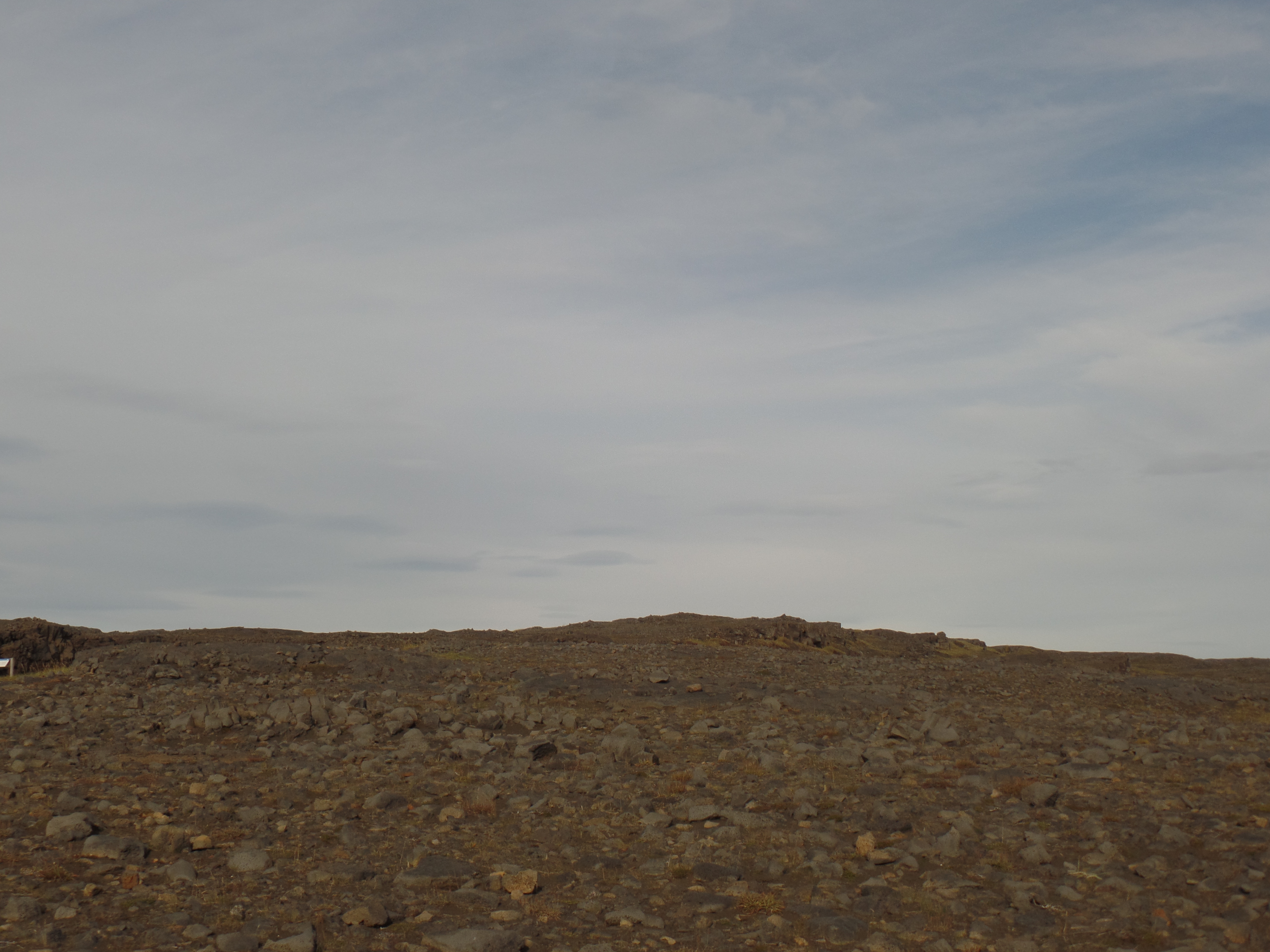
PIngvellir National Park, IcelandThe geological limit of North America-for nowThis could be the surface of the Moon.An Indian gentleman ran here (from Bengulu).Pingvellir Canyon, with a wealth of volcanic soil.The summit of Pingvellir-EastThe summit of Pingvellir-westThe midpoint of the continental gap.Stay off, and avoid a hot foot!Tapping into the Earth’s might (above and below)Saving on coal
Thus was my last full day in Iceland, for now, proving to be the most auspicious. Mankind has once again seen the fruits of division. Let’s take a lesson from Mother Earth, and show that there can be unity, even as we move through tension.
July 18, 2023, Sacramento- The day spent getting here had a potpourri of interesting stops, at least through the morning.
Ludlow– Holly B. served up a nice plate of scrambled eggs, Polish sausage, home fries and an English muffin, with a caveat: The eggs-and much chicken meat, no longer taste like much, when they come from a large factory farm. She has her own chickens at the small desert farm that she shares with her husband. They roam at will-as any chickens that taste good, and produce delicious eggs, are wont to do.
The others workers at Ludlow Cafe concurred. They, too, are farm folk. We spoke of health issues and I heard them out, about the health scares that have recently troubled their revered chef and their own family members. There is an alkaline taste in the local tap water, likely adding to those issues. Ludlow is at the eastern edge of California’s midsection-which starts at Calexico, on the southern border and zips on through, past Barstow, Bakersfield, Fresno and the ‘M’ cities- Madera, Merced and Modesto, to this bustling capital city, and on up to Redding and Chico, thence to the Oregon line.
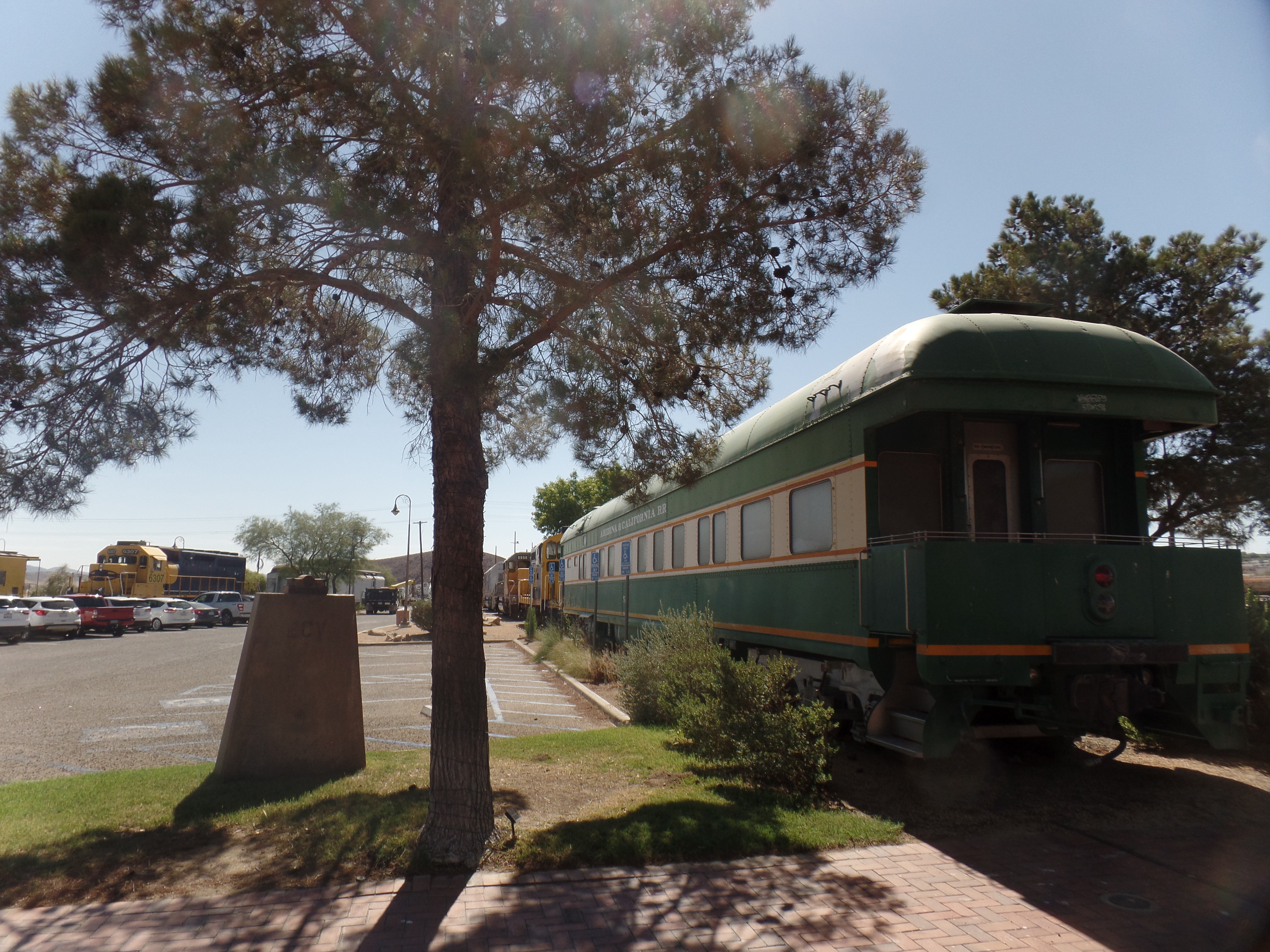
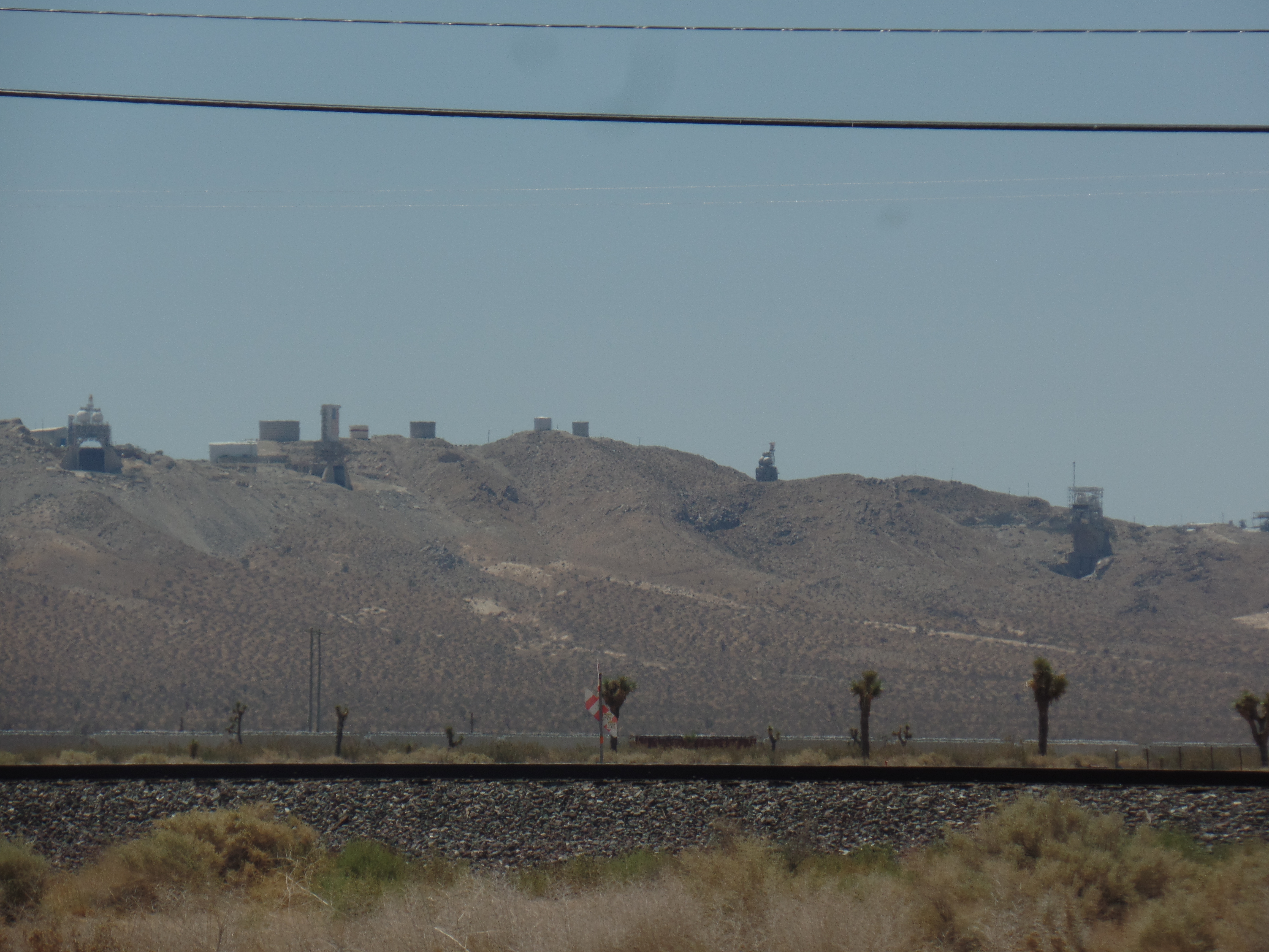
Barstow- I decided that the triple digit heat was not going to factor, in making a drive through this often overlooked, but essential, part of the Golden State. In Barstow, where I stopped after checking out of Ludlow Motel, there is a Harvey House, which serves as the city’s Amtrak Station. A Harvey House, of which there are still a few in the West, was a hotel built by Fred Harvey, in the late Nineteenth and early Twentieth Centuries. Barstow was seen as a vital link between Los Angeles and the great National Parks of central California-as well as with Death Valley, Joshua Tree and the Grand Canyon.
Today, the town soldiers on and keeps this superb building in mint condition. The two ballrooms can be rented for events, and look as if they are waiting for those who can still “trip the light fantastic”.
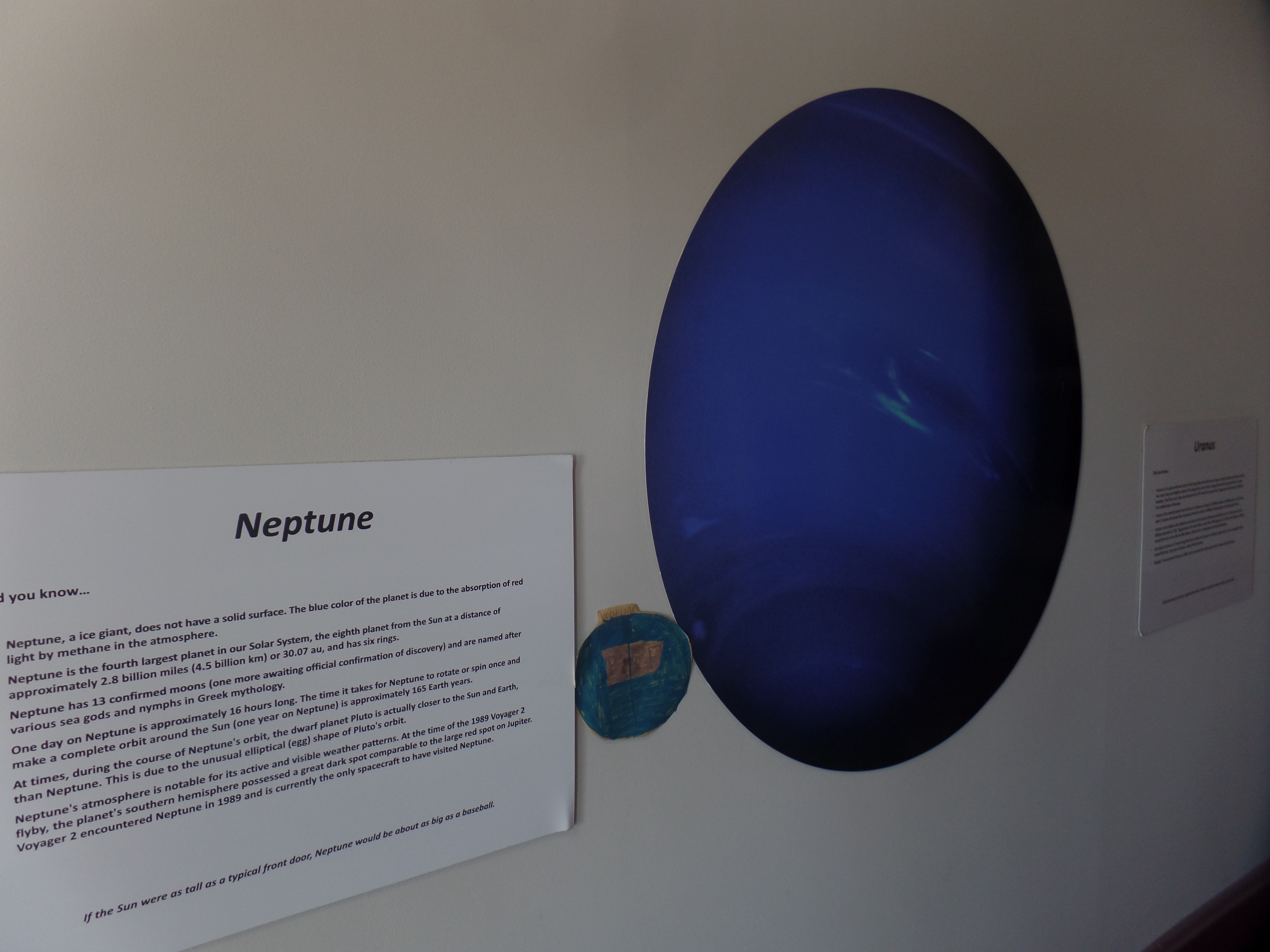
Railroad Museum, Barstow- at the Harvey House complex.Harvey House,BarstowEast Ballroom, Harvey House, BarstowUpstairs, there is a small NASA Museum, focusing on the Sun and planets of “our” Solar System. This montage of Neptune includes a drawing of the outermost planet, (it is actually farther from the Sun than is Pluto), by a young visitor named Paul. I like how he depicted Neptune’s North Pole. Barstow, and the western Mojave, have no shortage of creative talent.
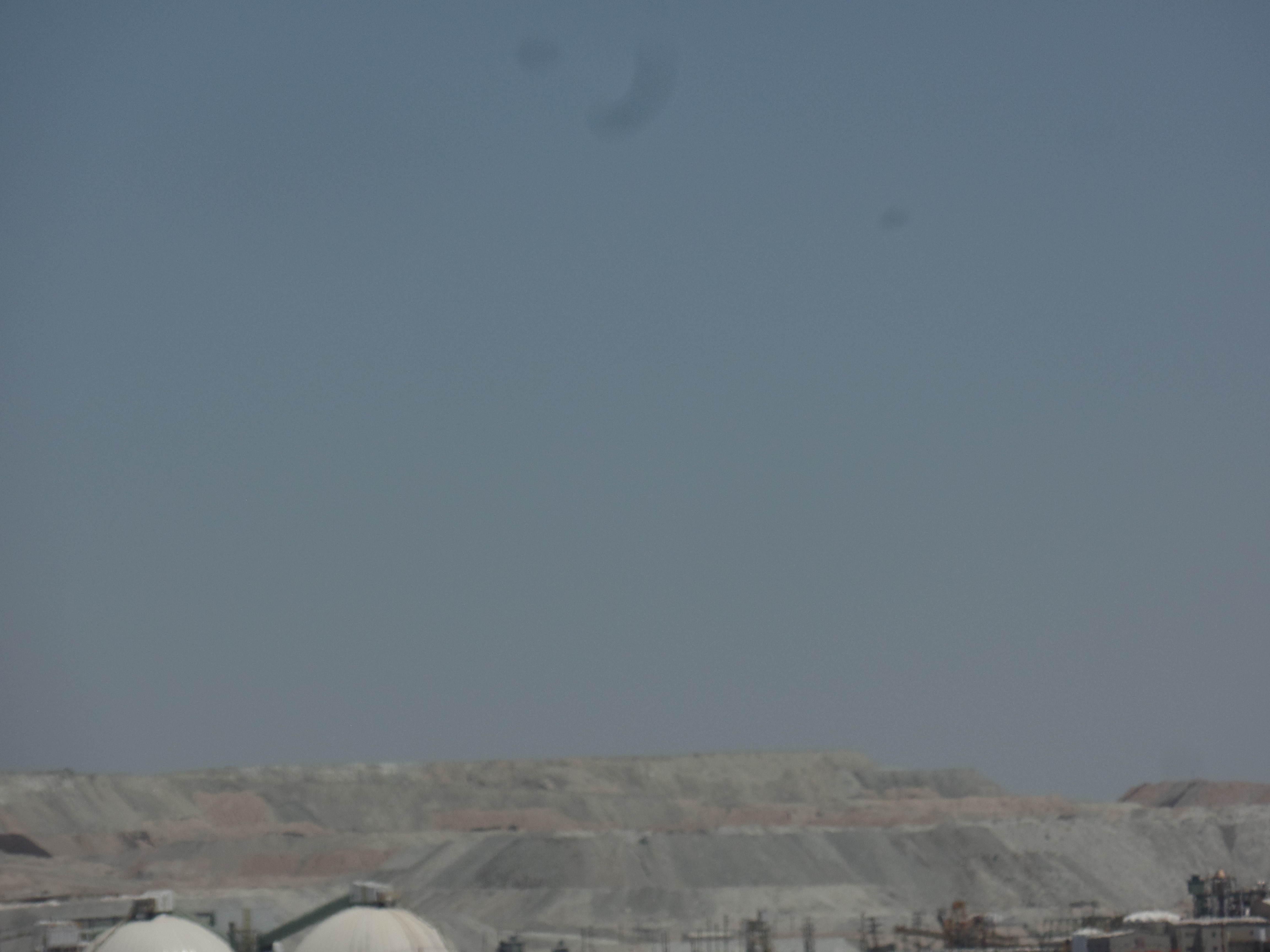
Boron- My last photo-oriented stop of the day was the resurgent home of Twenty Mule Team Borax. I recall, in middle school, that a sometime bully chortled, about yours truly, “He is a low-grade moron, who thinks he lives on boron.” No one laughed at his quip, and I pondered how, besides the two rhyming words, he ever saw himself as clever. We became friends as older teens, though, and he went on to live an exemplary life, before dying just prior to the COVID outbreak. So, I stopped here and took shots of the two active borax mines. Here, for Sean-and in honour of Mr. Reagan, when he hosted “Death Valley Days”, are those sites, from a distance.
West side mine, BoronEast side mine, Boron
Roadside observations- There was much that was unphotographed, but registered in my mind’s camera: The lava beds outside Newberry Springs, extending almost to Daggett, were blocked off by road construction at Newberry. Joshua Trees, the standout feature of the Mojave Desert, are plentiful in some areas and scarce in others. There is a huge stand of them, just north of the City of Mojave, west of Bakersfield. The latter-mentioned city pays proper homage to two of its great musical talents: Buck Owens and Merle Haggard, with streets named for both gentlemen and centers that showcase their respective life’s work. Fresno, and the three ‘Ms’, focus a fair amount of their agricultural wealth on education. Fresno is as much worthy of mention for its health care system, as for its farming.
A horrid accident, on the opposite side of road from us, stopped south bound traffic from the north side of Turlock, clear to the south end of Modesto. Our side of Highway 99 experienced a slowing, but mostly because of the need to position emergency vehicles opposite the crash site. Two vehicles were mangled, one of them lying upside down in the middle of the road.
I got to HI Sacramento around 6 p.m. and after struggling to get the parking lot gate open, due to solar flares interfering with the radio frequency of the gate’s system, enjoyed a lovely carnitas and black bean salad at La Cosecha, three blocks south of the hostel.
No assessment of life anywhere can fail to include its midsection-and California’s Central Valley is second to none.
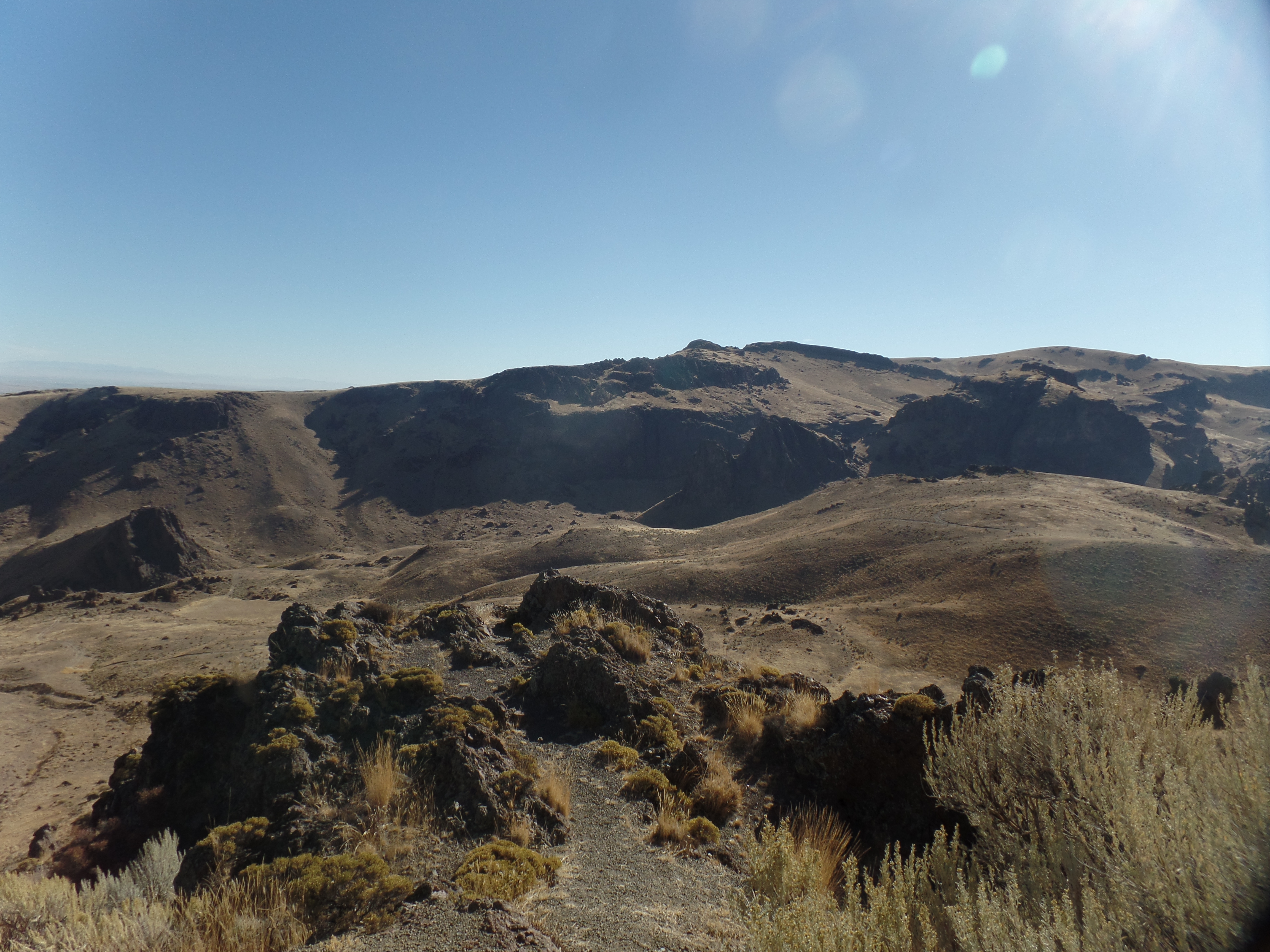
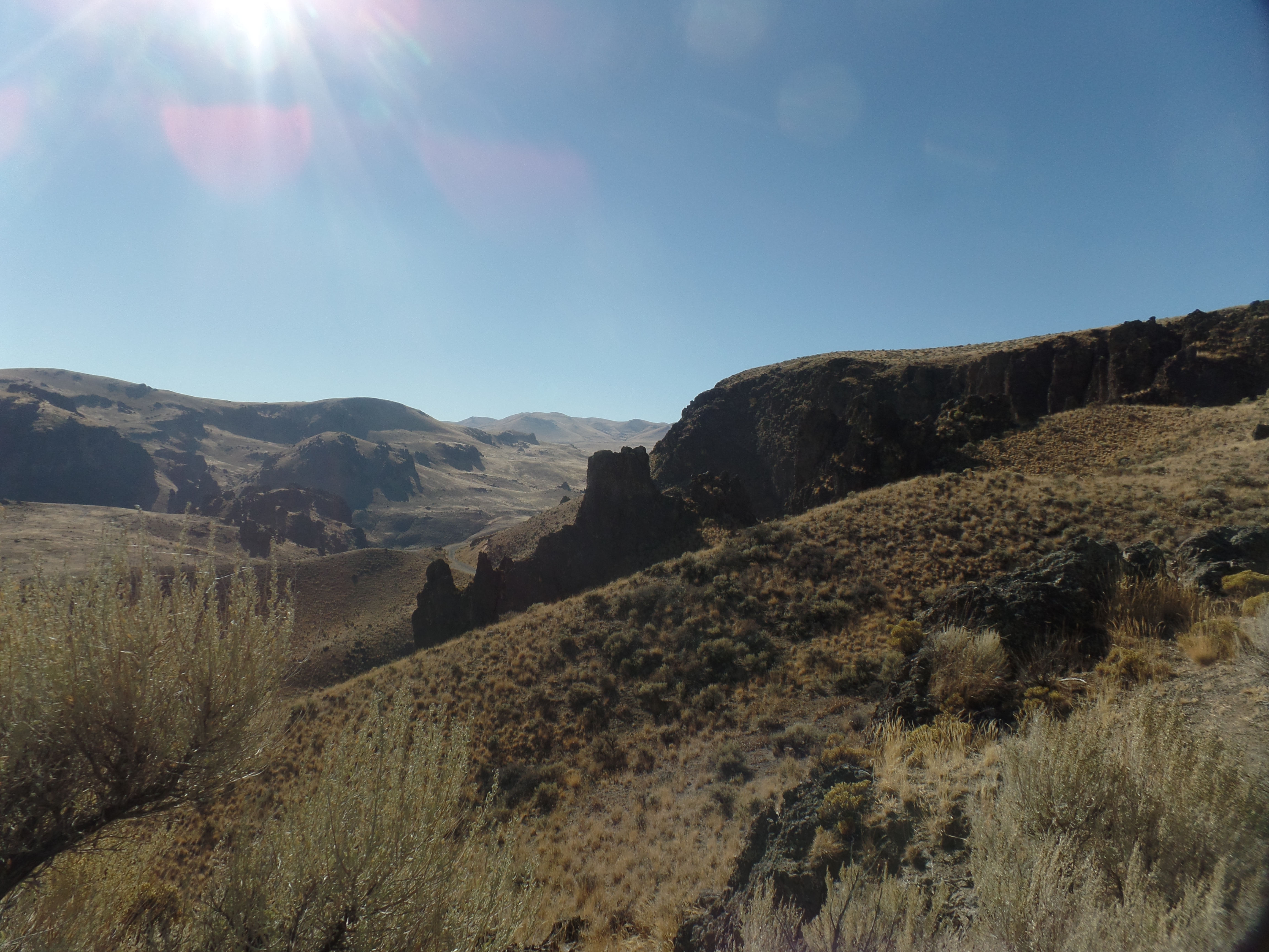
October 17, 2022, St. Anthony, ID- The boys noted a white ball cap, at the bottom of the small crater. One of them asked if he might shimmy down and retrieve it-which of course brought his father’s gentle but firm negative response. The presence of the family of five was a delightful addition to one of the most impressive flows of lava rock in the continental United States: Craters of the Moon.
This was my main draw to eastern Idaho, with Three Bears Inn, a cozy family home here in St. Anthony, a very close second. Three Bears is a serendipitous find, coming about when someone at Hotels.com misinterpreted my request for a room in St. Anthony, Newfoundland, last June. I was offered a room here, as compensation, for the charge that was incurred then.
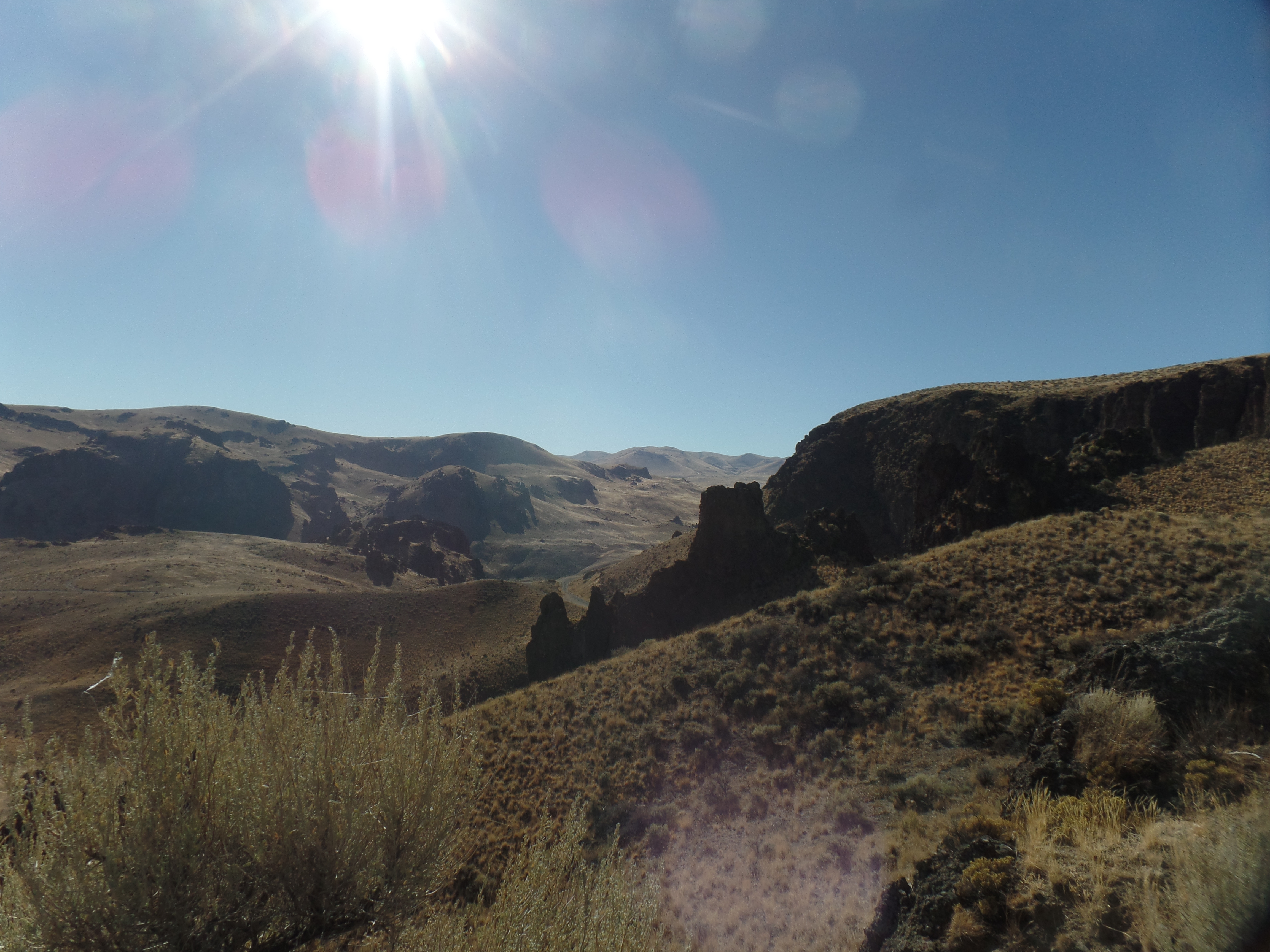
The day started, somewhat chilly, in Jordan Valley, with a convenience store breakfast sandwich the only morning meal option. After a fashion, I headed off towards Idaho’s Owyhee Region. The name is a corruption of “Hawai’i”, coming from fur trappers having brought a crew of Native Hawaiians to the area, in 1819. Three of the Hawaiians embarked on an exploration of the Owyhee River’s canyonlands, but never returned to the base camp. The name Owyhee has been bestowed on the area, spanning parts of Oregon, Idaho and Nevada, in their honour.
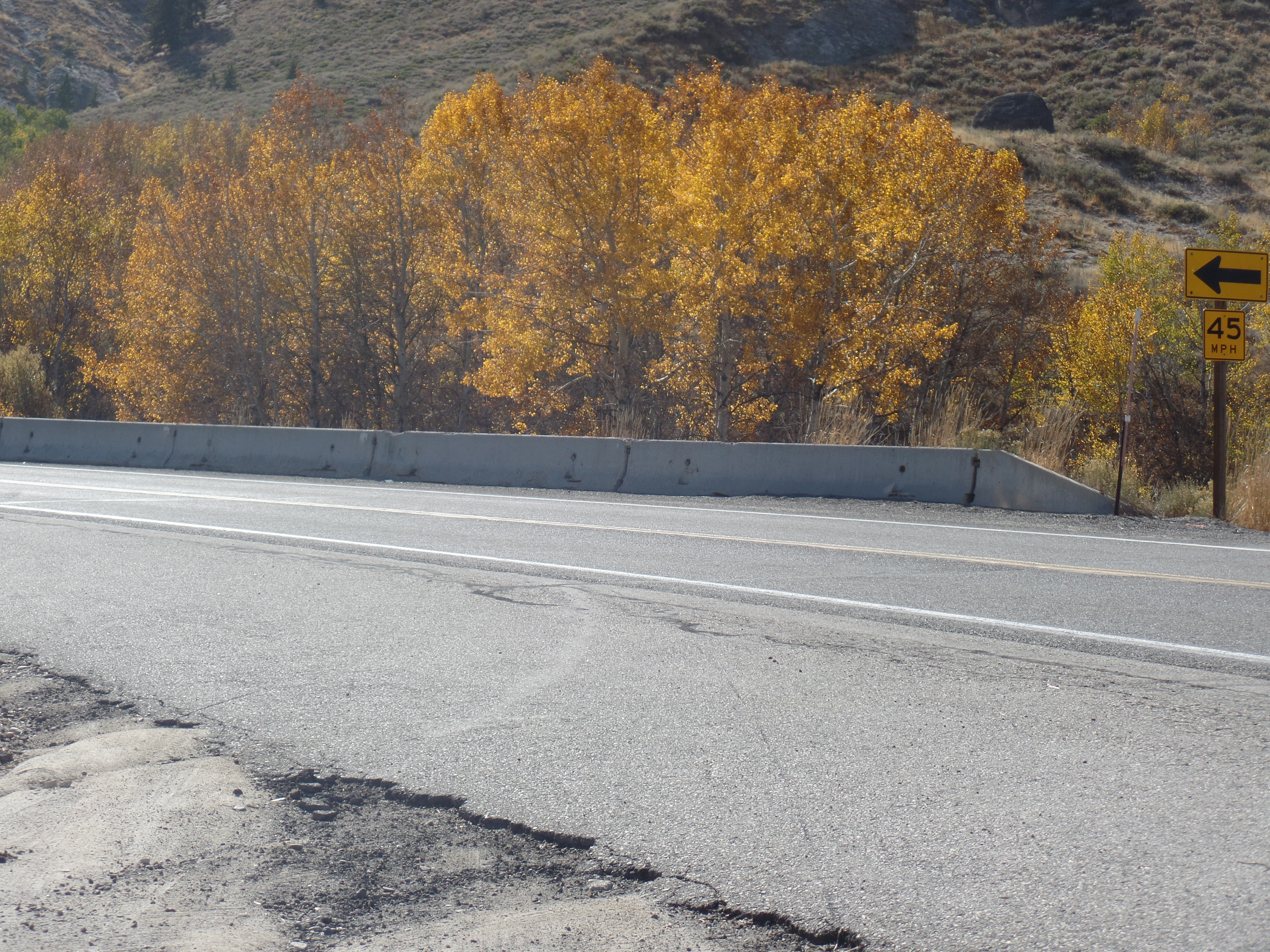
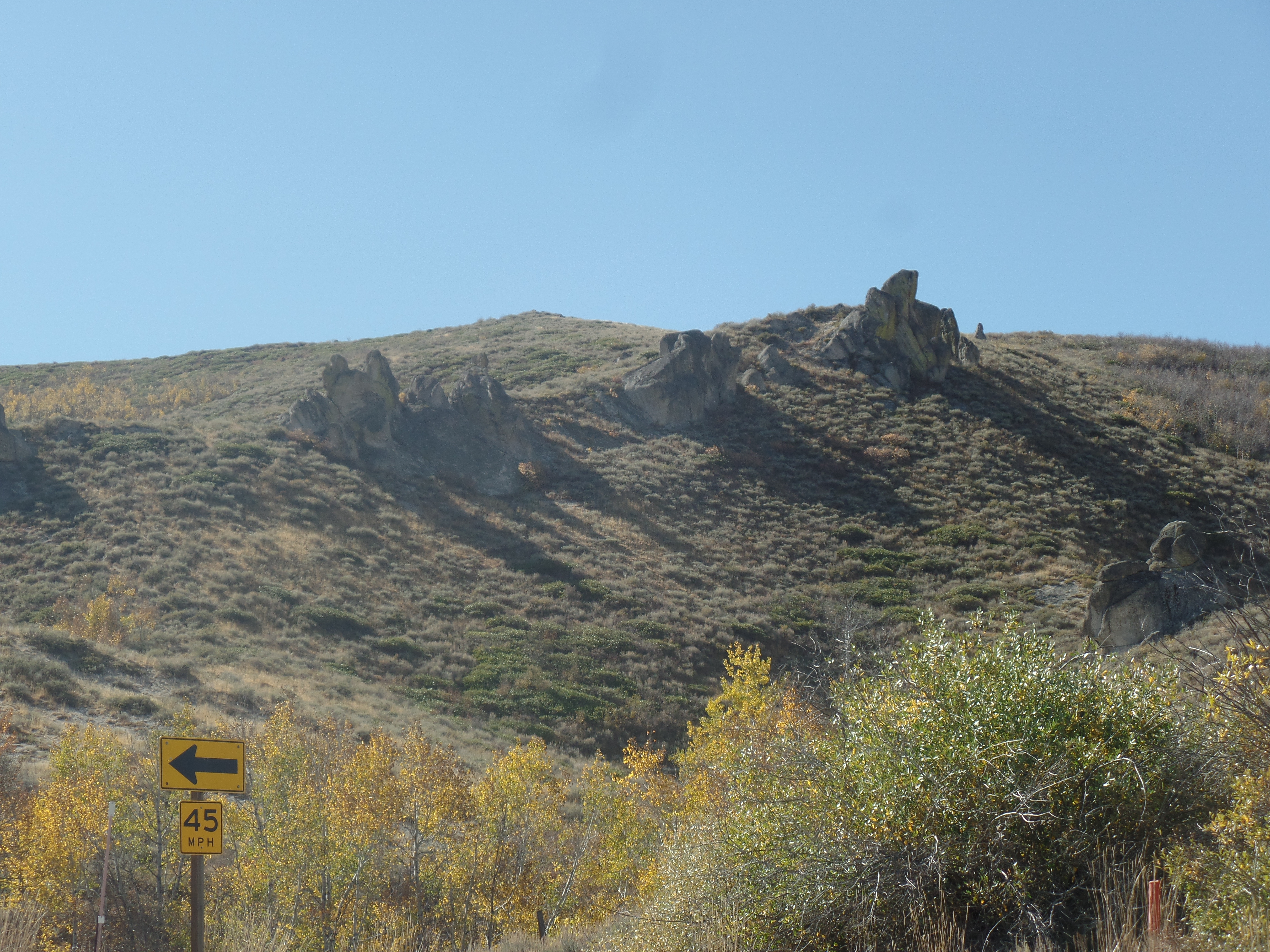
I continued past Boise, which will be a stop on the way back to Carson City, and found Little Camas Valley, where some of Idaho’s fall foliage was on view.
Oaks of the Little Camas, south central IdahoBasalt outcropping, Little CamasBasalt promontory, Little Camas
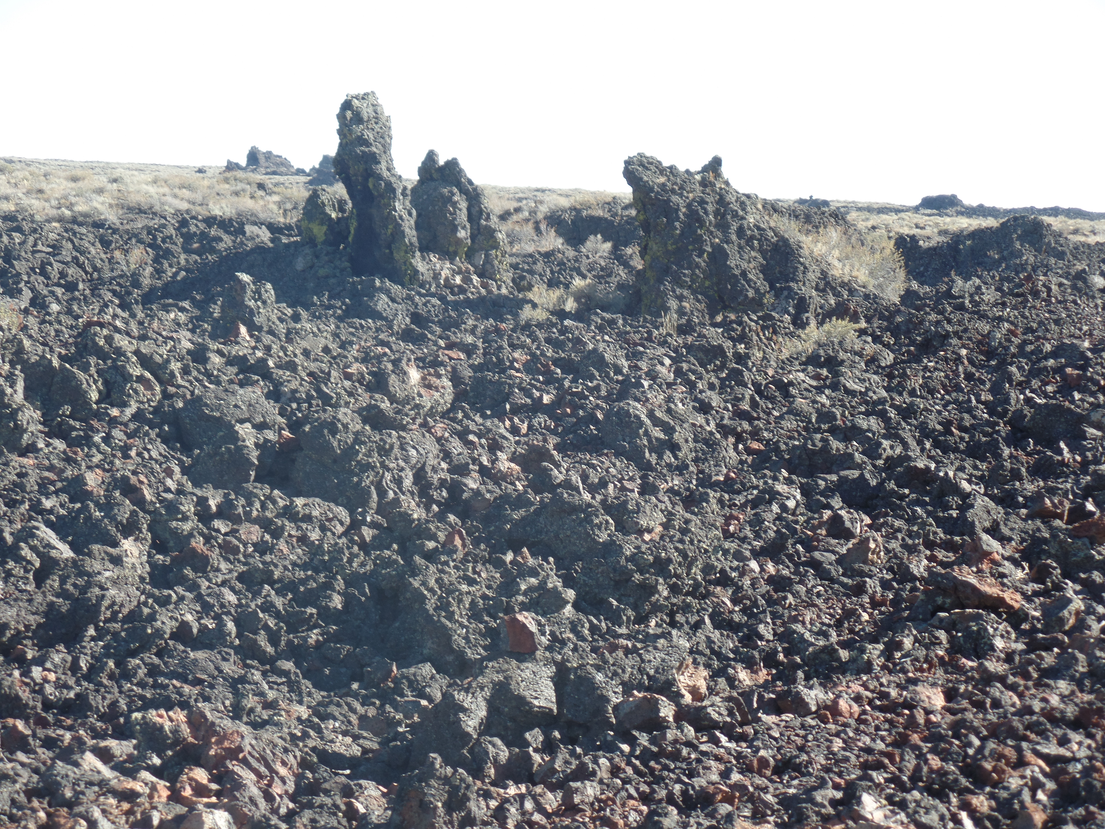
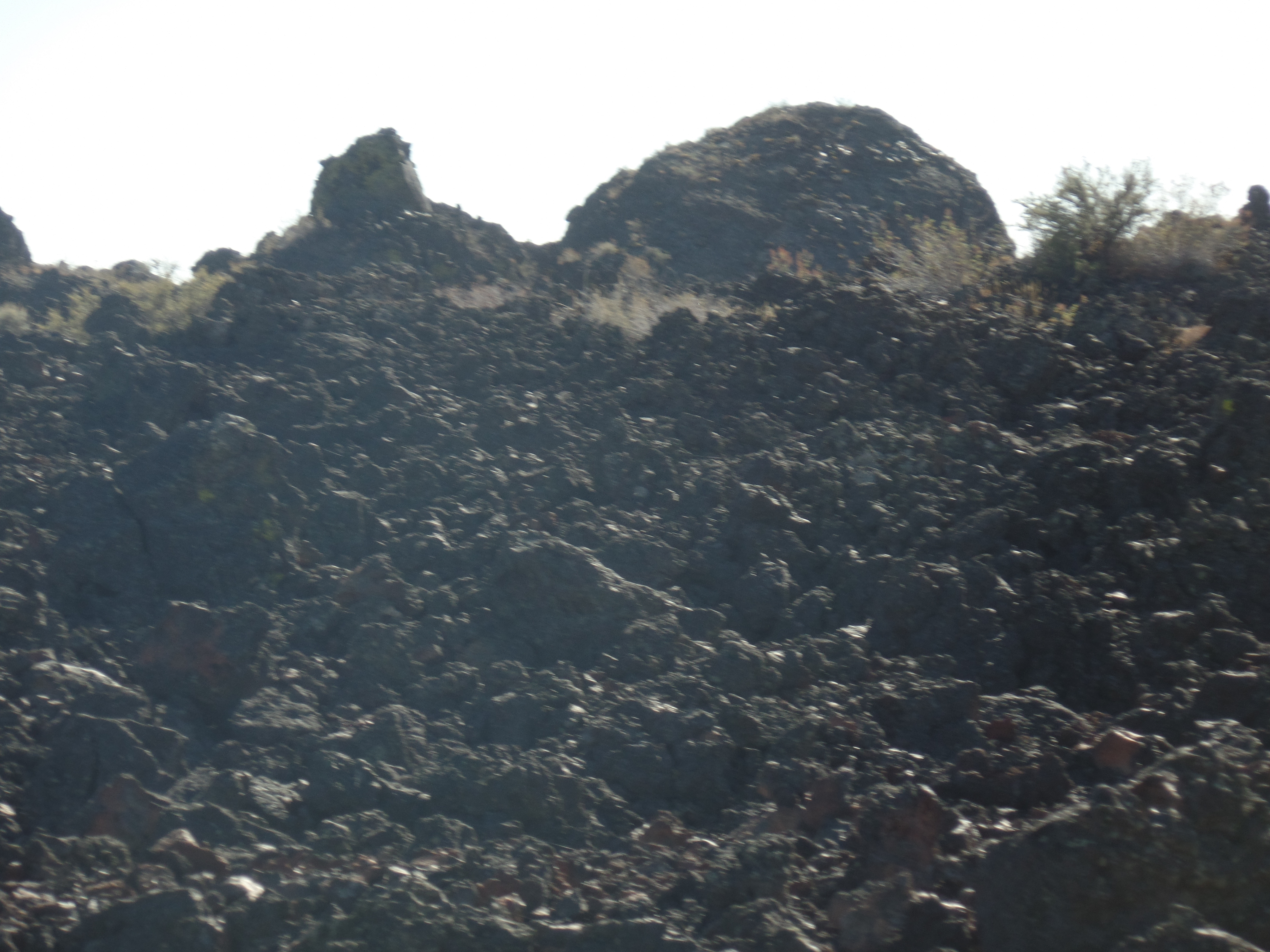
The presence of so much basalt, all along Highway 20, interrupts the constant presence of sage brush, as does the large presence of agriculture-both corporate and small scale. The Snake River Plain, from Fairfield in the west to Ashton in the east, is a prime potato growing region. Just shy of Arco, however, Craters of the Moon’s lava fields interrupts the farmlands, as much as the soil itself was created and enriched by the flow. This is the bounty of the Great Idaho Rift.
Here are some scenes, north of the actual monument grounds, and along Idaho Route 20.
Lava beds, north and west of North Crater, which is the central point of the Monument.Lava bed, along Rte. 20Pioneer Mountains, above the lava beds
Entering the Monument, which focuses on North Crater and its nearby flows, I encountered a family of four, joyfully coming back from a short walk in the lava field across from the Visitor Center. Here is what they saw.
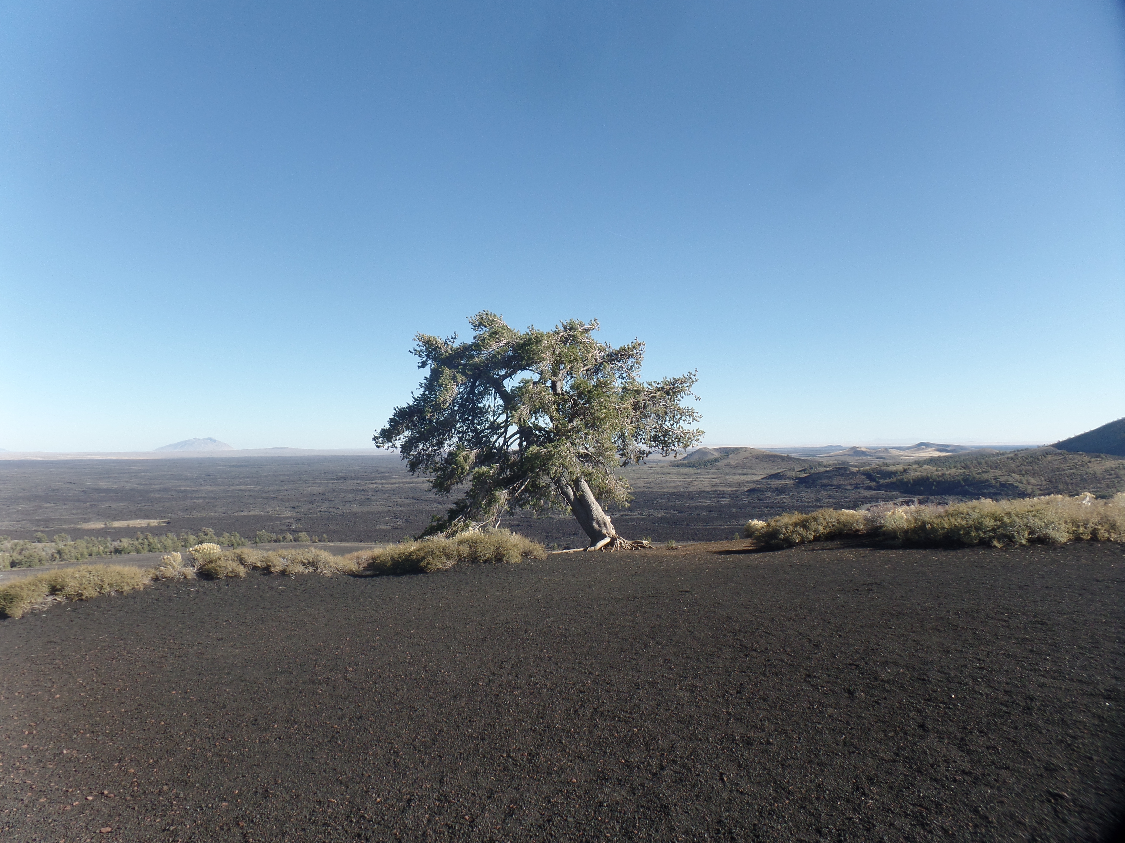
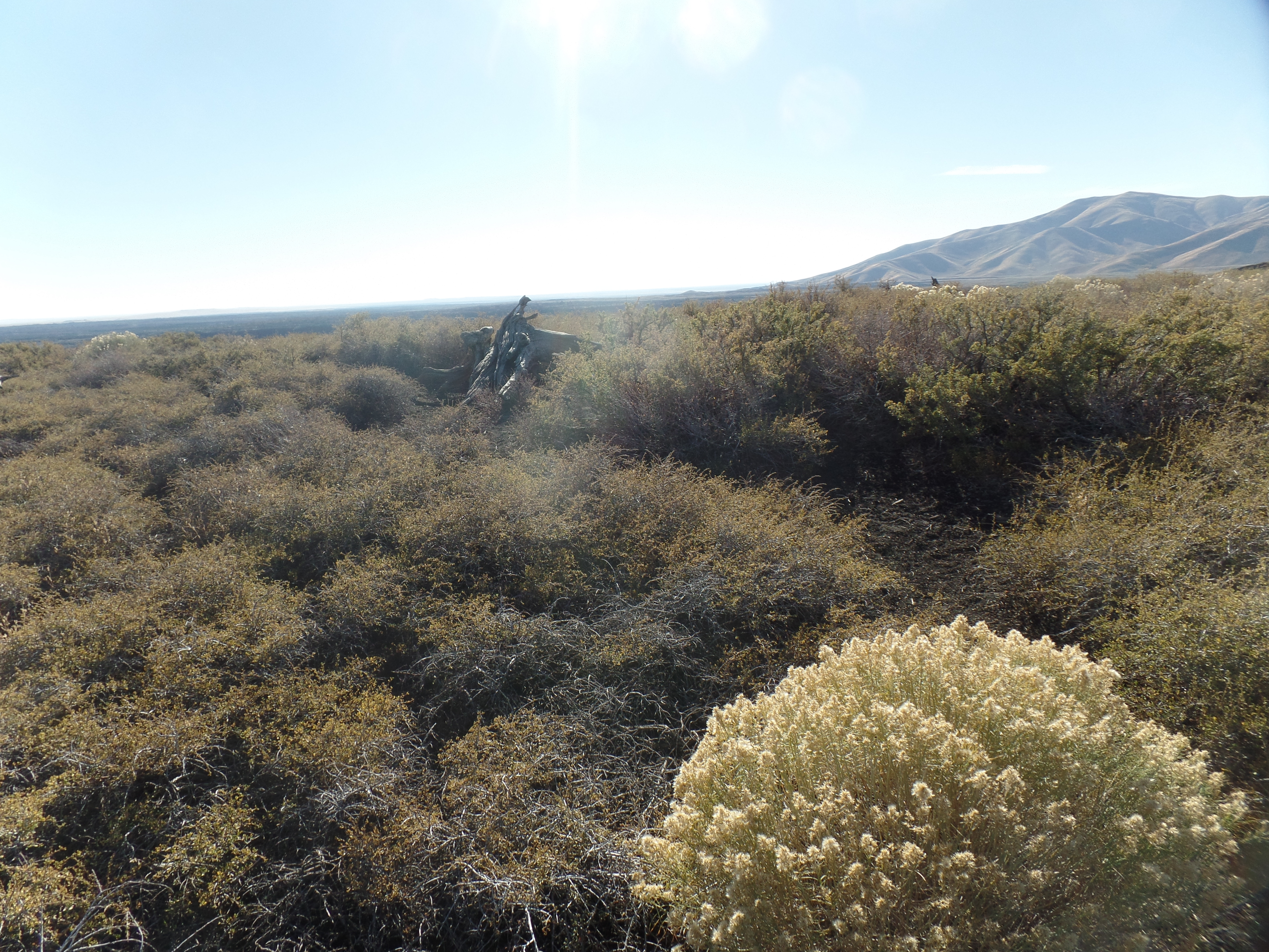
A determined and lonely pine rises above sage and stone.Older lava flow, at base of North CraterDwarf buckwheat is one of the more prolific flowering plants that has adapted to the lava beds.Inferno Peak, a hikeable cinder cone.
I made the hike to the top of Inferno Peak in ten minutes. There, to greet me, was the Leaning Juniper of the Craters.
Lone juniper, atop Inferno PeakResilient sage and mature buckwheat, Inferno Peak summitBig Craters, from the summit of Inferno PeakRed cinder, Inferno Peak summit
The last focus of this visit was on the Spatter Cones, small volcanoes-or as one of the little girls present called, “Baby Volcanoes”.
Here was the place where I encountered the family mentioned at the beginning of this post.
Lastly, I stopped at Devil’s Orchard, an otherworldly group of standing lava rock. The place was so named by a visiting Christian preacher, in the early twentieth century.
Basalt standing in Devil’s Orchard
The scope of Craters of the Moon surpasses Arizona’s Sunset Crater, and rivals Lassen. It will be a stop along the way to future visits to Yellowstone and Grand Teton. For now, I settle in for a day or so, with new friends at Three Bears Inn: A strong couple, three sons and a daughter, two cats and two ducklings. Everything is just right.
May 26, 2021, Grants- Sleeping on a leather couch was a lot more restful than I remembered from last time. The house has a far more relaxed vibe, as well, so that had a great deal to do with the ambiance, as well. This morning, John and I headed over to a branch of da Vinci Coffee House, on the northwest side of Enid, and joined three of his local friends, in solving the issues that confront us, as well as reminiscing about the music of the 60s-80s.
The suggestion was made, that I visit Capulin Mountain, in northeastern New Mexico, as it was not too far off my route. Taking a forty-minute lunch stop at Mazio’s, in the Oklahoma Panhandle town of Guymon, I found myself getting to Clayton, NM-the gateway to Capulin, a bit too late for any meaningful visit to the extinct volcano.
Thus, after spending about ten minutes looking around Clayton, I headed towards I-25, at Springer, then down past Las Vegas (NM), Santa Fe and through Albuquerque to I-40, and Grants, an old uranium-mining town, in western New Mexico, set on the edge of a huge lava bed. Grants has been enjoying a rebirth of sorts, as a tourism hub- promoting exploration of the lava beds and its own nearby extinct volcanos.
There is much to explore yet, in northern New Mexico, so if Europe remains closed in October, it may be that my time will be spent in the area from Chaco Canyon to Capulin Mountain. At some point, my focus will be in this truly enchanting spot. For tonight, though, I am at rest in Grants’ Days Inn.
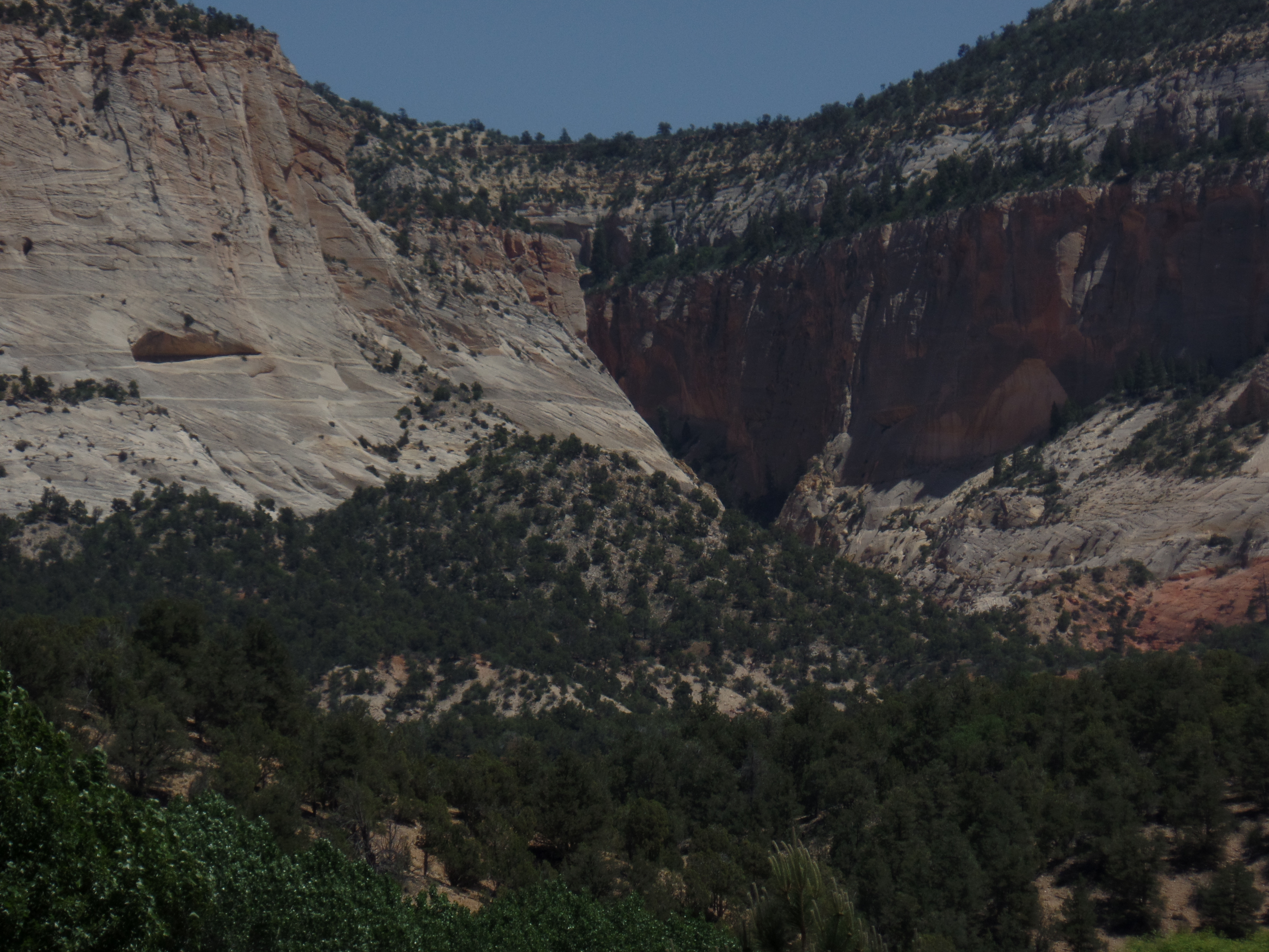
June 3, 2016, Chinle, AZ- After leaving Nevada behind, I decided that the drive through the expanse of heaven that is southern Utah would have to be somewhat less than just. I have the Golden Circle on my radar screen for a full month of exploration- but not until next summer, at the very earliest, and maybe not until 2020. The pines, cedars and unparalleled canyons of southern Utah are treasures to be taken one inch at a time.
One caveat I share with most other drivers is: Don’t make a nuisance of yourself, by constantly and abruptly pulling to the side of the narrow road, to get that great photo. So, the scenes presented herein are few in number- focusing on two places: Navajo Lake/Duck Creek and Orderville Canyon. These two very different environments give a snippet of the variety in a relatively small area of Kane County.
I spent a few minutes in the commercial hub of Cedar City, just refueling and resting my Nissan. The traffic was already gearing up for a crowded weekend, hereabouts, so on up through Kolob Canyon it was. Navajo Lake lies in the rim country, above Zion National Park. There were about a dozen people at the overlook, so we took turns with photographs.
Navajo Lake, Dixie National Forest, Utah
Navajo Lake, Dixie National Forest, Utah
Dike across Navajo Lake, Dixie National Forest, Utah
The dike was built by members of the Civilian Conservation Corps, during the New Deal, to maintain constant water flow.
Navajo Lake, and nearby Duck Creek, were created by lava flow, which altered the course of the Virgin River, which created Zion Canyon. Below, are some scenes of the lava beds, around Duck Creek Visitor Center.
Lava bed at Duck Creek Visitor Center, Dixie National Forest, Utah
Lava bed, Duck Creek Visitor Center, Dixie National Forest, Utah
Duck Creek, Dixie National Forest, Utah
Duck Creek, Dixie National Forest, Utah
Orderville is one of the small farming towns that are a delight to visit, in the midst of southern Utah’s canyon country. It is also a jumping off point for those headed east, towards Capitol Reef and Canyonlands National Park. Orderville has a gorgeous canyon of its own, though, and can easily enchant the visitor for 2-3 days.
Orderville Canyon, Utah
Orderville Canyon, Utah
With the day growing short, I headed on east and south, through Page, AZ, on the southern shore of Lake Powell, across the Navajo Nation, to Kayenta and Chinle. At Tsegi, just west of Kayenta, I cam across a couple whose vehicle and trailer had overturned. The Indian Health Service worker who had stopped to help was having a hard time getting through to emergency services. I was able to call and get help en route. Good thing that neither person,nor their two dogs, were injured. Past Kayenta, a brush fire had broken out, south of Chilchinbeto, where I once worked. Once again, 911 was dialed from my phone, and a fire truck was dispatched.
That was the end of the day’s excitement. I enjoyed a relaxing meal at Junction Restaurant, in Chinle, before heading down to Native American Baha’i Institute, another 1 1/2 hours further southeast. It is time to change gears, and focus on spirituality for a day or so.
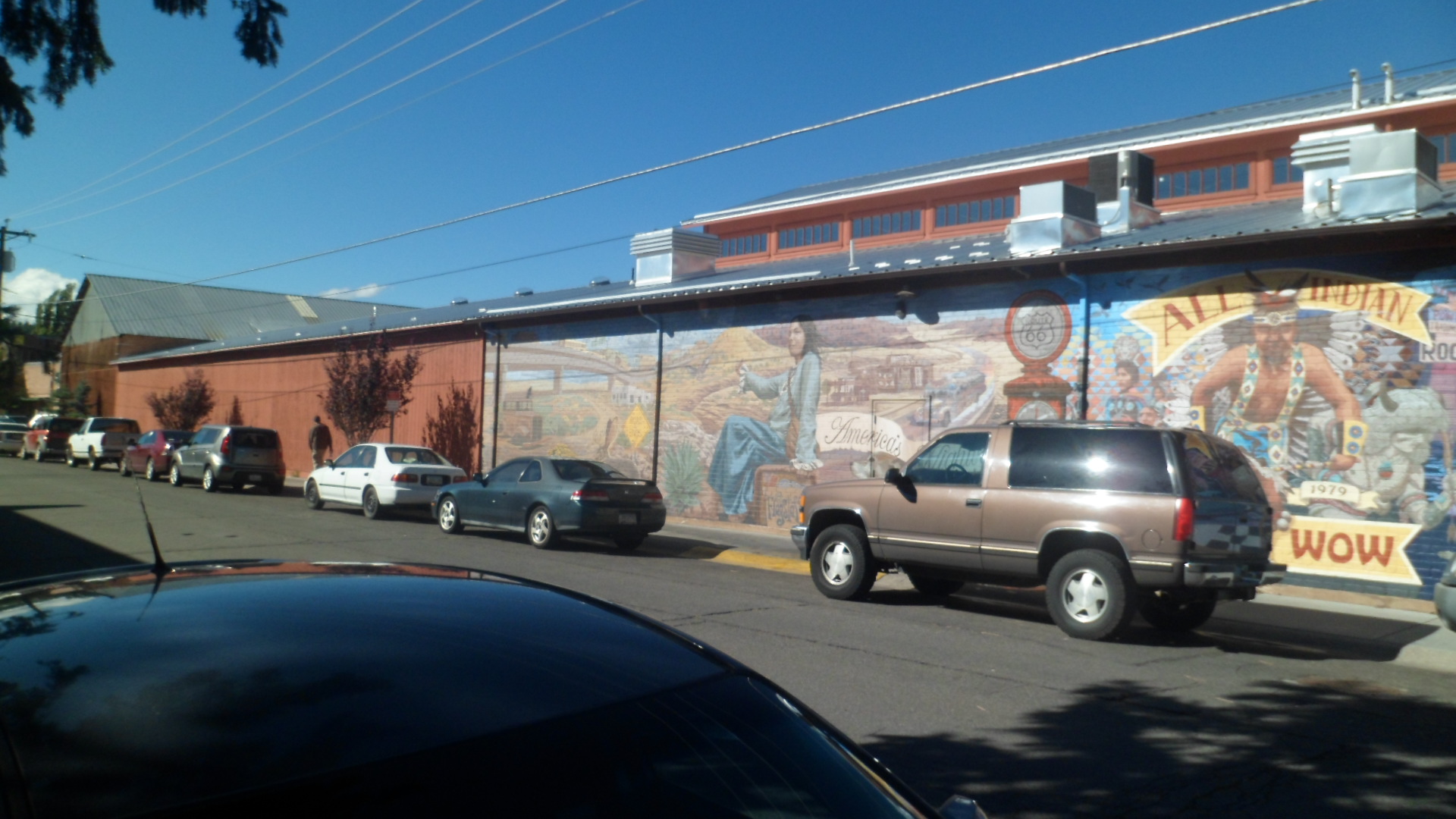
September 28, 2014- Flagstaff has always been friendly to me. So, on a Sunday afternoon, I drove up for a brief visit with some Hopis who were in town for a Native American Arts and Crafts Fair, which the Hopi Tribe was sponsoring. Flag has worked at being more welcoming to Native Americans, over the past twenty years or so, and the mural seen across the street is one small example of the change in attitude.
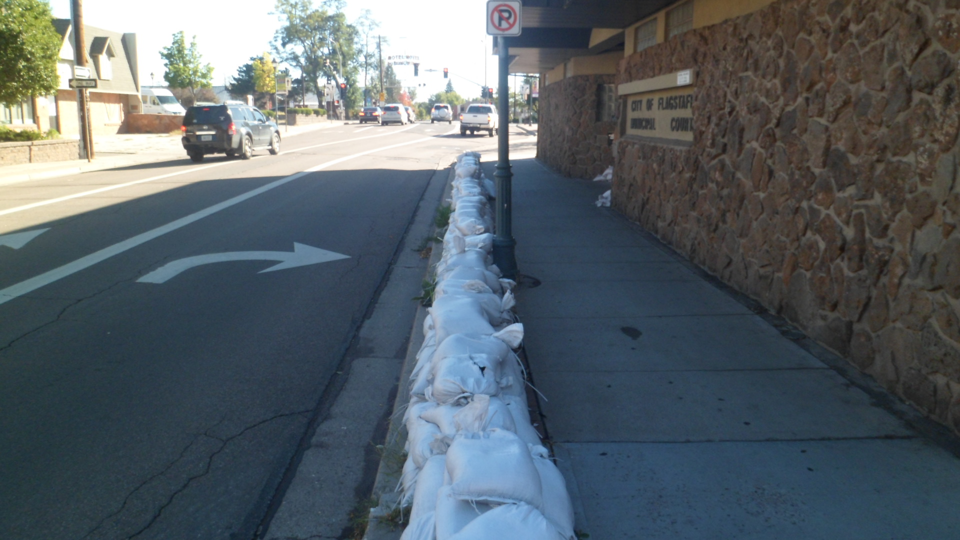
There had been a terrific downpour, from Casa Grande to Tuba City, the day before, and Flagstaff had seen its share of the threat of flood waters. It looked, on that Sunday however, that all was well, in the end. The sandbags were still in place, in front of the municipal courthouse.
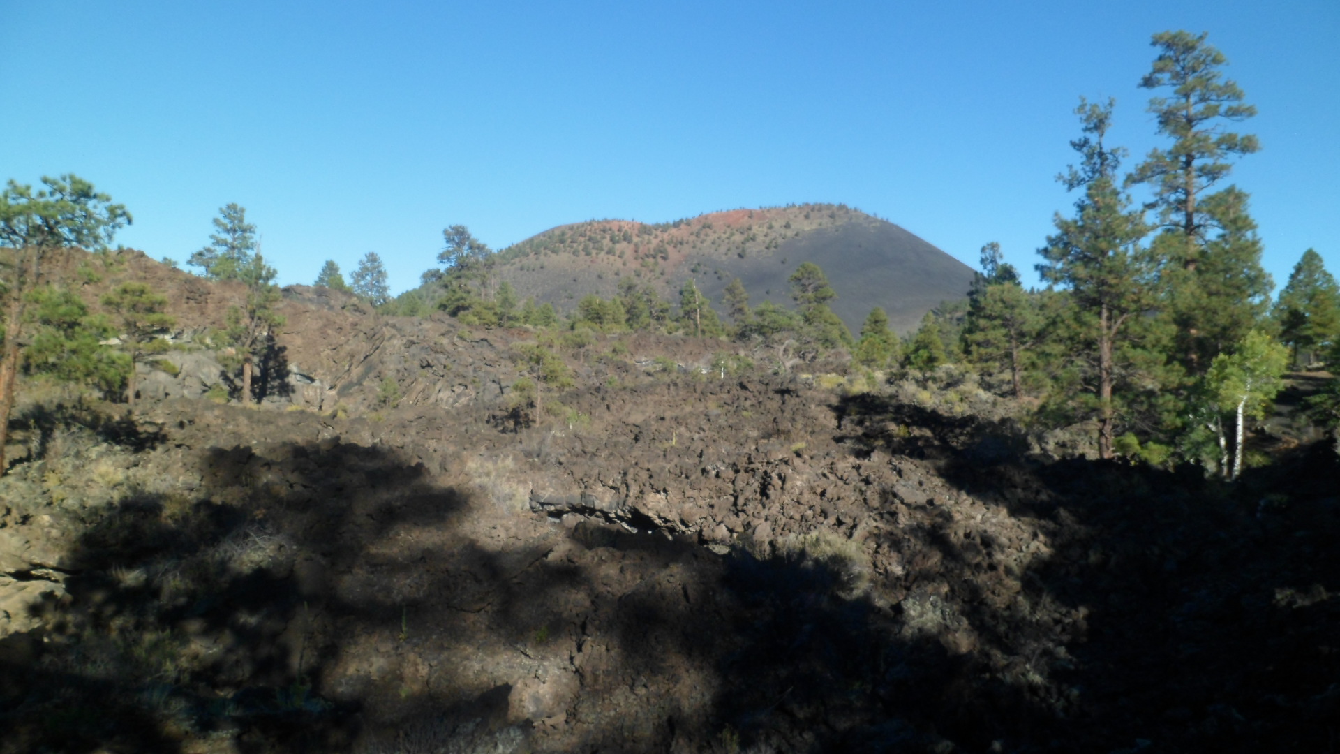
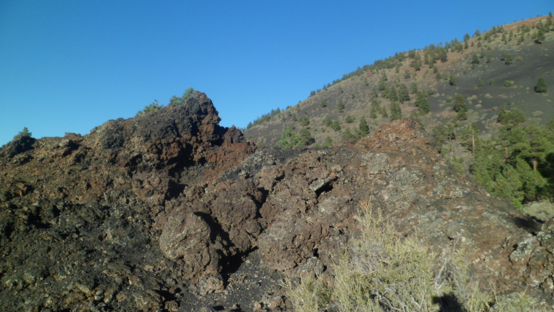
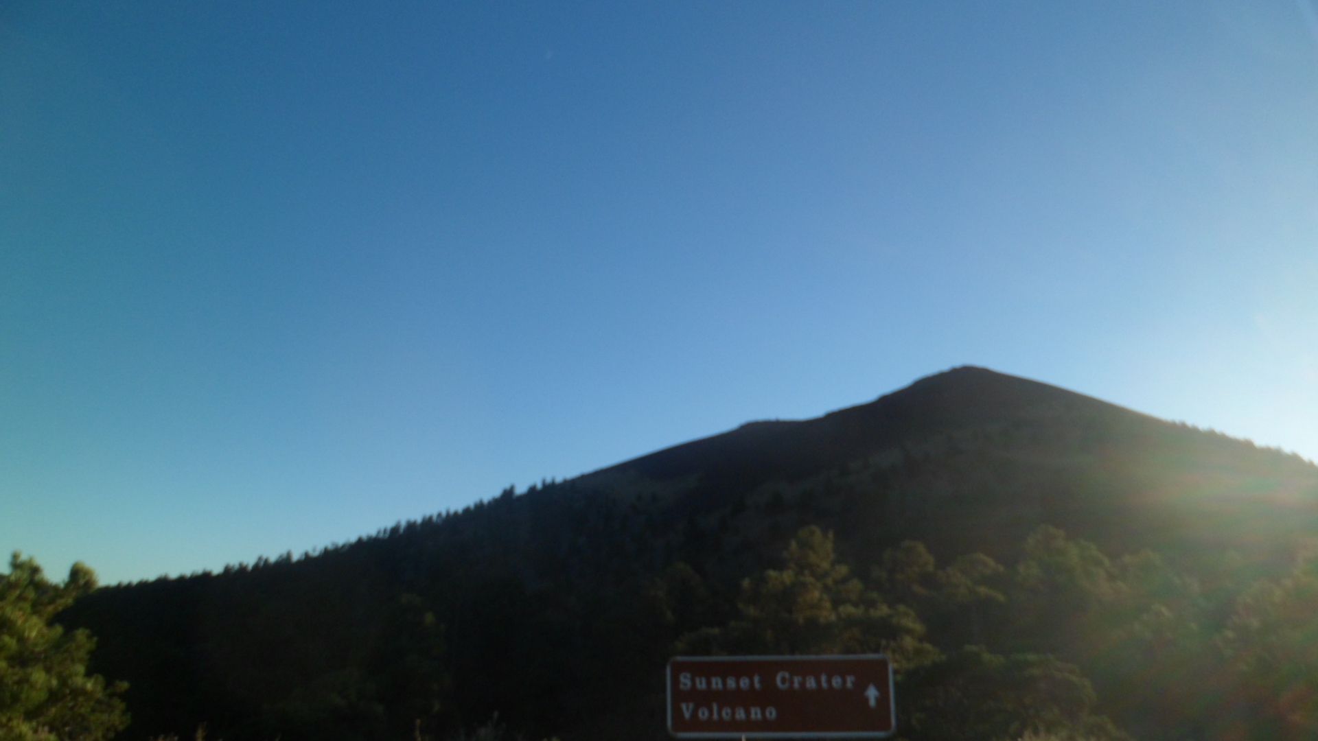
After a latte at Macy’s, one of my favourites in Flagstaff, I headed out to Sunset Crater. It’s near Wupatki, which I had visited a few weeks earlier. Sunset is the remnant of a much larger volcano, which erupted full-blast in the 1060’s. The Lava Beds extend for ten miles or so. Here is a Lava Flow trail, with a view of the San Francisco Peaks in the background.
From the same trail, Strawberry Crater, five miles to the northeast, is visible.
The scenery in volcanic parks tends to like like something straight out of JRR Tolkien’s Mordor. It is an object lesson in the lingering power of volcanic activity. In the long run, though, the soil is renewed. That’s important to remember, when encountering scenes like this. In fact, I learned that the Sinagua people chose Wupatki as a place to build angular pueblos, as a symbol of persistence, in the wake of the Sunset Crater eruptions. The Hopi believe their Kana-a kachinas (spirits) are associated with the crater and its eruptions. Navajos and Zuni also revere this peak, as well as all the mountains nearby. Settlers cherished the volcano as well, and actively thwarted a film company’s attempt to blow up the crater in 1929, during the making of “Avalanche”. As a result, President Herbert Hoover set aside 3,000 acres for the present Sunset Crater National Monument.
The trails in Sunset Crater National Monument tend to be benign and flat. The exception is the cardiopulmonary fitness experience known as Lenox Crater Trail- 300 feet straight up. The Ponderosa pine regrowth is about 30 years old.
From the top of Lenox, Sunset Crater is visible, to the east.
Much more in the way of igneous rock is visible, along the Long Trail, which is less than a mile in length, actually.
This little crater comes with a “No playing inside” warning. It is actually quite fragile.
Some iron deposit is visible, in this broken-off piece of lava.
Here is a long pit, on the west side of Long Trail.
Lightning had hit the cracked rock below.
From Cinder Hills overlook, at the eastern end of the Monument, copper and iron-inflected soil is visible, atop the cones for which the overlook is named.
With its eponym on the way, I got one last shot of Sunset Crater. The peak cannot be hiked, due to its sensitive condition. This is true of a great many volcanoes, both active and dormant. The danger to peak and climber alike is just too real. DO HEED THE RANGERS’ INSTRUCTIONS!