Single- Track Through Paradise

11

May 28, 2017, Cave Creek-

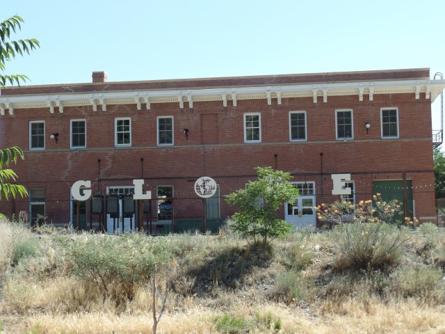
I have now gone from one point of angels to another, meaning from Superior to Cave Creek, via Globe and the Apache Trail.  This road (AZ Highway 88) is mostly single track, offering enough room for vehicles heading one way to pass, whilst those going in the opposite direction wait their turn.  It’s good for people to do this, at least a few times in their lives.  I last drove the AT, in 1983, with Penny in tow.  She was petrified and made me promise never to bring her there again. Today, she and my other spirit-minders made sure I paid close attention.  With scenes like the one below, it might not have been so easy, had my main focus not been on the well-being of everyone on the road, including yours truly.  Fortunately, there were also plenty of turn-outs.

SAMSUNG CAMERA PICTURES

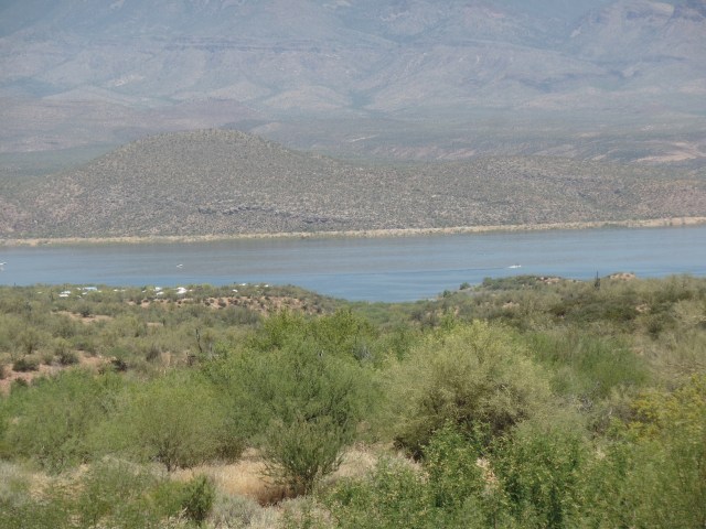
There are two lakes along the Apache trail, between Roosevelt Dam and Goldfield. Here is a view of Apache Lake.  When I taught at Villa-Oasis School, in the late 1970’s, this was one of the places groups of kids were sent for camping weekends.

SAMSUNG CAMERA PICTURES

Imagine how the Salt River must have flowed, before these reclamation projects took root.

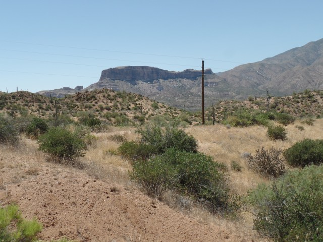
At Fish Creek Hill, I drove up a 10% grade, made doable by the dryness of the road, and the cautious courtesy of all comers.  One is rewarded at the top, by  amazing views of the Superstition Wilderness.

SAMSUNG CAMERA PICTURES

SAMSUNG CAMERA PICTURES

SAMSUNG CAMERA PICTURES

SAMSUNG CAMERA PICTURES

SAMSUNG CAMERA PICTURES

Fish Creek Canyon looks like a fun place to hike and camp- in November.

I drove on, and found the pavement had resumed, about 1 1/2 miles west of the overlook.  So did one young man behind me, who chose to pass, on a double yellow line, in a 15-MPH curve zone.  The look on the face of the driver who had to stop and wait for him was classic.  I would not want to be on approaching driver’s bad side. Itchy Foot was the only one who broke courtesy, on the 44-mile drive.

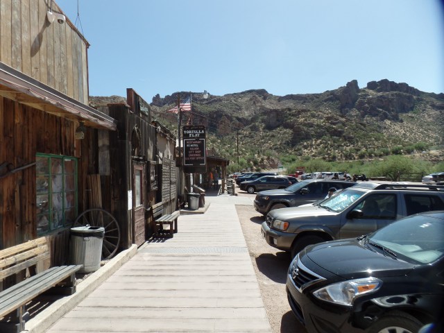
I stopped at Tortilla Flat, a small tourist haven, close to Lost Dutchman State Park, in the heart of the Superstition Wilderness.  Siphon  Draw and Boulder Canyon are two popular hiking trails, accessible from Tortilla Flat.  Again, late Fall and early Spring are the best times for this area.  Tortilla Flat does offer a wide variety of cool treats, and I thoroughly enjoyed a sarsaparilla float.

SAMSUNG CAMERA PICTURES

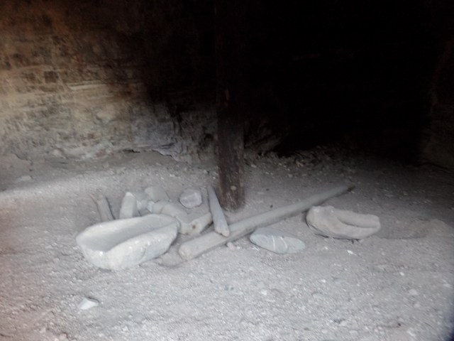
Back in  1900’s Arizona,, sidewalks, and even some roads, were made of planks.

SAMSUNG CAMERA PICTURES

Having had a nice relaxing break, I headed on towards Apache Junction, then up through the Valley, to pay my Memorial Day respects to Penny.

There is one more attraction on the Apache Trail, before one gets to Goldfield (another, slightly more upgraded “ghost town”),  This is Canyon Lake.

SAMSUNG CAMERA PICTURES

Each of the lakes and vista points along the Apache Trail is worth a day or two, in comfortable weather.  People, nonetheless, go there, even in the heat of summer, at least where there is water.  Looking back, I spent most of my summer days in and around water, as a child and young adult, so the appeal is a no-brainer.  It beats being inside.

I stopped at the Cemetery, anchored Penny’s flag, and one other, and thought of how fortunate I’ve been, with her presence, since 1980, and since 2011.

As I pulled up to Local Jonny’s, a lovely young woman, who seemed to be an advanced medical or law student, given her heavy briefcase, was securing her dog’s leash to the gatepost.  There weren’t many inside, so  Alicia was  glad I stopped in, and in ten minutes, I had the last of her pitcher of iced tea and a cilantro chicken salad was placed in front of me.  Jonny’s salads are good for two meals, so I have Monday’s lunch in my cooler, as the drive back to Prescott begins.

Having angels surrounding me, in all directions, including above, is a comforting state of affairs.  Oh, and an e-mail from the chief of department leaves the door to my staying in Prescott ajar, at least.


Tonto National Monument and Roosevelt Lake

6

May 28, 2017, Roosevelt, AZ-  The day started with a wait to check out of  Copper Mountain Motel, Superior.  It was uncertain whether Ms. Amy would be up and at ’em, as stuff was going around, and had stopped at her doorstep, yesterday.  Well, she was over it, by 8:15.  I checked out of my superb room, with its reminder of what we are, as a nation.

SAMSUNG CAMERA PICTURES


Globe, and breakfast, were next.  I spent about an hour with John and the dogs, watching as a hapless, and hopeless, individual ran over John’s flush hose, while trying to park at the RV clean-out station.  Some folks are worse off than I am, it seems.  We found the Copper Hen to be closed, so it was off to Judy’s Cook House, on the west end of town.  A few billowing clouds showed that the Pinal Fire was still a threat to the area, but was yet far from structures.  I heard nothing from the Red Cross, all day, so the fire is apparently being kept away, on this end.  Judy’s gave us a satisfying breakfast, and after solving a few of the world’s, or at least Globe’s, problems, John had to go straight back to customer service, at the Batting Cage, and I was on to Tonto National Monument, and Roosevelt Lake.

SAMSUNG CAMERA PICTURES

The Batting Cage and RV Park are across the tracks from Globe Station.  Trains aren’t very frequent, these days.

Roosevelt Lake was named for Teddy, who of course had much to do with the reclamation of the West, as well as establishing places like Tonto National Monument.  It is visible from several points along the trail to the Lower Tonto Ruins, as well as offering four different recreation points.  The northernmost of these has a Visitor’s Center, which is closed for the holiday weekend.  The second photo below shows the marina near the Visitor’s Center.

SAMSUNG CAMERA PICTURES

SAMSUNG CAMERA PICTURES

Now, more about Tonto National Monument.  Here is a glimpse of the Upper Ruins, which are closed until November, due to the heat factor.  It takes 3-4 hours, roundtrip, for the guided tour.SAMSUNG CAMERA PICTURES

The Lower Ruins trail is open year round, so I enjoyed that area, as well as the indoor exhibits.  As I said earlier, views of Roosevelt Lake are plentiful from the trail.  The Huhugam, and the Salado people who replaced them, made good use of the then-free flowing Salt River, whose waters comprise Roosevelt, Apache and Canyon Lakes.SAMSUNG CAMERA PICTURES

Here are some views of Lower Tonto Ruins.  Much of the wooden beams and braces are the original mesquite and ash used by the Salado people, in their construction.

SAMSUNG CAMERA PICTURES

Caliche, a calcium-based clay, is sticky when wet and hard as concrete, once dry.  It was the prime building material for the Salado people.

SAMSUNG CAMERA PICTURES

The docent told us that these beams are original Salado work, dating from 1150, or thereabouts!

SAMSUNG CAMERA PICTURES

Nooks and crannies abound, in the Lower Ruins.

SAMSUNG CAMERA PICTURES

SAMSUNG CAMERA PICTURES

There certainly seems more room in this complex, than in the Huhugam dwellings at Tuzigoot and Pueblo Grande.

SAMSUNG CAMERA PICTURES

Below, is a kitchen cave.  Note that mano and metate are both caliche.

SAMSUNG CAMERA PICTURES

Amaranth was one of the Salado people’s staple foods.  It is the bright red plant shown below, and was also used in dyes.

SAMSUNG CAMERA PICTURES

Having had a brief, but brisk, hike up to the ruins and back, I headed towards Roosevelt Bridge and Dam, two miles further north. The Dam was dedicated by its namesake, Theodore Roosevelt, in March, 1911.

SAMSUNG CAMERA PICTURES

SAMSUNG CAMERA PICTURES

SAMSUNG CAMERA PICTURES

The Bridge was completed, and opened, in October, 1990, after eighty years of vehicles being driven atop the dam.  Penny and I did so in 1983, and after we continued on to Apache Junction, via AZ Route 88, she made me promise never to do that again, with her in the car.  You will learn why, in the next post.