
Friday afternoon found me in search of petroglyphs. I knew they would not be as extensive as those of Mesa Verde or Bandelier, but they are our local link to the Sinagua people.
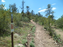
The first part of the northern spur is uphill. The uphill is not steep, and leads to a ridge, giving a fine view of Granite Mountain and Thumb Butte, plus all in between.
Of course, there is no direct trail from here. One would encounter several subdivisions along the way.
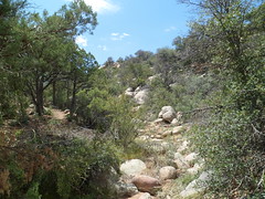
I crossed a dry wash bed, in between the two hills which make up the trail.
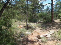
Going along towards the site of the petroglyphs, one encounters several limestone fields, as was true of the southern spur.


Once past these, there is a slightly-flowing North Fork of Miller Creek, as the water emerges from underground.
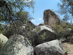
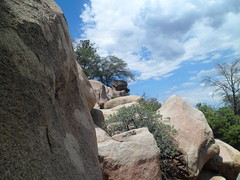
Then, a short climb over some other rocks leads to the final boulder field, and the petroglyphs.
The petroglyphs are faded spirals, with a barely visible upright figure on one of the boulders.


As I left the petroglyph area, I noted what looked like the head of a snapping turtle- petrified for posterity.

The trail is easy enough to do in one hike, on a cool day. This being the monsoon season, I found splitting the trail in two was the best course.

