
Here is a photo of my hiking buddies at in Granite Basin, west of Prescott, on February 26, 2012.

The hike was a prelude to my return to San Diego later that day. I will write more, if this post gets published.
Here is a photo of my hiking buddies at in Granite Basin, west of Prescott, on February 26, 2012.
The hike was a prelude to my return to San Diego later that day. I will write more, if this post gets published.
Thursday was “Back to Sedona Day”, via Jerome and Page Springs. I started with a crab cake croissant and grilled spinach, at Mile High Grill, in Jerome. I featured this fine place in my post on the Ghost City, last Fall.
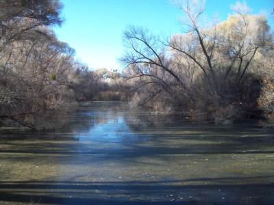
That set me to finishing what I started last week, so the road led to Page Springs, at the juncture of the Verde Valley and Oak Creek Basin. Page Springs is well-known for three things: Wineries, John McCain’s “cabin” and two fish hatcheries. I”m not into the first two,but I do appreciate fish hatcheries, and these two, Bubbling Ponds and Page Springs, help stock sport fishing lakes throughout central and northern Arizona. If you do like wine, the Page Springs fare is said to be quite satisfying.
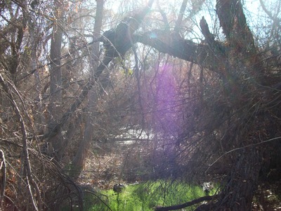
Here a few shots of Bubbling Ponds Hatchery:


A few miles further east, one comes to Page Springs Hatchery, run by the Arizona Department of Fish and Wildlife.


Here, stock tanks were running in earnest.


There is also a short nature trail, where Penny and I saw a wealth of birds, early one morning in September, 1983.
I headed up to Sedona, having had my fill of ducks and stock tanks for one day. Today’s goal was Chicken Point and Red Rock Chapel.
Here are some more bits of Red Rock Eye Candy:


As you might tell by the cars in a parking lot, I was getting close to Red Rock Chapel in the last frame.
Here is a view of the chapel, which is a non-denominational facility.

After this, I found the short cut back to my car was a route set aside by the Home Owners Association of Bell Rock Vista, through their neighbourhood. Although the trails were crowded, I felt solitude, since none of the visitors to Sedona is much for talking. If you visit, you’ll see why.
Wednesday afternoon, I got the notion to hike from the base of Mingus Mountain, 20 miles east of Prescott, to its summit, via a fairly rugged canyon called Yeager. Upon reaching the east rim of the canyon, I walked on to the actual summit, a gradual and easy 1 1/2 mile walk along the campground road.
Here are some scenes of the upward route:


Mingus is one of the three peaks in Yavapai County that I had left to climb, so this route was somewhat special. I was surprised that no one else was on the trail, but even more surprised to run into an old Army buddy, whom I had not seen in 41 years. He is here in Prescott, looking for work. Goes to show how small the world can be.
After talking with him for a while, i headed back down, using two trails- Little Yeager Canyon and Yeager Cabin Trail, which I partly hiked on New Year’s Day. Here we go, back towards my trusty KIA Optima:


The above photos are of the summit area. It’s not the most spectacular of vistas, but the trees are pretty.


 It was right about here that I ran into five head of cattle- two bulls, two cows and a heifer calf. Needless to say, they kept on nibbling at the creosote bushes, while I made a slight deviation in my route.

7.3 miles later, I hopped back into my trusty vehicle and headed into the sunset. Two high peaks remain for me in Yavapai County: Mt. Union and Mt. Davis, the Twin Peaks of the Bradshaws, on tap for the latter part of March.
I climbed Wickenburg’s Vulture Peak yesterday, thus satisfying yet another bit of curiosity. Even though it was a Sunday, and beautiful weather, only a handful of people were along for the hike, and I reached the saddle (trail’s end) alone.
Here is the summit, seen from the trailhead.


The last three views were taken from the top of the saddle. Summiting requires at least a buddy system, and ropes are advisable for coming down from the summit to the saddle.
Yesterday, I headed towards Wickenburg, with the express goal of climbing the town’s third anchor: Vulture Peak, having visited Desert Caballeros Museum and Hassayampa Natural Preserve earlier this year. Along the way down, and on the way back, I decided to give some love to the small gems that appear in the high desert.
Here is Wilhoit, which sometimes refers to itself as “Nowhere, AZ”.


A bt further on is Peeples Valley.


As you might guess, Peeples Valley is a ranching town. A man named Maughan has a number of ranching properties here, and in nearby Yarnell.

I stopped in Yarnell for about an hour or so, to pick up a book on northern Arizona’s geology and a new ball cap, at Painted Lizard, plus check out three interesting landmarks.


Above, and below, are views of Yarnell’s Flora Mae Ludden Memorial Park.


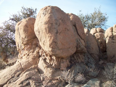
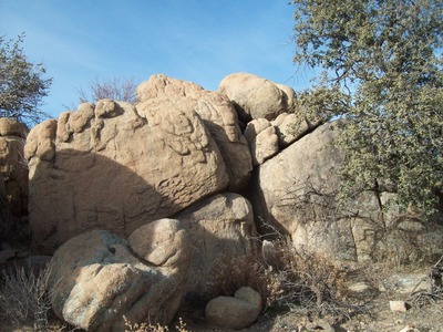
Like Prescott to the northeast, Yarnell has its share of rock dells from the retreat of the glaciers. Below are some boulders with names.


The park where these are found is about 1/4 mile from the Shrine of St. Joseph. This is a nondenominational shrine, featuring the Stations of the Cross. I found walking it a deeply moving spiritual experience, though I don’t belong to a Christian church. Christ’s Message still speaks through the ages, for those with open ears.


Peeples Valley was named for a rancher, A.H. Peeples. Yarnell was named for a prospector, Henry Yarnell. I’ve found no record of Wilhoit’s namesake, as yet.
On the way back from Wickenburg, I stopped by another little gem, this one four miles off the beaten track: Kirkland. Here is an old railroad hotel, restaurant and saloon, which is still very much in operation. I had a marvelous steak dinner here, topped by a dessert called “Pecan Passion”. If you’re ever moseying around in the high desert between Wickenburg and Prescott, stop in and enjoy the hospitality of Herb and Barb Carabeo. An extra sidelight: The paper placemats were illustrated by a friend of ours from Clarkdale, AZ. Her name is Ann Schnell.

Kirkland has a small rock dell of its own.


The village is named for William Kirkland, who also founded the city of Tempe, near Phoenix, before moving here in his later years.
There were lots of boulders, going up, though. I woke around 6:30 and went back and forth as to whether to do yet another hike. Camelback Mountain still awaited, and a hot soak in the tub at Premier Inn convinced me it need not wait much longer. The key would be whether there was a parking spot at Echo Canyon.
So, after a light breakfast of oatmeal, toast, OJ and coffee, I upgraded my cell phone (still just talk and text- I like my Internet sitting down) and dropped off my tax forms, then headed over to Echo Canyon. There was one space- my sign from above!
Echo Canyon Trail is notorious for people going off trail, getting stuck and making the nightly news. I was not going to be among them.
The jaunt featured, as I said earlier, lots of boulders, a few railings and an amazing number of hiking companions, for a Monday. Here are several shots of the day- the whole collection may be found in the “Phoenix Mountain Hikes” album.


Me vs. my vertigo.
After this third beautiful day in the semi-urban wilderness, I stopped at Arizona Memorial Cemetery and placed a Valentine’s bouquet at Penny’s resting place. I know she loves the red roses, baby’s breath and fern fronds in the vase- even in the Spirit Realm.
Since I had enjoyed lunch on the way down at Rock Springs Cafe, in Black Canyon City, dinner was at Roadrunner Restaurant, in BCC’s cross-county line neighbour, New River. Both eateries are worth a visit.


The music, the fireworks and the Polish sausage were happy memories on Sunday morning. I got myself together for another sunny day and enjoyed a hearty breakfast at the local Mimi’s Cafe. The plan for the day was to explore an area that had long intrigued me: White Tanks County Park, west of an area in which I had worked for several years.
Thoughts of Whitney Houston, and my Penny, were very much in the fore as I trekked the Goat Camp Trail and the Mesquite Canyon Trail, through some awesome canyons. Following, are twelve photos of this magnificent area. All the photos may be viewed in my “White Tanks” album.


This is Slick Rock Wash.


Communications towers are well-protected here.


Apropos of Valentine’s Weekend, here are what I call The Kissing Rocks.
Twelve photos? I lied. Here is # 13-

Once finished with this twelve mile hike, I got to do another three miles back to my car. We live in an age of distrust, and not even the folks who took my photo would chance having me in their car for three miles.
It was a lovely day anyway, and I capped it by treating a couple of my hosts from last summer’s travels to dinner at Macaroni Grill. It is a nice feeling to be able to be a host in return.
This past weekend, I went to Phoenix as a visitor, and as a citizen observing our state’s centenary. Saturday, I drove over to Camelback Mountain, which I had not climbed since Christmas, 1982, only to find zero parking. Opting instead for Piestewa Peak, which I had climbed three times previously, but had never photographed, I found parking and several lively climbing groups, with whom to enjoy the afternoon.
Originally called Squaw Peak, the name was changed virtually by Executive Order of then-Governor Janet Napolitano, in 2003, in honour of Lori Ann Piestewa, a soldier of Hopi-Yaqui descent, who was the first Arizonan to die in the Iraq War. “Squaw” is a Huron word for “female”, which descended into pejorative use by white settlers, then by the general American populace in the late 19th Century.
I had known Lori Ann, while serving as a counselor in her native Tuba City, in the early eighties. She was a sweet-natured, but bold child, and it seems she carried her boldness into military service. Boldness is a good quality for which to lend one’s name to a mountain. This particular mountain, with its narrow and steep trails, welcomes bold climbers.
Here are some scenes of the peak and its surroundings:


 ,
,
These last were taken by a Christian lay missionary, who was enjoying the peak with his wife and another young couple. In the course of the photo shoot, I laid my oak walking stick, a legacy of my maternal grandfather, dating from 1924, on a pile of rocks. Then, I headed down with the two couples, forgetting the stick. As luck would have it, another couple with a young boy passed by when I was halfway down. I told them about the stick and that if the child found it, the stick could be his. The couple replied that they would rather bring it down to me, if i had time to wait. So, I did and they brought it to me ninety minutes later. Oh, the joys of not being on a schedule!
Evening fell, and I went to downtown Phoenix, where a series of concerts was in full swing. I caught performances by Michelle Branch and the Gin Blossoms, gladly raising my arms in a group wave to the latter’s heartfelt performance. As the Blossoms launched into “Hey, Jealousy”, their final song of the evening, we were treated to this:

How cool was that?
I think it’s been thirty-six years since I have been present at such an emotional public gathering. Watching things on TV or online is just not the same.
The Hassayampa River (Assiampa, in Apache, for “waters hidden underground”) mostly lives up to its name. It rises in the Sierra Prieta Range, on the west side of Phoenix, and flows downhill to the area occupied by the small ranching and mining town of Wickenburg, about an hour northwest of Phoenix. The town, in turn, is named for Henry Wickenburg, an entrepreneur in rail and mining, in the Arizona of the late 19th/early 20th Centuries.
I went down there yesterday, to visit two of the area’s three defining places: The Hassayampa Riparian Preserve and Desert Caballeros Museum. This post shows some scenes of the preserve, which is manged by The Nature Conservancy. Most of the land is flat, save a small outcropping, called Lyle’s Lookout.
Here are some scenes of Palm Lake Loop Trail.


Note the “beard” or dead frondage, on the palm.

Palm Lake used to be pumped and cleaned up. Now it is left alone.
The Conservancy prefers to keep its holdings in their natural state.
The midsection of the Preserve is mostly dry.


As one gets towards Lyle’s Lookout, however, the Hassayampa emerges from underground.

The Lookout itself affords a fine view of surrounding mountains.
The approach to Lyle’s Lookout.


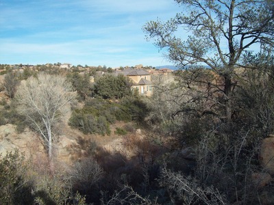
I am going to translate a photo blog from Xanga, of a natural area near my home. It is a western segment of Granite Dells, large boulder formations along the valleys of Willow Creek and Granite Creek, on the northern tier of Prescott, AZ. The Dells extend south, almost to downtown Prescott, west to near Granite Mountain, which predates the Dells by about a million years, north to near the city’s boundary with Chino Valley and east to near Glassford Hill.
I’ve been to most parts of this amazing range of granite boulders. The area shown below is largely in private hands, and is not on the usual hiker’s route, although cyclists are fond of the Pleasant Valley Drive route, on the south rim of Willow Creek Canyon.
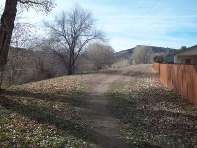
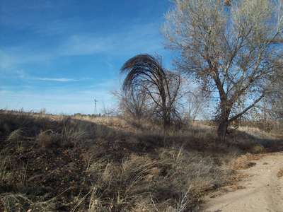
As the weather is much improved here this week, I thought to venture outside and go somewhere which didn’t require use of the car. Between my house and downtown, there lies a segment of Granite Dells which I had not yet explored. So, off we went, the pink Kodak digital and I.
Here’s the view, once past my back gate.
This great pasture extends from our lot to Willow Creek.
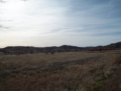
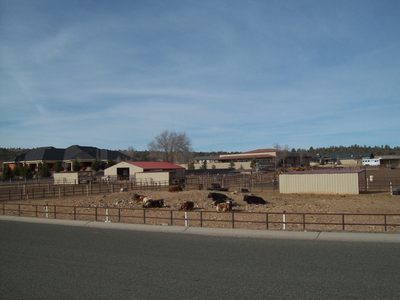
The clientele aren’t impressed by the pasture.
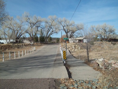
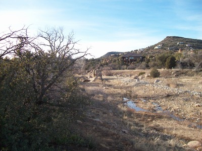
Here is the dry bed of Willow Creek.

Nevertheless, a bridge goes over it, just in case.
To the north, lies Pioneer Park.

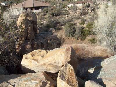
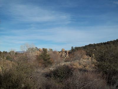
Here are several shots of the Dells, in the area of Willow Creek Canyon.


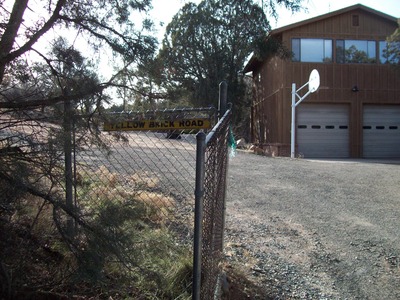
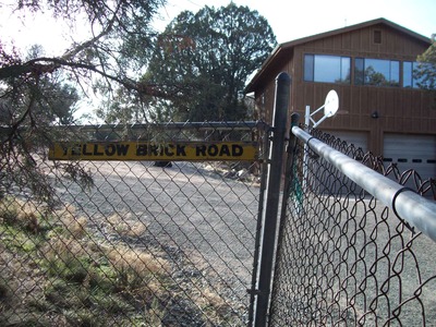
At the end of the public road, there was the Yellow Brick Road, with no Munchkins,
but a playful puppy.
The puppy really didn’t want to be photographed.
Going back, I focused my attention a bit more on the short, but scenic Willow Creek Canyon.
Lastly, a lone sapling asked: “Who did this to me?”
There is much to astonish, out one’s back gate!
Relationship Insights & Advice
food, nature, photography, art, travel
Exploring the spidery corners of a culture and the weird stuff that tourist brochures ignore.
I love to write about everything. Writing relaxes me.
Arist Writer Creator
Kings Consultants LLC
An Independent Nondiscriminatory Platform With No Religious, Political, Financial, or Social Affiliations - FOUNDED 2014
Open Your Mind
A blog about BPD and art
Homepage Engaging the World, Hearing the World and speaking for the World.
Helping Others to escape the Monkey Trap
Astrologer ~ Mystic ~ Writer
Poetry BLOG By Edge of Humanity Magazine
Healthy Body healthy Mind
Language Learning My Way
