March 29, 2024- The three-year-old girl wrapped her arm around a pole, while standing just above the stairs at the rear door of the shuttle bus. It was a crowded bus, and even with her watchful grandmother standing between her and the door, she was taking no chances.
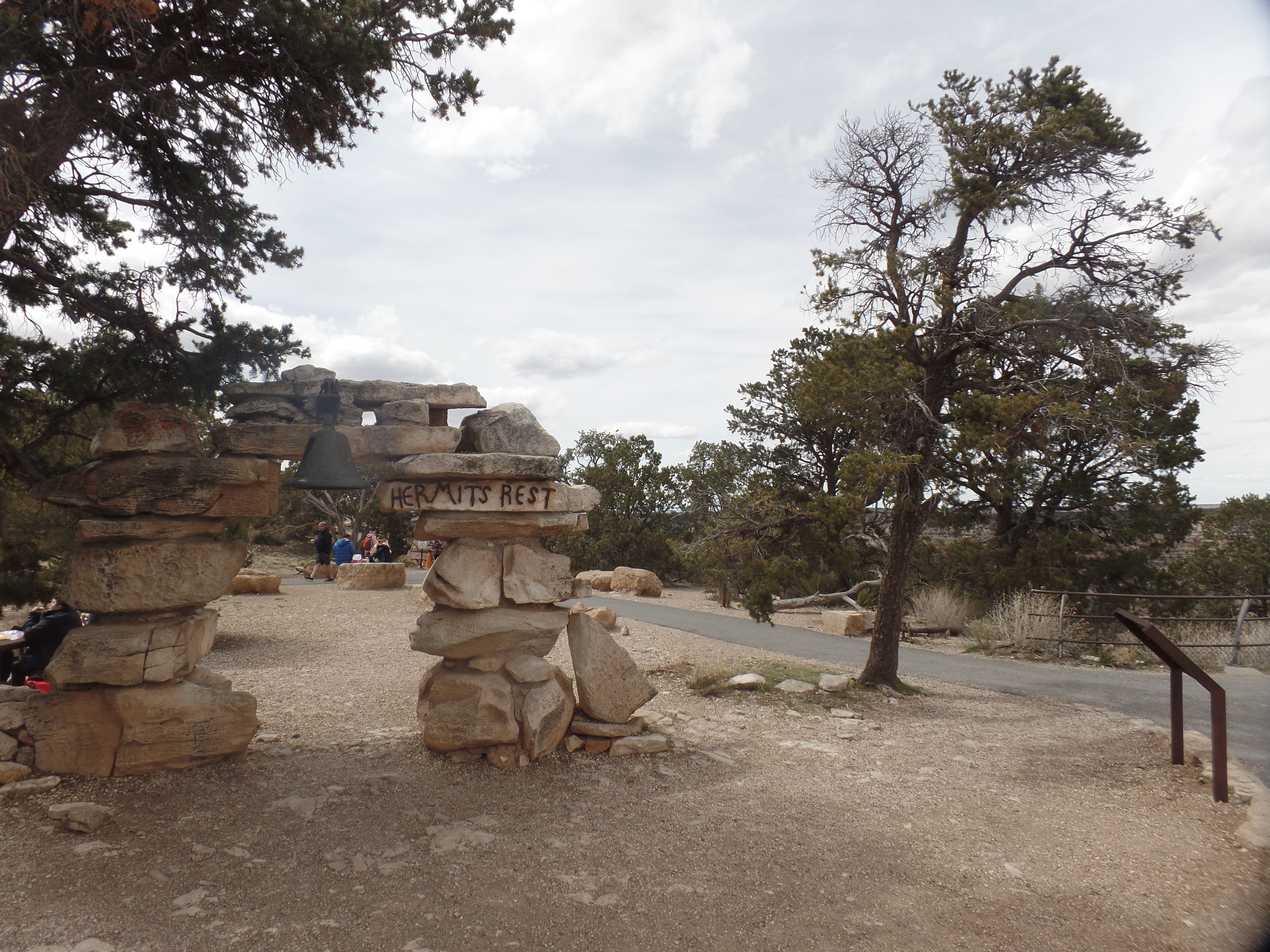
Hermit’s Rest is the site of the westernmost of Mary Colter’s eight buildings that grace Grand Canyon’s South Rim. It is in an otherwise nondescript section of the Rim Trail, set away from the stunning overlooks that are signature to the canyon’s edge. Louis Boucher would have preferred it that way. He was a prospector for gold, and probably uranium, in the days before the national park was established. His trail, now called Hermit Trail, leads down to the Colorado River, some 8.7 miles one way. (If I were to hike to the river, it’d involve a camp out at Hermit Camp-not far from where Louis made his home.)
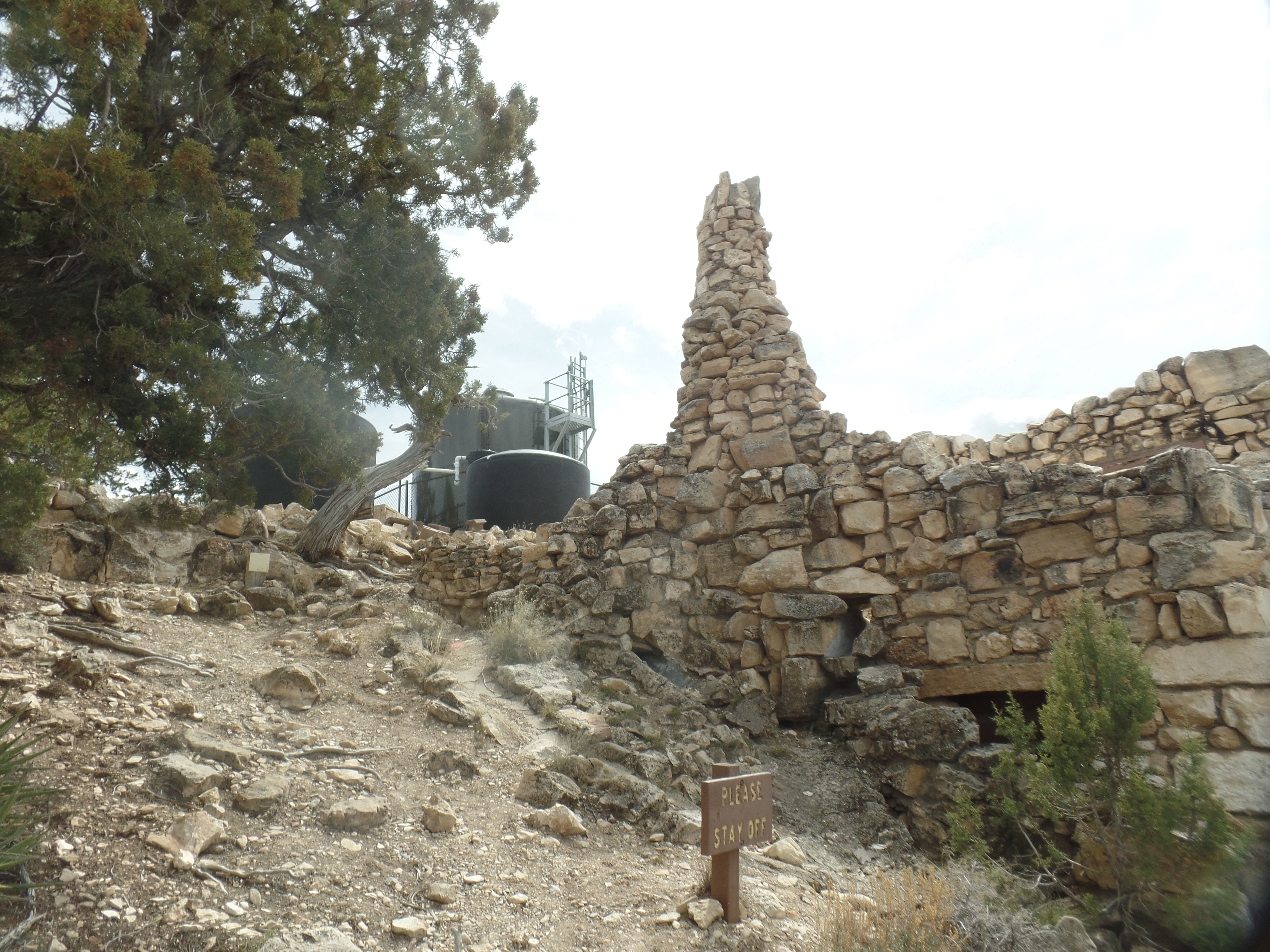
The gateway to the end of one line.Mary Colter’s Beehive Oven, resembling a Hopi outdoor ovenSouth side of Hermit’s Rest store.
Neither man-made nor nondescript last long at the Canyon, though. A short walk through the trees reminds the visitor of why the trip was made, in the first place.
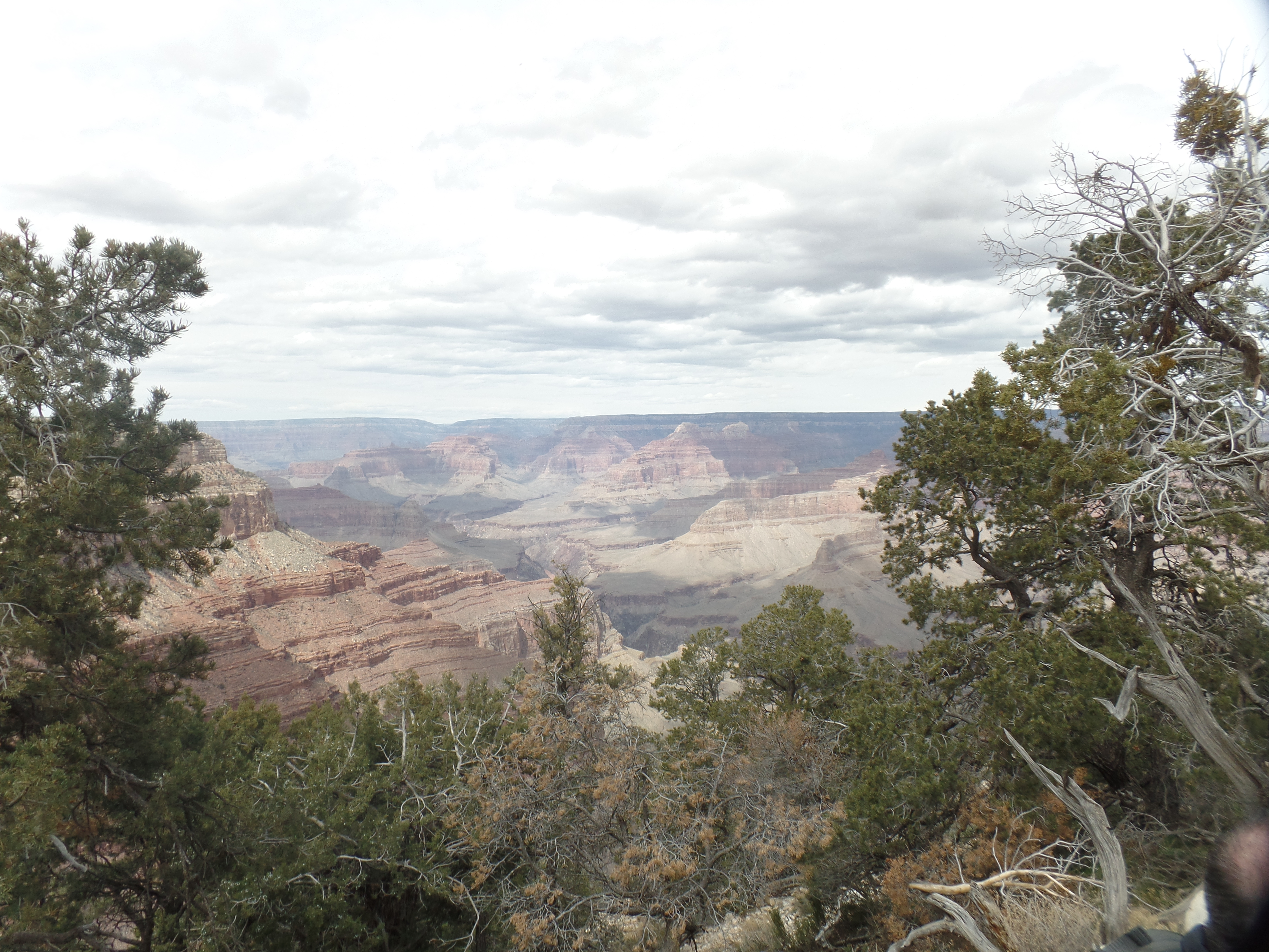
The Inner Basin, from Hermit’s Rest.
I began the visit at Hopi Point, where the last trip was cut short, owing to a flash flood in Tusayan, which necessitated most of the visitors having to go back to Grand Canyon Village and tend to their lodging. I was able to make the journey around the eastern route, to Cameron, and then back to Prescott, via Flagstaff. Not everyone was so fortunate, and many ended up spending the night in one of the lobbies of hotels within the park.
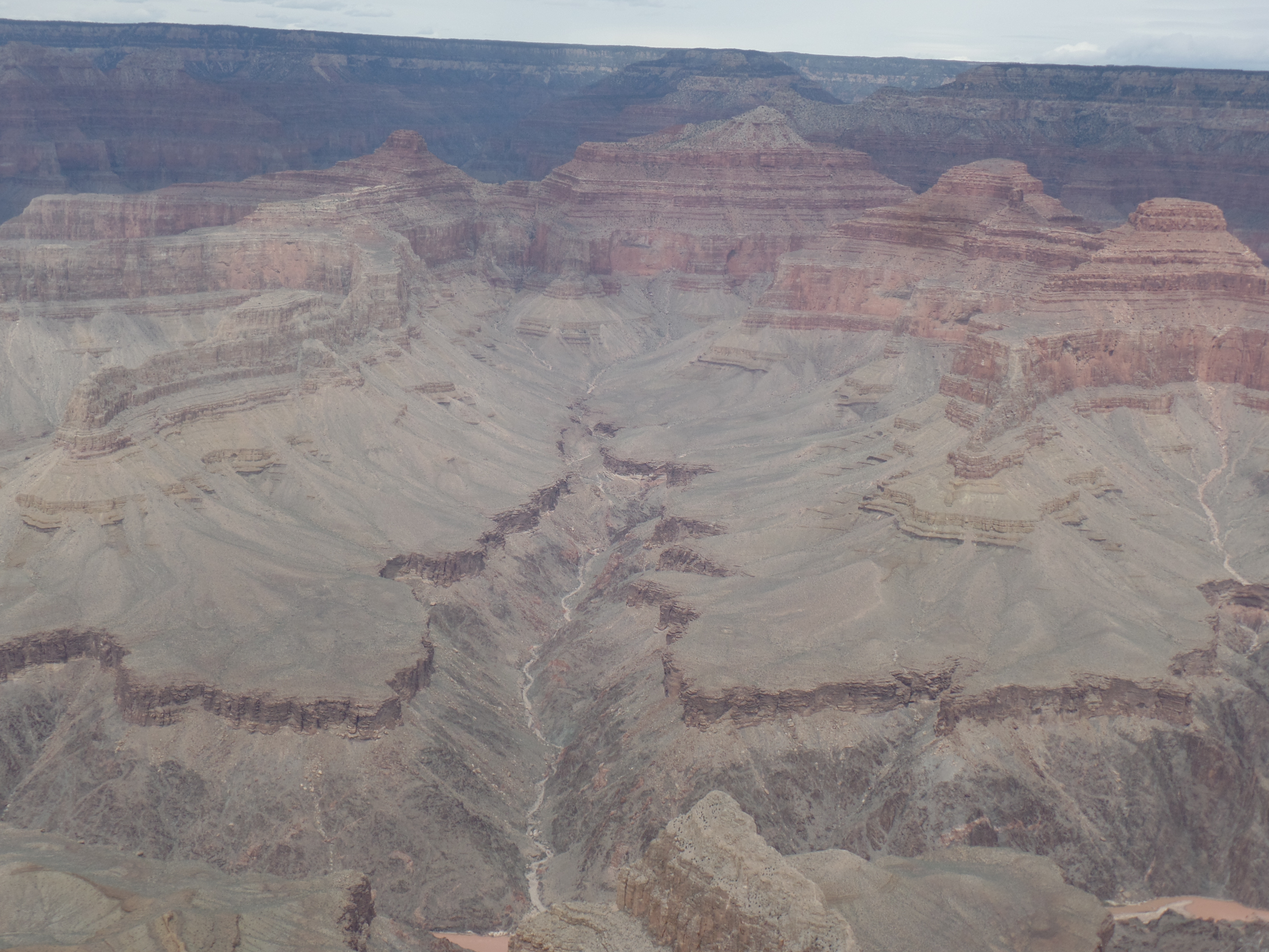
Today, there was wind, but no water, so all of us were able to go clear to Hermit’s Rest, or to one of the other viewpoints. I walked from Hopi Point to Mohave Point, taking in the following scene, among others.
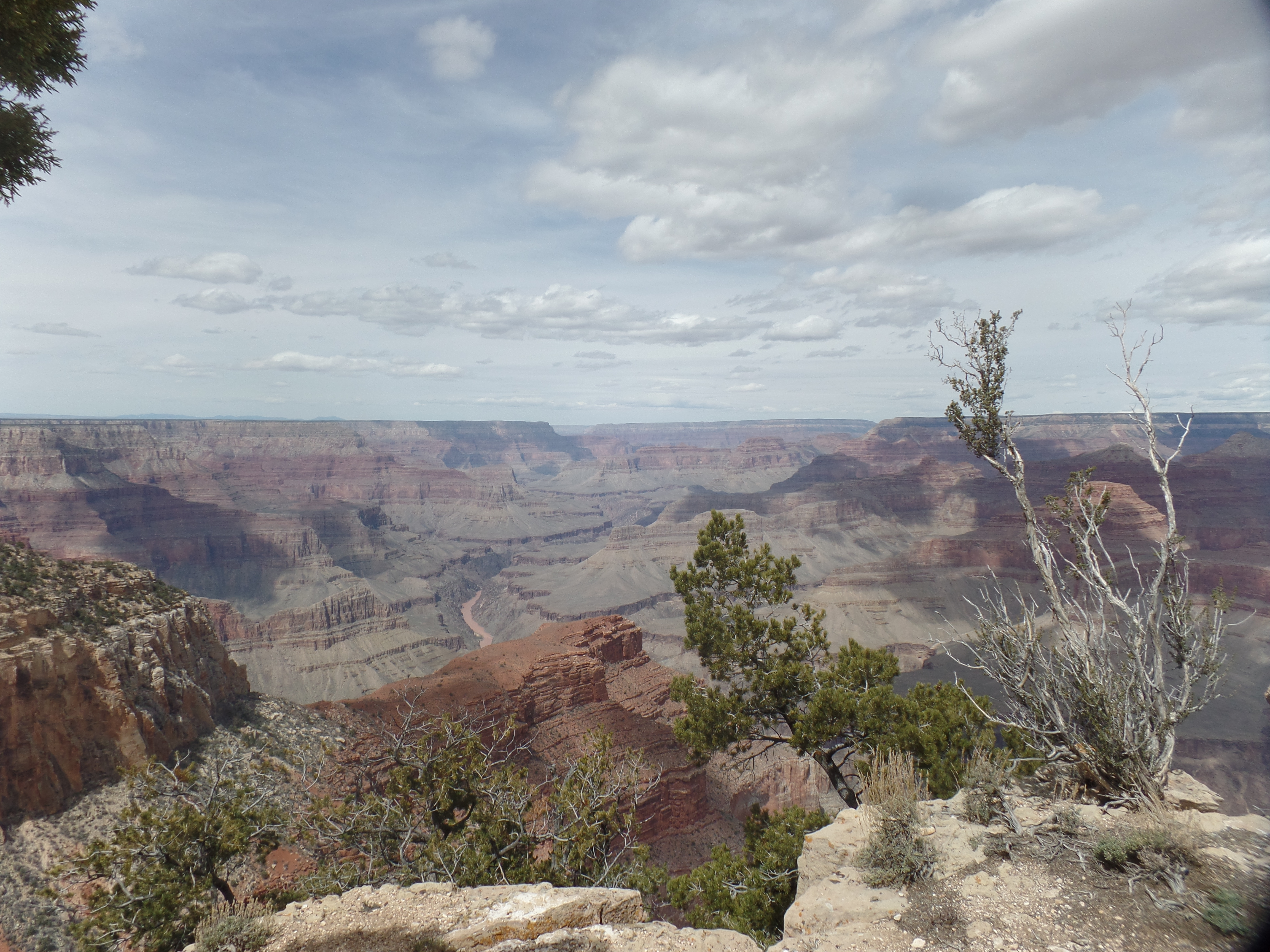
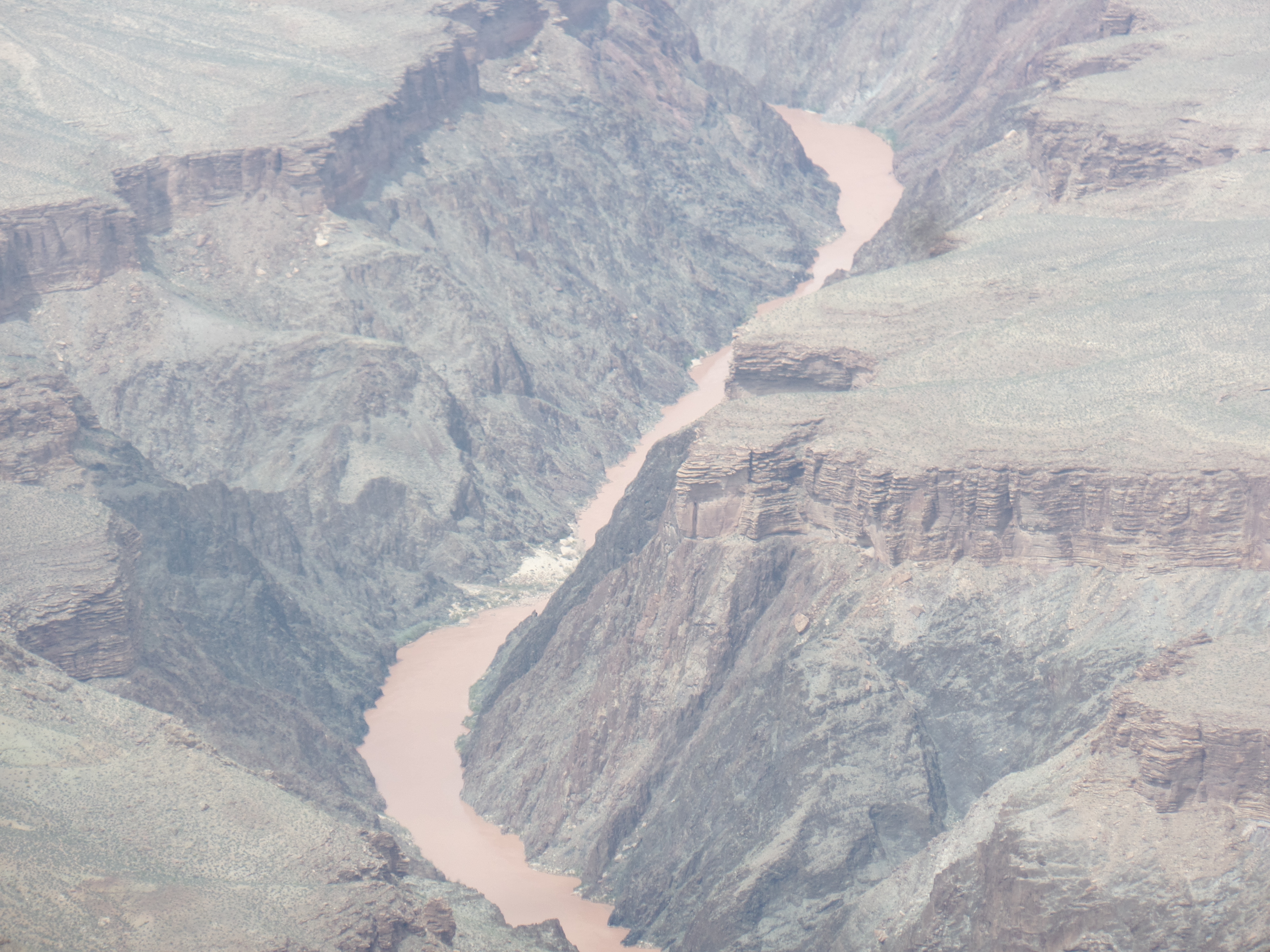
The Colorado River has a demure presence, beyond The Battleship, from Hopi Point.If you think that living on the South Rim is easy, this juniper pine begs to differ.A view from The Abyss.The Abyss also shows the effect of weathering, on the topmost layer of limestone.Here is a view of Monument Creek, flowing into the Colorado River.From Pima Point, a zoom lens affords a close-up of the Colorado River, without a long hike!
Finally, just when you think you’re done with the Canyon, here’s the next big thing:
The first question says it all.If your answer is “Yes”, happy hiking-and camping!
I am not beyond that sort of adventure yet, but for today, it was time to head back, so onto the shuttle buses I went, including from the Village to the Visitors Center, which was the bus where the little girl and her family crowded on. We all got to go where we had planned, today. No rain, just wind.
March 14, 2024- I felt rather the middle of a sandwich, the sprinters going down ahead and the lone woman, about my age, hanging back-especially when I stopped to take a photo-which is when she would dart out of sight, only to emerge when I was several steps ahead. Fun fact: We all got back to the parking lot, at Estes Canyon trailhead, at about the same time.
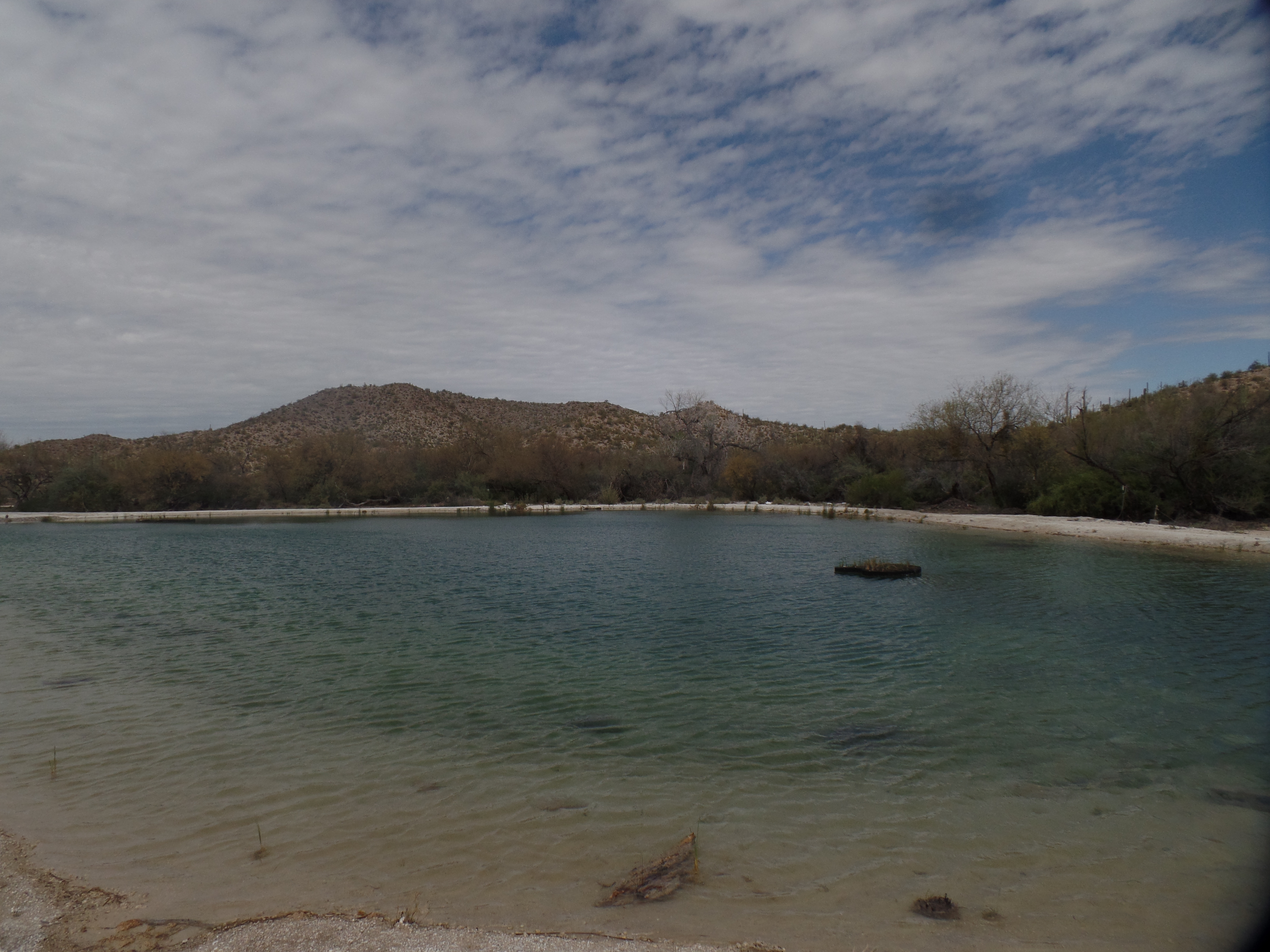
My first order of re-visiting business, to the places my late wife, Penny, and I visited, in 1983, was Quitobaquito. This spot is reached, either by driving down from the Visitor’s Center, via the North Boundary route, or by way of Highway 85. I chose the latter, first stopping for a few minutes in Lukeville, then following the unpaved, but graded, South Puerto Blanco Drive, for fifteen miles. The border wall is visible, to the south, for most of this route. There were no migrants visible, during my visit. Border Patrol agents were on site, at three spots along the wall.
Quitobaquito has no clear meaning, in English, but may be a hybrid Spanish-Tohono O’odham phrase meaning “little spring”. It as several springs, and a small rill to the east, feeding it. When Penny and I were here, it was shallow, and the water looked brackish, although the nearest salt water, in the Sea of Cortez, is still 6o miles to the southwest. Today, though, the pond was well-formed, and had been shored up by stone border-lining.
Trailhead, for short walk to the pond.Quitobaquito (above and below)
I wonder, though, about the lack of birds, which is an unusual state of being for a pond in the Southwest-or anywhere in North America. It was, in fact, once a very rich environment for birds, amphibians and fresh-water fish. Other than a trio of fellow travelers, I was the only soul around.
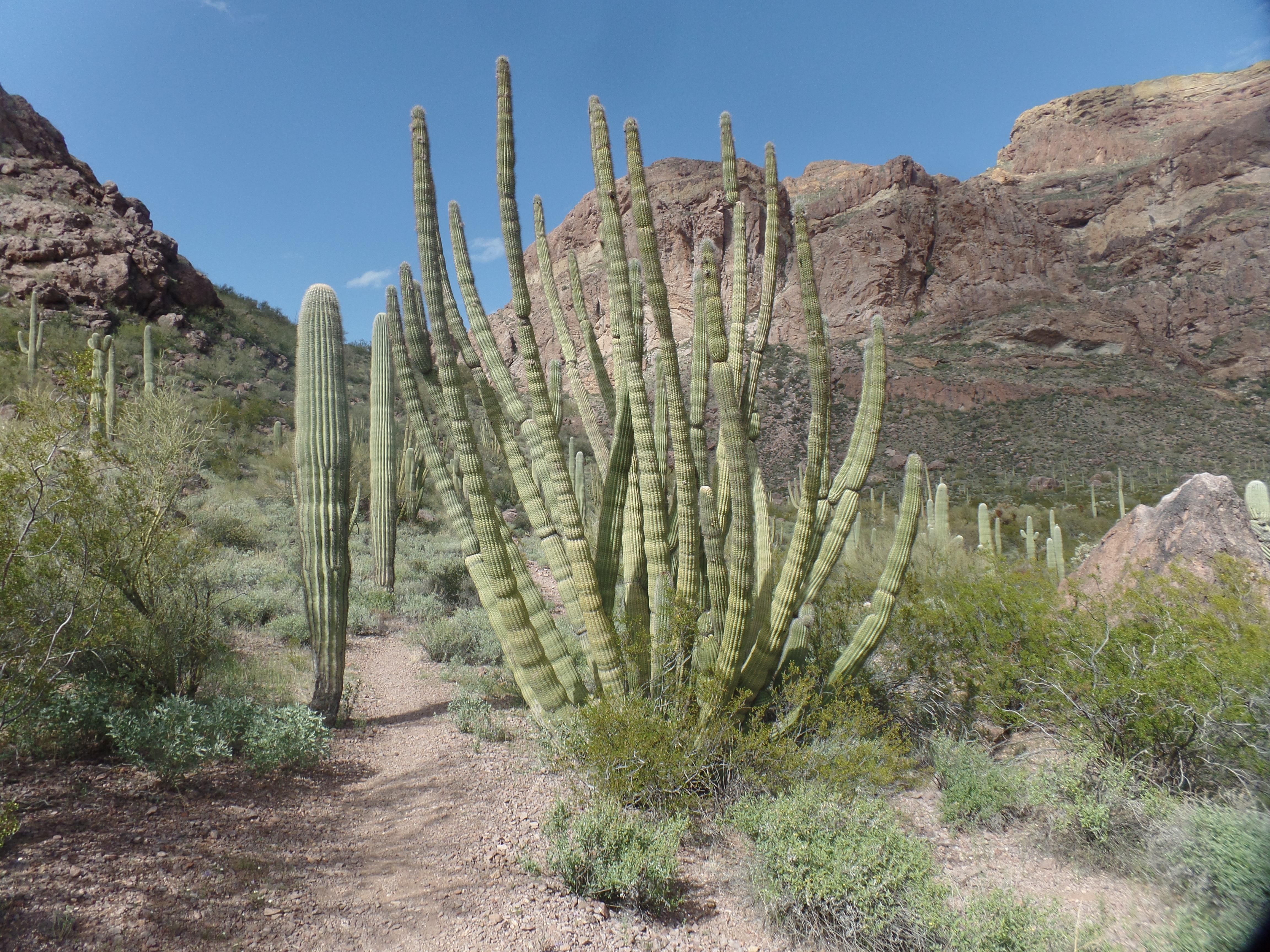
Next up was a return visit to Ajo Mountain, which has several stops of interest, along a 19-mile loop. Penny and I hiked to Bull Pasture, a fairly rigourous jaunt, when in her late twenties and my early thirties. It was a good follow-up, for me, to yesterday’s hike in Montezuma Canyon, 215 miles to the east. Although I have always been somewhat a dawdling hiker, I still made the walk up and back, in about 2 1/2 hours-taking about the same time as those who appeared to be moving much more quickly. They seemed to need more breaks, though, so that evened things out. I like to take a lot of photos, so here are five:
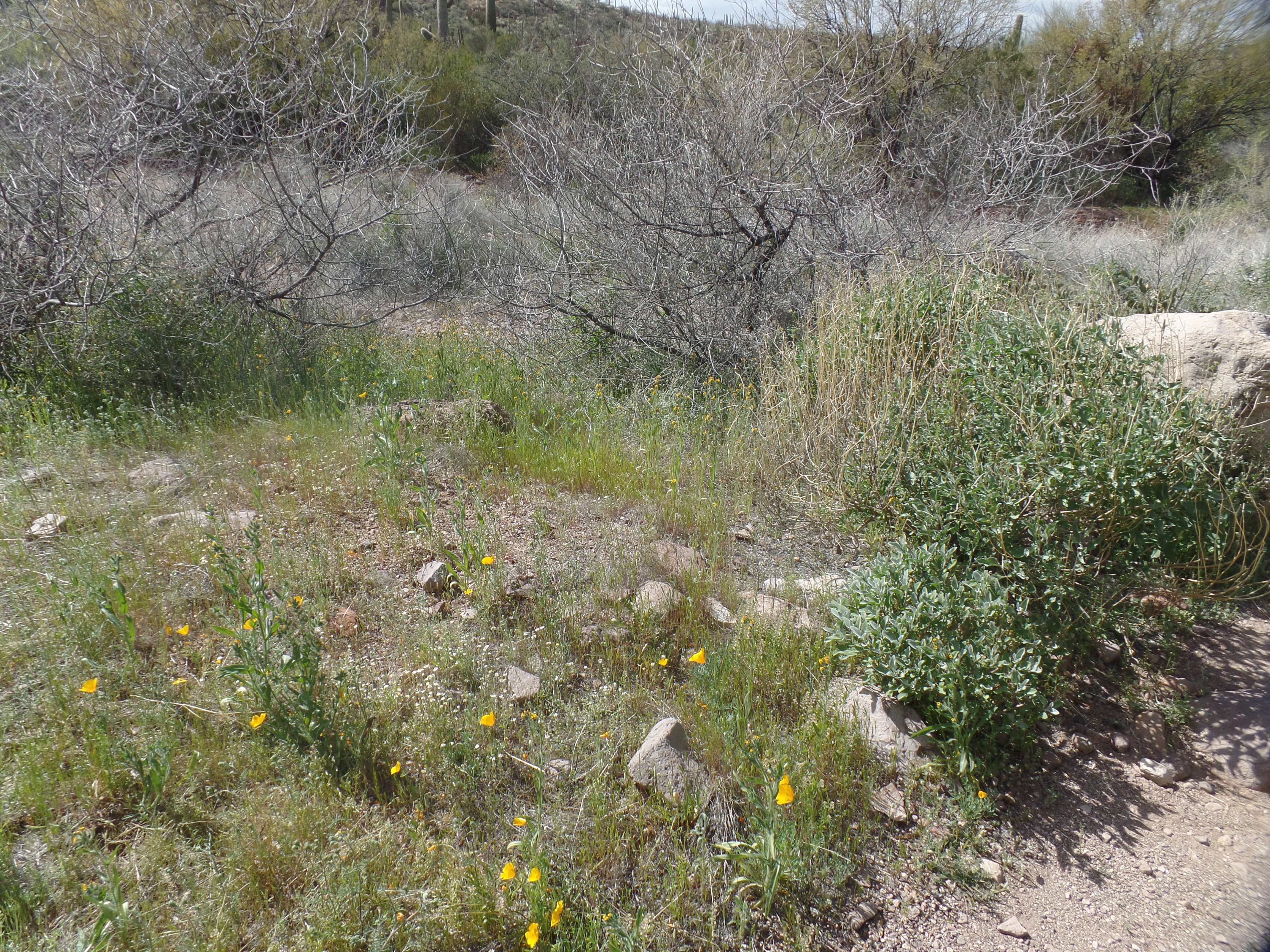
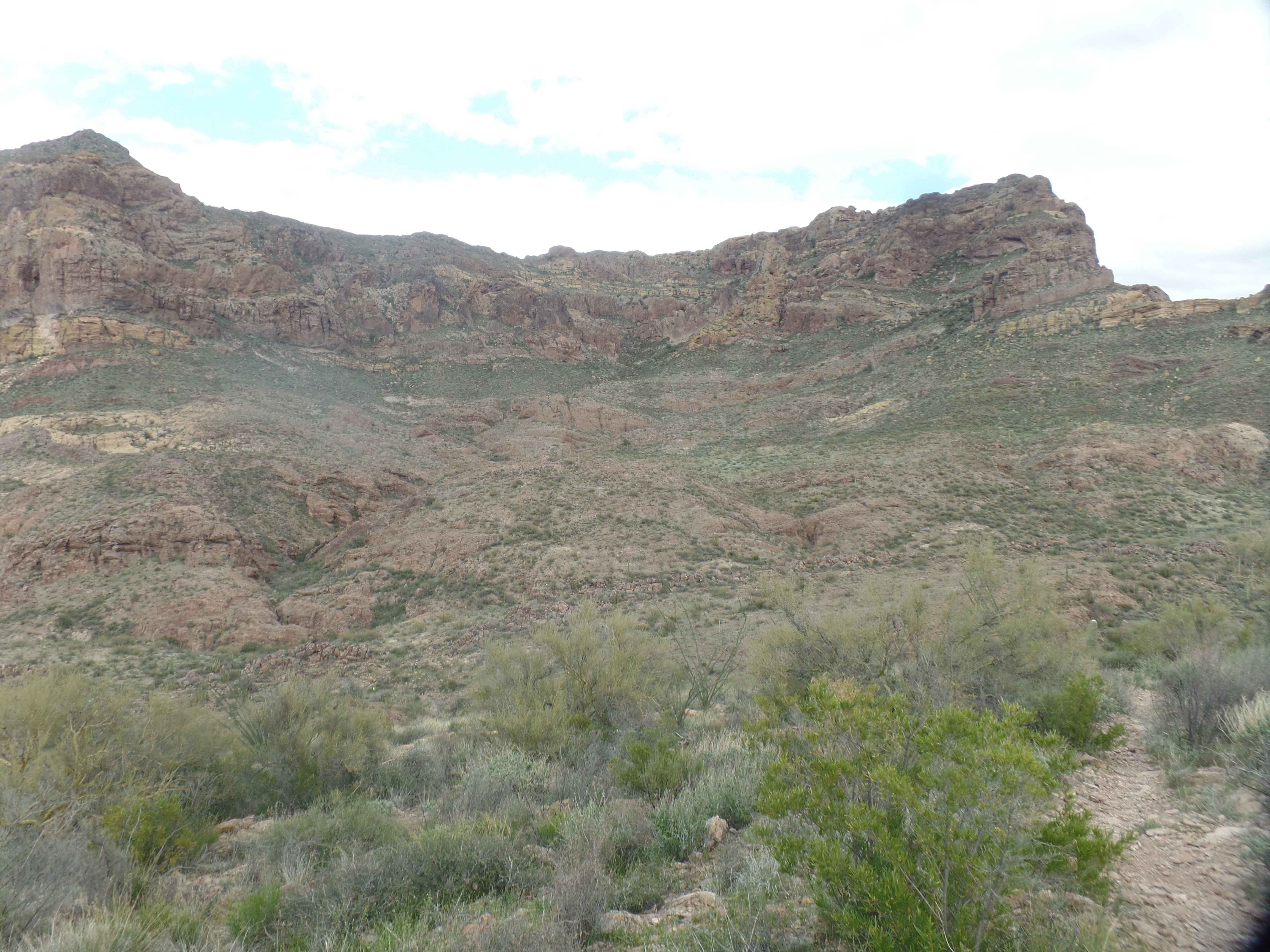
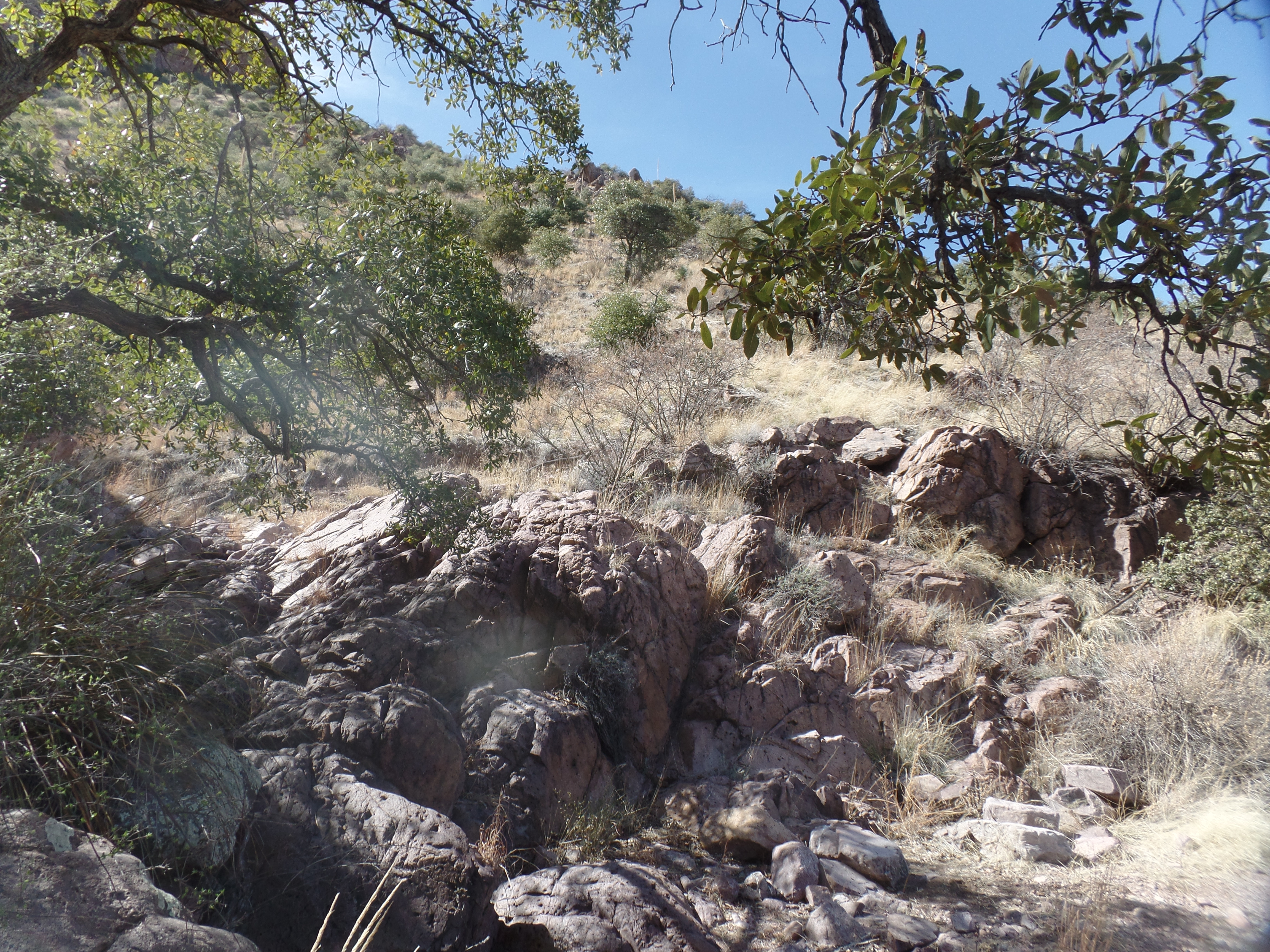
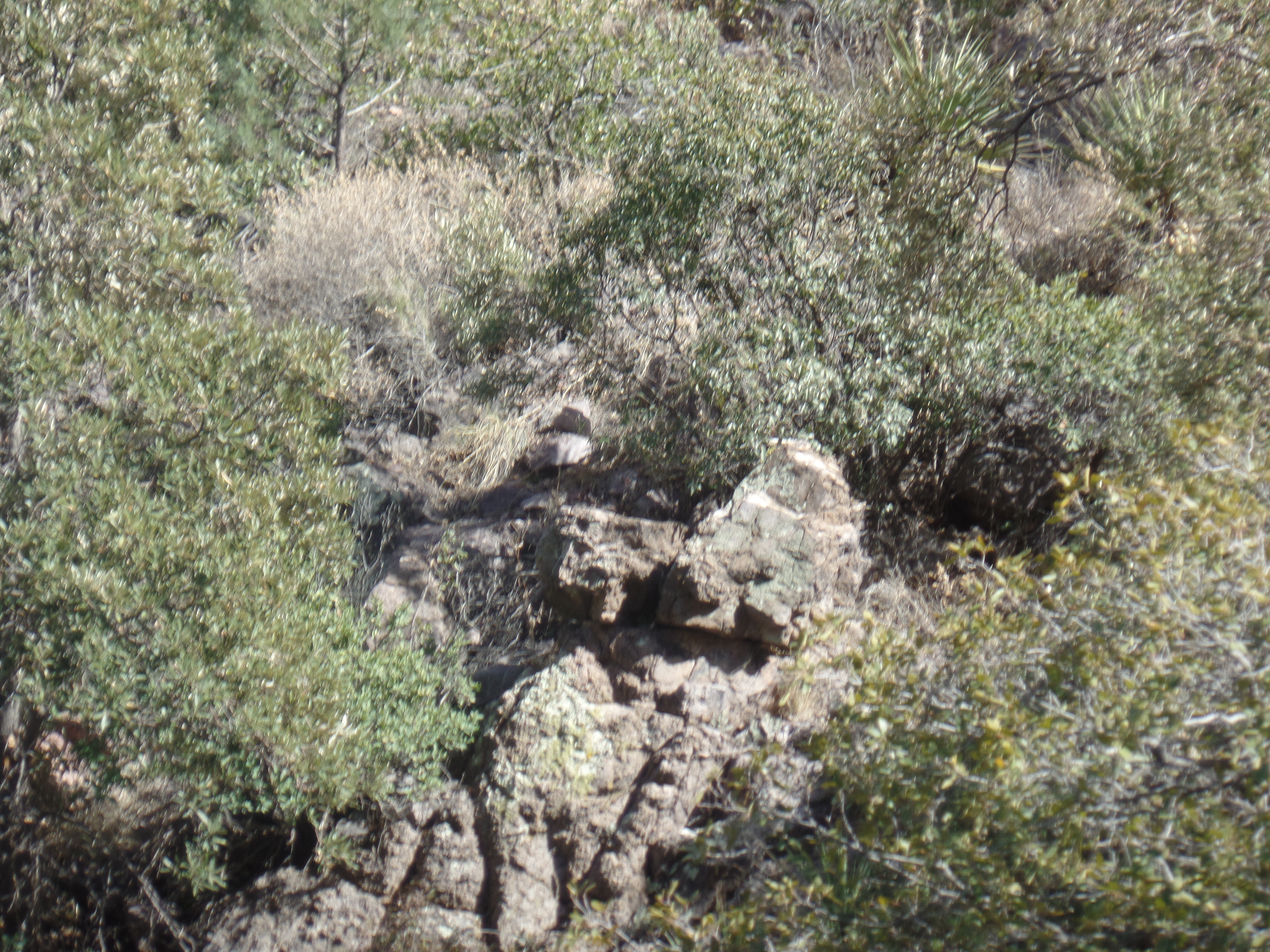
The west face of Ajo Mountain.Buttercups, the small delights of vast Estes CanyonOrgan pipe cacti are only found in southwest Arizona, Baja California and a swath of northwestern mainland Mexico. Seedlings thrive and grow on rocky hillsides, and then only when protected, for a time, under “nurse trees”, such as mesquite.There is a sprawling nature to Estes Canyon, a worthy hiking destination, in and of itself.Whilst in Estes Canyon, I met a couple heading back. The woman said that, in her view, Bull Pasture was more like bull pucky and that Estes Canyon was more pasture-like. Upon reaching the top, I can see that she may not have gone far enough. Here is the view from Bull Pasture itself.The actual area where Spaniards grazed cattle. Bull Pasture trail continues down from the sign, to a couple of springs. A party of college students and their professor came up from the springs, overtaking me, after a brief conversation. We still met up again, back at the trailhead.It was, nonetheless, a lovely return to an old gem.
March 13, 2024, Ajo- The motel owner came to the door, after I left a voice mail on her phone, and cheerfully welcomed me into the office. After I paid, she went over and showed me the room, proudly pointing out the improvements she had made to it.
Earlier in the day, as I checked out of Knight’s Inn, the clerk thanked me, profusely, for having stayed the night. There is always a pleasant stay to be had, at a Knight’s Inn-and the price has always been reasonable.
Between these two bookends of love and light, there was plenty of good cheer. When I went over to a nearby Speedway station, to get a cheap bit of breakfast, the clerk signed me up for a Speedy Rewards card, which I got to put to use, right away, when filling Sportage’s tank, an hour or so later. I had been a bit lazy, in getting onto such a discount program, up to now, but it’s time.
Making a pilgrimage to Bisbee, I found High Desert Market and Cafe was closed on Wednesdays, so another new spot was in order. I chose Main Street Bistro, which has a similar, if smaller, menu to HDMC’s. The wait was longer, with only one person staffing the patio area, but the wait was well worth it. I took a stroll downtown, after, and looked at the area where two buildings burned, a month ago. Of course, it was roped off, and pictures were not in order. I did take a shot of this rock formation, above the patio at Main Street Bistro.
Mr.Toad guards the Bistro.
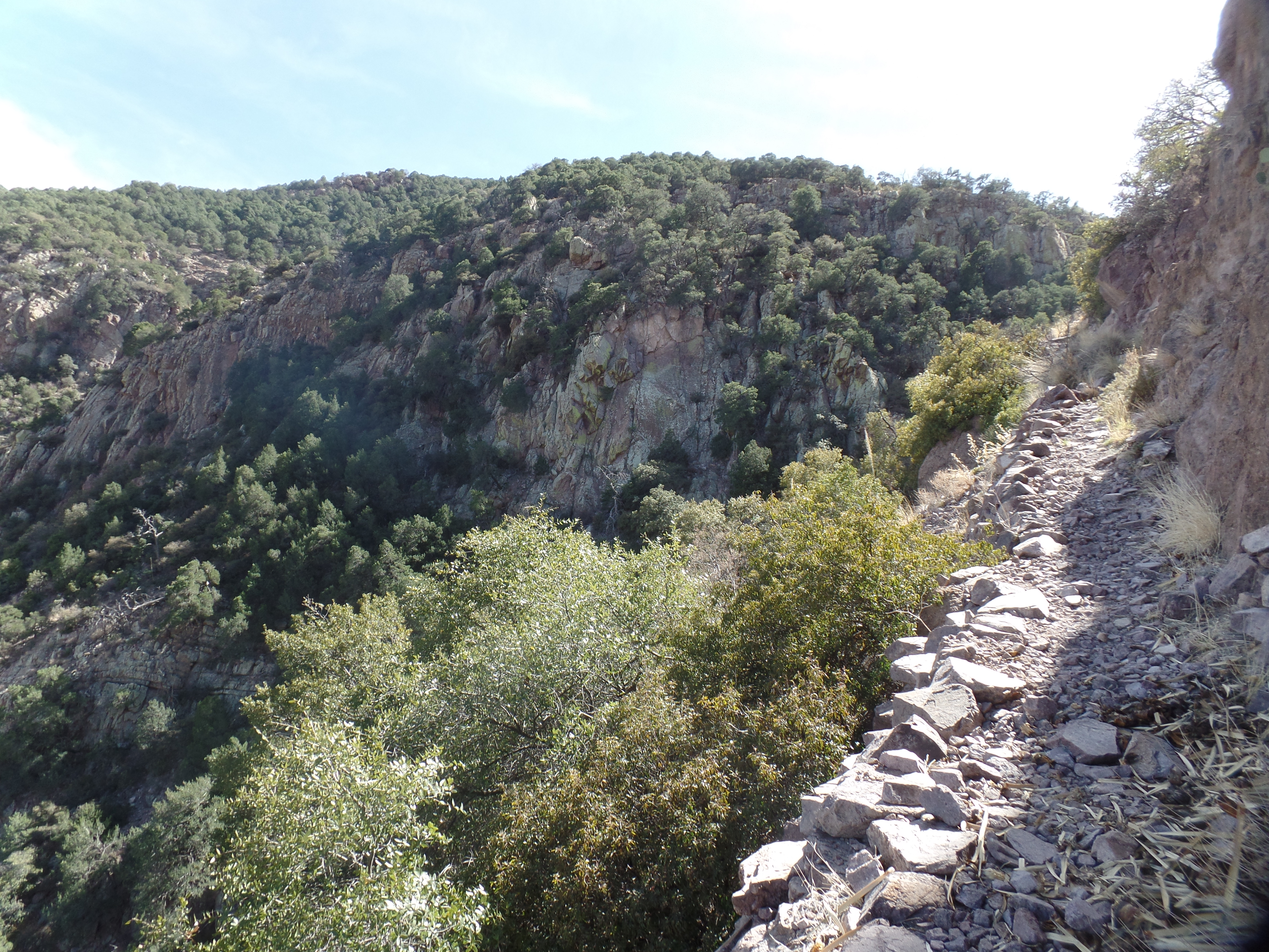
It was now time to return to Coronado National Memorial, high on the border, near Hereford, AZ. This time, I wanted to hike at least 3/4 of the way up Joe’s Trail, which runs from just west of the Visitor’s Center to the fourth ridge of Coronado Peak, where there is space for several vehicles. I left my SUV in the parking lot at the Center, and managed to get 3/4 of the way, turning around and hiking back, with the hope of finding a place en route to Ajo, in time to make a Zoom-based meeting. (This didn’t pan out, and was my one disappointment of the day). The hike, though, in Montezuma Canyon, was sheer delight.
View from the base of Joe’s Trail, Coronado National Memorial.Outcropping, lower Montezuma Canyon.A jolly old king, Montezuma Canyon.View from a narrow trail, Montezuma CanyonAt my turn-around point, with a view towards the canyon rim, Montezuma Canyon, Coronado National Memorial
I headed inexorably west, then north, and west again, after leaving the Memorial. The road called Ajo Way is one that Penny and I took, 41 years ago, to visit Kitt Peak, Organ Pipe National Monument and Puerto Penasco, Sonora. I would visit Organ Pipe, this time around, and drop in at the border town of Lukeville-but those are for tomorrow. Kitt Peak and Puerto Penasco are for another time, and possibly I won’t be visiting alone, but we’ll see.
For now, the border at Coronado is quiet, no sign of any mass incursions, surreptitious or otherwise, and the rangers suggested it’s been that way there, for a while. In Ajo, meanwhile, the Copper Sands Motel, and its owner, Linda, are delighted to have guests who mind their manners. Copper Sands kind of reminds me of Gram’s Place, the hostel where I stayed in Tampa, two years ago-lots of bric-a-brac and a funky patio or two.
I am getting ready to rest, bathed in love and light.
March 12, 2024- The Old Pueblo shimmered in the morning light, and invited me to stay a while. First was a dinner invitation, which I wouldn’t dream of passing up, then there was all that lay in front of me, in El Presidio, and nearby Jacome Plaza, the gateway to the University of Arizona. I would not have enough time to visit U of A, but more on that in a bit.
Pima County Courthouse, Tucson
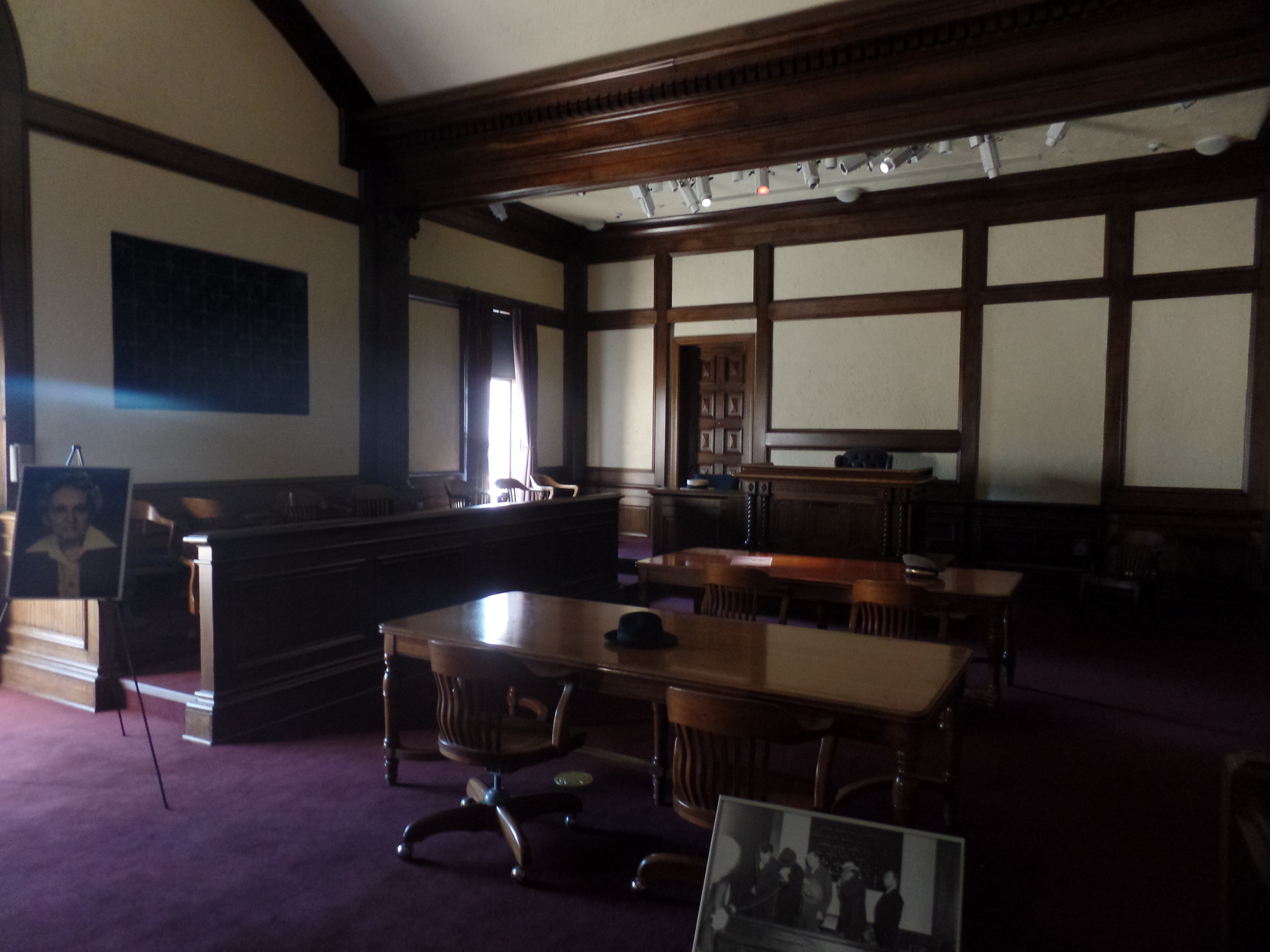
My first stop was the Pima County Courthouse, the domed gem of downtown Tucson. Five To Oh Coffee is a small stand, inside the building, with plenty of seating in the patio just outside. In the Sonoran Desert, “outside” is comfortable all day long-from mid-October to the end of May. So, I took my large coffee and blueberry empanada to a shady spot near the yet-to-open Southern Arizona Visitors Center.
A few minutes later, it was upstairs to the Dillinger Courtroom, where John Dillinger and his accomplices were tried and convicted-after the Tucson Police duped Public Enemy # 1 and the gang into a baited trap.
Dillinger Courtroom, Pima County Courthouse
Dillinger was still a media sensation, and his craftiness was matched by that of the Pima County Sheriff, who sold tickets to people wanting to see the killer bandit in his jail cell. After his conviction, Dillinger was sent to a prison in Indiana, from which he again escaped, and was later killed in Chicago.
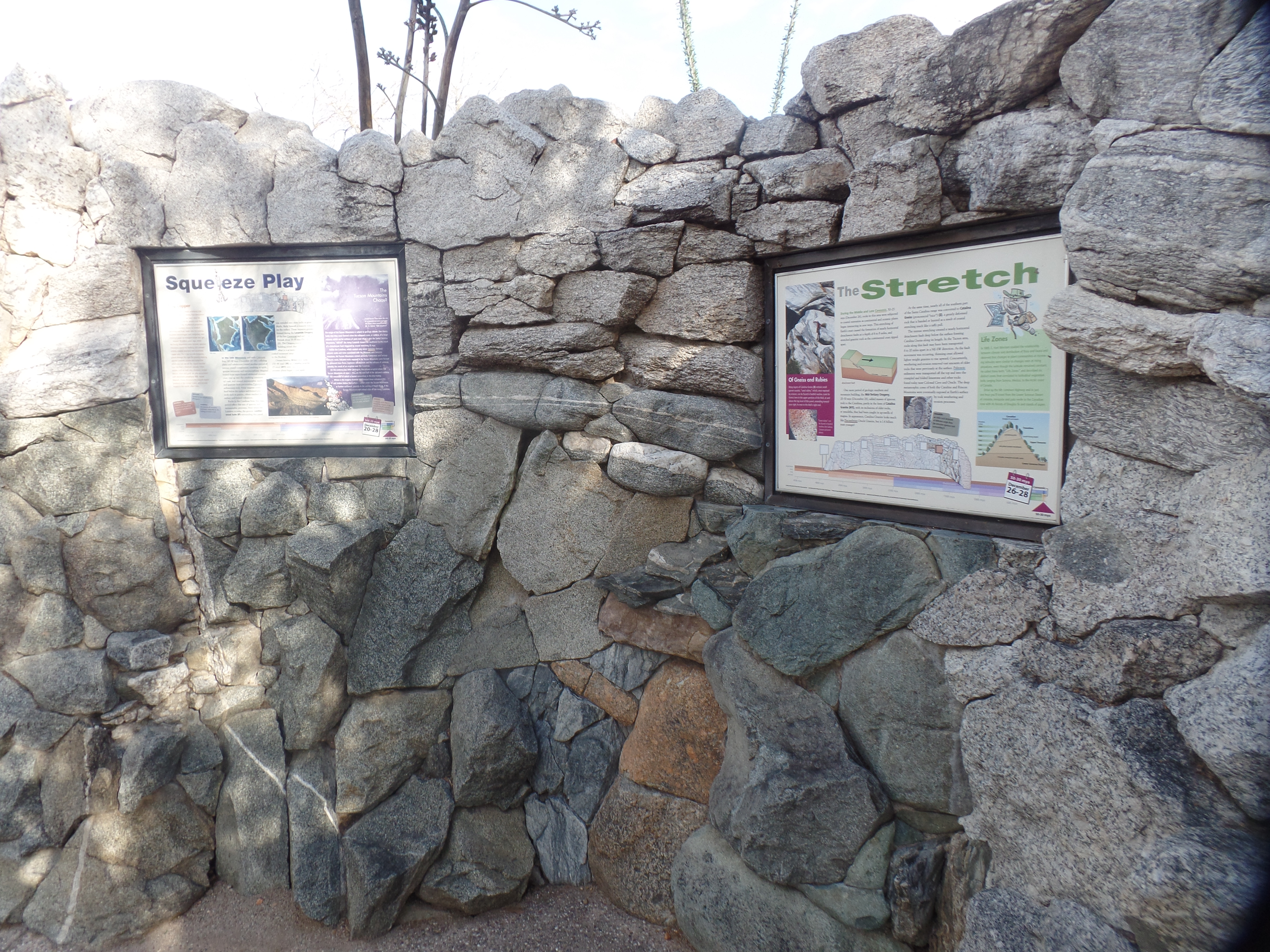
Once I had read the displays outside the courtroom ,including information on Wyatt Earp, it was time to check out the Visitors Center. There, I noted a diorama of southern Arizona, with various buttons that lit up cities, highways, rivers, mountain ranges (Pima County has nine of those) and Native American reservations (Arizona has 23 of those).
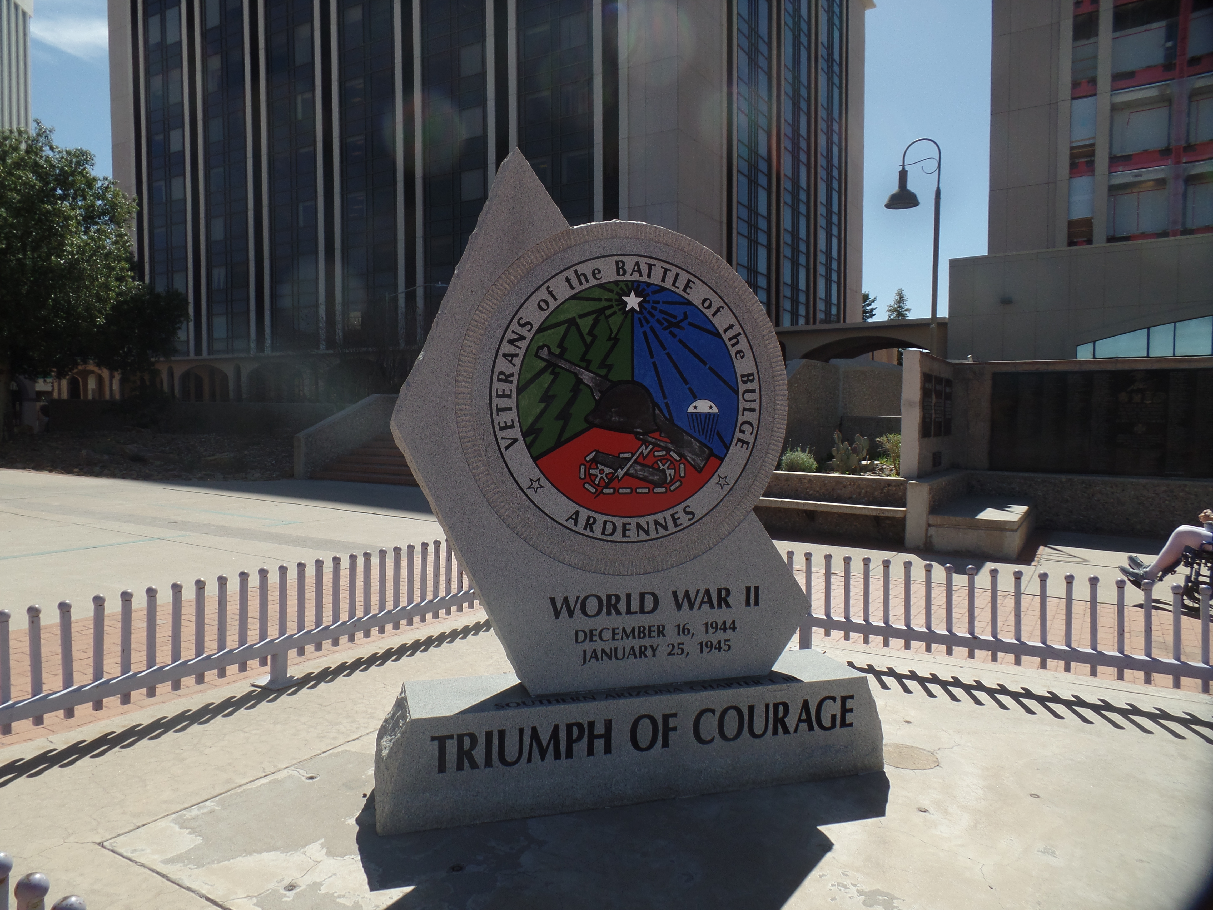
On the west patio of the Courthouse is a Memorial Park honoring the victims of the January 8, 2011 shooting, in a northeast Tucson shopping center. They ranged in age from 9 to 76, and included a sitting Federal judge, a Congressional aide and a girl who had been born on September 11, 2001. Left paralyzed by the attack was the shooter’s prime target: United States Representative Gabrielle Giffords, still alive and in recovery.
Christina Taylor-Green, the 9/11 Baby who died in the 2011 attack, was an avid swimmer. Thus, this fountain became a centerpiece of the memorial.Heroes of an earlier time of difficulty are also honoured here. Among them was my late father-in-law, Norman Fellman, captured by the Nazis near the end of the battle, in January, 1945. He survived six months in the concentration camp at Berga, where he was placed because he was Jewish.
Lunch time brought me to a small food truck, parked at Jacome Plaza, just east of the Courthouse. Carlos Jacome, Sr, and his wife, Dionicia, raised thirteen children-and the downtown Tucson business core-with help from a former rival, Harold Steinfeld. Jacome’s Department Store, along with Steinfeld’s, was a staple of downtown, for decades. In honour of the Jacome family, all of whom had a keen interest in the business, Jacome Plaza stands in front of the central public library. OaxaRio Food Truck serves fresh, delectable Oaxacan and Sonoran style treats. Next to it is Special Eats, which contributes to autism and Down’s Syndrome assistance programs. Here is a view of Jacome Plaza:
“Sonora”, by David Black (1991), restored by Trevor O’Tool.
Once lunch was enjoyed, under “Sonora’s” watchful gaze, I spent a nerve-wracking, but ultimately fruitful hour-long learning experience, in Joel D. Valdez Library, attempting to get online, and finally figuring out, with the aid of two library clerks, that my VPN was blocking access to the WiFi. Good to know, for the future: Get online first, then activate VPN-so long as the network is secure, as this one was. This experience used up the time I would have spent walking over to the University of Arizona, but no matter.
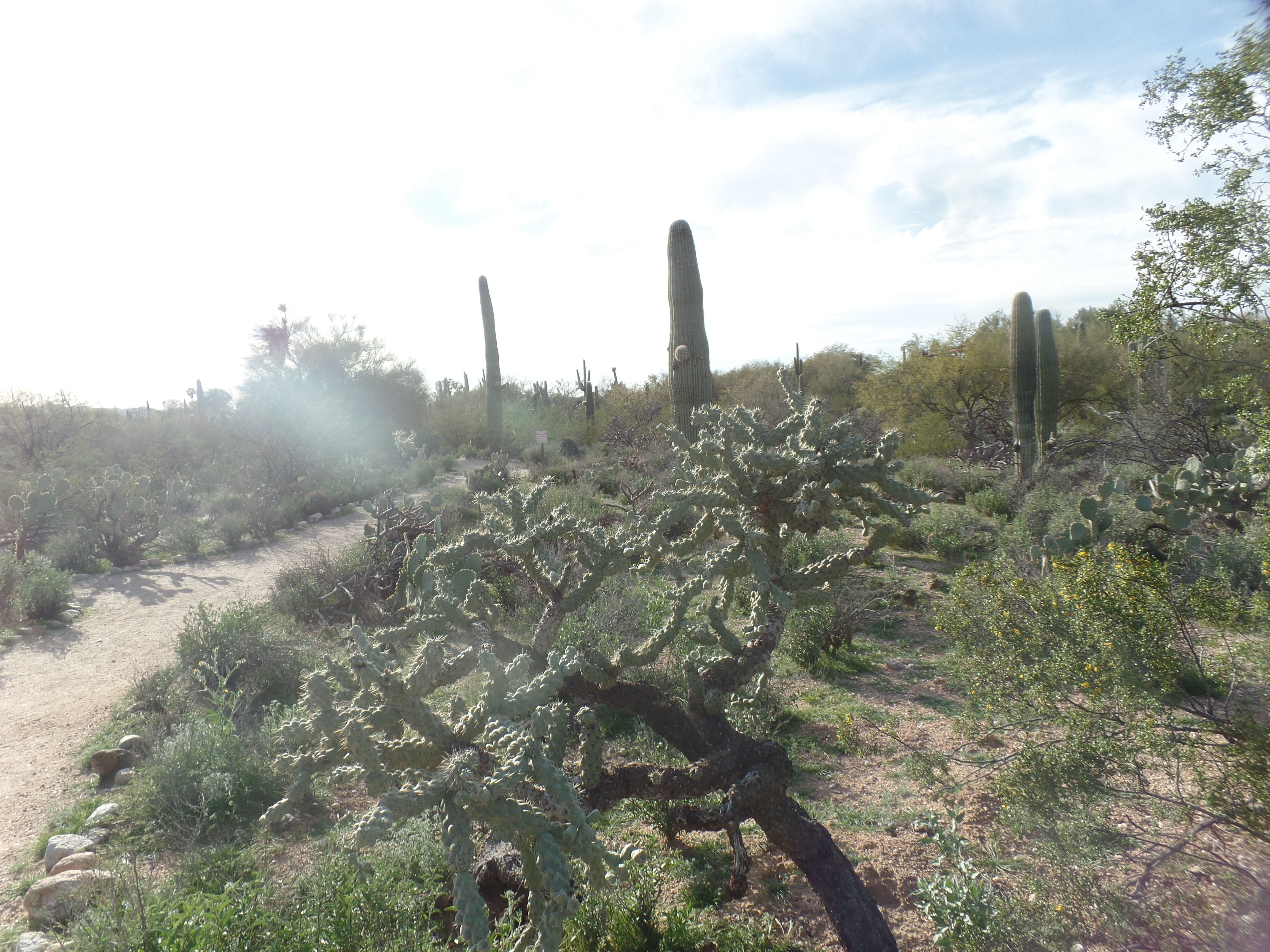
After checking e-mails, creating the previous day’s post and enjoying a refreshing Shamrock Matcha, at Ike’s Coffee, across the street from Jacome Plaza, it was time to go up to Tohono Chul, Tucson’s signature northeast green space. “Tohono Chul” means “desert corner”, in the language of the Tohono O’odham, whose own name means “Desert Dwellers”. It is a prime botanical garden, preserved by Richard and Jean Wilson, in the late 1960s. The Wilsons owned nearby Haunted Book Shop, from 1979-97, and gradually pieced Tohono Chul together, until the present 49 acres resulted in today’s bright oasis. Today, Jamie Maslyn Larson and her team maintain the vision set by the Wilsons, and Tohono Chul is a bright spot in the Catalina Foothills neighbourhood.
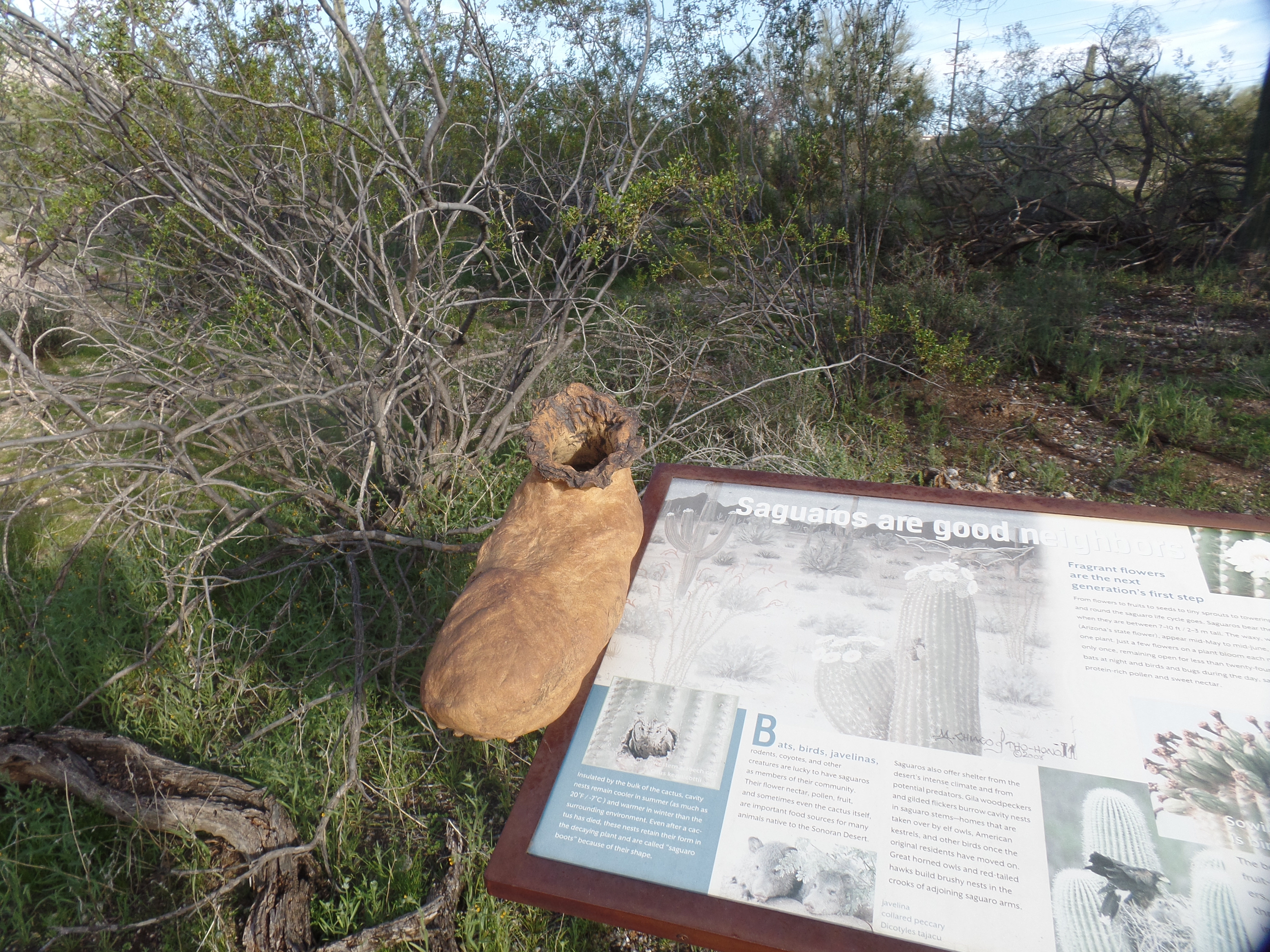
Tohono Chul Botanical Garden, north TucsonGeology Wall, Tohono Chul Botanical GardenJumping Cactus, aka cholla, Tohono Chul Botanical Garden.A “boot” left by a sahuaro, serves as a nesting site for various birds and small mammals.
It was soon dinner time, as well as quitting time for the Park staff, so off we all went, at 5 p.m. I headed down to a Red Lobster, on the southwest end of town, and joined a couple of old friends for a pleasant 90-minutes of catch-up and great food.
Finally, the drive southeastward, to Benson, then Tombstone, and finally to Sierra Vista-where my favoured Knight’s Inn was ready with a comfortable room. Thanks, Old Pueblo, for once again showing more of your many good sides!
March 11, 2024, Eloy, AZ- The manager of the motel took a minimalist view of the condition of her establishment: Rooms which are clean and very well-appointed, but have yet to install locks on several of the rooms-relying on chains inside the door, only. “We have a security guard who is constantly on the move or is watching the bank of security cameras! Those who want more can go the city, and pay more!” Me (Silently)- “I see, said the blind man”.
This is a place where tragedy is waiting to happen, despite the woman’s declaration that “My staff and I refuse to rent to anyone who looks shifty!” Update: As it happened, I got a wondrous night’s sleep here. Yet, it will be the last time I stay at the place. A skewed vision of how people should be served and protected will not end well.
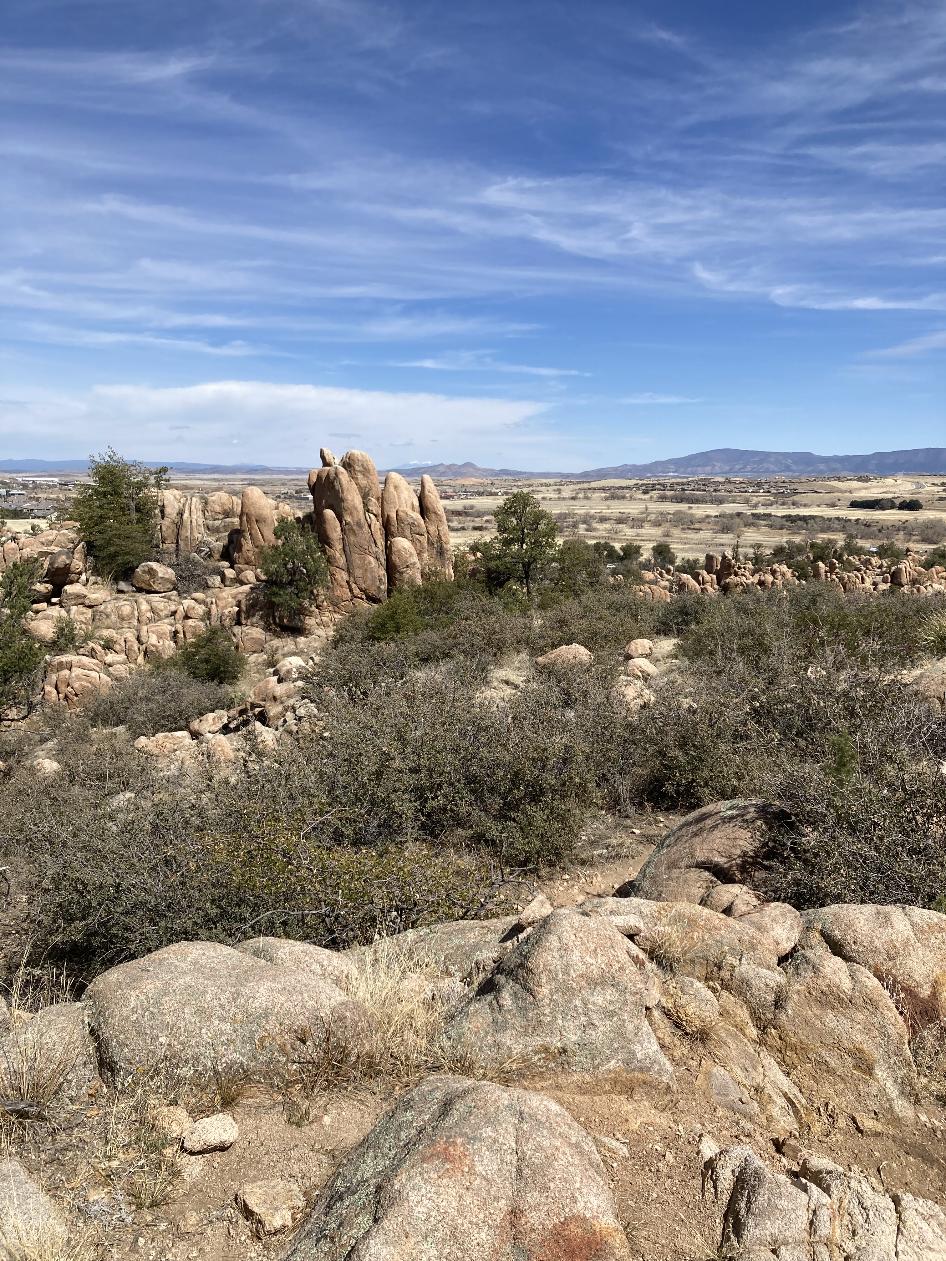
My day, otherwise, was splendid. Coffee with a group of fellow seniors, was followed by a Zoom session on contacting our district’s Congressman, on a matter of interest to my fellows in Faith-and me. Then, there was a hike with HB, in the Constellation Trail system, named for a jet plane, which crashed in the area, in 1959. We walked about an area with sweeping vistas, which I had last hiked, with another friend, in the snow-four years ago. It is equally majestic, in the snippets of Spring.
Northward view, from Constellation Trail system (Hully Gully Trail)
Looking towards Hully Gully Trail, Constellation Trail system
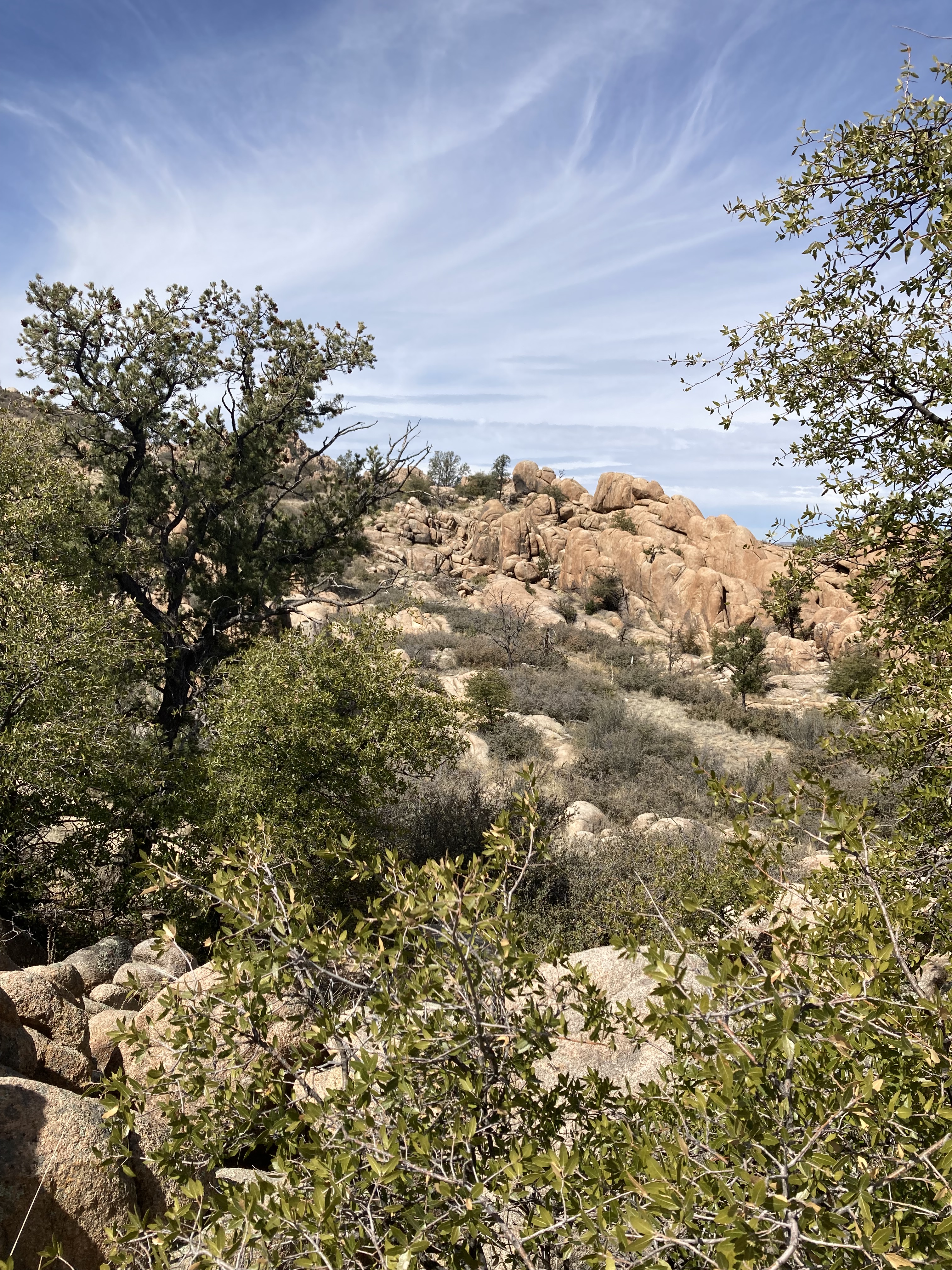
Striated rocks, Constellation Trail system
A petrified chorus, Constellation Trail system
One could spend days, exploring the Constellation system, itself part of the Granite Dells formation, on Prescott’s northeast side. I have been there several times, and will be there several more.
After helping serve another buffet-style meal, this evening, at Solid Rock’s soup kitchen, it was time to head out towards Tucson, and the border with Mexico-where I will spend a couple of days, seeing what is actually going on-as opposed to the conjecture of the mainstream media. Getting to this small, but growing, desert city, roughly halfway between Phoenix and Tucson, I settled in at the above-mentioned motel, which will remain nameless, for now.
It was a fine, productive day, so I leave the management of the place to learn their own lessons, as I have spoken my peace to them.
February 24, 2024- Four men in a vehicle, traveling for three hours and thirty minutes each way, can spend that time in a variety of conversational styles, from silence or one-word-dialogues (No thank you, to either of those) to elevated discourse. It’s best if the latter steers clear of politics, and today’s conversation did just that-focusing on the geological features through which we were passing.
Our planet came together, as an entity, 4.543 billion years ago. This is also called the accretion of Earth. The first known continent was Vaalbara, which formed about 3.6 billion years ago. Africa, the oldest modern continent, came into being 300 million years ago, followed, 100 million years later, by North America. The other extant continents’ formative dates were: South America, 225 million years ago; Asia, 66 MYA; Antarctica, 34 MYA; Australia, 10 MYA and Europe, 5 MYA.
This information, and the views that we enjoyed, traveling between Prescott and Mohave Valley, this morning and afternoon, were fodder for observations about the varied topography and geology. One may enjoy Ponderosa pine forests, that seem to go on forever, chaparral stands, Joshua trees, relatively barren desert, and rock formations from 1.84 million years ago-which are known as Vishnu Schist-this last, being close to the Colorado River, and the oldest layers of rock seen at the Grand Canyon.
As it happened, it was the Cerbat Mountains, a rugged, but rather low-lying range, in and around Kingman, which drew the greatest interest from the three men with whom I was riding, to and from the smoke alarm installations. Rocks have, over the past few decades, have achieved their due, both as scenic features and as backdrops for more extensive recreational activities. The Cerbats are mini-hoodoos, in spots, and have their share of fans, including the residents of Chloride, about twenty miles north of Kingman. I visited that old mining town a couple of times, most recently on the way back from a Carson City jaunt, in the summer of 2021.
The rest of the drive provided reminiscences of drives along a segment of Old Route 66, from Kingman to Peach Springs, and on to Seligman. The small villages, Grand Canyon Caverns and the various little restaurants and gas station coffee shops all have their adherents. My personal favourite is West Side Lilo’s, in Seligman, followed by Hualapai Lodge, in Peach Springs and Seligman Trading Post.
It is the scenery, though, that keeps me grateful for the chance to drive out to places like Mohave Valley (where we worked with the local Fire Department, installing smoke detectors). There are no boring places-at least not to me, or to those with whom I worked today.
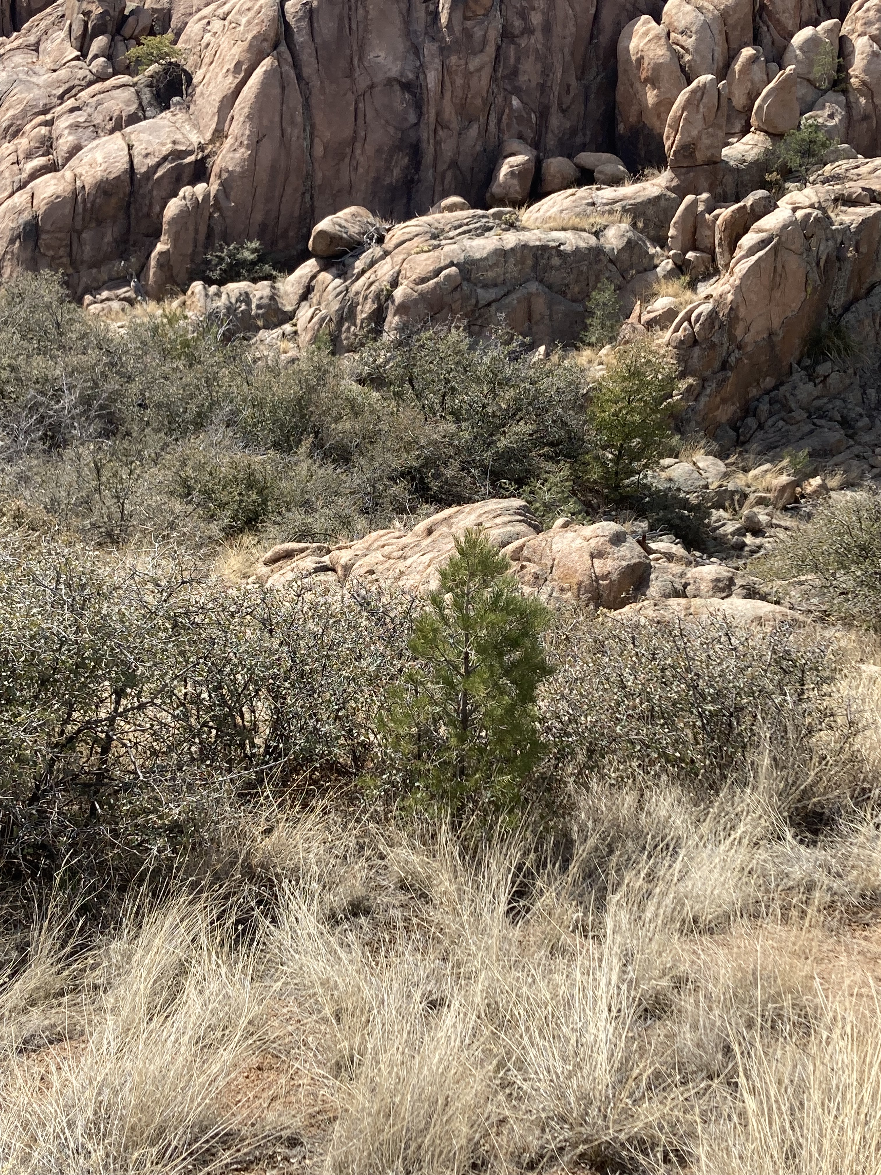
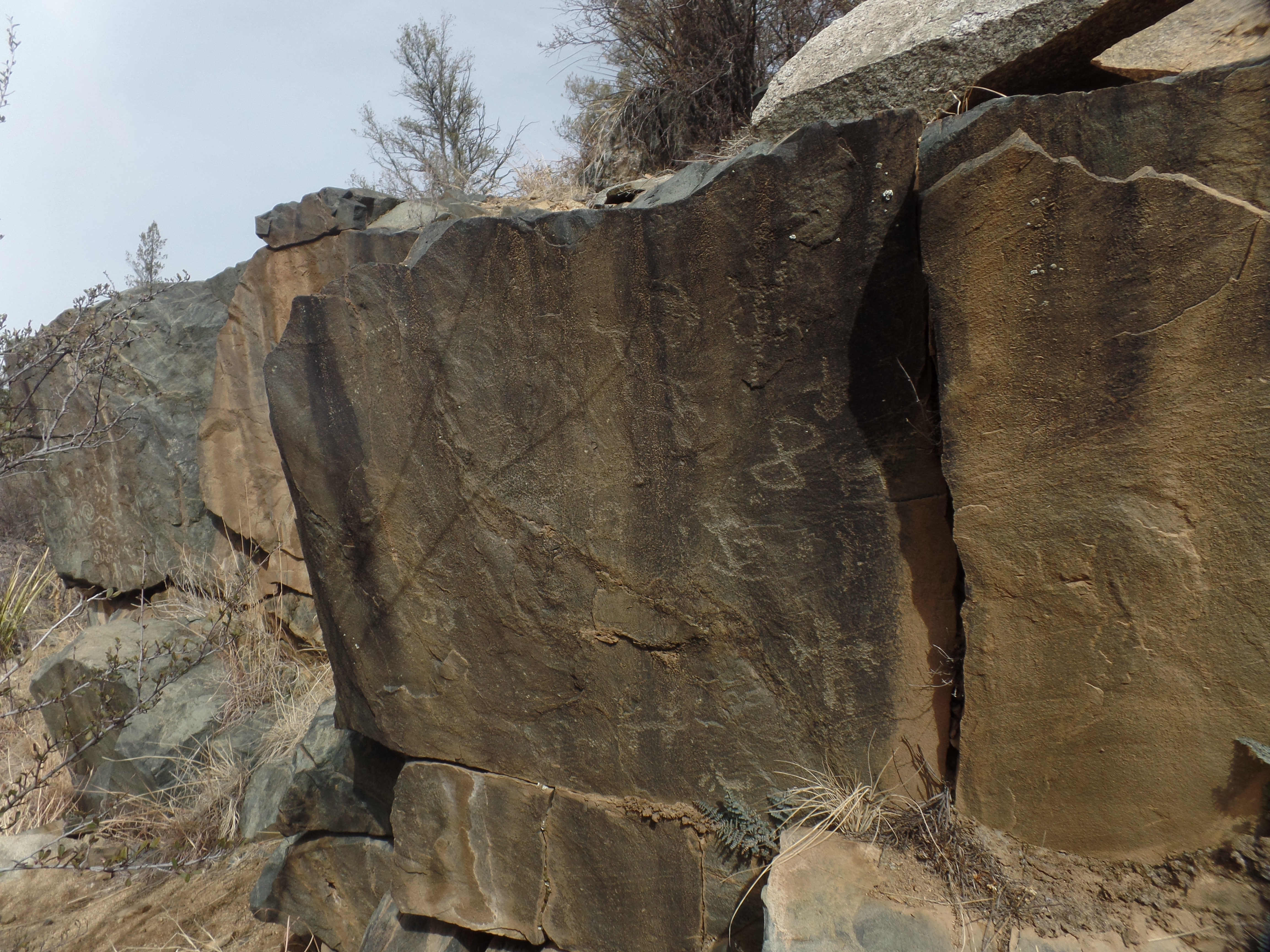
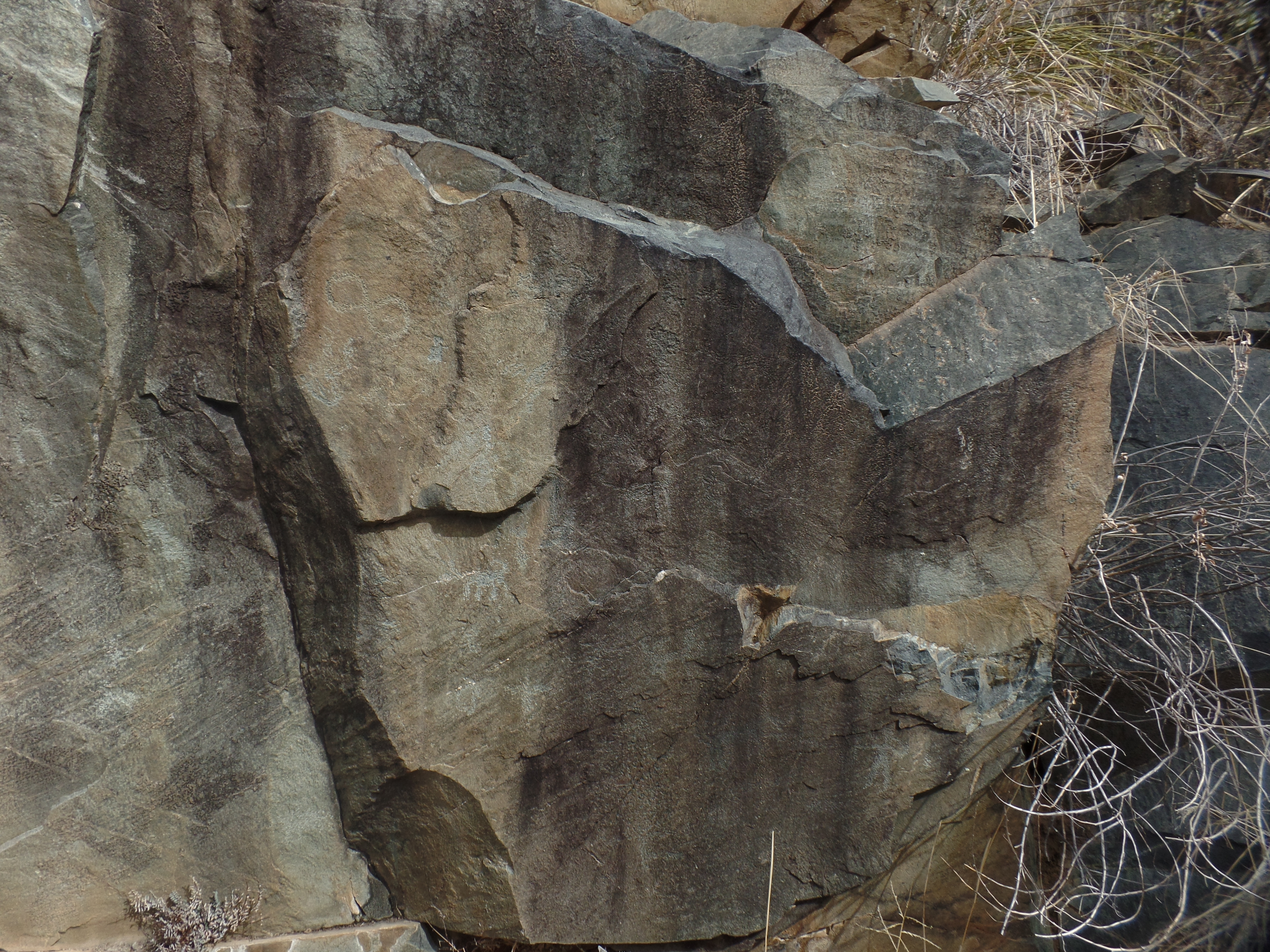
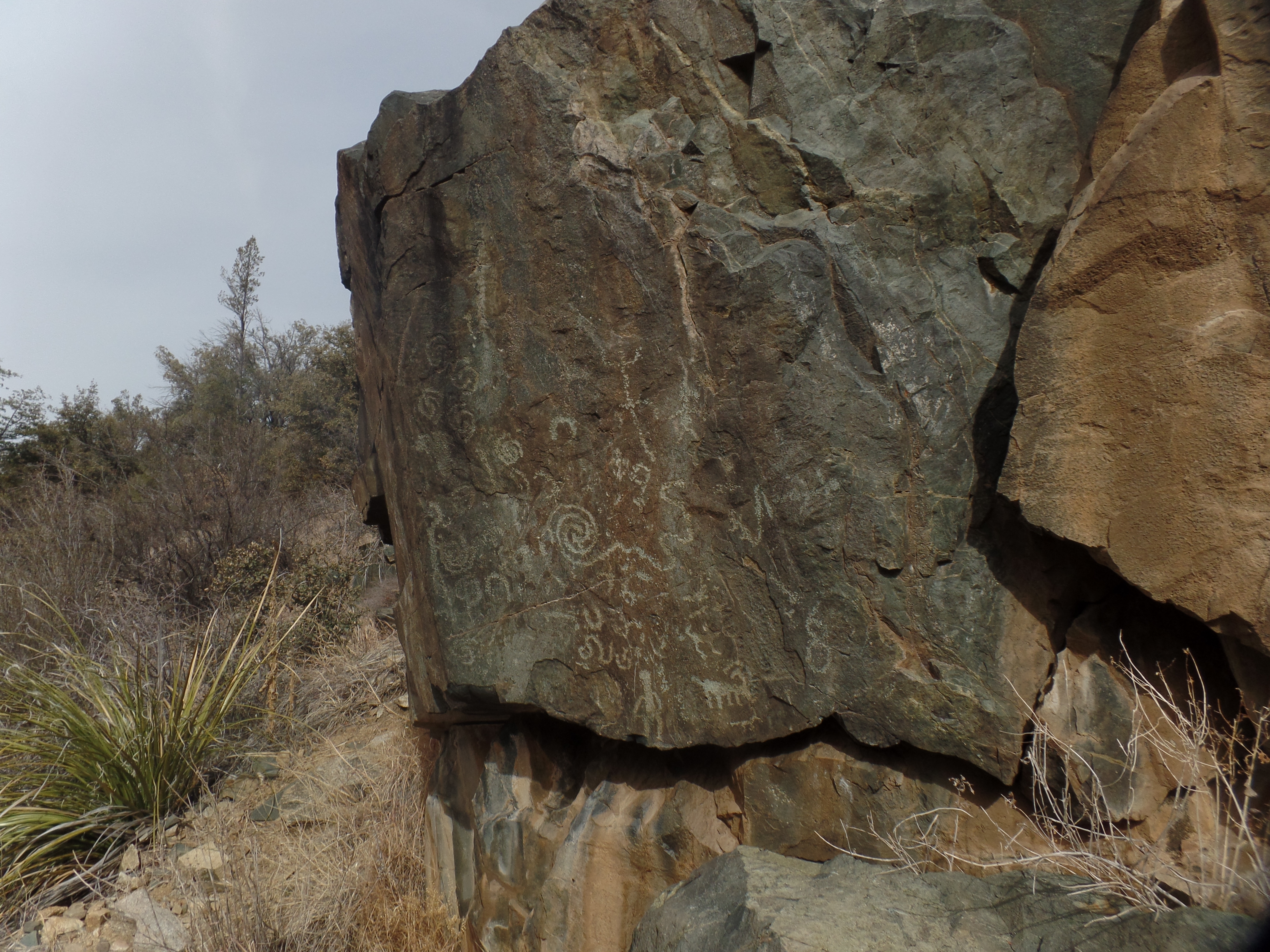
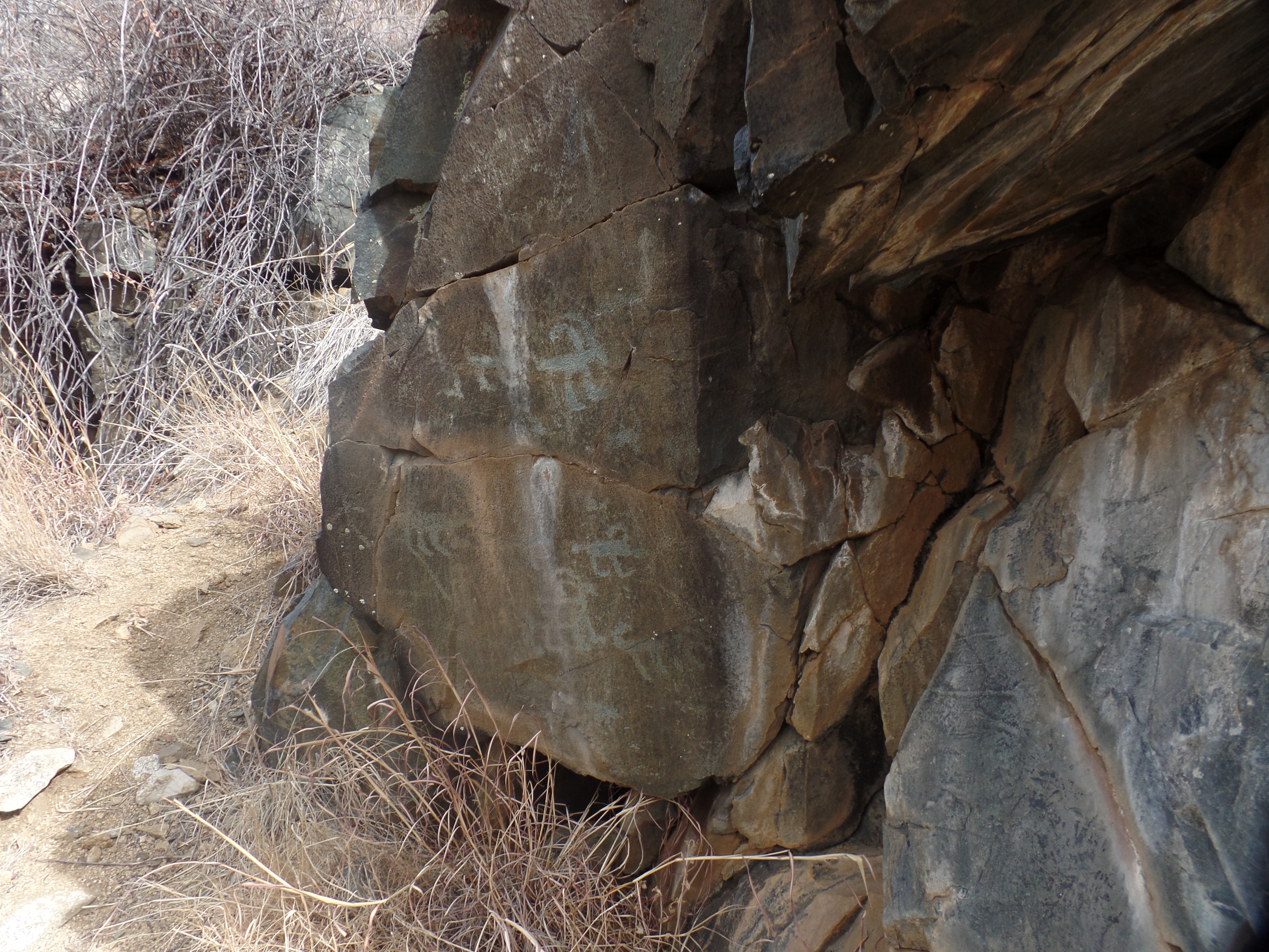
February 23, 2024- The images are still clear, after so many centuries: Big-horned sheep, dogs and dancing figures, presented in a small rock outcropping, possibly selected by the Huhugam people who once lived here, at the northern end of their realm, because of the smooth surface area of the slate.
My hiking buddy and I came here this morning, and found the petroglyphs, for which we had been searching for close to ninety minutes. We had gone up and over Salida Gulch, coming close to its junction with Blue Ridge Trail, then heading back towards the trailhead from which we started. About two miles further, there the images were, calling to us from a bygone millennium.
Infinity, a dancing figure and pronghorns- Salida Gulch TrailBig-horned sheep and mystical symbolsDancing figure, big-horned sheep spirals and possible snakesMultiple big-horned sheep and what appears to be a mountain lion
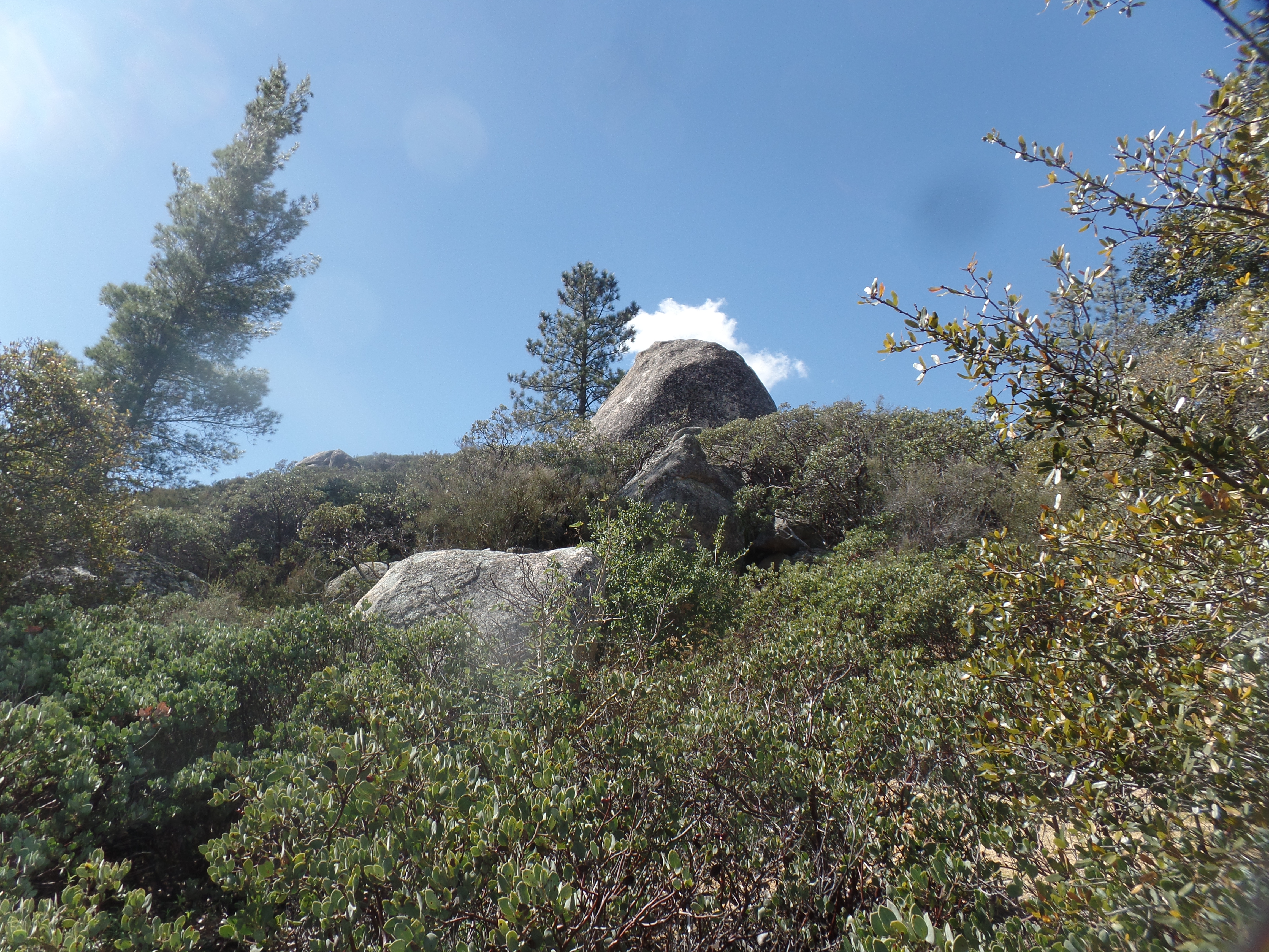
This sort of find is one of the things that make hiking in the Southwest so very rewarding. The glacial residue, by itself, is another. Rocks and boulders are everywhere, along the paths carved by glaciers during the last great Ice Age. Here is a standing stone, reminiscent of Carnac, or Easter Island.
Another “sentinel”, left by glacial retreat.
There will be more such scenes, as March and April play out, here in Home Base I.
February 22,2024- From the dour expressions on a few faces, both in San Diego and back in Prescott, it seems like winter is getting on several people’s nerves. I felt great, though, even as leaving San Diego is never easy. A sweet and affirming conversation with a fellow hosteler got the day off to a good start, and my checkout was methodical-something I’ve only mastered, in the past three years. Once again, nothing was left behind. From Ocean Beach, I headed over to an old favourite: Harbor Breakfast. Friend Maria was not working today, but the fare was still top of the line. I handled a bit of business, as calls came in during this late breakfast. It’s all good.
Before the King Fire, before Yarnell Hill, there was Inaja. The 1956 wildfire in Cleveland National Forest, just south of Julian, CA, resulted in the deaths of 11 firefighters. I made a brief stop at the Memorial Park, as it was time for morning prayers.
Inaja Memorial Park, Santa Ysabel, CAView towards the Laguna Mountains, from Inja Memorial Park.Inaja Memorial Park, Santa Ysabel, CA
The stop reminded me of the fragility, and of the endurance, of the forest.
The rest of my drive back to Home Base I was smooth, and though I arrived in the middle of the devotional which prompted the straight homeward route, all ended up well. The focus was on peace, and tranquility starts within. So, winter or summer, cold or hot, it is ever worthwhile to focus one’s energies on keeping a positive outlook, even while dealing with the changes and chances that come our way.
All in all, this weekday break was a reminder of the value of refreshing one’s energy.
February 21, 2024, San Diego- The stack of books is about 5 feet, 2 inches tall. It is arranged like Jenga blocks, though it won’t fall down if one pulls a book from the middle. This is Big Rainbow House’s library.
A Jenga Library
With a more sunny day in the offing, I headed up to visit a long-time friend in Orange County. In the past, we have frequented one or another beach front restaurant. Today, the focus was on Laguna Niguel, a community about five miles inland from Dana Point. I got to drive the length of Golden Lantern Road. There are nine “lantern” roads, emanating from Dana Point Harbor, that I recall: Violet, Crystal, Blue, Green, Ruby, Amber, Silver, Copper and Golden. The street names were a marketing tool for the newly subdivided community of Dana Point, in the 1920s. Each starts with a coloured lantern atop the western terminus of the street.
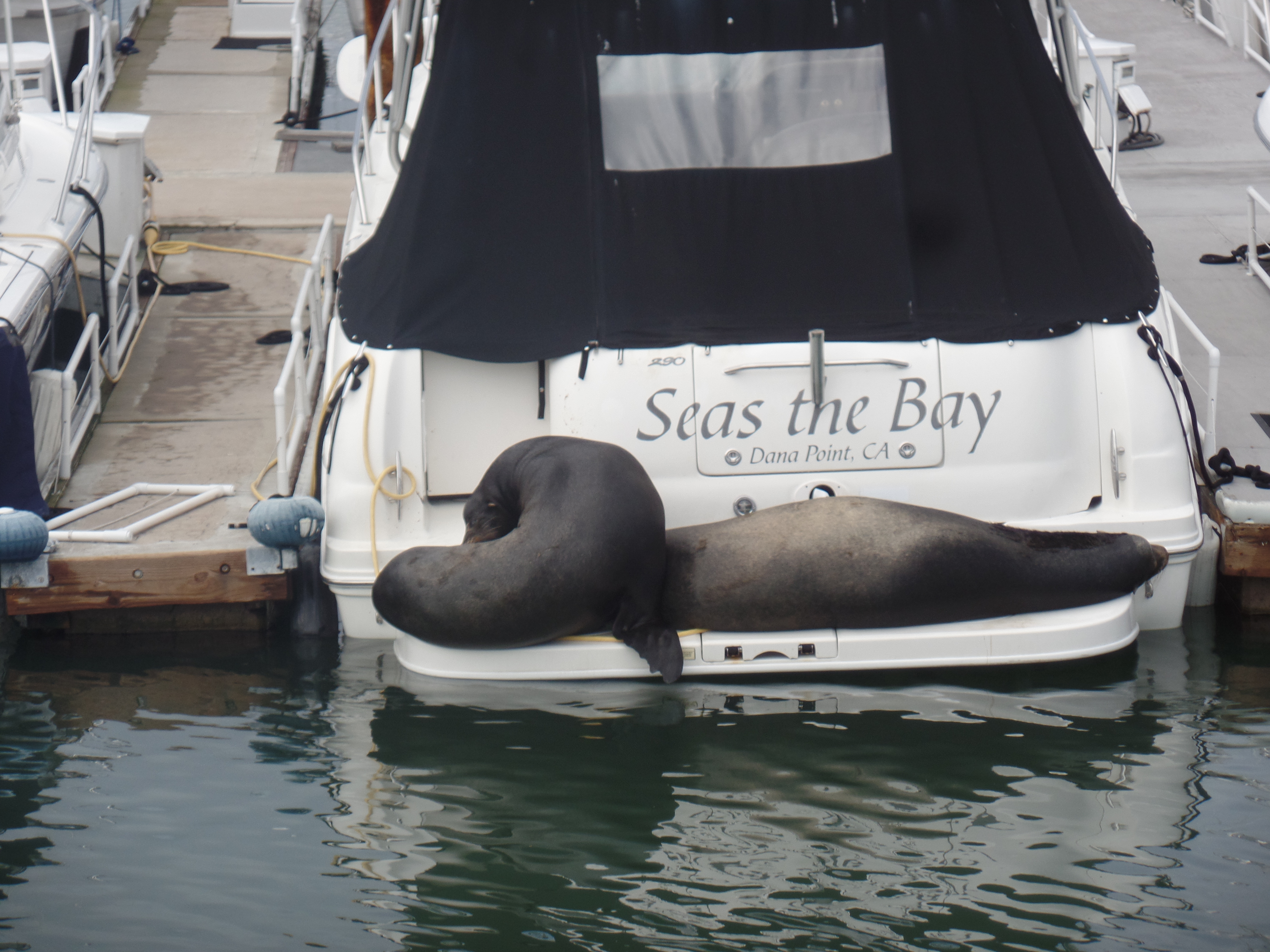
Before that little drive, I spotted a pair of harbour seals, lounging on the stern of a small yacht, in Dana Point’s central marina. The female was barking, clamouring for attention-or so it seemed. The male was seemingly dead to the world.
Two on a platform
After a brief stroll around the marina, and an equally short walk at Dana Point’s hilltop overlook, I headed towards Laguna Niguel. A large family of Baha’is once lived in this pleasant. green canyon-laced community. So I felt drawn to have a look at the area. Being a bit early for our lunch appointment, I walked around the community’s regional park. Its centerpiece is Aliso Creek, a shallow rill that is nonetheless running in robust fashion-a bantam rooster of streams, if you will.
Aliso Creek, Laguna Niguel Regional Park (above and below)
Just after I took these shots, I spotted a pair of Mallards, attempting to cross the road. I also spotted a vehicle coming towards them. Gesturing to the driver and pointing to the male duck, either spooked the quacker or he felt the vibrations of the car. The pair dashed back to the side of the road and the car kept on going. The ducks then made their way to Aliso Creek.
The surviving mallards (in center left, Aliso Creek)
Lunch, at Avila’s La Ranchita, one of about five family-owned chains, in southwest Orange County, is a true delight-with every dish prepared on site, from fresh ingredients-no cans or bottles. There is no skimping on the meats and vegetables in the various tacos, quesadillas, tamales, enchildadas or tostadas. Equally important, the chips are baked daily and the salsa is freshly made. Even the iced tea is brewed on site. I am always alert to the difference between fresh and processed. This place is for real-and worth a drive eastward from the beach.
I came back to Ocean Beach, in time for the Wednesday Farmers’ Market. It is slightly larger than ours back in Prescott-but this is San Diego, after all, and the vegetables, fruits, cheeses, juices and various hot foods are all amazing, in variety and quality. I got a few items, and called it a night. One must be prudent, even when on holiday.
February 20, 2024, San Diego- The small group of European youths spoke of their concern for their countries, should certain political and military forces hold sway. I stayed out of the conversation, and an older man in the group urged them to not jump to conclusions. Nonetheless, a rising tide of personal ambition and disdain for the changes that society is undergoing is having a disconcerting effect on a good many, in the generations of young adults. There is a renewed commitment to freedom of choice and group cohesion, across the range of political opinion, among a good many in the two emerging generations of young adults. From what I’ve seen, the Alpha Generation, those born since 2010, is showing the same collaborative spirit.
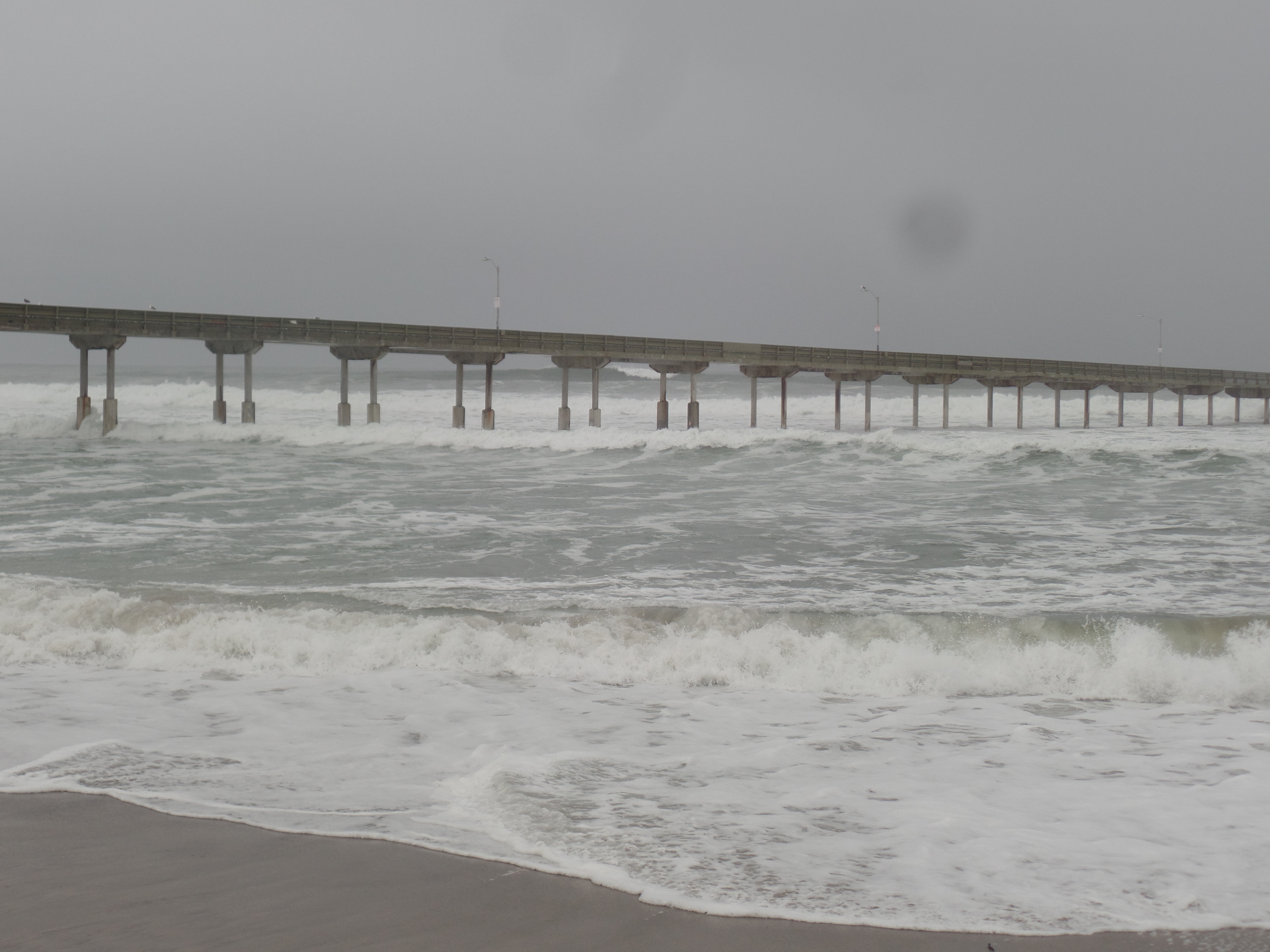
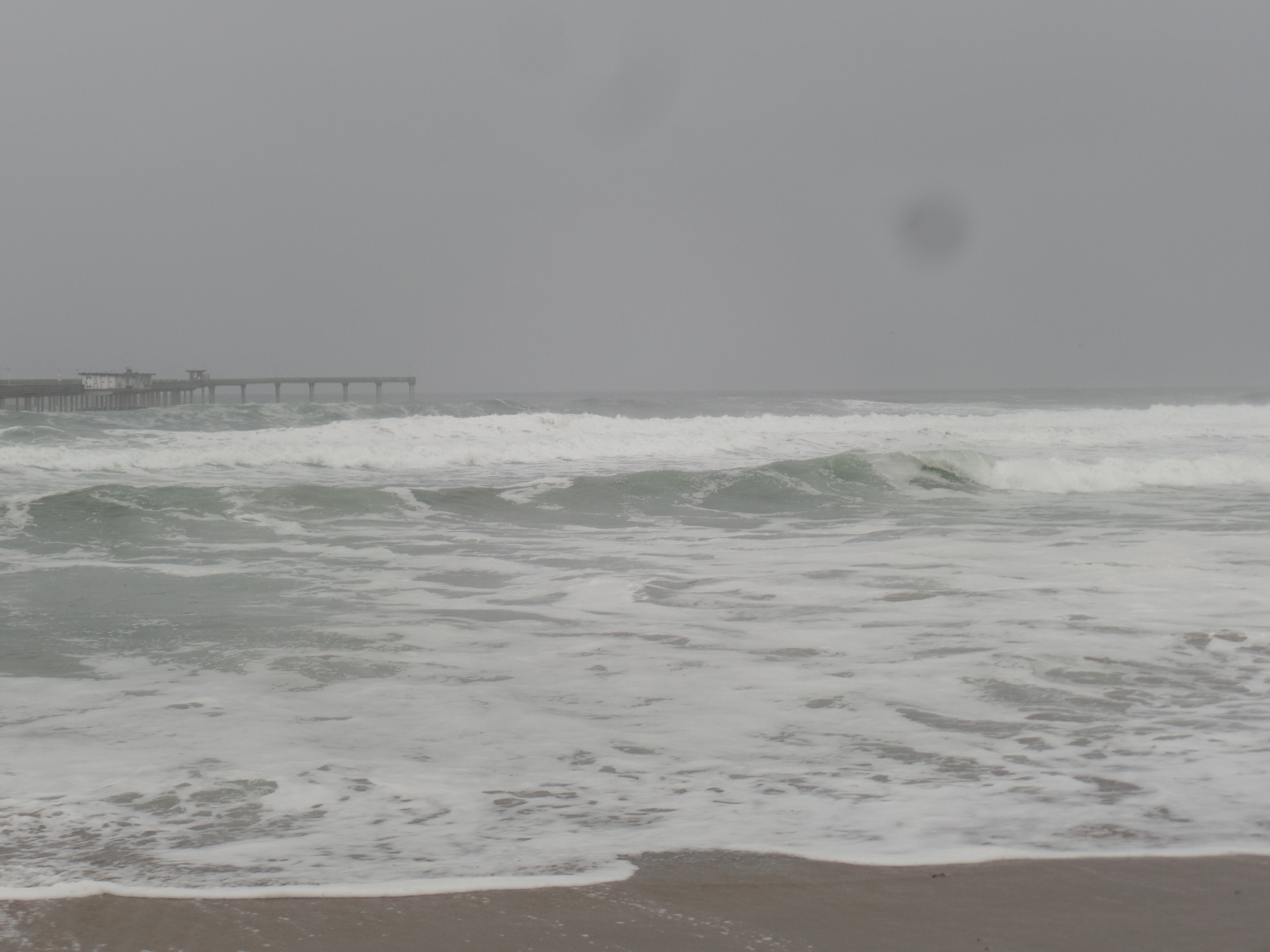
There was another sort of rising tide, at Ocean Beach and at Mission Bay, throughout the day. The oceanic tide kept coming in, from early this morning, until about 4 p.m., with roiling waves propelled by the storm that dumped about an inch of rain on OB. Here are a few scenes of both morning and afternoon.
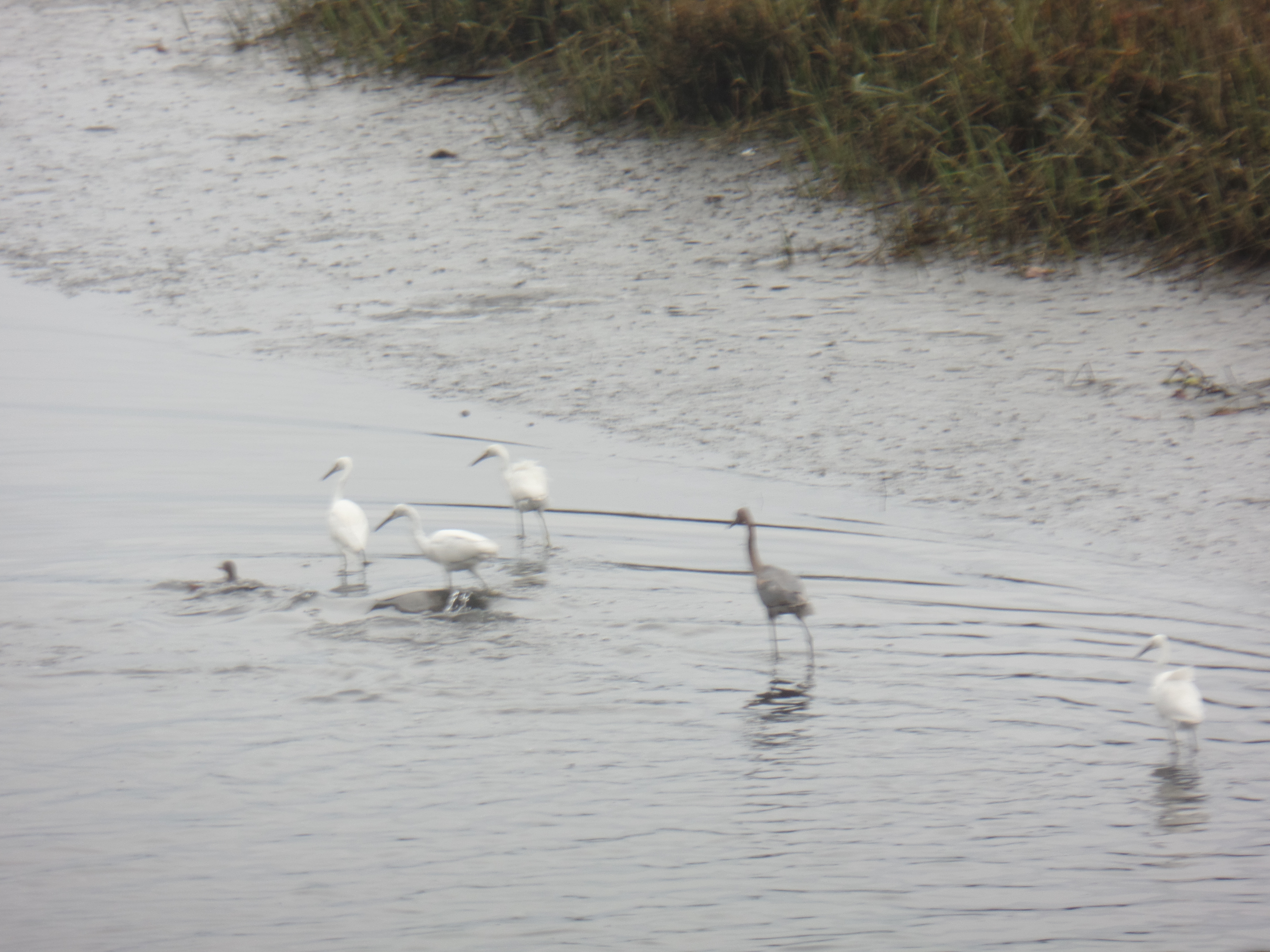
Ocean Beach Pier, at 9 a.m.Ocean Beach, at 9 a.m.Dog Beach, 3:30 p.m.Dog Beach, at 3:40 p.m.Egrets and ducks were unperturbed.
My energy tide was raised by a message, from someone I love dearly, as I woke up. It was capped by the news that my little family has successfully relocated to an apartment they like better, this evening. In between, I managed a two-mile walk, to Mission Bay and back to Rainbow House, cooked up some lobster ravioli and hosted a Zoom call, one of two meetings that punctuate this visit.
The rain has stopped and the oceanic tide, at least, has ebbed. It will be interesting to see how these other tides rise and fall.