The Carson Loop, Day 2: New Salt and Old Boulders

2

October 16, 2022, Jordan Valley, OR- William Least Heat Moon would probably find a wealth of interesting things to say about the vast expanse of sagebrush that occupies the Great Basin, from central Nevada, through eastern Oregon, southern Idaho and down into western Utah and parts of Wyoming. Going along U.S. 95, I find the towns and mountains interesting, but the flatlands are just part of the woodwork, so to speak. Were I to camp out in them, for several days, I might feel differently, and come up with detailed descriptions, such as the great man has done with the Kansas grasslands, in his fascinating tome, “Prairy Erth”. Yet, as another great man once wrote, “I have miles to go, before I sleep.”

About a third of the way between Tonopah and Hawthorne, in western Nevada’s outback, there lie the remains of what was likely a mining camp. The foundations of the buildings, easily accessible to all, became for a time the hangout of a group of teens-from either of the two towns mentioned above, or from the small villages of Mina and Luling, which lie a bit north of the ruins. In any event, the colourful graffiti adds an odd splotch of brightness to the monochrome of sagebrush.

Ruins of old camp, near Mina, NV

The other, and somewhat more disturbing, element that breaks the sameness (not monotony) of the landscape is salt. Saline licks and flats have proliferated across the Basin, since I was last through the area in July, 2021. They are larger, in an area south of these ruins, and newly-established along the shores off Walker Lake, to the north of Hawthorne.

Salt flat, north of Tonopah, NV
Salt lick, on south shore of Walker Lake

This type of salinity is toxic to birds and beasts, in its concentrated form. It is also not conducive to a nice day at the beach. It is, moreover, one of the consequences of the current drought and shrinkage affecting many bodies of water, throughout the planet-not just in the American West.

In the end, it was Oregon, not California, which became part of my route. Going north, from Winnemucca, I found myself tooling along the Beaver State’s share of Great Basin sagebrush. Then, just shy of the Idaho state line, lies this tiny community, which once had two motels and a cafe. One of the motels is shuttered and the cafe was locked and empty, but Basque Station and its adjuncts-Jim’s Sinclair and Mrs. Z’s Store are open and they’re glad to see you, even if their outer demeanour is world weary. Jordan Valley is a proud exurb of Boise, 1 1/2 hours away.

Pharmacy Hill, Jordan Valley, OR at dusk
Pharmacy Hill, at daybreak

Pharmacy Hill’s topography is of the ancient rocks that covered our continent in the Pre-Cambrian Era, as life itself was taking root, in the surrounding oceans. It reminds me a lot of the area between Kingman and Las Vegas, the first rocks thrust upwards by the actions of wind and water, which have cast the Grand Canyon. Here, though, the promontory stands by itself, oddly majestic above Jordan Valley. I will have more time, coming back this way in a few days, and may just hike up the Hill.

May mountain and hamlet long thrive.

Glen Canyon’s Legacy

4

October 7, 2019, Page-

Leaving the pleasant Utah border town of Kanab, after a good night’s rest and getting myself a neck pillow (replacing the one left behind in Pennsylvania, last summer), it seemed like a good time to stop a few places in the basin of Glen Canyon.  The area is now best known for the resorts and water-based recreation of Lake Powell.

Just shy of the Arizona state line, lies the former polygamist community of Big Water, UT.  It is now an industrial zone and a research center for the Bureau of Land Management.  The BLM has an interesting Visitor’s Center there, with much research on the fossil remains found in the cliffs shown below.

SAMSUNG CAMERA PICTURES

SAMSUNG CAMERA PICTURES

Ceratopsians, and their close relatives, are a major focus of the paleontology that has been done here. There is a well-illustrated display, which explains quite clearly the various members of this group of dinosaurs.  As is commonly known, what is now the Great Basin was once a large inland sea, separating  large peninsulas of present-day North America.  Ceratopsians, Mosasaurs and Icthyosaurs, along with giant crocodiles and sea turtles, were abundant here.

SAMSUNG CAMERA PICTURES

SAMSUNG CAMERA PICTURES

Note that there are three types of Ceratopsians, distinguished by the length and breadth of their snouts, as well as the complexity of their cranial armor.

SAMSUNG CAMERA PICTURES

Centrosaurs had narrow, short faces and simple armor.  Chasmosaurs had broad, long faces, with elaborate armor.

SAMSUNG CAMERA PICTURES

After examining the details of the paleontology being done at Big Water, I headed a few short miles to Wahweap, a resort area long Lake Powell’s western shore.  The lake views are refreshing, but strangely, Wahweap’s restaurant is closed for the season.

SAMSUNG CAMERA PICTURES

SAMSUNG CAMERA PICTURES

A good zoom view of Navajo Mountain, some thirty miles northeast, is available from Wahweap.


SAMSUNG CAMERA PICTURES

Feeling somewhat famished, I stopped in Page, the town which grew as a result of the building of Glen Canyon Dam, and enjoyed a hearty meal of barbecued pulled chicken, with potato salad, at this fine and popular restaurant.

SAMSUNG CAMERA PICTURES

Rarely does the Lone Ranger share space with a Hopi kachina, but that is what one might expect in Page, a welcoming resort town that makes the most of Lake Powell.  Page, Wahweap and about six other marinas reap the benefit of Glen Canyon Dam’s having “tamed” the Colorado River.  There are plenty of people who depend on the Dam and Lake Powell, for their livelihoods.  There are many others who think, as did the late Edward Abbey, that Glen Canyon was perfectly fine, both ecologically and economically, without any tampering.  I think that, had there not been a dam, Page might have become like Moab or Durango, and grown as a haven for the many who enjoy the still formidable canyon.


Sixty-Six, for Sixty Six, Part XLIV: The Great Basin Road

7

July 5, 2017, Moab-  

(This is the first of several backdated posts from Road Trip 2017.  I will be in a place with spotty WiFi, over the next few days, and family time comes first, so this series will be slow in posting.)

It’s always tough to leave loved ones behind, but life must go on, and nowhere does it go on better than in America’s Outback.  The Great Basin is largely the bowl left by Lake Lahontan, and other large bodies of water, remnants of one huge sea, that once occupied our continent’s mid-section.  The present Lake Lahontan is quite impressive, actually, with the seasonal rains having been copious here, as elsewhere in the West, this past winter and spring.  I took about a half hour to visit the lovely giant.

SAMSUNG CAMERA PICTURES

SAMSUNG CAMERA PICTURES

SAMSUNG CAMERA PICTURES

Much more was above water, this time last year.

I drove past the salt flats and noted they looked a bit browner than usually- another consequence of extra moisture.  At the foot of the Toiyabe Mountains, I came upon a forlorn looking man, whose jeep had just discharged a fair amount of water.  My jerry can took care of that aspect of the matter, in short order.  After, I followed him a short distance towards Austin, the nearest town, he told me to go on ahead, as the issue may have been the fuel pump, and he wanted to give it some rest.

It is a fair uphill, from the salt flats to Austin, so I informed the dispatcher, at Lander County’s office, of his issue.  After lunch, in Toiyabe Cafe, on Austin’s main drag, I noticed the town’s only flatbed tow truck was headed out, in his direction.  The ladies at the Cafe said the sheriff is most diligent about NOT letting stranded motorists wait too long.  That’s one of the fine things about people in remote areas:  Most everyone is a Good Samaritan.  T\

Toiyabe Cafe has some great eats, also.  Since my only beer is “near”, I guess I could wait.

SAMSUNG CAMERA PICTURES

There’s no bush meat available, though, but who wants to eat a carnivore, anyway?

SAMSUNG CAMERA PICTURES

I drove on and on, determined to make Utah’s sandstone country, by bedtime.  So, on past the Great Basin National Park, various other salt flats, the lovely towns of Eureka, Ely, Delta(UT), Salina and Green River, the Hyundai blazed.  Rooms in this bustling town were, of course GONE, by the time I pulled in, so a few miles down the road, in La Sal, I found a rest area/makeshift campground, guarded by this great sandstone:

SAMSUNG CAMERA PICTURES

Since the people parked in the foreground made themselves at home, camp-style, I did likewise.  Things are relaxed (24-hour limit), in the Beehive State.

NEXT UP:  Wilson Arch, Bluff Fort and an errand accomplished.

There Is No Empty

7

May 28, 2016, Carson City- The medical emergency which hospitalized an old friend, yesterday, has abated somewhat.  As is usually the case in a responsible medical institution, she has been kept overnight and will be able to leave hospital tomorrow, if her condition holds and tests turn up negative.

So, with my anxiety thus relieved, I headed north from Prescott, at a suitably early hour ( 8 A.M.), stopping for a late breakfast at Westside Lilo’s, my restaurant of choice in Seligman, a fun, touristy town, some 34 miles northwest of Prescott.  Lilo and her husband have had this German-Mexican fusion establishment since 1963.  It, along with several other places in town, do a land-office business, owing to the popularity of the area as a pit stop between Las Vegas and the South Rim of the Grand Canyon.   After a lovely chorizo scramble, and some banter with Lilo, I was off again, this time without the transmission issues that clouded last year’s Reno trip.

Being a holiday weekend, traffic through Kingman and Las Vegas was a fraction of what it normally is.  I made it through the metro area in rather short time, choosing to stop at Indian Springs, on the far north side of Clark County, for a refueling.

U.S. 95 was characteristically sparse with traffic, most of it being commercial on this serene Saturday, and much of that was comprised of fuel tankers, of all things.  A spot of rain in and around Tonopah, and again in the area east of Boundary Peak, gave a bit of a shake-up to the droning drive.  Another point of interest is the transition zone between the Mojave Desert and the Great Basin.  The Joshua Trees, and other plants native to the Mojave, fade out near Coaldale Junction, about an hour north of Tonopah.  The Basin is largely grassland, at least in this area.  Salt flats are a bit more common than I remember seeing, in previous visits.  Then again, I was pre-occupied with the car last year, and may not have noticed.

Speaking of which, my stop in Hawthorne, just south of Walker Lake, was brief and uneventful this time.  A tankful of gas was all that was needed.  Looking in the restroom mirror, though, I saw a scruffy face, with an uneven shave, looking back at me.  That may have explained the “30-45 minute wait” I was offered at Pizza Factory, near the Shell station.  I moved on, taking a quick look at the lake, before heading to Carson City in greater earnest.

It is still cool here, in the eastern reaches of Sierra Nevada, and it will be a while before Mt. Grant (above, right) sheds its snow cover.

The old friend whom I am visiting these next few days  has,  this very day, moved from Reno to Carson City, closer to her younger daughter and youngest grandchild.  It is partly my purpose to help with the inevitable furniture moving and unpacking of boxes, as her settling in again continues.  After a lovely drive through the scenic Smith Valley, with its towns of Yerington, Wellington, Gardnerville and Minden, punctuated by the gorgeous West Fork of the Walker river, I found it prudent to get a hearty dinner at El Charro Avitia, on Carson City’s south end.  There, I enjoyed the delights of seafood enchilada and shared in the locals’ joy in their favoured Golden State Warriors’ come-from-behind victory.

It took a bit longer to locate my host’s new residence, but here I am, at the end of the day, and in the process helping her to note that her new apartment complex has two distinct sub-complexes.  Out of confusion comes learning.  I am fortunate to have several places where I feel like I’m with family.  Tomorrow, a little angel will explain to me the world of cartoon dragons.


The Road to 65, Mile 213: Manzanar

8

June 29, 2015, Lone Pine-   Today is the last day of my second long road journey of this year.   Like all trips, it has been less of a “vacation”, (though to some, any time spent away from one’s home town is a vacation), and more of a time of self-discovery.  I learned that I could handle the worst of circumstances, with help from the spirit realm and logistical support from steadfast friends.  I learned that there are those who will love me, regardless of what condition I am in and that there are those who will despise and avoid me, no matter how humbly I approach them.  I learned, again, that there is no Final Destination, and that, no matter how far one goes, there is that one step beyond.061

My last key destination on this road trip is a place of national shame, and of continuous soul-searching.  Fear itself drove Franklin D. Roosevelt to order the removal of Japanese-Americans from the immediate Pacific Coast and of smaller numbers of German-, Italian- and Romanian-Americans from the Atlantic and Gulf Coasts, from 1942-1945.  These American citizens were interned in what the President himself called “Concentration Camps”, though there were no pogroms planned or carried out against any of the interned.

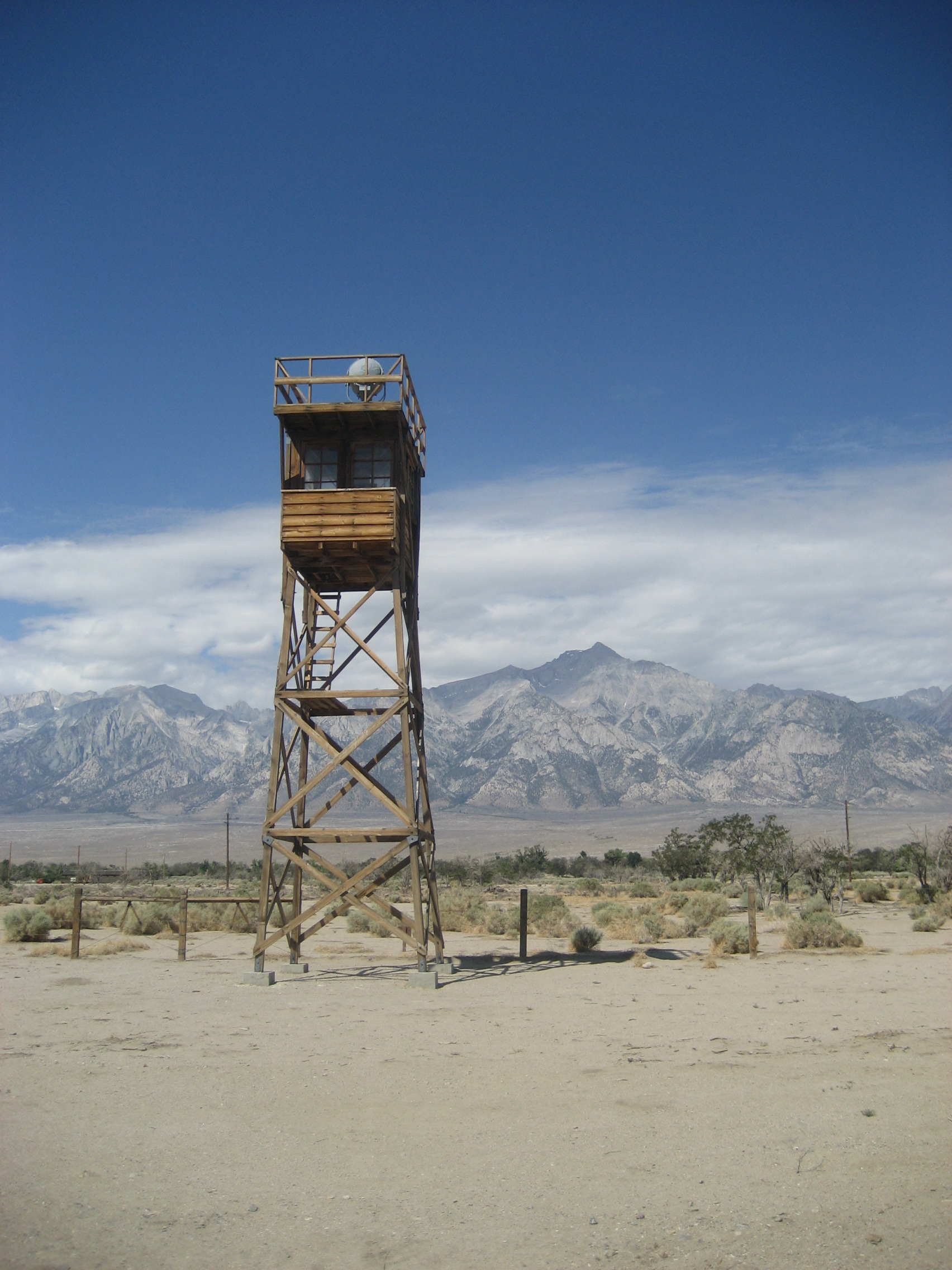
Manzanar was the largest of the camps, with the Sierra Nevada serving as a wall between its Great Basin location and the western 2/3 of California.  People were rounded up, without explanation, by the FBI and the military, early in 1942, from places like San Diego, Long Beach, Los Angeles, San Francisco, Sacramento, Portland and Seattle, and transported in buses and trains to this desert camp, and several others, such as Poston, AZ and Tule Lake, CA.  There are two ironies here:  The camps were often close to, or on, Native American reservations, though Manzanar was not- as the reservations in this part of California are on the outskirts of small Great Basin towns.  Manzanar was a small collection of farms and ranches, such as Wilder Farm and Shepherd Ranch.  These had been abandoned, before the U.S. government took over the area.  The second irony is that, in 1944-45, internes were recruited into the U.S. military, for service in the European theatre.  Many Japanese-Americans distinguished themselves in military service, including the late Daniel Inouye, who later served several decades as a U. S. Senator from Hawaii.

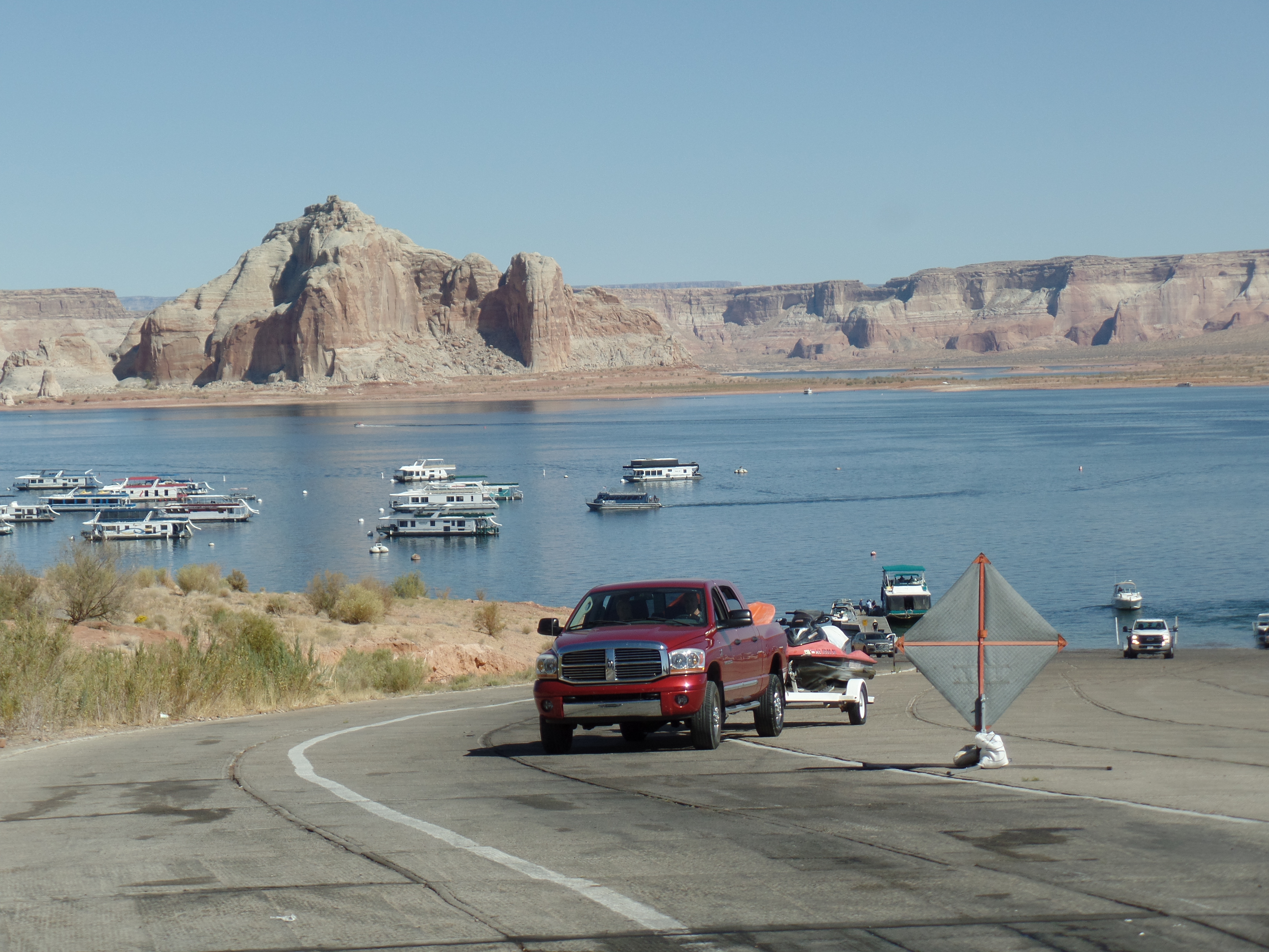
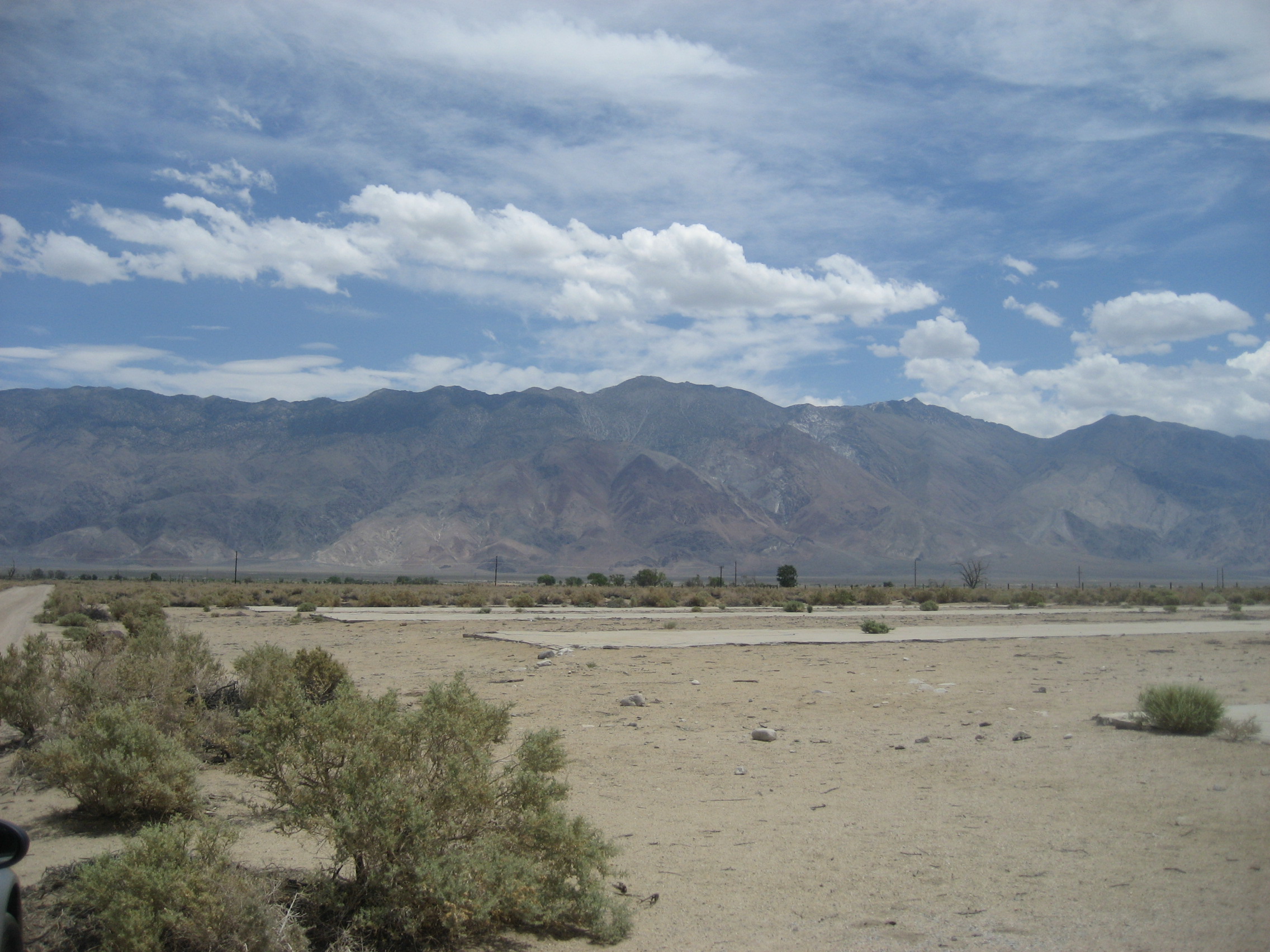
The Visitor Center at Manzanar National Historical Site has elaborate displays of both the Internment Period and of the history of the region.  The other big conflict between ordinary citizens and the governments, both state and Federal, involved water rights in this region, the Owens Valley.  The City of Los Angeles has bought up the lion’s share of water rights and built a pipeline, to meet much of its water needs.  There is ongoing discussion with Owens Valley residents, from Bridgeport and Bishop, in the north, to Lone Pine and Lee Vining, in the south, about how to strike a balance with the City of Angels.

062

Here is a scale model of the Internment Camp, at its peak.063

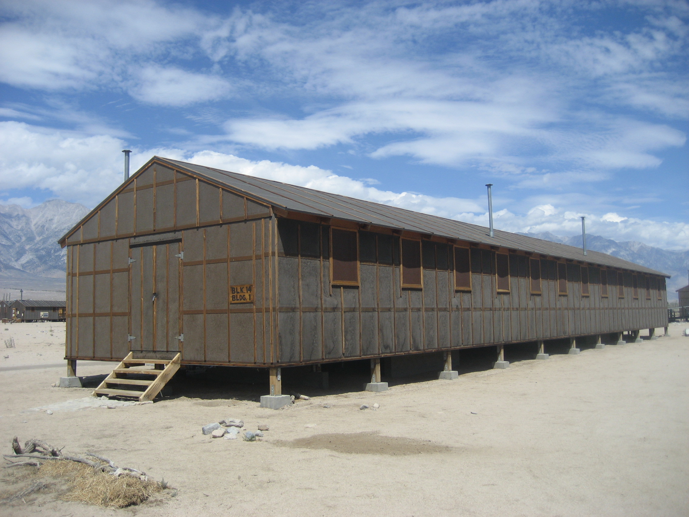
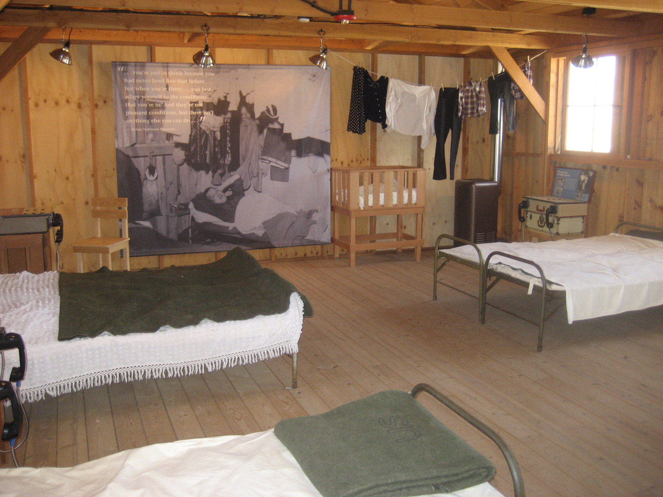
Some dormitories are maintained, by the National Park Service, to show just what living conditions were for the detainees.  Remember, in 1942, there was no air conditioning, such as we know today.

064

068

The dining halls were crowded, and there were few safeguards against infestations by vermin and scavenging insects.

078

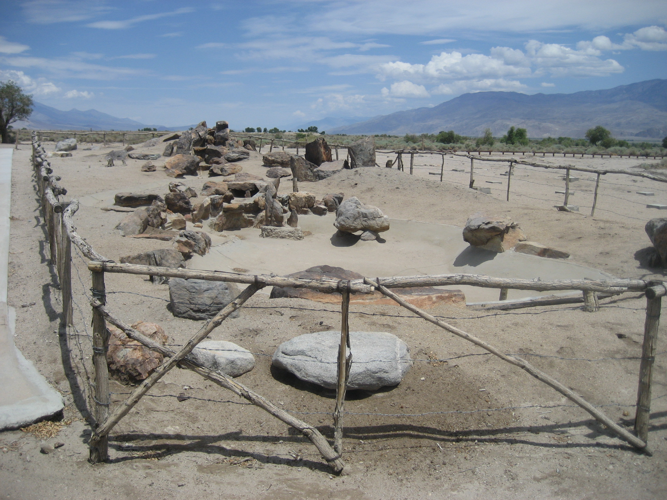
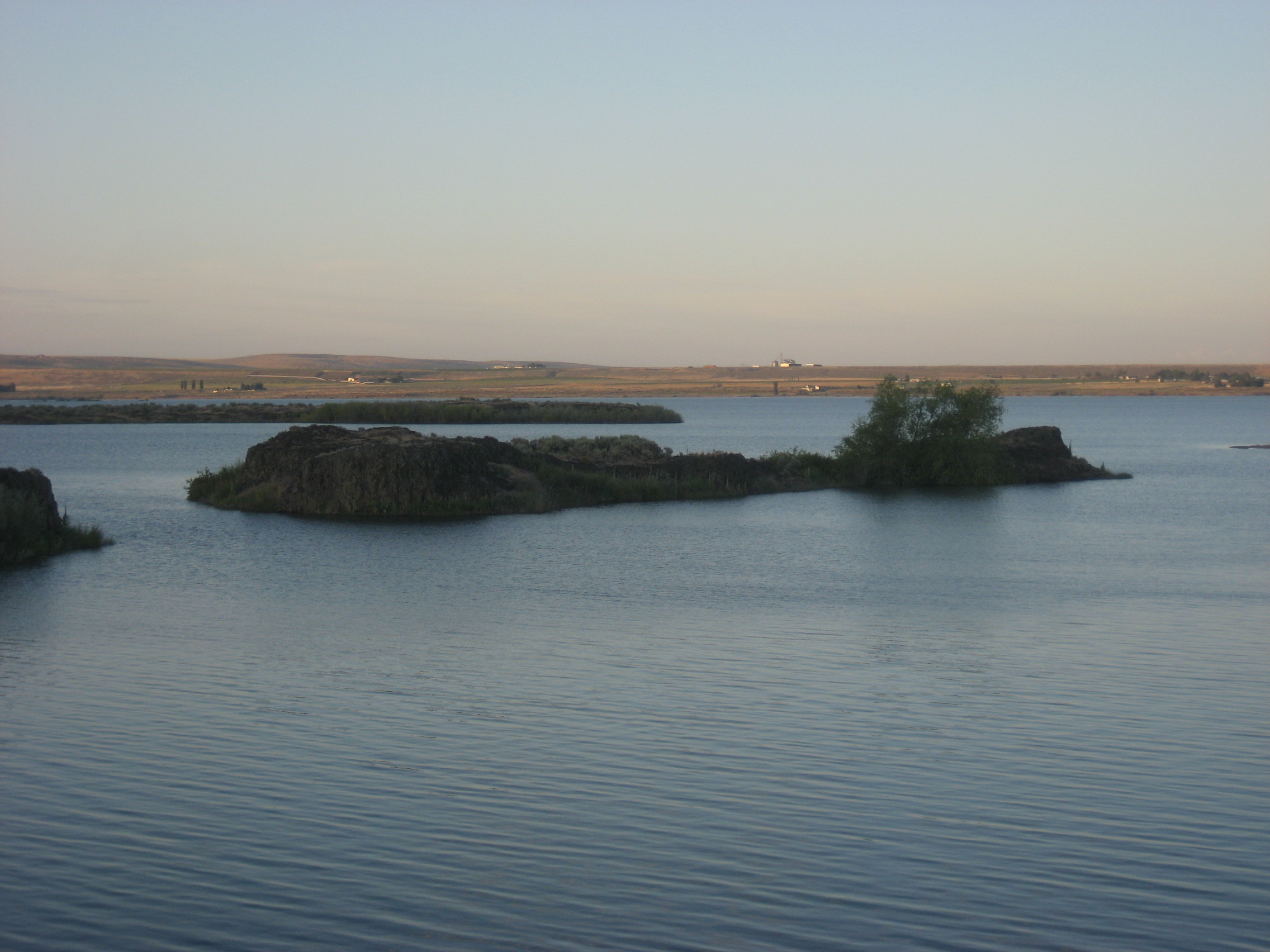
Ruins of several areas are accessible.  Here is what’s left of the house at Shepherd Ranch.

093

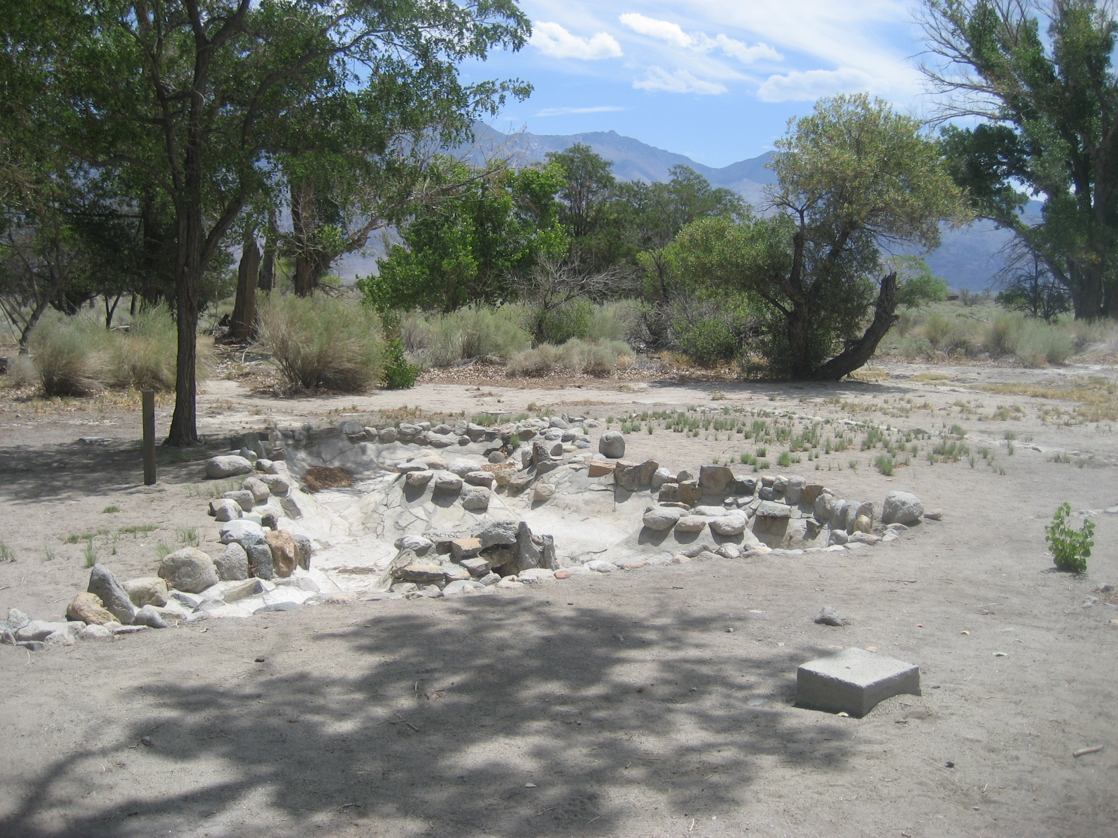
This was once a koi pond, maintained by the internes.

100

They kept up a splendid “city park”, on the north side of the camp.

103

Yes, it was called Pleasure Park.

107

This part of the park is sealed off, to prevent injuries to the public, and defacing of sacred inscriptions.

114

These are scenes of the hospital zone.  There was a full medical facility, separate doctors’ and nurses’ facilities, and as was the wont of the internes, a garden.

119

There was also a cemetery, and this cenotaph stands today, in honour of those who died during internment.

129

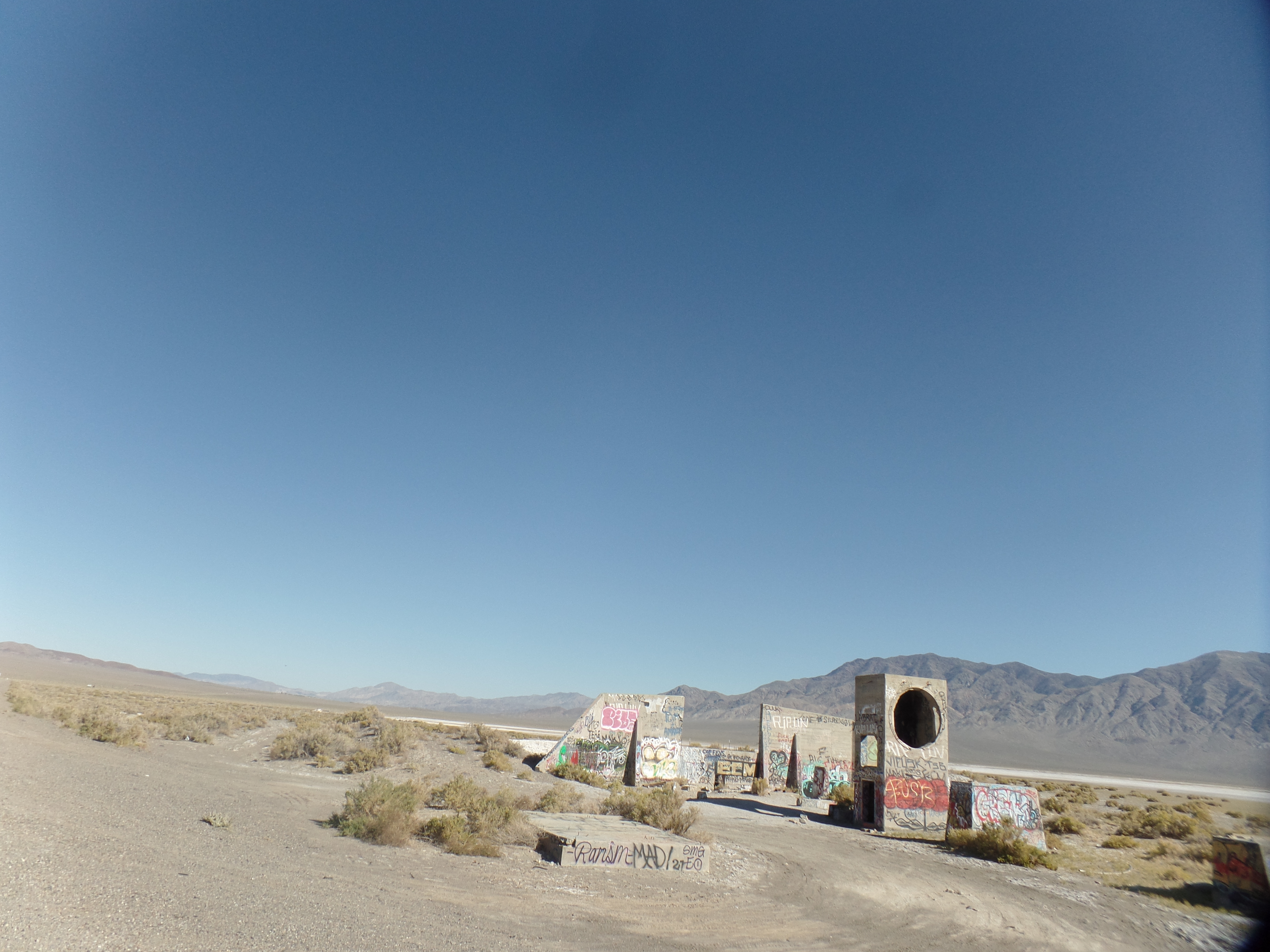
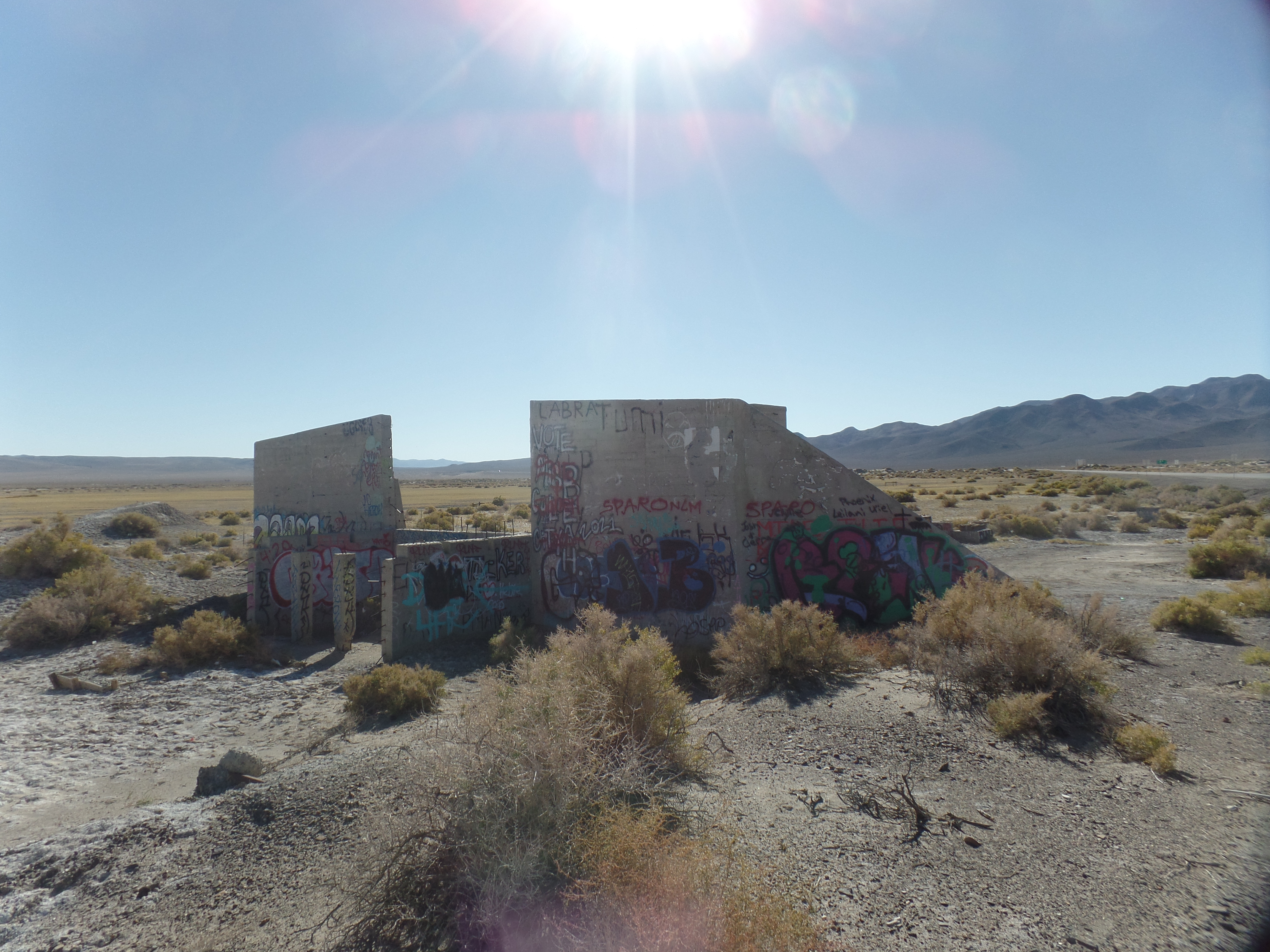
At the southeast corner of Manzanar, there is this slab, the remnant of a camouflage tent factory, where many internes worked, “for the war effort.”

136

This time in an American government internment camp was nearly as jarring, and as thought-provoking, for me, as my visit, about this time last year, to Berga, Germany, where Jewish-American and Hispanic-American POW’s were kept, in slave labour conditions, during the last months of World War II.  The difference was that the U.S. was, and is, a representative democracy, and Germany knelt to the whims of a few. The similarity:  Bigotry called the shots.

In 1988, President Ronald Reagan formally apologized to those interned, and to their families, and signed legislation which authorized $20,000 to be paid to each surviving victim.  This was the Civil Liberties Act of 1988.

I drove, purposely, with the windows rolled down and no AC, from Manzanar to Prescott.  Stopping for lunch and a copious amount of iced tea, at Totem Cafe, Lone Pine, set the stage for this.  I came in to the pleasant establishment alone, but was followed by 28 other people, within ten minutes.  The couple running the place managed to keep everyone pleased, but I had some concern fro the wife, who had to brace herself on the back cabinet and apply a wet towel to her forehead, for several minutes.

140

My heart goes out to all those who work in the hospitality industry, during these days of triple digit temperatures, in so many places, around the globe.  I also stopped at Juicy’s Famous Riverfront Cafe, Needles, for an early supper, before heading on across the Colorado and back to base.  Juicy was a stray dog, who attached herself to the fire company in Needles, and to the hearts of the entire town.  That, alone, made it worth the stop.  The service is excellent and the food fine and dandy.

I got back to Prescott at 9:40 P.M., exulting in the drizzle and cooling temperatures, no worse off, for the heat, having plied myself with lots of iced tea and cool water, along the way. Oh, yes, and plenty of sunscreen was applied.

The Road to 65, Mile 206: Evergreen Crossings, Day 4- Cascades and Coulees

4

June 22, 2015, Wilbur, WA- The day started with getting laundry done, in Monroe, at one of the more expensive laundromats I’ve seen in a while.  It uses an Easy Card, so the fare is purchased in advance, for  laundry supplies, washer and dryer.  I did everything in one load,as is my wont, when on the road.

I passed Travelers Park, before turning right onto Highway 2 East.

163

On the way out of town, I gave a short ride to three people, who my intuition said, correctly, were good risks.  They had no interest in me, other than to know why I was here, from Arizona- a reasonable query of a stranger.  Eight miles further, I let them off, at a place called Gold Bar.

My next stop, however, was a tough little town called Skykomish, which has about 500 people who still support a weekly bus service to Monroe and have their own school district.  It was founded as a rail stop, by routing engineer John Stevens, for whom nearby Stevens Pass is named. This old building used to be Skykomish Hotel.

164

The rest of the town also has a frontier air about it, still.

166

I had lunch (leftover lasagna) at a picnic table facing the main street. Then, it was on to Deception Falls.

169

This popular trail, at the foot of Stevens Pass, offers the three cascades of Deception Creek.

187

Note the relative purity of the water.

189

The trees provide variety in the scenery, especially as they lean,

170

serve as springboard stumps,

176

or act as nesting pots for new trees.

177

or, still as a place to drive piles.

183

Meanwhile,back at the falls:

191

192

200

203

205

There was a plenitude of visitors, yet much of the time, I found myself alone, as most people gathered at two overlooks.

The road led next to Leavenworth, not the Federal prison, but the touristy mountain community, about forty minutes from Wenatchee.  The Wenatchee River is a major comfort, for locals and visitors alike.

209

I stopped just long enough to walk along the river a bit, and to buy some coffee from a local grinder, Square 15.  It was to be a gift for my friends in Reno. The faux Bavarian scene can be taken in small doses.

215

I stopped in Wenatchee,for about two hours, long enough to marvel at the clear air (compared to the smoke which brought me here in prayerful service, three years ago) and to enjoy a fine Hispanic-fusion meal, courtesy of two friends.

219

I shall send them some Arizona treats, very soon.

The rest of the evening entailed driving down from the central Cascades, and into the western edge of the Great Basin.  Some outlying areas reminded me of the Great Plains.  There are patches of desolation.

225

There is a worrisome dryness.

226

The coulees of the Columbia River, and its tributaries, provide irrigation water, regulated by a series of dams.

227

One of these is Dry Falls Dam, about a mile south of Grand Coulee.

228

No, that’s not a fresh-water dolphin, in the river above.

I settled in on a grassy patch, at a little RV park called Country Corners, and slept fairly well, except there was this event called Aurora Borealis, and my tired self couldn’t leap out of the sleeping bag and take a shot or two.  Perhaps one or two of you saw it.