No Aztecs, Many Aztecans

0

March 15, 2023, Santa Fe- The day featured what is almost typical of my visits outside Home Base, this winter: A light, cold, but not overbearing rain. So, I took my umbrella, donned my rain and shine hat (with its flap and wide circular brim, to aid in protection from the two elements) and set my phone to the QC-enabled audio guide, going around Aztec Ruins National Monument. A ranger spoke of Earl Morris, the driving force behind the excavation of the western sector of the ancient community and the original occupant of the house which now serves as the Monument’s headquarters and museum. She also noted that the name of the place came from a Spanish stereotyping of all Mesoamerican First Nations into a single ethnicity: The Aztecs. The Tewas, Tiguas, Towas, Keresans and Hopi who settled Chaco, Mesa Verde and Aztec, before dispersing to their present home areas, had their trade connections with the people of Mexico, but they were entirely separate, culturally and linguistically, from the nation that dominated much of that ancient land. Another focus of the ranger’s talk was the system of roads that traversed outward from Aztec, as well as from Chaco. With no vehicles or beasts of burden, the people likely had to carry cut wooden beams, building stones and other materials on foot, using hauling mechanisms and walking two or three abreast, for almost unimaginable distances, in order to build the communities.

Here are some scenes of this remarkable complex, the pride of modern Aztecans.

Great House, Aztec West ruins
Southernmost of three Great Kivas, Aztec West ruins
Connected apartments, Aztec West ruins
Interior, re-constructed Great Kiva. Aztec West
Central Great Kiva, Aztec West ruins
Doors connecting apartments, Aztec West ruins. These were created because of pot hunting by thieves, in the early Twentieth Century.
View of original doors connecting apartments, Aztec West ruins
Interior doors, Aztec West ruins

The ruins on the eastern and northern sectors of the complex have yet to be excavated to the point they may be safely shared with the public. The ranger also noted that there may well be sites buried under the modern town of Aztec. These could very well be uncovered at some future time, as so many sites have been, around the world.

The rain only intensified, after I left this UNESCO World Heritage Site, so postponed until a later time are Salmon Ruin and other sites in Bloomfield, southeast of Aztec-and a hike up Kitchen Mesa, at Ghost Ranch.

I am holed up for the night at King’s Court, a small, cozy place (and my favourite in this town) not far from either downtown Santa Fe or from Pantry Restaurant, where three people I love dearly provided me with a steaming bowl of Green Chili Stew-a perfect, healthful meal for this chilly evening.

Brightness, Under A Half-Moon

2

September 5, 2022, Taos- About seven miles west of this town of Puebloans, hippies, cowboys and off-the-grid Libertarians, there is a bridge across Rio Grande Gorge. About a mile further west, there is West Rim Road, which takes people to old Apache campsites, new marijuana farms and a Buddhist stupa, atop a hill and past various homes built by Apaches, South Asians and the above-mentioned Libertarians. Among those who built a home, on ancestral land, is a friend, G. She and her surrogate grandson live in a comfortable solar-powered residence, about a mile off West Rim Road.

When I was leaving Colorado East Baha’i School, earlier today, I felt very strong energy, telling me to go towards Taos and G’s home, and to do whatever it took to visit them. So, after helping with the clean-up at CEBS, and bidding farewell to new friends, I headed down I-25, and arrived in Taos around 5:30 p.m. With my usual penchant for following general directions in a skewed manner, and for not checking my phone while I was driving, I missed a few last-minute updates-which came while I was on “Flag Road”, as her graded road is called. I also missed G, while going in one direction, only to turn around and see her, while driving in the opposite way. Call it lighting effect, fatigue or, as one local astrologer said, “the Taos effect”, in the end I followed G slowly up the driveway, and in short order was enjoying the delectable fresh garden vegetables, with chopped tuna and non-glutinous rice, that she had prepared in honour of my visit.

A half-moon guides us tonight, and with its energy, G filled me in on the events that have transpired since I last saw her, in Tucson, at her son’s residence. Grandson, M, proved a quiet, but congenial young man and seems like he will be an asset to G, in the months ahead. The time there was well-spent, and the house will not be hard to find, when I am next in this part of New Mexico. As the evening turned to late night, I headed back into town, and now am resting in Super 8, on Taos’ south side.

G’s brightness is always evident, no matter the phase of the Moon.

Besh Ba Gowah

8

October 11, 2017, Globe, AZ-

The Southwest is as abundant with remembrances of the past, as anywhere on Earth, and perhaps more than many places.  The various cultures and civilizations that came here, long before the Athapascans, the Comanches, the Utes, to say nothing of the Spanish and other Caucasians, will perhaps never be well understood.  I see, however, that in many ways, these distant ancestors of the Hopi, Zuni, Havasupai, Hualapai, Yavapai and Rio Grande Puebloans are mirrors of ourselves.  Visiting the Salado ruins at Besh Ba Gowah (Apache, for “Metal Camp”), I saw a carefully planned, apartment-based community, which relied on knowledge and cultivation of high desert plants, having drawn on the practices of the Huhugam and others who came here, well before the 11th and 12th Century heydays of the Salado people.

Here are a series of photos of the excavated and unexcavated ruins, the upper and lower gardens, of Besh Ba Gowah, lovingly restored and maintained by an appreciative City of Globe and its citizens.  I am not commenting on all of the individual photos, hoping that you may draw a sense of the vastness of this complex.

Entry to Excavated Ruins:

SAMSUNG CAMERA PICTURES

SAMSUNG CAMERA PICTURES

SAMSUNG CAMERA PICTURES

The Excavated Ruins:


SAMSUNG CAMERA PICTURES

SAMSUNG CAMERA PICTURES

SAMSUNG CAMERA PICTURES

SAMSUNG CAMERA PICTURES

SAMSUNG CAMERA PICTURES

SAMSUNG CAMERA PICTURES

Unexcavated Ruins:

SAMSUNG CAMERA PICTURES

SAMSUNG CAMERA PICTURES

Arizona Gray Squirrel, a bit mottled by the dryness.

SAMSUNG CAMERA PICTURES

Upper Ethnbotanical Garden:

SAMSUNG CAMERA PICTURES

Lower Ethnobotanical Garden:

SAMSUNG CAMERA PICTURES

SAMSUNG CAMERA PICTURES

SAMSUNG CAMERA PICTURES

Look closely, and spot a smiley face:

SAMSUNG CAMERA PICTURES

Besh Ba Gowah, and Globe as a whole, are nicely placed between Flagstaff, Phoenix and Tucson, making this stunning area a natural place, in which to enjoy a Fall day or three.

NEXT:  The Further Glories of the Gila Wilderness


Trailheads and Trails, Volume 1, Issue 21: Wupatki of the Valley

12

August 31, 2014, Flagstaff-  Wupatki National Monument, centered on the “Tall House”, for which the Hopi gave this series of ruins its name, sprawls across a wide high desert valley, just north  of the San Francisco Peaks.  It is administered jointly with Sunset Crater National Monument, which lies 18 miles to the southeast, but is a worthy destination all its own, for those seeking to understand the predecessors of today’s Hopi, and other Pueblo dwellers.  The volcano known as Sunset Crater erupted in 1240 AD, and was thus responsible for the emptying out of settlements both here and in Walnut Canyon, the subject of my previous post.

I will start this account at Lomaki Pueblo, the northwesternmost of the ruins, and proceed southeastward.

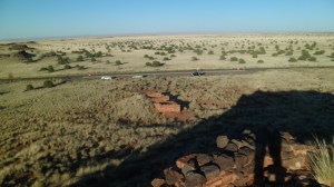
Lomaki and Box Canyon- This is a small, rough area, and was probably a way station for traders heading towards, or way from, the Little Colorado valley and salt gathering locations in the Grand Canyon.  Box Canyon was the gardening area for the fifty or so residents who maintained Lomaki.

SAM_2686

SAM_2689

SAM_2690

SAM_2691

SAM_2692

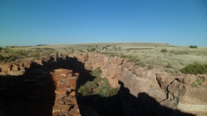
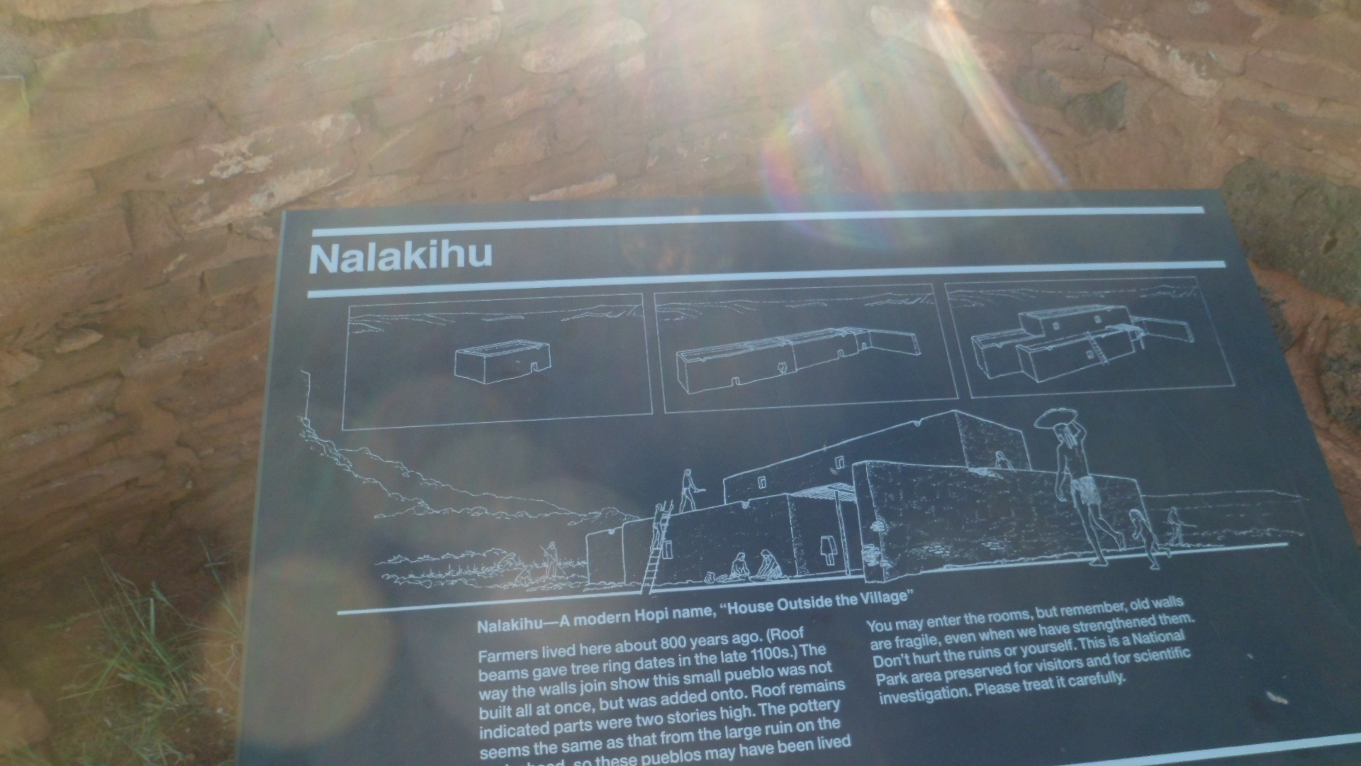
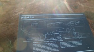
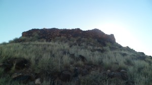
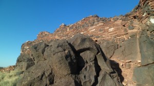
Nalakihu and The Citadel- This hillock, just south of Lomaki, provided the Wupatki settlers with a vantage point to both signal distant villages and to observe those approaching from the north and west.  Nalakihu, halfway up the hill, served as a farming enclave and a sort of suburb to the small, crowded Citadel.

SAM_2693

The Citadel lived up to its name.  I can envision the guards keeping watch on those headed along the trail which preceded the present-day road that leads to the ruins of the main settlement.

SAM_2695

SAM_2696

SAM_2697

SAM_2704

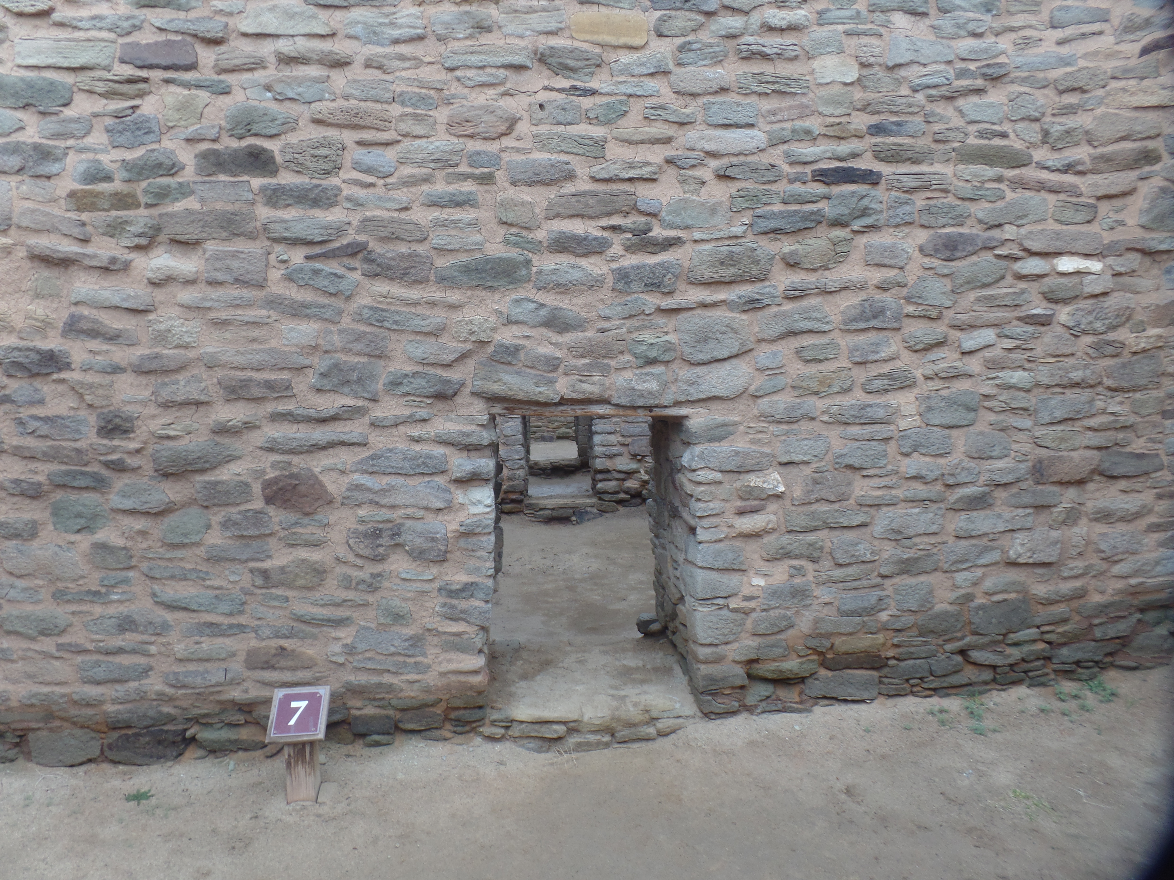
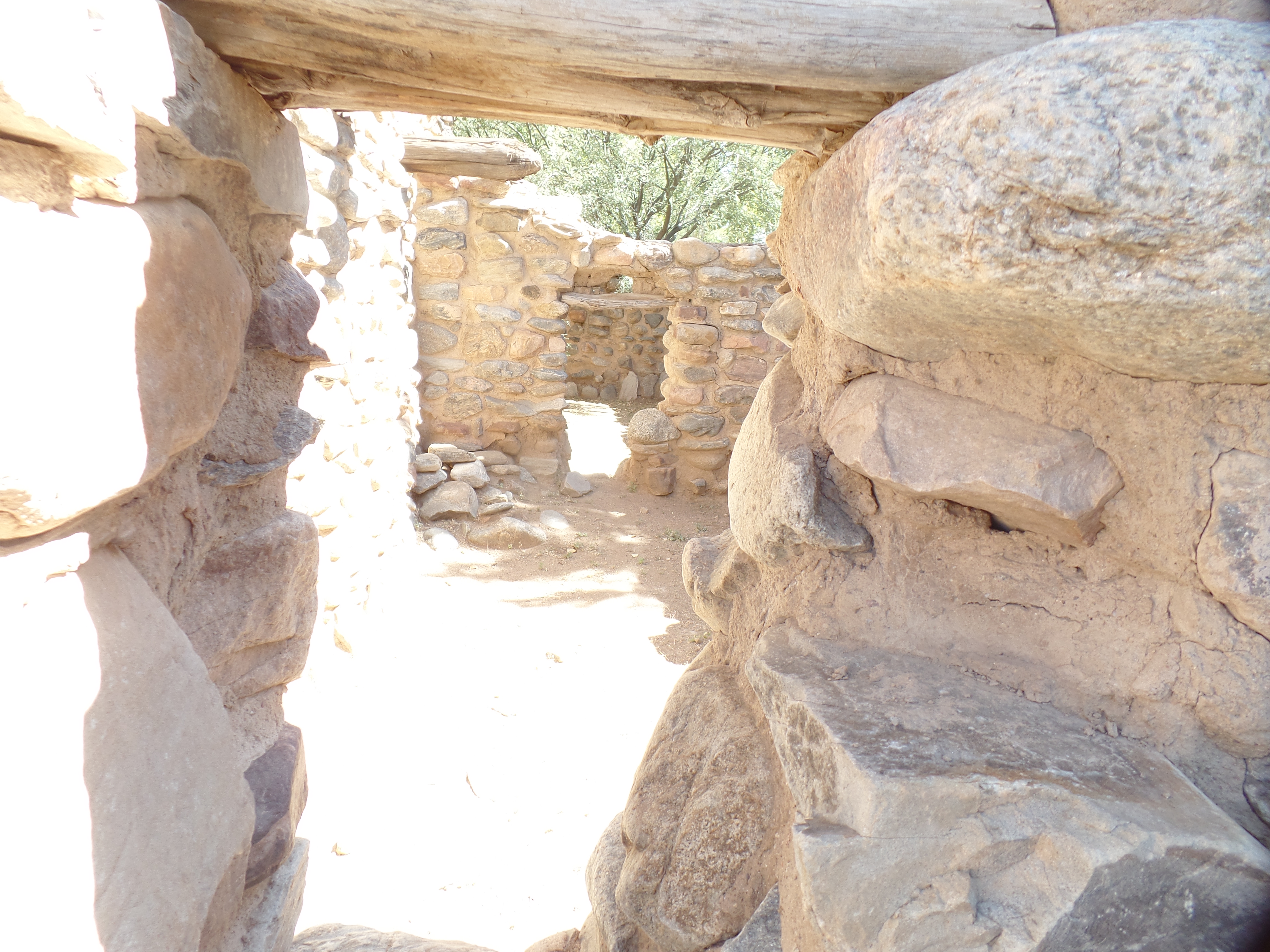
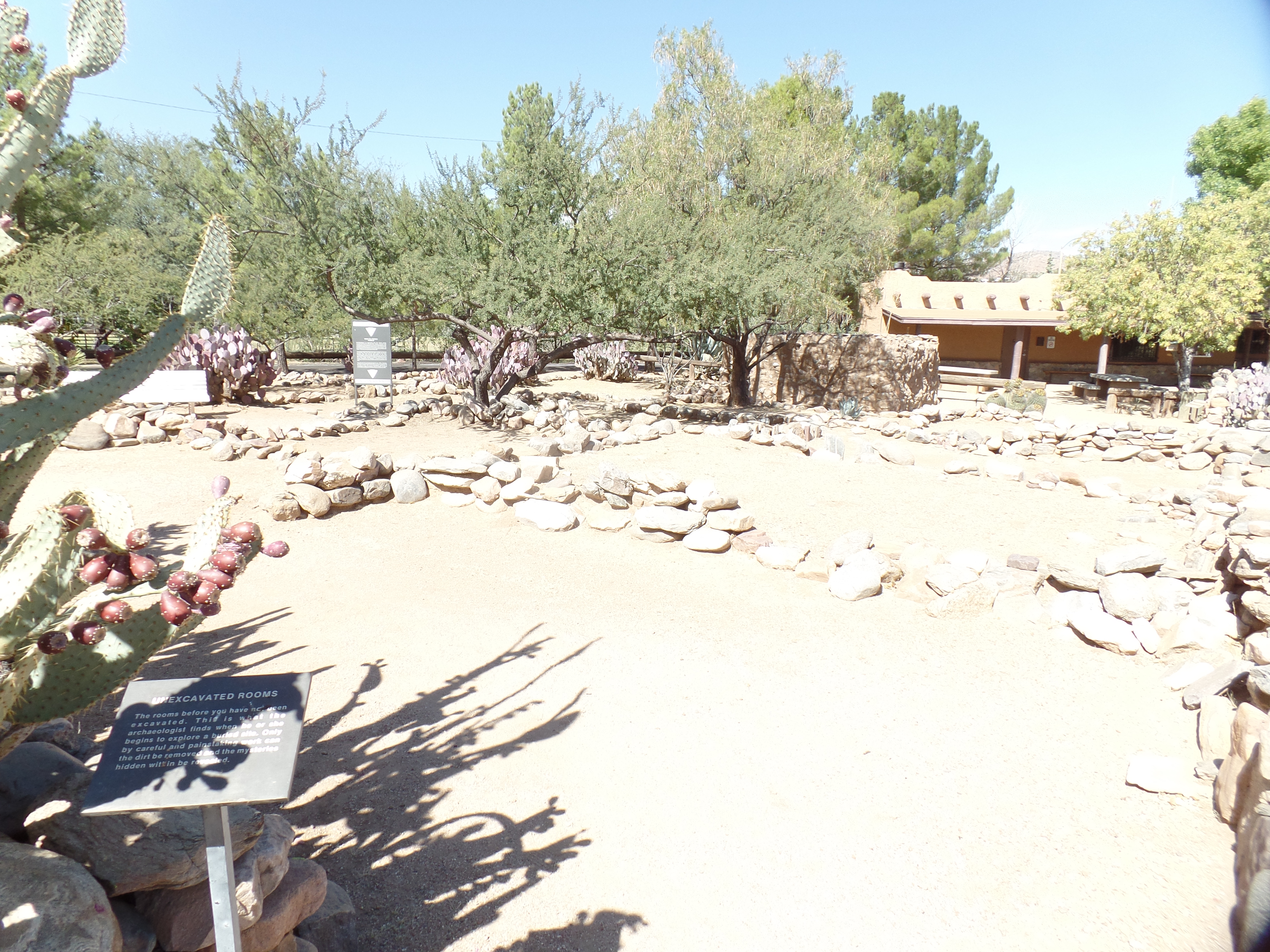
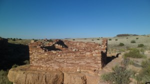
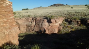
Wupatki Pueblo-  This is the grand settlement, closest to the main water source, and the relative safety of Woodhouse Mesa.  Runoff from the Doney Cliffs, two miles west, gave the settlers plenty of water.  There were large farm fields around the dwellings and common rooms.  Then, as now, corn (maize) was a staple, in various colours.  The modern Puebloans, including the Hopi, have preserved these varieties, and blue corn is the most famous and popular of the breeds.  I was delighted with the company of a family from India, who had settled in Phoenix, recently.  I started at one of the outlying houses, going clockwise around the settlement, as is my preference.

SAM_2715

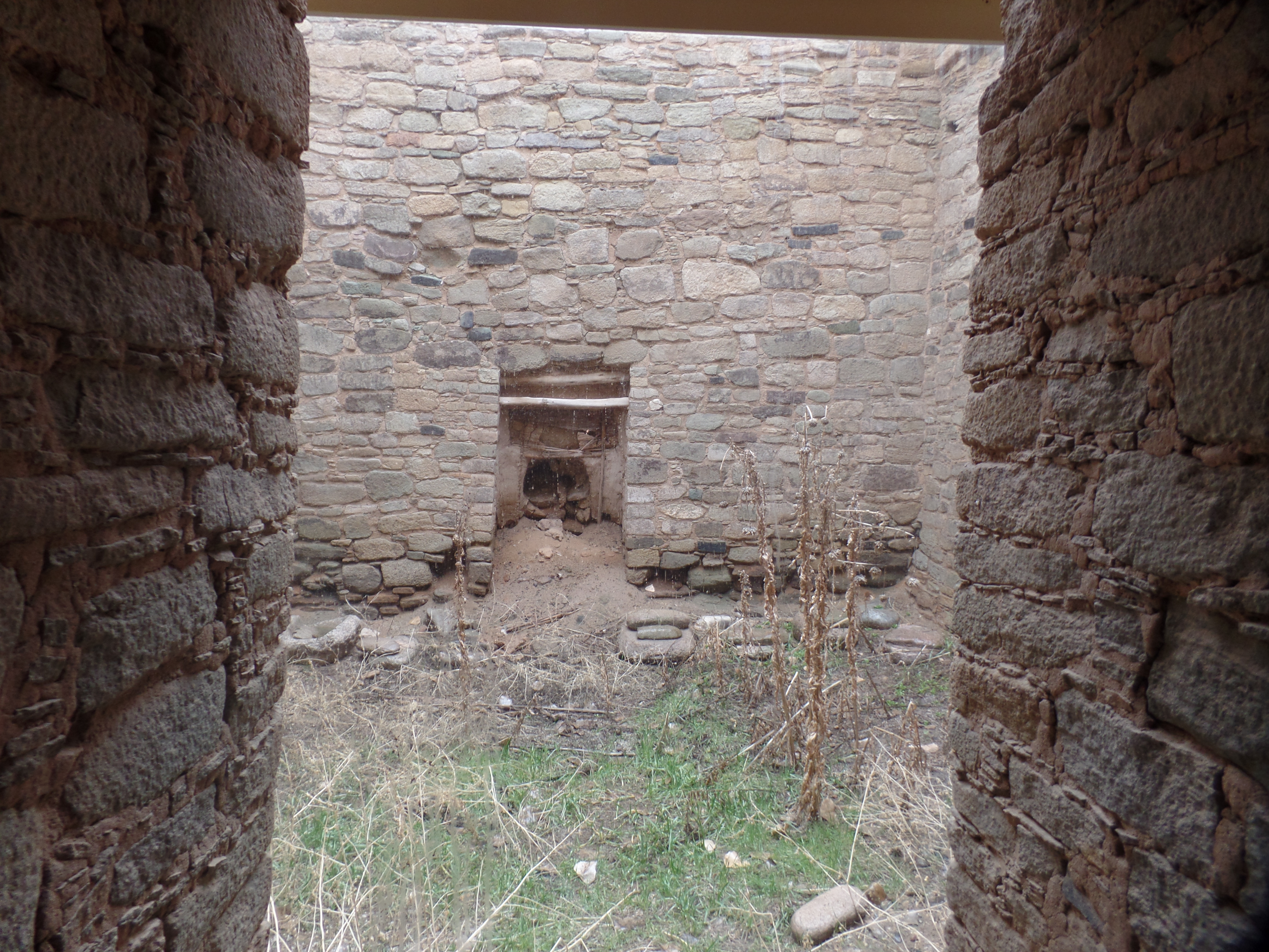
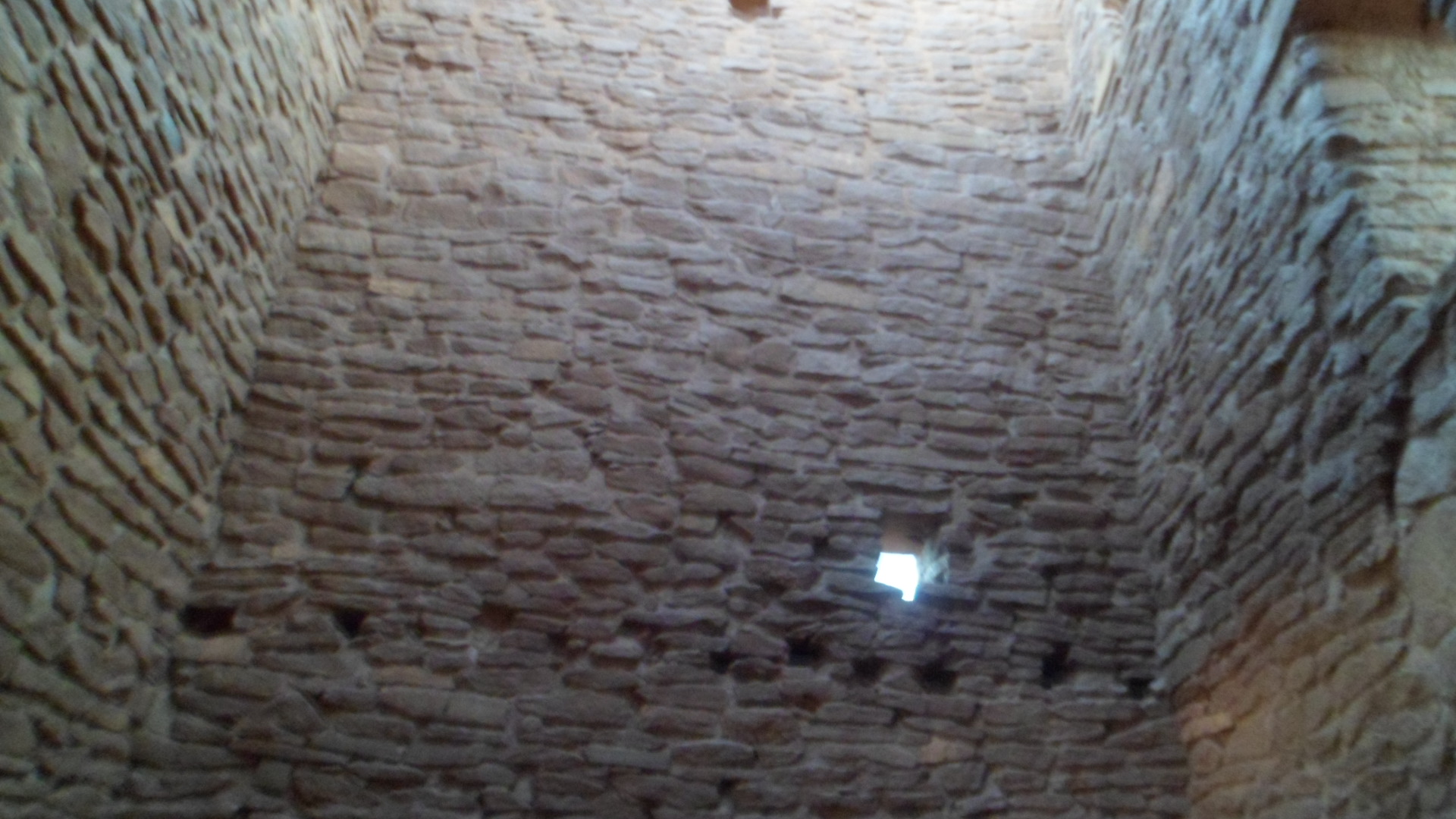
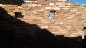
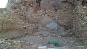
The people would patch holes in the square, chimney-like structures, with solid applications of thick, gooey mud, which was almost impermeable, once dry.

SAM_2717

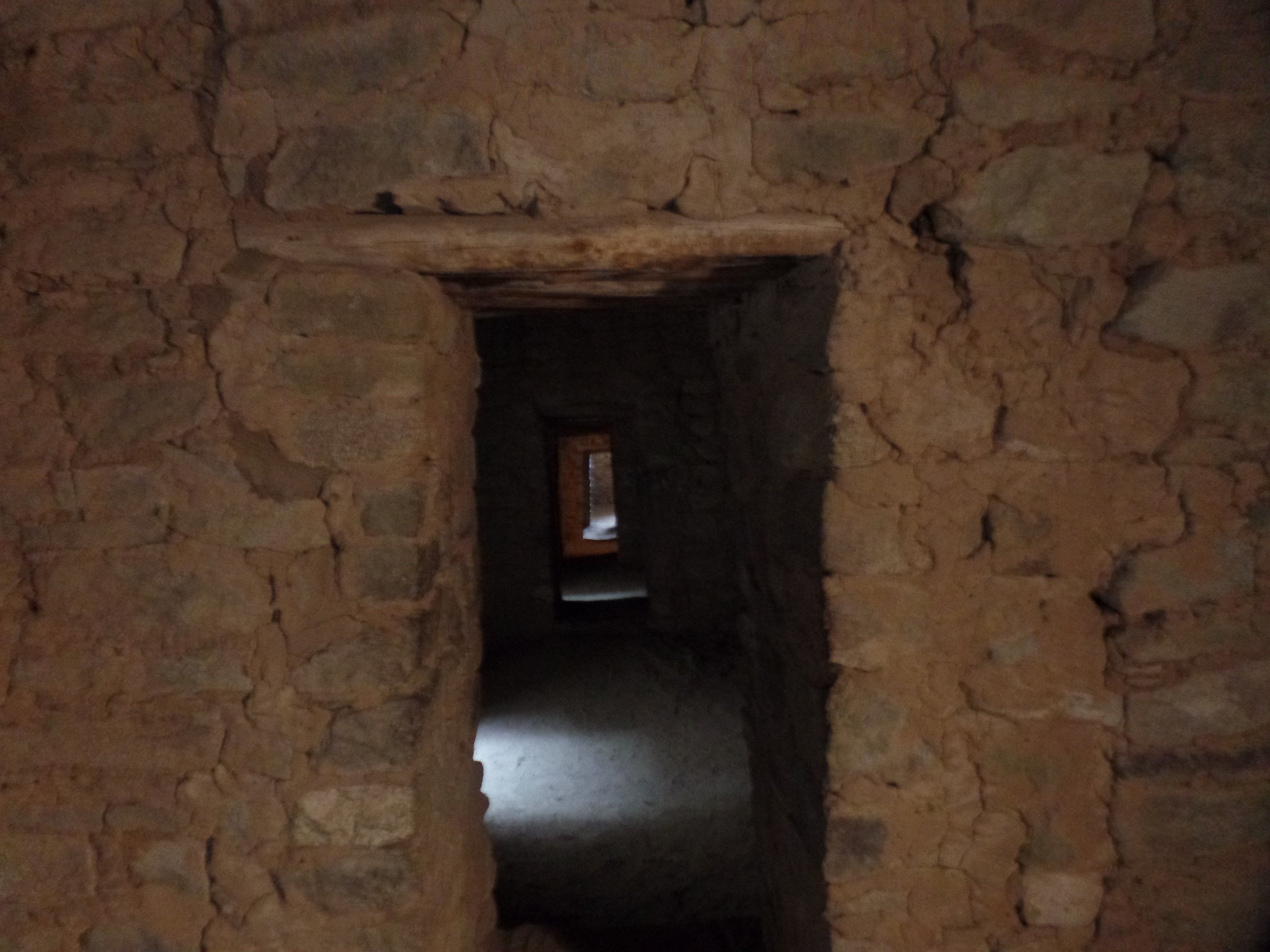
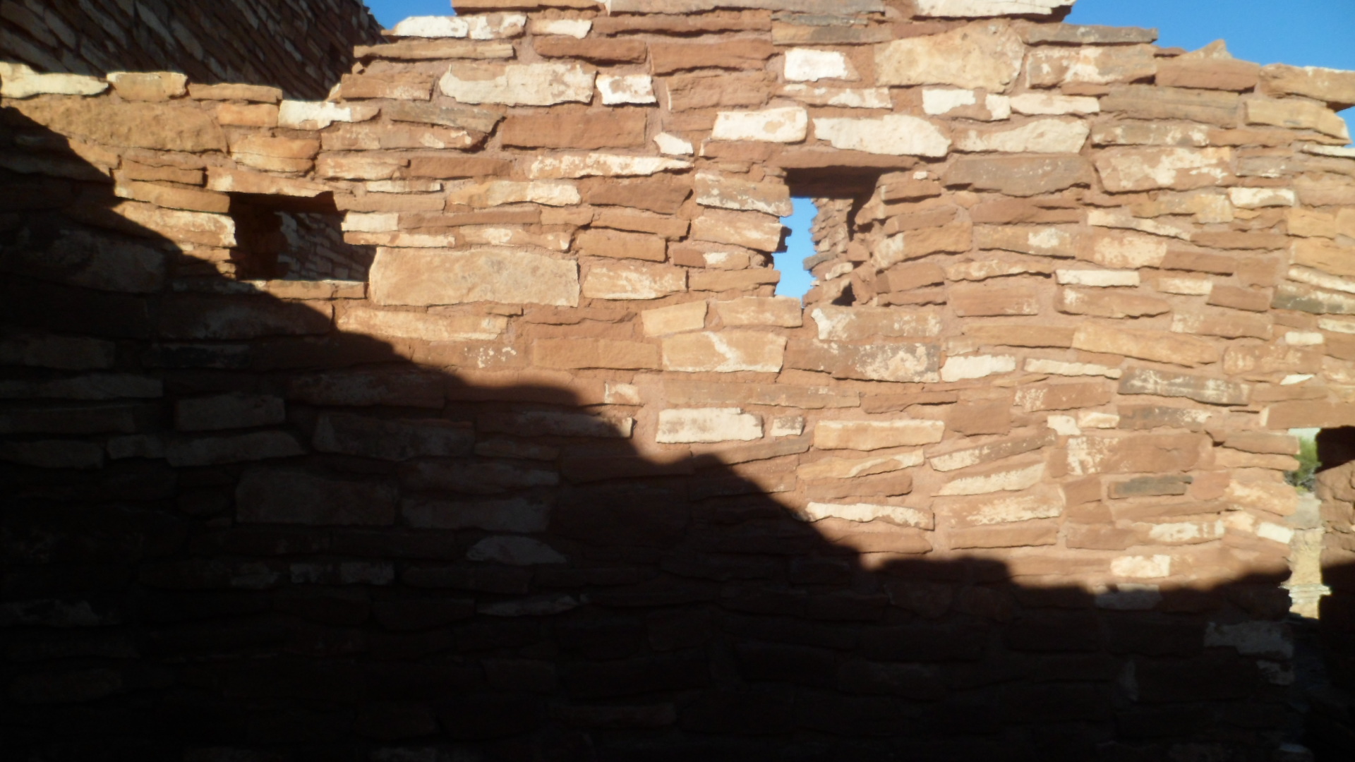
The native stone of the area is porous sandstone, but was useful for shoring up the mud brick, and for walkways to the fields and to the trading route.

SAM_2720

All major buildings had strategic portals, to the east, for praying and to the west, for observation of anyone who might be approaching.SAM_2721

Physical exercise was often communal, and the men would engage in a ball game, not unlike soccer, or lacrosse, though it seemed to have been played with a small, handball-type implement.  Ball courts were common in settlements around the Southwest.SAM_2725

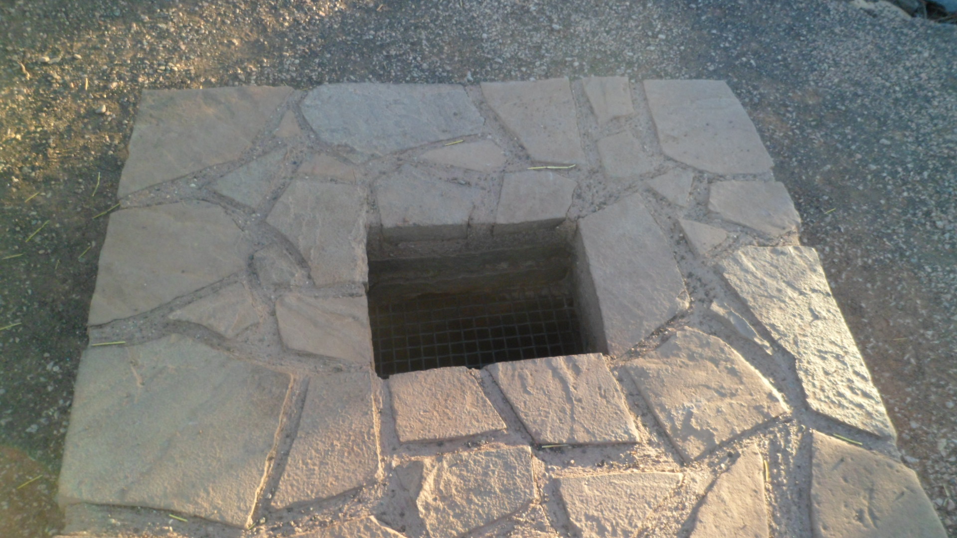
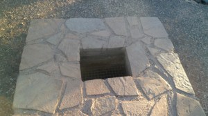
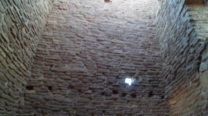
A blowhole, which produces cool air in times of dry heat above, and sucks air down, when the outside air is wet and moist.  It was blowing nice and cold, when I went up to take this photo.  The father of the Indian family had never experienced such a thing, and wondered if a cave was underneath.  The Hopi call this site Naapontsa, or “Wind Spirit”.

SAM_2727

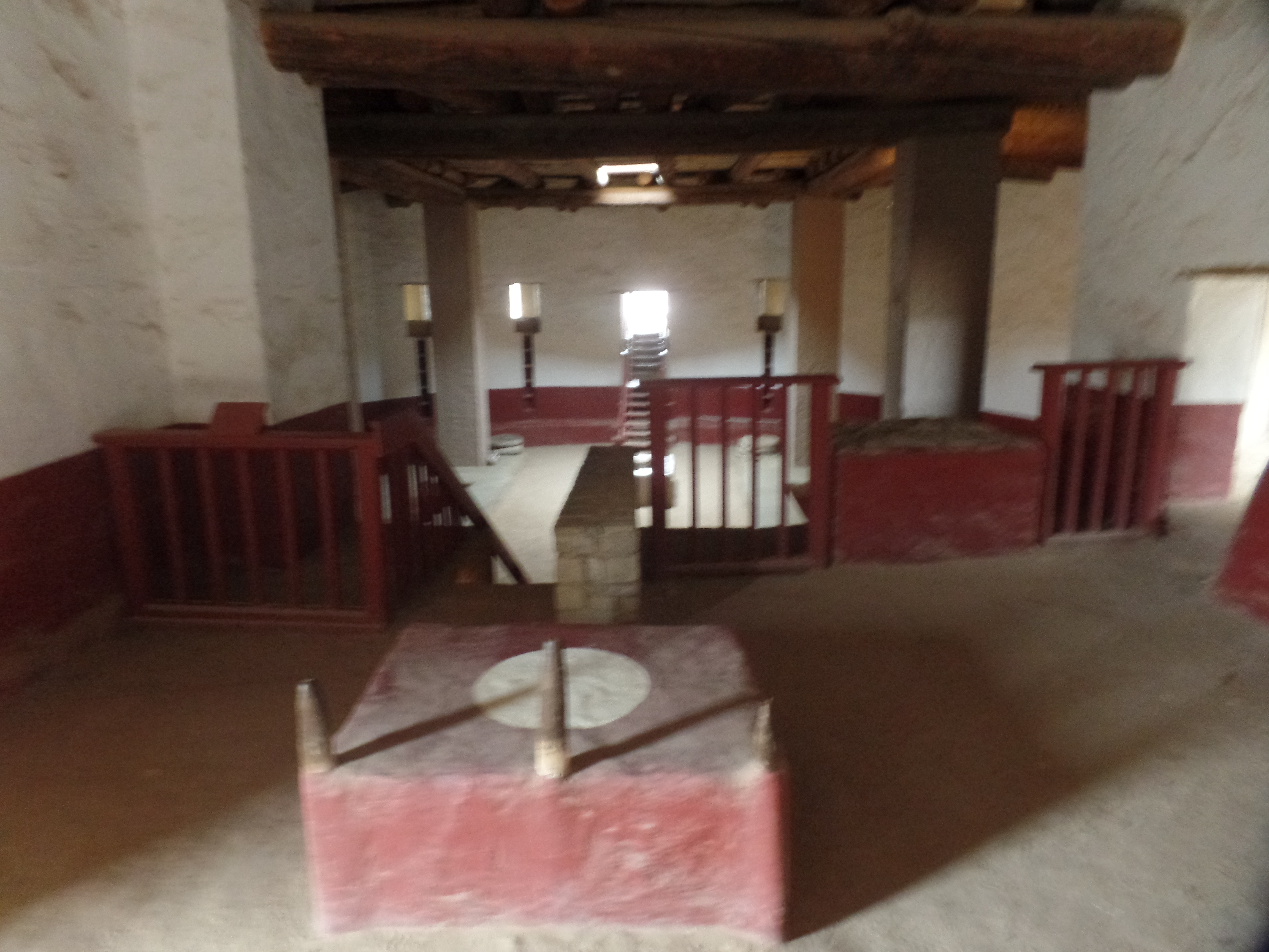
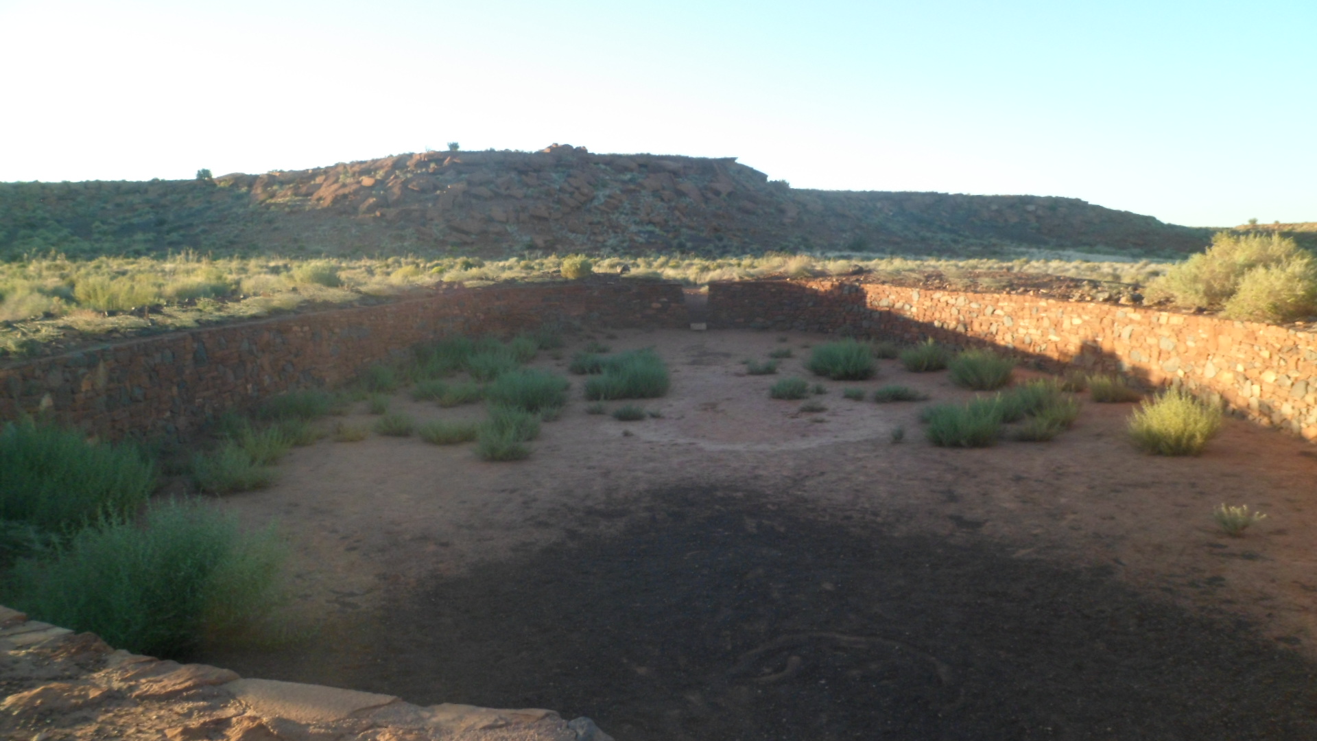
Below, is the Community Room of Wupatki Pueblo, where spiritual meetings and important community forums were held.

SAM_2731

The father of the family who were with me, graciously took some photos of me, in front of Great House.

SAM_2733

No, I was not turned into Jabba the Hutt!

SAM_2739

Here is a more extensive view of Great House.

SAM_2740

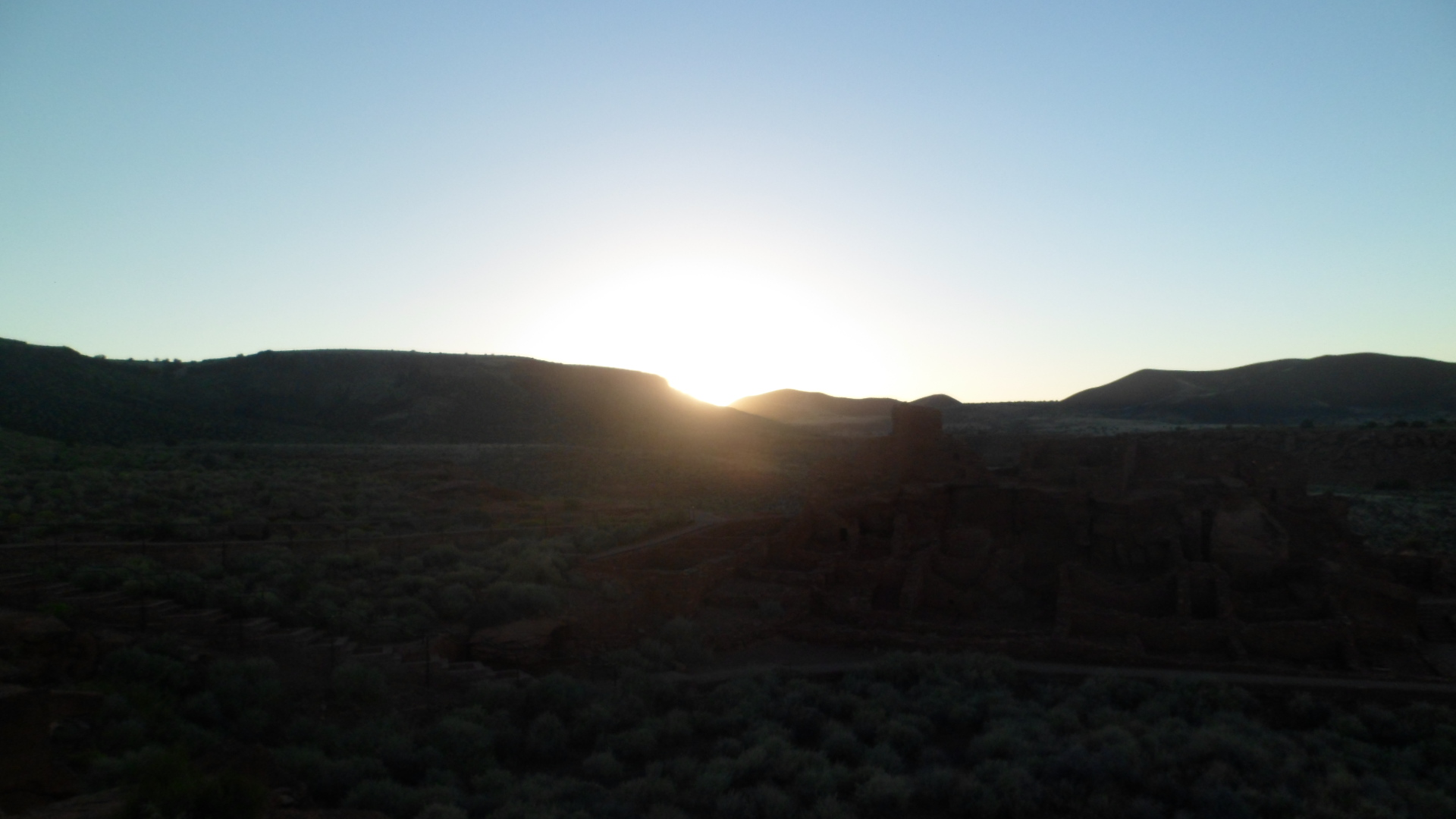
Sunset is always magnificent.  Here, it had a particularly auspicious ambiance.

SAM_2742

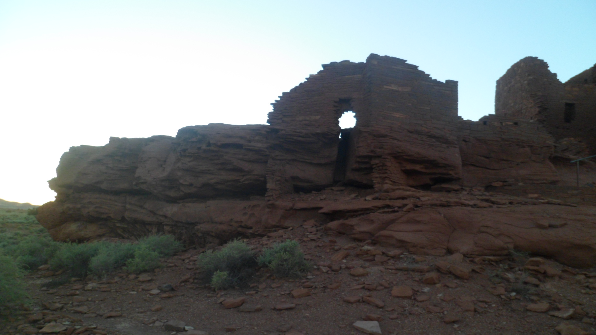
Wukoki- This settlement was the easternmost of the outposts in Wupatki Pueblo.  It also looked down on the valley, but was not quite as prominent as The Citadel.  It most likely received visitors from the Walnut Canyon and Homolovi settlements, to the south and east, as well as traders from further afield.  As the sun continue dto set, Wukoki also offered some eerie views.

SAM_2747

SAM_2749

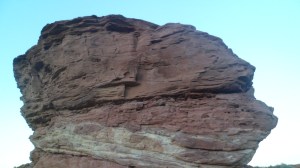
The rocks have character, as they do throughout the Southwest.  They also gave Wukoki an added layer of protection.

SAM_2752

SAM_2754

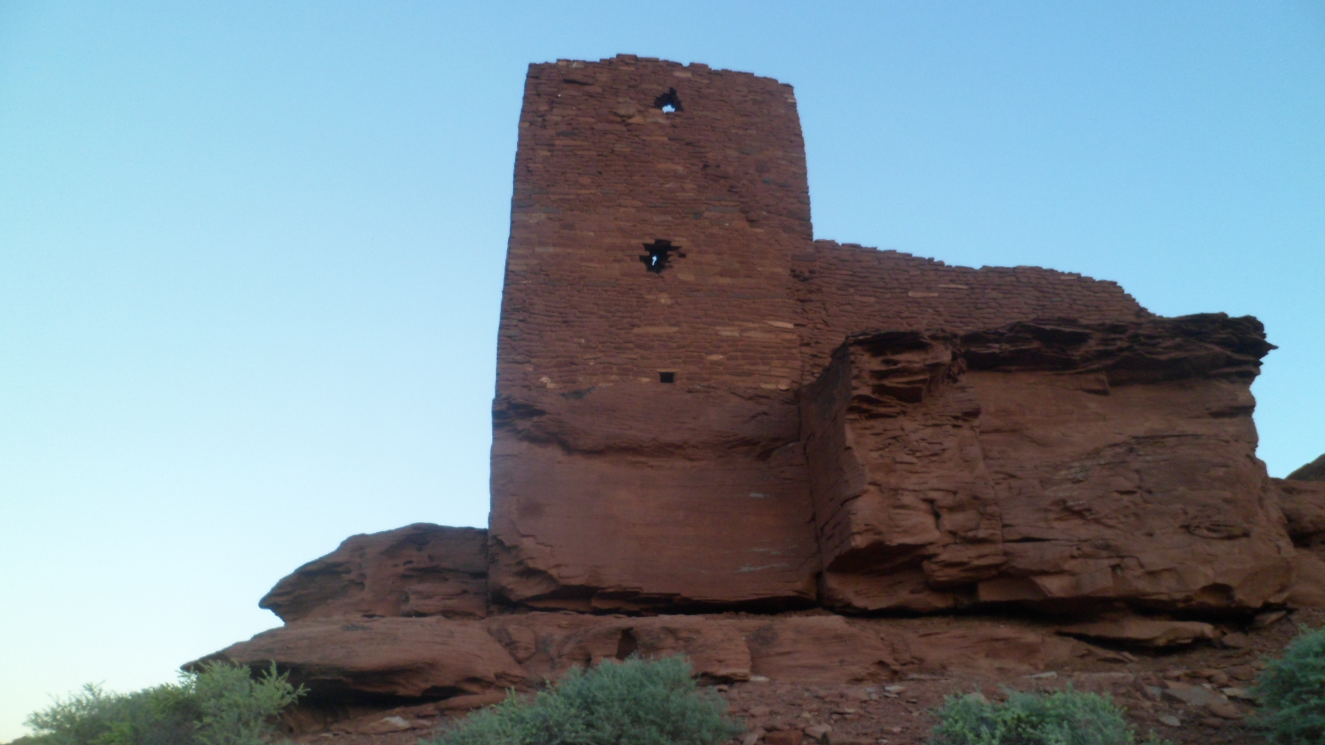
The watch tower was especially sophisticated for its day.  Bear in mind that this square building style pre-dated European contact.  Squares and rectangles provided the means to protect against wind and water erosion.

SAM_2756

SAM_2761

SAM_2763

This sort of building style is actually the more common, among even later Pueblo groups.  The round structures, also associated with the indigenous peoples of the Southwest, arrived with Athapascan groups, such as the Dineh (Navajo) and Indeh (Apache), later in the pre-Columbian era. I will continue to visit the sites of those who have gone before, over the course of the next several months.  Next, though, is a look at the cause of their diaspora:  Sunset Crater