Prescott Circle Trail, Segment 2: Thumb Butte Road to Iron Springs

10

April 24, 2016, Prescott- Today was another picture perfect day, with less wind than yesterday.  Thus, it was the right time to hike the 8-mile round trip, from one iconic landmark (Thumb Butte) to the near approaches of another(Granite Mountain).

Actually, I reversed the order, as Iron Springs’ parking lot is spacious and well off-road.  I was met by a couple who were on a short bicycle ride.  They went as far as the Fireplace Ruin, a distance of 1.8 miles.  That segment of trail follows an abandoned rail bed, the route of which once connected the mining camps of Iron Springs with downtown Prescott.  With those camps long closed, the route evolved into a Rails-to-Trails path.  There are several fine views, to the east, from the trail.

The left photo shows the Bradshaw Mountains, while the right-hand view is of two adjoining subdivisions, to the east. Below left, is a view of Badger Peak, five miles to the southeast.

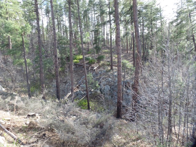
The above right scene shows some of the rock that was cut away, to push the rail bed through.  Below it, new growth has helped in recovery from the Indian Fire, of 2002, but the area was hit again, in 2013, by the Doce Fire.

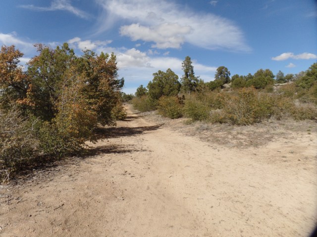
The dryness of our region concerns me, and we are doing all possible to avoid another serious fire season. This section of trail seemed drier than the last two, with sandy soil along much of the route.

SAMSUNG CAMERA PICTURES

This pump house is situated to help, in the event of another fire.

Another 1/4 mile ahead, the ruins of an old mining cabin attest to the ravages of fire.  The only thing left standing is the fireplace!

SAMSUNG CAMERA PICTURES

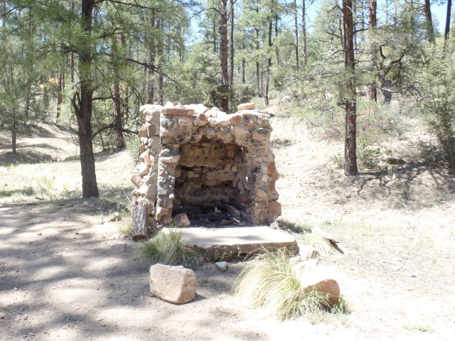
Fireplace Ruin, Javelina Trail, Prescott

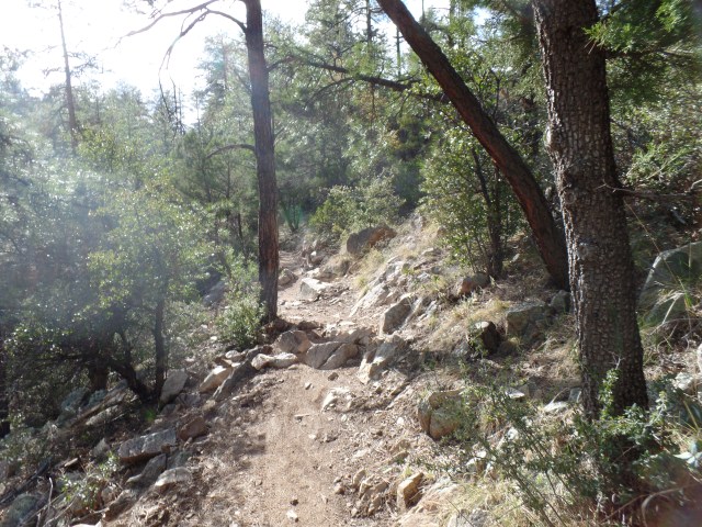
Granite boulders signal the turn-off from the abandoned rail bed, and Javelina Trail heads around a couple of small foothills of the Sierra Prieta.

SAMSUNG CAMERA PICTURES

Granite boulder field, Javelina Trail

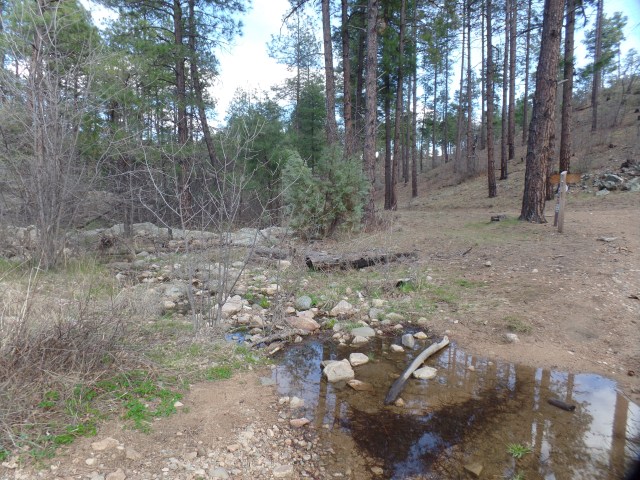
Willow Creek’s South Fork is the only running water along the trail, and it was not running today.

SAMSUNG CAMERA PICTURES

South Fork, Willow Creek

SAMSUNG CAMERA PICTURES

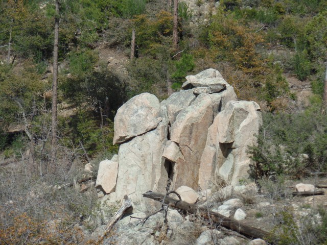
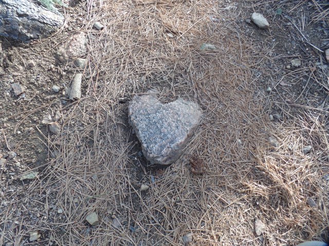
Looking vaguely like a moai head.

This boulder reminded me,obliquely, of a moai, from Easter Island.

Once I hiked over and above the drainage area of Willow Creek, Thumb Butte could be seen to the southeast.

SAMSUNG CAMERA PICTURES

Northwestern view of Thumb Butte.

Arizona woodpeckers are active here, as elsewhere along Prescott Circle Trail. As I learned last summer, in the Whatcom Museum, Bellingham, WA, these birds share nests with a variety of other creatures.

SAMSUNG CAMERA PICTURES

Arizona Woodpecker nests, Javelina Trail

So I have explored another segment of our area’s comprehensive trail system.  One segment remains- the area between Iron Springs and Williamson Valley Road, a distance of 5 miles each way.  I will see whether the effects of the 2013 Doce Fire are as telling there, as they are, in patches, here.

Prescott Circle, Segment 3: Copper Basin to Thumb Butte Road

2

April 9, 2016, Prescott- My companions today were about a dozen bicyclists, a few lone hikers, three herds of deer and birds-lots of them.  A wild turkey, or two, could be heard gobbling in the woods above Manzanita Creek- about a mile from Copper Basin Road.

With my Saturday afternoon appointment canceled, due to illness, and with a break in the storms, the trail called-loudly.  Who am I to turn down Mother Nature?

Choosing to use paved Thumb Butte Road, and one of its turnouts, as a safe place for my car, I opted to start the hike at the end point, and do the entire 10-mile round trip in an afternoon.  The jaunt took 4 1/2 hours.

SAMSUNG CAMERA PICTURES

Miller Creek, near Thumb Butte Road

There are several creeks, coming off the Sierra Prieta, in this section of trail. Miller Creek is the northernmost, followed, north to south, by Butte, Aspen and Manzanita- which has the nicest little canyon in the area.

As I made my way up Porter Mountain’s northeast peak, also called Williams Peak, it was telling, just how severe the Indian Fire of 2002 was to this area, itself so close to the Granite Basin, which was later to be ravaged by 2013’s Dolce Fire.  These collective memories, compounded by the dire tragedy of Yarnell Hill (which followed Dolce by two weeks), make us here in Prescott that much more grateful for this morning’s rain- and that which is expected to follow, this coming week.

SAMSUNG CAMERA PICTURES

Cloud, reaching up from base cirrus.

As if offering confirmation of my thoughts, a cirrus finger reached up from its base cloud, towards other clouds above.

SAMSUNG CAMERA PICTURES

Granite Mountain, from Williams Peak

Williams Peak offers a fine vantage point for the majesty of Granite Mountain.

A pair of Arizona Woodpeckers hung around, while I was admiring the scenery, so I obliged them with a portrait.

SAMSUNG CAMERA PICTURES

“Stormtrooper” Rock, Butte Creek Valley

As I headed into the Butte Creek watershed, I was watched by a Storm Trooper.

SAMSUNG CAMERA PICTURES

Butte Creek Road, atop Williams Peak, Porter Mountain

The trail follows Butte Creek Road, along the flat ridge of Williams Peak, until one reaches the area known as “Hilltop”, where three trails converge.

SAMSUNG CAMERA PICTURES

Thumb Butte, from Williams Peak

A clearing on Butte Creek Road afforded the best view of Thumb Butte, from the west.  It is two miles northeastward, from here.

SAMSUNG CAMERA PICTURES

Butte Creek

Crossing Butte Creek, one heads into slightly more heavily forested, and somewhat more rugged, terrain.

SAMSUNG CAMERA PICTURES

South Ridge, Williams Peak

SAMSUNG CAMERA PICTURES

Manzanita Creek Canyon, near Dugan Camp, Copper Basin

Manzanita Creek Canyon is on my list of “picnic hike” spots, during the second half of June.  Dugan Camp, about a half mile southwest, is still an active resting place for trailer campers.

SAMSUNG CAMERA PICTURES

Apparent ruin of miner’s cabin, south of Manzanita Creek

This area has been popular with campers and miners alike, especially during the heyday of Copper Basin, in the early 20th Century.

SAMSUNG CAMERA PICTURES

Heart-shaped granite, near Copper Basin Road

There was another confirmation, waiting for me, close to the turnaround point, near Copper Basin Road.

SAMSUNG CAMERA PICTURES

Stump, from 2002 Indian Fire

This stump stands as a silent sentinel, to warn humans of the lasting effects of careless camping and shooting.

Finally, in the spirit of Asian artists who leave a flaw in each of their works, here is a scene of one of the three herds of deer, who crossed my path on the hike back to Thumb Butte Road.

SAMSUNG CAMERA PICTURES

Deer, the best wild animals for selfie poses.

On Quartz Mountain

12

April 9, 2016, Prescott- Last Sunday, I threw in a 1-mile round trip side trail, to my Prescott Circle jaunt.  Quartz Mountain is a unique promontory, in the mostly pine-clad, dry-soil terrain that is prominent in the western half of Prescott Circle.  It appears to be the remnant of a volcano, which also makes sense, given that quartz is scattered from White Spar to an area just west of Thumb Butte.

I had the brief company of two men and three children, who had been atop the mountain for an hour or so, studying the quartz and learning of the different colour blends.  Most, as you will see, are white quartz, though there is a fair amount of pink, and some two-tone.

SAMSUNG CAMERA PICTURES

East side of Quartz Mountain

I checked out this area, just below the summit, before heading up.

The views from any point near the summit are thrilling.

SAMSUNG CAMERA PICTURES

San Francisco Peaks, from Quartz Mountain

Now, here are several scenes of the summit.

SAMSUNG CAMERA PICTURES

Iron-tinged white and gray quartz, Quartz Mountain summit

SAMSUNG CAMERA PICTURES

Southwestward, from Quartz Mountain, towards Sierra Prieta

SAMSUNG CAMERA PICTURES

View of Quartz Mountain summit crest, from just underneath

SAMSUNG CAMERA PICTURES

Agave and prickly pear cacti, Quartz Mountain summit

As you can see, the desert aspects of Prescott’s status as a transition zone are quite prolific, even at 6,000 feet.

This little gem is one of several good reasons for side hikes, off the main Circle Trail system.

As it happened, today (April 9), was a good day for Segment 3 of the Circle.  It’ll be featured in the next post.

Prescott Circle Trail, Segment 4: White Spar to Copper Basin, Part 2

4

April 6, 2016, Prescott-  While we were living in Phoenix, in 2002, news came of a horrific wildfire, that was bearing down on Prescott:  The Indian Fire.  It could easily have swept through Thumb Butte and down Copper Basin, slamming full force into downtown Prescott.  That didn’t happen, thanks to the Forest Service, and the fates of Nature.  As it was, though, the Indian Fire seared a large area between White Spar and Copper Basin, leaving several square miles of sticks in its wake.

On Sunday afternoon, I walked in some of the same areas affected by the Indian Fire. Wolverton Mountain rises above the trail, though no family named Clowers lives there. Quartz Mountain is reached by a side trail, about 1/2 mile south of Wolverton.  Both peaks were singed in 2002.

I began at the Copper Basin end of the segment, starting out on the Aspen Creek Trail.  The creek comes down, from the western base of Wolverton Mountain, and flows down towards Granite Creek and downtown Prescott.  The creek is barely flowing, and indeed, the ground in this area is badly in need of a soaking.

SAMSUNG CAMERA PICTURES

Trailhead, Aspen Creek Trail

SAMSUNG CAMERA PICTURES

Gray granite, Aspen Creek Trail

I came soon enough to the upper reach of Aspen Creek Canyon.

As the sun was getting a bit lower, I came to the junction with Wolverton Mountain Trail and Quartz Mountain side trail.  Walking along the Wolverton, I had several fine views of the high ridge of the Sierra Prieta Range, of which these peaks are an eastern offshoot.

A glimpse of Wolverton Mountain’s practical use was visible from the trail, though the summit itself will be the focus of a future hike.

SAMSUNG CAMERA PICTURES

Summit of Wolverton Mountain, from trail.

Shortly after passing Wolverton’s eastern edge, I came to Quartz Mountain Trail.  This unique promontory will be the topic of the next post.