The Road to Diamond, Day 133: Mather Point

2

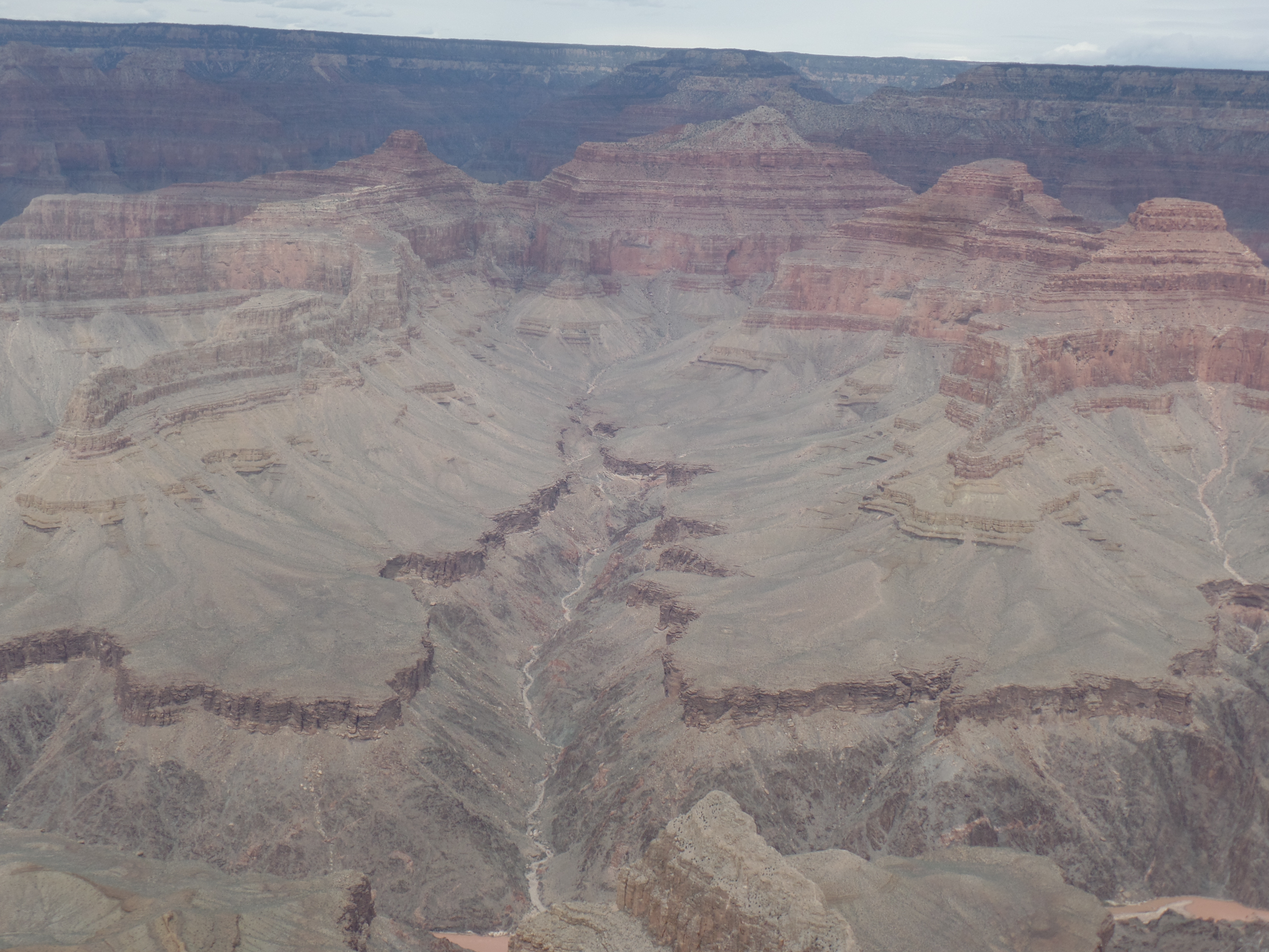
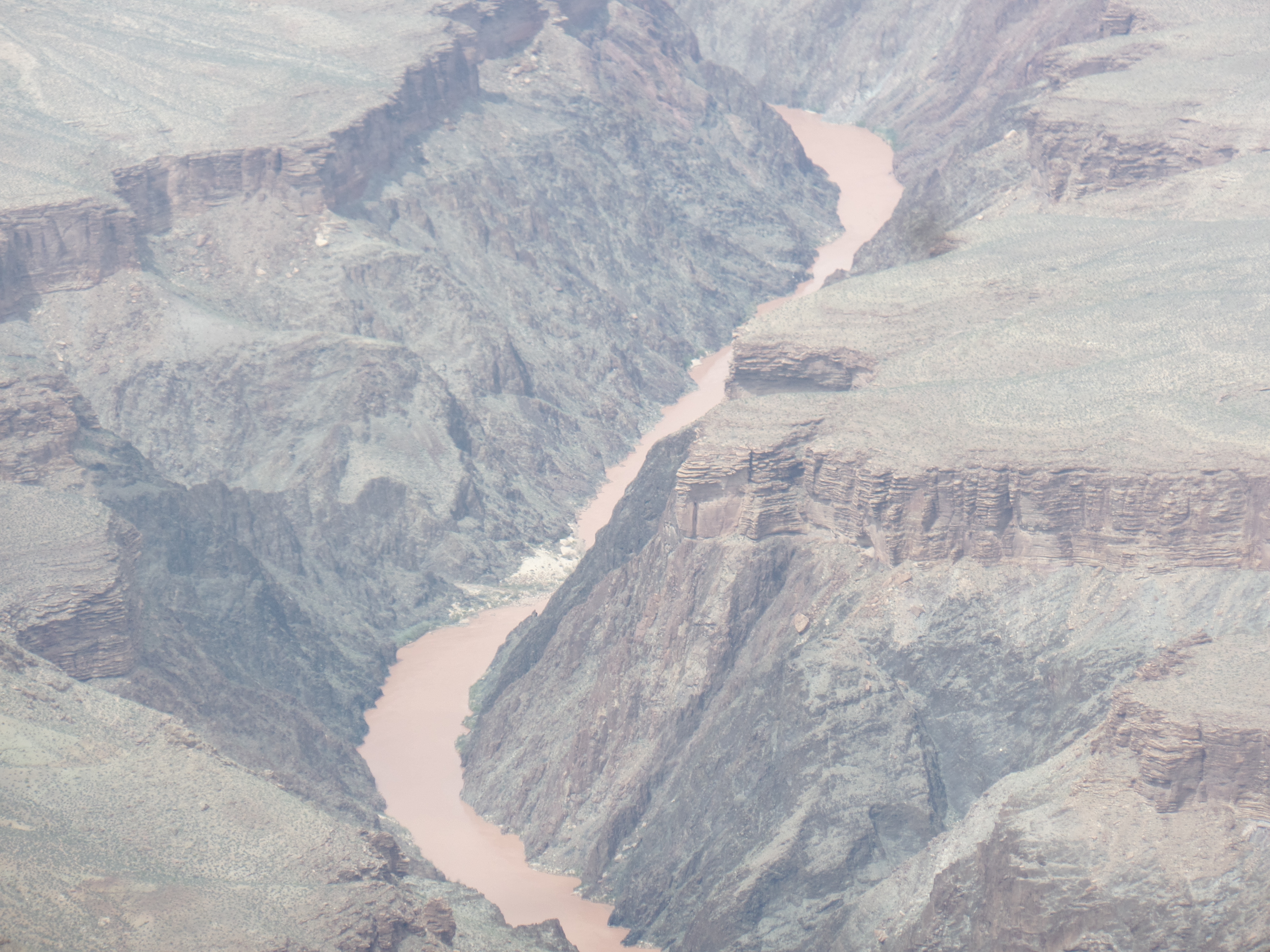
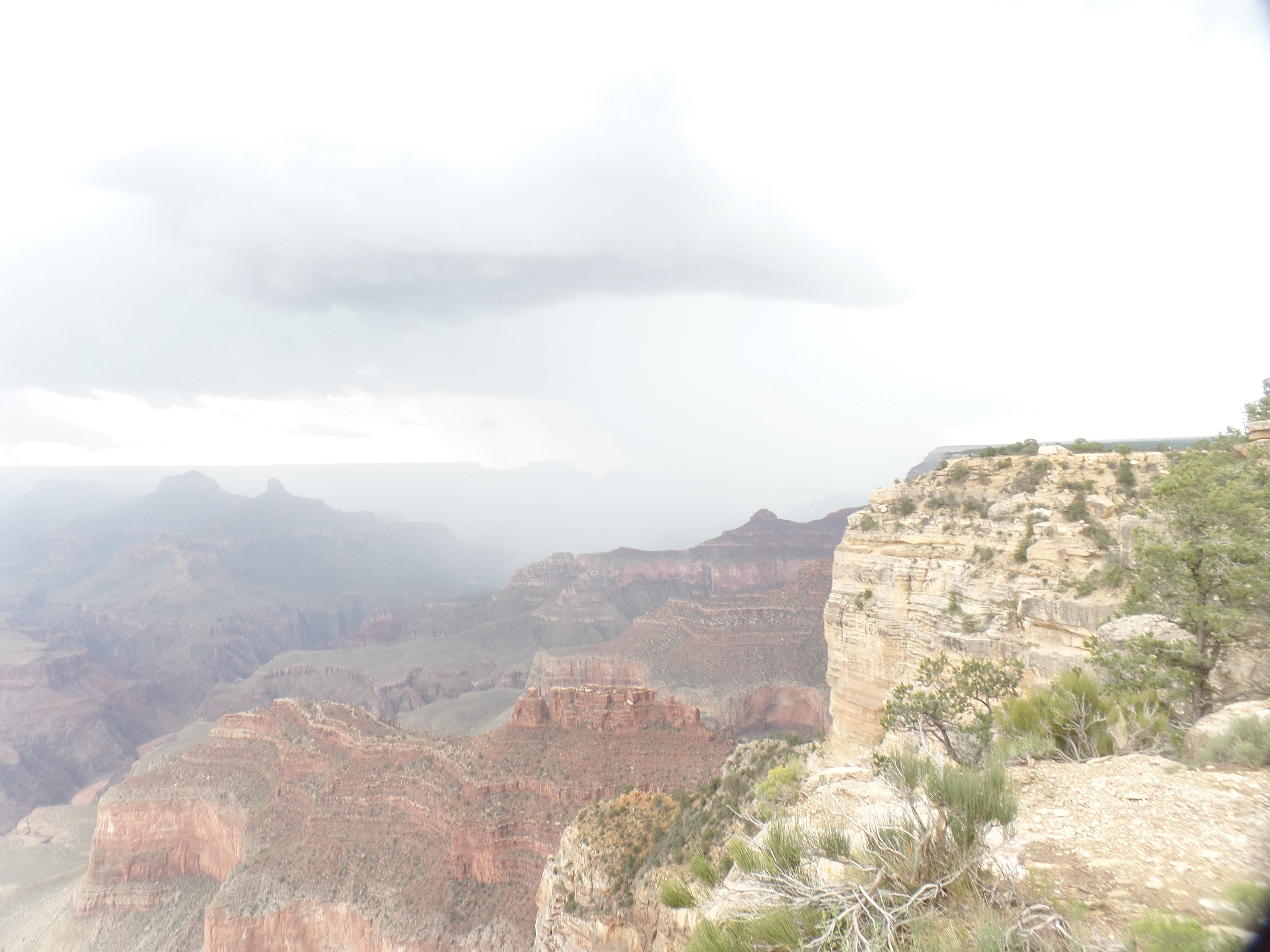
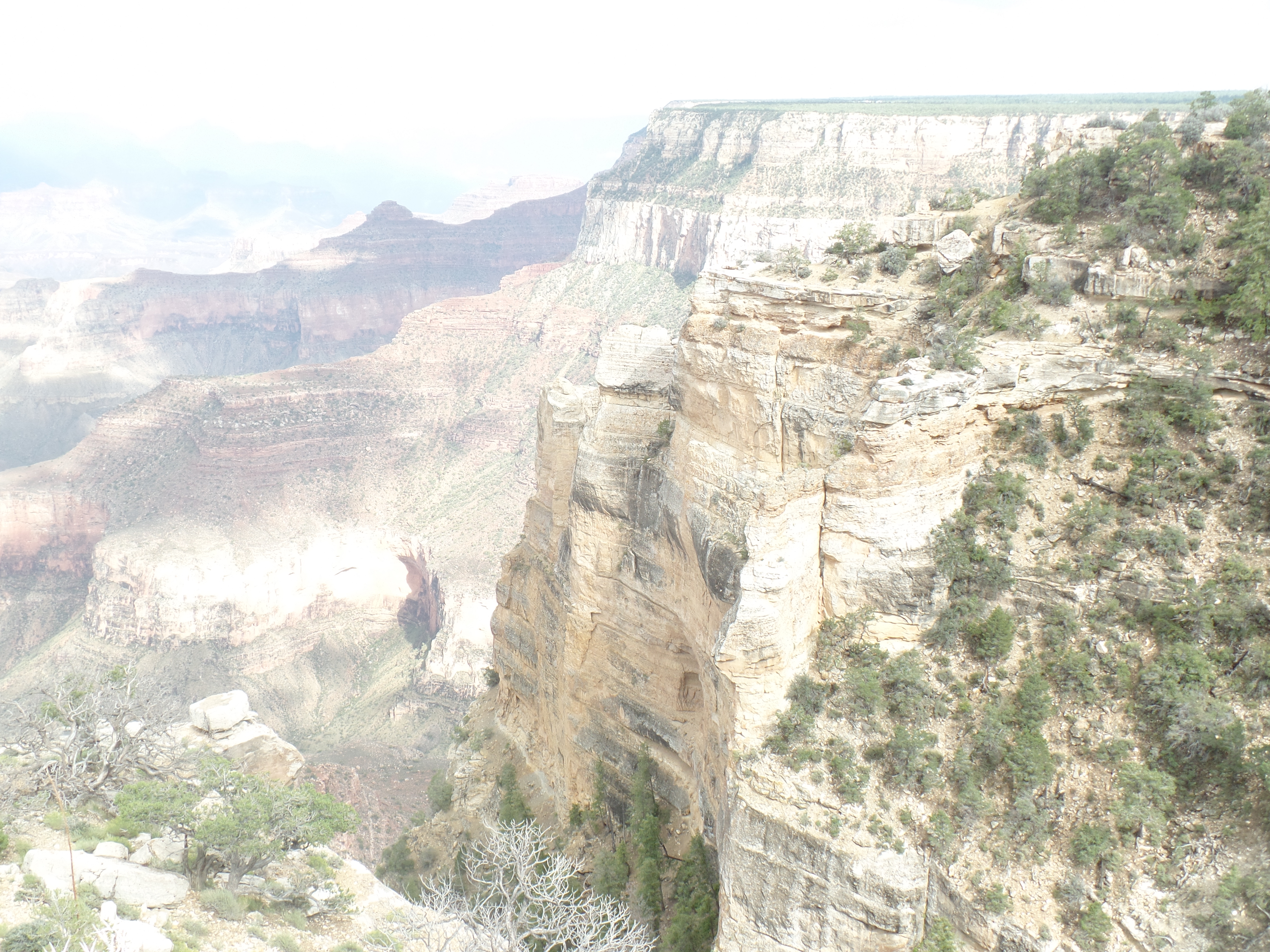
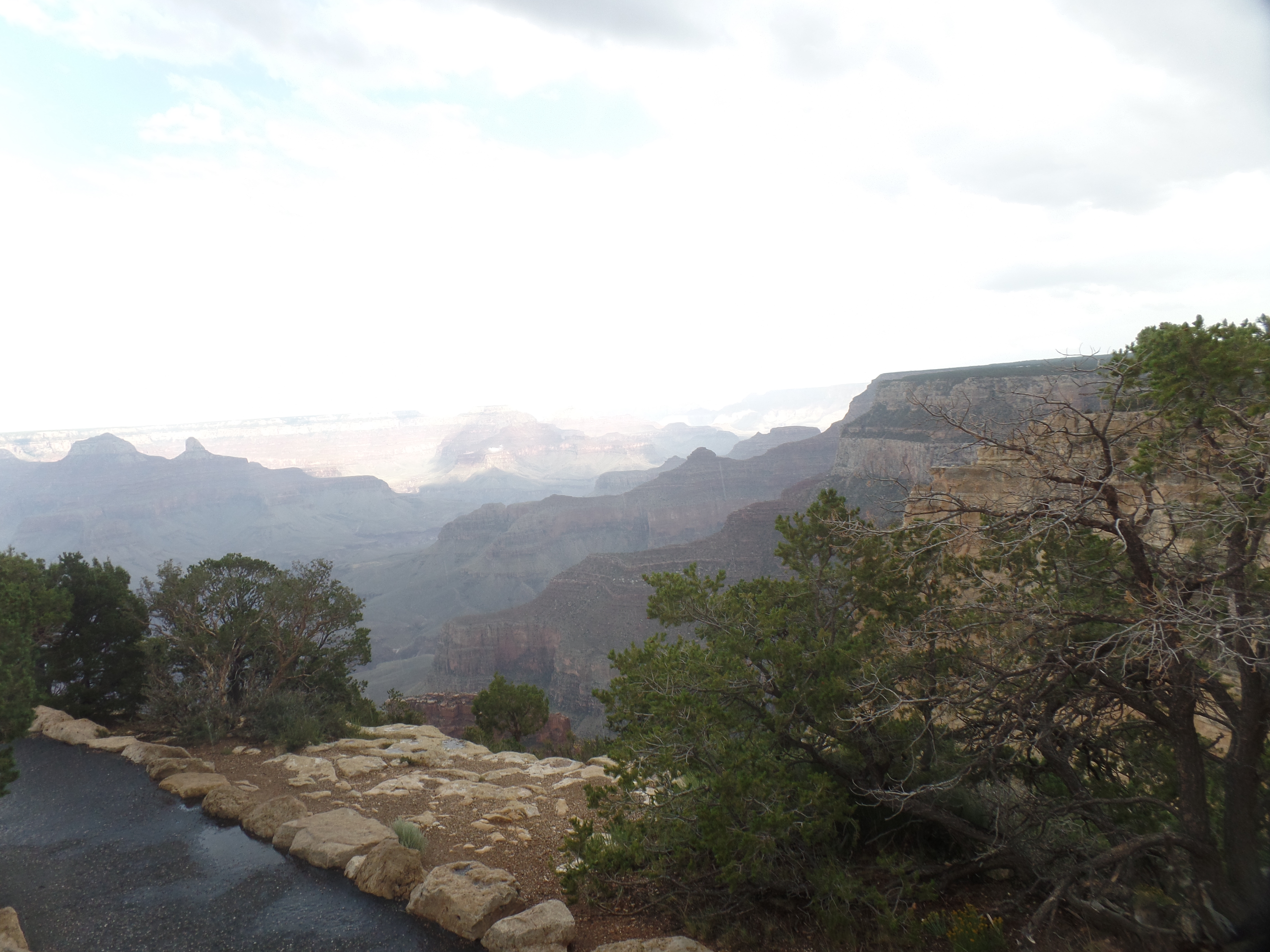
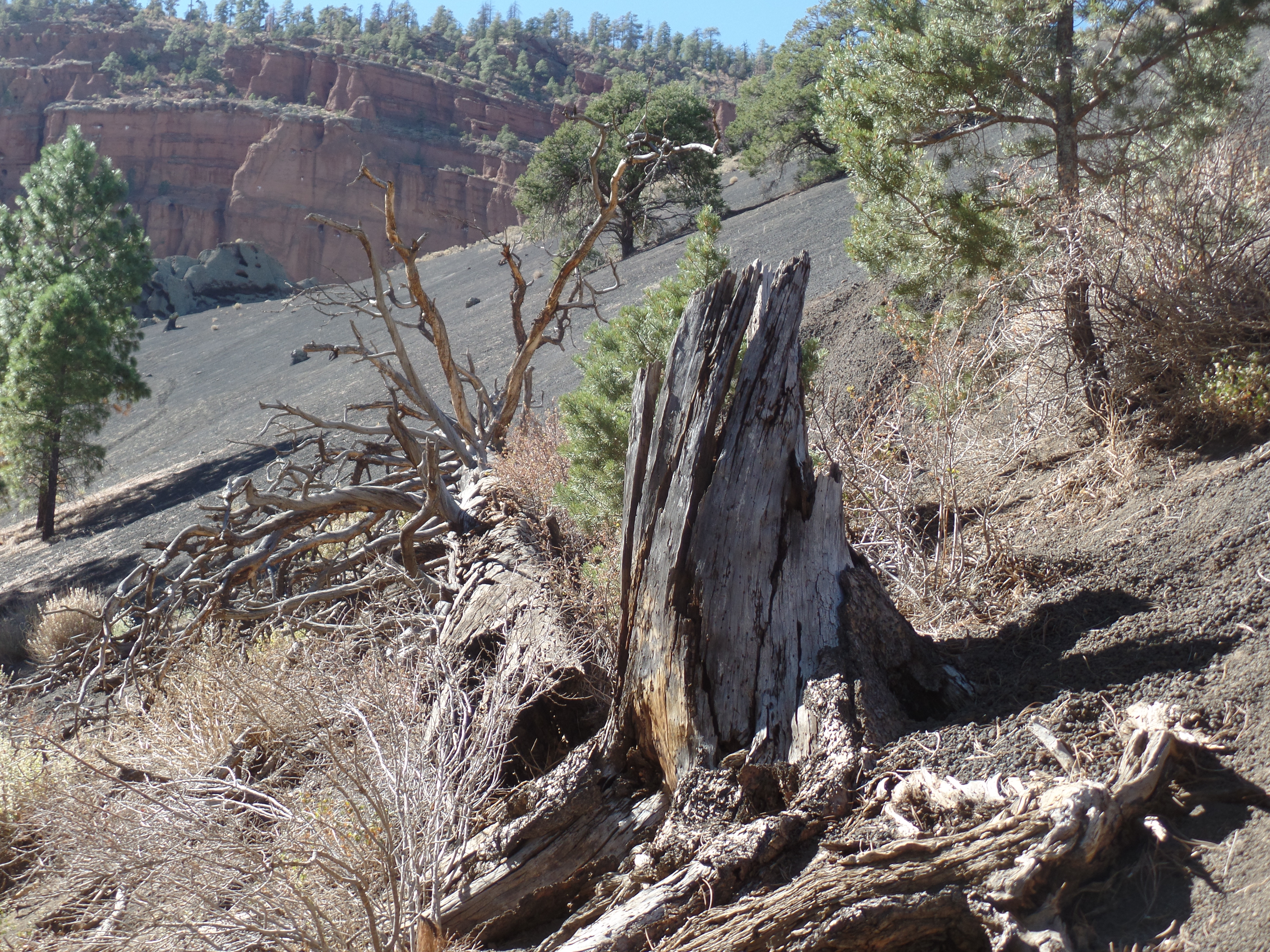
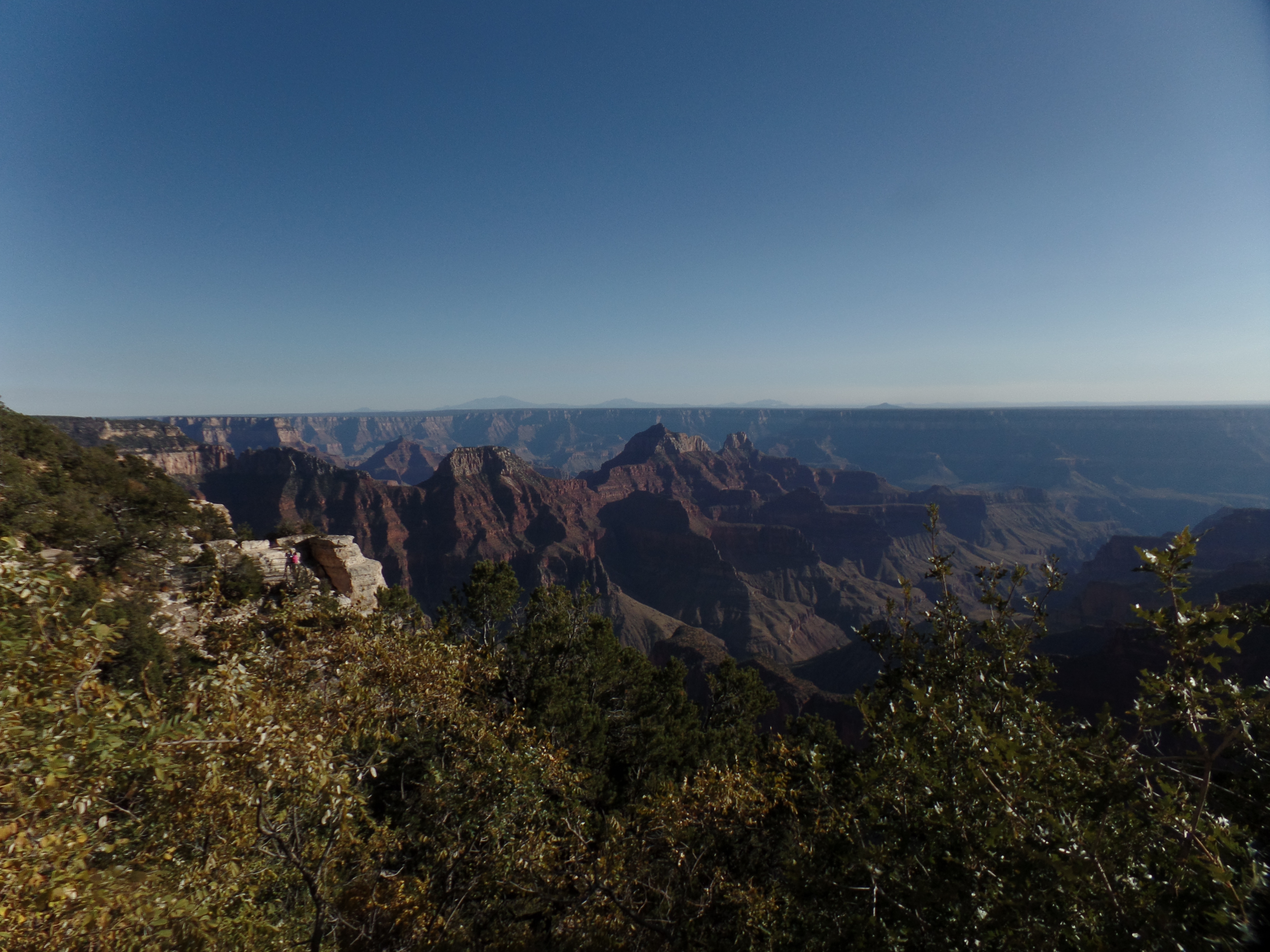
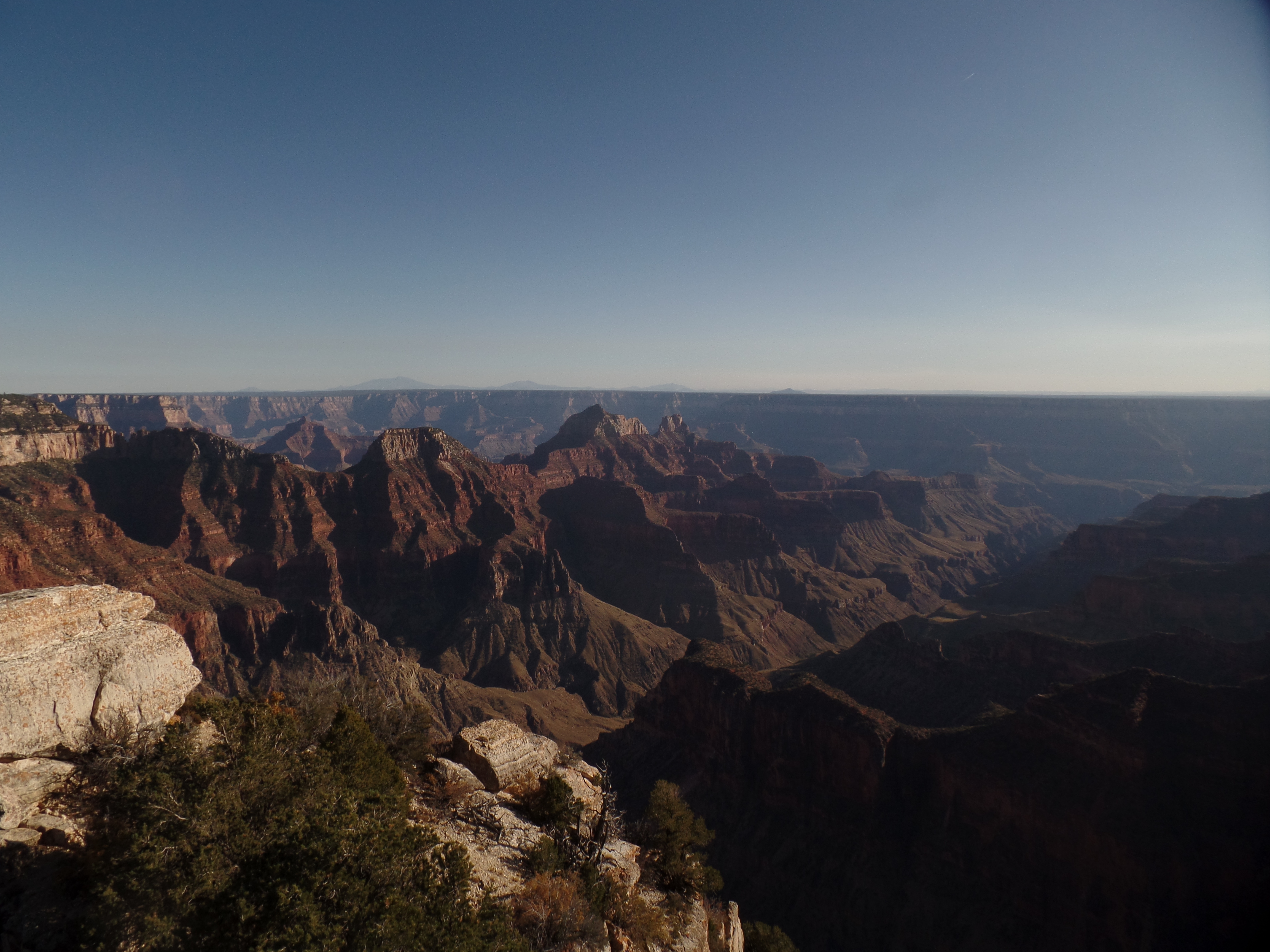
April 10, 2025, Williams, AZ- There is no one way to see the Grand Canyon. I have walked much of the Rim Trail, stood at high points with sheer drop-offs of 3,000 feet, hiked to the Colorado River and back,on the same day and in summer heat and visited ancillary spots, like the Confluence with the Little Colorado River or Havasupai Falls. I have taken meals in El Tovar Hotel’s dining room (with Penny and my parents) and eaten a grab and go sandwich at Hermit’s Rest snack bar. It is all what makes this place so indelible in the mind of anyone who has ever stood in The House of Stone and Light.

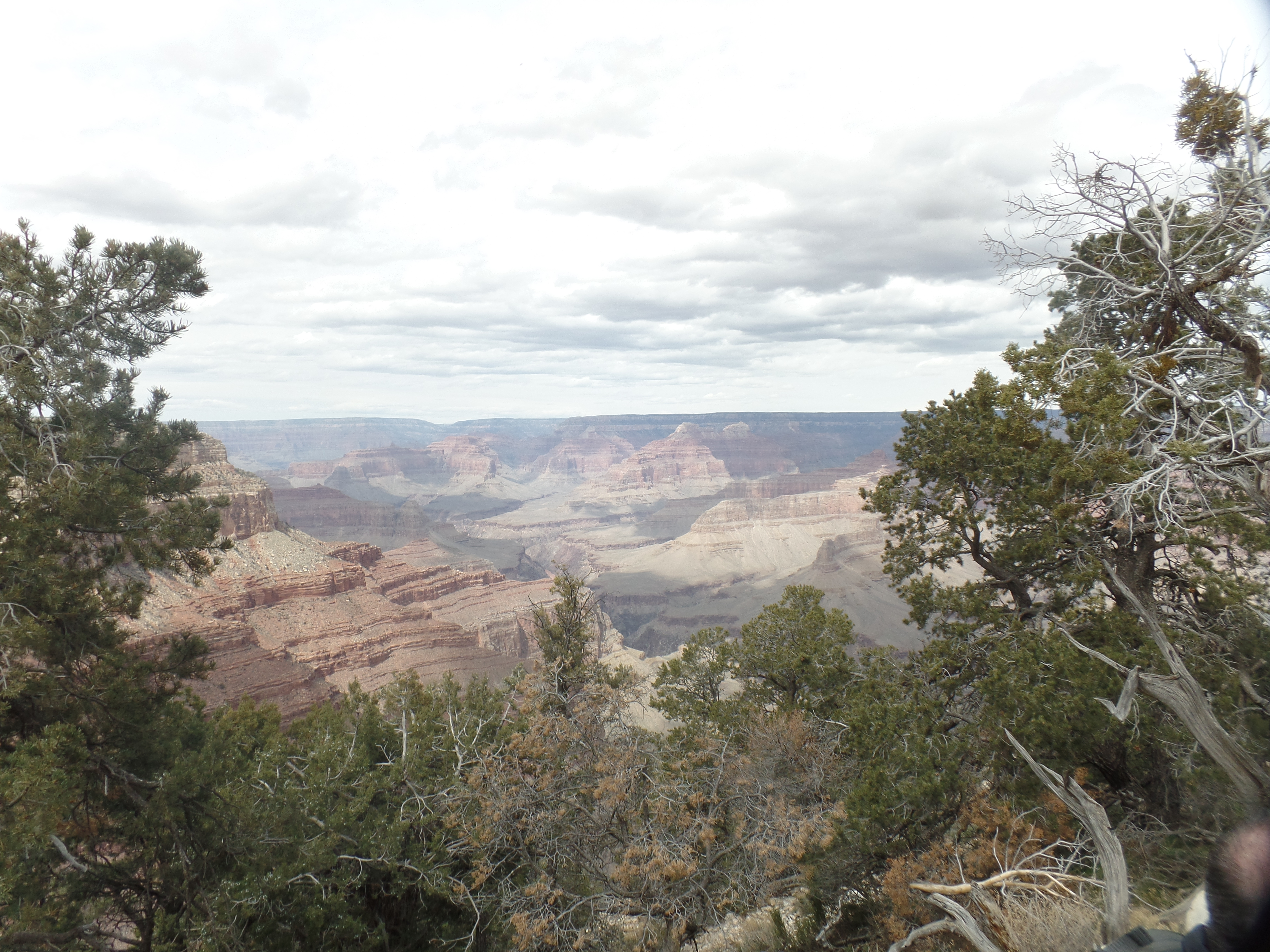
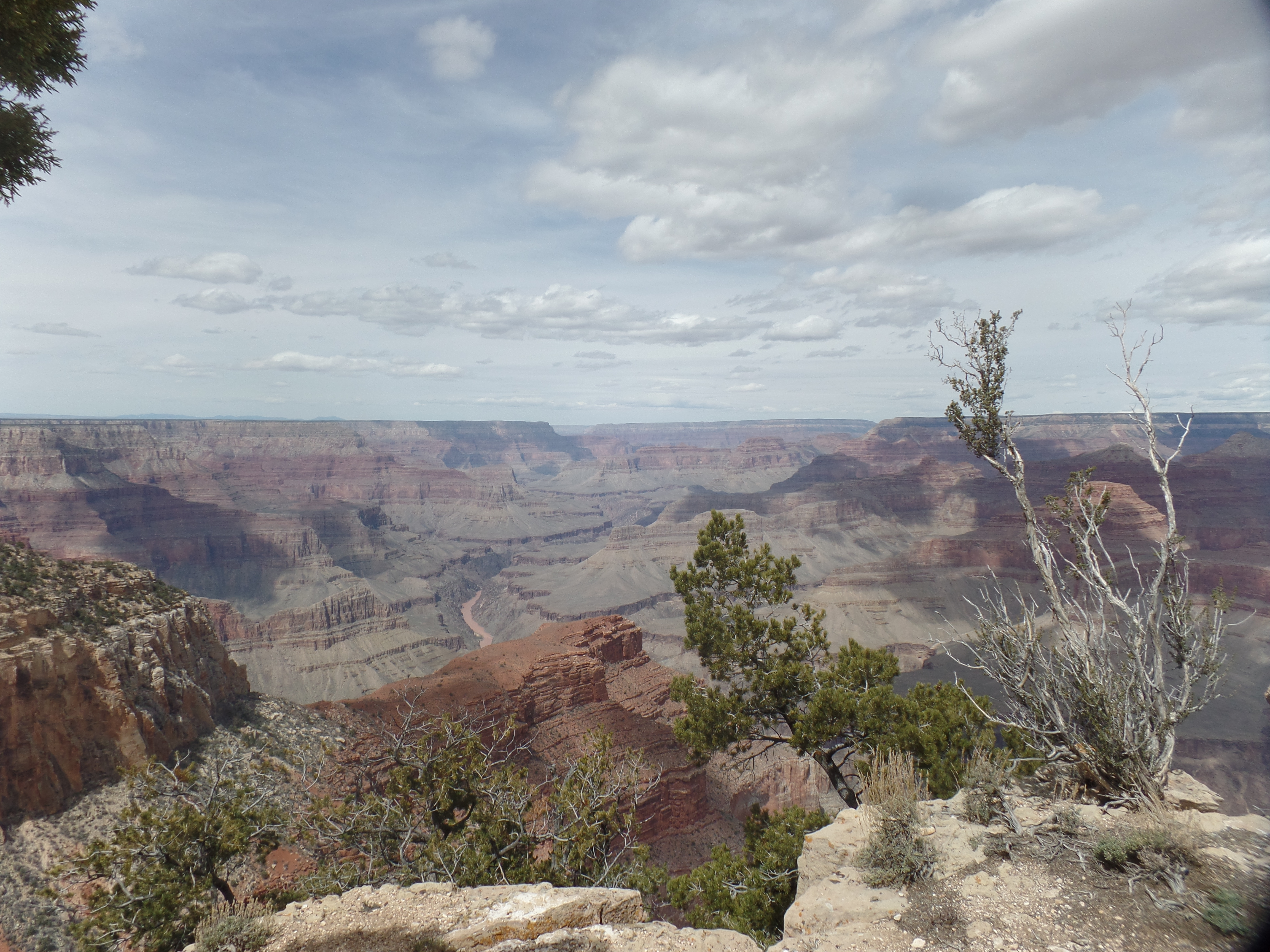
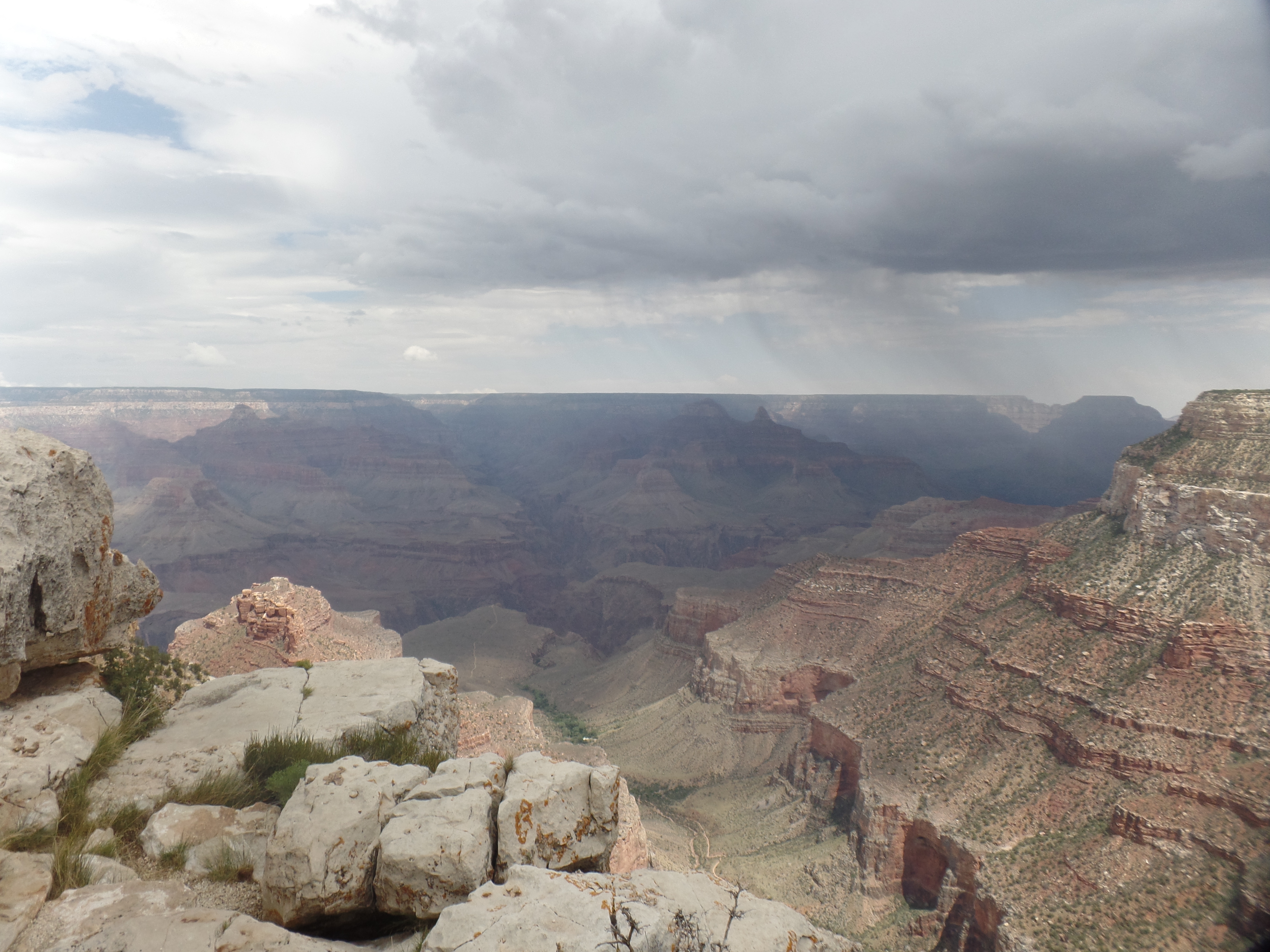
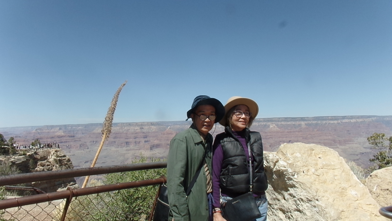
My visiting friends had never seen anything quite like the Grand Canyon. When we stood at Mather Point, in the noon transition, the sun was high overhead and they had to position themselves carefully, so as not to be photographed in shadow, as happened yesterday in Sedona’s Tlaquepaque. They were awestruck, for several minutes. Then they looked right and left,, and decided that walking in the relative heat would not reveal anything different from what they were already seeing. They asked to head back to the car.

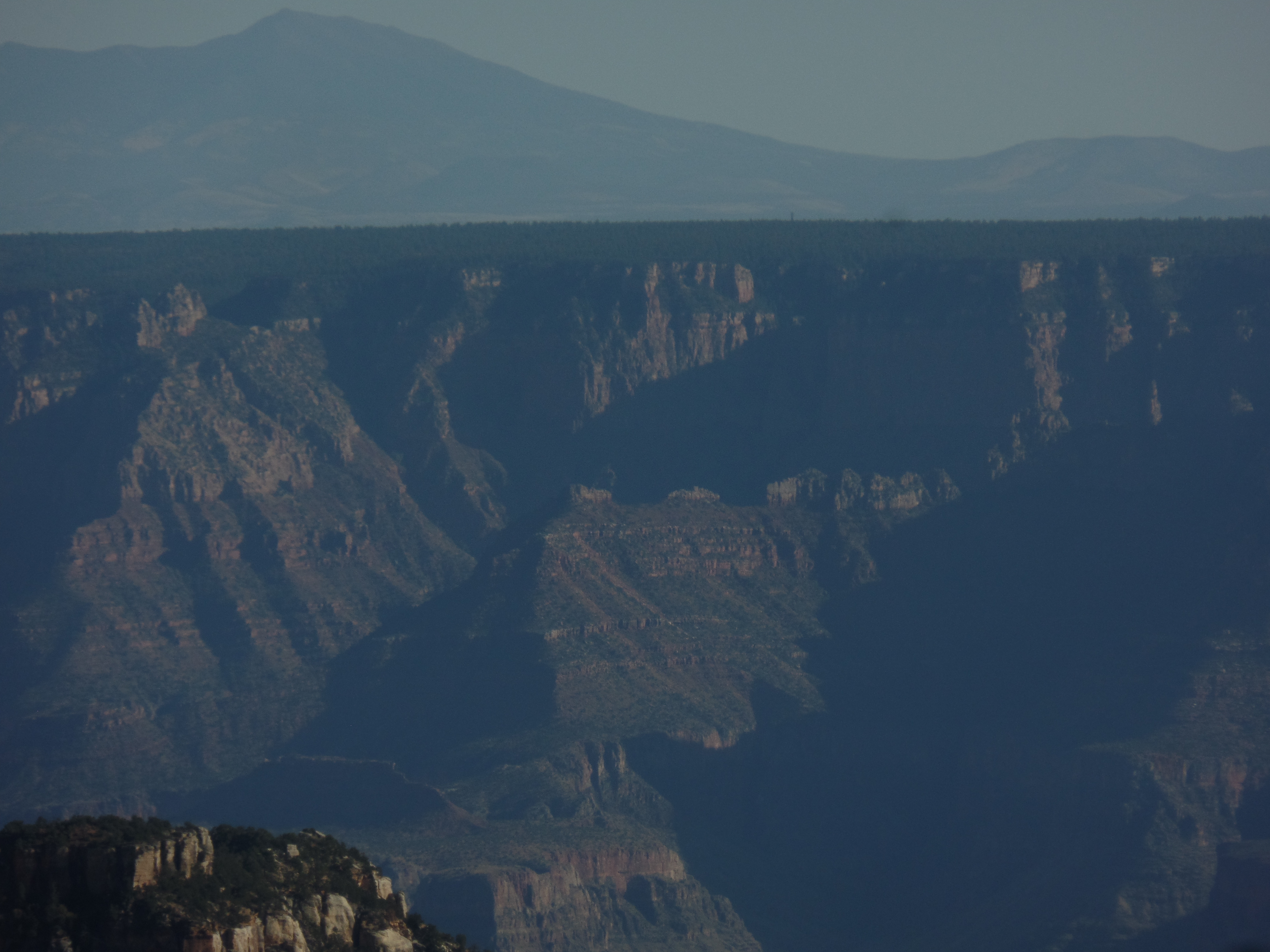
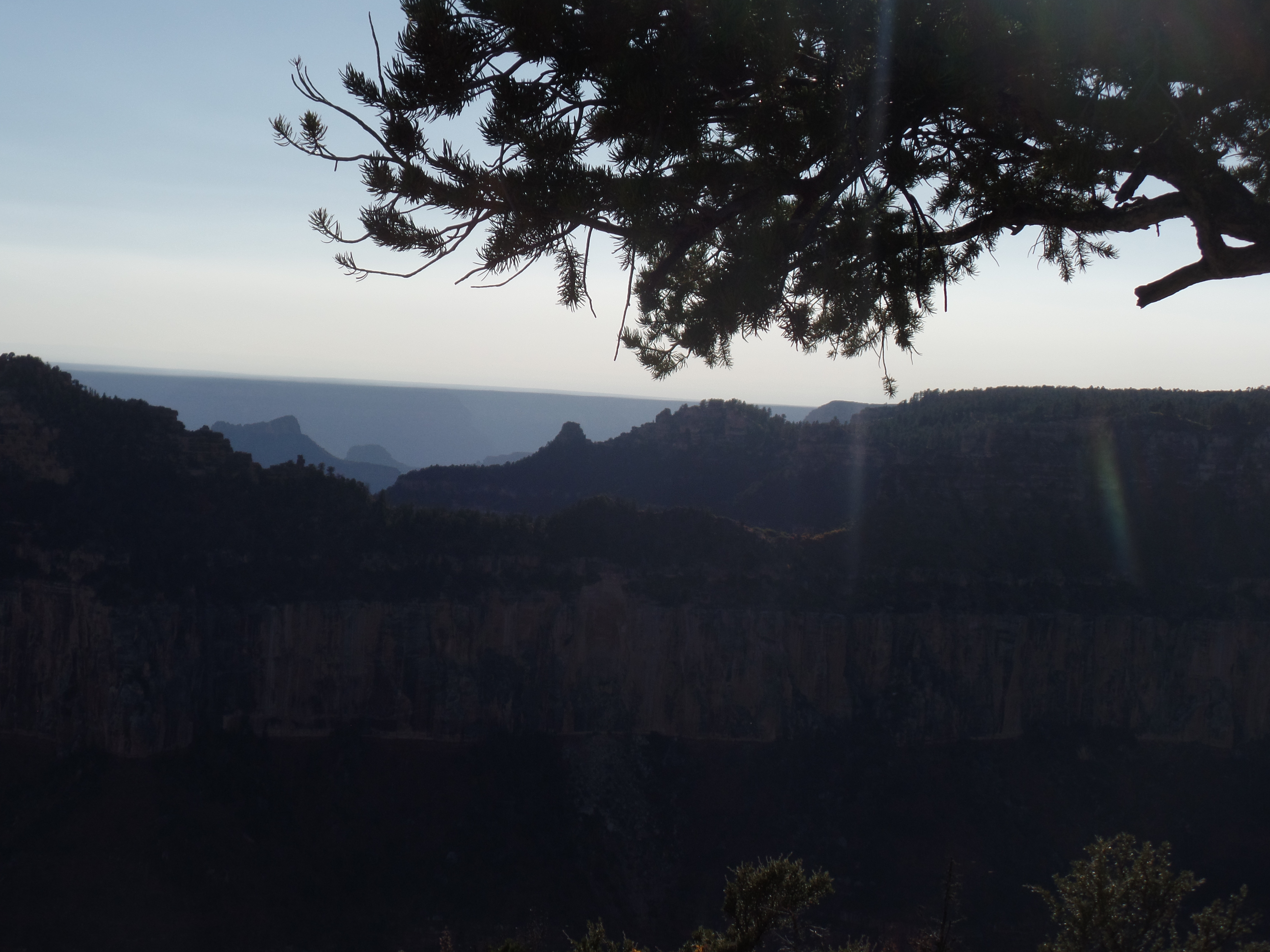
This is what they saw.

Mather Point 1
First view of the Grand Canyon
Mather Point 2
Staying close, at Canyon’s edge

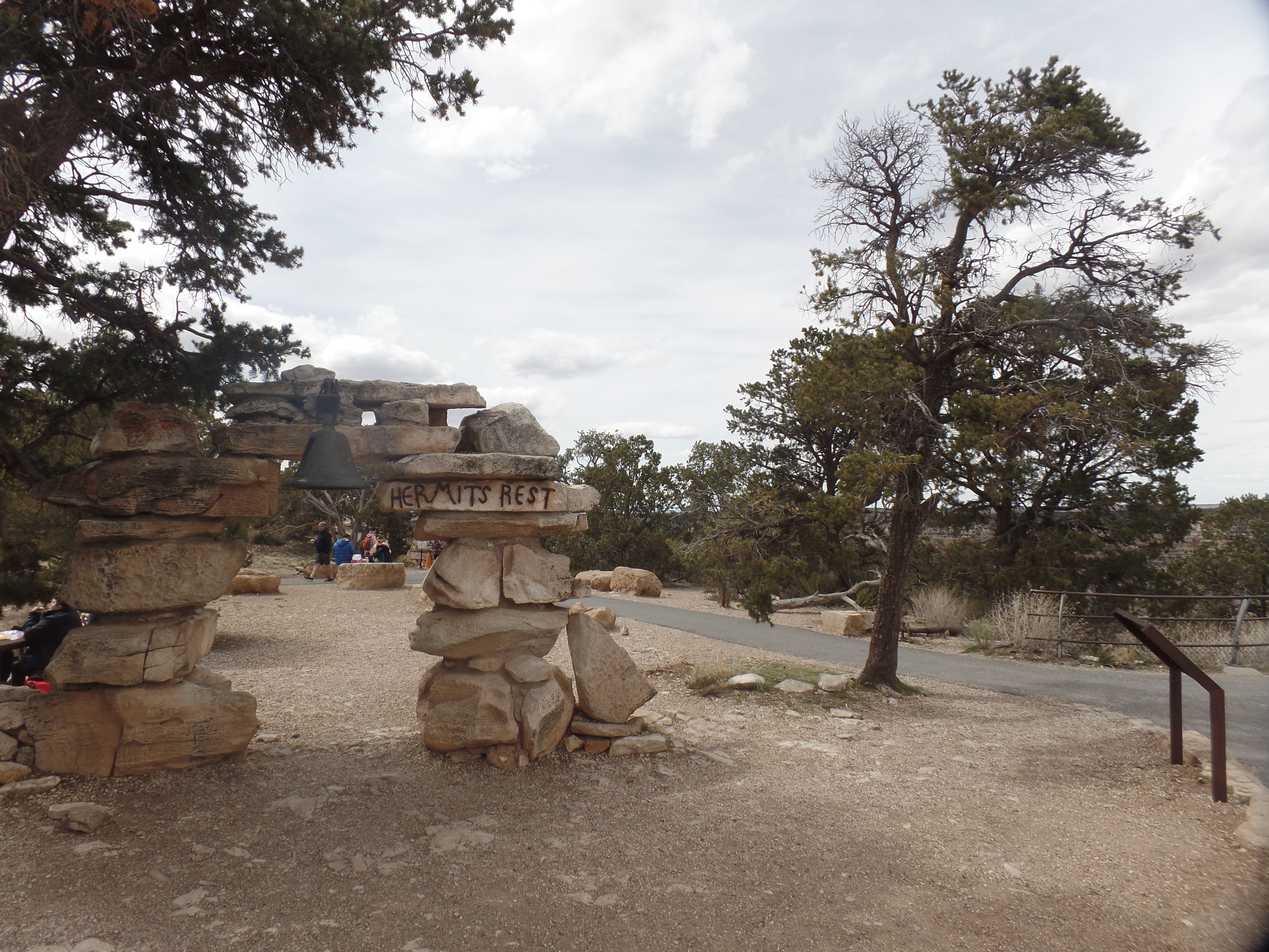
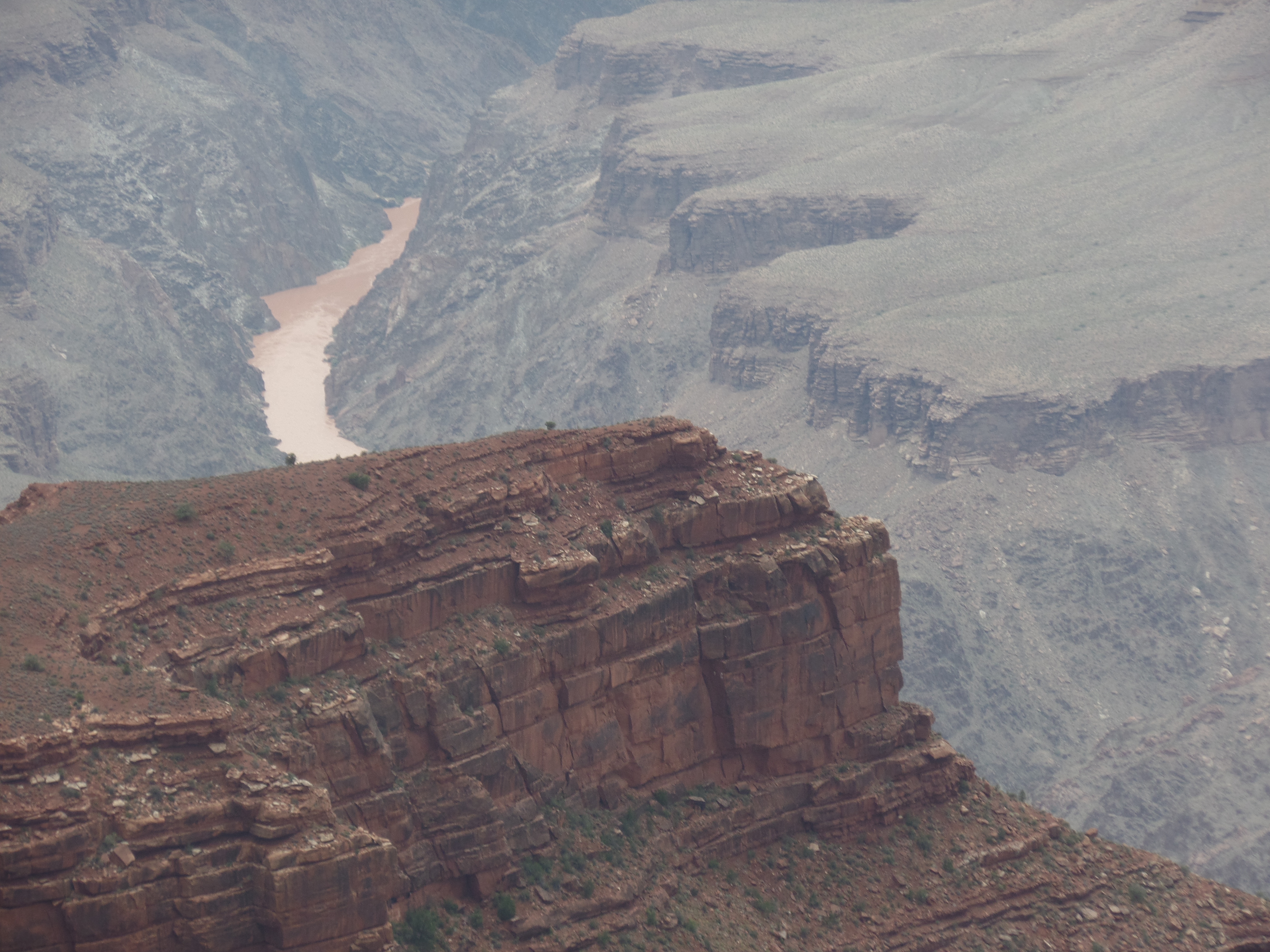
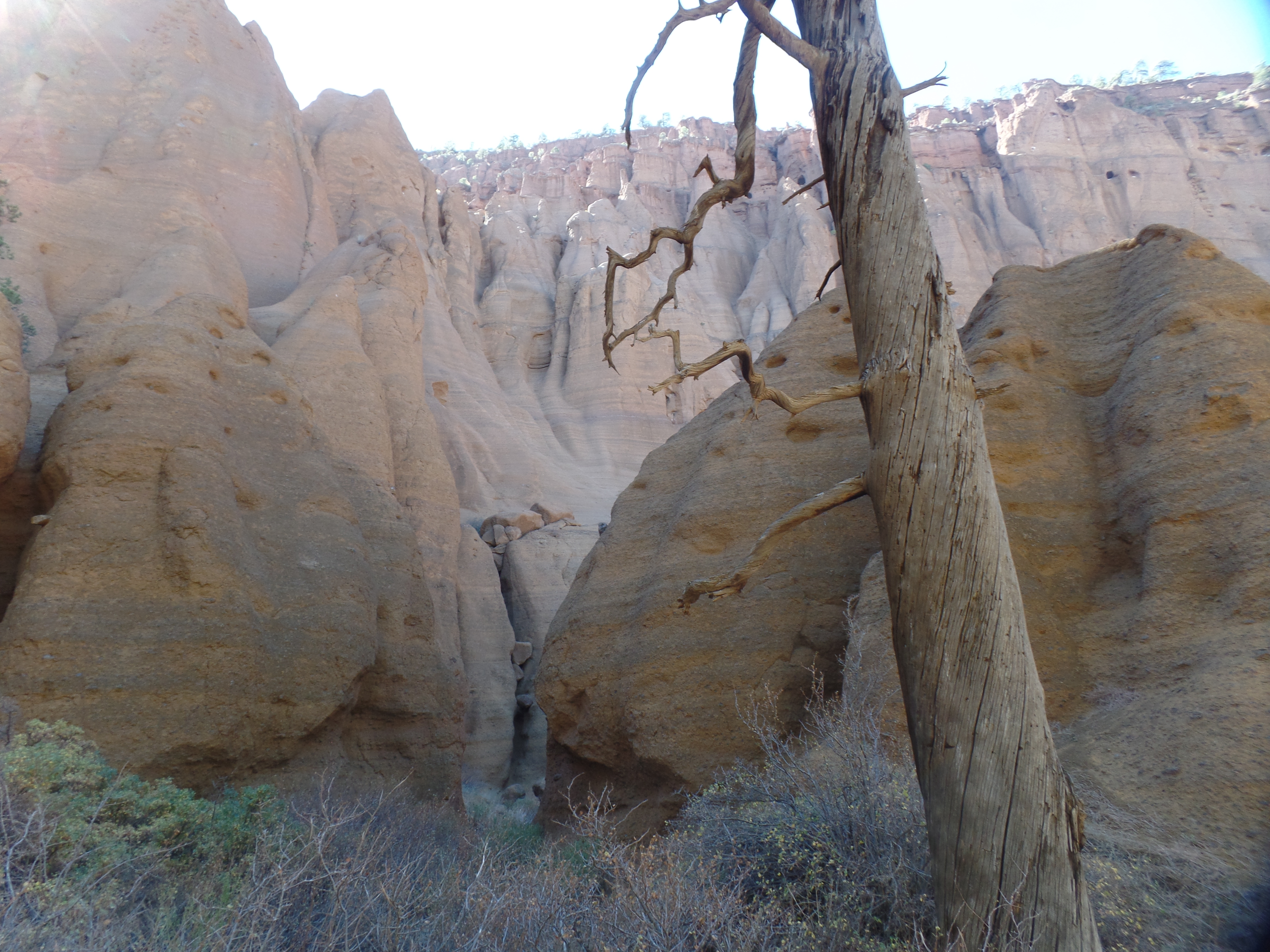
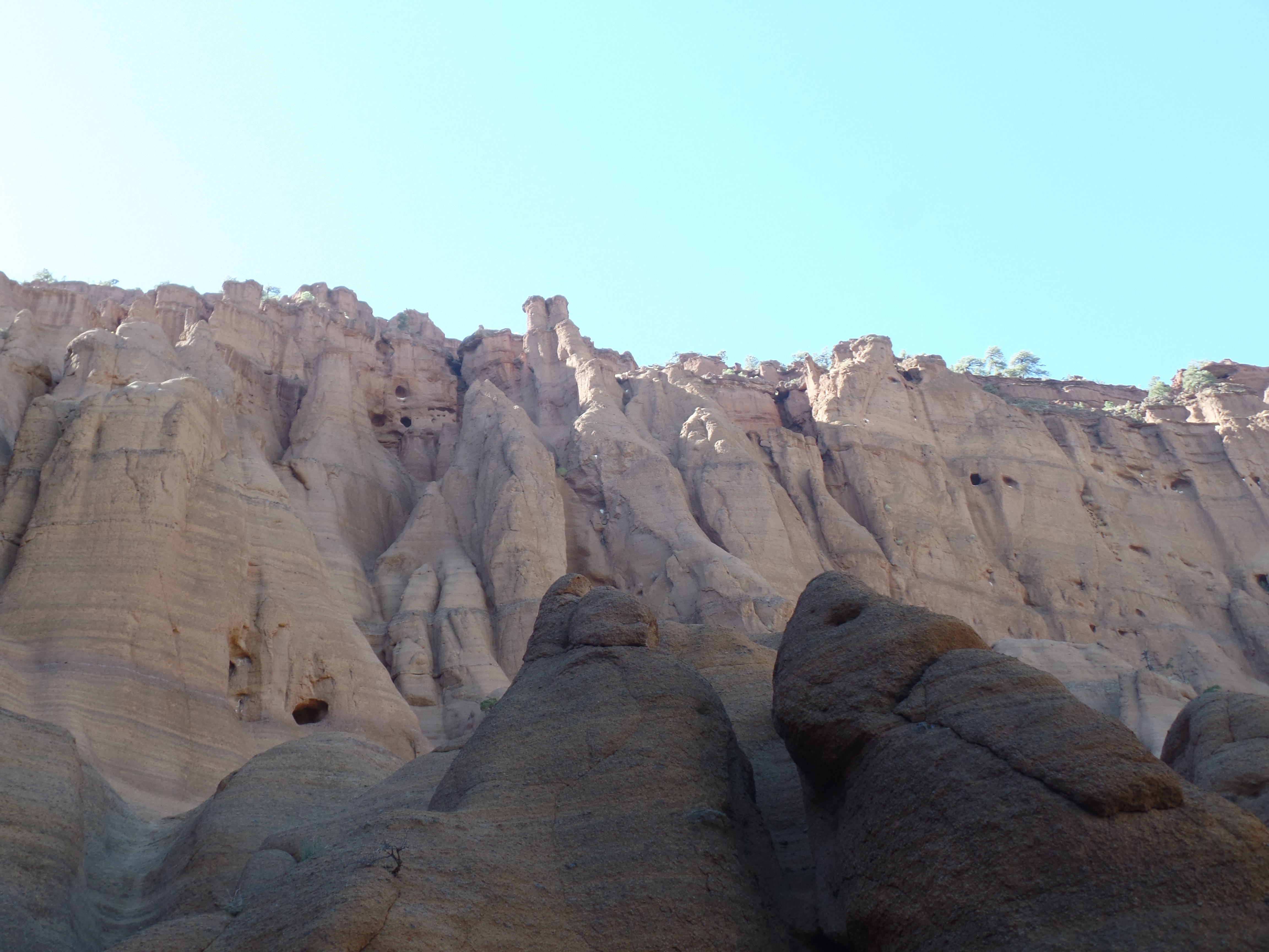
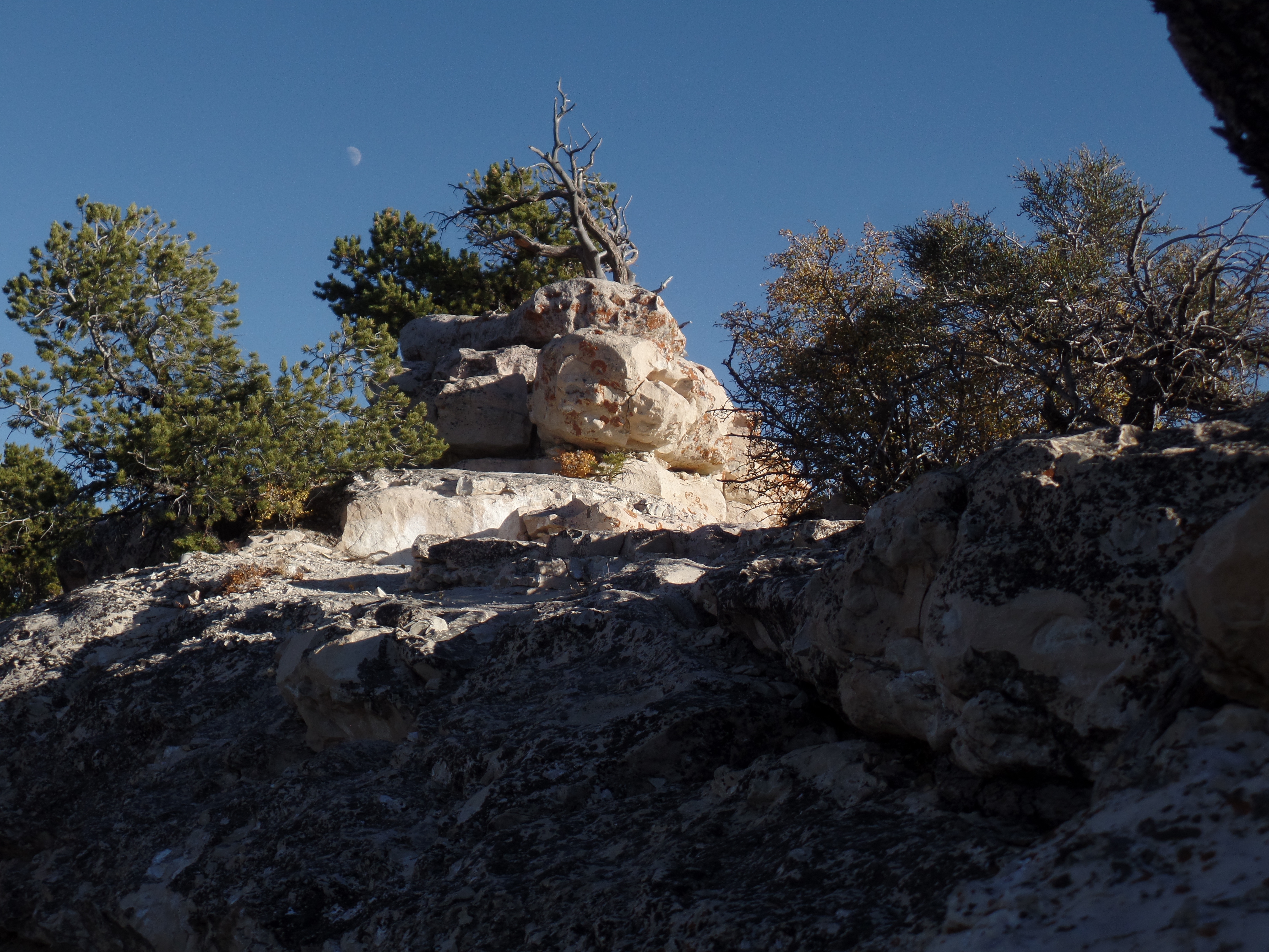
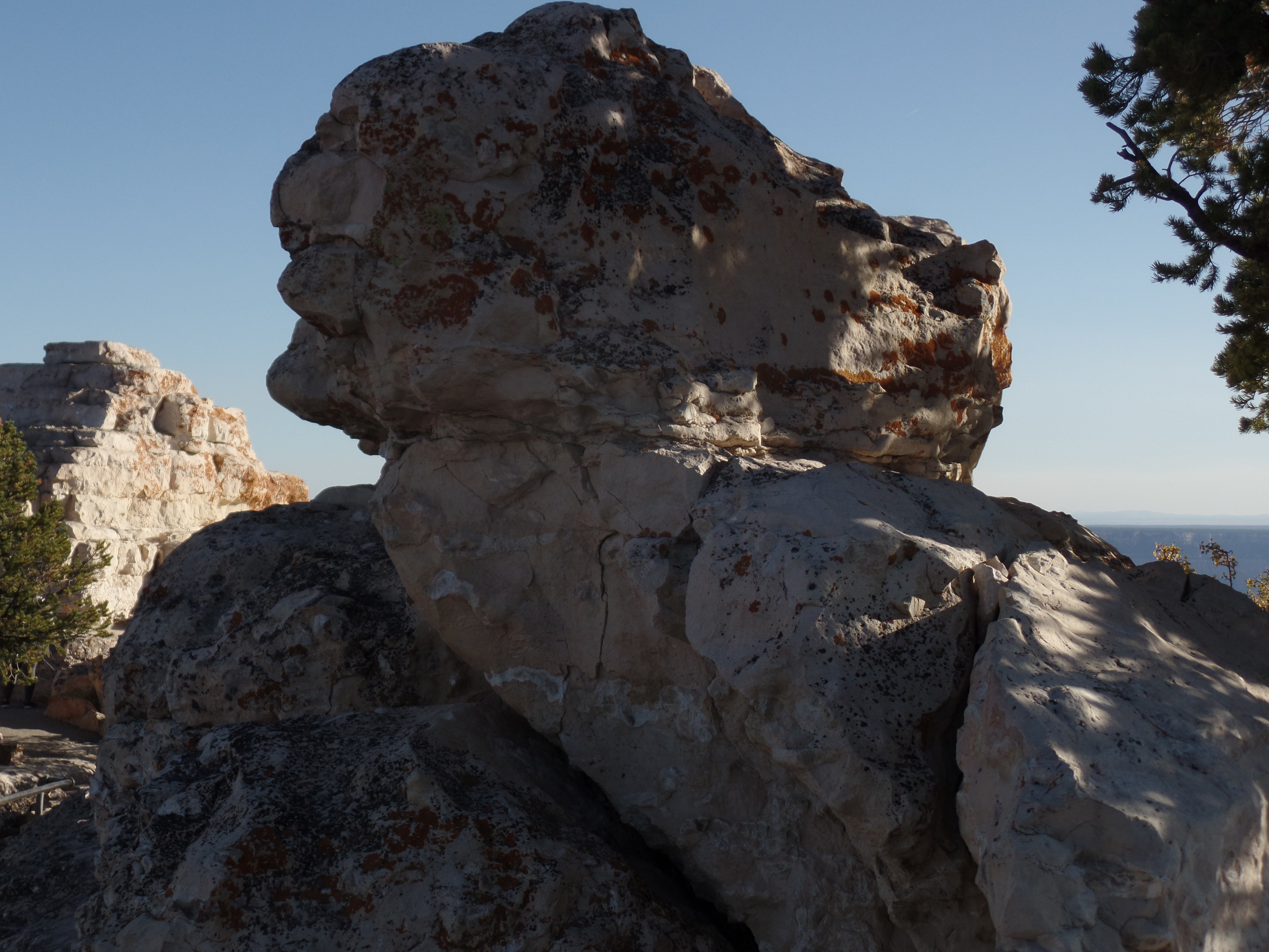
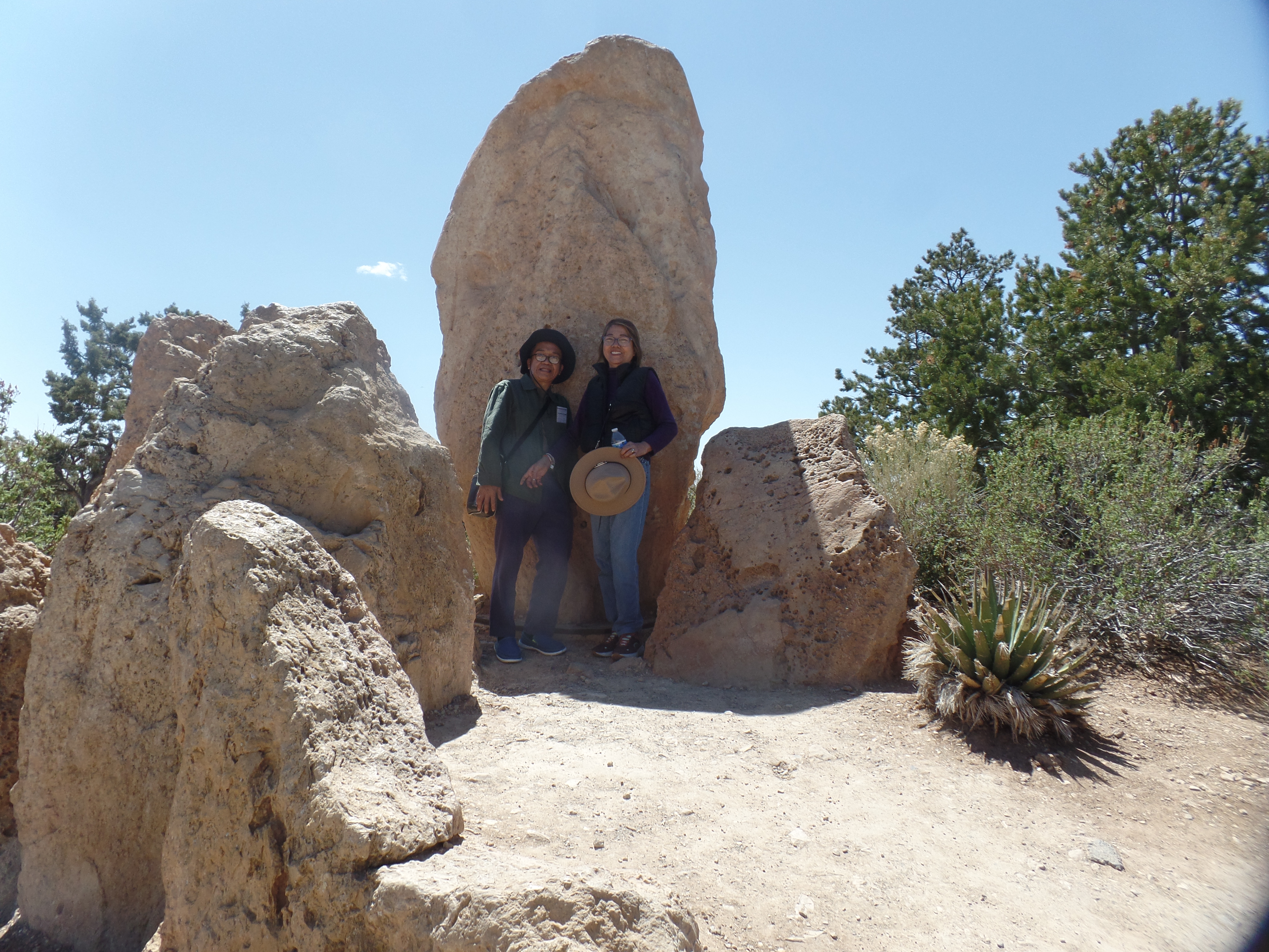
There is a unique collection of sandstone rocks, arranged at the approach to Mather. One of these is a menhir, evocative of Carnac or Stonehenge.

Mather's menhir
Bobot and Thelma meet a Standing Stone

It was lunch time, and being frugal sorts, my friends vetoed any meals in the Park itself. We opted for the simply-titled We Cook Pizza and Pasta, in nearby Tusayan, and shared a Classic Cheese pizza. It’s been a long time since I have actually enjoyed pizza with nothing more than cheese and tomato sauce. Simple was exquisite.

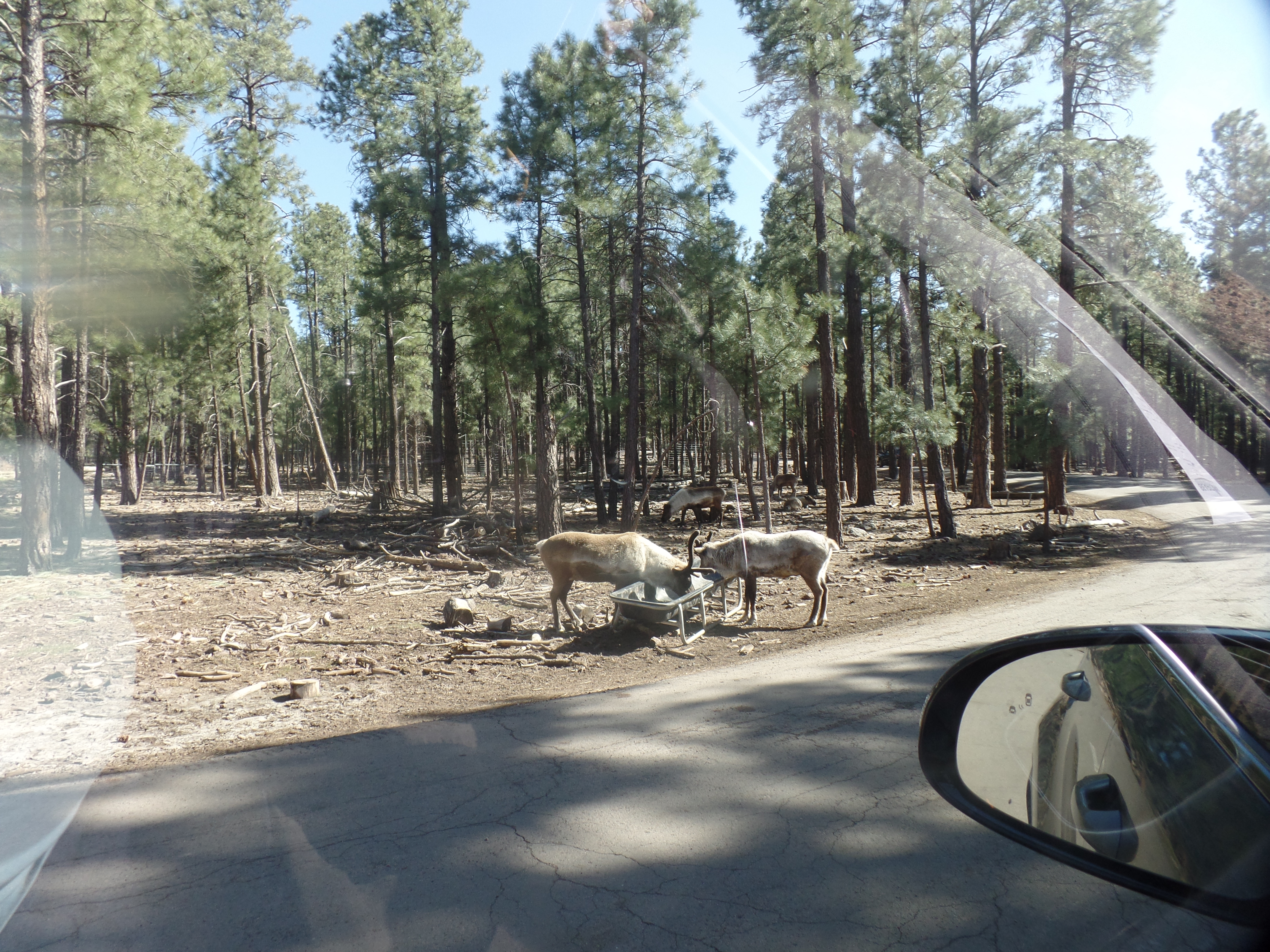
The day was not spent, so I took Bobot and Thelma to Bearizona, a park that lets people view wildlife, including apex predators, from their cars. The wolves and bears did not disappoint. There were also herbivores aplenty-mountain goats, bighorn sheep, deer, elk, reindeer and bison. None of these are prey for their neighbours, who are fed meat provided by the staff. Here are some that we saw, carside.

Bearizona 1
Bearizona’s reindeer

The wolves were curious, but laid back.

Bearizona 2
Curious Lobo
Bearizona 3
Tundra wolf trio

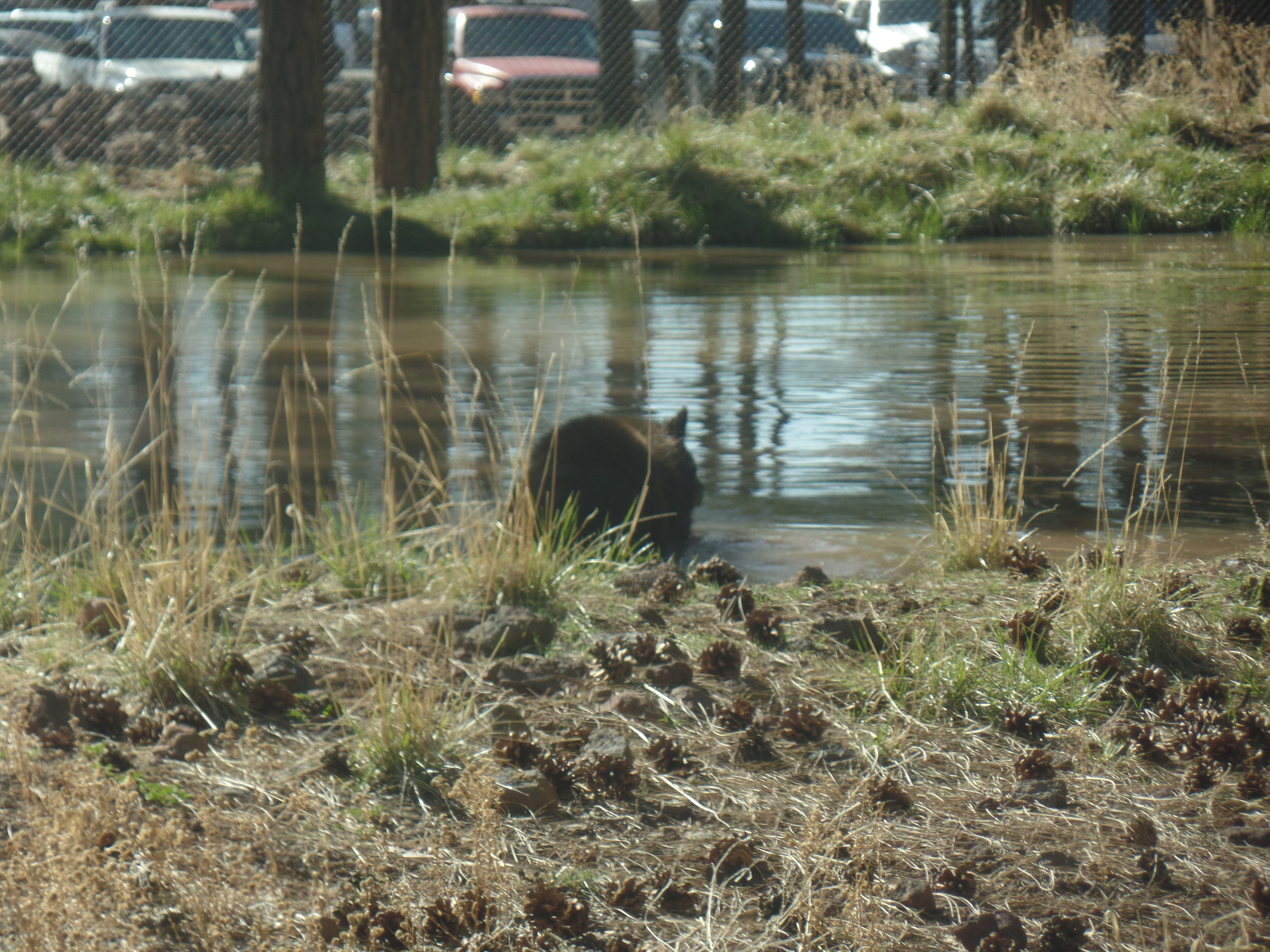
Next, it was the black bears’ turn.

Bearizona 4
Black bears at rest
Bearizona 5
Bathing bruin

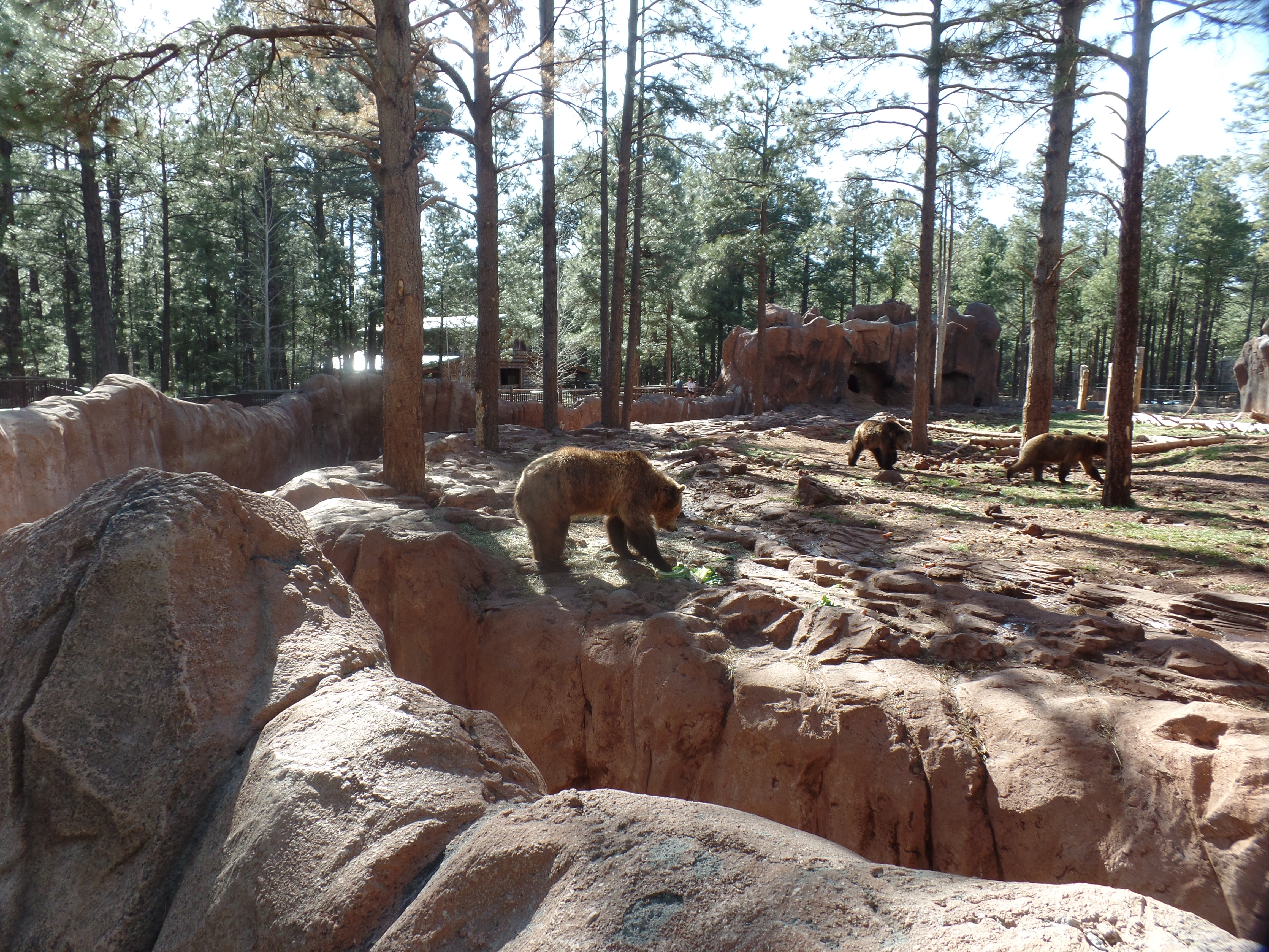
The Grizzlies have their own place, well-removed from the road.

Bearizona 6
Grizzly bears at dinner time

Our dinner time came later, as I had a business matter in the interim. No worries-Goldie’s Diner was open until 9, so we ate lightly but well. This week, like most weeks, has been a whirlwind, and time well spent.

The Hermit Shares Space

2

March 29, 2024- The three-year-old girl wrapped her arm around a pole, while standing just above the stairs at the rear door of the shuttle bus. It was a crowded bus, and even with her watchful grandmother standing between her and the door, she was taking no chances.

Hermit’s Rest is the site of the westernmost of Mary Colter’s eight buildings that grace Grand Canyon’s South Rim. It is in an otherwise nondescript section of the Rim Trail, set away from the stunning overlooks that are signature to the canyon’s edge. Louis Boucher would have preferred it that way. He was a prospector for gold, and probably uranium, in the days before the national park was established. His trail, now called Hermit Trail, leads down to the Colorado River, some 8.7 miles one way. (If I were to hike to the river, it’d involve a camp out at Hermit Camp-not far from where Louis made his home.)

The gateway to the end of one line.
Mary Colter’s Beehive Oven, resembling a Hopi outdoor oven
South side of Hermit’s Rest store.

Neither man-made nor nondescript last long at the Canyon, though. A short walk through the trees reminds the visitor of why the trip was made, in the first place.

The Inner Basin, from Hermit’s Rest.

I began the visit at Hopi Point, where the last trip was cut short, owing to a flash flood in Tusayan, which necessitated most of the visitors having to go back to Grand Canyon Village and tend to their lodging. I was able to make the journey around the eastern route, to Cameron, and then back to Prescott, via Flagstaff. Not everyone was so fortunate, and many ended up spending the night in one of the lobbies of hotels within the park.

Today, there was wind, but no water, so all of us were able to go clear to Hermit’s Rest, or to one of the other viewpoints. I walked from Hopi Point to Mohave Point, taking in the following scene, among others.

The Colorado River has a demure presence, beyond The Battleship, from Hopi Point.
If you think that living on the South Rim is easy, this juniper pine begs to differ.
A view from The Abyss.
The Abyss also shows the effect of weathering, on the topmost layer of limestone.
Here is a view of Monument Creek, flowing into the Colorado River.
From Pima Point, a zoom lens affords a close-up of the Colorado River, without a long hike!

Finally, just when you think you’re done with the Canyon, here’s the next big thing:

The first question says it all.
If your answer is “Yes”, happy hiking-and camping!

I am not beyond that sort of adventure yet, but for today, it was time to head back, so onto the shuttle buses I went, including from the Village to the Visitors Center, which was the bus where the little girl and her family crowded on. We all got to go where we had planned, today. No rain, just wind.

Humanity Isn’t Minimized

4

August 23, 2023- In August, 1974, a family visiting from Montreal had taken a cabin at a resort, in western Maine, where I was working for the summer. A fire was built in the hearth, then thinking that it would be secure and burn itself out-in the hearth, the family went to bed. At 2 a.m., the older daughter, 13, smelled smoke and got her parents and sister up and out of the cabin. I was one of the volunteer firefighters who did the best we could to extinguish the fire-and did keep it from spreading. Many of the other crew members were year-round residents of the village. Their own homes would have been at serious risk, in short order, had the blaze spread.

Tusayan is a small town, of about 6,000 people, most of whom work in service industries connected to Grand Canyon National Park’s South Rim. There are also those who serve the servers: The Coconino County Sheriff’s Substation, the Grand Canyon Unified School District and the Town of Tusayan’s government.

Yesterday, much of the town’s populace, and many visitors, were evacuated, due to unusual flash floods. While clean-up will take time, and there is an ongoing threat of more rain, through Friday, the main road-AZ Highway 64, has been re-opened, from the South Rim’s entrance to Williams. The eastern section, from the entrance to Cameron, did not need to be closed, though in taking that road last night, due to a commitment at a school in Prescott, today, I noticed that a severe hail storm had struck the eastern part of South Rim, earlier in the afternoon.

This is yet another in a series of wake-up calls for the tourism industry, and for travelers in general, that the places being visited are inhabited by people who are essentially the same as those who have left their homes to take a rest, be served or to just enjoy a change of pace from home sweet home. Lahaina is the largest, and worst, such tragedy, in a series spanning several years. Gatlinburg, Big Sur, Talkeetna and dozens of small forest encampments all over the continent-and across the globe, have seen fire and flood drive those involved in hospitality lose house and home.

There are many reactions to a tragedy in a vacation-oriented area, as I discussed last week. It has been reported that at least one tourist raged about his dinner reservation being canceled by the Lahaina fire’s burning down the restaurant. We are all on a journey away from self, and towards seeing “all humanity created from the same stock”, as Baha’u’llah wrote in a prayer, 150 years ago. Some of us have, in all sincerity and from a place of generosity, gone to the suffering area and purchased a vacation package, thinking that THIS is the way to help the people in the afflicted community know that the world stands with them. Others have sent large supplies of goods, often without checking as to what is actually needed. These are good-hearted people, who have just not taken the time to hear from the victims themselves, or from their spokespeople. Thus, some want to go to Maui, anyway. Others will go to Tusayan, and expect that business as usual has resumed, because the highway is open. The clean-up will continue, for some time.

Humanity isn’t minimized by where someone lives, or by which economic group they occupy. Yes, paying for a service does mean that one gets a product for one’s money. It is also true, in this age when nearly every place on Earth has something of interest to offer, that we are all both visitors and visited, servers and served.

I find that it is the deep connecting with those who live in a community, that makes visiting the locale worthwhile in the first place.

What’s The Point?

2

August 22, 2023- The robust cat sat in my carport, right by the hatchback, and looked at me, as if tho say: “Have you thought this through? Are you sure you want to go up to the South Rim?” It was raining lightly, which was one reason why the cat was sitting in that dry spot. I had, however, looked at the weather forecast for Grand Canyon, and saw PC (partly cloudy).

So, northward I went. Stopping at my Williams favourite, Brewed Awakenings, I fueled up with a Light Wrap and coffee, then headed up to the Park, an hour away from downtown Williams. The first hour or so of my shuttle bus ride/walk was quite pleasant. I took these shots of the Bright Angel Trail, from Trailview Point, just to the west of the Bright Angel.

Bright Angel Trail, seen from the west.
More of the Bright Angel Trail, from the west.
Approaching rain, from Trailview Point

I got back on the shuttle bus and headed to Hopi Point, from where I planned to walk back towards the JW Powell Memorial and Maricopa Point. I got in these shots at Hopi.

Hopi Point and the Colorado River below.
Approaching storm, from Hopi Point

I walked the short distance from Hopi Point to the Powell Memorial. It was then that lightning flashed in the east, a bus driver told me that we would all be evacuated from the Hermit Sector (the near west segment of the Rim Trail, which I had planned to explore in its entirety) and I found a spot to wait for an empty bus, as his was full. In about ten minutes, one arrived and took a bunch of us back to the transfer station. I went into Bright Angel Lodge and had a leisurely lunch, then returned to the transfer point and waited with about sixty other people, for the lightning danger to abate.

After about forty minutes, the storm was judged to have let up, and we went back towards Hermits Rest. I got off at Maricopa Point, walking about 200 yards, to these scenes.

Trailview Point, from Maricopa Point
Colorado River, from Maricopa Point
The defunct Orphan Mine (copper and uranium) was just below Maricopa Point. It is marked by this memorial.

As it was still not raining again, yet, I walked the .9 miles from Maricopa to Powell Memorial.

Plaque memorializing John Wesley Powell, first American navigator of the Colorado River, in the Grand Canyon.
View of canyon, from Powell Point

Once I got this shot off, the rain began to return, and we were evacuated a second time. I commiserated with the shuttle driver, as it must be quite frustrating to have to repeat an evacuation, only an hour after the first one was lifted. Needless to say, it was time to head for the car and towards home base.

There was a slight hitch in that, as well. The road back to Williams goes through Tusayan, and that little tourist village was flooded. The county sheriff had a road block up, which put those staying in Tusayan, Valle or Williams-or who were scheduled to fly out of Grand Canyon Airport, in a bit of a pickle. For me, it meant driving back by way of Cameron and Flagstaff, which I did. On the way to Cameron, I saw one thing we on the Hermit Sector missed: A huge pile of hail had remnants at roadside, from Mather Point, east to Desert View.

Let it not be said that this year’s monsoon was a total bust.

A Visit to “Mystery Mountain”

6

October 16, 2020-

It wasn’t a long absence from Home Base, especially in light of a wildfire that may require some attention, this weekend. I did, however, make good on a visit to northern Arizona’s “other” Red Mountain-this one about halfway between Valle and Flagstaff, on US Highway 180.

I began the day with a run to Tusayan, the service town that lies just outside Grand Canyon National Park. That was entirely to get some cash, which I had neglected to do in Williams, yesterday afternoon. With cash comes a gratuity for the motel maid, who has things extra difficult-dealing with the POSSIBILITY that some guests may not be conscientious regarding traveling whilst ill.

Saying good bye to Grand Canyon Inn, I headed southeast and found Red Mountain to be quite popular, on this tail end of Fall Break. An easy 1.2 mile walk, from the trailhead to a short ladder, leads to a mini-wonderland, not unlike the larger area of spires, hoodoos and expansive sandstone cliffs found in Bryce Canyon, Utah.

Red Mountain is a cinder cone, with volcanic ash covering the cinders, thus forming many of the hoodoos which grace its northern base. Slippery volcanic dust and pebbles form the groundcover, making it important to mind one’s steps. It was understood, by everyone present, to stay off the rocks themselves, which are clearly delicate.

Here are several scenes of the trail and of the Volcanic Park.

The 1.5 mile trail begins in this juniper grove.
A southward view of Red Mountain.
Red Mountain is the westernmost peak in the San Francisco Volcanic Field. Abineau Peak neighbours it to the southeast.
This scene points out the rugged nature of the terrain. Volcanic soil is rich, but is not thick.
Kids of all ages may be tempted to go up, and slide down, here, It is a very treacherous ledge and climbing is forbidden.
Cinder hoodoos, covered in black ash.
Ponderosa pines, the tallest trees in Arizona, sometimes have fallen victim to volcanic dust clouds that get whipped up in storms. Fire is also a danger.
Some of the stones evoke elephant images.
This volcanic box canyon is lined with basalt spires like these.
Every path has its guardians.
Sand, piled up in the box canyon, gradually hardened and formed these “busts”.
These crevices, as yet, do not go very far.
Older crevices, though, present a temptation to get oneself stuck.
Here is one end of the box canyon.
Here is a ledge of hoodoos, representing the other end of the canyon.

On my way out, I met a young family who were exploring the approaches to the box canyon, at the child’s own pace. The little girl asked me how to get up “Mystery Mountain”. I told her the ledge she was trying to get up could be the first Mystery Mountain and there were many more. (She was, with Mommy’s help, about two feet up.)

It is for moments like this, as much as anything else, that I go forth to see my own Mystery places.

The Peak of the Canyon-Part II

4

October 6, 2019, Jacob Lake-

I made a silent promise to my long-departed maternal grandfather, whom I never met in this life, but who has appeared to me, a few times, that I would not give in to a more irrational level of acrophobia.  He has been one of my spirit guides, all these years, exhorting me to face life and overcome obstacles.  He and Grandma imparted that message to my mother and her siblings; an examination of their lives bears out  that exhortation’s fruits.

So, as I readied for visits to three of the overlooks at the North Rim of the Grand Canyon, there was no trepidation at engaging the heights of this wondrous place.  The North Rim exists at the highest point of the western Colorado Plateau. Had the canyon never been carved, one would face a 2,000 foot increase in elevation, from Tusayan to  the site of Grand Canyon Lodge.

SAMSUNG CAMERA PICTURES

My first order of business, after looking around the Lodge for a bit, was a walk out to Bright Angel Point.  As today was one of the most gorgeous Sundays in quite a while, there were dozens of people, of all ages, walking about or at least lounging on the Lodge’s patio, which also offers views of the canyon below.

Here are a few of those scenes available to the sedentary.

SAMSUNG CAMERA PICTURES

SAMSUNG CAMERA PICTURES

I then availed myself of a couple of overlooks, close to the Lodge.

SAMSUNG CAMERA PICTURES

SAMSUNG CAMERA PICTURES

SAMSUNG CAMERA PICTURES

SAMSUNG CAMERA PICTURES

Bright Angel Point involves a fairly strenuous hike, mainly due to the elevation.  Those with pulmonary issues do best to stick to the Lodge area. An intrepid woman using trekking poles made it half-way, before concluding it would be a mistake to continue.  There were several of us late middle-agers who made the walk, though, along with folks as young as five.

SAMSUNG CAMERA PICTURES

SAMSUNG CAMERA PICTURES

SAMSUNG CAMERA PICTURES

SAMSUNG CAMERA PICTURES

SAMSUNG CAMERA PICTURES

SAMSUNG CAMERA PICTURES

It was at the above guard fence that a little girl wanted to climb up, for  “a better view”.  You’d best believe her mother’s hands were firmly on her, for that exercise in bravery!

SAMSUNG CAMERA PICTURES

The various striations in the sandstone clearly show the levels it has taken, to build this most magnificent of geologic records.

SAMSUNG CAMERA PICTURES

In the next post, Point Imperial and Cape Royal offer a northeastern perspective of the Canyon’s wonders.