Fair Columbia

5

June 25-26, 2019, Columbia, SC-

Fifty years ago, I found myself among thirty or so young men, some a bit more worldly than I, others as green to the ways of the world as yours truly.  We were the trainees of Echo Company, Third Battalion, First Brigade, at Fort Jackson.  There were times that I broke down in the tears of an under-challenged, immature novice to life. There were times that I tried to avoid the challenges that, deep-down, I knew I needed to overcome.  In the end, I managed to overcome my own physical challenges and the constant ridicule from the jaded First Sergeant- and earned the respect of most everyone else.  I was a better person for the time spent here.

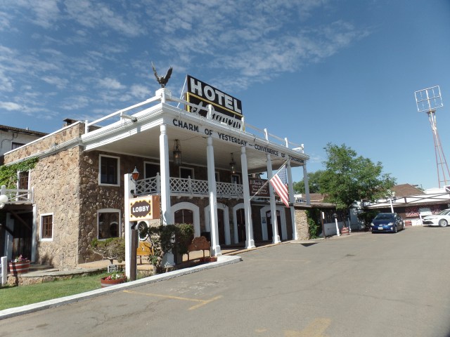
Once here, planted for what I thought was a day, at Palmetto Inn, east of town, I got messages from faithful readers, advising as to what I might do in the town.  Among these was word of a Wednesday evening event at a coffee shop, sounding as if it were sponsored by local Baha’is. So, I took the room at Palmetto for two nights.

The day started with a passable breakfast at George’s Southside Restaurant, hearing the plaint that I am finding increasingly common, in the workplaces along the road, this summer:  “I’m alone here, hon.  Please be patient, one co-worker quit and the other overslept. ”

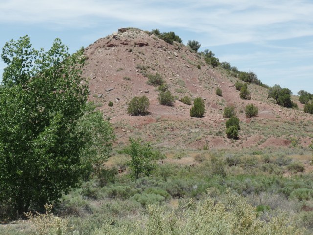
In planning my day here, I focused first on the South Carolina State Museum, then the area around the Capitol and, rather whimsically, thinking I might pay a visit to Fort Jackson.  This last, of course, would not be realized.  Military posts are very well-guarded, even against visits by veterans.

I had a tip from a friend who had also spent time on Fort Jackson, to visit a fine dining spot, with an unlikely name.  Before going to the museum, I followed up on this recommendation.

SAMSUNG CAMERA PICTURES

Motor Supply Bistro is a gem of a place.  I sat at the bar, for lunch, as I frequently do, when dining alone.  Bars and counters are a great place to feel at home, in an eatery, as one connects with both workers and with other solo diners.  I made several new friends here, as a result and the food is delectable.   There is valet parking here, and the attendant found himself being both ignored and blocked in, by a surly delivery truck driver, when he went to retrieve my car.  I tipped him for his trouble and faced down the ruffian, myself.  I did not get ignored and my car was off the lot, in short order.  I don’t take kindly to my contemporaries treating younger people with such contempt.

The South Carolina State Museum is worthy of at least two hours’ visit.  I focused on the Museum’s take on the Civil War, which was a bit less top-heavy on defending the Confederacy, than I had thought might be the case, before visiting, and on the various industries that took root, after the War, in both the Piedmont and Low Country regions of the state.

SAMSUNG CAMERA PICTURES

It is always a joy to see the work of students, in public museums.

Here is a map of South Carolina, prepared by children in a Columbia school.

SAMSUNG CAMERA PICTURES

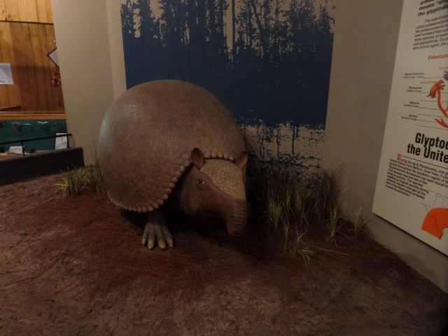
There is a fine little area that tells the story of Palmetto State paleontology.  The region had its share of dinosaurs-and of megamammals.  Here are an Albertosaurus skeleton

SAMSUNG CAMERA PICTURES

and a Glyptodont, or giant armadillo.

SAMSUNG CAMERA PICTURES

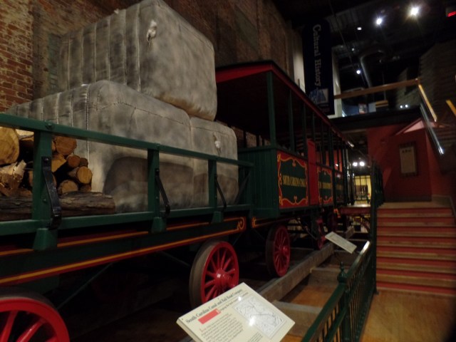
The rails were critical here, moving textiles and lumber, even before the Civil War.  This long car was called the Friend of Charleston.

SAMSUNG CAMERA PICTURES

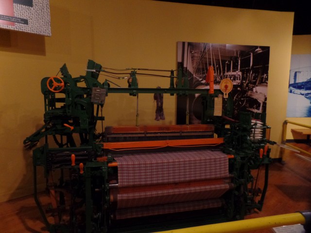
Textiles were able to be more efficiently produced, by machines such as this.

SAMSUNG CAMERA PICTURES

The processing and de-shelling of nuts, a major cash crop, was abetted by this machine.

SAMSUNG CAMERA PICTURES

Coastal hardwoods were much in demand, beginning in the mid-nineteenth century.  This device helped greatly, in hauling cut timber’

SAMSUNG CAMERA PICTURES

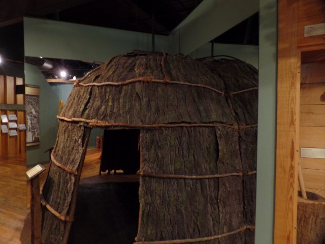
The Catawba people, who lived in the Columbia area, prior to European settlement, produced basketry and intriguing wood carvings, as part of their cultural legacy.

SAMSUNG CAMERA PICTURES

Here is a mock-up of a traditional Catawba house.

SAMSUNG CAMERA PICTURES

Finally, I ended my photo-journey around Columbia, by visiting the Capitol grounds.  There are a few statues in honour of the Confederates, but my interest there was the State Capitol as a whole.

SAMSUNG CAMERA PICTURES

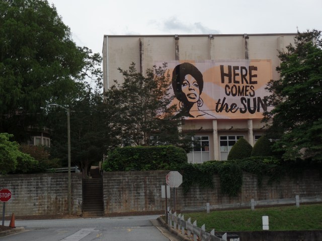
The day ended with a lively poetry and visual media session at Cool Beans Coffee House.  The person who had invited me never showed, but I was made to feel welcome by the program’s hosts, so Columbia left me with a warm feeling.  Gamecocks are good people.

SAMSUNG CAMERA PICTURES


Staying Independent

5

July 4, 2019, Saugus-

I will continue (go back to) my photo blogs, in the next few posts.  Jumping ahead to the Fourth of July just seems best, though.

I had a conversation with someone very close to me, during the family gathering at a niece’s home, this afternoon.  One thing rings very loud and clear, from this discourse and from other conversations I’ve had, these past few months:  Many people are feeling put upon by aggressive individuals and groups, who take a point of view opposite that which they happen to hold.  Many individuals and groups ARE resorting to the use of force, when confronted with those taking such opposite viewpoints.

I was raised to hear other people out.  My parents, social conservatives, made a great effort to understand even the most seemingly ludicrous viewpoints.  I have maintained an open mind, as a result, throughout fifty-six years of adolescence and adulthood.  Civil Rights have long been a matter of supreme importance in my life, and that cuts both ways.  The Right cannot bully people of colour, of Faiths other than that of the majority in a community, or those living a lifestyle different from that which is conventional. The Left, likewise, cannot deprive people of more traditional bearing, of life, liberty and the pursuit of happiness.  Violent behaviour, on either side, is the stuff of fascism (even when the bully calls self “Antifa”)

I am, as it happens, an obstinate soul, when people without authority try to force me to do their bidding.  Additionally, I question those who DO exercise authority, as to the ethical basis for their actions.  That is what I get from both the Declaration of Independence and the United States Constitution.    That is what I get from my Faith.

So, to my family-my elders, siblings and cousins:  You all matter, greatly.  Your point of view has at least some validity and is worth hearing, and pondering.  Our family is large, so there are all points covered, on the political spectrum. I will not plug my ears to any of it, so long as you do not ascribe to a coda of violence or or a policy of defamation against your opposite numbers.

To my children, nieces/nephews, and “grands”- You are, one and all, a great hope; you are people of immense promise and, especially if you are feeling vulnerable,  are worthy of all the support and love that we, your elders, can muster.  We cannot spare you from life’s ups and downs, but we can point towards the light. This is the very least we can do, in building and safeguarding your own sense of well-being and independence.

Most of the problems we face, when it comes to intolerance and reactive violence, seem to stem from the violent ones acting out of insecurity.  In truth, though, i have to ask, “How does a person expressing an alternative point of view, in and of itself, constitute a threat to my well-being?”  It may be annoying, but it is not a threat-unless accompanied by force-which then makes it an entirely different matter.

Staying independent means, to me, that one takes the time to carefully examine issues and evaluating a variety of points of view.  It also means extending that right to independence to every one else.  These are my thoughts as the Sun goes down on another July 4.

The Home Base That Wasn’t

2

June 25, 2019, Tryon, NC-

In the gloom of Spring, 2011, I was casting about in my mind, as to where I might plant myself.  At the time, I had one immediate goal:  To make my way to New Hampshire and attend the wedding of my sister’s youngest daughter- for whose happiness Penny and I had prayed for several years.  Other parts of life were in a state of suspension.  Though I worked the rest of the academic year, following Penny’s funeral and Aram’s life was slowly coming together, with the Navy on the horizon, I had ME to get settled.

Several locations presented themselves:  I could have relocated somewhere else in the metro Phoenix area, or somewhere else where I had family nearby.  Then, there were places with no family in the area.  One such place, to which I’d never been and of which I knew nothing, was Tryon.

I happened upon this town, whilst en route from Knoxville to Columbia.  It was dinner hour, so at long last, I left the highway and found a space for my car.  The place seemed magical.

It had been a fairly good day in Knoxville.  The East Side was hardly as intimidating as the earlier news reports had suggested.  There were troubled people in the room directly below me, but they kept their troubles to themselves and I had a good night’s rest.  A nice lunch, a workout at Planet Fitness and a car servicing at Big O all took place across town, and by early afternoon, I was back on the road.  If you’re ever in Knoxville and want a good, quick lunch, I recommend “Best Bagels in Town”- a small place, behind a Walgreen’s, just a couple of blocks north of Big O, at 120 S. Peters Road. I promised the owner I’d send a shout out, so here it is:  Best Bagels is true to its name.

SAMSUNG CAMERA PICTURES

Back to Tryon: The downtown is compact, with a well-known equestrian resort a few miles further east.  I am more of a cozy downtown type, so while resorts are nice and all, give me a small coffee shop/cafe restaurant, any day.  One such place is Huckleberry’s.

SAMSUNG CAMERA PICTURES

SAMSUNG CAMERA PICTURES

One of the recurring themes in my life is how much I want for the younger generations to realize their dreams, to succeed-often in spite of the powers that be “moving the goalposts” and recognizing when a young man or woman gets things right.

Georgia got it right, albeit being rather self-effacing and business-like. The sign that Huckleberry’s owner put on the wall says it best:

SAMSUNG CAMERA PICTURES

Georgia did keep busy, though, greeting, seating and doing half the serving.  I’ll say it again and again:  We Boomers are in good hands,  as we hand off the baton.

Tryon has a thing for bears-and for its claim to fame:  Horses.  The first sight that greeted me, as I parked was a wooden bear.

SAMSUNG CAMERA PICTURES

Horses adorn a couple of spots along Tryon’s two main streets.

SAMSUNG CAMERA PICTURES

SAMSUNG CAMERA PICTURES

This multi-coloured horse is found near the Post Office.

SAMSUNG CAMERA PICTURES

Any town which claims Nina Simone as a Native Daughter has my fullest admiration.  A consortium of artists is working to restore the home of her birth.

SAMSUNG CAMERA PICTURES

SAMSUNG CAMERA PICTURES

I chose Prescott, AZ, of course, as my Home Base-largely because it was familiar and the family had property, for the first 3 years of my time there.  I will continue to call Prescott my Home Base, until we see where my little family settles, next year.  A place like Tryon would not necessarily be out of the question.

NEXT:  Fair Columbia


A Few More Reflections

5

June 24, 2019, Crossville- 

I have also had occasion, whilst packing up for the further road, to think about why certain people are more like family to me than others and about just what my role in the scheme of such things actually is.

I am not much for patriarchy-as despite my gathering age, I don’t have all that many of the answers, in my own right.   Also, there has never been a time when the women and girls in my life have felt subservient. Groups tend to solve problems, better than do individuals.  In order for my various groups to do that, regular communication needs to happen. This little group of three, this weekend, got an aging dachshund through a very uncomfortable bout of the cruds.  Greater things require people’s attention, but there is none so heart-rending.

There is,as I alluded in the last post, a lady west of here, who I met on last year’s visit and who I would  get to know better, in a heartbeat.  There are hundreds, if not thousands of souls I have befriended-if only by electronic means and each means something special-as blood relatives, as surrogate children-and surrogate siblings, and as trusted friends/mentors.  My two friends here are high in the sibling category, as well as in the last one.  I spend a lot of time thinking about each of you, day and night-which is as much an impetus for my time spent in community work, when at Home Base, and in connecting with so many, when the Road calls.

So, now, I head down to Chattanooga, to see what makes a friend in Wisconsin so enamoured of Ruby Falls- and perhaps check out Rock City, which a couple of friends in the Southeast love.

Duke City Redux

0

June 17, 2019, Albuquerque-

This morning saw the last vestige of abdominal upset leave me.  Today would be a day for treading lightly and eating slowly.  It did not take long for the Elantra and me to get to Mother Road Hostel, though, and I was pleased to be able to get settled earlier than is the case in most hostels.  An early nap took care of what was left to be cured.

SAMSUNG CAMERA PICTURES

I had hoped to get in a return visit to Blackbird Coffee House, in Old Town, but the parking situation is such that exact change is required for a space, and I’m still not one to offer $10, for a $5 fare.  I did get laundry done, across from Mother Road, ignoring a “plea” from a street person who said he needed coins to do his laundry, yet there was no sign of said laundry, as he stood in front of The Wash Tub.

Mother Road is a thoroughly relaxing place, convenient to both downtown and Old Town, though it was rather toasty today.  By evening, though, with laundry clean and put away, I ventured to the west side of Downtown, and enjoyed a lovely dinner of Minestrone Soup, Vortellini and sauteed vegetables, at Villa di Capo.  Being the days of the Senior Olympics, I was joined by many people my age and older.  This competition augurs well for those seeking a higher quality of life, as people age.  I personally did not take part in the events, but the examples of my contemporaries spurred me to plan a hike tomorrow, at Palo Duro Canyon, south of Amarillo.

Declining spumoni or tiramisu, I bid my gracious hosts farewell, and took a stroll around the Raynolds neighbourhood, taking in both architecture (lots of Art Deco, in downtown Albuquerque) and street murals.SAMSUNG CAMERA PICTURES

SAMSUNG CAMERA PICTURES

SAMSUNG CAMERA PICTURES

There is a pizzeria, two blocks west of Villa di Capo, which invites patrons with this sidewalk piece.

SAMSUNG CAMERA PICTURES

Java Joe’s, closed for the evening, looks inviting, nonetheless.

SAMSUNG CAMERA PICTURES

Raynolds’ residents seem to be quite active, in addressing the needs of their surrounding area.

SAMSUNG CAMERA PICTURES

SAMSUNG CAMERA PICTURES

These three poles adorn a middle school playground.

SAMSUNG CAMERA PICTURES

Finally, the full range of the neighbourhood’s vibe is shown here.

SAMSUNG CAMERA PICTURES

Albuquerque was restorative to my health, and a confirmation that hostel life is most suitable to my mode of exploration.

NEXT:  A Spot of “Fun Zone” and A Lighthouse in the Desert


A Day for Setting Example

4

June 16, 2019, Grants, NM-

I told myself that this summer, I would not zip through the astonishing red rocks and juniper of northern AZ and New Mexico, so today, I set a limit of the 62.4 miles that lie between Gallup and this old mining town, which is struggling to redefine itself.

I began Father’s Day, last night actually, with a roughly forty-minute conversation with my son and daughter-in-law, reassuring me that all is well with them, and vice versa.  This morning, a light breakfast of yogurt, from the grocery store across from Lariat Lodge, seemed quite sufficient.  Afterward, the first order of business was a visit to the lobby and garden of El Rancho Hotel, Gallup’s premier historical property and a favourite of many of Old Hollywood’s great figures- from James Stewart to Claude Akins.  Several photos line the wall of the second floor of the lobby.  Here is an introduction to El Rancho:

SAMSUNG CAMERA PICTURES

SAMSUNG CAMERA PICTURES

SAMSUNG CAMERA PICTURES
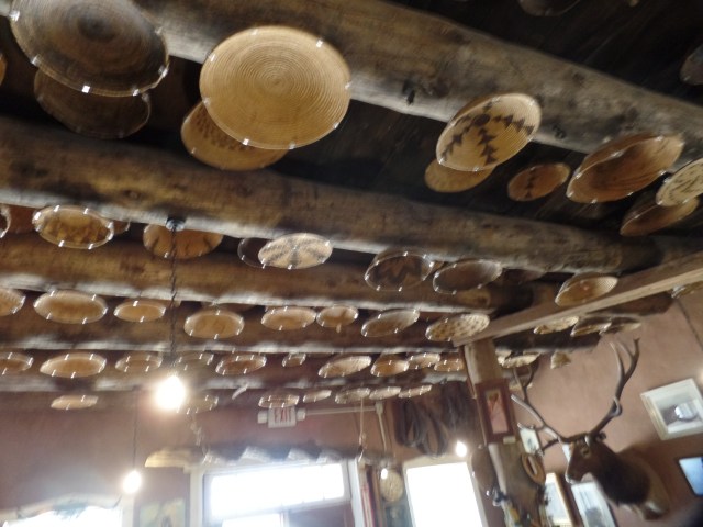
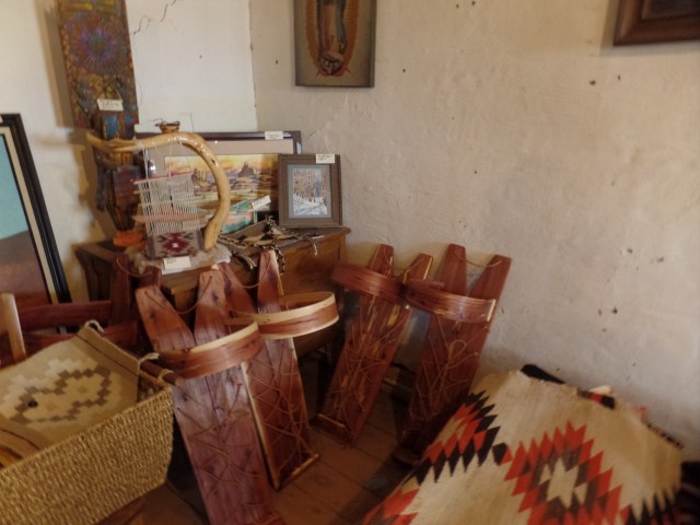
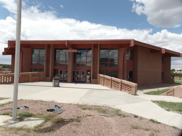
Gallup has made itself a haven for Dineh, Zuni, Acoma and Apache artists looking to sell their crafts.  Armando Ortega and his family were among the first to offer marketing services to First Nations artists in the area.  The Ortegas have sponsored this alcove display, in the center of the first floor lobby.

SAMSUNG CAMERA PICTURES

Even the outdoor benches are adorned with intricate design.

SAMSUNG CAMERA PICTURES

From here, it was time to head towards the rocks, specifically El Malpais National Monument, just south of Grants. In 1985, Penny and I took two sons of a then-recently departed friend to this area, camping overnight at the privately-owned Bandera Volcano (extinct), as a respite for his widow.  In the years since, the road has been a shortcut, when I have driven between Phoenix and Albuquerque.

Today, it was my Father’s Day present to myself, to explore the eastern portion of the Monument, some forty miles past the volcano.  The sandstone formations near Zuni-Acoma Trail are as majestic as any in the southwest. Whilst taking in these marvels, I fixed and ate a sandwich. This would prove to be of dire consequence.

SAMSUNG CAMERA PICTURES

SAMSUNG CAMERA PICTURES

SAMSUNG CAMERA PICTURES

SAMSUNG CAMERA PICTURES

After visiting the Ranger Station, I doubled back to Sandstone Bluffs Overlook.

SAMSUNG CAMERA PICTURES

Although the storm clouds looked threatening, the rain held off until I was back in Grants.

SAMSUNG CAMERA PICTURES

The series of holes, that are visible in the center of this frame, were actually bored by molten lava, during the last eruption of McCartys Crater, some 3000 years ago.  They are known, collectively, as Chain of Craters.

SAMSUNG CAMERA PICTURES

Of more ancient vintage is Mt. Taylor, seen to the north.  It is one of the Four Sacred Peaks which are revered by several First Nations in the area. Mt. Taylor has been inactive for millions of years.

SAMSUNG CAMERA PICTURES

Lichen have absorbed into the sandstone, over the centuries, giving some parts of Sandstone Bluffs the appearance of having been painted.

SAMSUNG CAMERA PICTURES

Whilst sandstone is not slippery, its delicate nature means it can be broken easily, especially close its seams.  All walking on rock surfaces requires close attention to what lies underfoot.

SAMSUNG CAMERA PICTURES

While heading towards La Ventana Natural Arch, I spotted this remnant of an early rancher’s attempt at settlement.

SAMSUNG CAMERA PICTURES

La Ventana is a continuation of Cebolita Mesa’s exquisite base, which we saw earlier, near Zuni-Acoma Trailhead.  This is older sandstone than that at the Bluffs.  There were several other people here, including a grandfather, his son and three grandchildren.  Grandpa was teasing the two younger kids about jumping off the rock on which they had climbed.  Of course, he and Dad each helped the kids get off, but it was amusing to watch the little ones’ initial reaction of “AWWW, GRANDPA!!”

SAMSUNG CAMERA PICTURES

SAMSUNG CAMERA PICTURES

This balancing rock evokes a visitor from another world.

SAMSUNG CAMERA PICTURES

Here are two views of La Ventana, itself.

SAMSUNG CAMERA PICTURES

SAMSUNG CAMERA PICTURES

A close look at this wall of Cebollita Mesa seems to show two faces. I am curious as to what you, the reader, sees here.

SAMSUNG CAMERA PICTURES

The area west of Cebollita Mesa is covered with lava beds.  These range from just north of I-40 to the Lava Falls Area, thirty-six miles southward.  They extend, east to west, for about twenty-five miles.

SAMSUNG CAMERA PICTURES

Once back in Grants, I was starting to feel a drag on my system.  Nonetheless, being Father’s Day, I was determined to get one good meal.  There being no locally-owned cafe open,near the Sands Motel (another Route 66 establishment registered as a National Historic Site), I chose the reliability of Denny’s.  The salmon and vegetables were very nicely done, as was the cup of soup.  I hydrated plentifully, as well.

Back in the motel room, I will only say that I dealt with my ailment as I had always taught my son to do- in  mature and responsible manner. I felt much better afterwards and Father’s Day was only mildly interrupted.  I had maintained my example, though, even if no one was around to notice.  That is what the day really signifies.

NEXT:  A Return to the Duke City


The Treasure Road

4

June 15, 2019, Gallup-

The fine thing about a diverse landscape such as that of the Navajo Nation is that one can experience five forms of weather, as well as of scenery, in the span of thirty minutes.

I left Canyon de Chelly around noon, heading for the small college town of Tsaile.  This is the site of the main campus of Dine College, the Dineh’s highest resident institution of learning.  It offers eight Baccalaureate programs and is led by Dr. Charles Roessel, a member of one of the area’s most distinguished educational families.

The place today, though, was the realm of crickets.  Being a Saturday, in summer session, everyone except a lone security guard seemed to be elsewhere. Here are a couple of scenes of that splendid silence. First, the Library.

SAMSUNG CAMERA PICTURES

The centerpiece sculpture is of life-sustaining maize.

SAMSUNG CAMERA PICTURES

There are two mountain ranges in this part of the Dineh Nation. Here is a view of the Lukachukai Range.

SAMSUNG CAMERA PICTURES

As I left Tsaile, the road led to its sister village:  Wheatfields.  The two share a single Chapter, in terms of jurisdiction.  Wheatfields is home to one of the Navajo Nation’s most popular recreation sites:  Wheatfields Lake.  Along the way, there are the buttes and peaks of the southern flank of the Lukachukai Range and the norther flank of the Chuskas.  Below, is a view of Tsaile Butte.

SAMSUNG CAMERA PICTURES

Not far to the south is Red Butte.SAMSUNG CAMERA PICTURES

Here is  a  view of Wheatfields Lake.  It was crowded with fisherfolk and water’s edge vacationers.  Unseen here, a storm front was approaching from the west.

SAMSUNG CAMERA PICTURES

The road next led through a small sliver of New Mexico.  The two Chapters, Crystal and Red Mesa, were significant to Penny and me, as a vibrant and forward-looking family of Baha’is had branches in each community, in the 1980’s and ’90’s.  I fondly remember the Coes, their bread truck office and its early-model Word Processor; then, there were their elders, the Belshaws, with a wealth of natural foods knowledge and holistic health tips.

Here is Red Mesa, near the village of Navajo, NM (Red Mesa Chapter).

SAMSUNG CAMERA PICTURES

The Treasure Road (my term) comes to an end in Window Rock, the administrative seat of the Navajo Nation.  A serene park encompasses the town’s namesake.

Here are some views of this unique red sandstone promontory, with its signatory arch.

SAMSUNG CAMERA PICTURES

SAMSUNG CAMERA PICTURES

SAMSUNG CAMERA PICTURESSAMSUNG CAMERA PICTURES

SAMSUNG CAMERA PICTURES

The park also feature a memorial to the Navajo Code Talkers, whose service during World War II was instrumental in the U. S. defeat of the Japanese Imperial Forces.  The Navajo contingent was the largest of several groups of Native American teams, who used their languages to convey information in a way that would not be decipherable by the enemy.  There are five living Navajo Code Talkers, as of this writing.

SAMSUNG CAMERA PICTURES

With this, I headed to Native American Baha’i Institute, briefly saying a round of prayers and careful not to disturb several work projects, then headed here, to this bustling community that lies in the midst of the Navajo Nation.  It was time to sleep, at the Lariat Motel.

NEXT:  A Checkered Father’s Day

Canyon de Chelly:The Land Still Thrives

7

June 15, 2019, Chinle-

After a comfortable night in my tent, I spent the morning hiking White House Ruins Trail, the only unguided hike into Canyon de Chelly.  The route takes one down to a properly fenced off ruin, with various formations, images and a working farm (no photographs allowed) along the way.

Without further ado, let the pictures speak for themselves.  First, a couple of views from the overlook:

SAMSUNG CAMERA PICTURES

SAMSUNG CAMERA PICTURES

The trail starts flat, then quickly gets steep.

SAMSUNG CAMERA PICTURES

There are two tunnels along the trail.  This is the smaller one.

SAMSUNG CAMERA PICTURES

The trail looks messy, but is actually well-maintained.

SAMSUNG CAMERA PICTURES

Some reinforcing has been needed, over the years.

SAMSUNG CAMERA PICTURES

The canyon is watching.

SAMSUNG CAMERA PICTURES

SAMSUNG CAMERA PICTURES

This verdancy allows many Dineh to farm here, at the Canyon’s bottom.

SAMSUNG CAMERA PICTURES

SAMSUNG CAMERA PICTURES

Caves abound-or they are watchmen?

SAMSUNG CAMERA PICTURES

Grey gypsum and turquoise are embedded in the sandstone, at this particular spot.

SAMSUNG CAMERA PICTURES

Here is the second tunnel.

SAMSUNG CAMERA PICTURES

Even ants need picnic benches.

SAMSUNG CAMERA PICTURES

Camellias add a nice touch to the canyon bottom.

SAMSUNG CAMERA PICTURES

This majestic tableau rises above the working farm I passed.

SAMSUNG CAMERA PICTURES

Chinle Wash is flowing mildly, but steadily.

SAMSUNG CAMERA PICTURES

After a leisurely hike, here they were:  White House Ruin, built by Ancestral Puebloans, around 1060 A.D. and occupied continuously for 200 years afterward.

SAMSUNG CAMERA PICTURES

SAMSUNG CAMERA PICTURES

The walk back up was not at all hard, with a couple walking slightly ahead of me, and stopping for occasional conversation, then moving along for their own private reflections.

This was my fourth time hiking White House Trail ,and certainly the most well documented.

NEXT:  The Road to Window Rock

Canyon de Chelly: The View From the Top

17

June 15, 2019, Chinle-

Many people, when comparing Arizona’s myriad of canyons, prefer smaller ones. Canyon de Chelly (pronounced SHAY), high on the eastern edge of the Colorado Plateau, has its thousands of afficionados.  It was one of the alternatives to the Grand Canyon, for Dineh people seeking to hide from Kit Carson’s forces, during the run-up to the Long Walk.

SAMSUNG CAMERA PICTURES

Today, the place is, reasonably, packed with visitors of all ages- taking jeep tours, riding horseback, walking with authorized Dineh guides, or on their own (along White House Trail, which will be the subject of the next post).  Some are happy with viewing the magnificence from rim overlooks.  Still others are okay with just camping, at the NPS-run Cottonwood, or at the privately-owned Spider Rock Campground. Then, there is the chill-out crowd, hanging out at Thunderbird Lodge.

My focus was two-fold: Take in the South Rim overlooks, camp at Cottonwood, then hike White House Trail and end with the North Rim viewpoints.  That worked well, and so-here are views from each of the overlooks, beginning with Tunnel Canyon and ending with Mummy Cave.

Tunnel Canyon Overlook:

SAMSUNG CAMERA PICTURES

Tsegi Overlook:  (Tsegi is Dineh for “canyon”)

SAMSUNG CAMERA PICTURES

Junction Overlook: (Canyon de Chelly {South} and Canyon del Muerto {North} converge here.)

SAMSUNG CAMERA PICTURES

The overlook, and other highlights, of White House Trail, will be featured in the next post.

Sliding House Overlook:

SAMSUNG CAMERA PICTURES

Face Rock Overlook:SAMSUNG CAMERA PICTURES

Spider Rock Overlook:

SAMSUNG CAMERA PICTURES

Now, from the North Rim, here’s a view from Antelope House Overlook: (This ruin may only be viewed up close, if one is accompanied by a registered Navajo guide.)

SAMSUNG CAMERA PICTURES

Massacre Cave Overlook:  (The cave itself was the scene of a wanton slaughter of Dineh women and children, by Spanish soldiers, in 1805.)

SAMSUNG CAMERA PICTURES

Mummy Cave Overlook: (This also accessible only on a guided tour.  Mummy Cave is the largest Ancient Puebloan ruin in Canyon de Chelly National Monument.)

SAMSUNG CAMERA PICTURES

So, as you can see, there is a wide variety of learning activities at Canyon de Chelly National Monument.  An old favourite hike, White House Ruins Trail, is among them and is the subject of the next post.


The Art of Encouragement

2

SAMSUNG CAMERA PICTURES
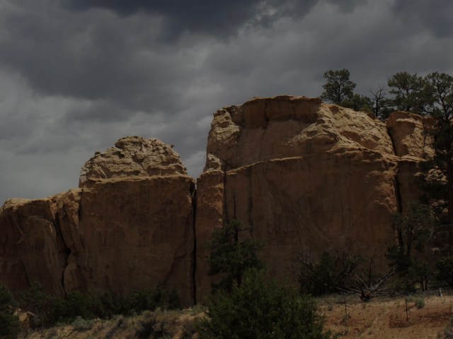
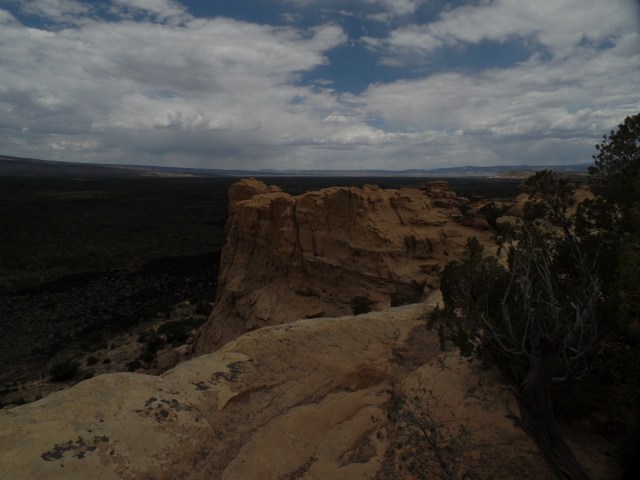
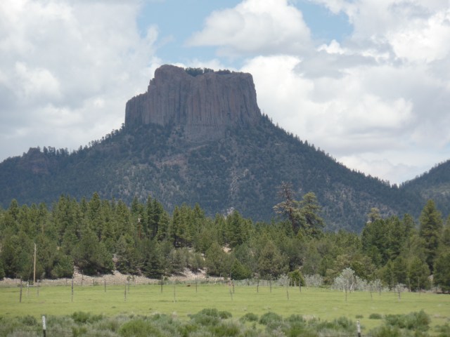
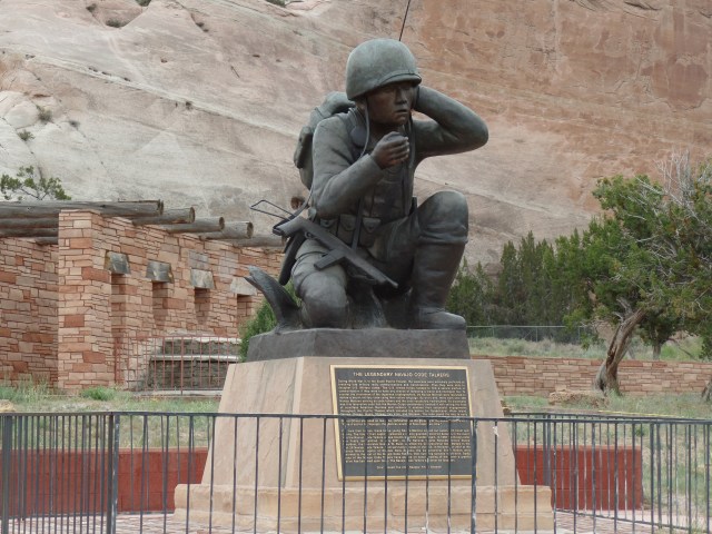
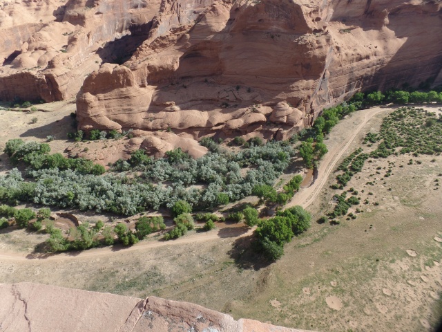
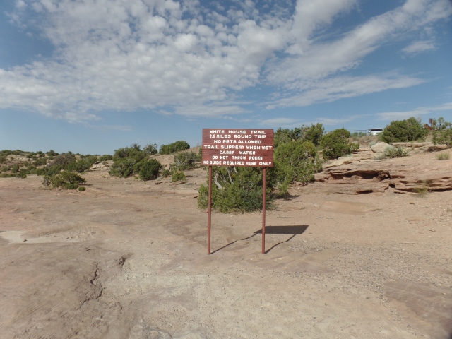
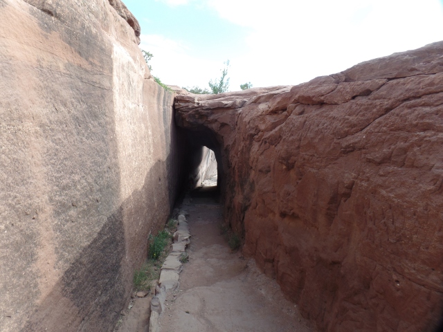
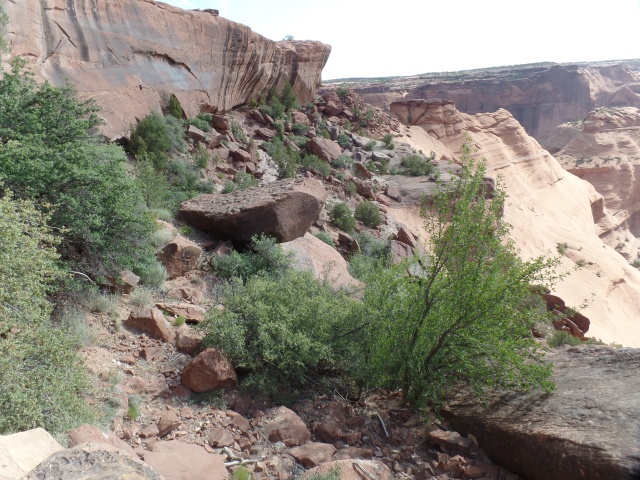
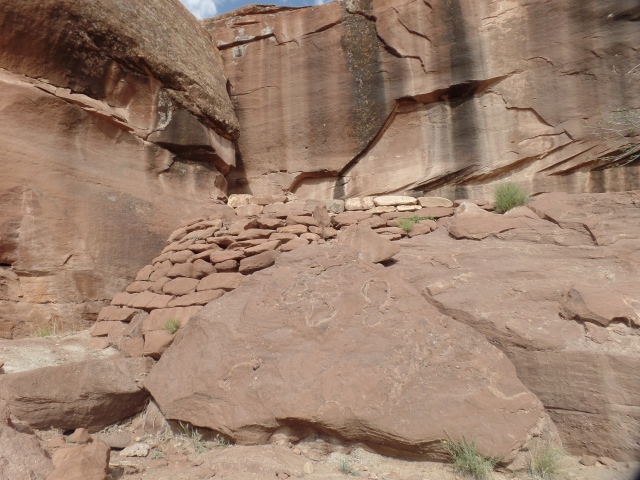
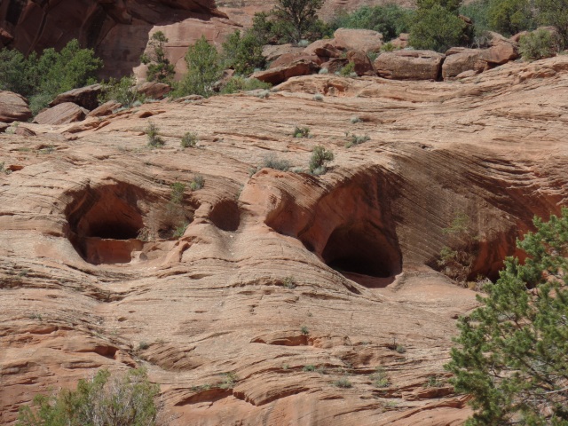
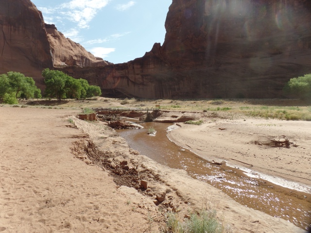
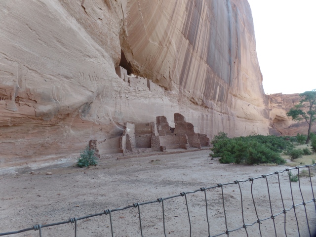
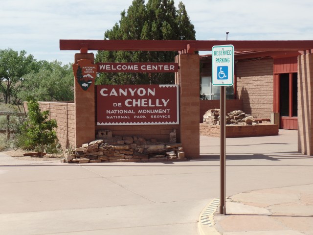
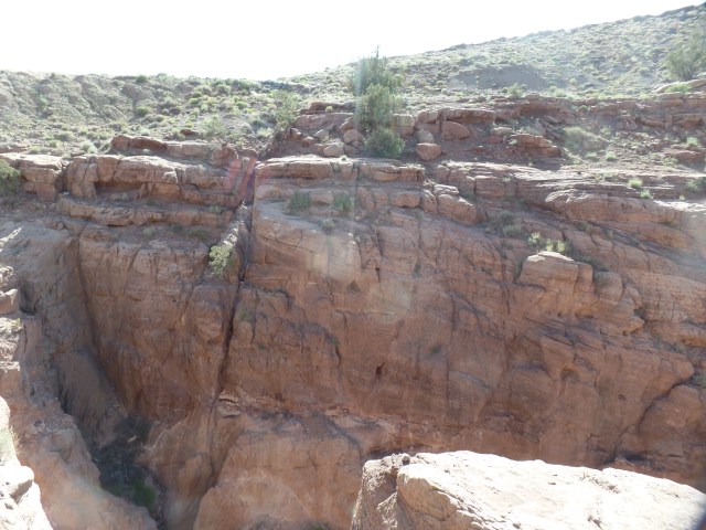
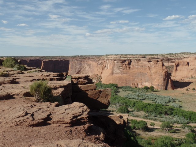
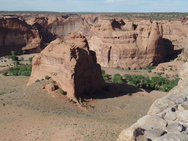
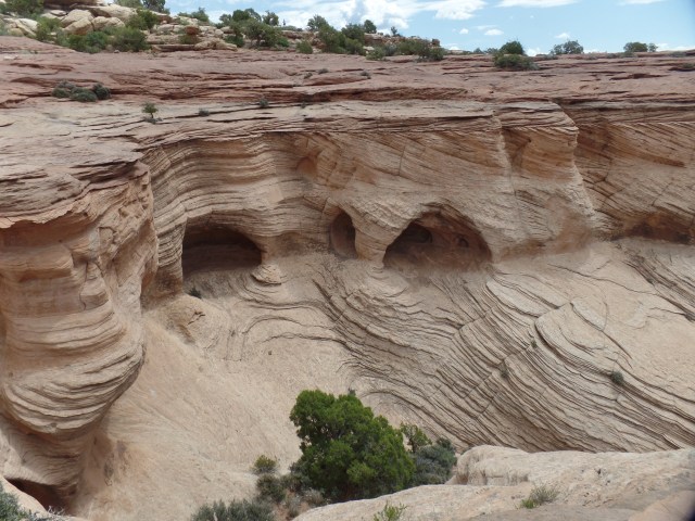
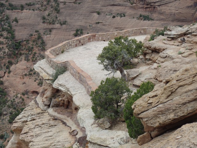
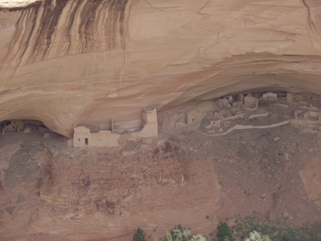
June 14, 2019, Ganado, AZ-

During the course of the tortuous process of incarceration, known as The Long Walk, white America showed itself to be of two minds, regarding the Dineh (Navajo) people.  There was the idea that, by removing Dineh, the resources of the area in which they lived would be available to the “Greater Nation”.   President Lincoln also retained the distrust and dislike of First Nations people, which he had carried since his participation in the Indian Wars of 1818-20.  He did not have to be cajoled into signing off on this travesty.

In all of this, an even-handed, but not easily-swayed, Dineh leader named Totsohnii Hastiin (“Man of the Big Water”) resisted incarceration, initially, fleeing to the Grand Canyon and living among his paternal relatives, who were Hopi.  He learned of his people’s suffering at Fort Wingate, and so surrendered, after a time.

When the Dineh were allowed to return to their traditional homes, by President Andrew Johnson, in 1868, some Euro-American traders, especially those of Spanish or Mexican ancestry, were allowed to approach the First Nations people, to establish trading rights.

One of these was a New Mexico native, John Lorenzo Hubble.  He settled with his family in a small Dineh settlement called Pueblo Colorado.  There, Chief Totsohnii established a friendship with “Don” Hubble (Don is a Spanish term of respect for a man of means.) In time, the village of Pueblo Colorado became regularly confused with the large town of Pueblo, Colorado. The people chose to rename their village as Ganado, after Chief Totsohnii’s common title, Ganado Mucho (“many cattle”).  Both names stuck, and today the great leader is remembered as Ganado Mucho.  The village has become a thriving crossroads commercial center.

An essential part of Ganado’s growth has come from the trading post established here, by John Lorenzo Hubble, in 1878.  Hubbell lived here with his family and actively encouraged Dineh artisans to sell their jewelry and wool rugs, two trades they had learned from the Spanish and which they had perfected over nearly a century.  His trading post became a model for others, throughout the Navajo Nation, and nearby First Nations communities.

Today, Hubbell Trading Post remains a working concern, whilst also being preserved in the National Park System, as a National Historical Site.  Here are some scenes of this special establishment.  Below, is the side entrance to the Main Trading Post.


SAM_1640.JPG

On the ceiling of the “Jewelry Room”, one sees baskets of many First Nations, who traded them with Mr; Hubbell and continue to trade with the present-day proprietors.


SAM_1641.JPG

The cradle board, examples of which are shown below, was essential for Dineh mothers to carry their infants, both during their work in the fields and along the Long Walk.  It is still used today, by traditional Dineh women.

SAMSUNG CAMERA PICTURES

In these corrals, the Churro sheep that are so essential to Navajo weaving, as well as for the mutton that is integral to the Dineh diet, are penned.  Churro mutton is one of the Heritage Foods, recognized by Slow Food International, in its work to maintain a diversity of foods for the human race.

SAMSUNG CAMERA PICTURES

Horses, also beloved of Dineh, as beasts of burden, are also corralled here.

SAMSUNG CAMERA PICTURES

I got a chance to briefly look inside the home of the Hubbell family, now preserved by the National Park Service.

SAMSUNG CAMERA PICTURES

The unique tree stump carving below, was commissioned by the  Hubbell family, as proof of  the range of Dineh artistry.

SAMSUNG CAMERA PICTURES

This hogan-like octagonal cottage housed artists who were commissioned by Mr. Hubbell.

SAMSUNG CAMERA PICTURES

The Hubbell family members are buried on this hill, which is off-limits to the public.

SAMSUNG CAMERA PICTURES

The property also shares a Veterans Healing Trail, a serene walk of about 3/4 mile, with the Chapter of Ganado.

SAMSUNG CAMERA PICTURES

It ends at this Peace Tree, on Ganado Chapter property.

SAM_1673.JPG

This first real effort, at bringing heretofore inimical peoples together, has served as an ongoing example of just how our our interests, both common and divergent, can serve as an example of alternatives to conflict.

NEXT:  Canyon de Chelly, As Viewed From the Rims.