Sixty-Six, for Sixty Six, Part LVIX: Return to Down East, Part 4: Rough Crags, Sweet Flowers

6

July 16, 2017, York, ME- 

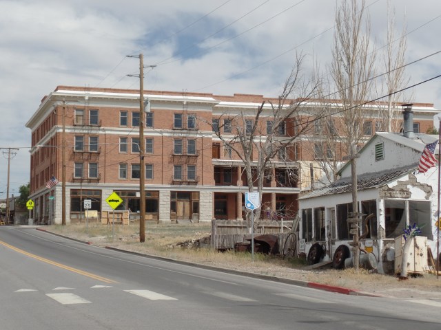
To so many, Maine means rocky shorelines, fronted by accessible beaches.  York County, the southernmost part of the state, has ample amounts of both, and is-along with Boothbay Harbor and Mount Desert Island, the most familiar area of Maine, when it comes to beach vacations.

York Harbor is upscale, in terms of accommodations, yet on this Sunday afternoon, plenty of people who one would not readily recognize as well-to-do were enjoying the nooks and crannies, between the  Agamenticus Yacht Club and York Harbor Inn. One of them was yours truly.

I was very much enchanted with Hartley Mason Reserve, and so present you with scenes from the north side of York’s stunning harbour.

First, here is a view from York Harbor Inn, looking towards Cape Neddick.

SAMSUNG CAMERA PICTURES

Thanks to zoom technology, here is a close-up of the promontory which hosts Cape Neddick Inn. One upscale resort can keep a clear eye on another!

SAMSUNG CAMERA PICTURES

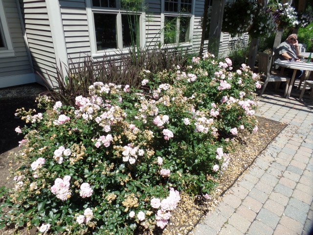
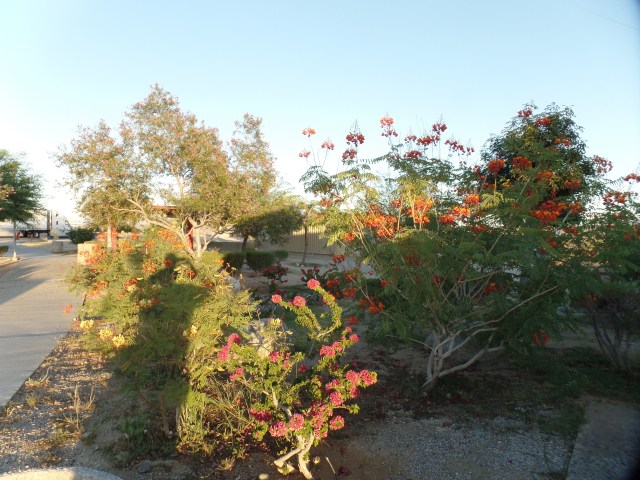
Both York Harbor Inn and Hartley Mason Reserve have done a fine job of keeping the area rich in colour and in fragrance.

SAMSUNG CAMERA PICTURES

As the gardens at York Harbor Inn are intended for that facility’s guests, I devoted the rest of my harbour time to the Reserve.  There was little information about Hartley W. Mason, other than that he was a wealthy York landowner, in the late nineteenth and early twentieth centuries.  When he died, in 1925, he left this land, south of York Harbor Inn, to the Town of York.  It became a public park, in 1993.

SAMSUNG CAMERA PICTURES

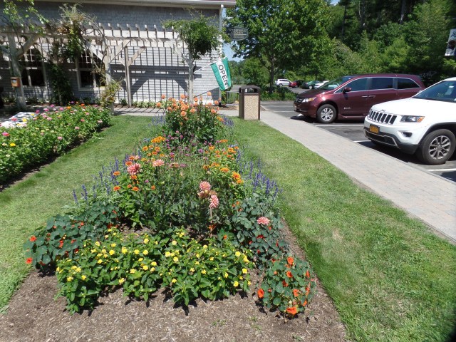
Many weddings take place here.  That comes as no surprise.

SAMSUNG CAMERA PICTURES

As I was enjoying these tickseed sunflowers, and preparing to take their photo, a little girl wandered into view.  She asked to not be kept in the shot, and I cropped this photo, accordingly.

SAMSUNG CAMERA PICTURES

Here is the York Fishermen’s Memorial, dedicated to the memory of Captain Daniel Donnell, who perished while on the job at sea, at the age of 78.  That’s how Mainers are.

SAMSUNG CAMERA PICTURES

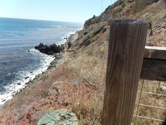
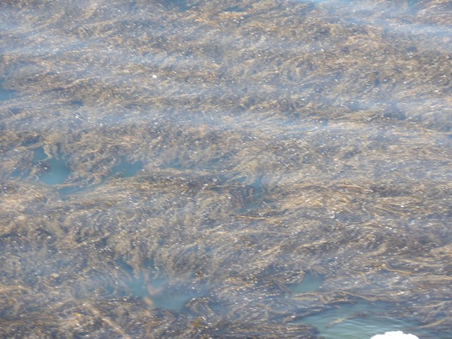
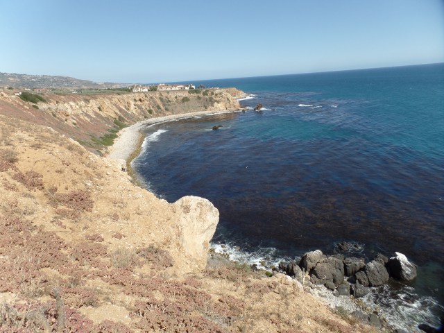
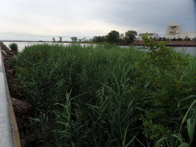
I walked down the well-trod York Cliffs Path, to enjoy the salt air and navigate the slippery rocks.

SAMSUNG CAMERA PICTURES

SAMSUNG CAMERA PICTURES

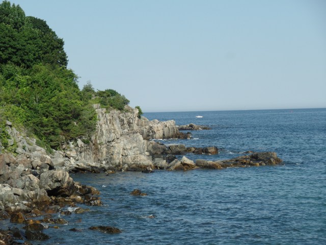
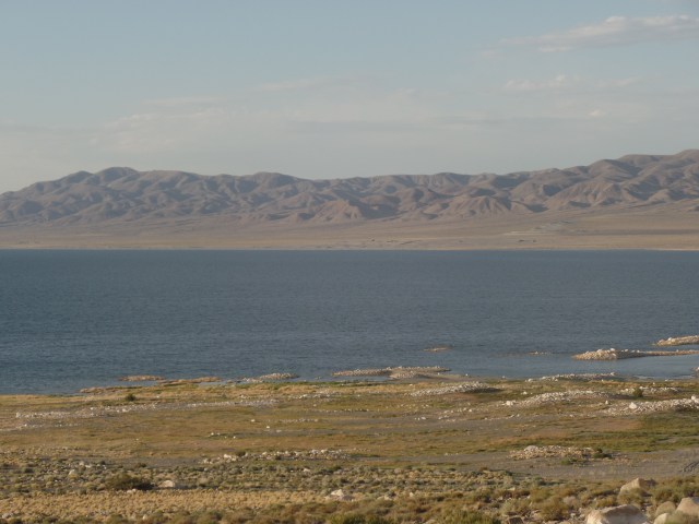
In contrast to my visit to Lynn Beach, yesterday, the tide here at York was coming in, albeit in a rather mild-mannered fashion.

SAMSUNG CAMERA PICTURES

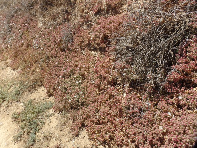
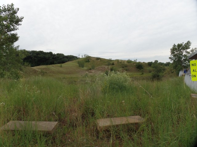
Returning to the top of the trail, I noted the limestone benches that are interspersed with the dense flora.  This is part of what makes the Maine Coast so magical.

SAMSUNG CAMERA PICTURES

There is so much more to York, and to its namesake county, to say nothing of the Pine Tree State.  In the coming years, I will no doubt be making more forays Down East, among other places.

I will close this part of  the Bruin Adventure, by thanking my York family.

SAMSUNG CAMERA PICTURES

SAMSUNG CAMERA PICTURES

Sixty-Six, for Sixty Six,Part LVII: Return to Down East, Part 2- Stonewall Kitchen and Downtown York

4

July 16, 2017, York, ME-

My father’s family hails from Maine, and several of us have lived in the Pine Tree State,  for certain periods of our lives.  Presently, one of my Dad’s sisters lives here, in York, two of her children and their families live nearby, and  two other cousins liveculinary center in other parts of the state.  It is Aunt Helen’s birthday, today, so this evening was spent at her home, with her youngest child, and her family, on hand for the celebration.

Beforehand, I stopped at Stonewall Kitchen, a large culinary center that celebrates Maine’s agricultural wealth and offers cooking classes.  Auntie works there, part-time and is a fixture at the place.  I had no trouble finding her, with help from two or three of her co-workers.  Since she was at work, I busied myself with checking out the store and the well-coiffed grounds, before moving on to York’s downtown, Old York historic district and harbor area.

Here are some scenes of Stonewall Kitchen (NOTE:  It is named for the iconic stone walls, that line many fields in New England.

SAMSUNG CAMERA PICTURES

SAMSUNG CAMERA PICTURES

SAMSUNG CAMERA PICTURES

SAMSUNG CAMERA PICTURES

SAMSUNG CAMERA PICTURES

SAMSUNG CAMERA PICTURES

You can see, from these scenes of the very southernmost part of Maine, why the state has exploded in popularity with travelers, tourists and people seeking to relocate.

I spent three more hours in York’s central districts.  The downtown area, like that of so many New England towns, is walkable and most inviting.  Here are some highlights, of the area just to the north of Old York.

I began at the town’s Civil War Monument.

SAMSUNG CAMERA PICTURES

The Old York Garden Club maintains the verdure, in this roundabout and at York public Library, as well as in the historic district itself.

SAMSUNG CAMERA PICTURES

SAMSUNG CAMERA PICTURES

The rushes are a natural part of York’s environment, and have been carefully preserved, just west of York Public Library, as a wetlands initiative.

SAMSUNG CAMERA PICTURES

SAMSUNG CAMERA PICTURES

SAMSUNG CAMERA PICTURES

After appreciating the exterior of York Public Library, and finding the building closed, for the Sabbath, I headed to Old York.


Sixty-Six, for Sixty Six, Part LIV: Chased by the Rain, Homeward

10

July 12, 2017, Saugus, MA- 

It was a lovely farewell to Tuesday, as I gazed out at the sunset, in a wooded preserve outside McKeesport, PA.

SAMSUNG CAMERA PICTURES

SAMSUNG CAMERA PICTURES

I thought, briefly, of camping in those lovely woods, but there was a sign: “Residents only”.

SAMSUNG CAMERA PICTURES

So, last night, after having waited out one intense storm, in the Pittsburgh area, I went eastward, and just shy of Chambersburg, I spent the night at Travel Inn, in the village of St. Thomas.

Today was relatively benign, across Pennsylvania, a bit of New York, over the Hudson-at Newburgh, and through Connecticut, which wasn’t bad, once I got past the Danbury Split (I-84 and U.S. 6).

Foodwise, I was too far east for breakfast at my  area favourite:  Bedford Diner. So, I checked out Andy’s, in Plains, up the road a piece from St. Thomas.  It was a decent substitute.  Around 2, despite my relative lack of activity, lunch called- so I gave a new spot, D’s Diner, in Wilkes-Barre, a try.  This is an excellent place, and a perfectly good excuse to use I-81 to/from New York, instead of cutting across New Jersey, as some have suggested.

Around 6:30, as I passed through East Hartford, the rain started again.  It made driving along the Massachusetts Turnpike rather interesting, but the real deal was MA 128/I-95.  I was surprised to find that my fellow Bay Staters seem to be greatly cowed by the rain, and we all inched along, past Boston, past Burlington and up to Wakefield, where I got off and used genetic memory to drive through a part of town, in which I hadn’t been in decades and make my way to the old hometown.  I will have three full days here, and one in Maine, as my New England “fix” for this year. Mom is ecstatic to see me, which is a good sign.

Sixty-Six, for Sixty Six, Part XLIII: Beyond Measure

6

July 9-10, 2017, Portage, IN-

My life has not been seemingly on a higher plane, since being invited to the spiritual forum that flows, quite nicely, with the tenets and expressions of faith that emanate from the Writings of Baha’u’llah.  A lovely service honoured His Herald, al-Bab (The Gate), who was so brutally executed on July 9, 1850- as part of a religious pogrom, that continues, to this day, in Iran.

The Baha’i House of Worship, in Wilmette, north of Chicago, blesses the entire area and brings solace to people of all spiritual traditions and inclinations.  The serenity extends to the surrounding shoreline of Lake Michigan.

SAMSUNG CAMERA PICTURES

Despite the solemn nature of the service, there is still much joy that the Baha’i friends take, from being together at this beloved Temple.

SAMSUNG CAMERA PICTURES

I was pleased to have met a new friend and mentor, at this gathering, as well as long-time fellows in Faith.  The energy propelled me, rather easily, through the freeway drive that could be otherwise rather draining.

I reached Indiana, in plenty of time for a Stromboli repast, in the town of Lake Station.  I did not hear back from a friend here in Portage, who has seemed a bit beleaguered, of late.  My plan to camp at Indiana Dunes National Lakeshore, however, did come to fruition.  There was a hint of a storm, which fortunately, did not strike the area until a bit after dawn, allowing me to break camp and head for the Dunkin Donuts.  My sad looking little tent is actually quite comfortable.

SAMSUNG CAMERA PICTURES

I like that Mother Nature waited, until I had everything down, folded and in the trunk, before the downpour began.  I felt badly for my neighbour,though.  She was a Hispanic woman, with four kids in tow.  I think the boys were in a tent, and she was in the camper, so it was probably only a temporary inconvenience.

After eating a breakfast sandwich and warming up with coffee, I headed to the Dunes.  The early morning was dark, and could have been gloomy, if I’d let it be.  There is a majesty, in the stark horizon and in the interplay between shore and lake.

SAMSUNG CAMERA PICTURES

SAMSUNG CAMERA PICTURES

There are all manner of trails, around the Dunelands- and one goes from the Illinois state line to the Michigan line.  I was content, today, just to enjoy the shoreline and life in the sand dunes.

SAMSUNG CAMERA PICTURES

There are several estuaries, a testimony to the sheer size of the lakes.

SAMSUNG CAMERA PICTURES

Here is a look at Portage’s harbour house and marina.

SAMSUNG CAMERA PICTURES

Vegetation and flowers are always very thick, among the dunes.

SAMSUNG CAMERA PICTURES

The allure of reflection is ever present.

SAMSUNG CAMERA PICTURES

Michigan is not quite visible, through the haze, but it’s there, way beyond the steel mill.

SAMSUNG CAMERA PICTURES

There is a fine interplay, at long last, between conservation and metallurgy, in this often buffeted area.

SAMSUNG CAMERA PICTURES

The “closeness” of Chicago?  At least, the haze is not strong, to the north and west.

SAMSUNG CAMERA PICTURES

The steel barons, long ago, had a lighthouse placed at the north end of the mill site. It is almost a stone’s throw, from the public walkway, west of the mill.

SAMSUNG CAMERA PICTURES

Here is the beach area, of the Portage shoreline.  A few hardy souls were here, in search of at least a morning’s catch.

SAMSUNG CAMERA PICTURES

Finally, this wetland area has been reclaimed, fully, from having been a Superfund waste site.  Indiana’s Congressional representatives and the steel industry managed to get this one right, and wildlife thrives, in the restored hills.

SAMSUNG CAMERA PICTURES
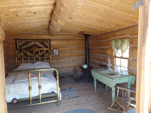
July 10 was a most momentous day, with two great visits, each of which will be the subject of a post.  Part XLIV (44) will feature the University of Notre Dame and Part XLV (45) looks at Elkhart, and a most unusual family farm.


Sixty-Six, for Sixty Six, Part XLV: The Enduring and The Fleeting

5

July 6, 2017, Santa Rosa, NM-

My day began, fresh and rested, with a stop at Wilson Arch, on the south end of a tourist attraction called “Hole In The Rock”, a collection of trinket shops and oddities.  It was easy to avoid, being closed.  The Arch, though, called out for some meditation time, so I walked to a sandstone bench, where I was able to sit undisturbed, while watching a group of other visitors, clambering up to the Arch, 300 yards away.

SAMSUNG CAMERA PICTURES

SAMSUNG CAMERA PICTURES

SAMSUNG CAMERA PICTURES

It was getting to be breakfast time, so I headed to the Monticello branch of Moab’s famed Peace Tree Cafe.  The small eatery features a wealth of inventive breakfast items, such as Coconut French Toast, which sustained me for nearly the whole day.

SAMSUNG CAMERA PICTURES

Continuing to Bluff, a small settlement, off the hipster trail that encircles Moab, I found a functioning laundromat, which was sorely needed, and Bluff Fort- a restored Mormon settlement, and testimony to the hard work and suffering that pioneers experienced, in the late Nineteenth Century.  This story did not, thankfully, involve conflict with Native peoples.  It was all about the harsh terrain that the Mormons found, in the course of settling southeastern Utah.

Here are some scenes of the Co-op store, water wheel and  a few of the sixteen cabins that greet the visitor. The first stop, in a self-guided tour, is the Old Schoolhouse.  Note the beamed roof.

SAMSUNG CAMERA PICTURES

SAMSUNG CAMERA PICTURES

The brick and mortar building, below, is the Co-op, a restoration of the original, which was burned to the ground by an outlaw, in 1909, after a botched robbery attempt.

SAMSUNG CAMERA PICTURES

Then, it was on to the water wheel and cabins, which highlight the differences in status among the settlers.

SAMSUNG CAMERA PICTURES

SAMSUNG CAMERA PICTURES

SAMSUNG CAMERA PICTURES

SAMSUNG CAMERA PICTURES

Despite the seeming differences, it is remarkable that the group braves the harshness of the Kaiparowits Plateau, with its nearly-impenetrable maze of sandstone formations.

Among the sandstone spires in the Bluff area are the Navajo Twins, which are named for the two warrior spirits of Dineh (Navajo) tradition.SAMSUNG CAMERA PICTURES

Once laundry was finished, I drove straight on down to Native American Baha’i Institute, where I left a set of crafts supplies, and headed eastward, in short order.  This was punctuated by my scrunching a desperate, nearly heat-prostrated couple into my front seat, and taking them to their utility’s office.  After the errands,  a dinner of  chicken and salad, at Gallup’s Sizzler, and a long haul, across New Mexico, brought me to the lovely Route 66 Inn, in this high desert town.  The motel is run by a wonderful family- grandparents, Mom & Dad and three happy children.

It is amazing, that the pioneers accomplished so much, by working together, in enduring camaraderie, while others seem to be just spinning their wheels, by indulging in caprice and in fleeting acquaintances.

NEXT UP:  Texas to Illinois

Sixty-Six, for Sixty Six, Part XLIV: The Great Basin Road

7

July 5, 2017, Moab-  

(This is the first of several backdated posts from Road Trip 2017.  I will be in a place with spotty WiFi, over the next few days, and family time comes first, so this series will be slow in posting.)

It’s always tough to leave loved ones behind, but life must go on, and nowhere does it go on better than in America’s Outback.  The Great Basin is largely the bowl left by Lake Lahontan, and other large bodies of water, remnants of one huge sea, that once occupied our continent’s mid-section.  The present Lake Lahontan is quite impressive, actually, with the seasonal rains having been copious here, as elsewhere in the West, this past winter and spring.  I took about a half hour to visit the lovely giant.

SAMSUNG CAMERA PICTURES

SAMSUNG CAMERA PICTURES

SAMSUNG CAMERA PICTURES

Much more was above water, this time last year.

I drove past the salt flats and noted they looked a bit browner than usually- another consequence of extra moisture.  At the foot of the Toiyabe Mountains, I came upon a forlorn looking man, whose jeep had just discharged a fair amount of water.  My jerry can took care of that aspect of the matter, in short order.  After, I followed him a short distance towards Austin, the nearest town, he told me to go on ahead, as the issue may have been the fuel pump, and he wanted to give it some rest.

It is a fair uphill, from the salt flats to Austin, so I informed the dispatcher, at Lander County’s office, of his issue.  After lunch, in Toiyabe Cafe, on Austin’s main drag, I noticed the town’s only flatbed tow truck was headed out, in his direction.  The ladies at the Cafe said the sheriff is most diligent about NOT letting stranded motorists wait too long.  That’s one of the fine things about people in remote areas:  Most everyone is a Good Samaritan.  T\

Toiyabe Cafe has some great eats, also.  Since my only beer is “near”, I guess I could wait.

SAMSUNG CAMERA PICTURES

There’s no bush meat available, though, but who wants to eat a carnivore, anyway?

SAMSUNG CAMERA PICTURES

I drove on and on, determined to make Utah’s sandstone country, by bedtime.  So, on past the Great Basin National Park, various other salt flats, the lovely towns of Eureka, Ely, Delta(UT), Salina and Green River, the Hyundai blazed.  Rooms in this bustling town were, of course GONE, by the time I pulled in, so a few miles down the road, in La Sal, I found a rest area/makeshift campground, guarded by this great sandstone:

SAMSUNG CAMERA PICTURES

Since the people parked in the foreground made themselves at home, camp-style, I did likewise.  Things are relaxed (24-hour limit), in the Beehive State.

NEXT UP:  Wilson Arch, Bluff Fort and an errand accomplished.

Sixty-Six, for Sixty Six, Part XLIII: Ever in Wonder

8

July 3, 2017, Carson City-

Along the path to Grama’s, I walked.

That path crossed a road,

and for crossing alone,

I felt a sting on my backside.

There are limits to what a three-year-old

can do, alone.

Along the path to the shopping center, I walked.

That path crossed several roads,

and for being alone,

I was briefly accosted,

by a couple of ruffians,

and almost struck by a wayward car,

that had jumped the curb.

There are challenges,

for a nine-year-old,

when walking, alone.

I sat in the airplane,

gazing out at the clouds,

and their patterns.

I was seeing for the first time, at their level.

The path through the skies,

held promise

and peril.

Many are the possibilities,

for an eighteen-year-old,

striking out, on his own.

Turning around,

in that crowded,

light-filled, noisy room,

I returned the gaze of one,

who had seen something in me,

that others overlooked.

My path was no longer

for me to walk in single file.

Life brings affirmations,

to a thirty-year-old,

who need not be alone.

Holding the little being

to the light,

I spoke words of welcome.

My line now continued,

for at least one more generation.

The Universe sang songs

of certitude,

to a new father,

listening, alone.

Father and son walked

from the car,

towards the hospice door,

and witnessed the wispy spiral

carrying dust and leaves skyward.

I touched her still-warm body,

and kissed her face,

with her eyes still open,

in seeming astonishment.

The path is ever-shaky,

for a sixty-year-old,

once again, alone.

Time and again, since then,

I have followed things through,

to completion,

having been roundly chastised,

by a well-meaning watchman,

for all those things,

I did not finish,

in times gone by.

The paths have been many,

and the rewards even greater:

Filbert Steps, Portlandia,

Space Needle, Stanley Park,

Wrangell, Mendenhall,

Mount Verstovia, Beuk-ai Temple,

Tuileries, Jeanne d’Arc’s Tower,

Mont St. Michel, Carnac,

Daily Gourmand, Old Bruges,

World Cup rally at the Bourse,

McAuliffe Square,

Luxembourg’s National Day,

the Dom of Frankfurt,

the Temple at Langenhain,

Waikiki, Iolani Palace.

The paths have seen me through,

to their ends:

Prescott Circle,

Black Canyon,

Granite Mountain,

and the Memorial to

its 19 Hotshots,

Bright Angel,

Spirit Tower.

The trails continue,

and the wonder,

at the limitless,

open to a sixty-six-year-old,

who  feels far from alone.


Sixty Six, for Sixty-Six, Part XLII: More Flow than Ebb

6

July 2, 2017, Sparks- 

The drive through northwestern Arizona and western Nevada, yesterday, was quite pleasant, thanks to a well-maintained vehicle and the unusual amount of energy I felt.  This last was despite having had to tend, however briefly, with a neighbourhood emergency, in the wee small hours of the morning. Long story short, when it comes to the welfare of children, or vulnerable adults, I am not going to just look at the clock and roll over, back to sleep.  Police were called, matter was resolved, and I did get back to dreamland.

One of my concerns, along the way, was the water levels of the major lakes, en route.  I stopped, briefly, for a look at Lake Mead, before doing the customary straight shot through Las Vegas.  The reservoir, which has suffered, mightily, in the drought of the past several years, has made a modest recovery, this Spring.

SAMSUNG CAMERA PICTURES

SAMSUNG CAMERA PICTURES

The shimmering haze reflected the heat, 112 in mid-afternoon.  Needless to say, this is why I don’t tarry in LV, in July.   A brief stop at Snow Mountain, north of the valley, for a turkey wrap, was sufficient.

Another of my interests, in western Nevada and across the Mountain West, is the architecture of various mining towns.  This runs the gamut from Victorian elegance to honky-tonk kitsch.  It’s all good.  I stopped in the eclectic little town of Goldfield, between Beatty and Tonopah,  On the west side of town, there are a few examples of the latter.

SAMSUNG CAMERA PICTURES

SAMSUNG CAMERA PICTURES

There is also plenty of faded elegance, begging for restoration. In the background, stands the vacant Goldfield Hotel.

SAMSUNG CAMERA PICTURES

This is not exactly the Arc du Triomphe, but it serves as a reminder of the frontier spirit.

SAMSUNG CAMERA PICTURES

My mining town fix having been satiated, I headed on, to Tonopah, stopping at one of that fine town’s newest offerings:  Beans and Brews Coffee Shop, for a much-needed boost.  Tonopah, also, has much to offer, in the way of late 19th Century memorabilia, as I’ve documented on prior trips.  I had four more hours of travel, though, so my cup of Joe was to go.

Hawthorne, just above Walker Lake, has seen my smiling face a few times.  This town, you may remember, is where my Nissan began to falter, two years ago, and my angels took over, to get it to Reno. The guys at Pizza Factory,  prepared a delicious baked spaghetti with meat sauce, which I took to an overlook, four miles north of town. Walker Lake also looks in much better shape.

SAMSUNG CAMERA PICTURES

SAMSUNG CAMERA PICTURES

My Reno/Carson family were glad for my arrival, at 10:15 PM, and we caught up on life, for about an hour.  Today was more of the same, in the modest family home, here in Reno’s neighbour.  The kids made slime, the adults watched family-friendly movies and the menagerie kept guard.

SAMSUNG CAMERA PICTURES


A SoCal Break, Day 2: Crystal Cove

8

June 13, 2017, Chiriaco Summit, CA- 

Not that much has come easy to me, over the years, largely because I grew up among impatient peers and had to do things quickly, or not at all.  Fortunately, my parents were a tad more sanguine, and gave me the space to master things at my own speed.

I mention this, because camping, while dear to my heart, has certain aspects, like putting up the tent, that have taken awhile to master.  So, it’s been a wonderful affirmation that my tent has gone up, three times in a row, without a hitch.  I know now that the whole discombobulation thing was a contrivance.  Even with the wind, at San Onofre State Beach, my tent stayed up all night, as did the others.

So, the day dawned with a fine view of the ocean, and I felt a strong sense of confidence.

SAMSUNG CAMERA PICTURES

Coffee, another morning staple, has always come easier.  Billy the Barrista, at Dana Point’s Crank and Grind Coffee House, put together a superb Cranked Up Americano.  As the name suggests, it’ll get any sluggish beast firing on all cylinders.

SAMSUNG CAMERA PICTURES

My next impulse was to stop and smell the roses, so up to Doris Walker Overlook, I went.  There is a commanding view of Dana Point Harbor, from this quiet redoubt, and I was able to offer my morning prayers in peace.

SAMSUNG CAMERA PICTURES

A sea of flowers is complemented by a sea of boats and the Pacific, itself.

SAMSUNG CAMERA PICTURES

After one further stop, at Corona del Mar public Library, to check my correspondence, it was time to head to Crystal Cove State Park, for a  lunch meeting with a long-time friend.   We have a mutual interest in the fortunes of the California coast, and the cottages of Crystal Cove are among our concerns.  Her news was that the California Coastal Commission had granted Crystal Cove’s Preservation Society permission to renovate the north side’s dilapidated structures.  In real terms, this means drawing blueprints, razing the existing structures, and building replicas.  That is certainly far better than putting up more high rises and condos, which would be a travesty here.

Here are some scenes of the north side cottages.

SAMSUNG CAMERA PICTURES

SAMSUNG CAMERA PICTURES

SAMSUNG CAMERA PICTURES

After a fine lunch and lengthy catch-up conversation, at the Beachcomber, we walked a bit along the south beach, in search of sea shells.  Those we found were embedded in several rocks.

SAMSUNG CAMERA PICTURES

Among the rocks which line this section of coast, here are two which are aligned perfectly.

SAMSUNG CAMERA PICTURES

There were many people enjoying the beach, as one would expect, on so fine a day.  A couple had found the perfect perch, atop a rock that resembled a whale’s head.

SAMSUNG CAMERA PICTURES

After a couple of hours, it was time to say farewell, and I headed south to Aliso Beach, in the southern part of Laguna Beach, and collected a Ball jar of ocean water, for a grieving friend.  Aliso, too, was packed, and as I was gingerly looking for a parking space, a beach ball sailed into the parking lot in front of me, pursued by a boy of about 10 or 11, just as I hit my brakes.  No one was any worse for the wear, but it reminded me of the TV ad, where a little girl, pursuing a soccer ball, runs pell mell in front of a car- whose brakes are shown to be of superior quality.

The drive from Oceanside, through Vista, Fallbrook, Temecula and overland to Palm Desert, was uneventful, save for a couple of crazed drivers doing 80, on a winding road that safely can support people doing 60, if that.  I always manage to pull off and let them go on their intrepid way, though seldom as quickly as they seem to want.  The second one chose to pass a tractor trailer, on a curve, against a double yellow.  I’d say his luck will run out, sooner or later.

Lastly, here is a scene at Cactus City Rest Area, uphill and east of Coachella.  There are no cacti, at Cactus City, but I had a peaceful supper break.

SAMSUNG CAMERA PICTURES

Back to Arizona I go, if only for a couple of weeks, before family time ensues.


A SoCal Break, Day 1, Part 2: Point Vicente

6

SAMSUNG CAMERA PICTURES
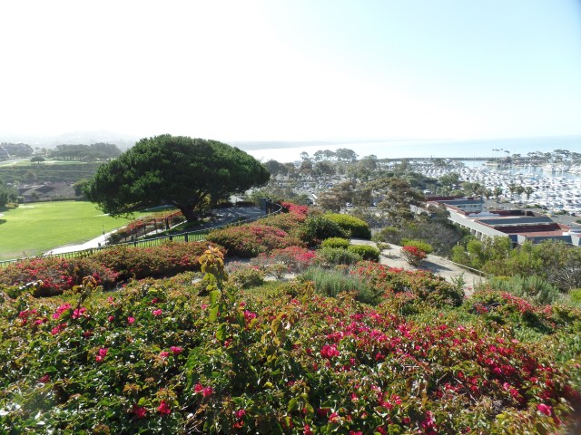
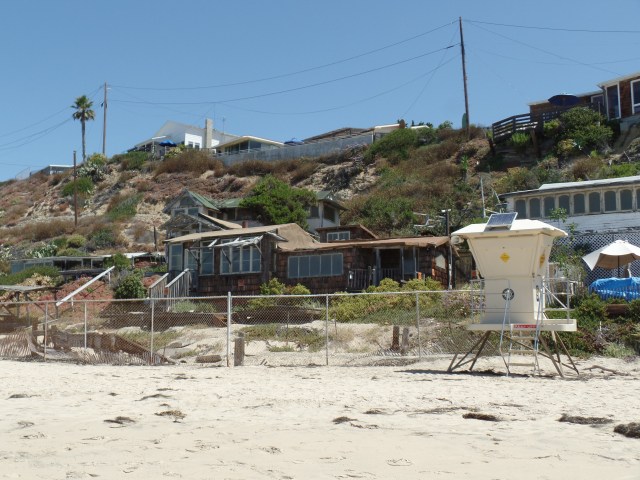
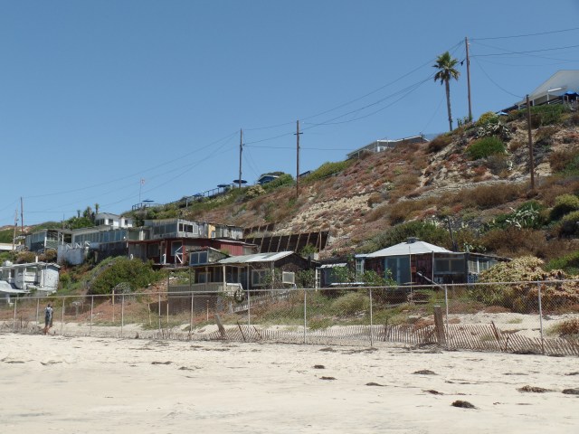
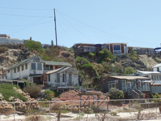
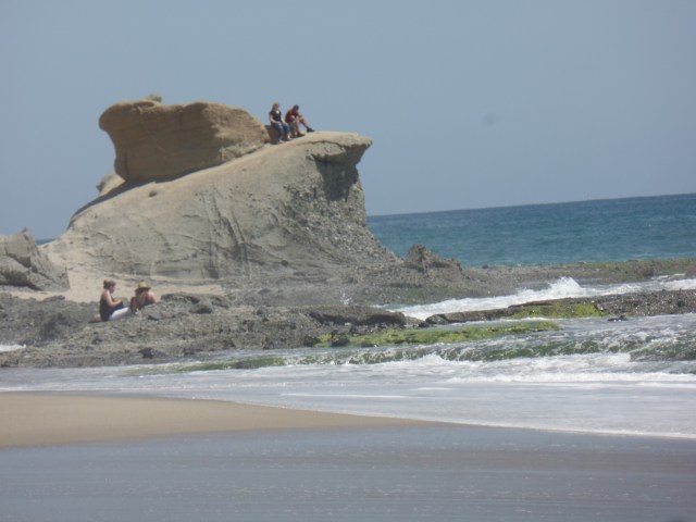
June 12, 2017, San Onofre-   

Since first visiting Palos Verdes Peninsula, west of Los Angeles, a couple of years ago, I have wanted to go back and actually walk a bit, from one of the overlooks, down to the beach and back.  This afternoon, I chose the southern end of the peninsula, at Point Vicente, to make that hike.

The Point Vicente area is the site of a U. S. Coast Guard lighthouse, one of three in southern California- the others being at Point Loma, in San Diego, and at Point Conception, between Santa Barbara and Santa Maria.  As an active Coast Guard facility, it is off limits to visitors, save for a few hours on a certain day of the week.  This was not that certain day.

SAMSUNG CAMERA PICTURES

Point Vicente does have a lovely Interpretive Center, operated by the City of Rancho Palos Verdes.  The small museum, focusing on marine mammals and other aquatic life, is supplemented by a crew of docent volunteers.

SAMSUNG CAMERA PICTURES

There is also a spacious viewing platform, with a particularly fine view, today at least, of Santa Catalina.

SAMSUNG CAMERA PICTURES

In between the platform and the island, however, there is much to hold a visitor’s attention.  Beach plum is as plentiful here, as it used to be at the beaches of Massachusetts, when I was a kid.

SAMSUNG CAMERA PICTURES

Once down to the narrow beach, it is possible to walk for about 1/4 mile, before a field of boulders renders the walk questionable, at least in the eyes of locals.SAMSUNG CAMERA PICTURES

SAMSUNG CAMERA PICTURES

Small rocks jut out of the open water, as they do all along the Pacific Coast, the result of continuous volcanic activity, over the eons.

SAMSUNG CAMERA PICTURES

Kelp is also plentiful, though the mollusks which feed on it are much rarer in southern California than they were, even ten years ago.

SAMSUNG CAMERA PICTURES

The rock below gave me the sense of a stranded turtle, looking seaward.

SAMSUNG CAMERA PICTURES

Flowering plants, like these daisies, always seem to find a niche, whether on the shore or in the desert.

SAMSUNG CAMERA PICTURES

I could not remember whether these are hydrangea or Oregon grape.

SAMSUNG CAMERA PICTURES

Palos Verdes’ trail system is also part of the California Coastal Trail, which “when completed” will provide access to 1200 miles of California shore line, from San Ysidro to the Oregon state line- after which, of course, the Oregon Coast Trail takes over, clear to Astoria.  I’m not getting any bright ideas, mind you, though there were four middle-aged people who made the trek from Crescent City to San Ysidro, in 2003.  The Trump Corporation has even granted an easement across its National Golf Course, south of Point Vicente.

Point Vicente, by the way, got its hybrid name from Captain George Vancouver, after his friend, Friar Vicente, when his ship rounded the peninsula, in 1790.   The connection, then, is with Mission San Buenaventura, some 92 miles to the north northwest.

A good day’s exploration done, I called it a rest, and headed southward, arriving here at San Onofre State Beach, a bit after 7 PM.  Tomorrow will bring a more sanguine visit with a friend of several years and a bit of collecting ocean water.