Sixty-Six for Sixty Six, No. XXII: Wonders of the Middle Realm

6

April 9, 2017, Prescott- Yesterday, I wrote of the western third of the contiguous United States, which is where I have spent most of my time, since 1992.  Being from the East Coast, and preferring surface travel over flying,  especially when the weather is good, I have developed an affinity for the regions which many call “flyover country”.  The Great Plains and South Central regions may not have the jaw-dropping grandeur of the Mountain West or Alaska, but there is plenty worthy of spending one’s time.

The Rockies, of course, are the heart of the Mountain West.  In many visits to the heights of Colorado, I have felt most at home in Longmont, Loveland and Denver, where I have family.  Manitou Springs, Garden of the Gods and Seven Falls have helped make Colorado Springs another “feel at home” stopover.  One of these years, I will find my way to the summit of Pikes Peak.  Boulder, also, has welcomed me, several times, with wonders ranging from Pearl Street Mall, and Boulder Books, to Eldorado Canyon, which I hiked in the rain, whilst carrying an umbrella.  The Tetons and Yellowstone invite me back, as well, with visions of geysers and Grizzlies.

As the Rockies recede into the Great Plains, I find Spirit Tower (forget the name, “Devil”), Medicine Wheel, the Badlands, Black Elk Peak (formerly Harney Peak), Scott’s Bluff and the determination of the Indigenous People of the prairie as riveting as any great mountain or canyon.  Little towns like Deadwood, Belvedere and Custer(overlook the name) (SD), Burlington, Granada and Walsenburg (CO), Wellington,Dodge City and Hays (KS) have been as welcoming as any place in the West.  There is, to my mind, a goodly amount of sophistication and culture to be found in Omaha, Lincoln and Wichita, as well.

Friends in Amarillo and Enid (OK) have helped make those cities almost necessary pit stops, on any eastward trek that takes a southern route.  Texas, like California, is a world unto itself.  I was captivated by the warmth I felt, across the state, from the great cities of El Paso, San Antonio, Austin, Fort Worth, Dallas and Houston to small communities- Grand Saline, South Padre Island, Laredo, Marfa, Sanderson, Quanah and Temple.  There wasn’t much happening in Luckenbach, when I happened through there, but the locals were glad I came, anyway.  Revelations abound, across the Lone Star State, from the view of the Rio Grande’s confluence with the Gulf of Mexico, to Pedernales Falls, northwest of San Antonio, or the wild canyons of the Llano Estacado and the Trans-Pecos region.  My favourite museum section remains the Music Hall, at Bob Bullock Museum of Texas History, near the Texas State Capitol (itself an extraordinary edifice).  Then, there are the five missions in San Antonio- a very full day of discovery!

Oklahoma has no end of variety, but I will content myself with sending kudos to Lake Texoma and Lake of the Cherokees, Black Mesa(the state’s highest point, at its juncture with New Mexico and Colorado), Tonkawa and its monument to Chief Joseph, of the Nez Perce, and the heartfelt, humbling memorial to the victims of Oklahoma City’s tragic bombing, in 1995.  Oklahoma City remains the only place where I have been mistaken for a county employee- being invited to an employee barbecue, as I walked by, on the way to the Memorial.

I will continue to skip the temptation to fly over, as long as the weather is not too harsh.


Sixty-Six for Sixty Six, Part XXI: Near and Far

5

April 8, 2017, Prescott-

I went to the Farmers’ Market, this morning, and attended a Red Cross Volunteer Appreciation Luncheon.  Then, I went back to Home Base and cleared the first of nineteen sections of a weed-filled back yard.  I am old school, when it comes to such things.  Herbicide and gasoline-operated weed whackers don’t appeal to me.  Pulling weeds up by the roots is tedious, but it has no side effects.  I also won’t wreck the beautiful tulips that are gracing the yard.

I chose to stay in, this evening, just for the sake of it.  In the process, I find myself wanting to note the things that are dear to my heart about each region of the United States- at least the contiguous area, with which I am most familiar.

So, I love the Southwest for its lush deserts, its canyons and their limitless surprises, mountains that rise like sky islands, the wildlife that seems so furtive and yet so likely to pop out of hiding, at a moment’s notice.  Its superlatives are the Grand Canyon, Nevada’s Valley of Fire and Cathedral Gorge, Mesa Verde, Chaco Canyon and Kartchner Caverns.  Its most sublime surprises are Canyon de Chelly, Slide Rock,  Thumb Butte, Picacho Peak, Quitobaquito, White Sands and Great Sand Dunes.  The revelations are the best of all:  Superior, AZ; Mancos, CO; Pioche, NV; Truth or Consequences and Chama, NM; Loa, UT.   Prescott will always feel like home, and so will Tucson, Flagstaff, Hopi, Dinetah, Reno-Carson City, the Front Range and Superior.

California is in several classes by itself.  The sunny (until this year) south; the interchangeable mountains and deserts of the east; the intense vegetation of the north.  It has been a home away from Home Base, for as long as I’ve lived in Arizona.  Its superlatives are Yosemite, Mount Shasta, the Coastal Redwoods, frenetic Los Angeles and exquisite San Francisco.  San Diego and Julian will always be welcoming, family places. Coastal Orange County, Palos Verdes, Santa Barbara, Santa Cruz, Point Reyes and Mount Lassen define inspirational.  There is no such thing as a boring Spanish colonial mission.  Revelatory, to me, are little towns like Banning, Brawley, Ojai, Willits, Lomita, Woodfords and Yreka.

The  Pacific Northwest defines majesty.  Nothing outdoes the Olympic Peninsula, the Oregon Coast, Rogue River Gorge, the North Cascades or the canyons carved by the Snake and Columbia Rivers.  Portland and Seattle exude creativity and cultural diversity.  The islands of Puget Sound and the Straits abound with familial small communities:  Anacortes and Friday Harbor stand out, in my memory.  Wenatchee, Toppenish, Leavenworth, Spokane, The Dalles, Bend, Culver, Ashland, Pullman, Lewiston and Moscow all took me under their wings, and  remain every bit  blessed in my heart.  The most surprising scenes were at Smith Rock, at the bridge outside Culver, at the alkaline lake for which Lakeview is named, on the boulder strewn beaches at Bandon and Kalaloch.

I am rambling, so there will be parts two and three to this elegy.

In Spirit Canyon

6

April 2, 2017, Prescott- The second good part about yesterday, after being treated to a lunch prepared with love and caring, was a hike in the upper reaches of Queen Creek Canyon.  The trail I took lies about a mile or so east of Oak Flat.  A sign, at the bridge over Queen Creek, refers to Devil’s Canyon.  I would rather use the name Spirit Canyon, in the same vein as those, who love Wyoming’s iconic towering butte, use the name Spirit Tower.

So, there I was, again almost totally alone, with the gathering wind and dark, but high clouds, and one Arizona gray squirrel.  The canyon is as magnificent here, as it is closer to town.  The trail here leads up to the feet of the Pinal Mountains, which include Picket Post Mountain, on their western edge.

As always, one can imagine the rhyolite spires as fortresses and sentinels.

SAMSUNG CAMERA PICTURES

SAMSUNG CAMERA PICTURESSAMSUNG CAMERA PICTURES

This scrunchy-faced sentinel was “alert”.

SAMSUNG CAMERA PICTURES

SAMSUNG CAMERA PICTURES

SAMSUNG CAMERA PICTURES

This rock almost reminded me of ribbon candy.

SAMSUNG CAMERA PICTURES

Wild flowers, while still sparse, are popping up in bunches, here and there.

SAMSUNG CAMERA PICTURES

SAMSUNG CAMERA PICTURES

Atop the canyon, alligator junipers take over from cacti, oaks and mesquite.

SAMSUNG CAMERA PICTURES

The Pinal Mountains lie ahead, across a trail-less expanse of about two miles.

SAMSUNG CAMERA PICTURES

As if to say “Heads up, there are fiery days ahead”, a small patch of Mexican Firecracker greeted me, as I got close to my car, at the end of the hike.

SAMSUNG CAMERA PICTURES

Whether the days ahead are tranquil or turbulent, I know that I have plenty of friends, both human and spirit, in the vast expanse, of which Arizona is a central part.

Sixty-Six for Sixty Six, Part XIX: Two Kinds of Heaven

5

March 14, 2017, Superior-  I was invigorated, despite it being an afternoon during the Fast, once the High Trail came into view.  This fairly easy trail first led down into Queen Creek Canyon, and past an old, abandoned Pump House.

SAMSUNG CAMERA PICTURES

SAMSUNG CAMERA PICTURES

The energetic and happy family ahead of me were already planning to bounce along the bridge that crossed Queen Creek and take on the ridge, which gives High Trail its name.  I was more than glad to follow suit.  As they bounced up and down, in unison, I lingered behind, to take in the fragrance of some Texas Scarlet, and view upwards, at the rhyolite which Queen Creek seems to have thrust upwards.

SAMSUNG CAMERA PICTURES

SAMSUNG CAMERA PICTURES

Then, it was time to do a bit of jumping of my own.

SAMSUNG CAMERA PICTURES

Queen Creek was still, on this gorgeous afternoon.

SAMSUNG CAMERA PICTURES

The views eastward, however, were an extra delight- the rugged edges of a particular heaven.

SAMSUNG CAMERA PICTURES

SAMSUNG CAMERA PICTURES

SAMSUNG CAMERA PICTURES

I was able to get one more, long-distance view of Picket Post House, before heading back down into the canyon.

SAMSUNG CAMERA PICTURES

Obsidian accompanies rhyolite, as one heads towards the Australian exhibit.

SAMSUNG CAMERA PICTURES

After one last look at the rhyolite “castles”, for today, I headed back towards the Arboretum.

SAMSUNG CAMERA PICTURES

There are two greenhouses, on the western edge of the park.  These house plants that are still delicate, primarily from the “cone” of South America and from southern and eastern Africa.

Mammilaria are the main feature of Green House 1.

SAMSUNG CAMERA PICTURES

Euphorbia, and aloe, dominate Green House 2.  The first shows plants from Madagascar, which, like the U.S. has a rugged desert Southwest.

SAMSUNG CAMERA PICTURES

These plants are from the equally rugged southwest of the Arabian Peninsula.

SAMSUNG CAMERA PICTURES

With that, I exited Boyce Thompson Arboretum.  My return,  in the first days of April, will be in no small part due to  a special soul, working in this little bit of heaven.  SAMSUNG CAMERA PICTURES

SAMSUNG CAMERA PICTURES

Nature and friendship are what keep me going, as many in Prescott, and elsewhere, know.

Sixty-Six for Sixty Six, Part XVIII: Queen Creek, as A Moat

0

March 14, 2017, Superior- After an intensive review of the desert plants, with which I have become so well familiar, thanks to both Boyce Thompson Arboretum and its sister institution, Desert Botanical Garden, I headed up along the High Trail, to have a look at Picket Post House’s exterior (the house doesn’t re-open for visits, until either next year or 2019), and  Ayer Lake, a small reservoir that was drawn from Queen Creek, for the purpose of attracting water fowl and aquatic reptiles.

High Trail goes between  Ayer Lake and Picket Post House, then loops around to the west and south, along the eastern base of Picket Post Mountain.  The first twenty minutes of my hike, on this relatively easy trail, found me in a wealth of company- it being Spring Break for Arizona schools.  There were birders galore, at  Ayer Lake, teen girls with selfie sticks, on the rocks above the reservoir and adventurous boys, who followed me in exploring a couple of ledges, overlooking a western spur of Queen Creek Gorge.  The parents of the kids were close by, enjoying the relative comfort of the thatched-roof ramada.

Here are further scenes of this very full visit.   Ayer Lake, rather still on this mild day, has at least one resident turtle, and several Black Phoebes, enjoying the cold water.

SAMSUNG CAMERA PICTURES

I saw a couple Red-tailed hawks circling around, as well.  They are said to nest in the rhyolite boulders, which abound in this park that was built from nature, not imposed on it.

SAMSUNG CAMERA PICTURES

SAMSUNG CAMERA PICTURES

This overlook was most popular with the girls.

SAM_7881.JPG

Of course, it had the best view of the reservoir.

SAMSUNG CAMERA PICTURES

SAMSUNG CAMERA PICTURES

SAMSUNG CAMERA PICTURES

Speckled and striated rhyolite, between lake and mansion, testify to the presence of both copper and iron, in the area.

SAMSUNG CAMERA PICTURES

SAMSUNG CAMERA PICTURES

Picket Post House itself looms just above these boulders, and almost seems protected by the creek and canyon, which loop around its northern and western flanks.

SAMSUNG CAMERA PICTURES

The boys and I saw this hint of the coming spring, from the canyon’s edge.

SAMSUNG CAMERA PICTURES

Here was a sight that caused the boys to turn back from the overlook.

SAMSUNG CAMERA PICTURES

Picket Post House, seen from a southwestern vantage point, shows its retaining wall.

SAMSUNG CAMERA PICTURES

I look forward to seeing the place, in its full magnificence, once it becomes part of the park’s exhibits, a year or two hence.

Next up:  The High Trail’s western course.

Sixty-Six for Sixty Six, Part XVII: The Amazing Fruits of Sand

5


SAMSUNG CAMERA PICTURES
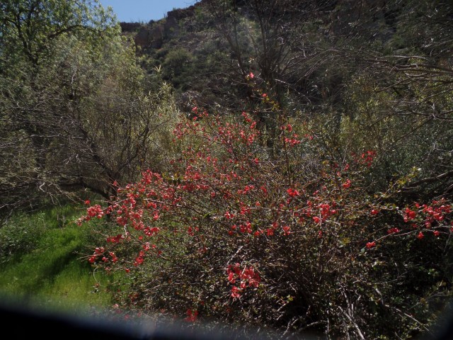
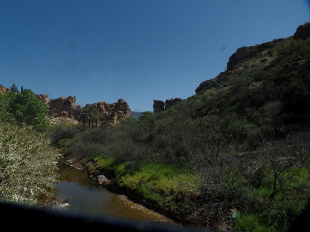
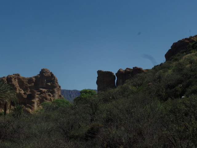
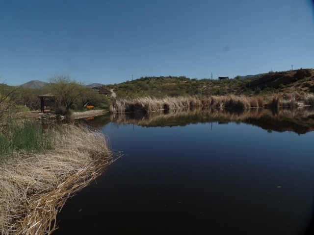
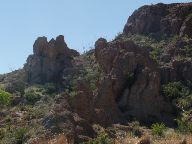
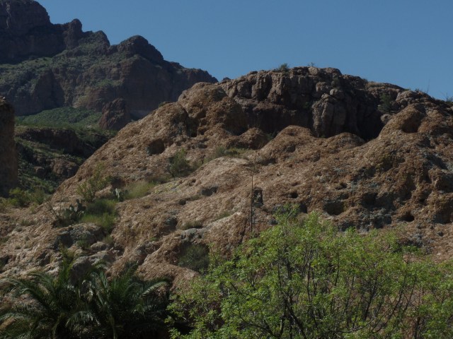
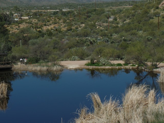
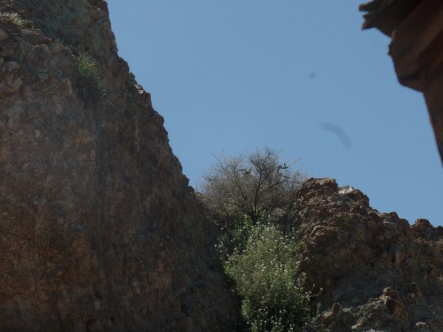
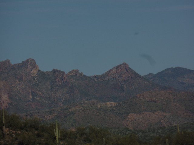
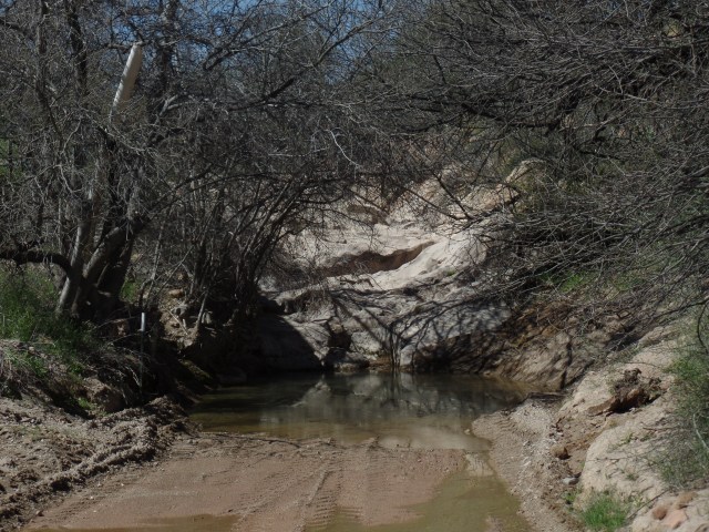
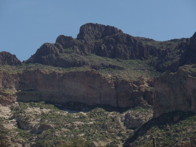
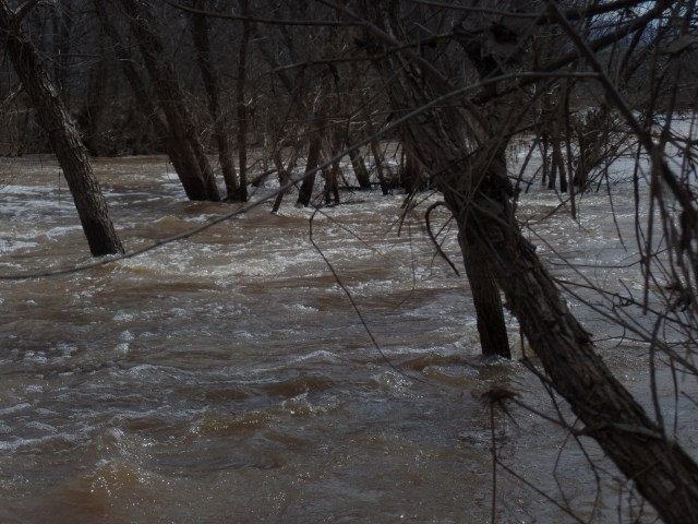
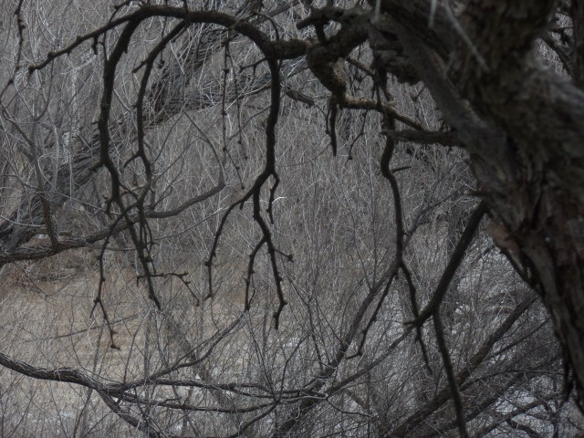
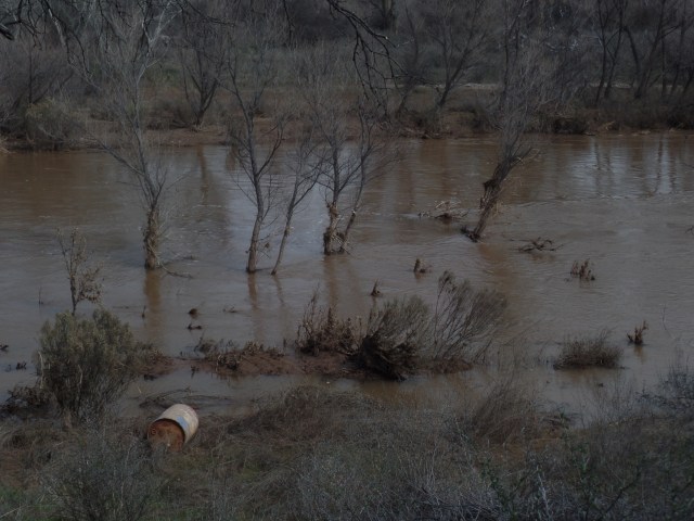
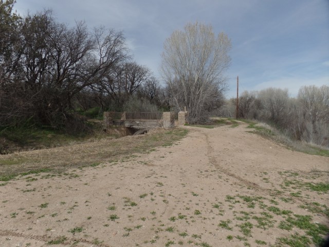
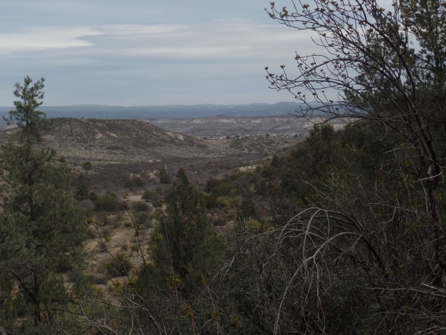
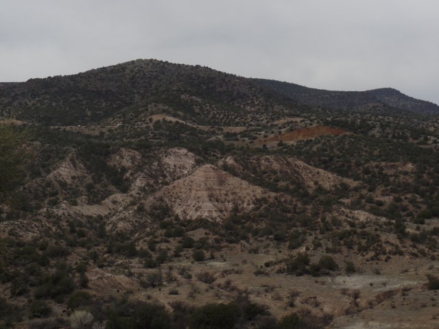
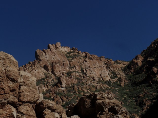
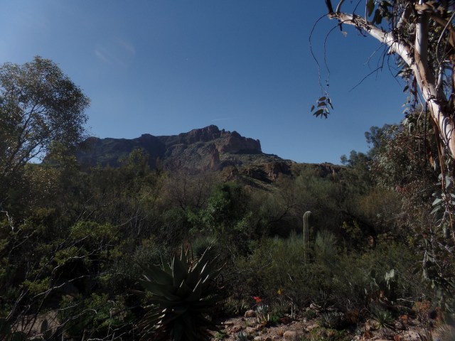
March 14, 2017, Superior- No doubt about it, this area has me hooked.  Boyce Thompson Arboretum State Park, a combination of Desert Botanical Garden and the Prescott Circle Trail, is the centerpiece of an intensely spiritual region.  Queen Creek, which runs through the park, on the south side, has carved Arizona’s best-kept secret, in its network of canyons.  Picket Post Mountain, to the west, watches over the Arboretum, like a strong big brother.  The people I met, from a gentle wanderer who is exploring all the National Forests west of the Mississippi, to a  vibrant,passionately caring barista, exuded the sort of spirituality that comes from tapping into the extant energy field that is found in places that stay close to their natural origins.

I will present Boyce Thompson Arboretum in three segments:  This first post looks at the various desert plants, from all corners of the world, with an emphasis on the Sonoran and Chihuahuan Deserts, which are closest to the central Arizona highlands, in which the park exists.

The next post will feature Lake Ayer and the terrain around Picket Post House (Boyce Thompson’s residence)  The last  will take in the High Trail and the west end of Queen Creek Canyon.

Here are four scenes of the Sonoran Trail, which offers the flora of Arizona, Sonora (MX) and Baja California.

This is a Fire Barrel Cactus, found in both the Sonoran and lower Mojave Deserts.

SAMSUNG CAMERA PICTURES

Maguey de Pulque is the source of a medicinal fermented beverage, popular first with the indigenous people of northwest and central Mexico.  It was originally used to relieve intestinal discomfort.

SAMSUNG CAMERA PICTURES

Palm trees, of various types, are found throughout the deserts of Mexico.  This San Jose Hester Palm is found only in Baja California.

SAMSUNG CAMERA PICTURES

Here is a testament to the full botanic splendour of the Sonoran Desert, holding its own with the exhibits of Desert Botanical Garden (Phoenix) and Arizona-Sonora Desert Museum(Tucson).  The flowering has not reached its peak, but anticipated rains, next week, may change that.  I may even catch some of the colours, when I am here next, on April 1-2.

SAMSUNG CAMERA PICTURES

The Curandero Trail, named for the traditional healers of Mexico, focuses on medicinal plants, both of the Sonoran and of the Chihuahuan Deserts.

Desert lavender has a calming effect, similar to that of its cousin, in the temperate climates to the north.  Here it is, in a dry tributary of Queen Creek.

SAMSUNG CAMERA PICTURES

Snakeweed, seen behind the informational sign, had a wide variety of uses, from treating snakebite to serving as a laxative for horses.

SAMSUNG CAMERA PICTURES
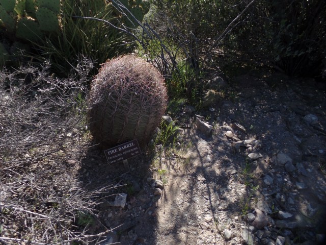
Boyce Thompson Arboretum has an extensive catalog of course offerings, on the uses of desert plants.  I am likely to make good use of those courses, in the intermediate future.

Finally, here are a few South American and Australian desert scenes.

This is a Toothpick Cactus, from Argentina’s Gran Chaco.

SAMSUNG CAMERA PICTURES

The Chaco, like the Sonoran Desert, gets quite verdant, with winter rains (July).

SAMSUNG CAMERA PICTURES

The interior of Australia  is, as is widely known, a place for only the hardiest of man and beast.  This water tower is indicative of what might be found in a swagman’s camp.  Swagmen herded livestock, in oases of the Outback.SAMSUNG CAMERA PICTURES

Here are  eucalyptus trees, found in the eastern part of the Outback.

SAMSUNG CAMERA PICTURES

SAMSUNG CAMERA PICTURES

This gum tree does not supply chicle, as its Mesoamerican and African cousins do, but did give swagmen a supply of resin, for their workaday adhesive needs.

SAMSUNG CAMERA PICTURES

This is, of course, a minute sampling of what is in store for the visitor to Boyce Thompson.  Two greenhouses, just shy of the park exit, offer sensitive African and Arabian desert flora.  These will have their own segments of the park, in the near future, as will Central Asian and Mediterranean plant life.

Next up:  Geology’s Turn to Dazzle


Sixty-Six for Sixty Six, Part XVI: Spirits and Graffiti

0

March 14, 2017, Superior-  SAMSUNG CAMERA PICTURES

Some call the place Devil’s Canyon.  Others prefer Spirit Canyon.  Folks like me look at it, and Queen Creek Gorge, it is.  There seem to be at least three canyons, branching off.  The one I checked out, from the highway rim, is between Superior and the Oak Flat turnoff.  It includes the high bridge over Queen Creek and a maze of rhyolite spires, reminding me of southeast Nevada’s Cathedral Gorge.

Bored local youths have, over the years, added their signatures, hopes and dreams to the pillars.  Most are mildly irritating, to those who seek solace, on the canyon’s edge.  One, though, is a statement that most of us can appreciate.

SAMSUNG CAMERA PICTURES

For the greater part, though, Queen Creek Gorge is a major delight, for hikers and rock climbers, alike.  It accounts for a good number of the campers who flock to Oak Flat.  On my next visit to Superior, I want to spend a key part of the time checking out the creek bed itself.

SAMSUNG CAMERA PICTURES 
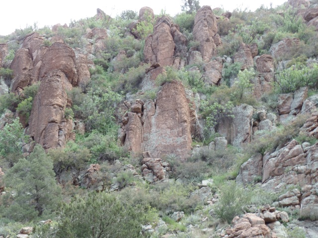
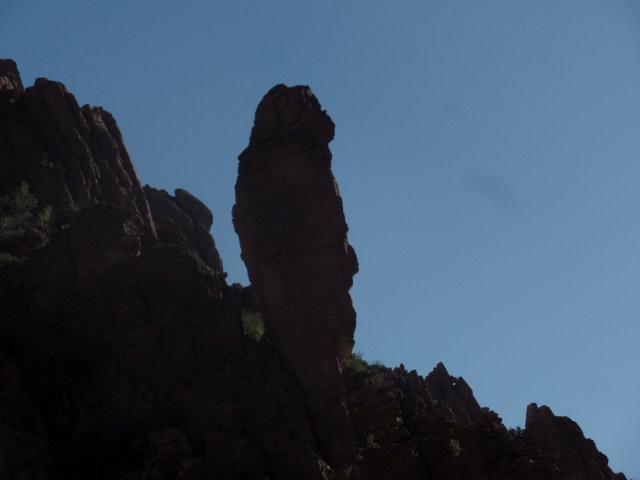
It also looks as if there is a ridge that could accommodate the hiker.

SAMSUNG CAMERA PICTURES

I always imagine the various face-like features of the sandstone spires, as if they were gargoyles.

SAMSUNG CAMERA PICTURES

Afternoon shadows mask what the stand-alone spire might resemble.

SAMSUNG CAMERA PICTURES

These three appear rather comical, yet ever watchful.

SAMSUNG CAMERA PICTURES

This one, I call Joe Palooka, because he probably isn’t into any funny business.

SAMSUNG CAMERA PICTURES

The scene on the north side of Highway 60 is every bit as amazing.  I saw an offbeat George Washington, in the figure to the right.

SAMSUNG CAMERA PICTURES

After about ten minutes of contemplation, it was time to bid adieu to the many spirits who seem to be inhabiting this compact, but extraordinary, canyon system.

SAMSUNG CAMERA PICTURES

Next up-  Boyce Thompson Arboretum:  The Regional Exhibits


Sixty-Six for Sixty Six, Part XV: Free Souls Abound

2

March 13, 2017, Oak Flat, AZ-

SAMSUNG CAMERA PICTURES 
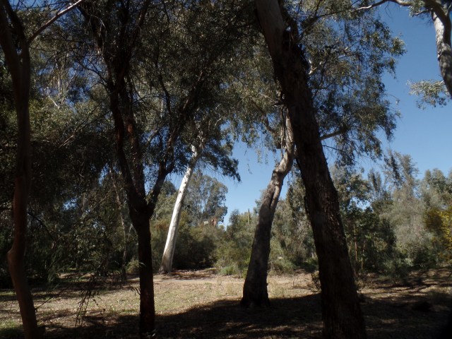
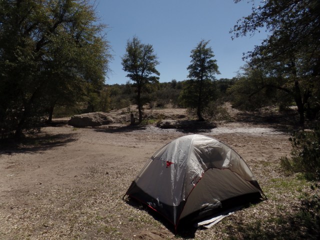
The young couple were a bit taken aback, as I returned to the campsite, where my tent was set up.  They hushed their small, annoyed dog, as I explained I had been at the campsite for a while and had gone to town for dinner.  As they were car-camping, and the campground is free, we were all fine with each other’s presence.  Besides, after some banter, I left them alone, and was content to watch the stars and think loving thoughts. The campground reflected those back.

SAMSUNG CAMERA PICTURES

Before all this, as there were about 45 minutes until sundown, I took a stroll along an easy trail that led south and west from the campground.  A free spirit, whose own goal was explore all the National Forests west of the Mississippi, had pointed me in the direction of a spring, which he said was a good two hours’ hike from here.  I took the stone path out of the campground and shortly found remnants of another of General Stoneman’s outposts.

SAMSUNG CAMERA PICTURES

Rhyolite and obsidian abound, in this part of Arizona, as you will see further in “Devils Canyon” (I prefer the name, Queen Creek Gorge, but to each their own.)

SAMSUNG CAMERA PICTURES

Stone walls were built to last, in the 1870’s.

SAMSUNG CAMERA PICTURES

SAMSUNG CAMERA PICTURES

I like to pay respects at  memorials to the local departed, wherever I go.  This cross honours the wife of an Oak Flat native.

The campground is of further interest to me, because there is a controversy over just how extensively a planned underground copper mine will be allowed to run, underneath this immediate area.  There are concerns about depleting the water table and about creating a giant sinkhole, under the current campground.  There is some debate, even among Native Americans, as to the sacredness of the site to the Apache Nation.  Several protesters have set up a camp, within the campground, featuring traditional Apache dwellings, called wikieup.  The environmental and archaeological concerns are valid, as is the need for work, among the residents of Superior and outlying areas.  I would probably favour a scaled back mining enterprise, with careful attention to the water table and to honouring any burial sites that may be found.

SAMSUNG CAMERA PICTURES

SAMSUNG CAMERA PICTURES


Sixty-Six for Sixty Six, Part XIV: Picketpost Mountain

4

March 13, 2017, Superior, AZ- Spring Break started in earnest, this morning.  A drive down to my dentist’s office took care of a moderately vexing issue, then I stopped at Scottsdale’s lovely Baha’i Center, to recite my morning prayers, in its serene courtyard.

Superior, and the Upper Queen Creek Watershed, have long been on my radar screen as a venue for exploration.  Picketpost Mountain forms a spectacular backdrop for Boyce Thompson Arboretum, a compendium of desert flora, from around the globe.  Like its counterpart, Desert Botanical Garden, in Phoenix’s  Papago Park, “The Boyce” manages to educate a wide-ranging public, on the value of deserts and the importance of preserving the life that is found in them.  Much more about all that, later.

My immediate draw, even before getting to the town of Superior, was a brief (2-mile, round trip) hike in the eastern approach to Picketpost’s base.  This gave me a foothold on Arizona National Scenic Trail, the length of which may yet be in my future.  It was also not enervating, as I am in the last week of a sunrise-to-sunset fast, of 19 days’ duration.

Here are some of the sights that greeted me, in the lushness of the Sonoran Desert landscape.SAMSUNG CAMERA PICTURES

This work station is managed by the Federal BLM, two of whose workers were on hand, when I first pulled in, to make sure I wasn’t planning on camping at the site.  Picketpost dominates Superior’s western approach, much as Pike’s Peak lords over Colorado Springs, and the San Francisco Peaks, over Flagstaff.  It was named by soldiers stationed here, under Gen. George Stoneman, in 1870, as it was a good spot for a sentinel post. Here are some of what await the serious hiker. (I would consider it in October, not before.)

SAMSUNG CAMERA PICTURES

SAMSUNG CAMERA PICTURES

The wall is a remnant of General Stoneman’s western camp.  The bulk of his operation was what is now the town of Superior, 3 miles further east.

SAMSUNG CAMERA PICTURES

As you will see, continuously, in this series, the rains have been good to Arizona, this winter.

SAMSUNG CAMERA PICTURES

Thanks to my zoom,  here is a close-up of the top ridge, from a good distance.

SAMSUNG CAMERA PICTURES

In the opposite direction, Weaver’s Needle says “Hey, remember me?”  I surely do, and what a marvelous trek that was!

SAMSUNG CAMERA PICTURES

I have encountered many heart rocks, all symbols that the Universe holds me in a good place.  Diamond-shaped rocks are a sign of one step further.  Superior would join Prescott, Bisbee, Flagstaff, Sedona, Tubac and Chloride as a special Arizona place in my heart.

SAMSUNG CAMERA PICTURES

Next up:  Oak Flat


Clear As Mud

4

March 4, 2017, Camp Verde- One of the features of Arizona life, that escapes many visitors, is the seasonal vitality of our rivers.  After taking part in a Red Cross service activity, I headed to Clear Creek Day Use Area, which offers access to the West Clear Creek, as it heads southeast, towards its eventual confluence with the Verde River.  As you will see, the creek’s name, this time of year, is a misnomer.

SAMSUNG CAMERA PICTURES

There was a party of above 18 people, including two small children, preparing to raft West Clear, as I arrived for a short hike along its west bank.  All were well-suited up for the experience, and I wished them safe passage.  Below, are several things that awaited them.

SAMSUNG CAMERA PICTURESSAMSUNG CAMERA PICTURES

Of course, there was plenty of open water, behind this particular tree; but you get the picture.

SAMSUNG CAMERA PICTURES

One of the attractions here, in calmer weather, is the jump-off point.

SAMSUNG CAMERA PICTURES

Some people just figure, in the dryness of September and October, that it’s no big deal to leave a memento of industrialism.  More’s the pity.

SAMSUNG CAMERA PICTURES

Once back on drier terrain, I made note of the footbridge, built by the Civilian Conservation Corps, way back in 1940.

SAMSUNG CAMERA PICTURES

There was still some energy left in me, so, despite it being the period of the Baha’i Fast, I took in a short segment of Copper Canyon Trail.  The last time, I walked the north segment, which leads to I-17.  This time, I headed southward and up a small mesa.  It is not an especially spectacular trail, but it’s nature and I practically had the place to myself.  An old cowboy, passing by, made note of my Red Cross t-shirt and remarked as how such charities are in debt, before going his way.  While that may have been true, at one point, I’m not so sure that our donors put up with such, anymore.


Anyway, here are a few scenes, which a couple of herds of cattle and I shared, along the trail.  There wasn’t much water in Copper Creek, but it was clear.

SAMSUNG CAMERA PICTURES

It wasn’t long, before I headed up the two switchbacks which led to the mesa top.  There are, actually, about five such mesas, rising up out of Copper Canyon.  The scene in the near distance, is Clear Creek Village, just south of Camp Verde.

SAMSUNG CAMERA PICTURES

It is possible for the discerning eye to see traffic, headed northbound, on I-17.

SAMSUNG CAMERA PICTURES

Despite the winter’s continued scenes of bareness, the promise of Spring is evident, in these wild dandelions.

SAMSUNG CAMERA PICTURES

So, there goes a very full day, spent with our beautiful eastern neighbour, the Verde Valley.