The Burros’ Wild Oatman

0

If  Oatman, a preserved 19th Century town which still has an active mining operation nearby, were to tout itself as a north Arizona version of Bisbee- it’d be a stretch.  Oatman is, however, unique.  It has a bustling crowd of California and southern Nevada day-trippers, a few off-the-beaten track adventurers, who scout the nearby Black Mountains- which are quite interesting, in and of themselves, and a pack or two of semi-wild burros.  The equines are descended from pack animals which came with northwest Arizona’s silver and uranium prospectors, in the late 1890’s.  They are generally beloved in these parts, and loathed by a few “earth-firsters” who have somehow concluded the burros are a threat to native bighorn sheep- which stay in the mountains, while the burros are town dwellers and content themselves with the foothills.

This past Presidents Day marked my second trip to Oatman.  The last time I was here, in 1979, the road was rutted and potholes were predominant in the pavement.  This time, the road was quite smooth, though there were several hairpin turns.  Oatman lies 28 miles west southwest of Kingman.  In between are the awesome Black Mts.


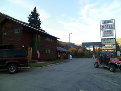
Oatman appears, rather suddenly, after 28 miles of Mohave goodness.  The initial ambiance is of a misplaced ski chalet.  Right around the corner, though, is the town’s official greeting.


The main street would not be out of place in any of a number of Western mining towns; nor would the wry humour.


The main attraction, though, are the town’s unofficial greeters.


Excuse the last, grainy photo.  I just couldn’t resist including Mama and Baby, even if they appear rather impressionistic.

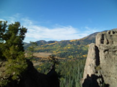
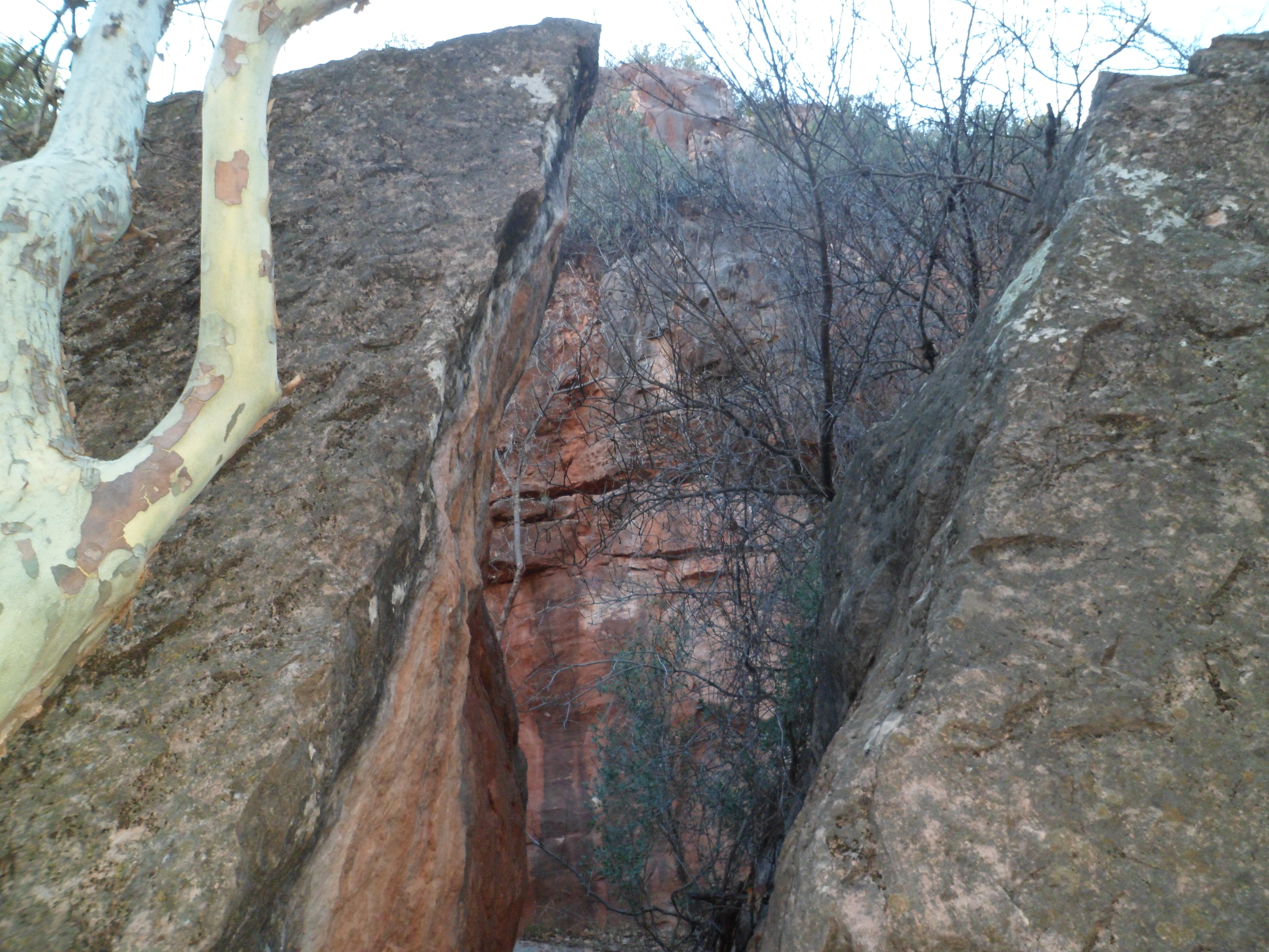
This all goes to show what a wealth of delightful scenes may be found between Phoenix and Las Vegas- a stretch of road many view as “Let’s just get it done.”


On Sue B.’s Loop

1

Dolan Springs, AZ is an unassuming little town- gateway to the Arizona shore of Lake Mead and the Hualapai Nation’s Grand Canyon Skywalk.  It does, however, have a series of four or five interlinked trails, including one named for Susan B. Anthony, who, to the best of anyone’s knowledge, never visited these parts.  No matter, the women of Dolan seem to be of the same independent spirit which led Ms. Anthony to achieve great things, which benefit all of us- male or female.

The Sue B. Loop goes for a bit more than two miles, in the Joshua tree forest, just east of Dolan’s business district and near the local elementary school.  The day I visited was President’s Day, so things were slow.  I was amazed, though, that I was the only person on the trail.  I could hear people up in the Mt. Tipton wilderness area, but that is another two or three miles to the southeast.  That’s the beauty of the desert:  Sound travels.

Here are some scenes of the Sue B. Loop, Mt. Mitten and Castle Rock (the last two will be visited another time.)

 The Joshua tree, along with the yucca, is a staple of the Mohave Desert.

Mt. Mitten and Castle Rock, seen below, are the northernmost sentinels of the Cerbat Range.


All things that grow, start small- whether human, animal, vegetable or even mineral.  Here, a “baby” Teddy Bear cholla greeted me- from a safe distance.

Whether on mild days, or in the blast-furnace of summer, the Sue B. Trail keeps vigil over pleasant Dolan Springs.


Roy’s Rocks Speak Volumes

0

After a week of finally divesting myself of the house in Phoenix where so much of Penny’s care, and most of her final days, took place, I am getting back to unfinished business.  Here in BruinLand, that means- oh, heck yeah, the Kingman trip of two weeks ago.  One of my most enduring memories will be the jaunt up to Chloride, an old mining town-about twelve miles northeast of Kingman, as the crow flies.  Chloride claims to be the oldest mining town in AZ, and about 300 people still hang out there, many hoping to still strike a bargain with the soil.

What really brings it home, though, are a series of rock murals, painted by artist Roy Purcell in the 1960’s, and redone by Roy and his family, about twelve years ago.  They treat the subjects of Egyptian and southwest mythology.  Here we are, in Chloride:    


After leaving “downtown” and the paved road behind, I stopped here   

and commenced walking the 3/4 mile up to the murals, with their preceding pictographs  and one more recent visitor’s autograph (thankfully, it is off in an obscure spot).  The murals themselves are a stunning contrast to what lies around them.


At the end of the self-guided tour, lies the purpose of it all.

After such a visual feast, it was time for lunch.  I was not disappointed.  Yesterday’s is one of those gems that can only be found by getting out and finding what’s out there.

The portions are HUGE and the quality of the food matches the quantity.  While I was waiting, the hostess showed me Roy Purcell’s gallery, in a side room of the restaurant.

Chloride would have been worth the trip, in and of itself, but two more gems lay ahead:  Dolan Springs and Oatman.

The White Tanks of the West Valley

2

The West Valley of Metro Phoenix is, for the most part flat farm country, mixed with suburban housing tracts, It has some man-made gems, like downtown Glendale, the stadium districts of Glendale, Peoria and Surprise and the Arrowhead shopping complex. Its natural wonder, though, is White Tanks Regional Park, the crown jewel of which, in turn, is Ford Canyon.

To get to the Ford, I took portions of three other trails: The flat, lush Waddell, the challenging, but heavily-traveled Mesquite Canyon, the serene and comforting Willow Canyon. The Waddell is a good intro trail for those unfamiliar with the Sonoran Desert. It also has some petroglyphs.

The Mesquite Canyon Trail was part of my first visit to the White Tanks, last winter.  It’s where one gets the groove on, and sheds unwanted girth, either by bicycle or, as I am wont to do, on foot.


Willow Canyon is gentle intermediary between demanding Mesquite and intense Ford.


It also gives hints of the white granite which, in times of flowing water, helps make Ford Canyon so ferocious and in dry times, so majestic.

The signal that Ford Canyon would be a challenge came early along the eastern section of the trail.

Fortunately, the ups and downs of the Ford Canyon Trail do not, for the most part, entail boulder hopping.  The exception is at the now-abandoned WPA dam and around its subsequent pools.


After traversing this lovely area, I had a thought: “I love you, Ford Canyon.” Whereupon, I came across a small rock, in the middle of the creek bed.

The tangible element of this feeling would appear ten minutes later, in the persons of Robin and Johnny, a devoted couple whose story mirrors that of Penny and me.  Robin is coming back from her disability, with an intensity that befits a person hiking the likes of Ford Canyon.

So, I knew what my love wanted of me and stayed with this indomitable pair for the rest of the hike. They are a prime example of what really makes my sojourns worth every minute

  •                                            
  • Johnny also makes great rock cairns, to guide those who come along later.
  • Ford Canyon is one crown jewel that shines brighter, for giving confidence to my newest friends.

January in Oak Creek Canyon

2

I felt the irresistible urge to return to Sedona today (January 6), so off the KIA and I went, to Grasshopper Point.  I headed first down Allens Bend Trail, to the edge of Oak Creek.SAM_3688                                                                                                                                                                                            SAM_3689

I found several rock overhangs along the way to the Casner Canyon Trail, which requires crossing Oak Creek.  That was not advisable today, with the creek running full tilt.                                                                                                                 SAM_3694 SAM_3695 SAM_3697 SAM_3701 SAM_3703 SAM_3710

As my dinner locale, La Cucina Rustica did not open until 5 P.M., I had time to savour Wilson Canyon, about 1 1/2 miles west of Grasshopper.  This canyon heads up to the foot of a mountain, also named for Charles Wilson, whose local claim to fame is that he took on a grizzly bear in the area, and lost.

SAM_3711

I had a bit more company on this trail.  In fact, the couple I met while on the way out of Casner Canyon showed up in Wilson, as I was hiking out.  I hope they hurried; the sun was going down.  It was good they were there, though. A young lady was hiking solo, up to the rim, as I was headed down.

Here are some scenes from that somewhat icier path.

SAM_3713     SAM_3716

SAM_3719     SAM_3720

SAM_3722     SAM_3723

After “Trail’s End”, I scrambled up to the top of the canyon rim, and saw a spectacular panorama:       SAM_3724

The silhouette below is of a horse-faced rock, which seems to be pointing towards the red rocks to the south.

SAM_3730

After Wilson Canyon, with my craving for fine Italian cuisine hitting a high level, I enjoyed cauliflower & cheddar soup, penne con salcicce and bocca negra con gelato.

(Salcicce is sausage and bocca negra is flourless chocolate cake.)  All of Chefs Lisa Dahl and Andrea Di Luca’s creations are heavenly.  I know this especially from owning a copy of Lisa’s cookbook.

New Year’s Day at Badger Springs

0

True to form, I got  up off my bottom and went out for a moderately vigorous clamber over the rocks along the Agua Fria River, in the Badger Springs area southeast of Prescott, on New Year’s Day.  I like this area in summer, as the languid river offers pools of refreshing water and plenty of smooth rocks for sun-bathing.  The steep canyon between Badger Springs and the second bend of the Agua Fria looked inviting, the last time I was there, so that was my focus on Tuesday.

\

I started where I left off, and relaxed, last summer.  It wasn’t hard to cross, hopping the rocks, though they are smooth and a bit slippery.  My idea being to survive for the coming year, at least, I was slow and meticulous in crossing.  
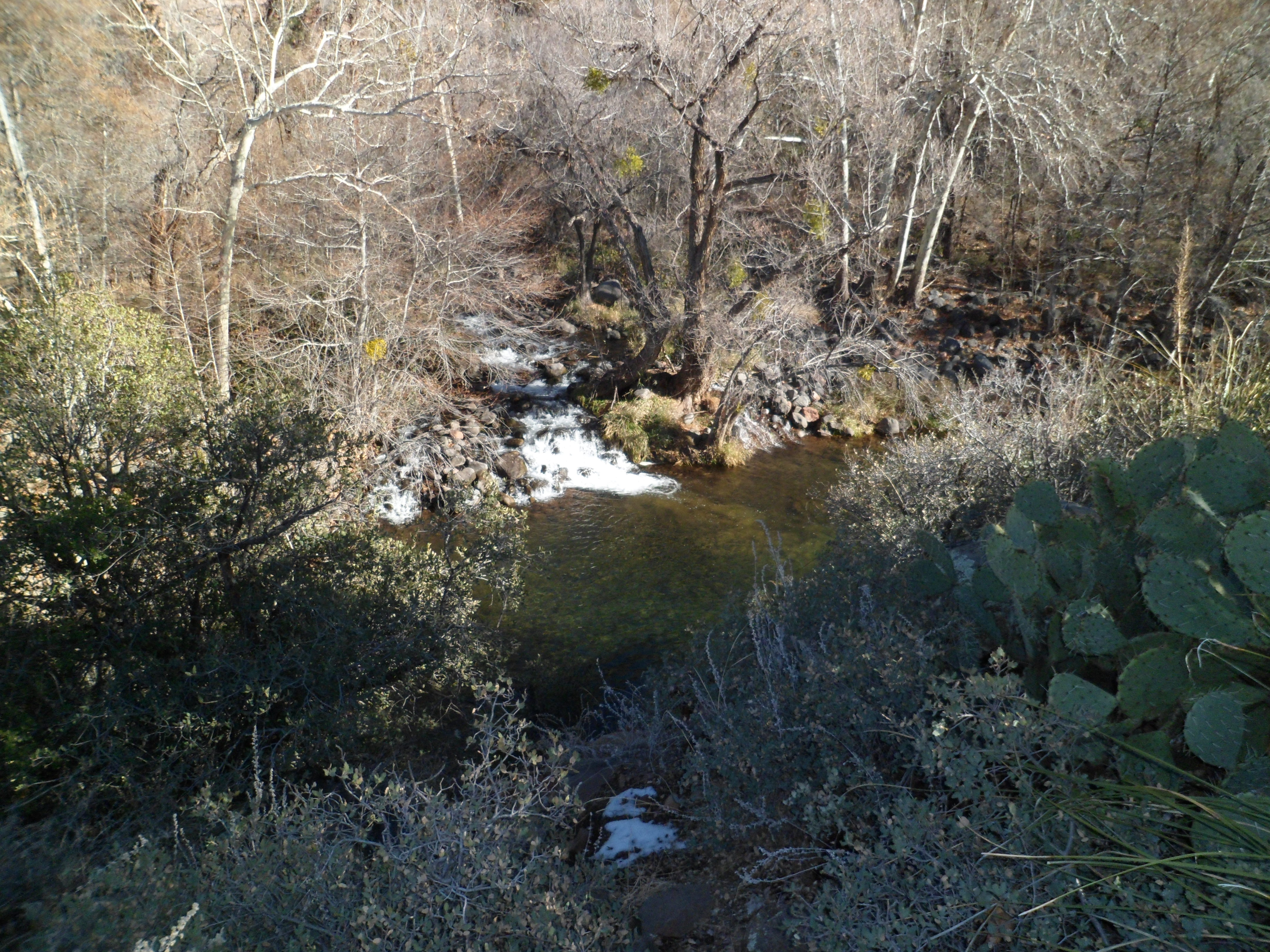
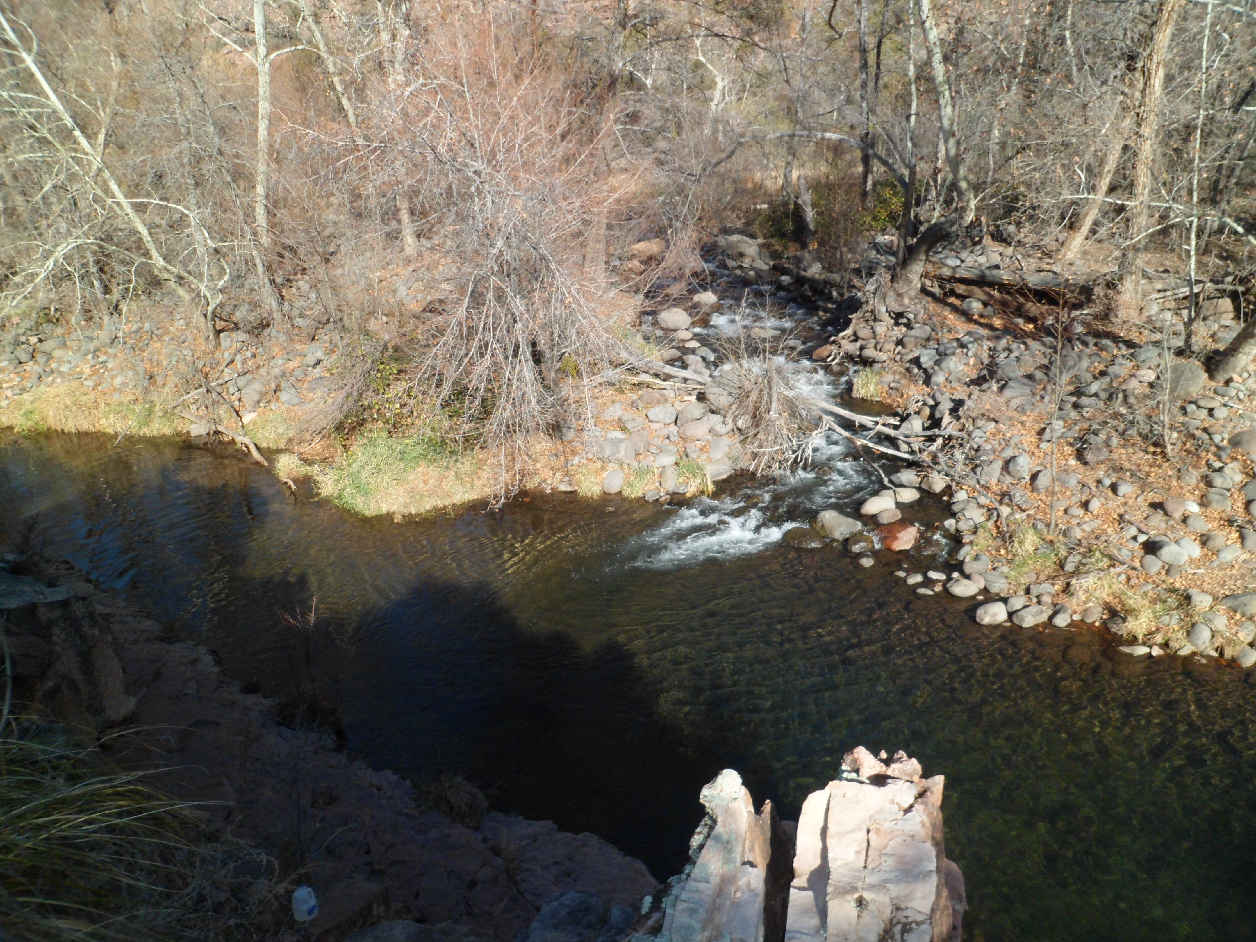
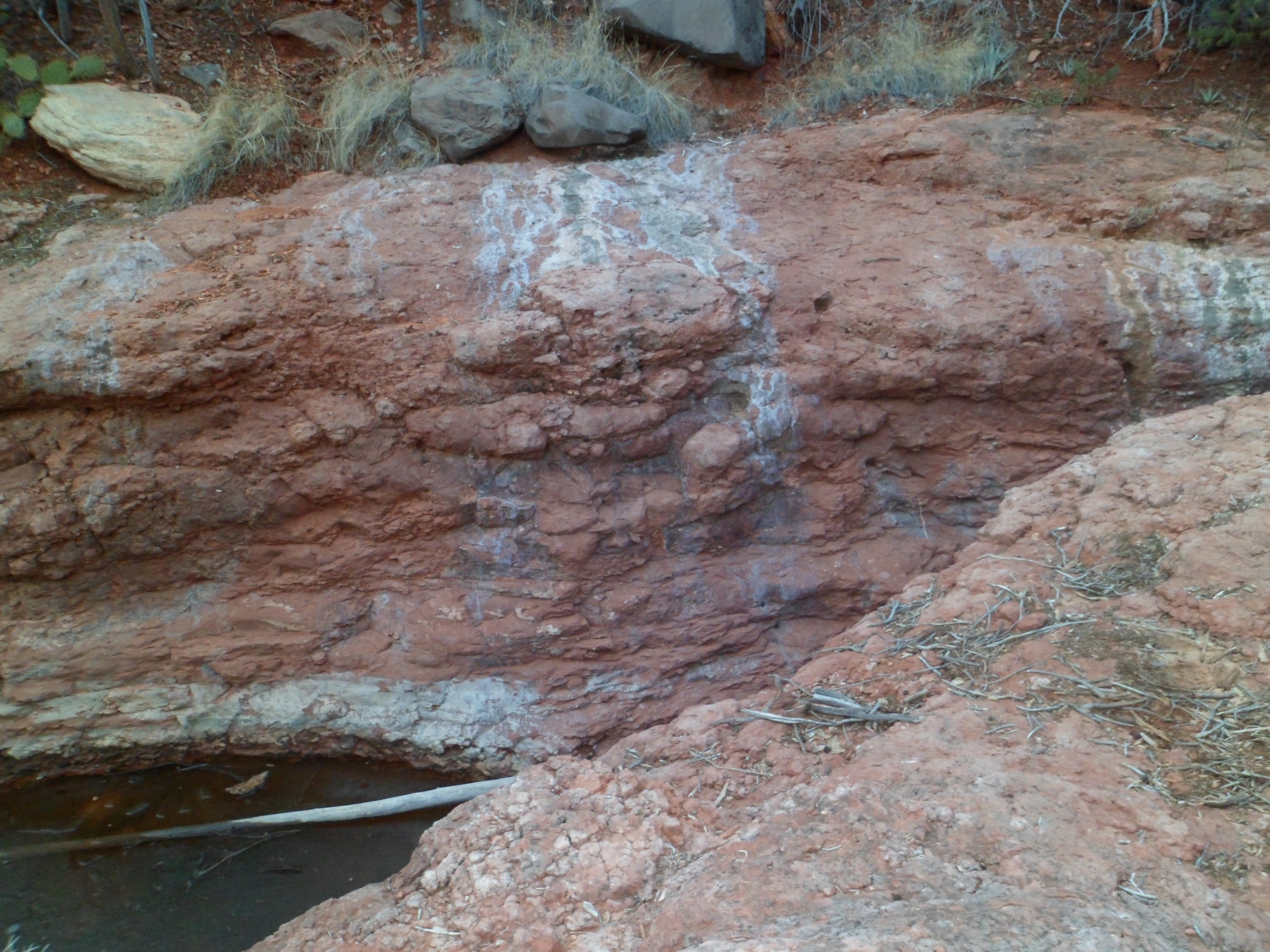
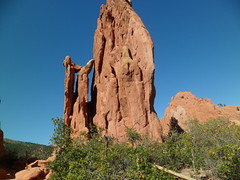
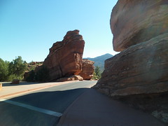
The rocks are mostly white limestone here, with the occasional igneous volcanic cast-off, from eons ago.  An example is the boulder in the lower right corner of the photo below.  Igneous rocks absorb salinity easier than their granite and limestone companions.

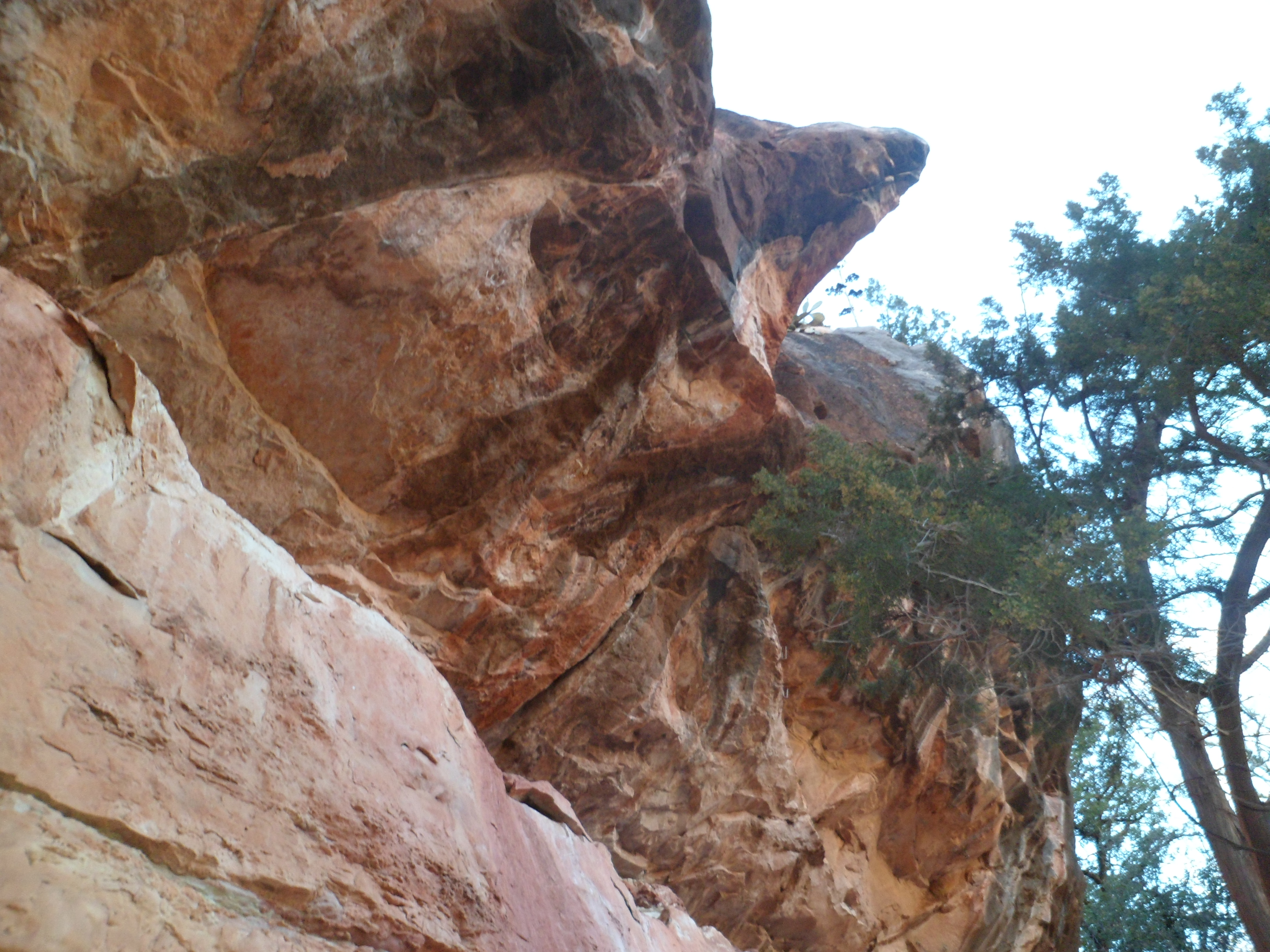
 Some fifteen years ago, a couple of local teens spotted some ancient petroglyphs along the trail from the parking area to Badger Springs.  Walking further towards the second bend, they decided to tell their own story on this limestone bench.  It’s a love story, and still is visible in the fluorescent spray colours they used.

An hour into my jaunt, I reached the second bend of the Agua Fria.  From here, it would be about a two-hour boulder hop to Black Canyon City.  One of these days, I will go down to BLC, park my car, and hike up the riverbank in the opposite direction.

As for the rest of the week, I have been happily occupied with Baha’i activities, the first of a series of dental appointments  and helping the neighbours take down and store their holiday ornaments.  I also went by the old house, found it wide open in the back, and, after determining this had been done by the soon-to-be new owners, picked up a few items that they won’t need and closed the house back up.

Tucson’s Sabino Canyon

6

I had the pleasure of visiting one of Tucson’s signature locales, Sabino Canyon, on Saturday evening and Sunday afternoon.  The first journey was taken with a group of  Baha’i friends and some children from an apartment complex, not far from the home of one of my friends.


Above is the Sabino Canyon Visitors’ Center, operated by the U.S. Forest Service.  Below are two shots of our happy group.

The vigilance of  my friend, Annick, kept everyone together.

We enjoyed a  sweeping vista, from the overlook near our designated picnic spot.

 This was my own introduction to Sabino Canyon, and after a restful night and a scrumptious breakfast at Blue Willow Cafe, I headed back to the canyon, for a loop hike.


Rocks abound, as always.  Some of them used to be trees.

 The ridge above leads to Tucson’s own Cathedral Rock, 5 miles to the northwest.

Sabino Canyon was the site of a dam, until the 1980’s.  Now the dam, and its “lake”, are but relics of  an experiment in irrigation.

The scenes here are but a taste of the marvels that await the visitor to Tucson.  It will be an interesting winter and spring, across this city and across our beautiful state.  Stay tuned.


Oktoberfest Sunday: Chicken-fried Brunch and Meditation at Cathedral Rock

0

Another of my Prescott ties is to the American Legion.  When I’m home on a Sunday morning, the lure of a delicious brunch at the post becomes irresistible.  So it was this past Sunday, and it was not just standard fare, but chicken-fried steak that was offered with eggs and hash browns.  Baked apples were also available, respecting the spirit of October. Thus, the Oktoberfest spirit continued.  Afterward, I did an act of service for a couple of friends in town.  Then, it was time for Sedona.  I headed for Cathedral Rock, and by the luck of the draw, I found there was parking to spare, in the usually jam-packed lot off Back O’ Beyond Road. I headed up to the rock, scrambling as far as the 2/3 point of the trail.  There, I spent a few minutes meditating, while several others, of all ages were scooting their way up through the crevice that provides the safest route to the base of Cathedral Rock itself. I would sit and contemplate the action, both above and below me, twice that afternoon, but refrained from joining the fracas of machismo.  I tend to follow my intuition more in Sedona than in some other places, and since my intuition has been on overdrive, in general, these past nineteen months, I sat and calmly took in my surroundings. Presenting Cathedral Rock:

Here is the crevice which one must follow to the second saddle of this formation.

I’ve been up worse trails, though, so some day, my intuition may well say- “Go for it”.

Near Cathedral Rock is the east-west Templeton Trail, a mostly flat mountain bike route, going from a housing area, three miles to the south, to a juncture with Cathedral Trail.

It was here that I had two rather mystical experiences.  The first was watching wind-blown spider web threads blowing in the wind, with the full sun as a backdrop.  I could imagine they were supernatural creatures, come to visit with us on that blessed afternoon.  I did sense a lot of spiritual energy at some points along the path.

The second eerie experience took place as I was heading back from this view  of Chimney Rock.  A group of four women and a man approached me, and asked how close they were to the south parking lot.  Of course, I didn’t know.  The uncanny part was, one of the younger women strikingly resembled Penny as a twenty-year-old.  This took me for a loop, momentarily.  As they left, the girl chuckled that it seemed I didn’t know quite what to make of her.  If she only knew.

As the afternoon still seemed young,   I took in Little Horse Trail, near Bell Rock and hiked it as far as Chicken Point.  Here is the bench that leads up to Chicken Point.

Chicken Point lies straight ahead and to the left. 

Below is a view of Submarine Rock, from Chicken Point.

Before heading back, in the fading light, I caught a glimpse of Chicken Point’s “guardian”.

The day was more than rewarding.  I was left with so much to ponder,  So I did what any overstimulated Prescottonian would do- I stopped at Leff-T’s Steakhouse, in Dewey, and had a steak fajita salad.  In view of the heavy brunch, this helped me enjoy a carb-free supper, thus avoiding a Diabolical Diastolic, the following morning.

The Flip-Flop, Day 14: The Four Corners and Back to Prescott

181

Yesterday, October 3 brought me along one of southwest Colorado’s most magnificent sights:  Wolf Creek Pass, with its spectacular blends of foliage and rock.

 This Castle Rock is at Wolf Creek Pass’s east summit.

 East meets south, at this face of WCP.  Below, one can catch a glimpse of Treasure Falls, southwest of Wolf Creek Pass.

I finally found a breakfast spot, at 9:50.  Junction Restaurant has tasty breakfast skillets, and Jackie will discuss anything from styles of eggs to the sorry state of the Everglades, in her native South Florida.  Junction is on the east end of Pagosa Springs.

I had hoped to catch some views of Wetherill Mesa,at Mesa Verde National Park, but the gate attendant said Wetherill was closed on August 31.  I did catch this view of fading foliage, near Mesa Verde’s entrance, before heading on to the Four Corners.

One of the truly special things about some of the southwest’s natural features is the way they seem to  line up.   There are two Chimney Rocks in Colorado.  The one near Ignacio and Bayfield, east of Durango, is a newly-minted National Monument.  The one south of Towaoc lines up almost perfectly north of Ship Rock, New Mexico and south of Sleeping Ute Mountain.  I stopped for several minutes at the Ute Mountain Chimney Rock, approaching it with reverence and contemplating its seeming relationships with Ship Rock and Sleeping Ute Mountain.

The Four Corners has a raised platform, where one may simultaneously put a hand or foot on each of the four adjoining states:  Arizona, Colorado, New Mexico and Utah.  To me, Mother Earth has her own monument to this accident of politics:  It’s the small rock formation, which is just at the northwest tip of New Mexico, seen below.

Just north of Flagstaff, the San Francisco Peaks, sacred to several indigenous nations, rise up and offer seasonal foliage of their own.

The peaks told me I was close to the end of my journey, and after a satisfying supper at Macy’s European Coffee House, I was a short hour and twenty minutes away.  Now, I have five weeks of being in one place.

The Flip Flop, Days 12 and 13: Colorado Springs and the Mountains Beyond

2

Monday, October 1, was my change-of-season, do nothing day.  Actually, I did walk about 1 1/2 miles on Northglenn’s Grange Hall Creek Trail, a paved route from Fox Run to the dog park.  There were lots of prairie dogs in the area just across from the dog park, which is in west Northglenn.

Besides that walk, I chose to not take a chance on making my uncle in Longmont, or friends in Boulder, possibly catch what I felt was coming on.  As it happened, I felt better by evening, having rested.  Such was Day 12, of my journey towards home.

Tuesday was different. After patiently working my way past the logjam caused by an accident on Denver’s south side, I spent time in three of Colorado Springs’ signature attractions.  First was the U.S. Air Force Academy, which marks the first time I have visited a service academy.  The Air Force cadets lucked out, in terms of scenery, getting the mountains of CS’s north side as their backdrop.

The civilian visitor is more than welcome here, but must enter and exit through the North Gate.  The Visitor Center offers a  good overview of life at the Academy, both in video and in stationary display,

After a Philly steak, at the Visitor center’s food court, I checked out the Academy’s Cadet Chapel, which offers spiritual care for every Faith and denomination.

The interior is equally inspiring.

Feeling that our future Air Force officers are in good hands, I went on to the stunning scenery of Garden of the Gods.  This is a city park of Colorado Springs, willed by its last private owner, Charles Elliott Perkins, who only visited the area twice.  He insisted that the city keep the park free from commercial development, that it not serve alcoholic beverages in its cafe and that the park itself be free of charge to all visitors.  ( A film on the park, at the Visitor Center does charge $5 admission, but the film is, of course, optional).

Here are five scenes from this magnificent place.

This is an view from the main parking lot, where we gathered for a free guided tour.

Here is Man and Lion.  Below, are the Cathedral Spires.

On the very left of the photo below, one may discern the Kissing Camels.  Sandstone can produce amazing images.

 After the guided tour was over, I continued on to Balanced Rock, about three miles southwest of the Main Garden.

One major attraction of Colorado Springs, visible from the Garden, remains:  Pikes Peak.  I will start out early in the morning, when I next visit the area, in order to make that special hike.

 The guide said the area on top of the ridge, between the Garden and Pikes Peak, had been the worst damaged area in the recent, horrific fire which hurt Colorado Springs so badly.  It is, fortunately, barely visible to visitors to CS, now.

I had one area left to check out on Tuesday:  Old Colorado City, on Colorado Springs’ west side.

On this south side of the street, I enjoyed a small eclair and iced tea, at La Baguette.  Its namesake bread is available for a very low price, and the pastry, my first eclair (pronounced here AY-klayr, as it is in France) in nearly thirty years, was “magnifique”.

The north side of the street has its standouts, as well.

Bancroft Park is a small, but pleasant hang-out for area youth.

Colorado Springs, as shown here, is indeed younger than Denver, by just a year.

My journey had only a day left, so on I went, gassing up in Pueblo, the friendly desert town to the south of CS, getting supper in Fort Garland and stopping for the night at Wolf Creek Ranch, a reasonable ski resort, at the foot of formidable Wolf Creek Pass.

It’s not as big as Union Spring, but few places are.

Next up- Back through the Four Corners, to home.