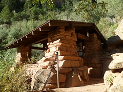
Yesterday, I hiked two miles, round trip on Prescott’s newest trail- The Centennial Trail, which runs along a limestone boulder field south of Thumb Butte and west of uptown Prescott. I took the southern spur, which gives views of the Bradshaw Mountains, Miller Valley and downtown.About 1/4 mile along, one comes to this wooden bridge.
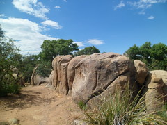
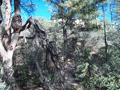
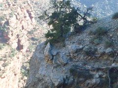
The following are some noteworthy limestone fields heading up to the overlook.
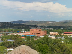
At the top of the South Spur, one may view midtown, just across Miller Valley and the Bradshaws,to the southeast.
The most visible building above is Yavapai Medical Center- Prescott Campus.
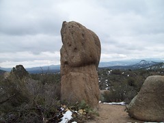
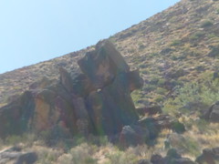
Off to the west, just past the overlook, below, there is a formation that somewhat resembles the Sphinx.
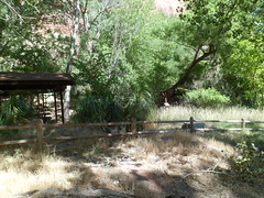
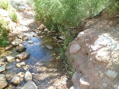
There was not a whole lot of water flowing, but the stream which is crossed by the trail is the North Fork of Miller Creek, which is not swiftly flowing, even in the wettest of seasons.
This is a pictureless post, because the images of terror that we see, every time a self-appointed social regulator takes to the streets or buildings, to kill and maim innocent people, are vivid enough. I leave it to qualified psychiatrists to judge whether a miscreant is psychotic.
When I was in graduate school, one of our professors gave a lecture on “Neurotic Means to Power”. The usual suspects, from Napoleon to Nixon, were examined briefly, but the crux of her message was that a neurotic person seeks power at various levels of the social structure. Friendships, families, work relationships, and politics are all subject to the neurotic in search of meaning in his/her life. Most likely, we all have a need to influence the behavior of those around us, so as to ensure personal safety. Neurosis kicks in, however, when a person’s identity depends on the number of people who listen and obey one’s dictates and demands, as well as the extent to which those people listen and obey.
Some obedience is necessary to the survival of the obedient. Laws are sent to us by God, the Creator, the Universe, Unknowable Essence, Great Wave of Energy, or whatever you wish to call That which put us here. We follow along, willingly or not, because the alternative, chaos, is way out of most people’s comfort zones. Children obey their parents and other adults, because they only have their own will power to guide them, otherwise, and it gets sketchy not having all the answers. Most people obey the police and courts, because without a system, it could be they who are hurt or killed next.
Those who know me know that I am a law-abiding person. I’ve never been arrested, and have paid willingly for the occasional excesses of my right foot, when behind the wheel. I have never, and won’t, however, kowtow to those who insert themselves into my affairs, with no more authority than “This is how I expect you to act.”
Back to the shooting in Aurora. James Holmes, as far as we know, acted alone. That makes him the same as the shooter at Virginia Tech, Andrew Kunanan and Ted Bundy. He could not dominate or control those with whom he was intimate, if indeed there were any such people, so he chose to thrash and flail at strangers. We don’t know if he had been bullied as a child, spanked on his birthday or spurned by a woman. We do know however that two wrongs don’t make a right, two stupids don’t make a smart, fourteen deaths don’t make a life.
What does neurotic seeking of power get a person, in the end? My guess is that it earns the person a label of toxic, among his/her peers. It earns annoyance, followed by anger, followed by avoidance and isolation. These may or may not lead the power-seeker to lash out in further anger- at self or at others.
James Holmes ended up controlling no one. The historical figures cited by my professor, except for Nixon, ended their lives in defeat and disgrace. My final point is this: There is a system, throughout the Universe, which follows the laws of physics and their subordinate man-made laws. This system is understood by most, and all are subject to it. This system makes no provision for those without authority to dictate, demand, cajole, ridicule or browbeat those around them into submission.
When someone who is not my mother, family elder, work supervisor or officer of the legal system tells me “You will!”, that’s when I won’t- unless it makes sense to ME. When that same person says “You can’t”, that’s when I will- if it would benefit me or others.
The lesson of the film which James Holmes disrupted is that ad hoc, casual, unsanctioned exercise of authority will never succeed, in the end, because the human spirit is answerable only to the Higher Power. This applies equally to the power usurper with arms and ammunition, and to those whose weapon is their tongue.
This day is among the more solemn for us Baha’is. On July 9, 1850, Baha’ullah’s Immediate Predecessor, whose title is al-Bab, or “The Gate”, was executed by firing squad, after having been held in three separate prisons.
Al-Bab’s basic message was that it was time for mankind to prepare for One Who would unite the human race, by spiritual principles. It was al-Bab’s purpose to pave the way for this Messenger, much as John the Baptist did for Christ.
As this was a challenge to Islamic orthodoxy, the mullahs prevailed upon the government of Persia (now Iran) to imprison al-Bab and oppress His followers. This went on for about five years, and when the Babi Faith grew anyway, execution became the method of choice for “containment” of the new faith.
The Faith of al-Bab was succeeded by the Baha’i Faith, with Baha’ullah’s Revelation in 1853, while He was in prison in Teheran, for having followed the Teachings of His Immediate Predecessor. The execution of al-Bab was only an accelerant to the growth of our Faith, first in Persia, then, gradually world-wide.
Between 200-300 of us gathered at San Diego Baha’i Center at noon on July 9. We offered prayers and solemnly reflected on the events mentioned above.
Before this solemn event, I spent some time at the nearby campus of the University of San Diego, a Catholic institution. Here are some of the larger buildings of this venerable institution:
After leaving San Diego, I had the unique experience of stopping in Palm Springs, which offered a temperature of 116. I chose not to take the tram up Chino Canyon, to the top of Mt. San Jacinto. This was a budget thing, not a heat thing. The top would have offered 71 degrees.
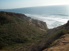
Here are some photos of the area.
I will go back and take the tram, right before New Year’s.
Now for the kitsch.
Marilyn was the first woman on whom I had a crush- at age 10. It hit me hard when she passed on.
The heat was what it was, and 116 was not quite what she, Jack Lemmon and Tony Curtis had in mind in the 1959 classic film. I cooled off nicely with a seafood salad and plenty of ice water, at Blue Coyote Grill.
Most diners chose to go inside. I found it quite pleasant, though, in the shaded courtyard, under the misters.
So, the day was an eclectic mix of sacred, profane and much in between.
So as to keep the right perspective, I will end with a house of worship in Palm Springs.
I am inspired by the workings of my Faith, awestruck by the power of nature and amused by the harmless aspects of pop culture. Now, though, it’s time to stay close to home for a couple of months, and take the inner journeys offered by the “Song of Ice and Fire” series of novels.
Since Aram had today off as well, we made plans to attend a spiritual discourse by a Baha’i scholar from Malaysia, at the San Diego Baha’i Center, then go to La Jolla and see how many seals were spending the summer here.
The talk was on the subject of spiritual progress, both in this life and after death. We believe one does impact the other, and that there is a connection between this world and the next.
After 2 1/2 hours of spiritual nourishment, we found ourselves looking about La Jolla for an equally satisfying lunch. We found it readily, at The Brick and Bell Cafe. The ladies go all out, with the quality of their food and the efficiency of service. It’s a small place, but they managed to serve about 40 people, in the half hour or so that we were there.
We walked down to the shore and spent equal parts of time looking down on the ocean and surveying the seal population- most of which was in the surf, hunting. Aram expressed happiness at having been introduced to this beach.
The white spot in the background indicates where a seal is near the surface.
The surf was not disappointing to either man or seal.
The rocks never are a letdown for our flippered friends.
After this, we went up to Torrey Pines State Beach. Aram chose to delve further into a book he is reading, while I went into the surf a bit. I have photos of Torrey Pines posted on my March, 2012 album on La Jolla.
We ended the day with light and satisfying entrees at the TGI Friday, in the Gaslamp Quarter. It was time for Aram to head back to base, and prepare for another week. I stayed at Parkside Inn for one more night, with a Baha’i holy day observance scheduled for the Center at noon on Monday.
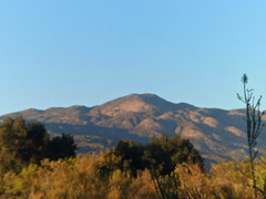
Neil Young sang, nasily,but well, of “24 and there’s so much more”. I want all that for my son, who turned twenty-four last Saturday. It was still early for him, when I broke camp, so I headed down Hwy 79 to Santa Ysabel, a small village where there is a mission to the Kumeyaay people.
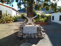
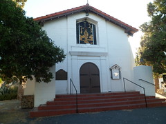
I spent a few minutes visiting the mission grounds, then had breakfast at Apple Country Restaurant. The story here is that someone stole the bells from the mission in 1929. The clappers were found later, but not the castings. The mission is open 9-5. I was there at 8.
Here is the front of Apple Country Restaurant. I sat at the counter, as I often do in such places, and enjoyed top-quality corned beef hash w/ scramblers, toast and coffee. There were several people in hunting garb, and military camo, and a lone woman, who struck me as an artist or poet of some sort. At least she kept to herself in the corner, and seemed lost in deep thought. I know that feeling well. I headed downhill after breakfast, and got into the city around 9:30.
Aram and I headed first to Cabrillo Point National Monument, which commemorates the defense of San Diego during WWII. Californians who were around back then would know of the attempted Japanese landing near Santa Barbara. The whole coast was soon well-defended, following that aborted attack.
The lighthouse and defenses lie well above the shoreline.
Joao Rodrigues Cabrillo, whose name’s spelling shows his west Iberian roots, stands guard over the point which bears his name. He captained the first Spanish landing, near Point Loma. After this, we had a sumptuous lunch at Sushiya, on the sea level side of Point Loma. Aram patiently endured my search for a motel, after my usual haunt was besieged by a convention of golfers, headed to Torrey Pines. I found my new haunt, Parkside Inn, which is actually more centrally located.
With that done, we headed to Mission Valley Mall, and took in “The Amazing Spider Man”. This sort of film always challenges my own acrophobia. I have made a solemn vow to NEVER be outside on a building higher than 10 stories tall. The inside of places like Seoul Tower, the Willis, or the Space Needle, doesn’t faze me. Neither do the overlooks at Grand Canyon or various tall mountains. Skyscrapers- forgettaboutit! The film, we both agree, is a cut above the previous series. Andrew Garfield is a more believable “teen”, Sally Field is always easy on the eyes, and Denis Leary is a great father figure. The Lizard Man is also more plausible than the Green Goblin, unfortunate as that would seem.
We would have more adventure, and misadventure, on Sunday.
These next four posts are all the result of my being there for Aram’s 24th birthday. As he “grows up”, and the Navy calls his tune, I cherish any chance I can get to help him celebrate one of the happiest days of my life.
I set out around 9:30 A.M., and made the drive to Blythe in little more than 2 1/2 hours. It was lunch time, so I went looking for the desert town’s best kept secret, after a photo shoot of the Colorado River, from the AZ side.
Once across, a quick drive down Lovekin Boulevard led me to my goal:
This fine little place does BQ the right way- slowly. It offers St. Louis-style ribs, and a nice variety of other styles, all in a tiny storefront that seats about 25 people indoors and four outside. Best of all, this is a sign that Blythe is coming back to stay.
I did my usual blaze across the desert to the Riverside area. This time, I chose to head down Hwy 79, from Beaumont, through Hemet, and the back country of San Bernardino National Forest, to Oak Grove Campground, just outside Aguanga.
In Hemet, I spent about an hour helping a stranded motorist, near a spot often mentioned by a friend who lives in the town.
Stranded in suburbia shouldn’t happen to anyone. Once he was safely on his way, so was I. There were some fine orange groves, and wild back roads, waiting.
I was delighted to find Oak Grove Campground, right off Hwy 79, just east of Aguanga. Here, I was lulled to sleep by the nearby crickets and not-so-nearby coyotes.
At 6 A.M., Saturday morning, I was up and ready for a day of celebration.
The warning sign is very clear: “Down is optional. Up is mandatory”. I was determined I would get to the Colorado River and back, within one 24-hour time period. There are things one can do to make that happen- drink the water that is available at three locations along the way, soak the shirt and hat, copiously. (Women can do this, discretely, and most of us men are gentlemanly enough to turn ourselves away). Lastly, take advantage of the four rest houses and numerous rock overhangs that provide shade.
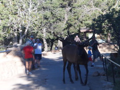
I set out from Mather Campground at 6:30 A.M., on Wednesday, the “Longest Day” of the northern year. Greeting several of us at the trailhead were a pair of elk.
The little boy on the right was my steadfast friend on the first 1/2 mile of the hike. Then he fell back to rejoin his father.
There are 21 more photos in this post. Bear with me.
I started off in earnest at 7:00 A.M.
The top layers are Kaibab and Toroweap Limestone, respectively. Toroweap makes the sheer wall one sees just below the surface.
A few big horn sheep were keeping us company during the first half mile. There were also mule deer, which were a lot more skittish.
We pass through two windows within the first mile of the trail. Next are two views of the Toroweap Limestone wall.
Not far away, I spotted the 1.5 Mile Rest House. This is very welcome in the afternoon! Below is a close-up of the rest house. Those at 3 Mile, Indian Garden and Pipe Creek are quite similar. Water is available at the first three, and all four have toilets.
Below 1.5 Mile, there is a solid layer of Coconino Sandstone.
As I neared Indian Garden, an NPS helicopter landed. This appeared to be a wild animal transfer of some kind. The ranger had his tranquilizer gun out, so it may have been a mountain lion, which would not have been welcome at Indian Garden Campground!
The Colorado Plateau is largely desert, at its lower elevations. Indian Garden offers a lush oasis, for about 1 1/2 miles, along Garden Creek.
Above, Undivided Dolomite and Mujav Limestone are your hosts, heading from Indian Garden to Devil’s Corkscrew. This rock layer is from the Cambrian Era.
Garden Creek remains a friendly helper, for about a mile past Indian Garden.
Devil’s Corkscrew is a mixture of Zoroaster Granite, Nankoweap Sandstone and Gardenas Lava. Dox Sandstone makes up the bottom layer, where one gets to Pipe Creek. This is a 2.5 segment of extreme desert, with triple digit temperatures in the afternoon. Be fit, or turn around!
I took this from underneath a rock overhang, along the Corkscrew. This postpile is of Dox Sandstone.
The emergence of Pipe Creek, and the presence of blue dashers, signal that the river is close by. I tried to encourage a couple of ladies to keep going the last mile or so. Apparently, they’d had enough. A man who came by while I was at Pipe Creek Resthouse said he saw them soak their shirts and head back towards the Corkscrew. I never saw them after that, so they made it out. Always follow your gut, in these situations.
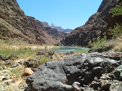
At 11;30 A.M., I reached the Colorado River, at Pipe Beach. The rock you see along the north bank is Bass Limestone and Vishnu Schist. This is all the legacy of Pre-Cambrian Earth, when everything lived underwater.
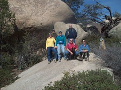
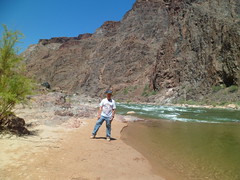
I rested, had lunch and soaked my feet at Pipe Creek Resthouse, after chatting with a couple who were kind enough to record my presence (above), and taking their photos, in turn. It took from 12:15 to 6:38 P.M. to return from the river to the rim. There were confirmations along the way, and I was constantly reminded that I would be just fine. One of those was a heart-shaped prickly pear cactus.
Here are the Navajo Sandstone and Toroweap Limestone layers, in late afternoon.
I had the good fortune to meet up with three people from Tusayan, when I got to 3-Mile Rest House. They pretty much stayed with me the rest of the way. It was their first Canyon hike, and two of them said it would be their last. I would be surprised if that were the case. Cooler weather brings a much different Grand Canyon experience.
I cannot say enough good about the rangers. These are among the hardest-working young people I’ve ever seen. They keep very close watch on hikers, and will be the adults in the room, when one’s judgment gets cloudy. I got through the Longest Day by following their guidelines. Though traveling rim to river and back on foot is discouraged, it can be done- if one is in good shape, takes his/her time and stays hydrated.
I had not been in the Grand Canyon since Penny and I went in June, 1981. We slept in the open that night. In 1983, we went for a day trip to the North Rim, but only went about a mile on the North Kaibab. We took Aram along the Rim Trail in 1996.
About a month ago, I read about the Alzheimer’s Association having a Longest Day campaign, to raise awareness on the plague of dementia. I didn’t have the money to formally register for the event, but decided to do a hike along the Bright Angel Trail, to make a statement, and maybe better-off people would feel like chipping in, on their own.
So, Tuesday afternoon, I headed north, through Williams and Valle, to the South Rim. Williams is the southern terminus of the Grand Canyon Railroad, a narrow-gauge system that also goes to the South Rim, ending at Bright Angel Lodge.
Here are a couple views of Williams.
Williams was named for Bill Williams, a roguish mountain man of the mid- Nineteenth Century, who is also the namesake of nearby Bill Williams Mountain, which I plan to hike over Labor Day weekend. His name extends to a river which flows from this area into the desert between Wickenburg and Kingman, eventually meeting the Colorado River, south of Lake Havasu City.
After a nice cup of joe at American Flyer, I headed on to Valle, home of Flintstones’ Bedrock City- a nice diversion for families with very young children. The outfitters’ supply store in Valle is made up of two pyramids.
The area from here to Tusayan varies between grassland and pine forest, but mostly has the former.
There are occasional buttes, like this one just north of Valle.
I got into Tusayan, the service town just southwest of the park, and purchased a few more necessaries, like granola for breakfast and ice for the cooler. Then, it was off to the campsite. Like South Carlsbad State Beach before it, Mather Campground was full. I took my reserved spot, at the tail end of the grounds and jerry-rigged my rodded tent, using twine and string. It served its purpose and any snickers were kept to a dull roar. NOTE TO SELF: Pick up some tent rods next week, before the three-day camp-out.
Here are a few shots around the Mather Campground area:
It’s dry here, so the ponderosas need all the help they can get.
At 6:30 PM, Ranger Kim gave a talk on the area’s wildlife.
At 7:15, one of her subjects introduced herself.
I arrived at Mather Point, the site of my evening photo shoot, around 7:20. Here is what awaited.
This is Kaibab Limestone, the topmost (for now) layer of the Grand Canyon.
Here is a formation of Navajo Sandstone.
Various Coconino and Toroweap (Limestone) formations bid farewell to the Sun.
This ominous looking creature is an outcropping of Kaibab Limestone.
Coconino Sandstone and Hermit Shale in twilight were awe-inspiring. These sights evoke my bird fantasies.
Sunset at any of the overlooks is a must-see. Now, for the piece-de-resistance.
This is one of the features that made me fall in love with this canyon. Next, I will present some of the others.
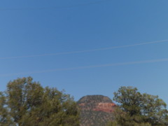
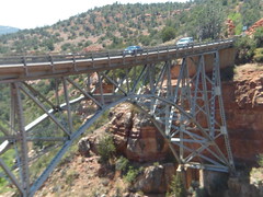
I went to Sedona today, on a whim. In 1983, Penny and I climbed a mountain called Wilson Mountain. It is about 1.7 miles northeast of Sedona proper, just across a span called Midgely Bridge.
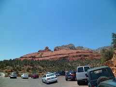
This being Father’s Day in Sedona, of course I parked by the side of the road.
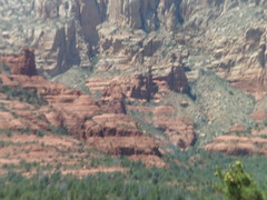
The majestic red rocks of Sedona speak for themselves. I will not interrupt.
Wilson Mountain trail itself wends away from the red rocks and is a sun-drenched, rugged high desert mountain hike. For this reason, as I had started late, due to a morning some commitment, I stopped at the saddle and leave the crest for another time. I did this with some nudging from the angel on my shoulder. She indicated she would not be happy with me if I over-stressed myself. That would have made two of us.
Still, it was a fine 5.4 mile round trip, and took me through some amazing country.
Above, one can view Oak Creek Canyon from the trail.
This rock formation lies midway up South Wilson Mountain
The flowering agave, below, is the tallest I’ve seen.
Here is what remains for me to explore here, on a slightly cooler day, maybe in early November.
After retracing my steps down Wilson Mountain trail, I looked down a bit at the coolness of Oak Creek and its canyon.
While I waited my turn to view Oak Creek at the overlook, a family from the Caribbean made a short video. As a token of gratitude for my waiting, the father of the family took this:
This was a fine Father’s Day, topped off with a Tuscan Tuna Salad and Mango Frappe at this fine establishment:
Canyon Breeze’s back patio gives a lovely view of the red rocks, while one savours its delicacies.

 About 1/4 mile along, one comes to this wooden bridge.