Prescott Circle Trail, Segment 1, Part 2: Trail’s End

6

May 22, 2016, Prescott- There are lots of challenges left in the world, for those who think it’s all been done by others.  I know that, no matter where I go, there will be someone who’s already “done” the trip, gone along the trail, gone up the mountain, forded the river, negotiated the canyon.  I’m happy for them, and hope that many will follow after us.  The world is for learning and for appreciating.

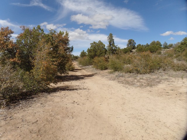
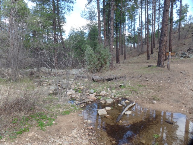
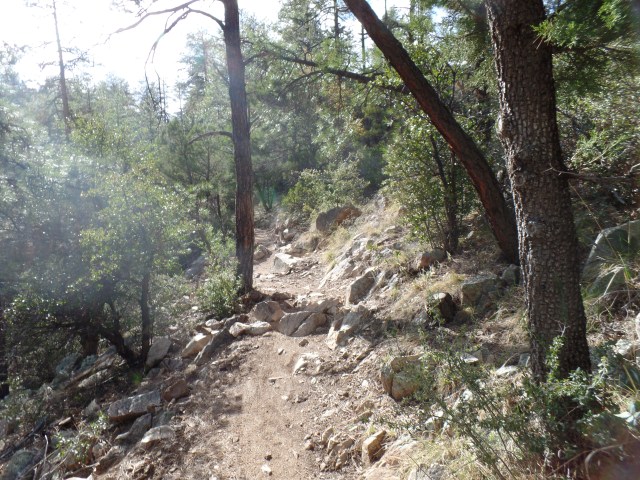
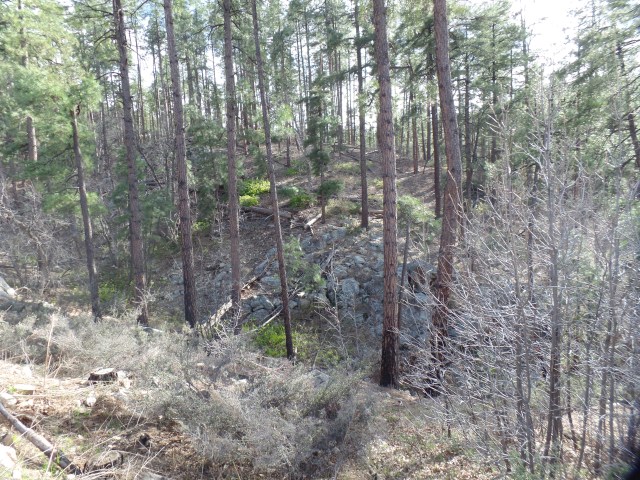
In twelve section hikes, I have explored the entire unpaved course of Prescott Circle Trail.  Ten segments, spanning 53 miles, separated only by a 1.8 mile gap of neighbourhood and ranch, offer a variety of terrain and ecosystems:  Pinon juniper forest, manmade lakes, grassland, highway underpasses, scrub oak forest, tall pines and, always, granite or shale badlands and Dells.

I started this effort last autumn, with a  view towards getting a holistic sense of my adopted home base and the condition of its natural environment.  This afternoon, the final section of trail presented itself:  A loop, starting and ending on the side of Granite Basin Road, a bit south of Cayuse Day Use Area, an equine staging area.

Hence, the photos:

SAMSUNG CAMERA PICTURES

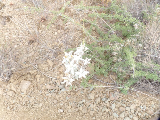
Two days of steady rain, this past week, have brought the fireweed into a healthy state of being.  I took a brief walk to an area I explored last week, to see how they were doing.

SAMSUNG CAMERA PICTURES

Once up on the Ho-Kay-Gan Trail, the settled homes of Williamson Valley’s horse lovers come into view.

SAMSUNG CAMERA PICTURES

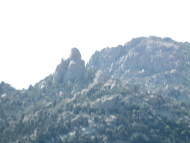
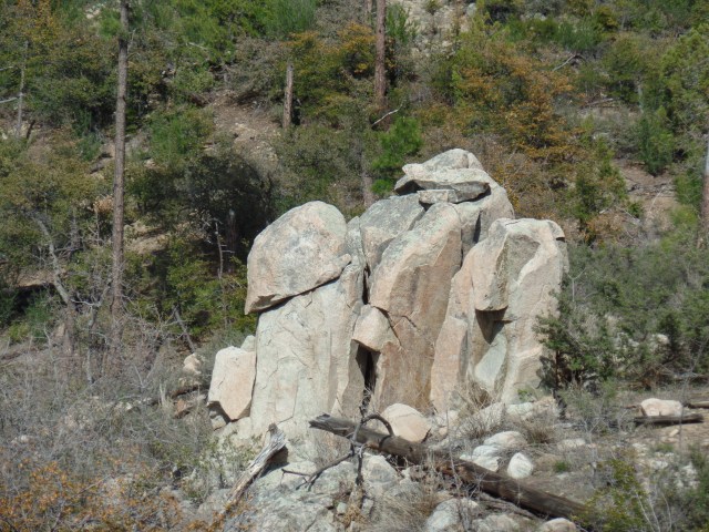
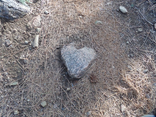
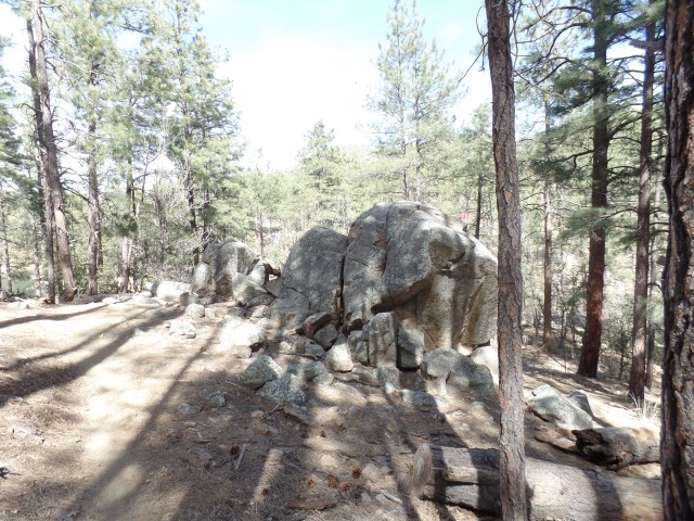
As is often the case, the stone watchmen are on the job.

SAMSUNG CAMERA PICTURES

A rock that resembled an ancient sage sits with its back to the trail.

SAMSUNG CAMERA PICTURES

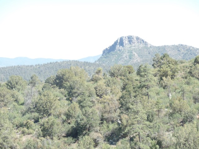
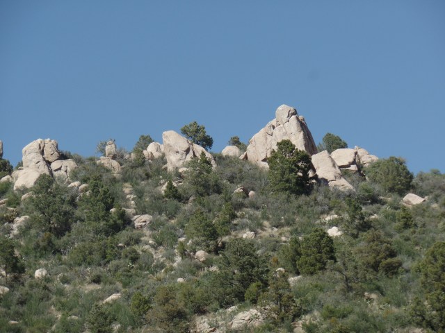
I like finding hills that resemble pyramids.  Ho-Kay-Gan is a steep little mountain, and the trail skirts its slope, with a sharp descent into Alfano Gorge.

SAMSUNG CAMERA PICTURES

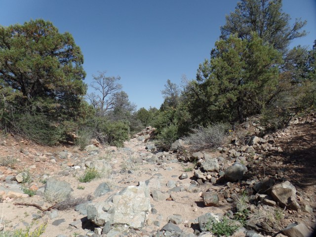
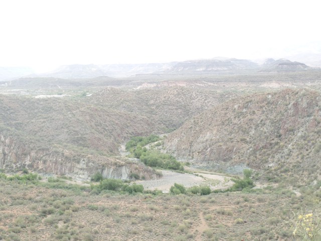
Here is a view of Alfano Gorge, headed upstream.  This part of Williamson Valley resembles Pioneer Park, not surprising, given that the two are  a scant two miles apart.

Above, is Ho-Kay-Gan Trailhead.

A nice party of three hikers, who had passed me, while completing their own loop hike, graciously took this keepsake.

SAMSUNG CAMERA PICTURES

Ho-Kay-Gan Trailhead

So, my first completion of a long-distance trail system is now complete, at least the unpaved portion.  I will walk the gap, from Katahn Drive to Pioneer Parkway, for the sake of integrity, early next month.  Then, too, completing Black Canyon National Recreation Trail by the end of 2016 is also a goal.

Prescott Circle Trail, Segment 1, Part 1: In Granite Basin

4

May 19, 2016, Prescott- This is a different sort of Throwback Thursday.  Last Sunday’s hike took place, in between two social gatherings.  It’s important, somehow, that I complete Prescott Circle Trail, before summer starts.  So, May 15’s sumptuous afternoon found me hiking from Iron Springs Road to just above Granite Basin Road, a distance of 3 miles each way.

I began by crossing the first fairly busy roadway, Iron Springs Road, then down a mildly steep path, across Willow Creek’s relatively benign gorge, and along an easy trail to the overlook for Granite Basin, one of the most majestic places in Yavapai County.

SAMSUNG CAMERA PICTURES

South trailhead, Prescott Circle Trail, Segment 1, near Iron Springs Road

SAMSUNG CAMERA PICTURES

Granite Mountain, peaking over the south ridge of Granite Basin

Granite Mountain lords it over this area, as it does, by extension, over the cities of Prescott, to the south, and Chino Valley, to the north.

SAMSUNG CAMERA PICTURES

Thumb Butte, to the south, isn’t about to be ignored.

SAMSUNG CAMERA PICTURES

As always in the Southwest, boulders are a huge presence in Granite Basin.

SAMSUNG CAMERA PICTURES

This resembles an ancient philosopher king, from some city-state in the Mediterranean region.

SAMSUNG CAMERA PICTURES

Granite Mountain comes into clearer focus, at the edge of the Basin.

SAMSUNG CAMERA PICTURES

The Basin itself has been the source of hours of pleasurable exploration for me, in the past few years.

SAMSUNG CAMERA PICTURES

The sweep of Granite Basin, leading to the great mountain.

SAMSUNG CAMERA PICTURES

The summit of Granite Mountain, through the afternoon haze.

SAMSUNG CAMERA PICTURES

An old friend, “Mini Sphinx”, about a mile along Willow Trail, my diversion for the early evening, before hiking back to Iron Springs.

Lastly, here are a couple of  flower-gems, so that the little beings are not overlooked.

SAMSUNG CAMERA PICTURES

Fireweed flowers punctuate the sandy brushland.

SAMSUNG CAMERA PICTURES

Desert Dandelion are found, closer to the Basin rim.

This area has been an old comfort to me, both when I first came here, in April, 2011, and at various points along the Grief Road.  That it is the near ending of a 55-mile circle around my adopted home base seems most appropriate.  In a few days, I will complete Segment One, from Willow Trail to Williamson Valley Road.  Summer looks to be soothing, followed by a return to a secure work environment.

In Utmost Isolation

10

April 30, 2016, Black Canyon-  This is a few days late getting to print, but here is what happened today. I started out in mid-morning, stopping in for breakfast at Flour Stone Bakery, a lovely little spot in the old mining town of Mayer, some 30 miles southeast of Prescott.  It has authentic challah, and finely baked rye and other loaves of bread.  I am inclined to stop here on future forays along Black Canyon National Recreation Trail, which I started walking, in segments, about 15 months ago- just north of Mayer.

Here is Flour Stone Bakery, inside and out.

It seemed that the entirety of western Yavapai County, from Prescott to Mayer, was hopping, with one form of mass entertainment or another- Bicycle Marathon, Antique Car Show and, here, just plain Antique Shows.

I needed to get back into the wilderness, though, at least for several hours.  So, on to Black Canyon it was.

The segment I hiked today extended from Black Canyon City’s trailhead to Cottonwood Gulch, about 6 miles one way.  It is roughly 3/8 of the Black Canyon-Table Mesa Road section of this amazing high desert system.  In a nutshell, that means I have hiked a bit more than half of the entire trail (44 of 81 miles), over the past 15 months. Manageable segments work well for me, in this regard.

Here are a few scenes from along the trail, which alternates between hugging the Agua Fria and exploring the rugged hills and mesas, west of the river.

SAM_6739.JPG

Here is a view of Horseshoe Bend, about two miles south west of the trailhead.  A family was enjoying the water of Agua Fria, at this serene spot. They were among the few people I encountered this afternoon.  Six bicyclists, here and there, rounded out the “companionship”.  Mostly, though, it was the desert and me, alone.  Plants, though, were quite prolific.

SAMSUNG CAMERA PICTURES

Flowering barrel cactus, Black Canyon

SAMSUNG CAMERA PICTURES

Emerging cholla, in basalt field

SAMSUNG CAMERA PICTURES

Mr. Sandstone

He didn’t bring me a dream, but his presence was oddly reassuring, in the quiet of the afternoon.

SAMSUNG CAMERA PICTURES

Hilltop bench, Cheapshot Mine region

I chose this little redoubt, atop Cheapshot Hill, to rest and write a bit in my journal. After a brief interlude here, I kept on going to Cottonwood Gulch, just shy of an intriguing Thumb Butte-like mesa, whose name escapes me.  I will check that one out on my next segment hike, from Table Mesa Road, probably next Fall.  Here is where I chose to turn around.

SAM_6758.JPG

This bush reminded me a bit of mimosa, though I know it is something different- just don’t know its name.  It looks like a four-wing saltbush, but the flowers resemble those of saltcedar.

SAMSUNG CAMERA PICTURES

Desert lily, Cottonwood Gulch

Well, those last two gave me a reason to pick up a wildflower book, which was actually part of a map of Death Valley, of all places.

This trail was certainly the most isolated I’ve experienced since Seven Falls, northeast of Tucson, and it was every bit as satisfying a challenge- 12 miles in a day.

.Upon returning to community life, a poetry reading and a lively jazz-funk concert rounded out this last day of April.

SAMSUNG CAMERA PICTURES

Heart-shaped Prickly Pear colony


Prescott Circle Trail, Segment 2: Thumb Butte Road to Iron Springs

10

April 24, 2016, Prescott- Today was another picture perfect day, with less wind than yesterday.  Thus, it was the right time to hike the 8-mile round trip, from one iconic landmark (Thumb Butte) to the near approaches of another(Granite Mountain).

Actually, I reversed the order, as Iron Springs’ parking lot is spacious and well off-road.  I was met by a couple who were on a short bicycle ride.  They went as far as the Fireplace Ruin, a distance of 1.8 miles.  That segment of trail follows an abandoned rail bed, the route of which once connected the mining camps of Iron Springs with downtown Prescott.  With those camps long closed, the route evolved into a Rails-to-Trails path.  There are several fine views, to the east, from the trail.

The left photo shows the Bradshaw Mountains, while the right-hand view is of two adjoining subdivisions, to the east. Below left, is a view of Badger Peak, five miles to the southeast.

The above right scene shows some of the rock that was cut away, to push the rail bed through.  Below it, new growth has helped in recovery from the Indian Fire, of 2002, but the area was hit again, in 2013, by the Doce Fire.

The dryness of our region concerns me, and we are doing all possible to avoid another serious fire season. This section of trail seemed drier than the last two, with sandy soil along much of the route.

SAMSUNG CAMERA PICTURES

This pump house is situated to help, in the event of another fire.

Another 1/4 mile ahead, the ruins of an old mining cabin attest to the ravages of fire.  The only thing left standing is the fireplace!

SAMSUNG CAMERA PICTURES

Fireplace Ruin, Javelina Trail, Prescott

Granite boulders signal the turn-off from the abandoned rail bed, and Javelina Trail heads around a couple of small foothills of the Sierra Prieta.

SAMSUNG CAMERA PICTURES

Granite boulder field, Javelina Trail

Willow Creek’s South Fork is the only running water along the trail, and it was not running today.

SAMSUNG CAMERA PICTURES

South Fork, Willow Creek

SAMSUNG CAMERA PICTURES

Looking vaguely like a moai head.

This boulder reminded me,obliquely, of a moai, from Easter Island.

Once I hiked over and above the drainage area of Willow Creek, Thumb Butte could be seen to the southeast.

SAMSUNG CAMERA PICTURES

Northwestern view of Thumb Butte.

Arizona woodpeckers are active here, as elsewhere along Prescott Circle Trail. As I learned last summer, in the Whatcom Museum, Bellingham, WA, these birds share nests with a variety of other creatures.

SAMSUNG CAMERA PICTURES

Arizona Woodpecker nests, Javelina Trail

So I have explored another segment of our area’s comprehensive trail system.  One segment remains- the area between Iron Springs and Williamson Valley Road, a distance of 5 miles each way.  I will see whether the effects of the 2013 Doce Fire are as telling there, as they are, in patches, here.

Prescott Circle, Segment 3: Copper Basin to Thumb Butte Road

2

April 9, 2016, Prescott- My companions today were about a dozen bicyclists, a few lone hikers, three herds of deer and birds-lots of them.  A wild turkey, or two, could be heard gobbling in the woods above Manzanita Creek- about a mile from Copper Basin Road.

With my Saturday afternoon appointment canceled, due to illness, and with a break in the storms, the trail called-loudly.  Who am I to turn down Mother Nature?

Choosing to use paved Thumb Butte Road, and one of its turnouts, as a safe place for my car, I opted to start the hike at the end point, and do the entire 10-mile round trip in an afternoon.  The jaunt took 4 1/2 hours.

SAMSUNG CAMERA PICTURES

Miller Creek, near Thumb Butte Road

There are several creeks, coming off the Sierra Prieta, in this section of trail. Miller Creek is the northernmost, followed, north to south, by Butte, Aspen and Manzanita- which has the nicest little canyon in the area.

As I made my way up Porter Mountain’s northeast peak, also called Williams Peak, it was telling, just how severe the Indian Fire of 2002 was to this area, itself so close to the Granite Basin, which was later to be ravaged by 2013’s Dolce Fire.  These collective memories, compounded by the dire tragedy of Yarnell Hill (which followed Dolce by two weeks), make us here in Prescott that much more grateful for this morning’s rain- and that which is expected to follow, this coming week.

SAMSUNG CAMERA PICTURES

Cloud, reaching up from base cirrus.

As if offering confirmation of my thoughts, a cirrus finger reached up from its base cloud, towards other clouds above.

SAMSUNG CAMERA PICTURES

Granite Mountain, from Williams Peak

Williams Peak offers a fine vantage point for the majesty of Granite Mountain.

A pair of Arizona Woodpeckers hung around, while I was admiring the scenery, so I obliged them with a portrait.

SAMSUNG CAMERA PICTURES

“Stormtrooper” Rock, Butte Creek Valley

As I headed into the Butte Creek watershed, I was watched by a Storm Trooper.

SAMSUNG CAMERA PICTURES

Butte Creek Road, atop Williams Peak, Porter Mountain

The trail follows Butte Creek Road, along the flat ridge of Williams Peak, until one reaches the area known as “Hilltop”, where three trails converge.

SAMSUNG CAMERA PICTURES

Thumb Butte, from Williams Peak

A clearing on Butte Creek Road afforded the best view of Thumb Butte, from the west.  It is two miles northeastward, from here.

SAMSUNG CAMERA PICTURES

Butte Creek

Crossing Butte Creek, one heads into slightly more heavily forested, and somewhat more rugged, terrain.

SAMSUNG CAMERA PICTURES

South Ridge, Williams Peak

SAMSUNG CAMERA PICTURES

Manzanita Creek Canyon, near Dugan Camp, Copper Basin

Manzanita Creek Canyon is on my list of “picnic hike” spots, during the second half of June.  Dugan Camp, about a half mile southwest, is still an active resting place for trailer campers.

SAMSUNG CAMERA PICTURES

Apparent ruin of miner’s cabin, south of Manzanita Creek

This area has been popular with campers and miners alike, especially during the heyday of Copper Basin, in the early 20th Century.

SAMSUNG CAMERA PICTURES

Heart-shaped granite, near Copper Basin Road

There was another confirmation, waiting for me, close to the turnaround point, near Copper Basin Road.

SAMSUNG CAMERA PICTURES

Stump, from 2002 Indian Fire

This stump stands as a silent sentinel, to warn humans of the lasting effects of careless camping and shooting.

Finally, in the spirit of Asian artists who leave a flaw in each of their works, here is a scene of one of the three herds of deer, who crossed my path on the hike back to Thumb Butte Road.

SAMSUNG CAMERA PICTURES

Deer, the best wild animals for selfie poses.

On Quartz Mountain

12

April 9, 2016, Prescott- Last Sunday, I threw in a 1-mile round trip side trail, to my Prescott Circle jaunt.  Quartz Mountain is a unique promontory, in the mostly pine-clad, dry-soil terrain that is prominent in the western half of Prescott Circle.  It appears to be the remnant of a volcano, which also makes sense, given that quartz is scattered from White Spar to an area just west of Thumb Butte.

I had the brief company of two men and three children, who had been atop the mountain for an hour or so, studying the quartz and learning of the different colour blends.  Most, as you will see, are white quartz, though there is a fair amount of pink, and some two-tone.

SAMSUNG CAMERA PICTURES

East side of Quartz Mountain

I checked out this area, just below the summit, before heading up.

The views from any point near the summit are thrilling.

SAMSUNG CAMERA PICTURES

San Francisco Peaks, from Quartz Mountain

Now, here are several scenes of the summit.

SAMSUNG CAMERA PICTURES

Iron-tinged white and gray quartz, Quartz Mountain summit

SAMSUNG CAMERA PICTURES

Southwestward, from Quartz Mountain, towards Sierra Prieta

SAMSUNG CAMERA PICTURES

View of Quartz Mountain summit crest, from just underneath

SAMSUNG CAMERA PICTURES

Agave and prickly pear cacti, Quartz Mountain summit

As you can see, the desert aspects of Prescott’s status as a transition zone are quite prolific, even at 6,000 feet.

This little gem is one of several good reasons for side hikes, off the main Circle Trail system.

As it happened, today (April 9), was a good day for Segment 3 of the Circle.  It’ll be featured in the next post.

Prescott Circle Trail, Segment 4: White Spar to Copper Basin, Part 2

4

April 6, 2016, Prescott-  While we were living in Phoenix, in 2002, news came of a horrific wildfire, that was bearing down on Prescott:  The Indian Fire.  It could easily have swept through Thumb Butte and down Copper Basin, slamming full force into downtown Prescott.  That didn’t happen, thanks to the Forest Service, and the fates of Nature.  As it was, though, the Indian Fire seared a large area between White Spar and Copper Basin, leaving several square miles of sticks in its wake.

On Sunday afternoon, I walked in some of the same areas affected by the Indian Fire. Wolverton Mountain rises above the trail, though no family named Clowers lives there. Quartz Mountain is reached by a side trail, about 1/2 mile south of Wolverton.  Both peaks were singed in 2002.

I began at the Copper Basin end of the segment, starting out on the Aspen Creek Trail.  The creek comes down, from the western base of Wolverton Mountain, and flows down towards Granite Creek and downtown Prescott.  The creek is barely flowing, and indeed, the ground in this area is badly in need of a soaking.

SAMSUNG CAMERA PICTURES

Trailhead, Aspen Creek Trail

SAMSUNG CAMERA PICTURES

Gray granite, Aspen Creek Trail

I came soon enough to the upper reach of Aspen Creek Canyon.

As the sun was getting a bit lower, I came to the junction with Wolverton Mountain Trail and Quartz Mountain side trail.  Walking along the Wolverton, I had several fine views of the high ridge of the Sierra Prieta Range, of which these peaks are an eastern offshoot.

A glimpse of Wolverton Mountain’s practical use was visible from the trail, though the summit itself will be the focus of a future hike.

SAMSUNG CAMERA PICTURES

Summit of Wolverton Mountain, from trail.

Shortly after passing Wolverton’s eastern edge, I came to Quartz Mountain Trail.  This unique promontory will be the topic of the next post.

Prescott Circle Trail, Segment 4:White Spar to Copper Basin- Part I

10

April 5, 2016, Prescott- This past weekend, I was able to break this 6-mile section of juniper pine forest, quartz and gray granite into two hikes.  It was prudent, due to a commitment here in town, each day.  It also gave me more time to focus on the features of each part of the segment.

Saturday’s jaunt began at White Spar North Trailhead, going 3.5 miles to the junction with Quartz Mountain Trail. The entire segment is Wolverton Mountain Trail, about which more later.

Above, are three scenes at the south end of the trail.  Even this close to White Spar, there are many small fragments of pink quartz.  The trail is rather flat, for the first 2 miles or so, until past this magnificent view of a local observatory, privately-run, and of the majestic San Francisco Peaks, seventy miles northeast, as the hawk flies.  The Granite Dells may be seen, holistically, in the midground.

The East Peak of Quartz Mountain, seen in the next two frames, signals a slightly more rugged terrain.

SAMSUNG CAMERA PICTURES

East Peak, Quartz Mountain

I noticed small wonders along the way, as well, including this white quartz(below) and the upper jaw bone of a hapless raccoon, which I have left out of this gallery.

SAMSUNG CAMERA PICTURES

White quartz, at foot of East Peak, Quartz Mountain

This area was filled with blooming manzanita, another special treat.

SAMSUNG CAMERA PICTURES

Manzanita in bloom, near Quartz Mountain

The stopping point gave me incentive for a Sunday completion of the segment, starting then from Aspen Creek Trailhead, off Copper Basin Road.  As this was done after a Sunday brunch, I was grateful for a somewhat more strenuous trail.

Here is the junction with Quartz Mountain Trail.

SAMSUNG CAMERA PICTURES

Stopping place for hike on 4/2/2016

This Singing House

10

March 20, 2016, Prescott- I had the good fortune, this weekend, of being in two amazing places, locally.  The first was Chapel Rock Conference Center, of which more in a coming post.

Today being Naw-Ruz, the first day of the Baha’i  calendar, as well as an ancient Persian cultural festival (which used to last twelve days, I’m told, in the time of Zoroastrianism), I focus now on our community’s local celebration.

It was held, on this glorious afternoon, at the self-built home of two amazingly inventive and eclectic people, who I have been honoured to call friends, for over twenty years.  Each time I visit here, there are new items either added to the house, inside or out, or in the works, in one studio or another.

When we sat for the devotional part of our celebration, the hostess was asked whether recorded music would be part of the program.  She said “No”, and at that moment, the house itself began its music- in the form of three sets of wind chimes taking turns.

The chimes were not overly clangy, which would have not set a good mood, but gently interspersed our readings.  Afterwards, we had a light meal, which sufficed this one’s appetite for the rest of the day.  Some days are just meant for one meal, supported by snacks.

Here are some scenes of this lovely home, atop a bucolic hill.

SAMSUNG CAMERA PICTURES

Yard art, Prescott

SAMSUNG CAMERA PICTURES

The Seven “S’es” of Naw-Ruz

(See my next post, for a detailed description of this elegant holiday arrangement.)

Here are a couple of the reasons my friends were drawn here, in the first place.  Note the embedded iron ring, atop the crag.

So, another fine year has begun  for us Baha’is.  I wish all my friends north of the Equator a lovely Spring, and all to the south, a bountiful Fall.

Prescott Circle Trail: Tales of Two Segments

4

March 13, 2016, Prescott- “It is not yours to keep, this ever-changing trail”- Laura and the Killed Men, “The Ever-Changing Trail” (All rights reserved, Laura Kepner- Adney and Sam Golden, 2015).

I sat, joyfully, in one of my favourite evening live music venues, The Raven Cafe, and listened to this Tucson country-folk band’s first set.  The line above is from their a capella set closer.

They excel with instruments, also.

Include the video, as it happened that the evening was a fine counterpoint to two hikes I took this weekend, on Prescott Circle Trail.  Yesterday afternoon, the spontaneity of which I wrote, a few posts ago, kicked in.  I accepted the urge to do a “fill-in-the blank” hike, to the top of Badger Peak, which is circumnavigated by Section 7 of the Circle.  The peak is also called “P” Mountain, owing to the large white first letter of my adopted town’s name.

Here are some scenes.  The first two were taken from the access road, to which I transferred from Prescott Circle, at the half-way mark to the summit.

The third photo shows a communications station, atop the peak.  The white circular arrangement is the top of the P.  There is no access to the arrangement, in its entirety, without permission of the Yavapai Nation, which owns the mountain.  The final photo shows Watson Lake and the Granite Dells, from the summit.  This hike was four miles, round trip.

This afternoon, a friend, who had wanted my help with a remodeling project, postponed it until next week.  This gave rise to spontaneous hike # 2:  Segment 5 of the Circle.  It is a ten-mile round trip, something I’ve not done during the Fast.until today.  I was inspired in this by another friend, who is both older and physically smaller than I am, and who hikes and runs during this time period.  So, out of my comfort zone I went- with enough water on which to fall back, in the event I felt weak.  As it happened, that was not a problem, as the air was cool this afternoon, and the Sun was hidden by clouds, most of the time.

This segment goes from a point south of Upper Goldwater Lake, around the south and west shores of that body of water, above the west shore of Lower Goldwater Lake, which is closed to the public and through Prescott National Forest, to White Spar Campground. This hike was ten miles, round trip.  Sitting here tonight, I feel refreshed and focused.

Here are some scenes of Segment 5.

Note the “Tree-Pod”, on the right.

SAMSUNG CAMERA PICTURES

Gray granite boulders, south of Goldwater Lake

SAMSUNG CAMERA PICTURES

South shore, Upper Goldwater Lake

On the left are a pair of daisies, seen along the way, above Lower Goldwater Lake.  The heart-shaped stone memorial, on the right, is dedicated to the 19 firefighters who died at Yarnell Hill, in June, 2013.  It is atop a ridge, 1 1/4 miles southeast of White Spar campground.

The Sierra Prieta range can be seen from Monument Ridge.  On the right, is the trailhead at White Spar Campground.  I spent only ten minutes, resting, at this very full facility.  There were 2 hours’ back journey left.

On the way back, I stopped for several minutes at this lovely nook, Banning Creek.


There had been a fair crowd here, when I was headed towards White Spar.  When I returned, only one lone bicyclist and I had the place to ourselves- and he was about to leave.  I saw very few other people, the rest of the way, until I got back to Upper Goldwater.

Now, with the next two weekends booked, I will wait until April to take on the next segments of Prescott Circle- unless things get canceled and spontaneity calls.