On Juniper Mesa

10


SAMSUNG CAMERA PICTURES

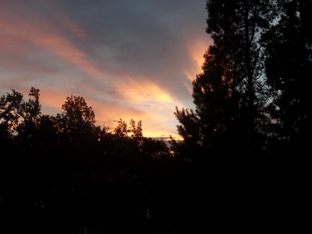
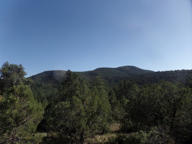
Juniper Mesa, from George Wood Canyon

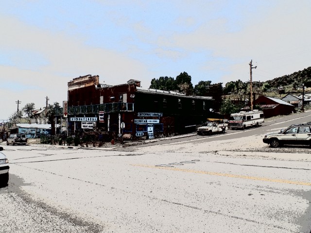
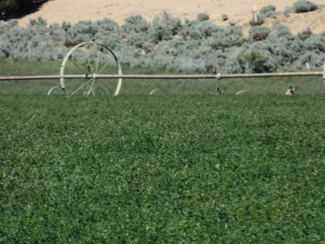
September 4, 2016, Walnut Creek, AZ-  This settlement is only intermittently populated, when researchers from Arizona’s public universities, and Prescott College, show up to conduct their monitoring of the high desert’s overall health, in an area far from any permanent, sizable human community.  A few ranches break the landscape and, indeed, one of those ranches, just west of Juniper Mesa’s main trailhead, is sealed off from anyone not associated with its operation.

I came out here, in mid-afternoon, to explore the sky island known as Juniper Mesa.  The place was, in the 1870’s and 80’s, a military encampment, an extension of Prescott’s Fort Whipple.  It was, to the cavalrymen of the time, the perfect spot for a railway station, with the route commencing in Prescott, going through Del Rio (now Chino Valley) and pushing clear to the Colorado River, at Hardyville (now Bullhead City) and, from there, to San Pedro, one of the ports serving Los Angeles.  The railroad was built, but it went north, to Ash Fork, then to Seligman and Kingman, connecting with a much larger, transcontinental track, the Santa Fe.


So, Juniper Mesa has reverted to a lonesomeness.  I was the only person on the trail today.  Fortunately, I have come to expect that, even in areas closer to Prescott.  The large pack, with an ample water supply, a first aid kit, two knives, a detailed topographic map and a sturdy flashlight, along with one of my trusty walking sticks, has been an integral part of my communes with nature.  What has occasionally caused chuckles, from the smug hipsters doing lakeside botanical and entomological research in Prescott’s city parks, is, to me, a must on any hike lasting more than an hour.  Besides, it wasn’t too long ago, that one of those individuals had to be rescued from Watson Lake Park, a ten-minute walk from a North Prescott business district, because she was dehydrated and delirious.

I saw fairly fresh horse-hoof prints, along the way and smelled fresh bobcat urine, trail side, closer to evening, but it was the insects and I who had the place to ourselves, from all outward seeming.  Juniper Mesa could be for lovers, but so far, it is for the soloists.

I used three trails, in the course of my loop hike:  Oaks and Willows; Juniper Mesa (rim)  and the steep Bull Spring Trail.  Oaks and Willows meets Walnut Creek Road (County Road 125), proceeds through the lush George Wood Canyon to the top of Juniper Mesa, then branches off to the northeast.

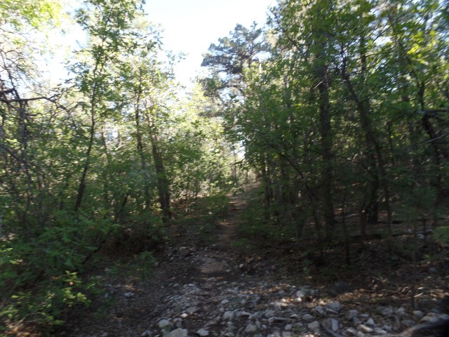
Here are some scenes of Oaks and Willows.

SAMSUNG CAMERA PICTURES

Broad trail, along the Oaks and Willows, Juniper Mesa

SAMSUNG CAMERA PICTURES

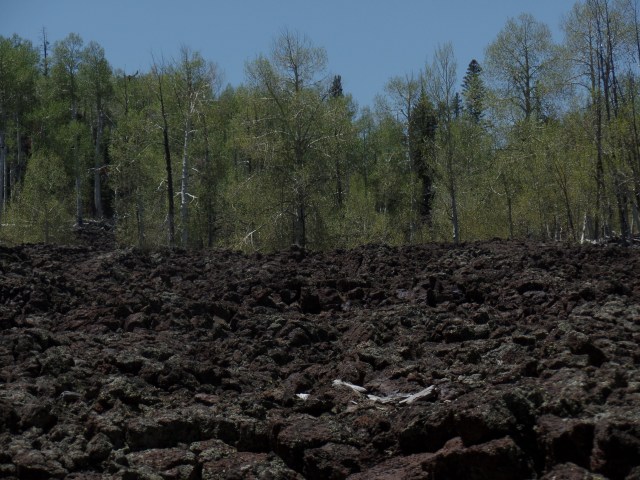
Thick scrub, George Wood Canyon, Juniper Mesa Wilderness

SAMSUNG CAMERA PICTURES

View across George Wood Canyon

SAMSUNG CAMERA PICTURES

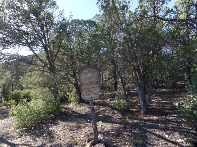
Sign, gnawed by black bears, over several years

SAMSUNG CAMERA PICTURES

Heart of George Wood Canyon, Juniper Mesa Wilderness

Once atop the mesa, I basically followed Juniper Mesa Rim Trail, though finding it rather sparse, in several places.  Horse trails, though, are easy to identify by their indentation into the ground.

SAMSUNG CAMERA PICTURES

Alligator Juniper, top of Juniper Mesa.  I almost see a parrot’s face, in the branch stump.

SAMSUNG CAMERA PICTURES

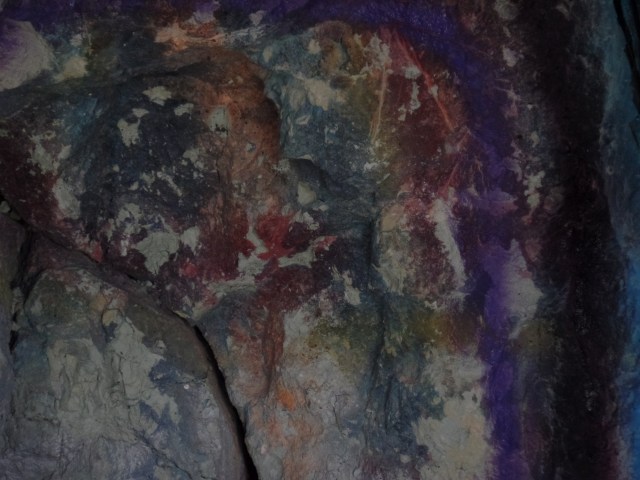
Bear image, small sandstone, Juniper Mesa Rim Trail

Bears are reported to be common here, but I saw no sign of them- not even old scat.  They are probably further north, or in areas more sheltered from the lightning that hits Juniper Mesa frequently, during the monsoon season, that is in hiatus for several days.

SAMSUNG CAMERA PICTURES

Lightning-struck tree, Juniper Mesa Rim Trail

SAMSUNG CAMERA PICTURES

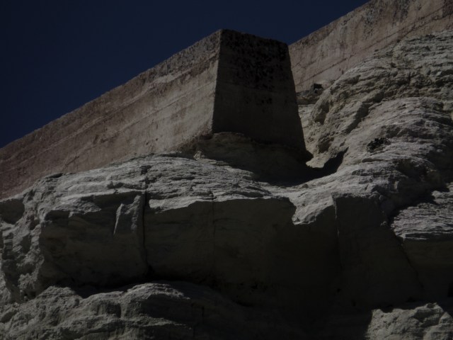
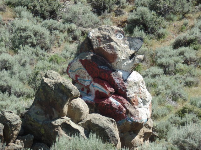
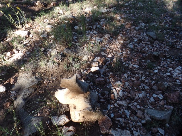
Lightning-struck piece of limestone, and heart rock, Juniper Mesa Rim Trail

The rock above was given a fierce countenance, by a recent lightning strike.

SAMSUNG CAMERA PICTURES

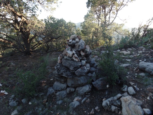
Cairn, Juniper Mesa Rim Trail

Large cairns mark Juniper Mesa Rim Trail, at several points, especially after Oaks and Willows Trail branches off to the north.  A half-mile further east, I bid farewell to the benign rout along the rim, and began the descent, on steep Bull Springs Trail.

SAMSUNG CAMERA PICTURES

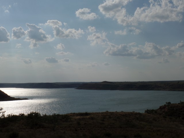
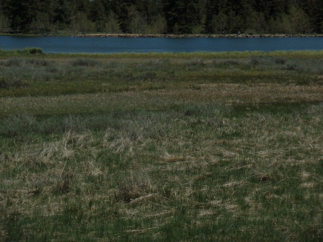
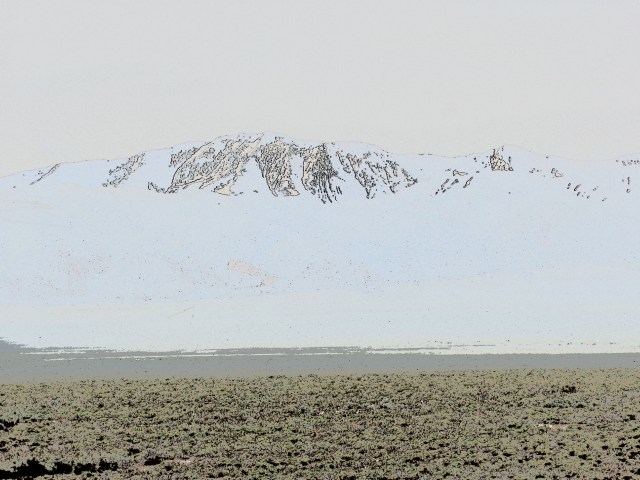
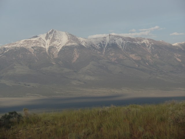
View of Walnut Creek settlement and the Santa Maria Range, from Bull Spring Trail

SAMSUNG CAMERA PICTURES

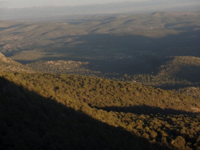
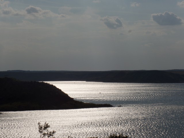
Hazy view of Walnut Creek settlement, from Bull Spring Trail

SAMSUNG CAMERA PICTURES

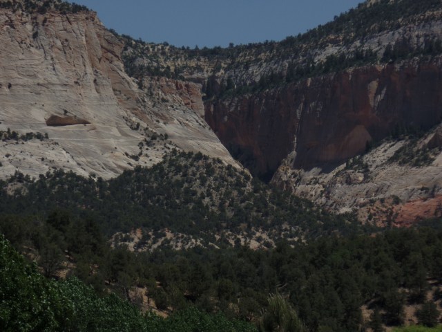
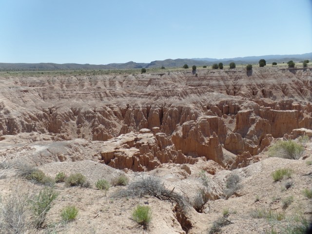
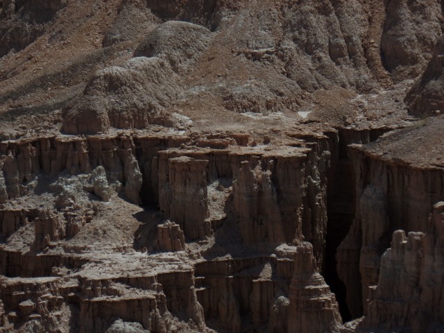
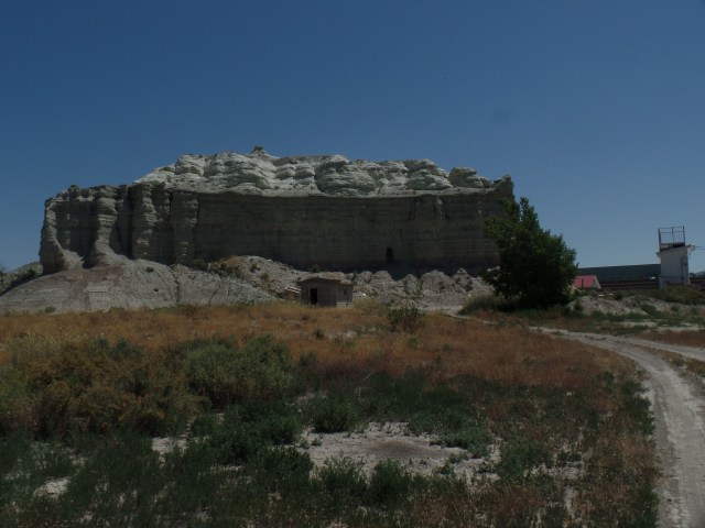
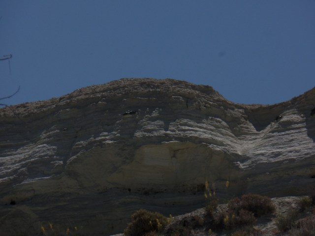
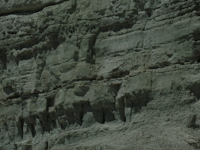
Limestone cliff, east end of Juniper Mesa

The cliffs seen above, and in the next photo, were redoubts for Yavapai and Hualapai warriors, who resisted the U.S. Cavalry in the 1870’s.

SAMSUNG CAMERA PICTURES

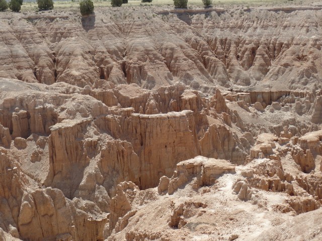
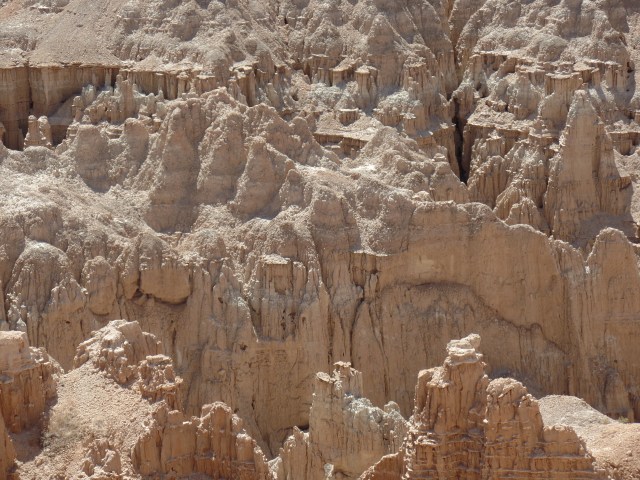
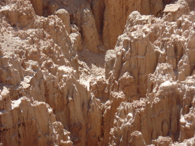
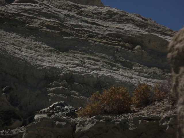
Limestone cliffs, east end of Juniper Mesa

After climbing down from the mesa top, I followed Bull Spring Trail, into the darkness.  Although it was along this trail, that I smelled the bobcat’s markings, the animal itself stayed out of sight, and only small insects, attracted by the flashlight’s beam, showed me any interest.  It took careful attention for me to find the last trail sign, returning to the nub of Oaks and Willows Trail that led me to the car, but I enjoyed a very deep sleep tonight- far from Juniper Mesa.

This is one of several places, in the middle of Arizona’s “nowhere”, that have been on my hiker’s list, in the wake of having completed Prescott Circle.  Stay tuned for others.


Tales of the 2016 Road: Crystal Clear in Georgia

6


July 17-18, 2016, Newnan, GA-  I got up earlier than usual, on Sunday morning.  It was 12:30 A.M., PDT; 3:30 A.M., Eastern Daylight Time.  No, I wasn’t planning an assault on one of the Great Smoky Peaks- the nearest, Mt. Mitchell, being an 11-hour drive, anyway.  The occasion that set me on the road, at 4:30, was a 12 Noon lunch at my brother’s house, in this western Georgia town, some 240 miles north of Hudson.

Breakfast on the fly, and  brief gift shopping at Florida Citrus Center, in Jasper, on the Georgia state line, were my only diversions, en route to Newnan.  I actually made it, right after the Noon Bell.  After meeting, and being escorted to the lunch table, by my fourth grand nephew, I joined brother and the gang for cranberry chicken salad and a variety of fixings.

The centerpiece of the afternoon was us all taking a pontoon boat ride on man-made, but crystalline, Lake Redwine.  This reservoir has none of he brownery of most southern lakes, perhaps because its fill level is well-managed.

Here are several photos of the lake and its surroundings.

The pontoon took the seven of us around the lake, under the able navigation of my brother and nephew, in a bit under forty-five minutes.  You can see how the lake is a place of solace, for so many, even on a warm summer day.

The place has different ambiances, at sunset,

SAM_7255.JPG

and at dawn.

SAMSUNG CAMERA PICTURES

First light along Lake Redwine, GA

After my nephew, niece-in-law and the kids had left, the three of us headed up to The Hil, a farm-to-table restaurant, in the rustic community of Serenbe, several miles north of Newnan.  This would be a place where I could feel well at home, also, but for the price tag. The Hil’s cuisine, though, is thoroughly refreshing.


The day was exhilarating, and prepared me for Monday.  This day was spent in well-rewarded service, taking two of my best friends in all the world to tend to personal matters, enjoying fine meals at Pappacito’s (lunch) and Six Feet Under (dinner), with a viewing of the film, “The Shallows” (Blake Lively’s character faces down a shark, after it bites her leg), in between errands and meals.  Six Feet Under is so-named, as it is located across the street from historic Oakland Cemetery, Atlanta, where the golfer, Bobby Jones, among other prominent Atlantans, is laid to rest.  It’s said that there are those who practice putting on the cemetery grounds.  Six Feet Under, though, is rather a lively place.  I liked the fare at both establishments.

Since my mood was far more relaxed and upbeat than those of my last visit here, five years ago, Newnan and Atlanta likewise felt more like home.  It was well worth the long detour down to both Florida and Georgia.

NEXT:  Back west, through Tennessee and the Great River Valleys

Tales of the 2016 Road: Bushkill Falls and Busted Pipes

10

July 7, 2016, Middletown, NY-  This is another of those years when I could not be present for my son’s birthday.  He was at sea, anyway.  I rose early, at Glick’s Greenhouse compound, and bid Beth and Dave a fond adieu.  My goal was to reach Saugus in time to visit a bit with a nephew and his family, who were visiting from Indiana.   Some goals don’t get reached.

The day began nicely enough.  I made good time past the Lehigh Valley, and its tough, surviving cities of Allentown, Bethlehem and Easton, jumping on Rte. 209, past the Stroudsburgs, to Bushkill Falls, where my in-laws spent their honeymoon, and several subsequent wedding anniversaries.

The privately-owned park retains its magic, and offers a fairly extensive network of hiking trails, some of which are paved.  Families and single wanderers alike were having a fine time, this morning.  Here a few of the scenes I encountered, in this Pride of the Poconos.

SAMSUNG CAMERA PICTURES

Entrance and concessions complex, Bushkill Falls, PA

SAMSUNG CAMERA PICTURES

Approach to Main Falls, Bushkill Falls

SAMSUNG CAMERA PICTURES

Main Falls, Bushkill

SAMSUNG CAMERA PICTURES

Signs of a rain forest, Bushkill Falls

SAMSUNG CAMERA PICTURES

Frontal view of Main Falls, Bushkill

SAMSUNG CAMERA PICTURES

Nice picnic spot, near Bridal Veil Falls, Bushkill

SAMSUNG CAMERA PICTURES

Bridal Veil Falls, Bushkill

SAMSUNG CAMERA PICTURES

Cave, at foot of Bridesmaid Falls, Bushkill

SAMSUNG CAMERA PICTURES

Bridesmaid Falls, Bushkill

SAMSUNG CAMERA PICTURES

Pennell Falls, Bushkill

Pennsylvania has had copious rain, so far this summer.  Thus, the rain forest ambiance of Bushkill Falls, and other places in the Poconos, make for a lovely vacation stopover.  The sense of peace and tranquility I found there, sustained me through what followed, in the afternoon.

After stopping in Port Jervis, NY, in the Three Corners region of New York, New Jersey and Pennsylvania, and enjoying a hearty lunch at Muller’s Diner, I sensed something was awry with Nissan.  Once on I-84, it was worse:  Lack of acceleration reduced my speed to 50.  It was fortunate that I made it up the road apiece, to Middletown, and found a Nissan dealership.  The men took two hours to find and fix what their diagnostics said was the problem:  A clogged front exhaust pipe.  Thanks to them, I was back on the road by 4:30.  It was too late to see nephew and his family, but I made it safely to my mother’s house by 10 PM.   Safety is always first.

Tales from the 2016 Road: The Other Half Gives

7

July 3, 2016, Ponca City-  I spent about forty minutes visiting this spacious northern Oklahoma town’s three major landmarks, all associated with the oil magnate, E.W. Marland, and his family.

Prior to arriving here, I stopped at the roadside memorial to Chief Joseph, logistics chief of the Nez Perce, in the mid-Nineteenth Century.  The captive Nez Perce, native to Idaho, had been brought here, to Tonkawa, in 1877, and made to remain there, until 1884.  They were allowed to return to Idaho, then, and given the choice of becoming Christian and staying in Idaho, or retaining their old ways, and being moved to Colville, Washington.  Chief Joseph and his band chose the latter.  Below, is the photo of the memorial to him.

SAMSUNG CAMERA PICTURES

Memorial to Chief Joseph, Tonkawa, OK

Ponca City, in Osage country, has among the earliest ties to the petroleum industry in Oklahoma.  It is, nonetheless, among the state’s most spacious and well-appointed communities.  Here is a look at downtown.

SAMSUNG CAMERA PICTURES

Grand Avenue, Ponca City

City Hall is also strikingly modern.

SAMSUNG CAMERA PICTURES

Ponca City Hall

There are two homes, built by E.W. Marland, which feature prominently in Ponca City’s civic life.  Marland’s  Grand Home, built by him in 1916, now serves as the city’s cultural center and Indian Museum.

SAM_7078.JPG

Veranda, Marland’s Grand House, Ponca City

SAMSUNG CAMERA PICTURES

Full view of Marland’s Great House, Ponca City

SAMSUNG CAMERA PICTURES

Original Marland Oil Company Flag Staff, Ponca City

Ernest Whitworth Marland had a sincere respect for the sacrifices made by women, on the prairie, and had this statue built, in their honour.

SAMSUNG CAMERA PICTURES

Pioneer Woman Statue, Ponca City

The Marland Mansion, where the family lived after 1916, is the centerpiece of a city park, and is maintained in the spirit of the early 20th Century.  I toured the grounds, as the interior is not open on Sundays.

The Marland children, George and Lydie, are honoured with statues, at the northern and eastern ends of the property, respectively.

The mansion itself was built in grand, European style.  Ernest was a generous man, and did not spare himself or his family of that largesse.

SAM_7085.JPG

SAMSUNG CAMERA PICTURES

Marland Mansion, Ponca City

There is a wealth of flora on the grounds.

SAMSUNG CAMERA PICTURES

Rhododendron bush, Marland Mansion, Ponca City

There is an extensive walking trail around the grounds, which I did not have time to explore, given my invitation to a Fourth of July gathering, east of Joplin.

The pond, though, lends a serenity, and a wildness, to this most epicurean of parks.

SAMSUNG CAMERA PICTURES

Pond, Marland Mansion grounds

The park is a refreshing place for Poncans to gather, so in my view, E.W.’s largesse has had a good long-term effect.  Now, as long as we keep moving towards cleaner energy….

NEXT UP:  Christmas in July

Tales from the 2016 Road: Back to the Texas Panhandle

6

July 1, 2016, Amarillo-  Any road trip that involves I-40 will entail a stop in Amarillo- at least as long as Texas Tidbits is around to spin a yarn or two.  Wes has been a friend for about ten years now, since I started reading his recollections of his town as it was, in the heyday of Route 66.

Southwest 6th Street, below Georgia Avenue, is a pleasing remnant of that time, and may as well be called Amarillo’s Fun Zone.  It reminds me of the North Side, in Fort Worth, or old downtown Nashville.

SAMSUNG CAMERA PICTURES

Southwest 6th Street, Amarillo

The Goldenlight Cafe and Cantina is a good place for old men and young ladies to see each other as human beings, in search of an appreciative listening ear and reassuring arm around the shoulder- so I’m told.  The folks who were here today seem to get along well, and the photo board shows many more, of people who have befriended one another, over the years.  Wes has taken to this place, and its regulars, since Blue Front became a more upscale establishment.  Oysters for breakfast don’t quite cut it, in the Amarillo he calls home.  We each had our choice of hamburger, and shared a “small” basket of fries.  (Remember, this is Texas.)

SAMSUNG CAMERA PICTURES

Interior of Goldenlight Cafe and Cantina, Amarillo

Wes was a bit more pensive than usual.

SAMSUNG CAMERA PICTURES

Wes, in the Goldenlight

After lunch, I drove Wes over to another of his favourite haunts, the Dragon Bar.  It’s a small neighbourhood joint, close to I-27.  Wes pointed out a mural, across the street.  He said it was designed by an attorney who organized the Freedom Project, which focused on getting innocent people released from prison, a while back.

SAMSUNG CAMERA PICTURES

Street mural, 15th Street, Amarillo

Wes was tired, after a fashion.  So, bidding him farewell, I headed towards Oklahoma, but via the upper Panhandle, stopping by Lake Meredith, a popular local boating site, west of Borger.

SAMSUNG CAMERA PICTURES

Lake Meredith, TX

SAMSUNG CAMERA PICTURES

Lake Meredith, TX

SAMSUNG CAMERA PICTURES

The wild prairie, east of Lake Meredith, TX

There is much else worth exploring and photographing, in the rough remnants of glaciated North Texas.  It was getting on in the day, though, and Enid, OK was still ahead.

NEXT UP:  Da Vinci, Plant in the Window and Art Deco

Various Shelters

6

June 23, 2016, Eagar, AZ-  I have been helping to staff a Red Cross shelter, in this small eastern Arizona town, for the past two days.  Those who are here, have come because of respiratory issues.  The smoke from the Cedar Fire, a human-caused forest conflagration, has been more of a problem than the actual blaze.  Few, if any, structures have been affected by the fire.  The school where we are housed is well away from the blaze, of course, as is the school in the Painted Desert town of Holbrook, where a second shelter has been opened.  The concerns now are smoke and flooding, once the monsoon rains come, in earnest.  We got a foretaste of the latter, last night, when the parking lot outside our staff motel got about twenty minutes’ worth of shower activity.

The other day, in between beach visits in southern California, I spent about forty minutes walking in the western lagoon area of San Elijo Lagoon Natural Reserve, in Cardiff-by-the-Sea, north of San Diego.  A brackish water lagoon is also a shelter.  Both marine animals and desert mountain creatures find a safe haven.  The lagoon is, however, a tenuous place of refuge.  Given its location near various industrial areas, there is always a balance to be struck between the natural filtering that water plants offer and Man’s perceived need to generate waste, in the name of “prosperity”.  Brackishness has a long way to go, in being appreciated for what it offers the balance of nature.

Thus, San Elijo’s lagoon is a vital educational tool.  Here are some views of the western portion of this extraordinary refuge.

SAMSUNG CAMERA PICTURES

Thick vegetation is needed, to help filter out toxins.

SAMSUNG CAMERA PICTURES

Several channels converge in the lagoon, en route to the sea.

SAMSUNG CAMERA PICTURES

A lone egret was partaking of the solace, this morning.

SAMSUNG CAMERA PICTURES

The channel on the right has cut through to the ocean.

SAMSUNG CAMERA PICTURES

The Kumeyaay people, now also called Diegueno or Luiseno, had simple, temporary dwellings, when they came to the lagoon to gather fish, crustaceans and kelp.

SAMSUNG CAMERA PICTURES

Here is a view of the ocean-bound channel, from the Visitor Center’s second-floor observation deck.

The eastern section of San Elijo Lagoon Natural preserve lies east of Interstate 5, in the community of Encinitas.  It’s an area best enjoyed in the coolness of Fall.  I may well stop and investigate the emerging channels and their hillside source, come October.

There are no real external shelters from one’s own struggles.  The only way, as was said in “The Empire Strikes Back”, is through.  I have been my own worst foe, in so many situations, that the aforementioned option has become my default.  There were two instances, in the past day or so, where my efforts at maintaining the shelter clashed with others, who were either not thinking things through, or were just worn out and seeking the path of least resistance.   The only thing I could do, in both cases, was quietly continue what I was doing, for the benefit of the shelter clients, while not pushing the confrontation envelope. Our manager has confidence in my judgement.  This is a continuation of what I experienced this past Spring, at Prescott High School.  It’s refreshing, actually, and indicates I’m doing something right.

I am grateful for many shelters.

Stairstepping In Kodachrome Land, Part 3: A Zip Through The Cedars

8

June 3, 2016, Chinle, AZ- After leaving Nevada behind, I decided that the drive through the expanse of heaven that is southern Utah would have to be somewhat less than just.  I have the Golden Circle on my radar screen for a full month of exploration- but not until next summer, at the very earliest, and maybe not until 2020.  The pines, cedars and unparalleled canyons of southern Utah are treasures to be taken one inch at a time.

One caveat I share with most other drivers is:  Don’t make a nuisance of yourself, by constantly and abruptly pulling to the side of the narrow road, to get that great photo.  So, the scenes presented herein are few in number- focusing on two places:  Navajo Lake/Duck Creek and Orderville Canyon.  These two very different environments give a snippet of the variety in a relatively small area of Kane County.

I spent a few minutes in the commercial hub of Cedar City, just refueling and resting my Nissan.  The traffic was already gearing up for a crowded weekend, hereabouts, so on up through Kolob Canyon it was.  Navajo Lake lies in the rim country, above Zion National Park.  There were about a dozen people at the overlook, so we took turns with photographs.

SAMSUNG CAMERA PICTURES

Navajo Lake, Dixie National Forest, Utah

SAMSUNG CAMERA PICTURES

Navajo Lake, Dixie National Forest, Utah

SAMSUNG CAMERA PICTURES

Dike  across Navajo Lake, Dixie National Forest, Utah

The dike was built by members of the Civilian Conservation Corps, during the New Deal, to maintain constant water flow.

Navajo Lake, and nearby Duck Creek, were created by lava flow, which altered the course of the Virgin River, which created Zion Canyon.  Below, are some scenes of the lava beds, around Duck Creek Visitor Center.

SAMSUNG CAMERA PICTURES

Lava bed at Duck Creek Visitor Center, Dixie National Forest, Utah

SAMSUNG CAMERA PICTURES

Lava bed, Duck Creek Visitor Center, Dixie National Forest, Utah

SAMSUNG CAMERA PICTURES

Duck Creek, Dixie National Forest, Utah

SAMSUNG CAMERA PICTURES

Duck Creek, Dixie National Forest, Utah

Orderville is one of the small farming towns that are a delight to visit, in the midst of southern Utah’s canyon country.  It is also a jumping off point for those headed east, towards Capitol Reef and Canyonlands National Park.  Orderville has a gorgeous canyon of its own, though, and can easily enchant the visitor for 2-3 days.

SAMSUNG CAMERA PICTURES

Orderville Canyon, Utah

SAMSUNG CAMERA PICTURES

Orderville Canyon, Utah

With the day growing short, I headed on east and south, through Page, AZ, on the southern shore of Lake Powell, across the Navajo Nation, to Kayenta and Chinle.  At Tsegi, just west of Kayenta, I cam across a couple whose vehicle and trailer had overturned.  The Indian Health Service worker who had stopped to help was having a hard time getting through to emergency services.  I was able to call and get help en route.  Good thing that neither person,nor their two dogs, were injured.  Past Kayenta, a brush fire had broken out, south of Chilchinbeto, where I once worked. Once again, 911 was dialed from my phone, and a fire truck was dispatched.

That was the end of the day’s excitement.  I enjoyed a relaxing meal at Junction Restaurant, in Chinle, before heading down to Native American Baha’i Institute, another 1 1/2 hours further southeast.  It is time to change gears, and focus on spirituality for a day or so.

Stairstepping in Kodachrome Land, Part 2: Cathedral Gorge and Panaca’s Box Butte

0

June 3, 2016, Panaca, NV- Kodachrome turned into monochrome, once I left Pioche.  No matter, though; Miller Point overlook, on the north side of Cathedral Gorge, has views that elicit thoughts of how the Grand Canyon must have looked, back in the Triassic Era.

SAMSUNG CAMERA PICTURES

Cathedral Gorge, from Miller Point

The Edwards Brothers, Nephi and Elbert, discovered Cathedral Gorge in 1911, making it a playground for their family. They built a series of ladders and explored several caves here.  The Edwards family pushed to have the State of Nevada safeguard the gorge, and in 1935, it became a state park.

Here are several more views from Miller Point, and along the first section of trail, below the Point.

SAMSUNG CAMERA PICTURES

Cathedral Gorge, from Miller Point

SAMSUNG CAMERA PICTURES

Cathedral Gorge, from Miller Point

SAMSUNG CAMERA PICTURES

Cathedral Gorge, from Miller Point

SAMSUNG CAMERA PICTURES

Cathedral Gorge, along Miller Point Trail

SAMSUNG CAMERA PICTURES

Cathedral Gorge, along Miller Point Trail

SAMSUNG CAMERA PICTURES

Cathedral Gorge, along Miller Point Trail

SAMSUNG CAMERA PICTURES

View of Juniper Draw Loop, from Miller Point Trail

SAMSUNG CAMERA PICTURES

Eagle Point, from Miller Point Trail

It’s a reasonable assumption that I will be back here, relatively soon, for a full exploration of Cathedral Gorge on my own.  The heat precludes doing so in summer, so maybe next Spring.

Panaca, a short distance down the road, is a rather utilitarian community, with modern buildings that distinguish it from Pioche- as does the sere Great Basin landscape. It is a friendly town, and when my attention was drawn to the sizable butte, just beyond the fence of Lincoln County High School, two girls playing in a nearby yard called to their father, who came outside, saw where I was heading, and shook his head, in a good-natured way.  Not many visitors, apparently, are interested in this formation- which goes by the simple name of Box Butte.

SAMSUNG CAMERA PICTURES

Box Butte, Panaca, NV

SAMSUNG CAMERA PICTURES

Small cave, Box Butte, Panaca, NV

SAMSUNG CAMERA PICTURES

Small cave, Box Butte, Panaca, NV

SAMSUNG CAMERA PICTURES

West side of Box Butte, Panaca, NV

SAMSUNG CAMERA PICTURES

Free-form mural, inside cave, Box Butte, Panaca, NV

SAMSUNG CAMERA PICTURES

East side, Box Butte, Panaca, NV

SAMSUNG CAMERA PICTURES

Crane-lifted slabs, top of Box Butte, Panaca, NV

SAMSUNG CAMERA PICTURES

East side, Box Butte, Panaca, NV

As I drove off, I heard the girls call- “Daddy, he’s leaving now.”  It is unusual to be of note, but something tells me I’d be welcome back, if only to take further examination of this local play place.

I didn’t spend a whole lot of time stopping and photographing the innumerable wonders of southern Utah- if for no other reason than I had a destination, in the Native American Baha’i Institute, some 380 miles further southeast.

NEXT UP:  Navajo Lake and Orderville Canyon, Utah


Highway 50: Loneliness Is All In The Mind

2

June 2, 2016, Ely-  Sitting in the spare, but comfortable Silver State Restaurant, in this little anchor-town of the White Pine country of eastern Nevada, I had a bit of time to reflect on “America’s loneliest highway”.
I got on U.S. Highway 50,  in the eastern edge of Carson City, around 10:30 this morning, saying goodbye to my Baha’i sister, and her new home across town.  Gradually, the wonders of the Silver State itself unfolded:  The exit to Virginia City, the Comstock Lode historic site of Dayton, and the small commercial hub of Fallon, which serves as the western anchor of the so-called Lonely Road.

Fallon was rather quiet, on this first of many hot days to come.  It did have its share of business, though, and some of that filtered in to Susie’s BBQ, where I stopped for lunch.

SAMSUNG CAMERA PICTURES

Susie’s BBQ, Fallon, NV

I opted for brisket, as it was not really a sausage kind of day.  A Big Heat has taken the West under its wing, probably for the next seven or eight weeks, so we move, eat and adjust accordingly.

On my last ride across Highway 50, in 1980, my driver pointed out an expanse of salt flat, a remnant of ancient Lake Lahontan.  This was a massive body of water, stretching from the Sierra Navada to the Toiyabe Range.  Its remnants include the much smaller Lake Lahontan, east of Fallon, plus Lake Tahoe, Mono Lake and Pyramid Lake.  I did not, given the nature of my visit, go to any of the three western lakes, and there is intensive road work around the present Lake Lahontan.  Thus, here are some surrealist, filtered scenes of the Carson Lake Salt Flats.

SAMSUNG CAMERA PICTURES

SAMSUNG CAMERA PICTURES

SAMSUNG CAMERA PICTURES


SAMSUNG CAMERA PICTURES

Notice there are some graffiti, inscribed by local lovebirds and various passers-by, who find romance in the desolation.

My next focus was on the Toiyabe Range, one of three mountain ranges that stretch north to south, in central Nevada.  The Toiyabe and White Pine mountains, like the Sierra Nevada, are still somewhat snow- packed on their summits and high ridges.

SAMSUNG CAMERA PICTURES

Toiyabe Range, central Nevada

SAMSUNG CAMERA PICTURES

Toiyabe Range, Central Nevada

Austin is one of those little towns that used to be a link on the Pony Express, as well as where silver, lead and zinc were mined.  Silver still can be found, here and there. Lead being largely out of favour these days, for health concerns, is cause for several closed and shuttered mines.  The few folks who live here tend to be flinty-eyed towards anyone wearing shorts and a camera, but I find places like Austin intriguing, nonetheless.

SAMSUNG CAMERA PICTURES

Main Street, Austin, NV

SAMSUNG CAMERA PICTURES

St. Augustine’s Church, Austin, NV

The back streets have their appeal, as well.  Virginia Street alludes to the Mother Lode.

SAMSUNG CAMERA PICTURES

Lander County Courthouse, Austin, NV

Back on Main Street, the courthouse and visitor center(closed at the time) give Austin a bit of gravitas.

The walls in back of the main properties were built to last, with land slides always being in the back of people’s minds.

SAMSUNG CAMERA PICTURES

Retaining wall, behind Courthouse, Austin, NV

The old city hall was taken over by the American Legion, as John F. Hiskey Post 45, in 1947.

SAMSUNG CAMERA PICTURES

Old City Hall, Austin, NV

Crowning the heights above Austin is Stokes Castle.  Anson  Phelps Stokes, The Elder, was an industrialist and entrpreneur in the late-19th Century.  He built the edifice as a summer “tower”, but only actually used it for two months, in 1897.  After that, the Stokes family abandoned the place.  Austin’s citizens have fenced the structure off, and it is indeed unsafe to enter.  It remains, though, as a testament to the town’s glory days.

SAMSUNG CAMERA PICTURES

Stokes Castle, Austin, NV

An hour or so east of Austin lies Eureka, where people smiled, flashed peace signs and seemed quite relaxed, as their work day was coming to an end.

SAMSUNG CAMERA PICTURES

Eureka Opera House, Eureka, NV

SAMSUNG CAMERA PICTURES

Eureka County Courthouse, Eureka, NV

SAMSUNG CAMERA PICTURES

A westward look down Main Street, Eureka, NV

I had miles to go, before I slept, so on east it was, to Ely, NV, a more contemporarily- built, commercial hub, at the end of the “Loneliest Road”.  I had dinner at the aforementioned Silver State Restaurant, then gave my camera a rest- until I came to the White Pine Range.  These mountains are named for the light-coloured wood of the local evergreens.

SAMSUNG CAMERA PICTURES

White Pine forest, south of Ely, NV

Wheeler Peak, not to be confused with the mountain of the same name that is New Mexico’s highest peak, is the crown of the White Pines, and second only to Boundary Peak, (in western Nevada), in terms of high points in the state.

SAMSUNG CAMERA PICTURES

Wheeler Peak, White Pine Range, south of Ely, NV

Thus, as you can see, loneliness is a definite state of mind.

NEXT UP:  Pioche, Panaca and the amazement of Cathedral Gorge


Extended Family, Reno & Carson, Days 3 &4: Tides of Transition

5

May 31-June 1, 2016, Carson City- 

SAMSUNG CAMERA PICTURES

Sundial, Carson City

We spent the past two days intermittently going through boxes, tending to errands in Reno, watching days 2 &3 of the new version of “Roots” and enjoying a fantastic barbecue, at the Sandoval residence.  Above is Veronica’s sundial, which keeps watch over her little swimming pool.  Uncle Gary, of course, had to get splashed, show her how to toss water at the far fence and discuss the meaning of an episode of “My Little Ponies”- which does have more intellectual fiber, for the minds of 3-5 year-olds, than we older ones might think.

Tuesday was busy, but peaceful here, roiling back at home base (Prescott) and generally a day that brought some enjoyment (see below), but which I was glad to see over. By bedtime on Wednesday, though, all was calm again.

We had a pleasant lunch at Mel’s Diner, in Reno, served by one of the most effervescent young women I have ever met.  Diner food is one of my guilty pleasures, anyway, so it didn’t take much to get me to agree to stop there, after Michele’s walk-through at her old apartment.

On the way back to Carson, we drove through Washoe Lake State Park, between Reno and Carson City.  The serenity of this place is reminiscent of several similar places in the Prescott area.

SAMSUNG CAMERA PICTURES

Bridge along Hwy. 395, Washoe Valley, NV.  Mt. Rose is in background.

The bridge over Washoe Valley is remarkable for its length.  Mount Rose calls out to be hiked, but that is an item for another year’s agenda.  The Valley itself is stunning, as a place to unwind for many, and as a redoubt for the well-to-do.

SAMSUNG CAMERA PICTURES

Deer, resting near irrigation sprinkler, Washoe Valley, NV

A herd of deer were roaming near this irrigation pipe, an excellent way to beat the mid-day heat.

SAMSUNG CAMERA PICTURES

Beagle Rock, Washoe Lake State Park, NV

This rock was painted, by person or persons unknown, about ten years ago.

The crowning event of the day was Veronica’s tae-kwon-do session.  Watch out, world!

SAMSUNG CAMERA PICTURES

Veronica gets ready to chop.

Watching my little angels grow has been a joy, for thirty six years and counting.  I thank the Lord this will be ongoing.  The session took me back to the late ’90’s, when my son was learning this martial art form.

The time here was capped with the above-mentioned barbecue.  The Sandovals pulled out all the stops, and presented us with everything from the usual hot dogs and burgers to carne asada and grilled pineapple.  Freshly baked  pan dulce capped the meal.  It was one of those “No more food for a month” affairs, which is what happens, in a loving environment.

Now, it’s time to head on down  to the next important event:  A 35th Anniversary Reunion of those who opened the Native American Baha’i Institute, in Burntwater, Arizona.

NEXT UP:  The highway that was once “America’s loneliest”.