From Home to Home, and Back, Day 13, Part II: Pigeon Cove and Halibut Point

4

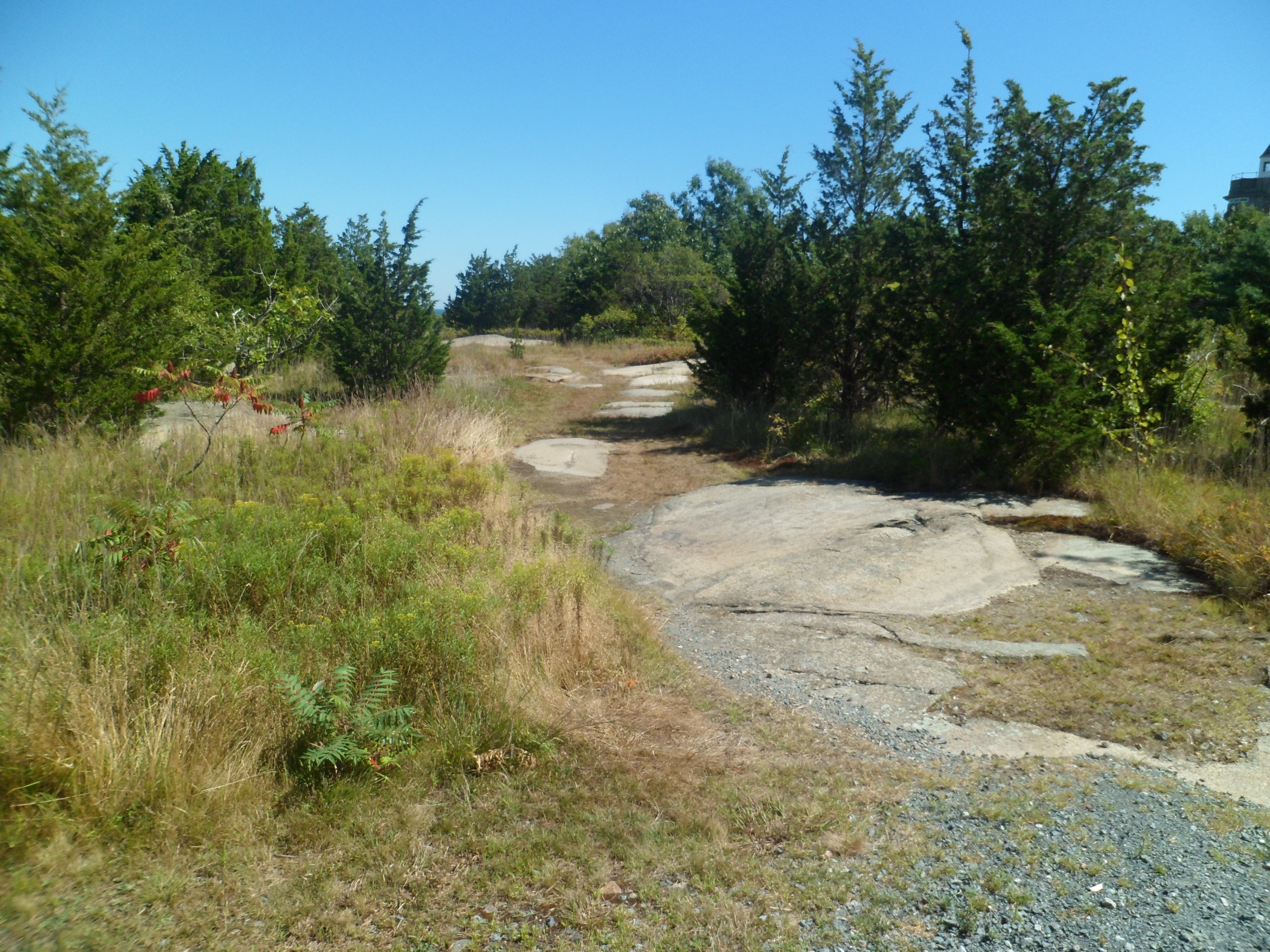
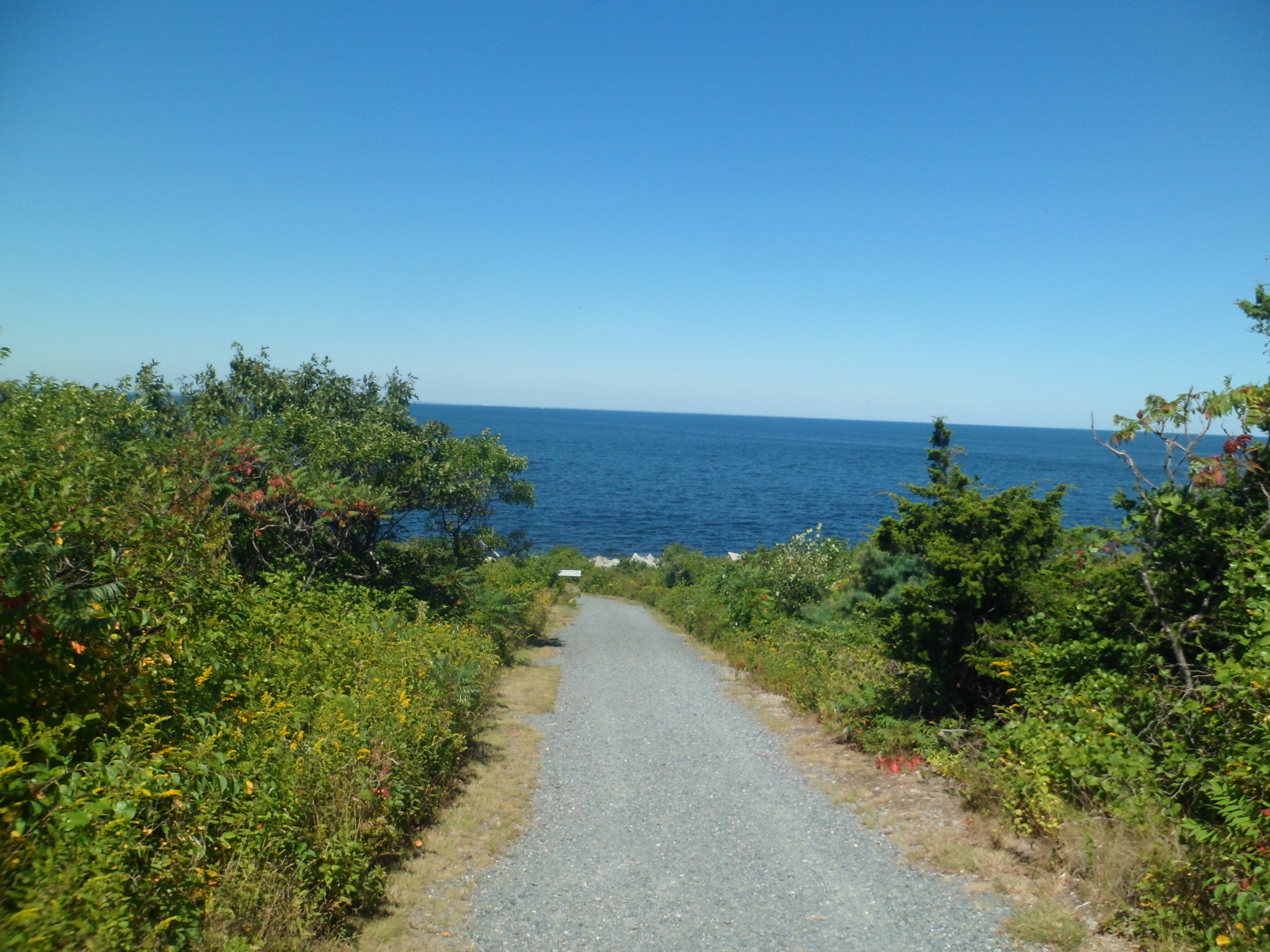
The west side of Rockport has the village of Pigeon Cove, and Halibut Point State Park.  The latter gave me the first of two good hiking opportunities, on Sept. 3.  It offers clifftop to beach and quarryside walks.

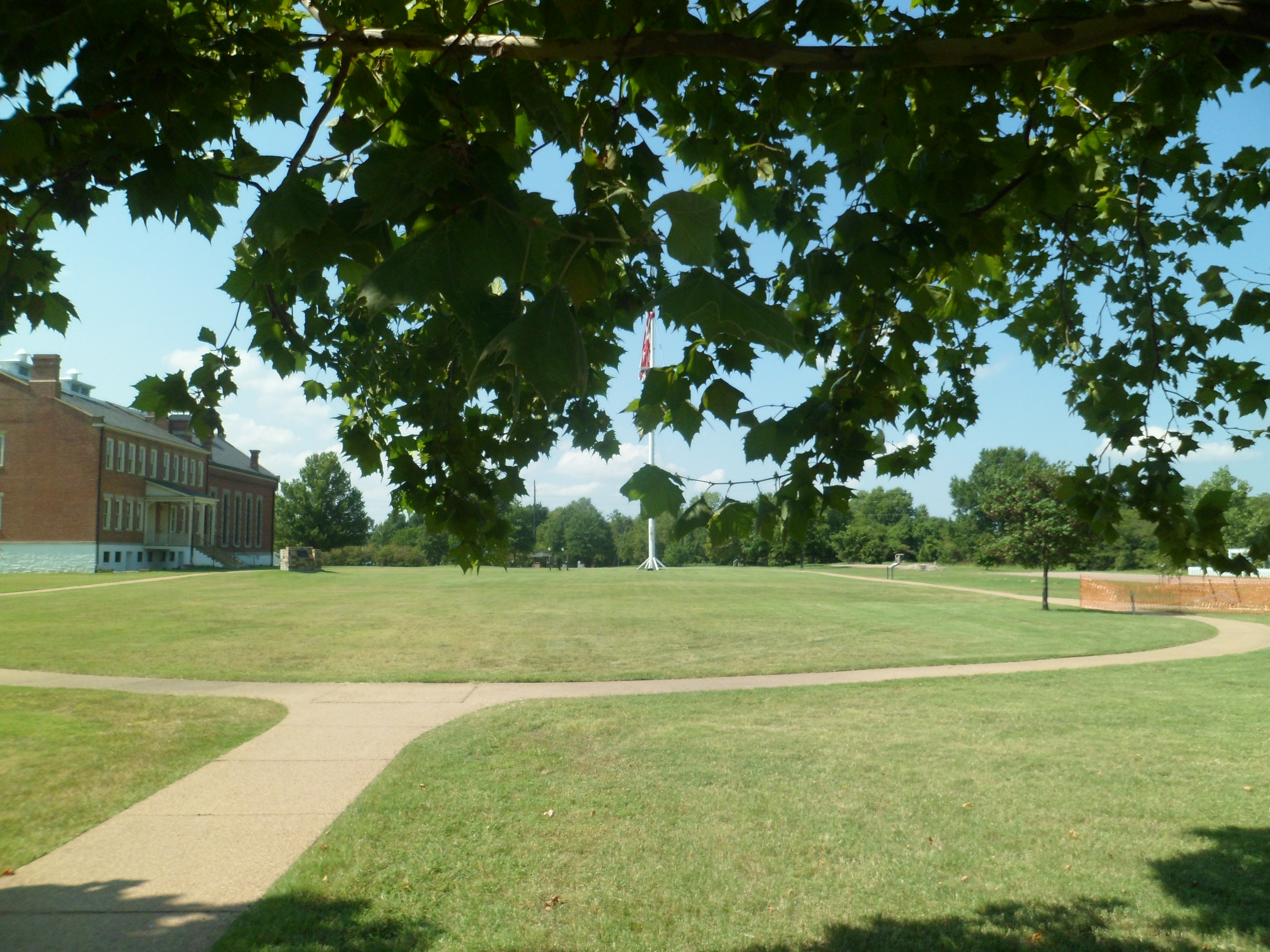
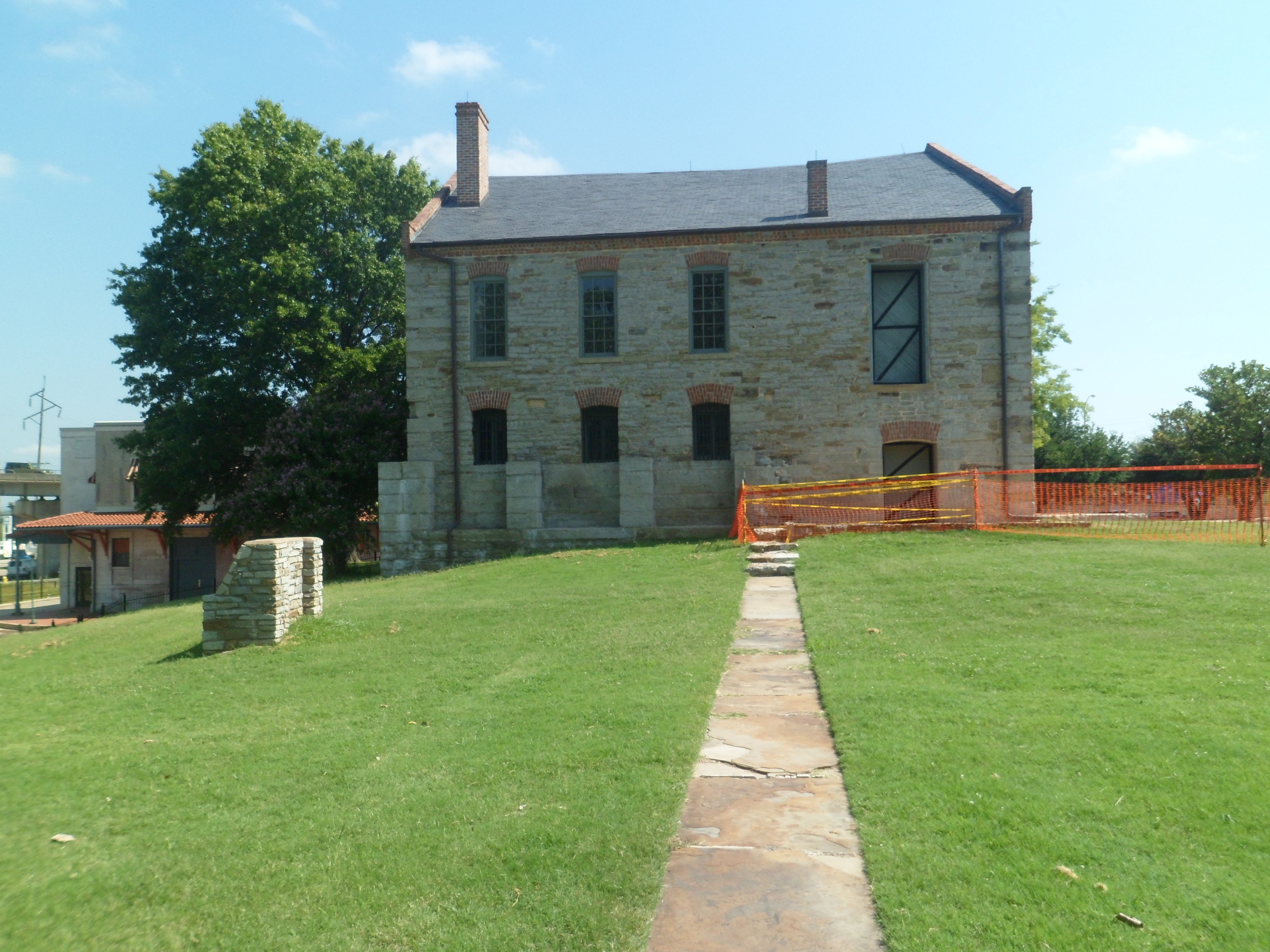
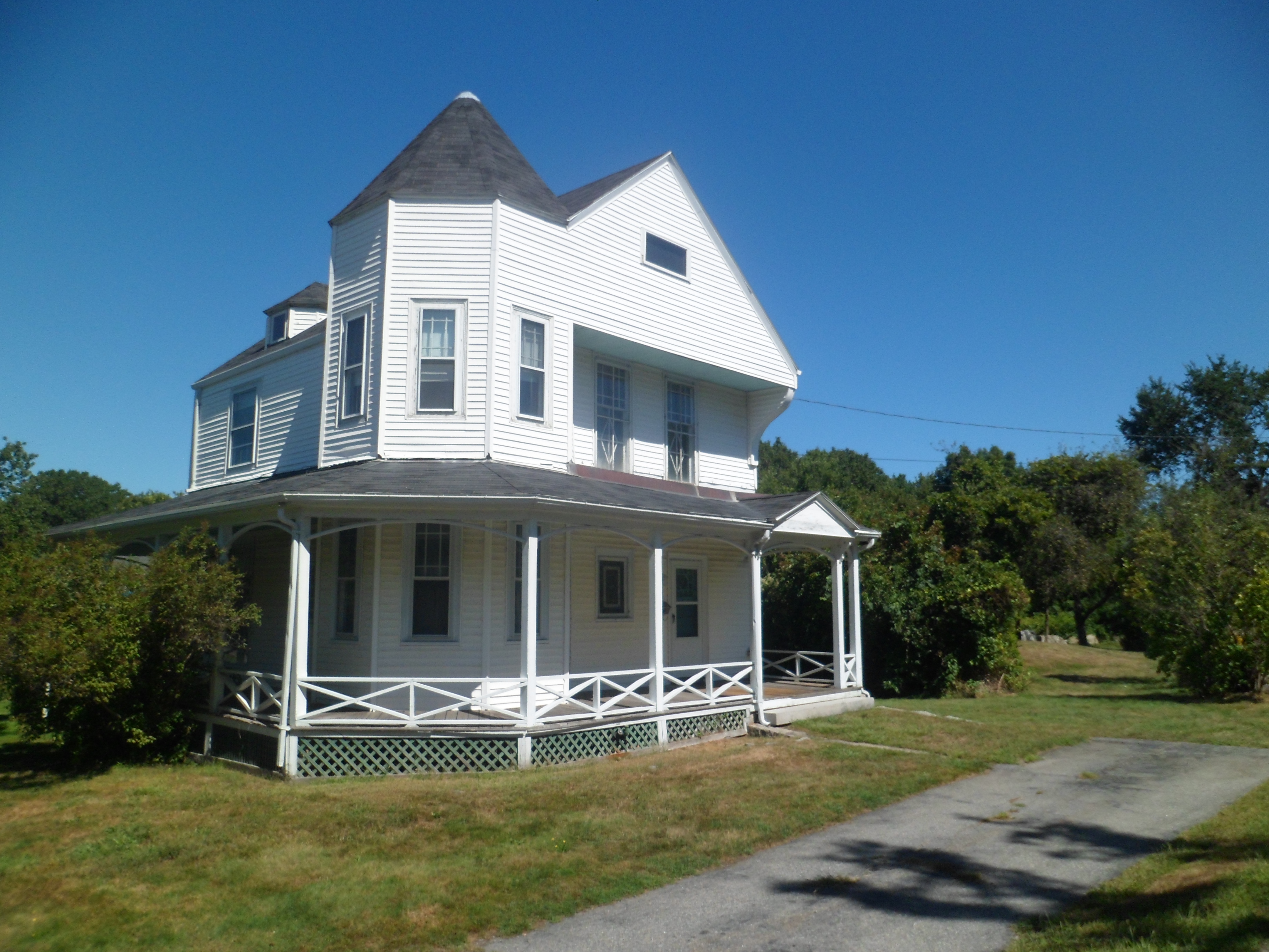
Here are several views of the trail, the ocean, the quarry pond and the Visitor Center, at Halibut Point, followed by a shot or two of Pigeon Cove.  The first photo is of the old quarry master’s house, at Halibut Point.

SAM_6698

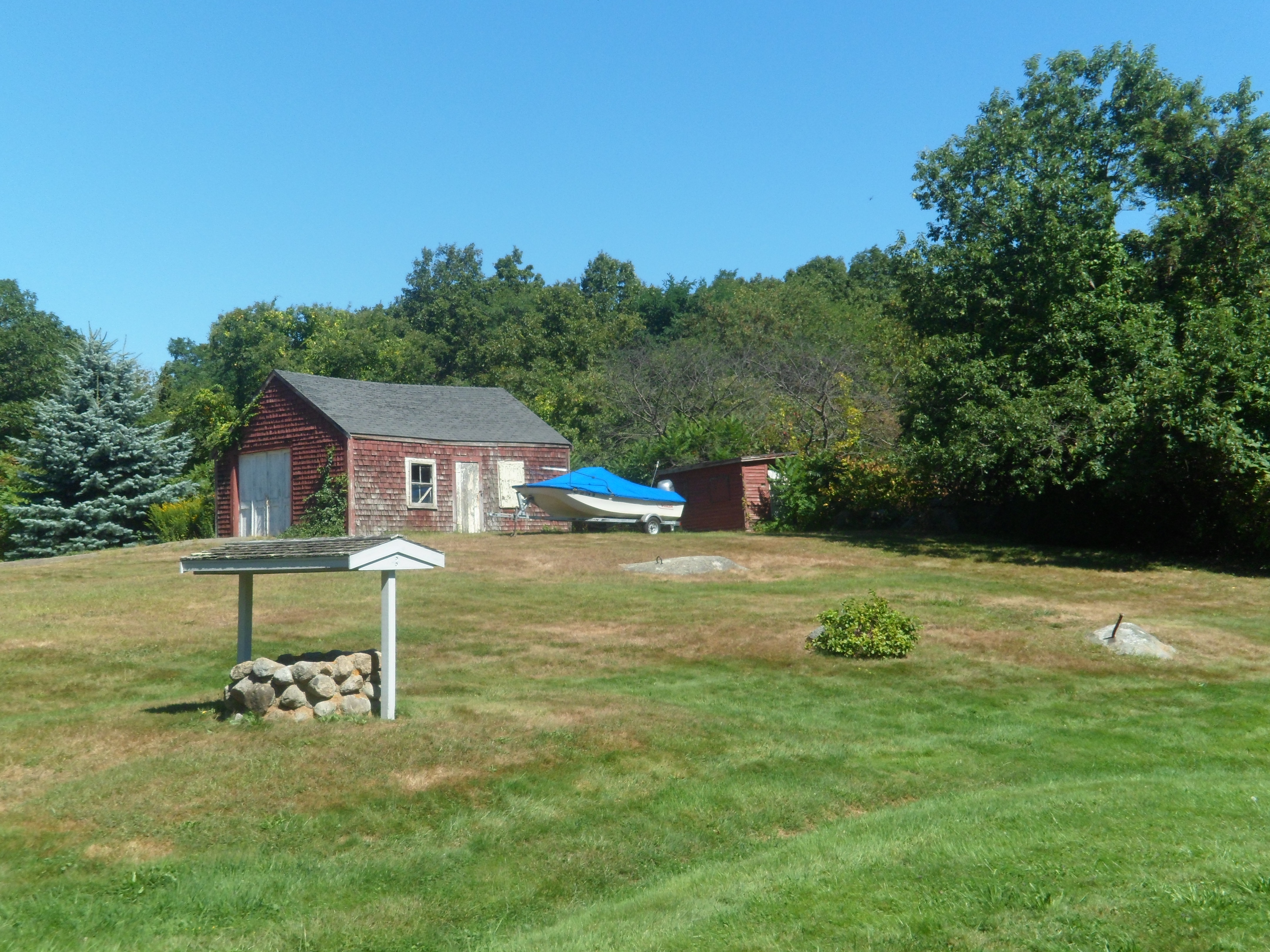
Next, is a farm shed and well.

\SAM_6699

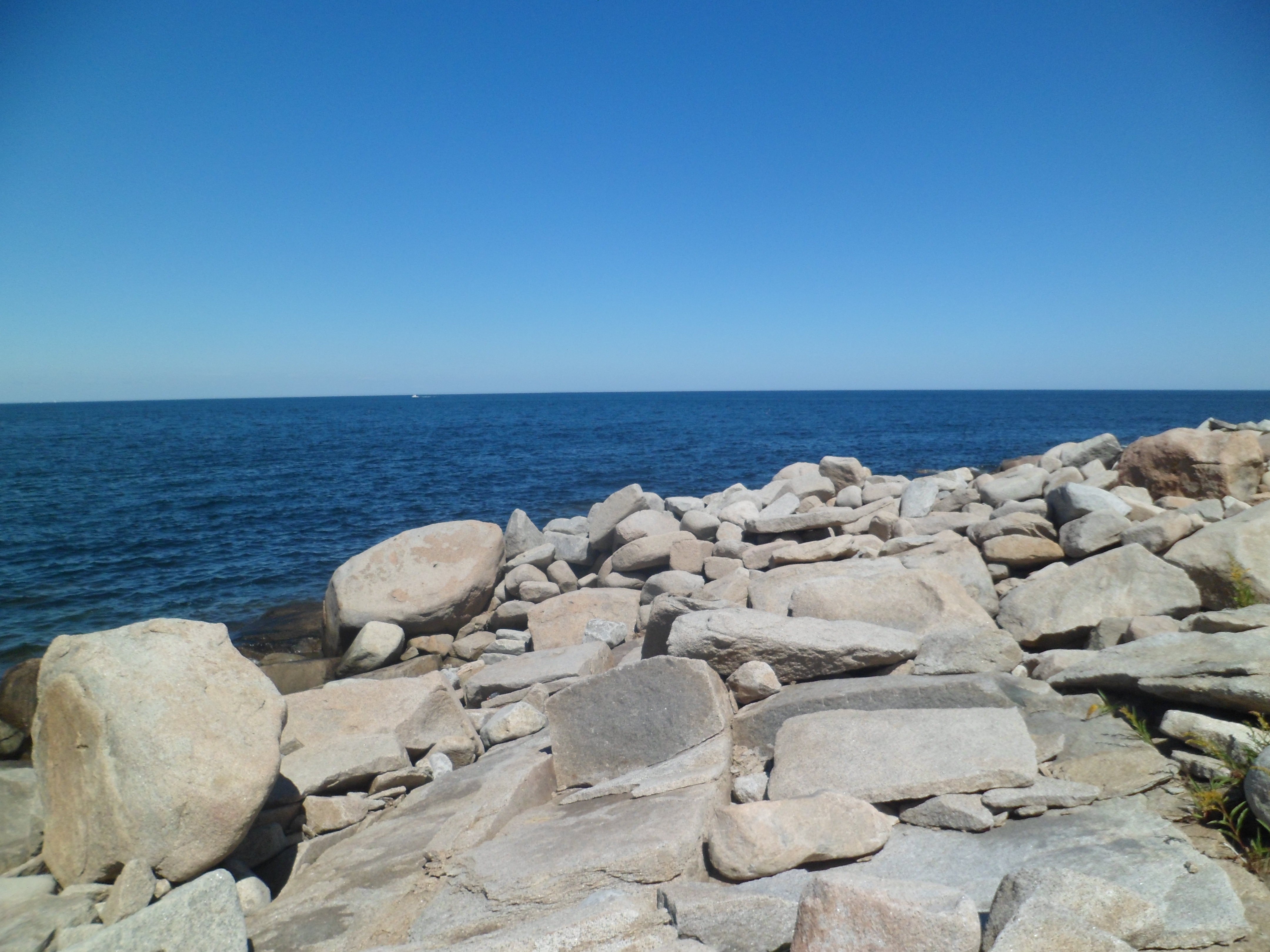
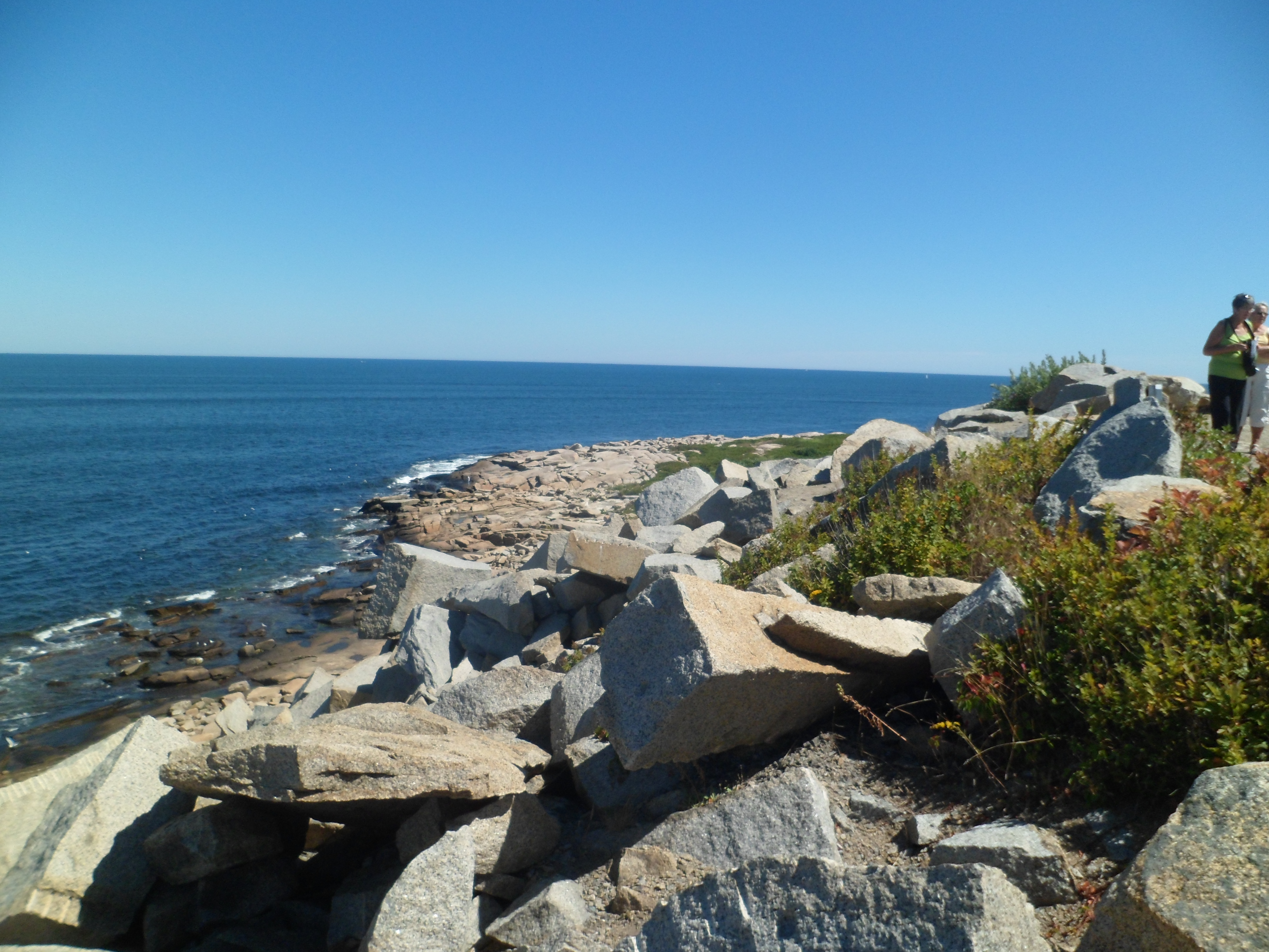
Now, on down the trail to the seaside.

SAM_6701

SAM_6702

SAM_6703

SAM_6706

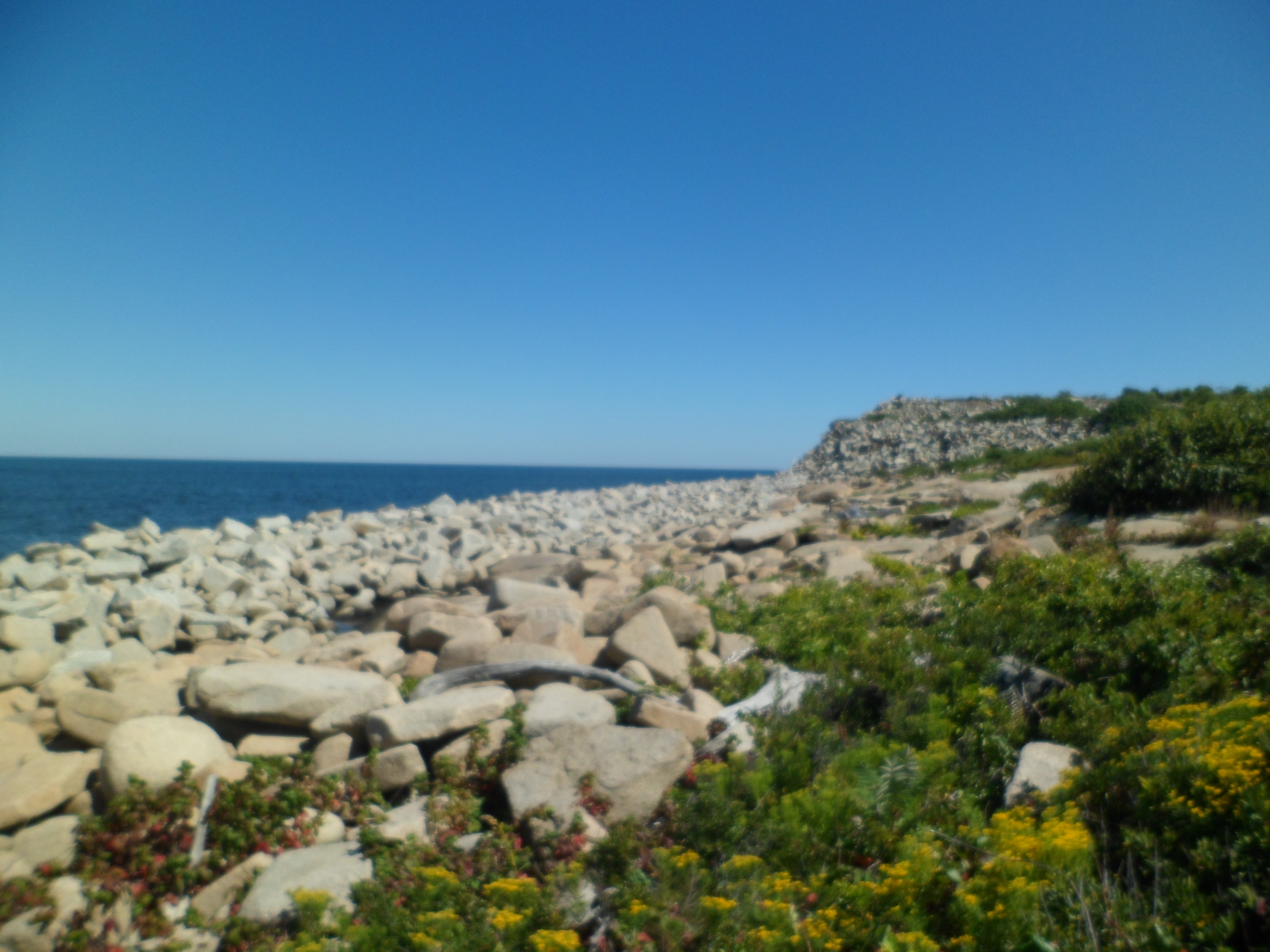
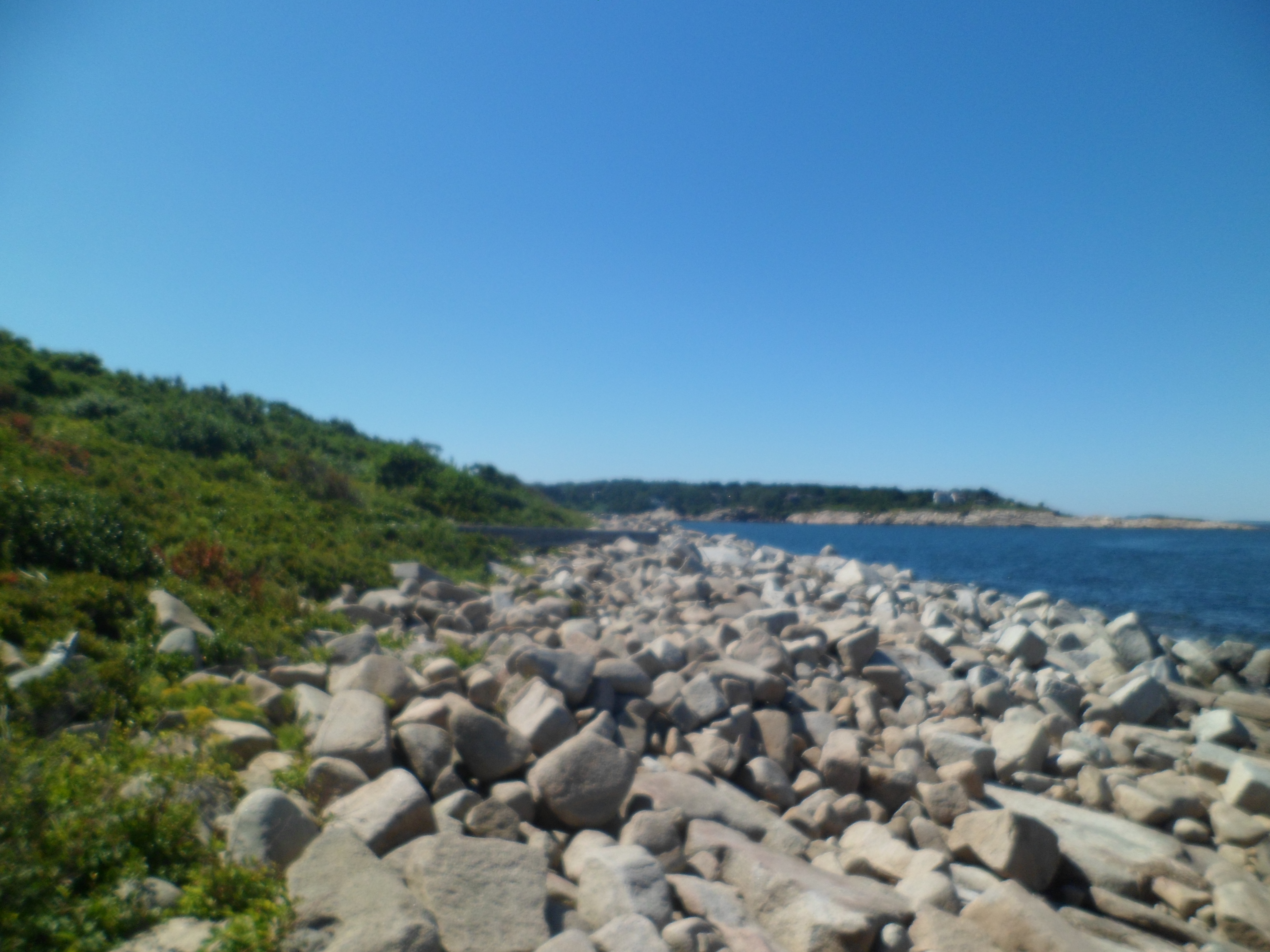
The above scenes evoke Bandon, OR and Kalalaoch, WA.

SAM_6709

SAM_6714

Cairn art, similar to this, is found on several New England beaches.SAM_6717

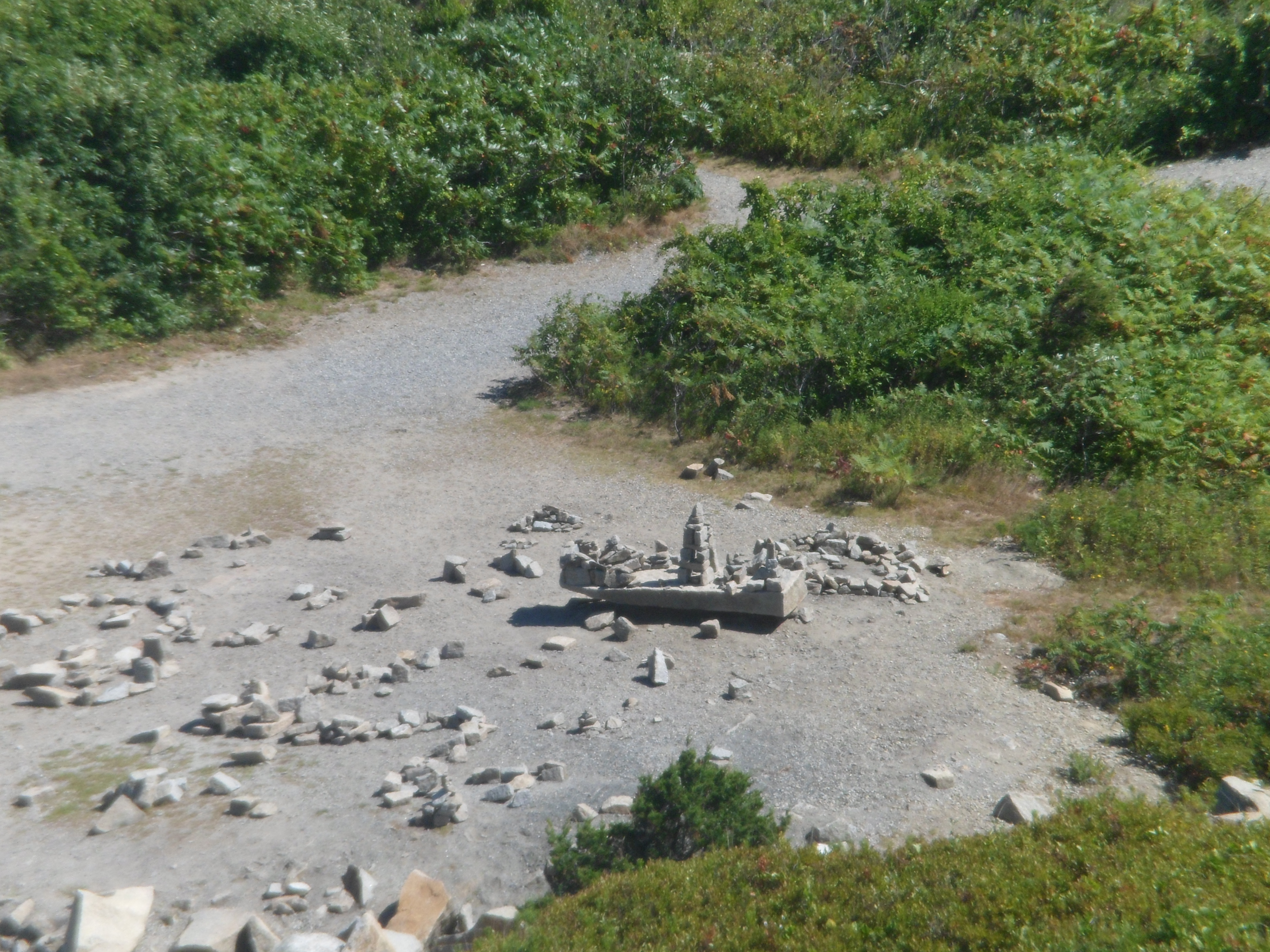
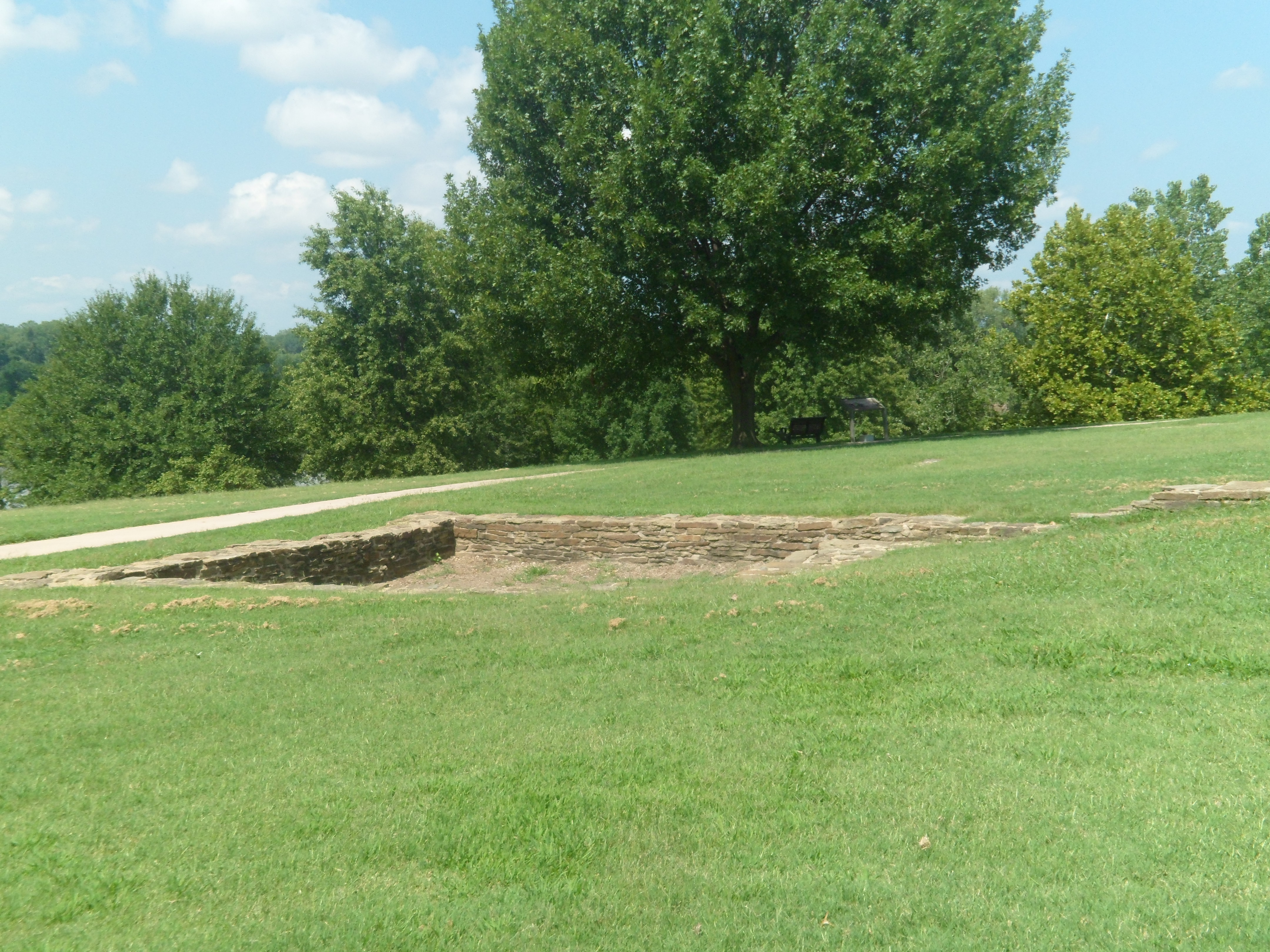
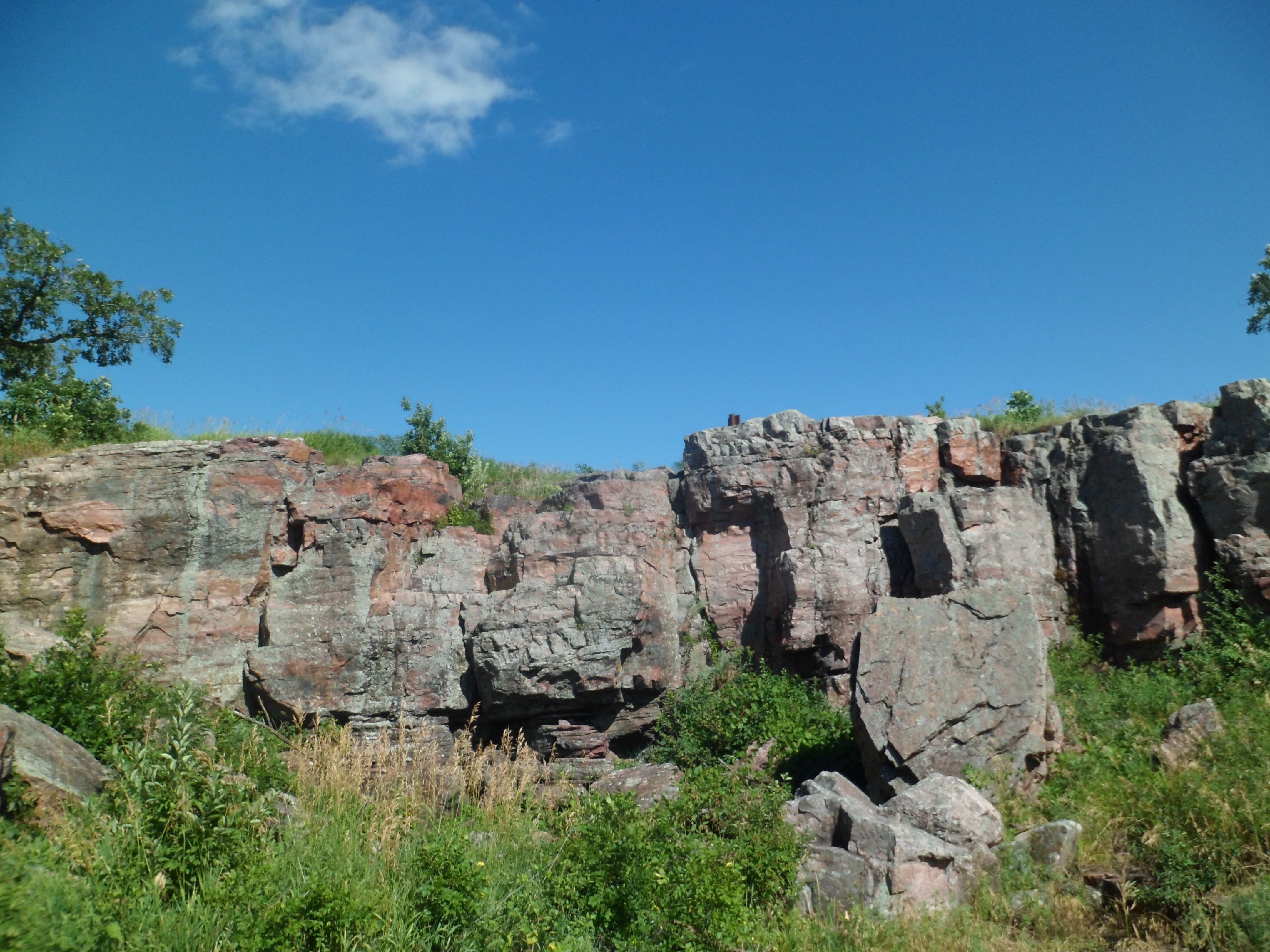
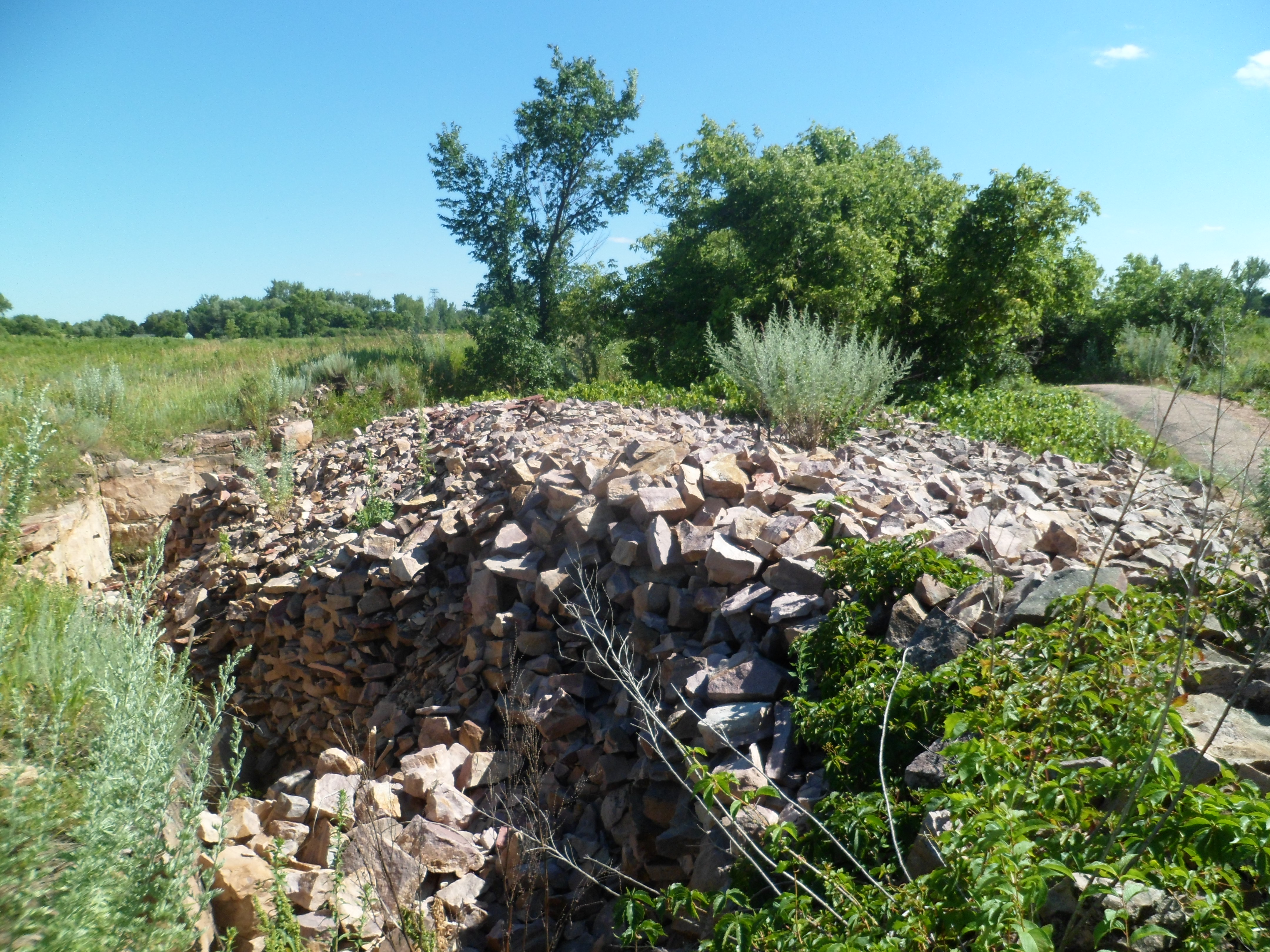
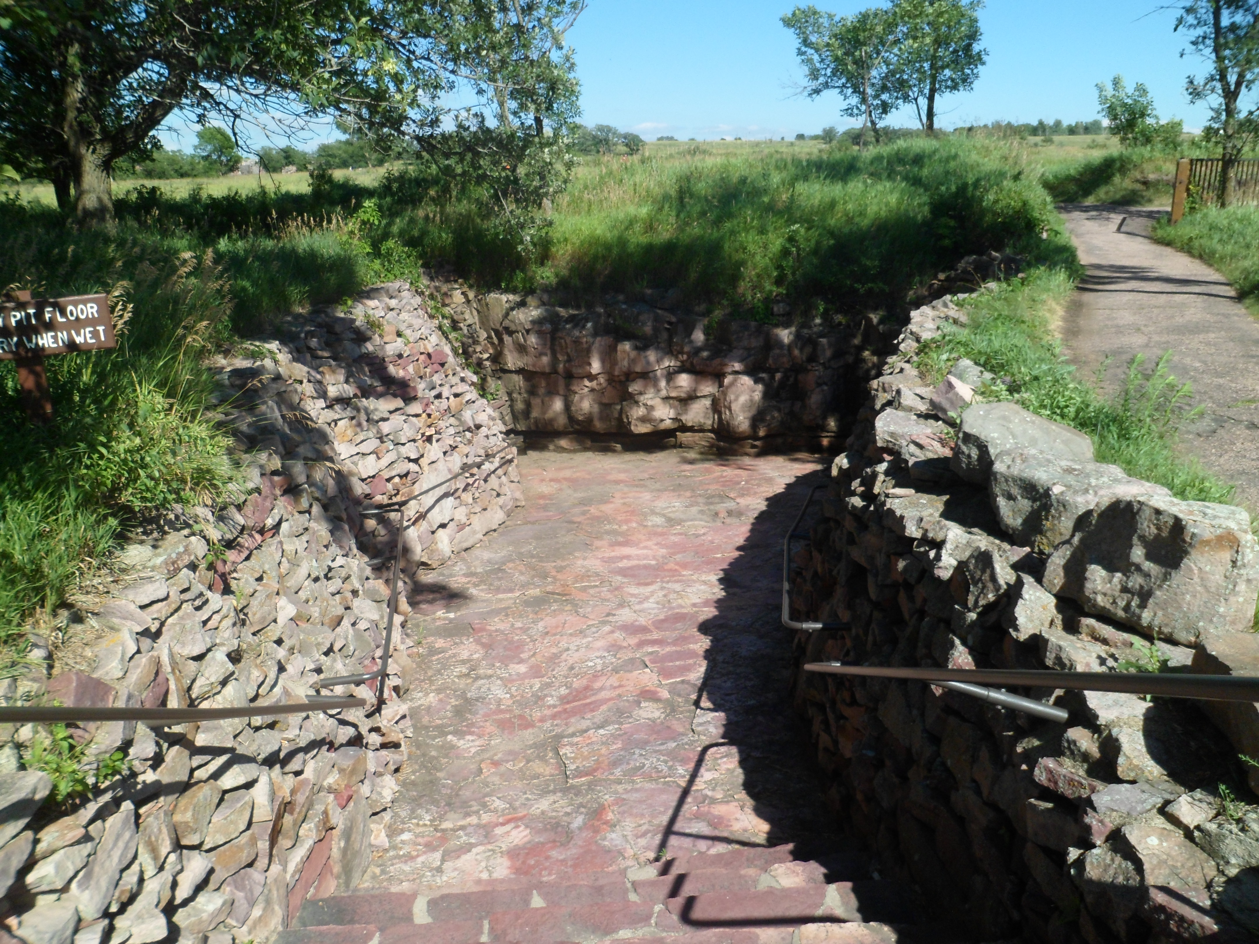
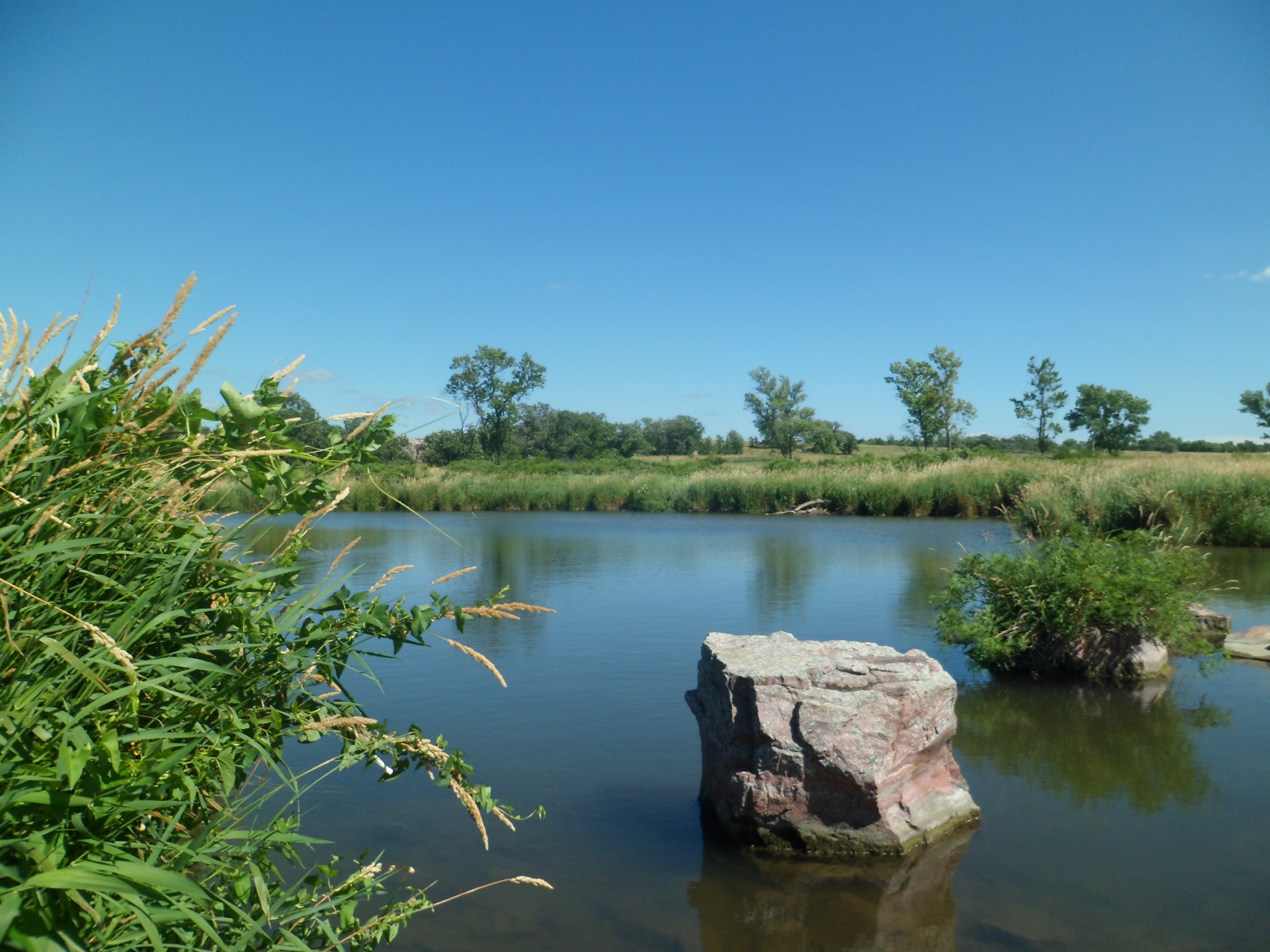
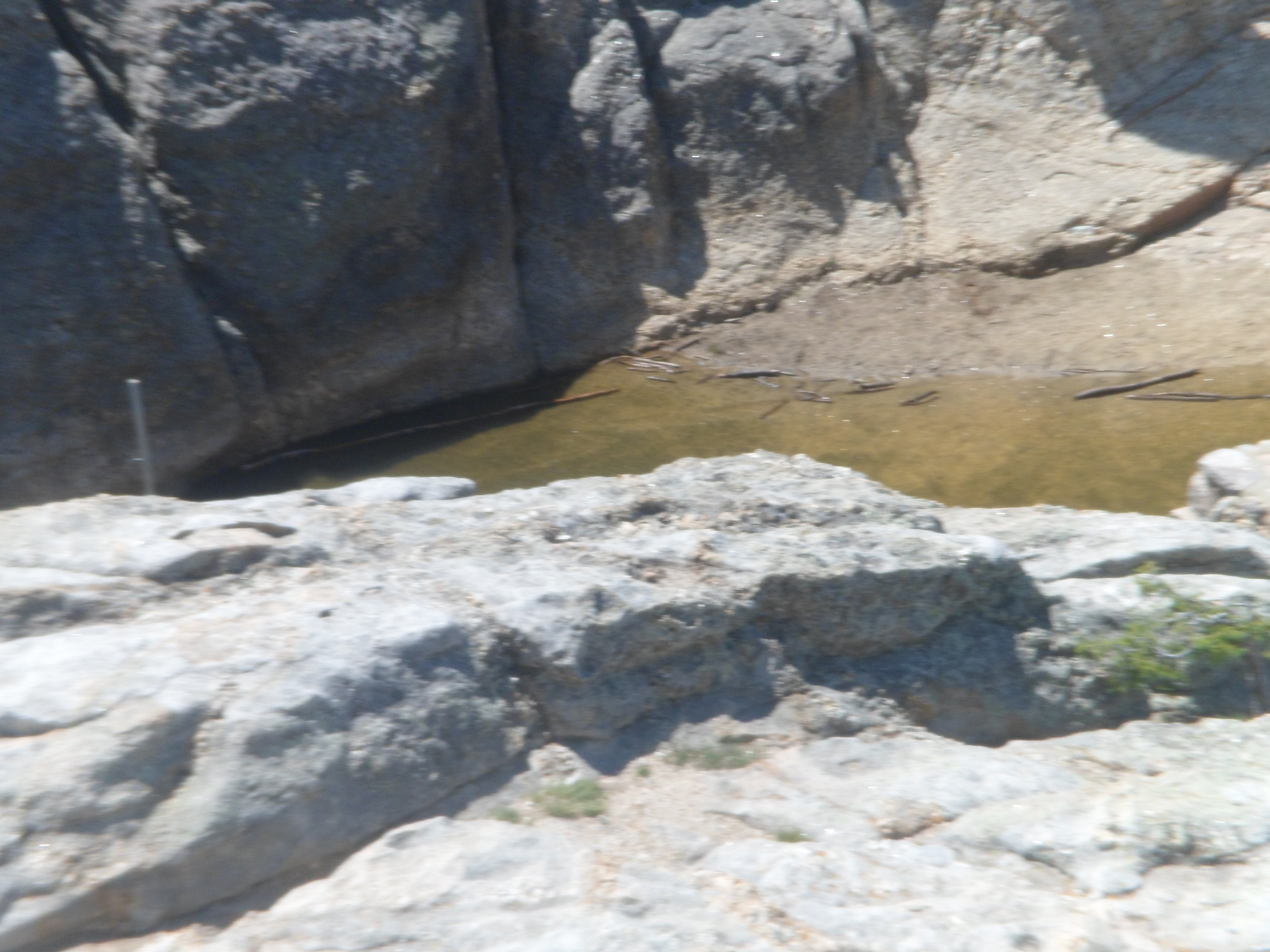
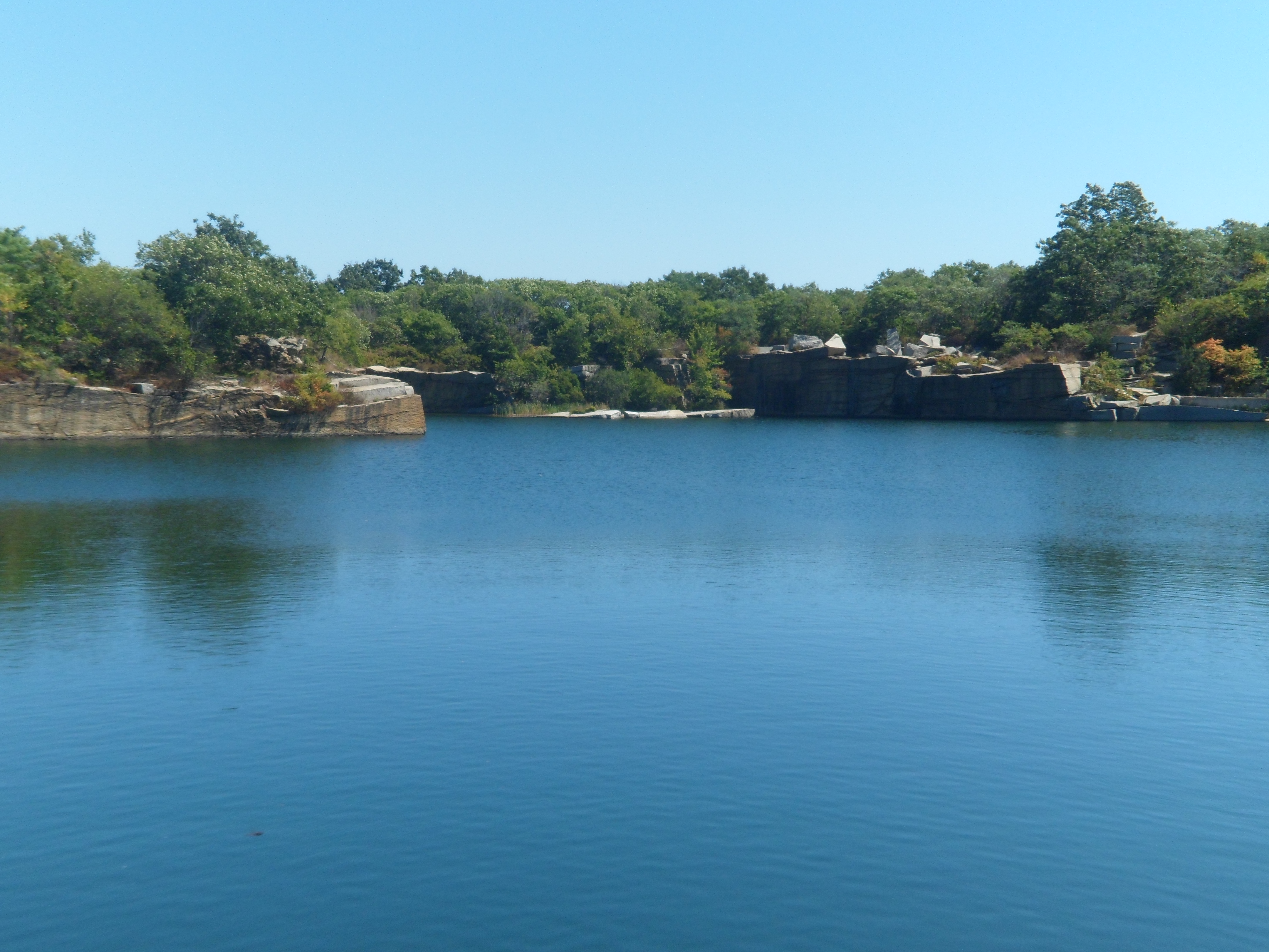
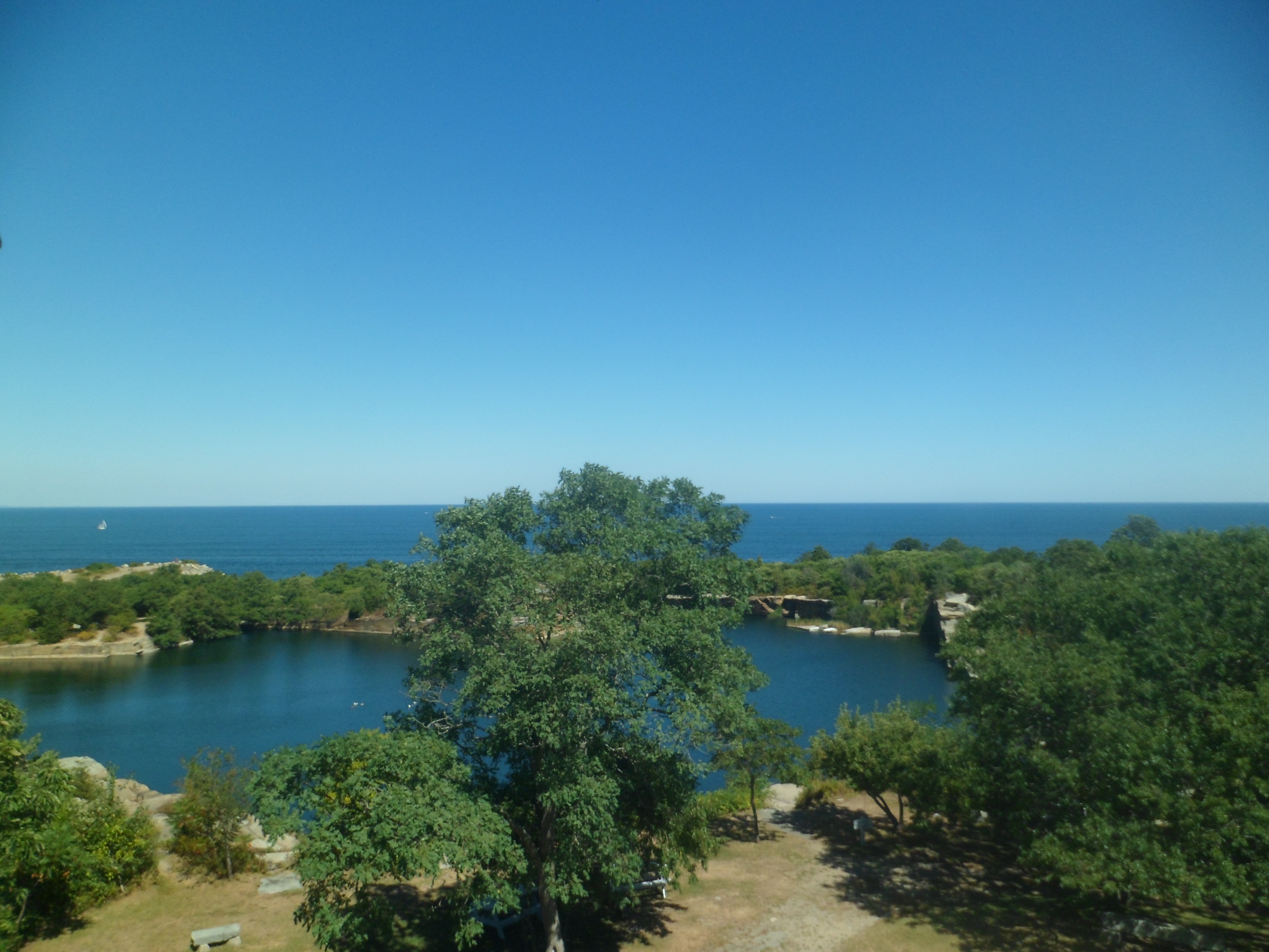
Now, for several views of the abandoned quarry, now a gorgeous little pond.

SAM_6710

SAM_6711

SAM_6719

SAM_6724

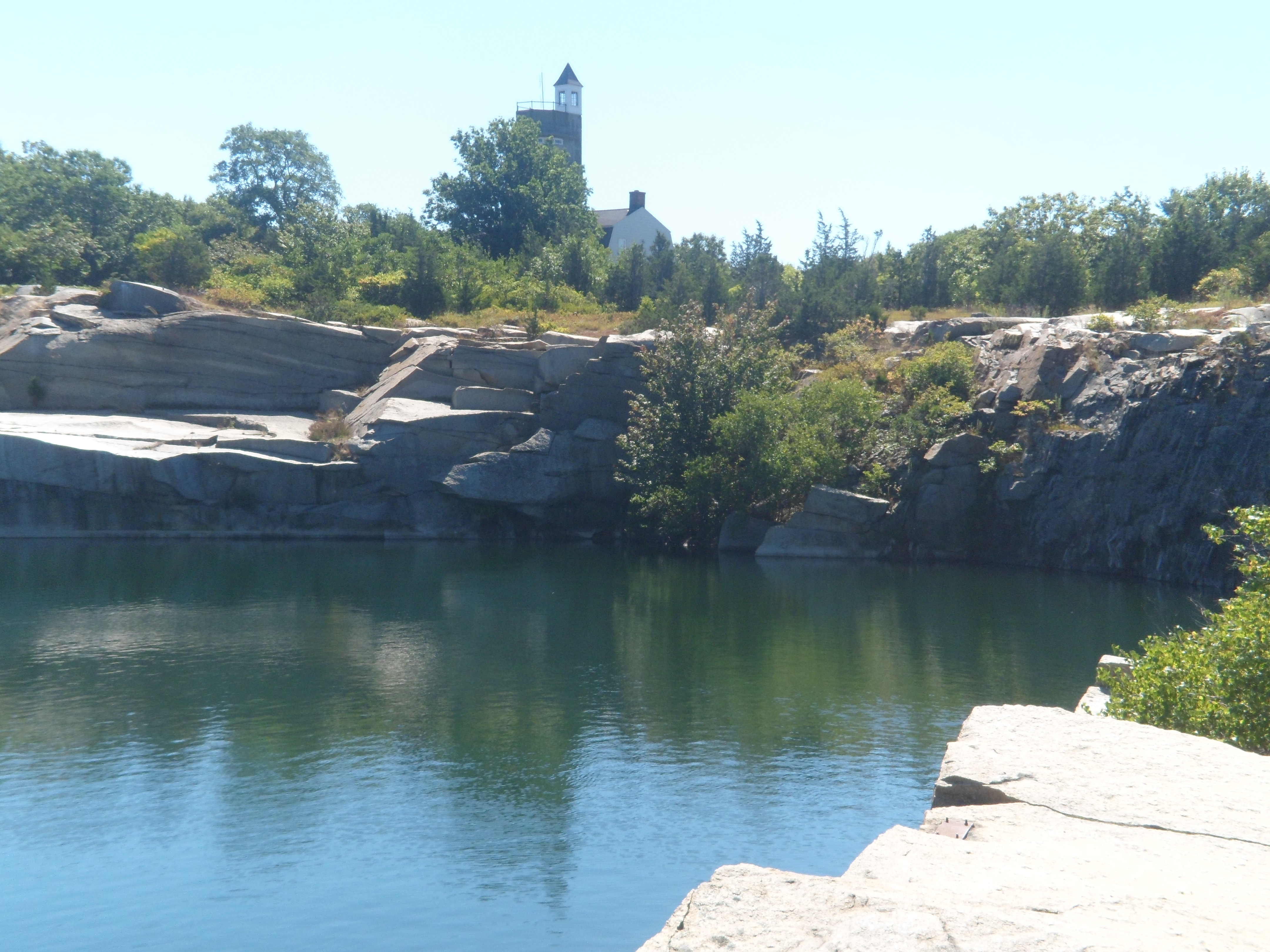
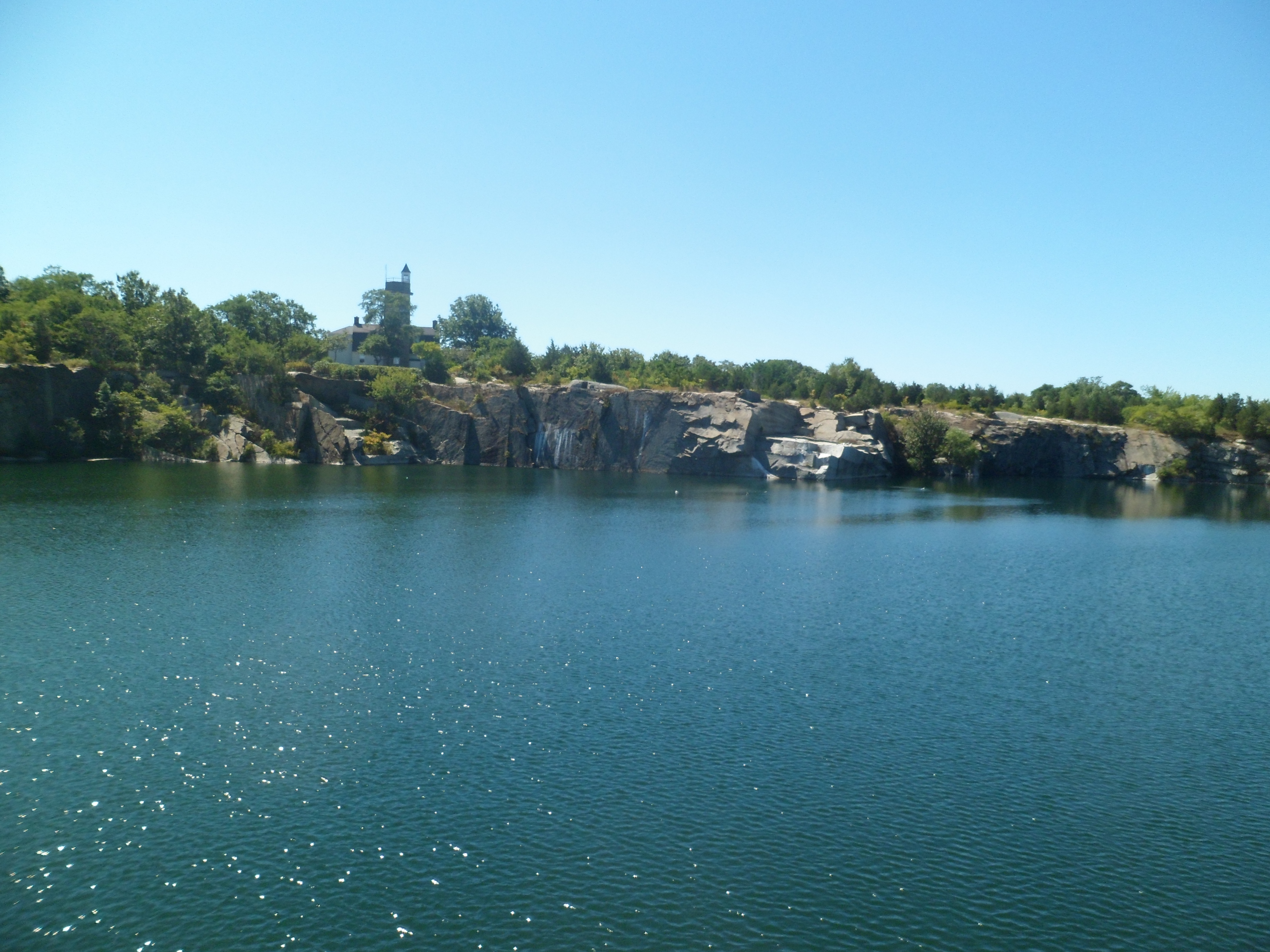
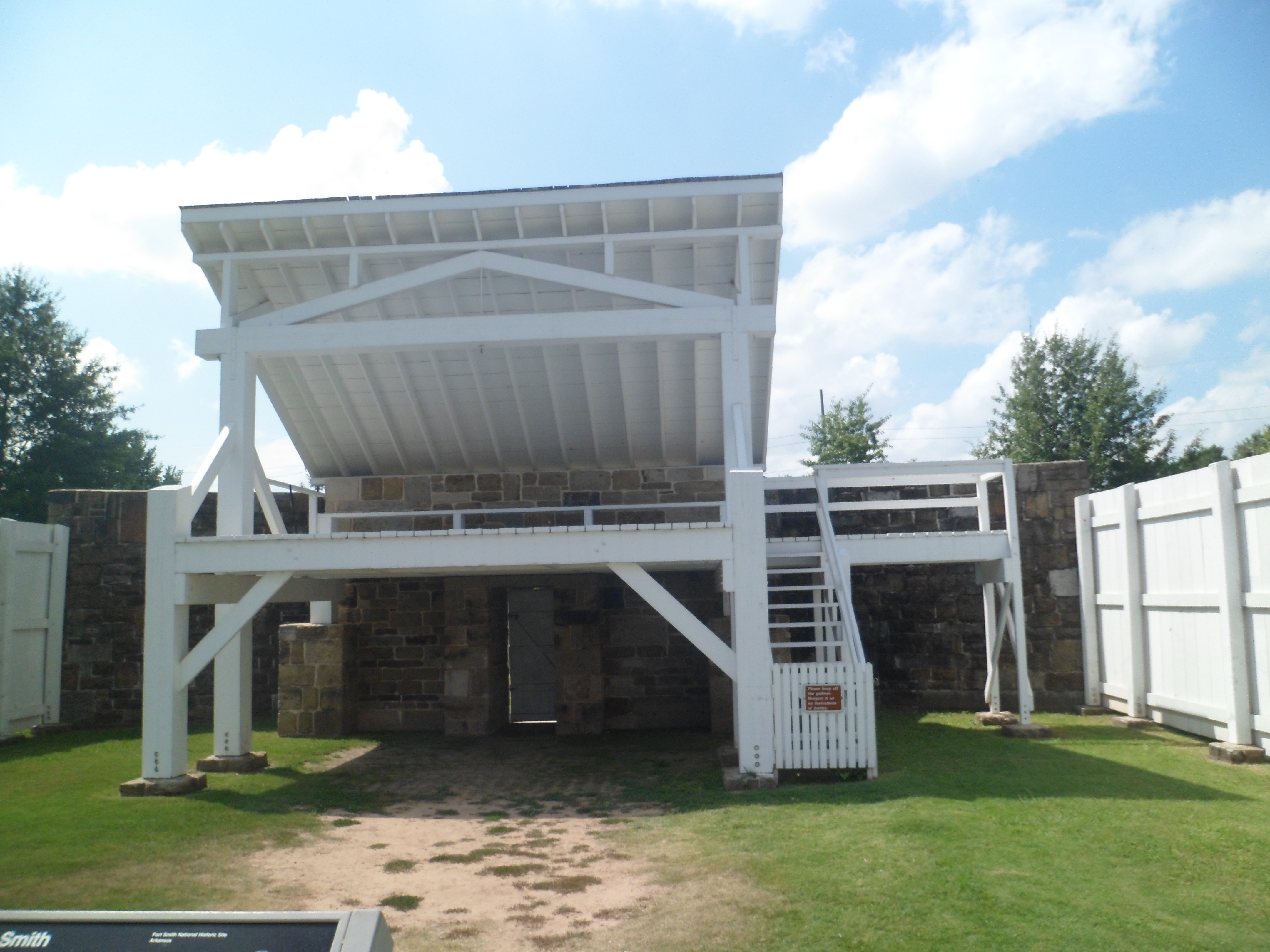
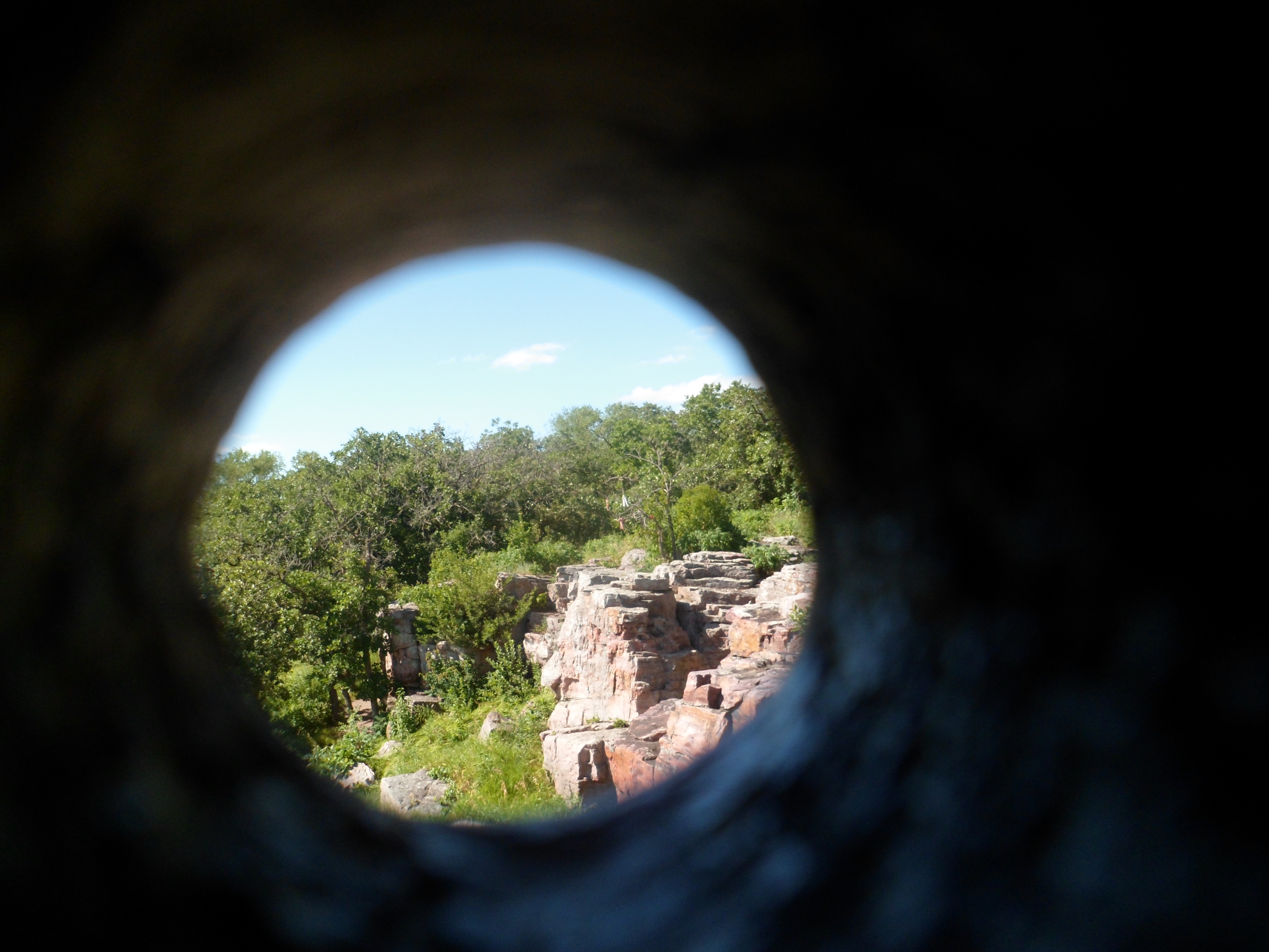
The last views at Halibut Point are of the watch tower.  An osprey graced the roof peak, as I walked around below.

SAM_6722

SAM_6723

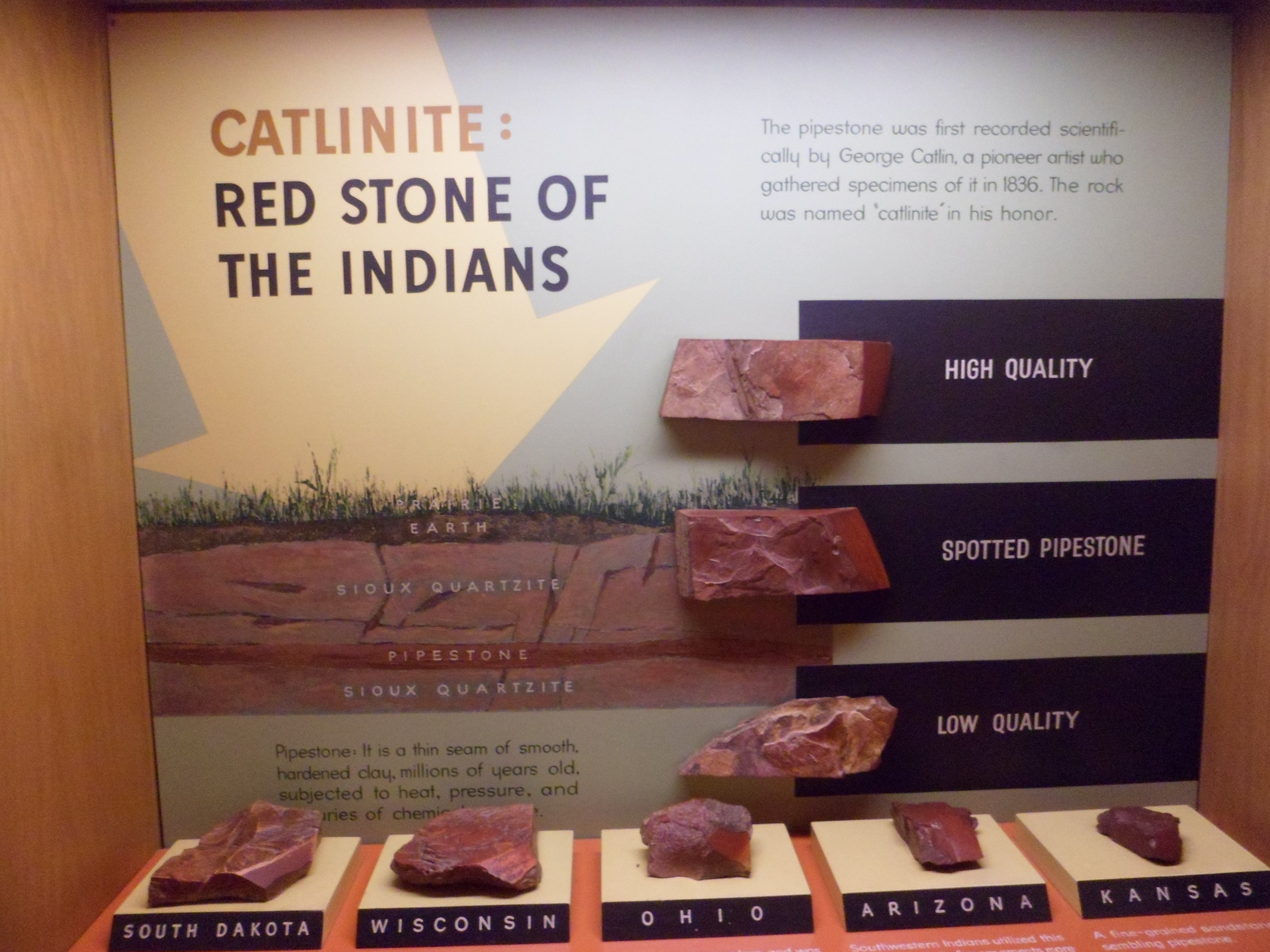
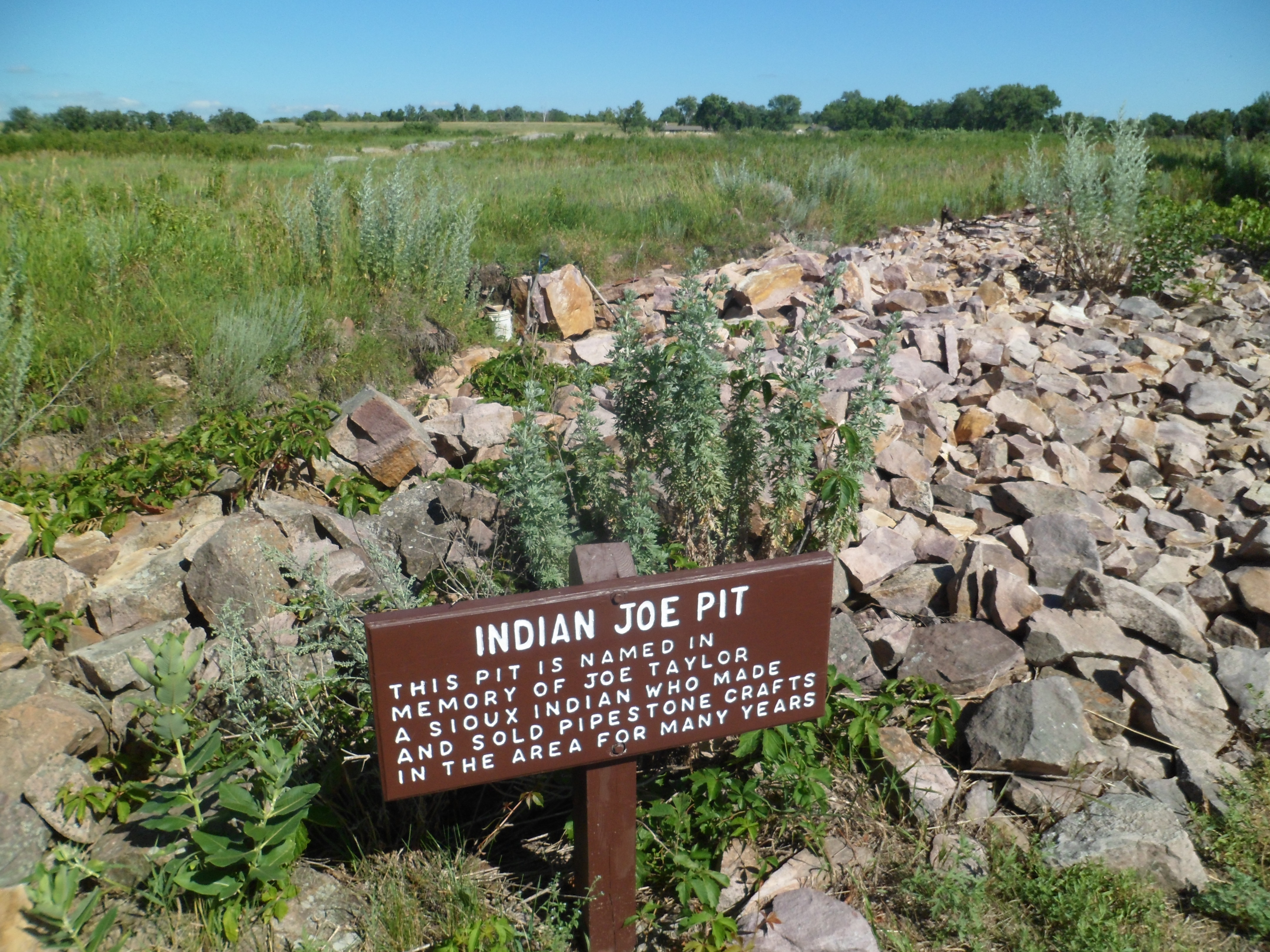
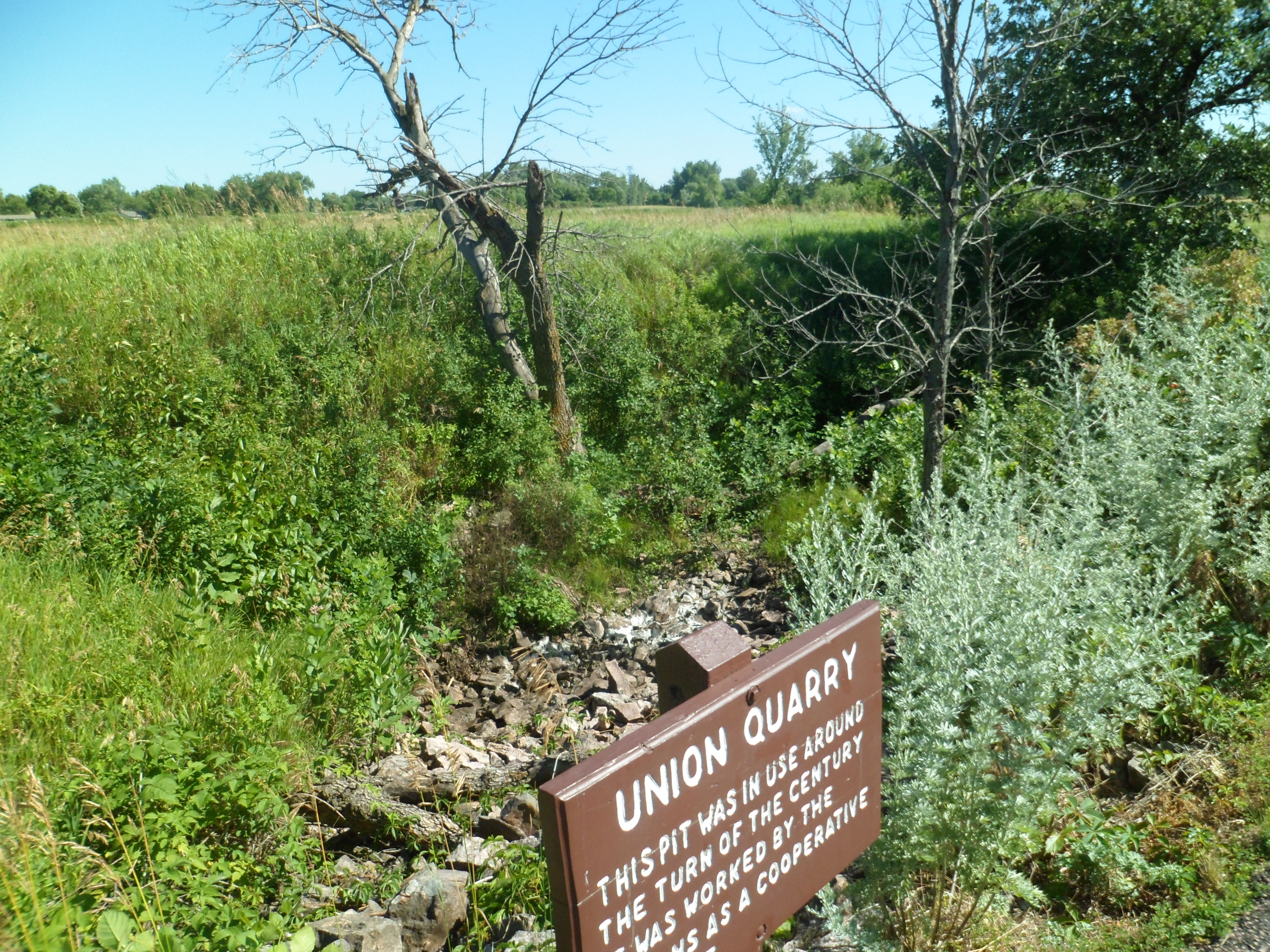
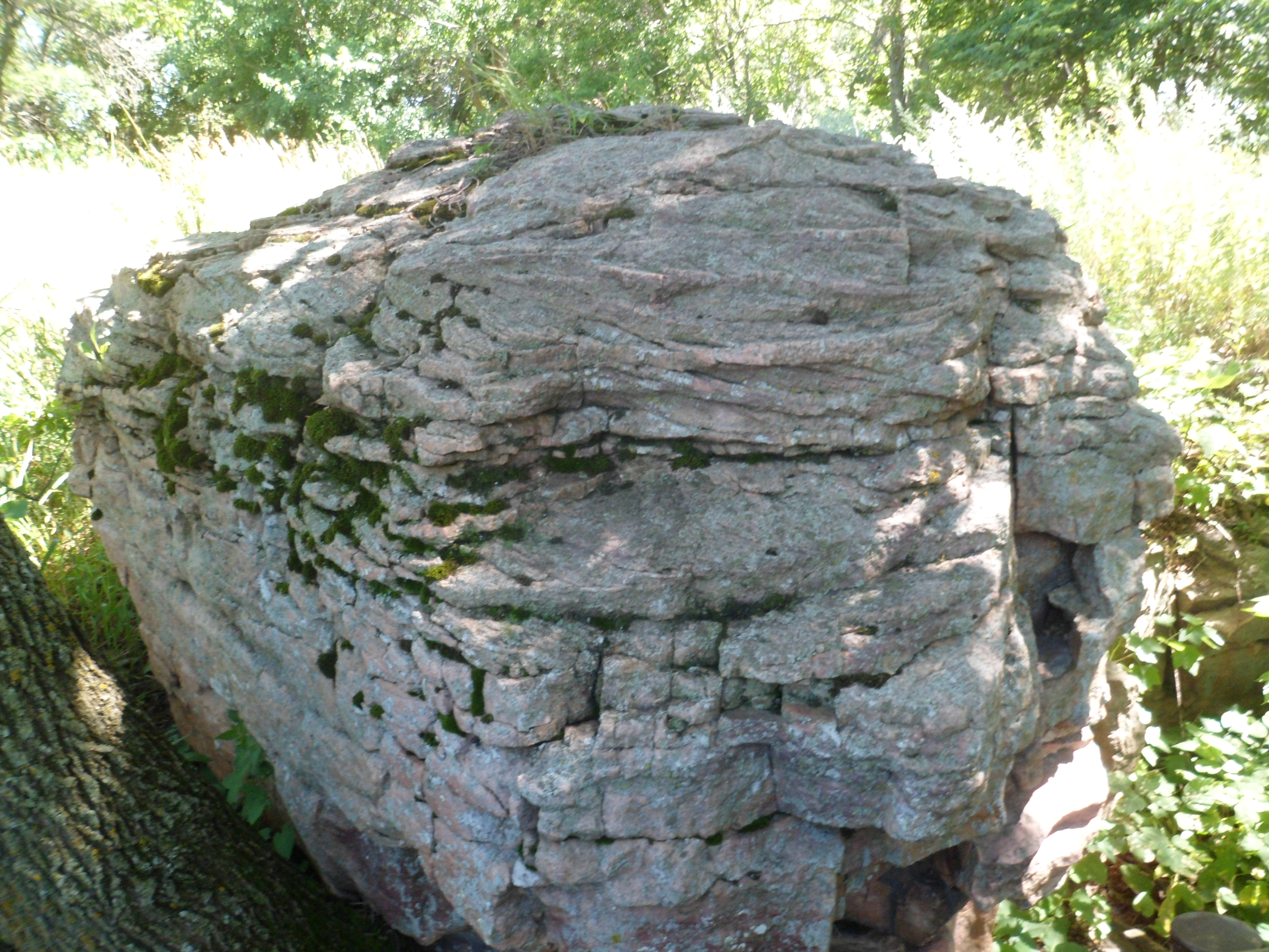
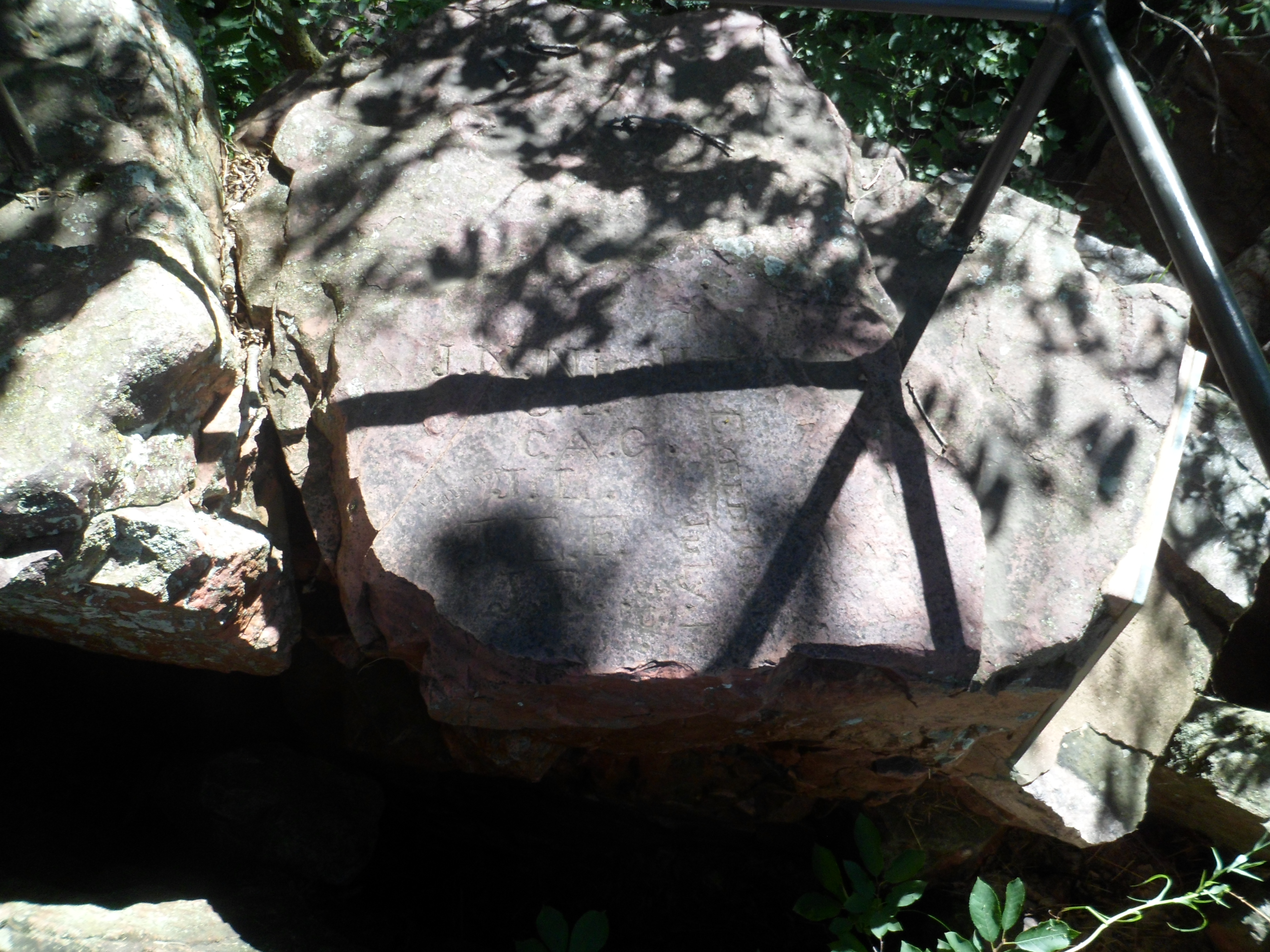
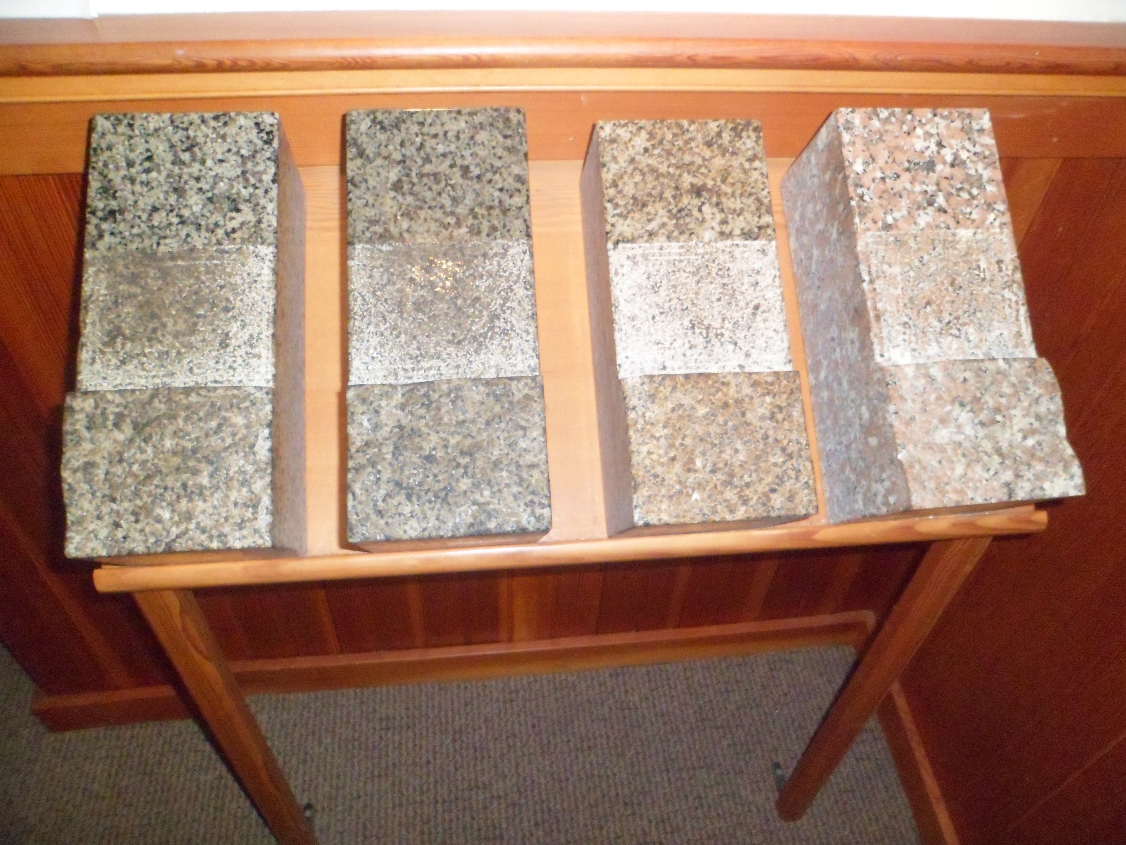
Here is a range of  rock samples obtained from the quarry.

SAM_6728

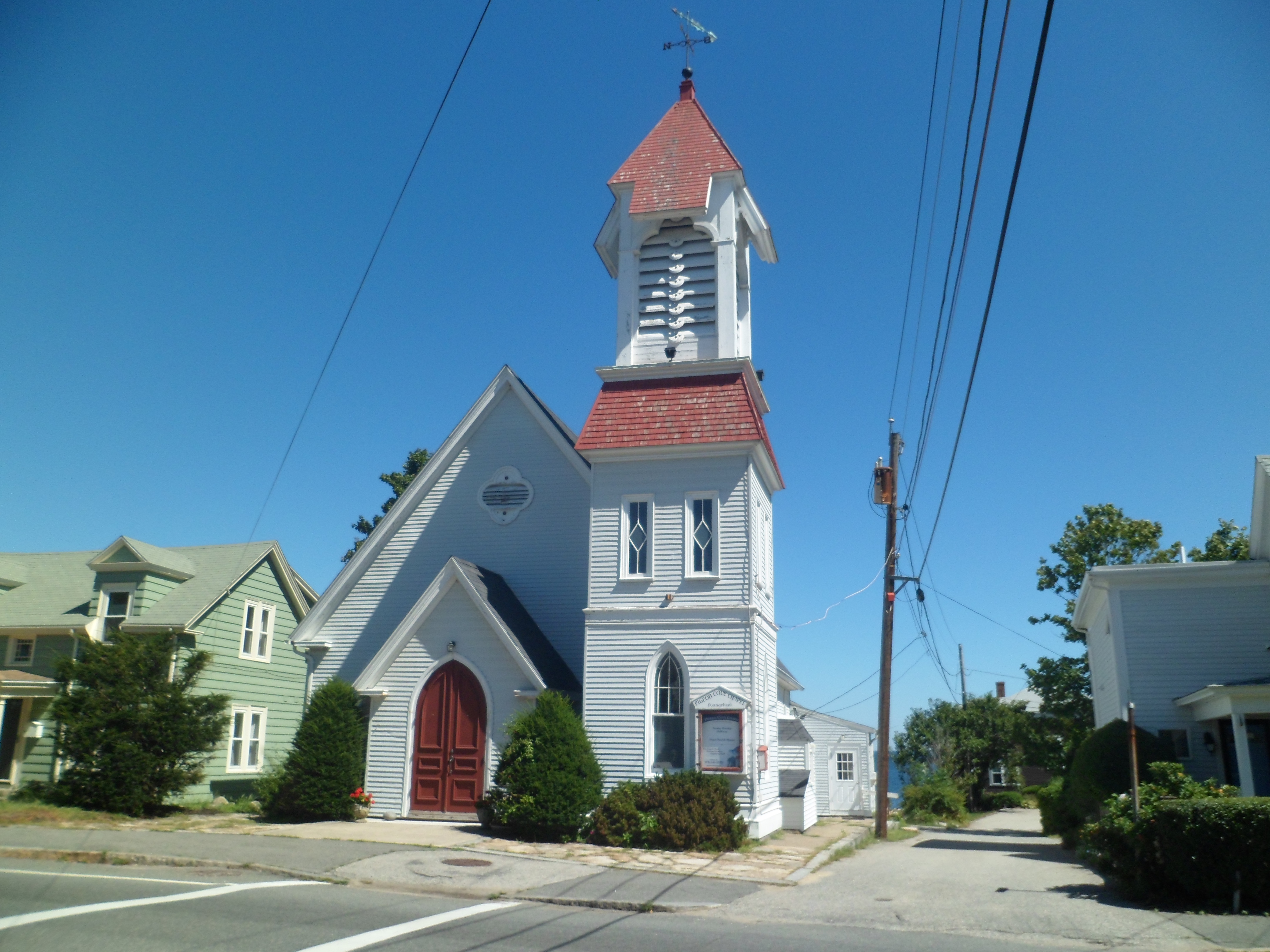
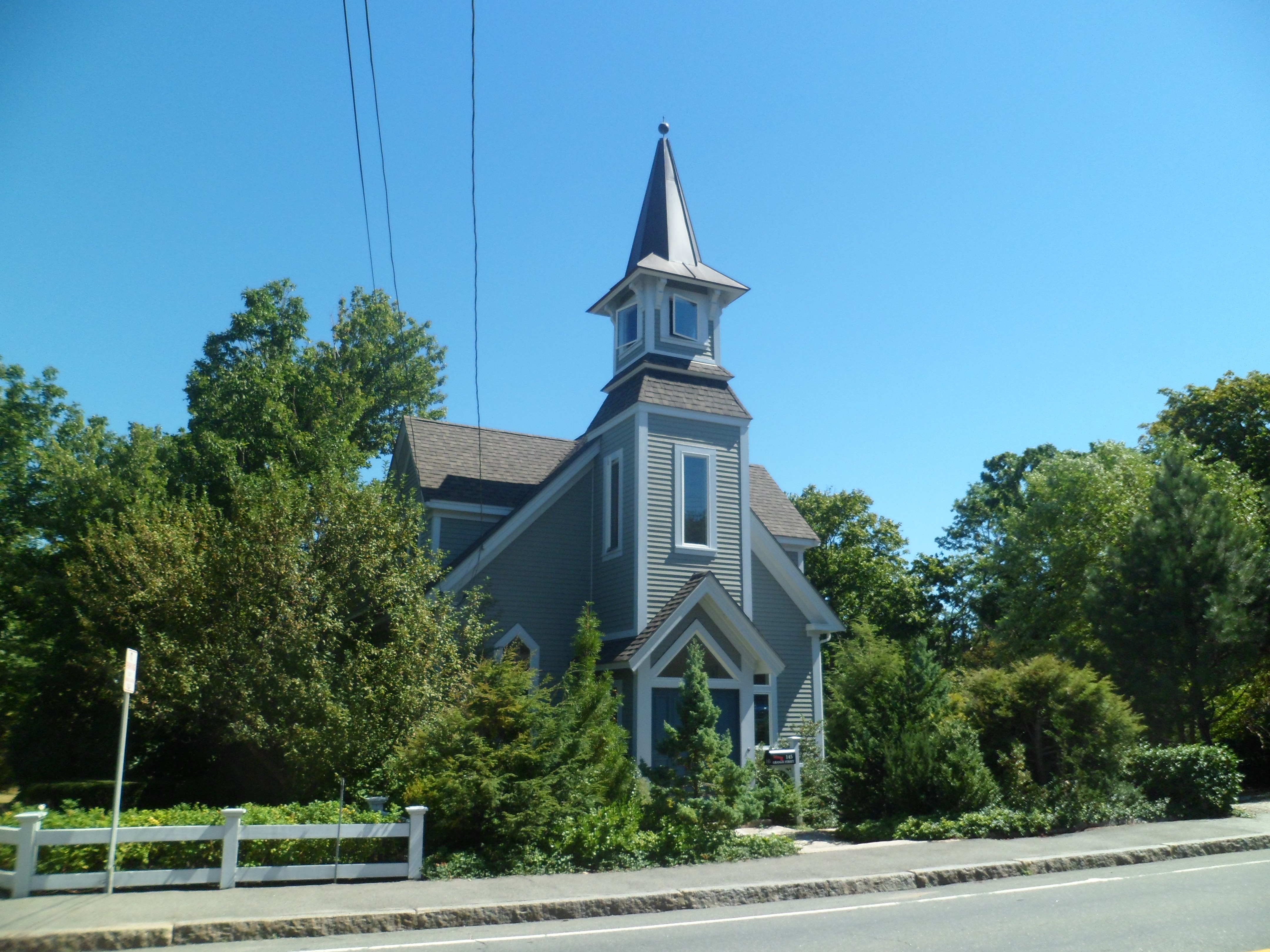
Lastly, here are the two most prominent structures in the village of Pigeon Cove. First is the community church, followed by a private home.

SAM_6729

SAM_6730

Next:  The first of three posts on Gloucester, MA

A Paradise Called El Dorado

4

In May, 2012, a  very dear friend showed me the way to El Dorado Springs State Park.  We weren’t able to do much more than view the falls area, that day, but I kept the scene in my heart.  On July 29,of this year, I was able to ignore the intermittent rain and take the canyon hike, up to the junction with a longer loop trail, then back again.  It is among the most gorgeous trails I’ve yet seen.

So, meet El Dorado Canyon! 🙂  There are a  lot of photos here, so take your time.

SAM_6080

SAM_6081

SAM_6083

SAM_6085

SAM_6088

SAM_6089

SAM_6091

SAM_6094

SAM_6095

SAM_6096

SAM_6099

SAM_6101

SAM_6102

SAM_6106

SAM_6109

SAM_6112

SAM_6116

SAM_6120

SAM_6122

SAM_6123

SAM_6126

A narrow-gauge rail system goes through El DoradoCanyon, regularly.

SAM_6127

Prickly Pear cacti do nicely,at 10,000 feet.

SAM_6128

SAM_6130

SAM_6133

SAM_6139

Location, location, location!

SAM_6140

SAM_6141

So, there you have it.  This was not just any hike; it was the one that led me to overcome a few barriers- both physical and emotional.

Next:  Manitou Springs, Part 1:  The North Side

Spiritual Anchor on The Prairie

8

SAM_6007

I last visited Cahokia Mounds National Monument in September, 2011, when it was dusk.  This time, July 25, 2013, it was a bright afternoon.  The difference was palpable.  At dusk, there is a sense of the spiritual, the ephemeral.  In bright sunshine, tour groups and easily-spooked people, jumping when I walked by them, were all over the park.

No matter, this area is home to intense spiritual energy, which not everyone can handle.  It was built by an ancient nation of traders, and appears to be an array of tumuli, burial mounds.  Overlooking the scene is Monks Mound, across the highway from the main park area.

I spent about 40 minutes in the Visitor Center.

SAM_6008

A clockwise jaunt around the main park revealed several mounds.

SAM_6015

SAM_6022

SAM_6033

It was soon time to mount the stairs to Monks Mound. Here, priests conducted observations of the sky and presided over ceremonies, relative to the solstices, equinoxes and phases of the moon.

SAM_6030

There are some fine views of the surrounding countryside, including the city of St. Louis.

SAM_6038

SAM_6039

To the east, there is a  fence, built by the U.S. Army, during the Trail of Tears, in the 1830’s.

SAM_6047

Finally, I visited Woodhenge, a mile west of Cahokia Mounds, and largely viewed as another place where the indigenous people could observe and measure celestial events.

SAM_6050

SAM_6049

With this important site being offered tribute in both light and darkness, I crossed the Father of Waters, to St. Louis, and the Gateway Arch.

From Home to Home, and Back, Day 3, Part 3: Little Rock’s River Walk.

13

Arkansas’ state capital has been in the forefront of a statewide effort, that started with Bill Clinton as Governor, and has continued through the Huckabee and Beebe administrations, to get the populace up and at ’em.  A good part of this effort, in the capital city, revolves around the Arkansas River, and the recreational opportunities it, and its banks, provide.

The focus is fitness, for one and all, starting with the children.  I saw people of all ages and ethnicities getting into the act.  Count Kasimir Pulaski, who aided in the first U.S. Army, is honoured here, well west of the first frontier of the United States.  Here are Pulaski Way and a bust of the Count.

SAM_6433         SAM_6443

The message is clear about fitness, from the outset of the trail system along the Arkansas.

SAM_6441

SAM_6444

There are some obstacles and sculptures along the way.

SAM_6437

SAM_6438

The river inspires both LR and the City of North Little Rock.

SAM_6446

Kids have a high bar to reach, with grandpa getting to “relax’.  It wouldn’t be that way with my grandbabies.

SAM_6449

There is a light at the end of the tunnel.

SAM_6442

This includes shopping!  Here is River Market.

SAM_6434

SAM_6451

Yes, in Little Rock, life is getting increasingly sweet, with plenty of hard work being done.

SAM_6440

Arkansas treated me nicely that day. I made it to Memphis, late at night, and would blaze to northwest Virginia the following night.  There was a deadline to meet.

Home to Home, and Back, Day 3, Part 1: Fort Smith National Monument

6

On Monday, August 26, I started the day with a couple of hours at the fort which established to stop fighting between  the indigenous Osage people and the Cherokee, who had been pushed into the area, by the policies of President Andrew Jackson.  Thus, Fort Smith is indelibly associated with the Trail of Tears.

The place is named for one Col. Thomas A. Smith, who commanded the fort at its establishment.  Another person by that name was a friend of mine, who recently passed on, so it was poignant to read of Col. Smith’s efforts at peacekeeping.

Here are some views of the grounds of this national monument, and of the River Trail, which follows the Arkansas River, along its path through western Arkansas’ commercial center.

We start with the Courthouse and Jails of the fort, now a museum.

SAM_6370

Here’s a view of one of the fortifications.

SAM_6369

Now, here’s a look at where bad actors spent their time, courtesy of Judge Isaac Parker.

SAM_6381

Here is a glimpse of Judge Parker’s dungeon,

SAM_6379

and one of his courtroom.

SAM_6389

The soldiers, then as now, had to parade in formation, before their superiors.

SAM_6376

The remnants of the original Fort Smith may be seen here and there.

SAM_6373

SAM_6399

Here is the quartermaster’s store.

SAM_6375

Then we come to the gallows.

SAM_6393

The less said, the better about this place of ghoulish amusement.

My favourite section is the River Trail.  Oklahoma lies across the Arkansas River.

SAM_6400

SAM_6402

SAM_6406

At the end of River Trail lies Fort Smith Train Station.

SAM_6412

It does not take a train, though, to go the scant 17 miles to Van Buren, the next stop of mine on August 26.

Supplying the Spirit Quest, Part II: Pipestone, from Winniwissa Falls to the Quarries

4

Several of you found Winniwissa Falls to be a delight, in your responses to my first post.  I did, as well, and in following the trail to the true treasure of Pipestone National Monument, learned of the value of this water, in softening the stone, so that it could be used for the ceremonial pipes that are so valued by Native Americans.

Here are scenes leading to the quarries, and the rock supplies themselves. Let’s start with the rim of Pipestone Canyon.

SAM_5907

Atop the rim, lies The Oracle.  Do not ask what it foretold!! 🙂

SAM_5910

SAM_5911

We proceed from The Oracle to the quarries, some of which had catlinite.

SAM_5855

There are four main quarries at Pipestone, each serving a different grouping of tribes.

SAM_5923

SAM_5924

SAM_5925

SAM_5927

Quartzite fixed quarry, the northernmost of the four quarries.

SAM_5929

Here is a view of the tallgrass prairie, which once covered most of the upper Midwest.

SAM_5920

Once one says farewell to Pipestone’s main section,

SAM_5850

it’s worthwhile to stop at Three Maidens, also a site sacred to the Sioux and other nations.

SAM_5930

This was also a point on the North American Spiritual Arc, as I have styled the points along my journey of late July.

Next: I ended July 22 with an hour or so in the town of Pipestone, a delight in itself.

Supplying the Spirit Quest, Part I: Pipestone, from the Visitor Center to Winniwissa Falls

11

Coming into the grounds of Pipestone National Monument, MN, I had a sense of the importance of the stone from which ceremonial pipes were being made.  It is instructive to me that the Chippewa, Sac and Fox, Lakota Sioux and Yankton Sioux regularly quarry the stone, from three places on this site.

I toured the visitors center first, though quite frankly, I was not impressed with the staff, other than one of the young women rangers, who seemed genuinely glad I had stopped there.  The others were either perfunctory or rude, to varying degrees.  The natural area was much more satisfying, but then, that is why I came here in the first place.

Here are some scenes from the  trail network, which features a creekside walk, a clifftop view, and Winniwissa Falls.

SAM_5888

SAM_5886

SAM_5882

SAM_5876

SAM_5890

SAM_5898

SAM_5899

SAM_5901

The place itself is fascinating, as is the concept of fashioning ceremonial pipe from cut quartz and catlinite.  More on the quarries will follow, in Part 2.

Black Elk Peak, Segment III: Playtime on the Summit, then Back Down

10

There were quite a few people on different parts of Black Elk Peak’s summit, on July 21:  The usual college-age guys posing for photos, on the most seemingly inaccessible rocks; the young ladies, sun-bathing, on their own “private” section of boulder, and folks like me, checking out pools of water in the area once used as a water-collection spot for the fire watch crew.

SAM_5828

SAM_5830

SAM_5829

Throughout nature, living creatures seek companionship.  Look closely, and you will see two butterflies.

SAM_5832

On the way down, along Trail # 9, I came across an injured man, whose party had already requested medical assistance.  The dangers of heat prostration cannot be minimized.  I was fortunate to have an abundance of water, on hand.  The Search and Rescue crew passed me, about a mile further down the trail.  They have some amazing equipment in this area.

SAM_5833

Passing the westernmost boulders, at the base of Black Elk Peak, I bid the fair mountain thanks and farewell.

SAM_5834

Thus ended this phase of my spiritual quest.  It brought me in touch with myself, forced me to confront my darker places, and helped cleanse those areas.  My focus now was on crossing the prairie, to Pipestone National Monument, in southwest Minnesota.

Black Elk Peak, Segment II: Cathedral Spires to the Summit

8

Cathedral Spires is an area where I could camp for days on end, if it were permissible.

SAM_5789

SAM_5790

SAM_5791

SAM_5793

Yet, there was something of grandeur lying ahead for me, on Sunday afternoon, July 21:  The summit of Black Elk Peak.

SAM_5794

The columbine were there to send me forward.

SAM_5797

As I ascended, the views of the surrounding Black Hills region underscored the uplifting air.

SAM_5799

SAM_5800

While the haze was a small bit of a damper, one can look beyond it and be glad for such as this.

SAM_5808

SAM_5810

SAM_5812

SAM_5813

The summit was now just a stone’s throw away, once past this little “tunnel”.

SAM_5815

SAM_5817

SAM_5818

SAM_5819

Upon reaching the summit, I found several rather hazy views, but there was also this:

SAM_5823

and this,

SAM_5824

this,

SAM_5826

courtesy of this:

SAM_5825

It was a beautiful day, in the hawks’ neighbourhood.

Next:  Playtime at the summit and someone’s harrowing descent

A North American Spiritual Arc- Heart of the Black Hills, Part 4: Black Elk Peak, from Sylvan Lake to Cathedral Spires

13

After spending about an hour at Crazy Horse Monument, I headed directly for Custer State Park, and Sylvan Lake.  From there, Trails 4 & 9 offer breathtaking choices, in heading for the summit of Black Elk Peak, another mountain that is sacred to indigenous people of the High Plains.    I will describe my hike of Sunday, July 21, in three segments.  Today,  I present the first half of the ascent:  Trail #4, from Sylvan Lake to Cathedral Spires.

The photos will tell the rest.  The approach to Custer State Park offers a hint of what lies ahead on Black Elk Peak.

SAM_5715

Next,we arrive at Sylvan Lake, a very popular fishing and swimming spot.

SAM_5717

Now, on to Trail # 4.

SAM_5718

The Black Hills remain heavily forested, yet have igneous, granite and limestone formations much like those of points further west.

SAM_5720

SAM_5722

A spire, looking like a cave, got some new friends and I in the mood for further adventures, uptrail.

SAM_5725

The trail itself is quite moderate, in terms of elevation gain, up to and including the turnoff to Little Spirit Tower (which I did not visit, this time) and Cathedral Spires.  It was worth noting, however, the effects of heat on the quartz which is also ubiquitous here.

SAM_5726

Now, back to the various and wondrous shapes, which the rocks present.

SAM_5728

SAM_5731

SAM_5734

SAM_5739

SAM_5740

SAM_5741

Wildflowers get in their two cents, every now and then.

SAM_5748

Through it all, the rock guardians keep watch.

SAM_5750

Soon, again alone, I came to Cathedral Spires.

SAM_5758

SAM_5771

SAM_5779

SAM_5780

From these majestic volcanic uplifts, I would continue on a somewhat steeper course, to the awe-inspiring summit of the highest mountain in the Great Plains region.