Texas, Day 8, Part 3: Port Isabel

4

There is something about an anchoring outpost, at the far end of any of the four directions, that continually fascinates.  People of all walks of life, ethniciities, orientations and creeds can appreciate the ambiance and raw challenge suggested by a human settlement  at the very edge of  a landmass, or even of a political unit.  Someone once posited, rather indelicately, that “Key West and Provincetown aren’t just for Gays anymore”.  True enough- a die-hard “straight” person like me would enjoy such places perfectly well.   I think my “gay” friends would agree.

The appeal is in the edge; but I digress.

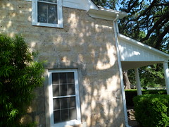
Port Isabel lies at the southeast corner of the Texas mainland.  Though the small settlement of Boca Chica is just a tad further to the south and east, Port Isabel has the role of  welcoming anchor, with its lighthouse that once guided thousands of ships to safe harbour.   Today, “Isabel” is the gateway to the beaches and boat slips of South Padre Island.  Its school system serves island children, as well as its own.  The town has three museums, which complement one another and operate in unison.

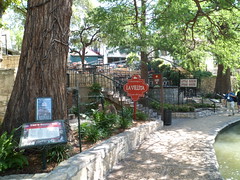
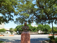
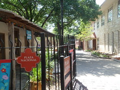
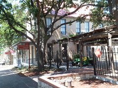
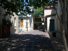
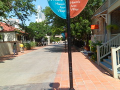
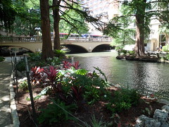
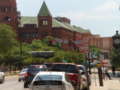
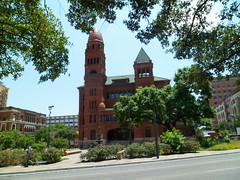
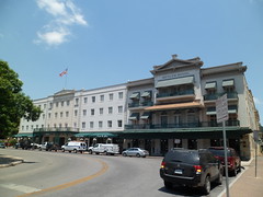
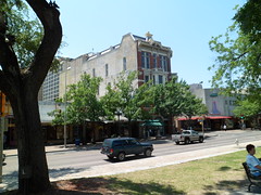
Here are some views of this surprisingly complex town.

8188908721_9409eb5551_m

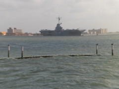
First, a look back towards South Padre Island.

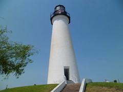
Next, I visited the Port Isabel Lighthouse.  It’s no longer serving its original purpose, of course, but kids of all ages can challenge their acrophobia and claustrophobia by climbing up the narrow stairs, and cramming into the veritable crawlspace that is the tower.  It holds two adults at a time, comfortably.
8188871333_3c47017b0b_m (1)

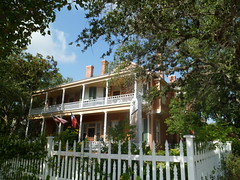
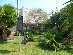
Next, I walked over to the Port Isabel Historical Museum.  It  does a fine job of chronicling the cultural contributions, and relationships to the land, sea and river, of the Coahuiltecan indigenous people, of the Spanish, Tejano, and American settlers. This area was vital to the cotton trade, and as I’ve said before, the mercantile Tejanos of the lower Rio Grande Valley were more ferocious in defense of the Confederacy than even the cotton barons themselves.
8188867061_64653b2799_m

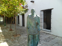
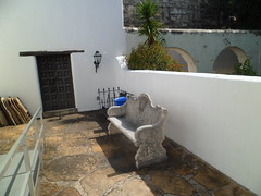
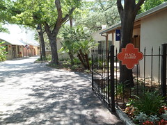
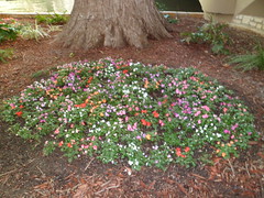
Here are a few shots of the Historical Museum, starting with the front garden.

8188924627_3eb3db6c67_m

Children of Victorian Port Isabel were taught the finer things of life.  Girls learned manners through play with intricately-made dolls.

8188911573_d190ccb3c9_m

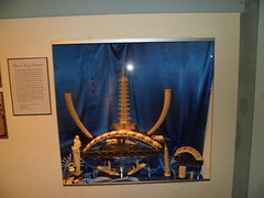
Like any maritime community in North America, Port Isabel had ties to, and a fascination with, the culture of eastern Asia.
8189992640_efc10677c3_m

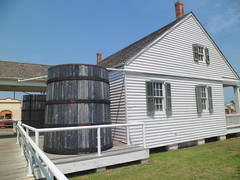
The last museum on this circuit is Treasures of the Gulf.  I took no photos inside, but the museum does have marvelous murals and artifacts of Spanish and Civil War Era shipwrecks, as well as hurricane memorabilia.  A Children’s Discovery Room will make this a great place for visiting families to beat the heat.
8188874161_bf38f18a20_m

It was getting to be time to leave the Gulf region, so I headed up the Rio Grande Valley, past the farms and thriving communities of Cameron and Hidalgo Counties, to:

Day 9, Part 1: Laredo

Texas, Day 8, Part 2: Andy Bowie Beach Park and Boca Chica.

2

I had the opportunity to see and savor the Gulf of Mexico twice today.  After saturating my senses with SPI’s Birding Station and Wildlife Sanctuary, I headed across the road to  the city’s Andy Bowie Beach Park.  The basics are all here- rolling dunes, vegetative windbreak, a roiling surf and strong undertow- but with a shallow sea level, as far as five miles out.  This gives the surf a sandy, brownish tinge.  It doesn’t feel gritty, though. Truth be known, I was glad to be back in the water.  It has been 21 years since I was last in the ocean- that was in Korea. I’ve been around it, in SoCal, Massachusetts and New Jersey, but to put on a swimsuit, beach shoes and full-body sunblock- not since 1991.

So,  on Thursday afternoon, I went to a swim shop, and got two new swimsuits,  and beach shoes.  Friday morning (5/25), I was one with the surf, for thirty five or forty minutes.  Then, I walked along Bowie Beach for about 1 1/2 miles,  just letting the surf do its thing on my feet- perfect.  The Gulf is a comfortable 75 degrees.

Here are some things I saw at Bowie Beach.

8188848399_0583a5c0d0_m

The dunes here are well covered, a good plan to avoid erosion.

8189925478_e7bae67790_m (1)

Here’s a casualty of  a short attention span.

8188843039_a4e136d3ff_m

The tide was slowly coming in.

8188841651_c7fe7ba072_m

These condos are a risk for a low-lying, hurricane-prone island, but are better-built than some of their predecessors.

8189961566_915a682dc7_m

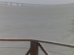
I took this shot of the South Padre Island- Port Isabel Bridge, from Pier 19, at the island’s southern tip.

8189960316_56f52cd9e0_m

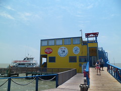
Here’s Pier 19, where I indulged on more seafood enchiladas.

8188878015_21a38dcc83_m

Across the narrow channel from South Padre’s own southern tip, is Boca Chica.  The peninsula is about four miles, north to south, and ends where the Rio Grande empties into the Gulf.  Part of me wanted to see this, but when I got there, it was thirty minutes until sunset, and security concerns kept me back.
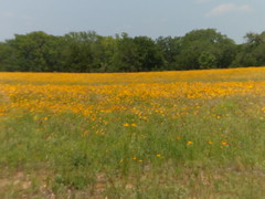
I still got to see Boca Chica’s rather primitive and captivating beach.

8188905697_7c460004a8_m

Boca Chica’s dunes are more highly sculpted than those of South Padre.

8189982250_4212950a54_m

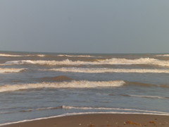
The surf towards sundown was every bit as feisty as earlier.

8189980802_b65136e842_m

I was able to get a shot of the Rio Grande, about three miles shy of its confluence with the Gulf.  Across the river is an area once known as Bagdad, Tamaulipas.

8188898575_23d8d681e9_m (1)

A sidelight to the story of this border region is the last battle of the Civil War, fought AFTER Robert E.Lee surrendered at Appomattox.  Tejano cotton traders, led by Santos Benavides, defeated a force of Union regulars at Rancho Palmito.

8190043018_a22a93fbba_m (1)

In between the two beaches, I spent two hours in the delightful town of Port Isabel.  Its treasures comprise Day 8, Part 3.

Texas, Day 7, Part 3 and Day 8, Part 1: South Padre Island Birding Station and Wildlife Sanctuary

3

As I headed south on Thursday afternoon, my intention was to go into Brownsville, get a room, and check out the mouth of the Rio Grande at Boca Chica.  Sometimes, the angel on my shoulder can gently get me to change direction.  When I got to the turn-off to South Padre Island, a whisper told me to turn left and go over the bridge.  I did so, and was rewarded with an affordable motel room at Island Inn, and visits to both the western, or Laguna Madre side of the island, and to the eastern, or Gulf side.

South Padre Island was detached from the rest of the barrier island by the dredging of Port Mansfield Channel in 1964.  It’s relative isolation spurred economic development as a beach resort.  The presence of condominiums along the Gulf side increases the risk of hurricane-induced damage, both to the structures and to the sand dunes that lie in from the shore.

The island is nonetheless captivating, though, and I spent about an hour Thursday afternoon , and two hours on Friday morning,  taking in the SPI Birding Station and Wildlife Sanctuary and its attendant boardwalk, which takes the visitor out onto platforms overlooking serene Laguna Madre, on the bay side of  the island.

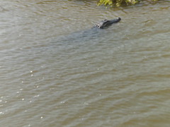
Birds, fish, crustaceans and four American alligators, may be seen below the boardwalk, at work and at play.

8188928416_d5e2f3a82e_m

8188870268_dc94c8502e_m

The facility is a five-story wonder.

Here is a view of the Boardwalk, which juts out into Laguna Madre.  There are 7 viewing platforms and 8 sections of Boardwalk, overlooking both bay and marsh.

8187799377_af9c57364a_m
8187797613_376d2e5f6f_m

Pintails like both marsh and bay.

8188875888_94e5cf2827_m (1)

Alligators have found their way to South Padre.  A family of four is here now, with more eggs preparing to hatch.

8187839533_cd10cbfc98_m

Great blue herons, gallinules and egrets top the list of shore birds who enthrall birders by the dozens.

8189895638_a7d63f1b01_m (1)

The glistening bay may be appreciated, both at eye level, and from the fifth floor lookout.

8189883946_b70c3d1c80_m

With all of South Padre Island’s natural wonders, the greatest and dearest wonder is the strength of its people.  The community has organized a Memorial Park, just north of the Birding Station.  Great local leaders, and lost youths, are commemorated here.

8189886746_82fcde758a_m

Among the fallen, Alyson Marie Knight, 18 at the time of her passing, stood out to me.

8189885394_a1f8cd9009_m

I trust the people of this beautiful island may always have Alyson’s stars to hold.

Next, Day 8, Part 2, Andy Bowie Beach Park and Boca Chica

Texas, Day 7, Part 2: Blucher Park

6

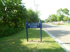
Corpus Christi has made a concerted effort to preserve the semi-tropical forest in its midst, thanks largely to George Blucher.  He was a son of Felix von Blucher, an early settler of the Corpus Christi area, and with his siblings, managed his father’s ranch and coastal properties, until his own passing in 1929.  His house is still maintained as a Bed and Breakfast and is registered with the Texas Historical Commission.

8186474769_acedb1dc36_m

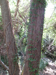
The park is across the street from the B & B.  I post these photos, without further comment, so that you get a sense of the serenity, even in the midst of a busy neighbourhood.

8186473205_d4e6a40b4e_m
8187513296_a10b3a1315_m
8187514688_0337b35106_m
8186459631_6dc9c76877_m

After this delightful walk, I headed south on US 77, towards the Rio Grande Valley.  Along the way, I passed through the countryside that was home to John G. Kenedy, the benefactor to Corpus Christi’s Catholic diocese.  His ranch is a Texas Historic Site, near Falfurrias.

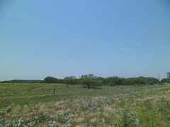
Here is a glimpse of the area.  It’s known as the Wild Horse Desert.

8187587836_2fd52f46d5_m

Next-  Day 7, Part 3:  South Padre Island Intro.

Texas, Day 7, Part 1: Corpus Christi, Gulf and Downtown

0

I hit a few internal speed bumps on this part of the trip.  Stopping at a motel, thirty miles outside of town, on Wednesday night, I encountered my first, and only, cockroaches- in the refrigerator, of all places.  Fortunately, I had my cooler for the food, and kept my smelly clothes and shoes out of harm’s way.  I let the owner know right away, the next morning, that I had killed 7 little scavengers that night.

The second bump was my own doing- forgetting that surface roads, along the Gulf, in Corpus, are TWO lanes each way, I gingerly started making a left turn from the inside lane, until screech-and-beep let me know I wasn’t alone.  Fortunately, there was no harm, unless the kid had a heart attack afterward.

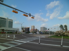
As to the good parts of the morning, Corpus Christi has two standouts- the Gulf and Blucher Park.  This post focuses on the former, and on some of Corpus Christi’s finer downtown features.

8186484637_772702a335_m

The city honours its indigenous people, the Karankawa, with the name of its main north-south downtown  street:  Carancahua.  On this pleasant street is Czech-Mex Bakery, where I again indulged in kolache.  These were stuffed with apple, and were every bit as good as the ones in West, TX.  Czechs just take their baking seriously, as they should.

Here is the busy intro to Bayside- Corpus Christi is not on the open Gulf, but it’s close.

8186485899_1ac612de70_m

Crossing carefully, I spent about fifteen minutes taking in the glorious salt air of north Corpus Christi Bay.

8186488425_5b1341229a_m

A permanent fixture here is the USS Lexington.  Along with Texas State Aquarium, the  UT Marine Science Institute and Texas Museum of Asian Cultures, this will be a major part of a more focused Corpus Christi visit.  Then, I would also spend two or three days on the main part of Padre Island.

8187530378_572d879c95_m

After disturbing the sea gulls and napping fishermen, with the click of my camera, I headed up hill to the downtown area.  Here are two notable houses of worship:  Corpus Christi Cathedral and St. Patrick’s Church, near Blucher Park.

8187526186_eec85850a8_m

The cathedral was built in 1940, to replace an older facility.  Some of the stone from the old building was reused here.  The land was donated by John G. Kenedy, a South Texas rancher who figures quite prominently in the history of Texas’ southeast.

8186481739_019d7637c4_m

St. Patrick’s is the home church of a Catholic school on Alameda Street.

8187522152_121ee35469_m

After visiting the public library, to post my work for that Thursday, I happened by this delightful place for lunch.

8186458173_5386d0f1ba_m

It seems all of north Bayside was here, but I had good service, and well-made seafood enchiladas, with okra soup, a generous side salad and fresh sourdough bread.  I hadn’t had sourdough east of the Pecos, until then.  It was just marvelous.

I know, I missed the statue of dear Selena.  I loved that girl, and will be here again.

Next:  Day 7, Part 2- Blucher Park

Texas, Day 6, Part 4: Spanish Governor’s Mansion and The Outer Missions

2

When one approaches the Spanish Governor’s Mansion, maintained by the City of San Antonio as a national historic site,   the “greeter” is a conquistador.

8184159264_c26f19fc78_m

He is not any one conquistador in particular, but symbolizes the spirit of the Spanish fighting explorer of the 16th-17th Centuries.

Despite its name, the palace housed successive Spanish military commanders of Tejas, until the Mexican people achieved independence from Spain in 1821.  The last commander, Ignacio Perez, was allowed to remain in the palace.  His family sold it to Tejano merchants, upon his death, and it served a variety of purposes until the City of San Antonio purchased the property in 1928.  It has since been restored to its original design, so as to better help tell the story of San Antonio’s rich Spanish heritage.

I will let the photos tell much of that story as well.

Here is the entrance, on the east side of the building.

8184160842_15dabde507_m

This was the Captain’s front sitting room.

8184153068_1cb57bef04_m

Like most Spanish gentlemen of the time, captains took solace from their exquisite gardens.  That makes them a lot like us.

8184152220_2d9a1fb0fe_m

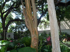
Here is a False Christmas Cactus.   I love the two-tone hues of the leaves.

8184110415_49d5a2ef95_m

The trees seem to be talking things over.

8184144446_2b009f1dfb_m

After an hour of checking out this most stately of downtown buildings, I headed south, out of the city proper, to look at two of the four outer missions that are part of San Antonio Missions National Historical Park.  They are among the most enduring structures in the State of Texas, and certainly compare favourably with what I have seen in Arizona, New Mexico and California.  Most striking, as you will see, are the solidity of the walls.  These outer missions were places for Indians who were studying Catholicism to live, as was  the Alamo, originally.

I first stopped at Mission de La Concepcion, 2.5 miles south of downtown.

8184236404_88cacacc17_m

This is the east wall.

8184188091_3e2d5efe1e_m

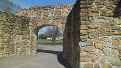
This is the east entrance, which visitors use when the mission is open (9-5).  I got here at 5:10 P.M., but the exterior was impressive enough to me.

8184189637_08d5f1a8fd_m

Below is the northeast courtyard.  It looks like a fine place to hide.

8184230254_fb712c11bb_m

The spires have weathered nearly four hundred years of  Texas heat and humidity.

8184218952_0faaea87e4_m

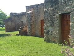
Around, to the northwest, lies a more approachable door, now left locked to visitors.

16629090960_86286c9861_m

Glimpsing inside the outer wall, I got a view of  some artistic expression of the Mission’s residents.

16194113834_3e61112104_m

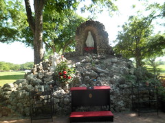
Lastly, La Concepcion offers visitors a serene shrine for prayer and meditation, in its northwest garden.

8184178569_0e7ca3dfe2_m

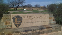
I had time for one more investigation of a mission, before darkness would spur me  southward.  The last stop on this visit to San Antonio was Mission San Jose.  This is 3 miles further  and is a bit larger than La Concepcion.

16790593916_e092e226d9_m

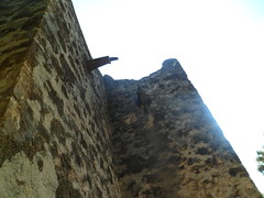
Here are some views of the east and south walls.

8184212518_bb5ffba129_m
8184210962_ed846b5fa7_m
8184209258_4d5bd3d4e1_m

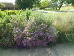
The gardens are not neglected here, either, and are, in fact, the first thing one sees, upon parking.

8184170495_90574e72f7_m
8184169059_5bd586dc03_m
8184204570_c24e4d6a1d_m

The garden walls on the north and east segments are a bit lower than those of the mission itself, suggesting the Indians may have had fields outside the mission, which they regularly accessed.

8184203116_02cb2b8ca7_m

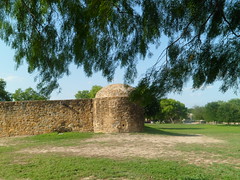
There was a vantage point from which to shoot photos of the interior, despite the high walls.  This is a fairly good view of the cupola and south tower.

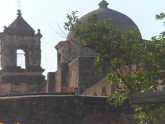
8184164387_2e235e9489_m

This is a view of the great courtyard of Mission San Jose. There are two missions off to the west of Mission San Jose, which I have left for another time.  It’s another reason to make this great city a fairly regular stop on my seemingly incessant journeys.  Then, there are my dear friends who make San Antonio home.

16630341219_d0776f9d28_m

I was glad to have made San Antonio one of the centerpieces of my journey.  Now, it’s off to the next fine place.

Next: Day 7, Part 1:  Corpus Christi- Shore and Downtown

Texas, Day 6, Part 3: Riverwalk and La Villita

2

Many regard San Antonio’s Riverwalk as an artifice, a gimmick.  Actually, the gimmickry is man-made, with various high-priced shops and restaurants- some good, others mediocre- you be the judge of which. The river itself is intended to be enjoyed, in pretty much a manner such as that provided by the sidewalks and tunnels.  Southern rivers tend to be a bit on the muddy side, but that is a testimony to the richness of the earth.

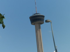
For me, the ambiance that mild Wednesday afternoon was mellow and sweet.  People were taking their time strolling along the walkway, south of Commerce St.  The Tower of the Americas loomed large over the eastern end of Riverwalk.  As many know, the International Exposition of 1968 was held in San Antonio.  HemisFair Park is the legacy of that event, and the Tower of the Americas is its showpiece.

8183790458_1d75570b92_m

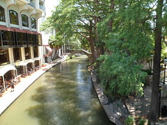
The walk itself, like the river, ambles at its own enjoyable pace.

8181074054_5b6f268256_m
8183759901_16c031da3a_m

This is the entrance to Riverwalk, just off Commerce Street.

8181036693_bf34616810_m (1)

The underpass is its own world within a world.  It observes all around it, unnoticed and often passed by.

8183758221_8e783f17de_m

The gondolier, though, has a few stories about it, and the other segments of the river.


8183753261_5ced2b2890_m

Once on the west bank of the river, it’s La Villita time!

This little group of plazas was the civilian sector of San Antonio, when the settlement was a fortress and mission.  It is here that the lion’s share of commerce was conducted, along with the hubbub of household life.

8183787434_10942a7056_m

The two main squares were Plaza Nacional and Plaza Juarez.  A third plaza, named for the innovative mayor of San Antonio, Maury Maverick, was opened in 1968.

8183748505_b9a8044555_m

Here is Plaza Nacional.

8183777696_edf38ca72a_m
8183775896_ed8b8c1ceb_m


Slightly to the north and west, is Plaza Juarez.  One comes out of La Villita at Bowen’s Island.

8183774368_48004c7600_m
8183736615_c781944763_m

This area was actually a peninsula in the San Antonio River, until the river was diverted in 1927.

8183735093_f7e7392bf8_m

John Bowen settled here in 1845, and became San Antonio’s first postmaster.   Along with his family,he maintained a productive farm until his death in 1867.  After the passing of his widow, Mary Elizabeth, in 1903, the city planners took control of the land and eventually used it as a high-rise office park- so as to better compete with Houston and Dallas.  The river diversion made Bowen’s Island part and parcel of downtown San Antonio.  It still has a lovely flair to it, if you look away from the high rises and towards the river.

8183731969_f61ce7dc8b_m
8183766726_cc4c505c57_m
8183728737_caa51b5053_m


I left Riverwalk near the Spanish Governor’s Mansion, and turned to see San Antonio City Hall, well- adorned by live oak.  A statue of Sam Houston stands guard, in front of City Hall.

8184126825_3e4b959dbd_m

The Riverwalk continues on to King William Historic District- a journey for another day.  I was happy to get this overview of San Antonio’s core, and to spend an hour or so at:

Next:  Day 6, Part 4: The Spanish Governor’s Mansion and the Outlying Missions.

Texas, Day 6, Part 2: The Alamo

3

In my maturity, I have come to approach sacred and iconic places with far more reverence than I once did.  I walked around the exterior of the Alamo, both before and after entering the Long Barracks and the Shrine itself.  I viewed the ten minute film on the siege, with about twenty other people.  Mostly, though, I was in my own thoughts during my time here- cap off, camera put away, while inside the two hallowed buildings, and mind focused on the process of securing and maintaining a free society.  I was, and am, grimly mindful of the irony that both sides were seeking to maintain a slave-based economy.  The Texans’ fight, however, did obliquely set the stage for the eventual emancipation of Black people, and many freed slaves did gravitate towards Texas’ back country, upon being released.

Let us approach the Long Barracks.

8181016647_e863ff0348_m

The siege of this building, and of the Shrine, has to be felt from within the confines of the buildings themselves.  Thus, photography would tend to detract from the experience, and is not allowed on the inside.

This Live Oak was planted in 1912, and is thus a celebrity in its own right, this year.

8181215041_d48ce3525a_m
8181208663_f20b211f7e_m

This archway was restored in time for the Texas Republic’s Centennial, in 1936.  The section of wall which is seen below, however, survived the battle in 1836.

8181210255_1a715bde02_m

This  is  the Visitors’ Center/Gift Shop, built in 1936.

8181240036_2995e8335c_m

The Alamo Mission has been splendidly restored.  It was originally built as one of the five area missions to the Coahuiltecans and Comanches.

8181240619_9939387347_m

The Centennial Commission took great care to adorn the courtyard with local flora, also.  I found prickly pear cacti clear to the Gulf Coast.  They are well-represented here.

8181243483_f103634904_m

This marker is also a survivor of the battle in 1836.

8181233695_5aa176084b_m

Finally, those who find themselves exhausted by the visit to this great shrine can amble over to the Emily Morgan Hotel, just across the street to the north.

8181237917_5a5746e1b6_m

Approached with reverence, regardless of the crowds, the Alamo provides plenty of food for thought and meditation.

Next:  Day 6, Part 3:  Riverwalk and La Villita

Texas, Day 6, Part 1: San Antonio Downtown and Midtown

4

This is Texas’ oldest awesome big city.  When I arrived on the evening of May 22, I found a very warm welcome at Rodeway Inn Downtown and that Quiznos sub I mentioned earlier was very welcome to my famished abs.

After a grand night’s sleep, on the highest bed I encountered this trip, I checked out of Rodeway, parked my car in a covered garage, and headed out for a day in this magnificent city.

Here is an overview of the heart of downtown.

8181097638_d375417fd1_m

Below is the front of Catedral de San Fernando.

8181092262_a61007e497_m

The remains of the heroes of the Alamo lie here.

8181054471_d71132b9ac_m

The cathedral is a working, vibrant parish church.  Worshipers were present here when we tourists were circulating.  I removed my ball cap upon entry, of course, and only photographed when two men were done praying.

This altar, though, is exquisite.

8181084956_edacbf3f07_m

The courtyard is also serene, and an enterprising parishioner has a comfortable and friendly restaurant, Poblano’s, on its east side.   I enjoyed mole enchiladas, with a zingy unsweetened chocolate sauce.   Poblano’s is a Main Avenue institution, coming back from a fire a year or so ago.  It would be to the right of this fountain.  I know where I will head next time I’m in “San Antone”.

8181081470_e112e692cc_m

Just southeast of the cathedral is Bexar County Courthouse.

8181041971_2fefe7bf4f_m

I headed east, along Commerce Street, passing a few Riverwalk venues (See Day 6, Part 3).  One, on the north side of Commerce, near Crockett Street, is the Five and Dime, a huge market and cafe, reminiscent of  the store where many people my age bought school clothes and had an ice cream soda or a milkshake, back in the 1950’s.  This is the beginning of San Antonio’s Midtown.

8181068678_6b9f27fca2_m

Near Alamo Square, well-heeled travelers can enjoy fine hotels, like the Menger.  The St. Anthony, northwest of Alamo Plaza, is also a fine hotel, and is being remodeled

8181029535_a272cbb60d_m
8181063174_9cfc44b7c7_m

Midtown’s bustle, based on the heart of the Riverwalk, comes to a halt as one reaches Alamo Plaza.  For many, a sense of reverence starts to enter the psyche and heart.

8181026015_40eea83ee1_m

People even approach the Gazebo (above) with respect.

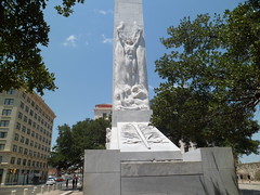
Just before entering the Alamo, it’s good to stop and reflect at the Cenotaph:  “Spirit of Sacrifice”.

8181059454_b6f8aab89d_m

Day 6, Part 2:  The Alamo

Texas, Day 5, Part 3: LBJ Ranch

11

This being a post about our nation’s 36th President, there are lots of photos.  For the same reason, there are no photos of the interior of the Ranch House.  Lyndon Baines Johnson had his public side, and his private side.  He made it very clear, very fast, which was which.  I never heard of anyone back-talking the man who once said:  “In this White House, there’s elephants and there’s ants.  Right now, I’m the only elephant.”; no one that is, except Lady Bird- the only human being who ever terrified him, once his Grandma passed on.

LBJ enjoyed inviting people to come to the Texas White House, telling them to “take the first left across the bridge, when you see the Ranch House.”  It was the original Bridge to Nowhere, and many a chagrined visitor ended up in the Pedernales, with Lyndon standing on the north bank, laughing his head off.  Word is, he invited the Reverend Billy Graham to the ranch once, and Reverend Graham said, “I’d like the REAL directions to the house.”  You can’t fool a man of the cloth.

8177627080_dc8b4213ac_m

Today, thousands of people make their way here. There were 65 of us, in three tour groups, when I showed up.

This was Lady Bird’s home, first and foremost, so there were lots of coreopsis, and a myriad of other kinds of wildflowers.

8177645236_673752cba9_m

This is  the spot where LBJ had his prank foils try and cross the Pedernales.

8177608527_1192bbc540_m

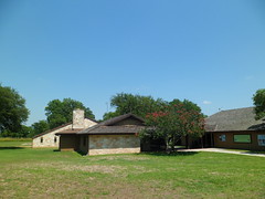
Before touring the Ranch, I spent about thirty minutes at the Visitors’ Center, near the Living History Farm.

8177637190_8ee7fe4314_m

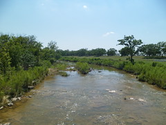
This is the Pedernales River, near where Billy Graham, and those of us visiting presently, crossed to get to the Ranch.

8177593933_492e1236e4_m

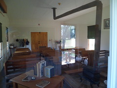
In this schoolhouse, a four-year-old Lyndon insisted on attending, so that he might make friends, being an only child at the time. (Sam Houston Johnson came a bit later.)  He also developed a thirst for knowledge, and eventually became a teacher, prior to entering politics.

8177618224_c75f22c46d_m

This was the dog trot house where LBJ lived as a small boy.  Remember the dog trot houses from Log Cabin Village, in Fort Worth?  They were all over the Hill Country, also.

8177616146_6f1bf57269_m

This view is of Stonewall Lutheran Church, which the Johnsons sometimes attended.

8177598279_a86fbac127_m

These are the final resting places of President and Mrs. Johnson.  Luci and Lynda ask that people not enter the cemetery.  Photos may be taken from outside the fence.

8177564439_9651f31bd7_m

I’ve seldom met a horse I didn’t like. LBJ felt the same way.  His horses stayed here, in the Show Barn.

8177585524_a02106c57f_m

Every plane a president of the United States uses is dubbed “Air Force One”.  This was one of LBJ’s favourites, and now sits next to the Hangar Visitor Center, from whence tours of the Texas White House begin.

8177576010_fb7141fce6_m

LBJ loved to amuse his grandson, Patrick Lyndon Nugent, by singing along with his dog.  Mr. Nugent is today the principal manager of LBJ Ranch.

8177571002_c6959371ee_m

Here is a car which LBJ himself liked to drive into the Pedernales.  Often, Robert McNamara, his Secretary of Defense, would come along for the soaking.

8177537927_a7892824b5_m

Here is the fine native stone that was used to build the Ranch House, by LBJ’s  uncle, Judge Martin.

.8177533169_9cf82f2d43_m (1)

The interior of the Ranch House carries its share of stories.  As a Southern man of the Fifties and Sixties, LBJ made sure there was an ashtray in every room, beer in all seven refrigerators, and that all fifteen televisions were on, continuously.  He had another motive for the last one, though.  In his bedroom, there were three TV’s.  As back then, we only had three major networks and PBS, he had one TV set to each commercial network.  He kept an eye on what was being broadcast , and would call the head honcho of any network that was critical of his policies, and browbeat the hapless exec, on the subject of patriotism.  Some of these calls were made in the middle of the night, and LBJ made no note of time zones.  He didn’t worry about PBS, since he was technically its boss.

When a person was invited to the Ranch, and was escorted, upon arrival, into the Living Room, he knew a tongue-lashing was coming. George McGovern was brought to the Living Room.  Richard Nixon wasn’t.

Lyndon and Miss Claudia Alta maintained separate, but adjoining, bedrooms.  This was done so that she could get some sleep.  The President was a night hawk, and lay his head down around 3 A.M., many nights.  Of course, he’d be up by 7.

He died here in January, 1973, at age 64.  A lifetime of smoking, drinking, and all-around rough living took Lyndon Johnson out, probably far sooner than he might have left.  What really did him in, though, was feeling tossed aside.  His decisions with regard to Viet Nam made him a pariah to many Democrats.  So, he fell to depression, and the broken heart gave out.

Nonetheless, Mr. Johnson’s considerable legacy transcended the Viet Nam War, and the man whom the children of Stonewall, Texas called  “Mister Jellybean”, for his gifts to them of candy, lived a life worthy of study.