This Singing House

10

March 20, 2016, Prescott- I had the good fortune, this weekend, of being in two amazing places, locally.  The first was Chapel Rock Conference Center, of which more in a coming post.

Today being Naw-Ruz, the first day of the Baha’i  calendar, as well as an ancient Persian cultural festival (which used to last twelve days, I’m told, in the time of Zoroastrianism), I focus now on our community’s local celebration.

It was held, on this glorious afternoon, at the self-built home of two amazingly inventive and eclectic people, who I have been honoured to call friends, for over twenty years.  Each time I visit here, there are new items either added to the house, inside or out, or in the works, in one studio or another.

When we sat for the devotional part of our celebration, the hostess was asked whether recorded music would be part of the program.  She said “No”, and at that moment, the house itself began its music- in the form of three sets of wind chimes taking turns.

The chimes were not overly clangy, which would have not set a good mood, but gently interspersed our readings.  Afterwards, we had a light meal, which sufficed this one’s appetite for the rest of the day.  Some days are just meant for one meal, supported by snacks.

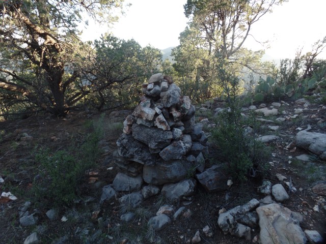
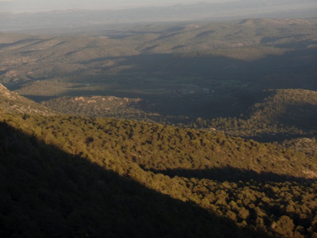
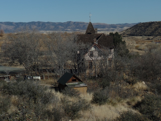
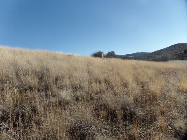
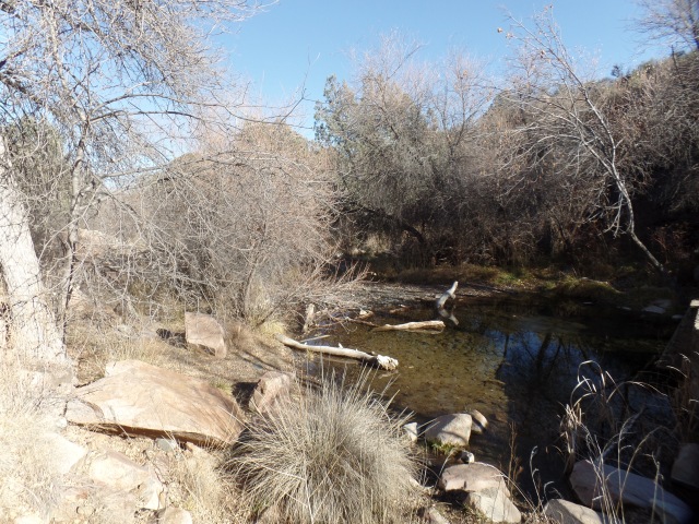
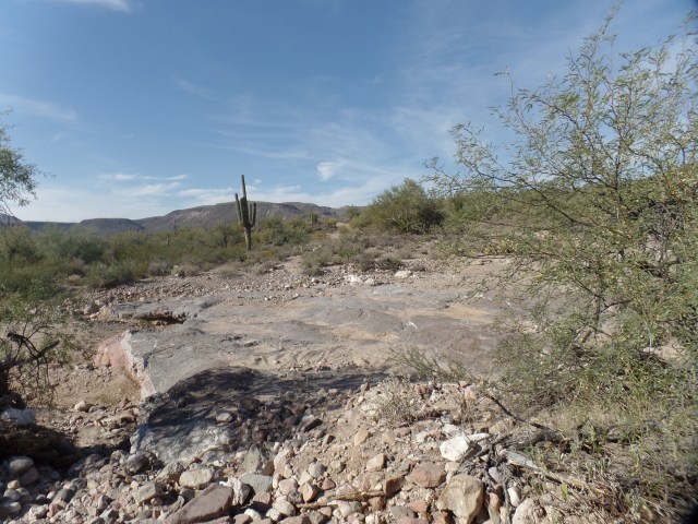
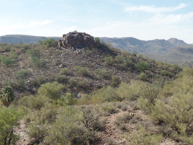
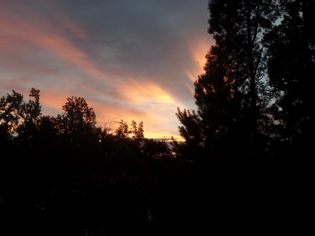
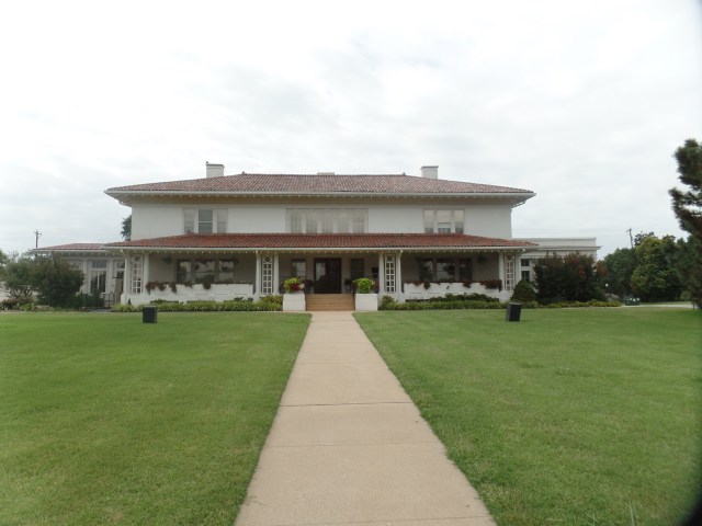
Here are some scenes of this lovely home, atop a bucolic hill.

SAMSUNG CAMERA PICTURES

Yard art, Prescott

SAMSUNG CAMERA PICTURES

The Seven “S’es” of Naw-Ruz

(See my next post, for a detailed description of this elegant holiday arrangement.)

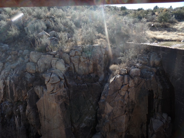
Here are a couple of the reasons my friends were drawn here, in the first place.  Note the embedded iron ring, atop the crag.

So, another fine year has begun  for us Baha’is.  I wish all my friends north of the Equator a lovely Spring, and all to the south, a bountiful Fall.

Prescott Circle Trail: Tales of Two Segments

4

March 13, 2016, Prescott- “It is not yours to keep, this ever-changing trail”- Laura and the Killed Men, “The Ever-Changing Trail” (All rights reserved, Laura Kepner- Adney and Sam Golden, 2015).

I sat, joyfully, in one of my favourite evening live music venues, The Raven Cafe, and listened to this Tucson country-folk band’s first set.  The line above is from their a capella set closer.

They excel with instruments, also.

Include the video, as it happened that the evening was a fine counterpoint to two hikes I took this weekend, on Prescott Circle Trail.  Yesterday afternoon, the spontaneity of which I wrote, a few posts ago, kicked in.  I accepted the urge to do a “fill-in-the blank” hike, to the top of Badger Peak, which is circumnavigated by Section 7 of the Circle.  The peak is also called “P” Mountain, owing to the large white first letter of my adopted town’s name.

Here are some scenes.  The first two were taken from the access road, to which I transferred from Prescott Circle, at the half-way mark to the summit.

The third photo shows a communications station, atop the peak.  The white circular arrangement is the top of the P.  There is no access to the arrangement, in its entirety, without permission of the Yavapai Nation, which owns the mountain.  The final photo shows Watson Lake and the Granite Dells, from the summit.  This hike was four miles, round trip.

This afternoon, a friend, who had wanted my help with a remodeling project, postponed it until next week.  This gave rise to spontaneous hike # 2:  Segment 5 of the Circle.  It is a ten-mile round trip, something I’ve not done during the Fast.until today.  I was inspired in this by another friend, who is both older and physically smaller than I am, and who hikes and runs during this time period.  So, out of my comfort zone I went- with enough water on which to fall back, in the event I felt weak.  As it happened, that was not a problem, as the air was cool this afternoon, and the Sun was hidden by clouds, most of the time.

This segment goes from a point south of Upper Goldwater Lake, around the south and west shores of that body of water, above the west shore of Lower Goldwater Lake, which is closed to the public and through Prescott National Forest, to White Spar Campground. This hike was ten miles, round trip.  Sitting here tonight, I feel refreshed and focused.

Here are some scenes of Segment 5.

Note the “Tree-Pod”, on the right.

SAMSUNG CAMERA PICTURES

Gray granite boulders, south of Goldwater Lake

SAMSUNG CAMERA PICTURES

South shore, Upper Goldwater Lake

On the left are a pair of daisies, seen along the way, above Lower Goldwater Lake.  The heart-shaped stone memorial, on the right, is dedicated to the 19 firefighters who died at Yarnell Hill, in June, 2013.  It is atop a ridge, 1 1/4 miles southeast of White Spar campground.

The Sierra Prieta range can be seen from Monument Ridge.  On the right, is the trailhead at White Spar Campground.  I spent only ten minutes, resting, at this very full facility.  There were 2 hours’ back journey left.

On the way back, I stopped for several minutes at this lovely nook, Banning Creek.


There had been a fair crowd here, when I was headed towards White Spar.  When I returned, only one lone bicyclist and I had the place to ourselves- and he was about to leave.  I saw very few other people, the rest of the way, until I got back to Upper Goldwater.

Now, with the next two weekends booked, I will wait until April to take on the next segments of Prescott Circle- unless things get canceled and spontaneity calls.

Rice Canyon

11

March 7, 2016, Prescott-  This past weekend featured my shortest visit to southern California, since July 3, 2013.  It was truncated by the intense storms hitting the region- with rare  Winter electrical elements, and hail, in the mix.

My visit with my son, Aram, was the main reason for the journey.  It is indicative of how much of me he has absorbed, that he asked whether I was just “swinging by” on the way to see friends.  It is true that, in the past, I have combined a visit with him and those with friends in Orange County and Los Angeles.  That was not the case this time, as both weather and fiscal prudence put the latter two segments on hold, until early June.

One of the things I enjoy doing is connecting people with places in the area where I happen to be, that they enjoy or find useful.  I do this here in Home Base, and I was able to do so with Aram, in Chula Vista.  I introduced him to a small Thai restaurant, near his home, on Saturday night.  Yesterday afternoon, we discovered Rice Canyon, a lovely trail just ten minutes’ walk from his apartment.  This trail system, a feature of the City of Chula Vista, gives area residents a lovely venue for hiking, biking and jogging.

Here are some scenes of this floral, riparian preserve.

There is a pleasant mix of desert and subtropical flora here, as elsewhere in the San Diego area.  Palm trees abound, though they are in a state of drought-induced duress right now.

Erosion, mostly man-made, is a concern for the friends of Rice Canyon.  Aram was underwhelmed at the notion of “side trails”, in the preserve.  Lemonade berry shrubs(above/upper right) provided the Kumayaay people with a sour beverage.   A small creek, (above, lower right) peeked out at the discerning walker.  Myrtillocacti (below) are also common in the South Bay of San Diego and the Tijuana Estuary.

SAMSUNG CAMERA PICTURES

Myrtillocacti, Rice Canyon, Chula Vista

We had a fine introduction to the canyon, during a seven-hour respite from the rain that graced southern California with its presence.  This morning, no sooner had I left the city, than the rain resumed, with a vengeance.


Bell Trail

6

February 28, 2016, Rimrock, AZ- I spent yesterday, it seemed, with fork or spoon in my hand, from 2-6 P.M.  There were three gatherings:  The first, a lovely afternoon tea, was the big meal of the day, it turned out.  Then, there was a small gathering at a local bakery (I had a cup of soup),followed by an appearance at a chili cook-off. The last one only had smatterings left, so the meal ended up being, thankfully, paltry- though, being chili, it was full-on tasty.

So, today, I headed off to visit some long-time friends near Montzeuma Well, a beautiful and refreshing extension of Montezuma Castle National Monument, on the northeast end of the town of Rimrock.  Further northeast, still, lies Bell Trail, which sometimes parallels the Verde River tributary of Beaver Creek, and sometimes follows a path down to the creek.

So, after a light lunch, and visiting with the family as a group, while they put together a rabbit hutch, for Hako,

SAMSUNG CAMERA PICTURES

Hako

I headed out, with one of the family members, to explore Bell Trail.  The various stops,along the trail, gave much time for meditation, even as I listened to my friend’s stories of adventure, both home and in far off lands.  I shared a few of my own, along the same lines.

SAMSUNG CAMERA PICTURES

Sandstone formations, off Bell Trail

SAMSUNG CAMERA PICTURES

Sandstone “fortress”, off Bell Trail.

The trail ended at “The Crack”, an overlook and creek access point that is popular with students from Northern Arizona University, as well as local youth.  The whitewater of a currently deep Beaver Creek is visible  above, at lower left.  While we we there, about a dozen youth were there, and several more were en route, as we took the return trail.  It was tempting to get in the water, with temperatures in the upper 70’s, though when we stuck our hands in the creek, it felt like the water was about 55.  That didn’t stop some of the younger folks from jumping in, though!

The afternoon was another well-spent day on the trail.  I also thoroughly enjoyed my hiking companion’s stories of time spent in  China, Tibet, and the Navajo Nation.  Many of the latter experiences I shared, having been among the Navajo and Hopi, for 11 years.

Prescott Circle Trail: Lingering Snowpack

9

February 15, 2016, Prescott-  I spent yesterday afternoon not being a nuisance to anyone, and finishing my walkabout of Segment 6, on the Prescott Circle Trail.  Long segments, such as this, can be broken into two manageable hikes.  Today, I started at the trailhead that lies across a narrow, but busy, highway from Goldwater Lake.  There was plenty of parking in the dirt lot, so by 1 PM, I was bound for the point at which I stopped on my last visit to this route.

The first part of the trail was dry, which was fine by me, as it was also the closest thing the trail offered to being steep.  Mud, and snowpack, came a bit later, and were a constant, for the length of the trail.  There are seven “fingers” of Government Canyon that impact this section of trail, but not as much up and down, as in the eastern part of the canyon.

Two hours after I started, the segment’s end came, at the three-way junction of Prescott Circle, Boy Scout Trail and Turley Trail.  Boy Scout leads to Walker Road, near Lynx Lake.  Turley, whose trailhead is a mile east of my house, brings one back towards downtown.

With my car back near Goldwater Lake, I tooled around the back country of Government Canyon, for about an hour, then headed in reverse.

Here are a few scenes from this workout, which resulted in 10 miles, altogether.

SAMSUNG CAMERA PICTURES

Western end of Segment 6, Prescott Circle Trail

Above, are two views of Goldwater Lake, which has upper(left) and lower (right) halves.

SAMSUNG CAMERA PICTURES

Snow appeared frequently, along the north side of the canyon, as one might expect.

SAMSUNG CAMERA PICTURES

Snowfield, on east side of “finger” Number 3, Government Canyon.

I reached my turn-around point (left), and felt the urge to look around.  So, I did an extra loop, including this limestone outcropping, on Seven-Mile Gulch Trail.  This became a two-mile loop.

The return hike was not strenuous, and I made it back to the west-facing section of trail, in time for a glorious sunset.

SAMSUNG CAMERA PICTURES

Sunset near Goldwater Lake, Prescott, February 14, 2016.

So it is that I have completed half of the Prescott Circle Trail.  In truth, though, with trails, one is never “done”.  The stunning scenery is here for anyone who needs a lift.

A Touch of the Rio Grande

9

January 31, 2016, Albuquerque-  One of the places Penny and I liked in the Duke City was Rio Grande Nature Center.  As the name implies, it celebrates the great river that plies Albuquerque’s west side, on its way to becoming the Rio Bravo and a feeder for the Gulf of Mexico.

The last time I was here, it was summer, my wife was alive and well, and our son was about 8.  Now, it’s winter, Penny has been at rest for nearly five years and Aram is pushing 28, doing just fine on his own.

I’m good, though, because of places like this.  These refuges, with their waterfowl and raptors, tangled trees of the bosques and True Believer hikers and bicyclists, work their magic, regardless of how bare the trees are, or how turgid the river tends to be.  The majesty of the place lies in the comfort it gives to the birds, and to those, like me, who can sit and watch their antics, for hours on end.

I didn’t have, nor take, those hours, today.  There was a storm to outpace:  One that the locals here were expecting, but which was still churning from California to western Colorado.  Nonetheless, this visit gave me a bench by the river, a picnic lunch at that bench, and the joy of watching the ducks, Canadian geese and lesser sandhill cranes compete for the silver minnows and other fish that Rio Grande serves up.

Without further ado, here are a few scenes of the Rio, its feeder Silver Minnow Channel and the bosque, in its own state of repose.

SAMSUNG CAMERA PICTURES

Entrance to Visitors’ Center, Rio Grande Nature Center

SAMSUNG CAMERA PICTURES

View of Silver Minnow Channel, from Rio Grande Visitors’ Center

SAMSUNG CAMERA PICTURES

Rio Grande, Albuquerque, NM

SAMSUNG CAMERA PICTURES

Ducks, trying to stay warm, Rio Grande Nature Center, Albuquerque

SAMSUNG CAMERA PICTURES

Sand bar, Rio Grande, Albuquerque.  These spots are good places for insects, and other food sources for the birds, to hunker down and wait out the cold.

SAMSUNG CAMERA PICTURES

Somnolent trees, along Bosque Loop Trail, Rio Grande Nature Center

SAMSUNG CAMERA PICTURES

Rio Grande, Albuquerque

I have seen this river run higher, and have seen it at a trickle.  I have stood on its banks near Brownsville, TX and near its headwaters, in the mountains known as Sangre de Cristo.  Nowhere does the Rio Grande reach out to comfort its patrons more than it does here, at the western edge of a bustling, but heritage-laden metropolis.

Black Canyon Trail: The Elusive K-Mine and More Agua Fria

10
SAMSUNG CAMERA PICTURES

Cactus Wren nest, in ocotillo plant.

January 24, 2016, Black Canyon City-  I returned to the Black Canyon National Recreation Trail,  this afternoon, with a long-time family friend and her dog in tow.  This hike was 5.5 miles round trip, not as intense as last week’s jaunt, but exactly what I had in mind.

We parked in the spacious Trailhead Lot, just north of Black Canyon City, and were treated to a taste of the lushness this section of the Sonora Desert offers.

SAMSUNG CAMERA PICTURES

Blooming creosote, Black Canyon City Trailhead

SAMSUNG CAMERA PICTURES

Ocotillo and sahuaro cacti, Black Canyon City Trailhead

We headed out, up a 1.1 section of trail called Horseshoe Bend, being on the south side of the feature of the same name, which was my stopping point last week.  It is not a strenuous trail section, and offers a few anomalies, such as the Pharaoh’s Face.  At the 1.1 mile point, Horseshoe Bend meets two other segments:  K-Mine and Skyline.  We took the K-Mine Trail, which took us close to the spot where I stopped last week.

SAMSUNG CAMERA PICTURES

Pharaoh’s Face, with a barrel cactus keeping watch, Horseshoe Bend segment, BCT

SAMSUNG CAMERA PICTURES

Friends along for the afternoon, junction of Horseshoe Bend and K-Mine Trails

The K-Mine Trail features mild switchbacks, down into a vast valley, outside Black Canyon (the natural feature).  The cacti and succulents here take full advantage of the water wealth proferred by the Agua Fria and its tributary streams.

SAMSUNG CAMERA PICTURES

K-Mine Trail, west of Black Canyon City

SAMSUNG CAMERA PICTURES

K-Mine Trail, west of Black Canyon City

SAMSUNG CAMERA PICTURES

Desert valley, west of K-Mine Trail

The K-Mine Trail offered striking vistas, before taking us down to the Agua Fria, southwest of last week’s fording spot.

We explored a bit along the Agua Fria, but my intuition said it would be best for the three of us, that we turn back.  This did not happen, though, before we checked out a small cataract, a bit upstream from the K-Mine Trail.

SAMSUNG CAMERA PICTURES

Edge of box canyon, along Agua Fria, near the K-Mine Trail

SAMSUNG CAMERA PICTURES

Agua Fria River, north of Black Canyon City, with small cataract in the background.

We met three young ladies, riding a quad and a small motorcycle, and watched as they gingerly negotiated the river.  After returning to the trail proper, we found yet another crossing place, but again I had a feeling in my gut to turn back.  So, up the K-Mine Trail we went again.  The short section of trail to my last stopping place can wait for another day.  Everyone’s well-being mattered more.

On the way up, we spotted a couple of cactus wren nests.  One was wedged in between the arms of a sahuaro.

SAMSUNG CAMERA PICTURES

Cactus wren nest, K-Mine Trail

With such confirmations as these, and several heart-shaped rocks along the way, we called the day a success.  More exploration of the Black Canyon Trail, and other such routes in Arizona, await, over the next several months.


Black Canyon Trail: Ever Glorianna

9

January 17, 2016, Black Canyon City-  With the snow along Prescott Circle Trail slowly turning to mud, I determined that today was as fine a time as any to resume my journey down the Black Canyon National Recreation Trail.  Last spring found me stopping at a ranch in Bumble Bee, an old mining town-turned-have for off-gridders.  About a mile further east, along the old Crown King Road, lies Glorianna Trailhead.  It was there that I began today’s marathon:  12.5 miles, round trip, to Black Canyon City and back.

The crew of All-Terrain Vehicle enthusiasts, who greeted me at the trailhead, confirmed that this was the route I needed to follow-  a fact I had determined from looking on the BCNRT website, earlier.  It’s always good to have locals know where one is headed, the fantasy goons in “Deliverance” aside.  So, I bid them a fine afternoon, and headed out.

SAMSUNG CAMERA PICTURES

Granite tower, near Glorianna Trailhead, Bumble Bee, AZ

Above, I encountered a cholla cactus, shimmering in the afternoon sunlight, a group of sahuaro, seemingly on the march, and, upon climbing a ridge, my first trailside view of Black Canyon City, still four miles further southeast.

The shared use portion of the trail ran for about two miles, before it split off from the road, and headed uphill, just west of the small shooting range, where a very focused young man was practicing,  and thankfully facing away from me.

About thirty minutes later, I came upon one of the two big treasures of the route:  The Agua Fria River.

SAMSUNG CAMERA PICTURES

View of Agua Fria River, from a ridge to the northwest.

This used to be privately-held ranching land, and the old fence posts dot the trail.

SAMSUNG CAMERA PICTURES

Old fence post, about a mile west of the Agua Fria.

The river needed to be forded, but as you can see, the shallowness made this a minor task- and it was rather delightful.  The cast and stunt people of “The Revenant” would have been rolling on the ground laughing.

Just before I made my way down to the flowing stream, the ruggedness of the upper branch of Black Canyon presented itself.

SAMSUNG CAMERA PICTURES

Upper Branch of Black Canyon, north of its namesake town.

Above are two views of the Agua Fria, before I crossed (right) and after (left).  Just after I forded, a mother/daughter hiking pair came down from the south rim, accompanied by their protective 1 1/2 year-old-German Shepherd, who let me know my presence was not appreciated.  The women were more gracious, though, and held the youngster by her collar.

Onward and upward, I headed towards the canyon for which the town is named.  It is a far more interesting sight than I had previously thought. On the lower right is one of the four spur canyons which one encounters along the Horseshoe Bend subsection of the Glorianna.  On the lower left is a good view of the limestone “wall” which distinguishes Horseshoe Bend.


The canyon itself, which will be the focus of further exploration, next Sunday, is seen again, on the lower right.  I got a nice zoom shot of a cylindrical edifice that rises about three miles east of Black Canyon City, from the vantage point of Black Canyon’s north rim.

So as to get back to the wide road before dark, I did not tarry long at Horseshoe Bend, before heading in reverse.  Below are three examples of the mineral beauty to be seen along this trail section.

I encountered the three female hikers again, on my way uptrail, after recrossing the Agua Fria.  Dog was no happier to see me than she was the first time, but no matter.  I also met the ATV group, once back on the shared-use part of the trail.  They had been concerned for my safety, and once it was established that I was fine and knew where I was going, they headed on their way.

There are enough loose ends to be explored around Horseshoe Bend, that I will return here next weekend.  Stay tuned.

Prescott Circle Trail: Segment 7, Part II

2

January 3, 2016, Prescott-  This weekend is billed as the last stretch of fair weather, before a series of storms takes up the entire first week of January.  I spent yesterday afternoon with that in mind, heading for the southern portion of the above-mentioned trail segment.

The trail I followed was only completed in July of last year, following a multi-party easement that involves the Prescott-Yavapai Indian Community, the Bureau of Land Management, the U.S. Forest Service, the State Land Trust and the City of Prescott.  It was the last large link in the trail system.

So, it was with great satisfaction that I was able to do an 8-mile round trip, from Turley Trailhead, at the west end of Government Canyon, along the edge of that sizable chasm, around Badger Peak (also known as “P” Mountain), in back of three shopping plazas, to the edge of Highway 69, where an underpass links the trail with the last segment I covered, in late Fall of last year.

The trail was mostly modest, or so it seemed to me.  Two young women came the other way, with their dog, and told me they thought the eastward trail was easier than the way I was heading.  Somehow, I did not find either way all that taxing.  I’m sure they would do just fine, being at least thirty years my junior.

Here are a few scenes from trailside.

SAMSUNG CAMERA PICTURES

Limestone crag, on north side of Badger Peak, Prescott.


SAMSUNG CAMERA PICTURES

Junction of Turley and Badger Peak Trails.


Above, the P on Badger Peak’s north side is visible, as is frost on the trail.

The day ended perfectly, with a sunbow appearing to the northwest.  Along with the nearly two-dozen heart-shaped rocks I spotted along the way, this augurs well for my 2016.

Highway 16

12

January 1, 2016, Prescott-  Yes, I know it’s still 2015, here in the American West.  It’s New Year’s Day in Rouen, France, one of my ancestral homes.  It’s also 2016 in: Silesia, Poland; Bremen, Germany; and Tours, France- three of my other ancestral homes.  In 5 1/2 hours, the New Year will come to Old Town, Maine, where my Native American relatives still live.  I am starting to beat a dead horse.

I will use the road motif for this year’s posts, much as the Road took me to age 65.  Highways indicate assertiveness, clear vision and moving out with a purpose.  So I intend 2016 to be.

I came back to Home Base, yesterday, to find I have a financial issue to settle, and will tend to it next week.  In the meantime, bills and rent will get paid and I was, thankfully, able to fulfill a promise I made, last week, to help a sick friend.  My nest egg isn’t growing right now, but neither is anyone else’s, in Wall Street’s mad rush to sell anything that’s not nailed down.  My nest egg IS nailed , though, so the bears can just go back into hibernation.

Meanwhile, I am not hibernating.  The next three days will see me on one trail or another, as we enjoy crisp, clear weather.  The schools will be back in session next week, and I will be ready for whoever needs my services.  The certification process will take a bit longer- ADE doesn’t save transcripts, so those need to be re-sent, and my long-ago teaching internship host will need to verify that I did complete “practice teaching”- in Fall, 1975.  So, I see that process being successfully completed by the end of January.

My essential oils have benefited me, health-wise, and I will be at three conferences, this year, that focus on their promulgation.  This month, and June will find me in Boulder and September features an International Convention in Salt Lake City.

Travel in the summer will depend on how well I do, work-wise, this winter and spring.  A week or so in Reno/Tahoe, at the end of May, is a given.  Anything beyond that, though, remains to be seen.  In any case, the focus will be on time with friends, not on “Here’s Gary at yet another fabulous site!”  I never want the latter to be how all this is viewed.

Reading is still huge for me, and with the Kindle, an excellent library system and three nearby book shops, I will never run short of material. I am currently engrossed in “The Witches:  Salem, 1692”, Dick Van Dyke’s “Keep Moving”, “Terra in Cognita”, by a fellow Baha’i:  William Barnes, “Extreme Ownership”, and “The Dinosaur Heresies”.  My tack is to read at least ten pages of a book, then go to one of the others, and so on.

This year marks the Centenary of ‘Abdu’l-Baha’s initial offerings of “Tablets of the Divine Plan”.  I will have much more to say about this remarkable set of documents, during the course of the year.  Suffice it so say that, without the guidance I have received as a Baha’i, the person some in my family remember from long ago, and still think they see, would still be stumbling around- and I would not be blogging, to say the least.

This year also marks the Centenary of the National Park Service.  I will visit several National Park holdings in Arizona, and around the Southwest, in the course of this year.  Most certainly, my boots will meet some trails of the Grand Canyon, and Canyon de Chelly, for the first time in 18 years.

Most importantly, though, is WHO I am going to be in these next twelve months.  That will never be defined by anyone but yours truly.  To say otherwise would be to invite chaos.  Some, not far from here, want me to move nearer to them.  That is not happening.  Others would rather I stay as far away from them as possible.  So be it.  Any given decision could be resolved in at least seventy different ways.  The factors, for me, are these:  Service to those in need, especially children and youth; my own family’s well-being; my ability to fend for myself (I am not presently, nor will I be, a burden on anyone else); and, lastly, the overall circumstances of the world-at-large.

Happy 2016, one and all!