The Goosenecks and Valley of the Gods

8

October 8, 2019, Blanding-

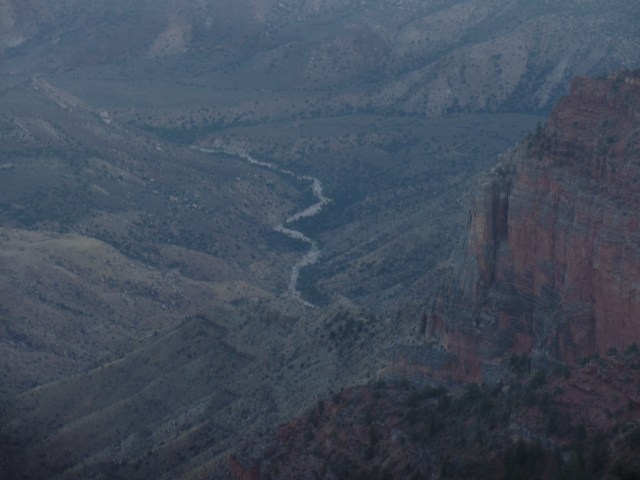
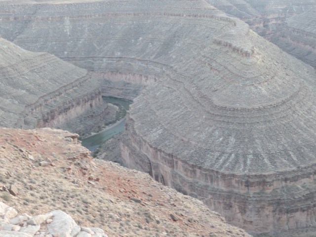
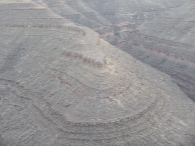
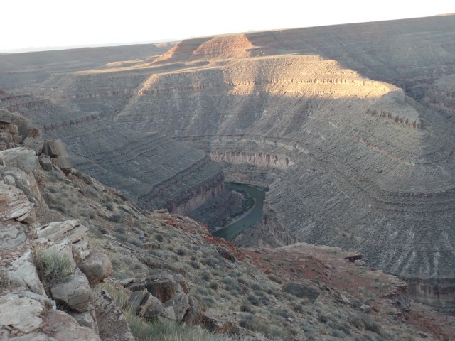
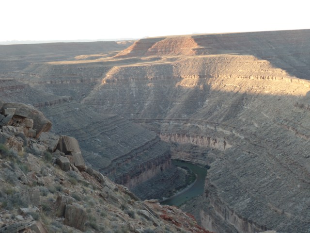
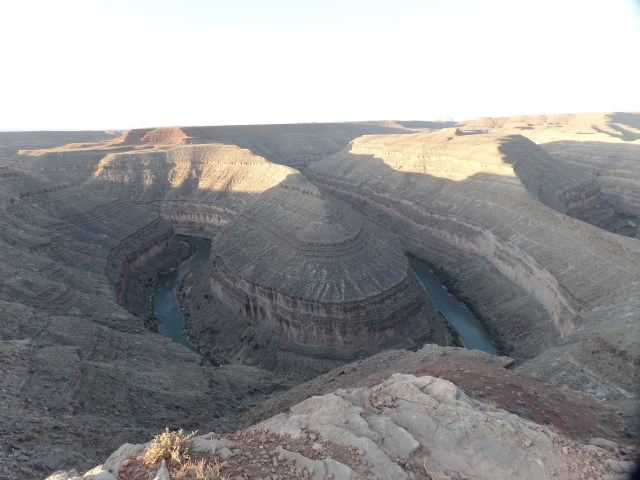
There have been several goals that I have kept on embers, for several years now.  Camping out, above the Goosenecks of the San Juan River, is one of these.  The otherworldly ambiance of this unique landscape has captivated me, every time we passed by there, en route to visit the Dineh of southeast Utah.

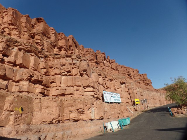
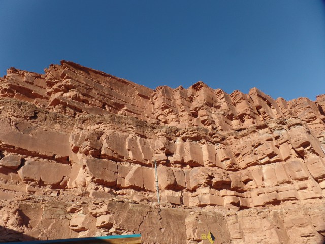
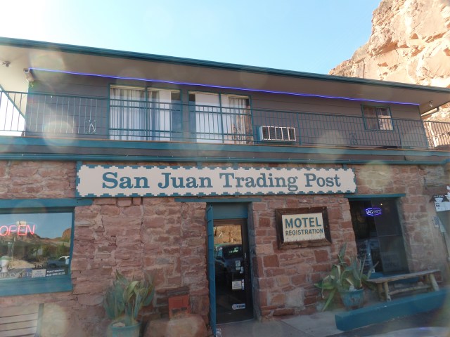
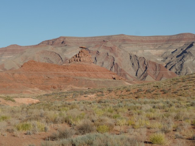
Once out of Monument Valley, one comes upon Mexican Hat, a small, mainly Dineh town that offers astonishing cliffs, a small, expensive motel and a fairly economical cafe.  I enjoyed dinner there, then pursued my camping option.

SAMSUNG CAMERA PICTURES

SAMSUNG CAMERA PICTURES

SAMSUNG CAMERA PICTURES

SAMSUNG CAMERA PICTURES

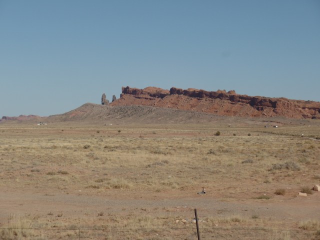
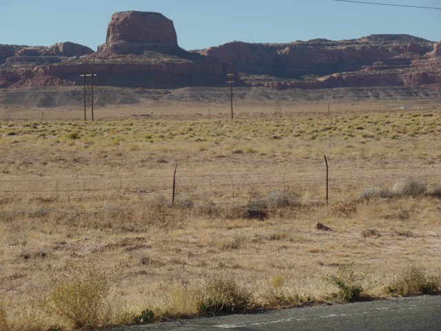
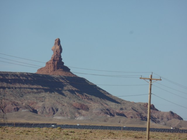
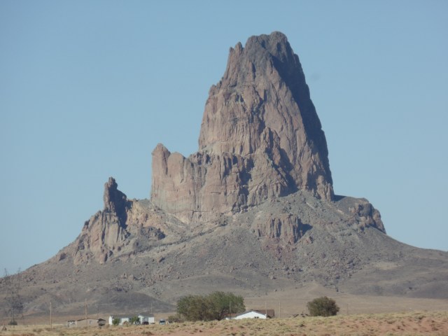
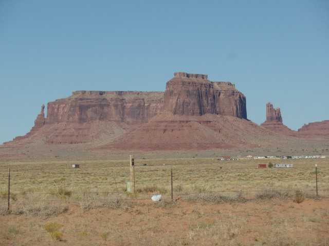
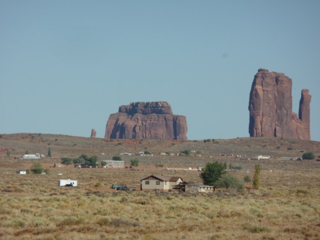
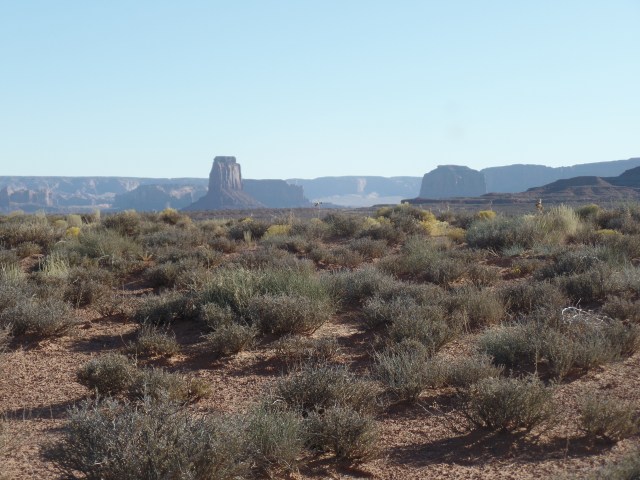
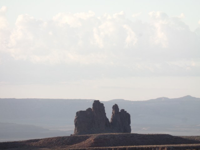
Small outcroppings of Monument Valley appear to the southeast of Mexican Hat.

SAMSUNG CAMERA PICTURES

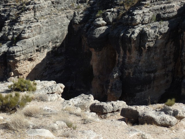
Three miles due east of the town, I turned left, drove three miles north and came upon the Goosenecks.

SAMSUNG CAMERA PICTURES

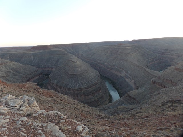
As the soil at the campground is powdery, for at least a foot down, I opted to sleep under the stars.  It was a bit chilly, towards morning, but the brilliance of the stars and the sheer stillness of the place made it more than worthwhile.  I felt there were two rivers, one below and the other above.

SAMSUNG CAMERA PICTURES

SAMSUNG CAMERA PICTURES

SAMSUNG CAMERA PICTURES

SAMSUNG CAMERA PICTURES

SAMSUNG CAMERA PICTURES

SAMSUNG CAMERA PICTURES

SAMSUNG CAMERA PICTURES

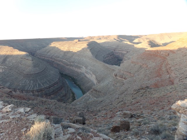
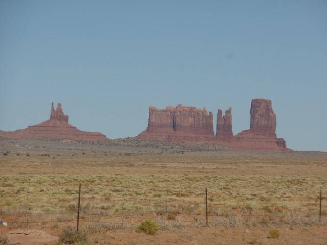
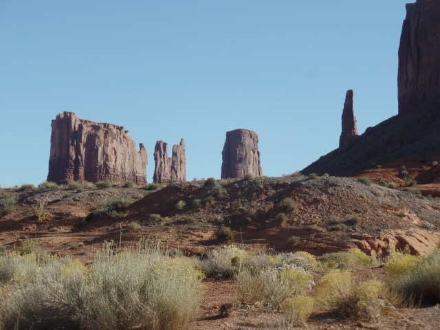
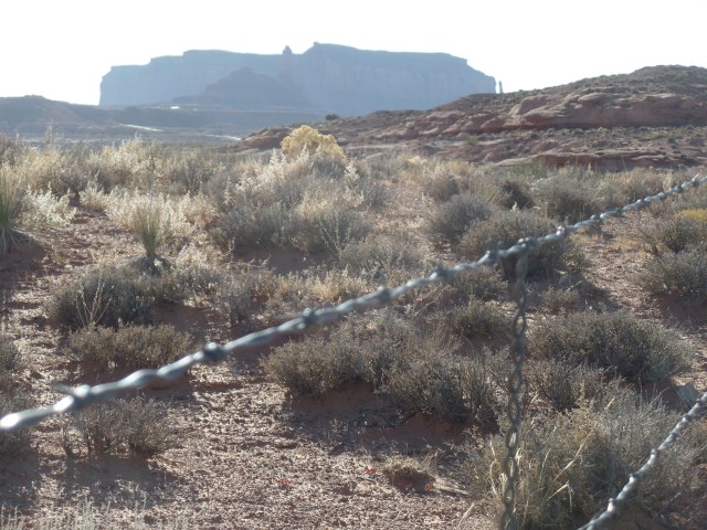
The easternmost promontory of Monument Valley is visible to the south.

SAMSUNG CAMERA PICTURES

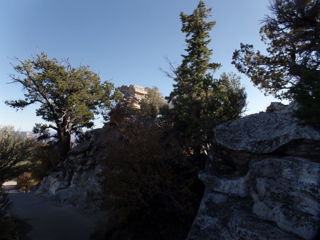
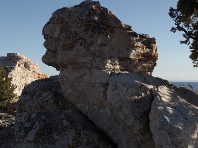
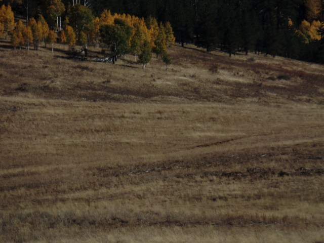
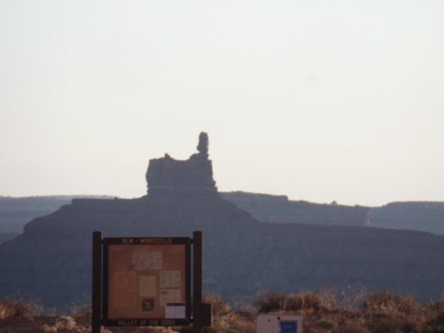
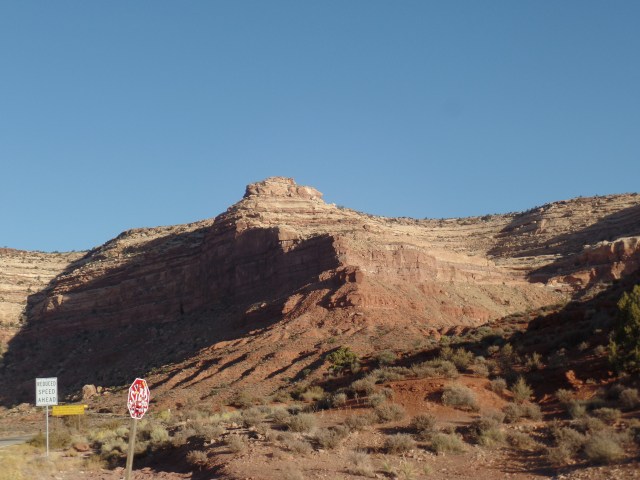
Once morning arrived, I greeted a few of the other campers, ate some stale leftover cinnamon buns and called it breakfast, changed clothes in the port-o-potty and headed uphill, to the Valley of the Gods.  This small, unorganized park is accessible by gravel road, just before engaging the 3-mile series of narrow switchbacks which leads to Natural Bridges National Monument.  I opted to take several photos from the side of the road.

SAMSUNG CAMERA PICTURES

SAMSUNG CAMERA PICTURES

SAMSUNG CAMERA PICTURES

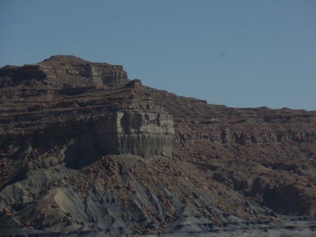
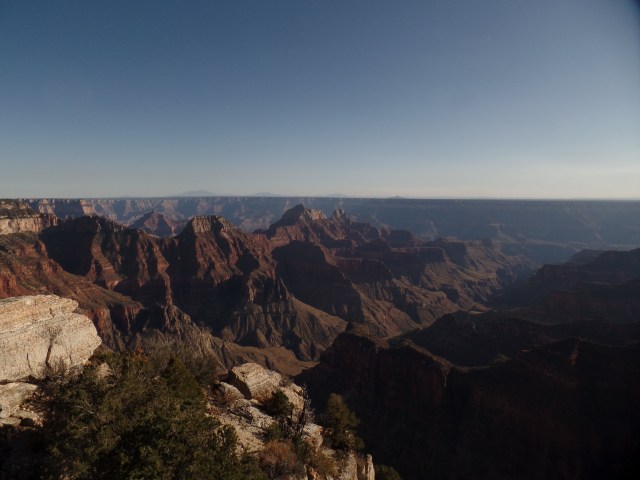
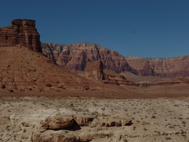
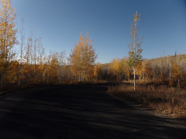
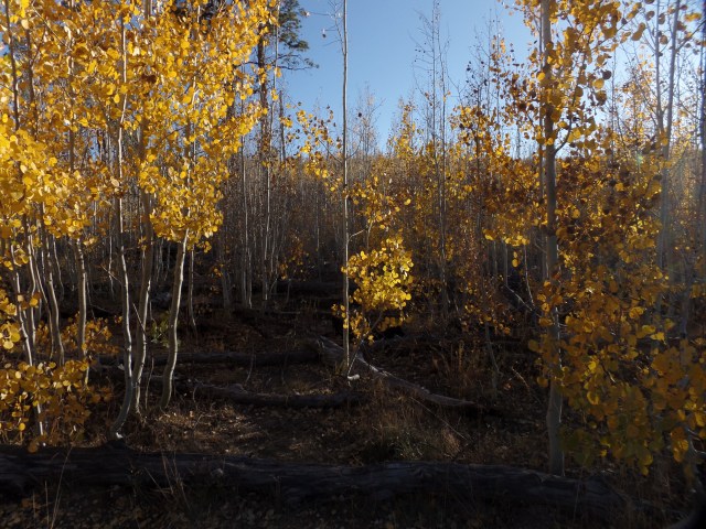
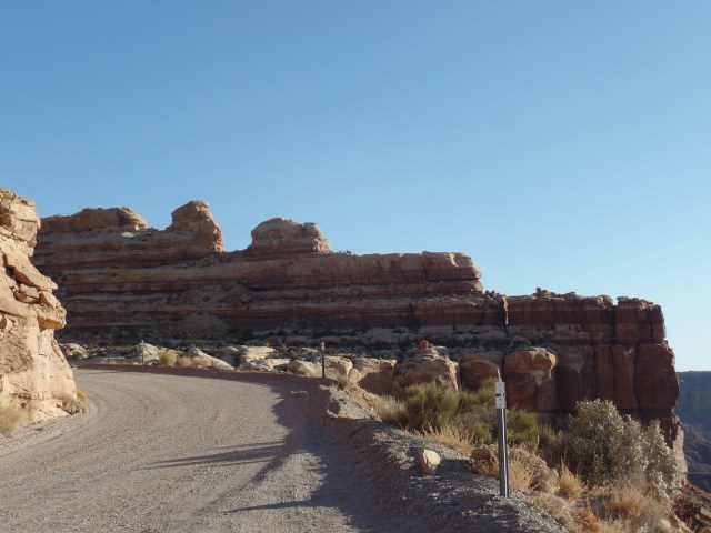
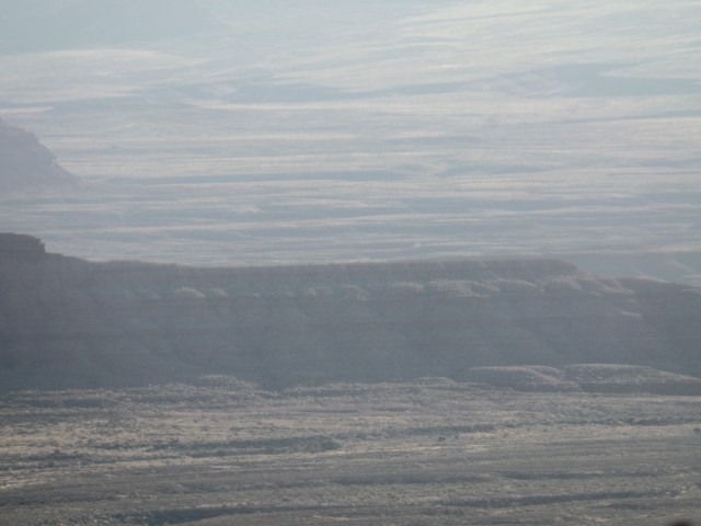
The last two photos were taken from turnouts, along the switchbacks.

SAMSUNG CAMERA PICTURES

This view of the area was made even more otherworldly by the early morning cloud cover.

SAMSUNG CAMERA PICTURES

In about twenty minutes, I had scaled the switchbacks in my Elantra and was en route to Natural Bridges.  I look forward to returning to this area again, in the near future.


The Grandeur of Monuments in Red

6

October 7, 2019, Mexican Hat, UT-

Several years ago, Penny and I took a guided jeep tour of Monument Valley, another of the Southwest’s signature geological wonders.  We encountered rock formations which resembled all manner of creatures, both past and present. There are, of course, myths and legends which explain these formations, though geology does quite well to keep things in the realm of reality.

My drive along U.S. 163, in northeast Arizona and southeast Utah, offered a glimpse of the formations which are visible from the road and some of which allowed for a better view, from overlooks.

The Mittens and Agathla Peak are the southernmost, and among the most famous, of the “monuments”, which are mostly sky islands that remain from the Oligocene Period, nearly 25 million years ago.

SAMSUNG CAMERA PICTURES

Various ridges also remain from  the Oligocene.

SAMSUNG CAMERA PICTURES

SAMSUNG CAMERA PICTURES

This pinnacle resembles an otherworldly sentinel.

SAMSUNG CAMERA PICTURES

Agathla is 7055 feet in elevation.  It is what’s left of  an ancient volcano.

SAMSUNG CAMERA PICTURES

This butte is also part of the same dormant volcanic outcropping.

SAMSUNG CAMERA PICTURES

Second from right, the column looks like two spouses, engaged in a conversation.  The column to the far left resembles two onlookers.

SAMSUNG CAMERA PICTURES

No matter how captivating and iconic the red columns and benches look, one must always remember that this is a working environment.  Ranching is a huge enterprise for Dineh people, struggling to thrive in an extremely arid environment, with poor soil.

SAMSUNG CAMERA PICTURES

SAMSUNG CAMERA PICTURES

As the valley rises, and gets closer to the San Juan River, the promontories become more spread out, but no less majestic.

SAMSUNG CAMERA PICTURES

SAMSUNG CAMERA PICTURES

SAMSUNG CAMERA PICTURES

SAMSUNG CAMERA PICTURES

Monument Valley, even fenced off, has a decluttering effect on one’s psyche.


And The Bears Came

8

October 15, 2019-

On Saturday evening, after I had put in about 7 hours of volunteer work in the kitchen at Arcosanti, I drove back to Prescott, with the intention of helping someone else with an early morning project.

There was a lot of energy generated that night, at Arcosanti.  Some of it found its way to me, at my Home Base.  in the prime dream time that is the early morning, I had a lucid dream that a group of children were in my apartment.  We had enjoyed a small celebration of sorts, and were looking out the window, when I spotted a large, shaggy brown bear heading into the neighbourhood. (We don’t have brown bears here, although the occasional black ursines show up, in the areas near the mountains.)  Kids ran, screaming, into nearby houses, and some came here.  Several more brown bears came, some walking on their hind legs. (Bears do not customarily run in groups.)

I found myself talking, through the closed window, to the bears which were approaching my place.  They understood my firm tone and went away.  One small boy called to  me and said that some “wind energy” had just messed up my bed. As no one had been in my bedroom, it was rather stunning to see that the previously well-made bed was indeed messed up.  I looked out the back window, and saw three more brown bears standing outside, with a nineteen-foot-tall figure, who resembled a character from the Transformers movies, in their midst.  I spoke to the tall figure, and it collapsed.  The bears then dropped to all fours, and went away.

I interpret this dream as meaning that there may be a time, soon, when I will need to safeguard vulnerable people, and speak truth to power.  Ironically, the bear, along with the tiger, is my spirit animal.

Glen Canyon’s Legacy

4

October 7, 2019, Page-

Leaving the pleasant Utah border town of Kanab, after a good night’s rest and getting myself a neck pillow (replacing the one left behind in Pennsylvania, last summer), it seemed like a good time to stop a few places in the basin of Glen Canyon.  The area is now best known for the resorts and water-based recreation of Lake Powell.

Just shy of the Arizona state line, lies the former polygamist community of Big Water, UT.  It is now an industrial zone and a research center for the Bureau of Land Management.  The BLM has an interesting Visitor’s Center there, with much research on the fossil remains found in the cliffs shown below.

SAMSUNG CAMERA PICTURES

SAMSUNG CAMERA PICTURES

Ceratopsians, and their close relatives, are a major focus of the paleontology that has been done here. There is a well-illustrated display, which explains quite clearly the various members of this group of dinosaurs.  As is commonly known, what is now the Great Basin was once a large inland sea, separating  large peninsulas of present-day North America.  Ceratopsians, Mosasaurs and Icthyosaurs, along with giant crocodiles and sea turtles, were abundant here.

SAMSUNG CAMERA PICTURES

SAMSUNG CAMERA PICTURES

Note that there are three types of Ceratopsians, distinguished by the length and breadth of their snouts, as well as the complexity of their cranial armor.

SAMSUNG CAMERA PICTURES

Centrosaurs had narrow, short faces and simple armor.  Chasmosaurs had broad, long faces, with elaborate armor.

SAMSUNG CAMERA PICTURES

After examining the details of the paleontology being done at Big Water, I headed a few short miles to Wahweap, a resort area long Lake Powell’s western shore.  The lake views are refreshing, but strangely, Wahweap’s restaurant is closed for the season.

SAMSUNG CAMERA PICTURES

SAMSUNG CAMERA PICTURES

A good zoom view of Navajo Mountain, some thirty miles northeast, is available from Wahweap.


SAMSUNG CAMERA PICTURES

Feeling somewhat famished, I stopped in Page, the town which grew as a result of the building of Glen Canyon Dam, and enjoyed a hearty meal of barbecued pulled chicken, with potato salad, at this fine and popular restaurant.

SAMSUNG CAMERA PICTURES

Rarely does the Lone Ranger share space with a Hopi kachina, but that is what one might expect in Page, a welcoming resort town that makes the most of Lake Powell.  Page, Wahweap and about six other marinas reap the benefit of Glen Canyon Dam’s having “tamed” the Colorado River.  There are plenty of people who depend on the Dam and Lake Powell, for their livelihoods.  There are many others who think, as did the late Edward Abbey, that Glen Canyon was perfectly fine, both ecologically and economically, without any tampering.  I think that, had there not been a dam, Page might have become like Moab or Durango, and grown as a haven for the many who enjoy the still formidable canyon.


Resurgence

2

October 14, 2019, Arcosanti-

The first sentient being to greet me,

this morning, was my friend Pam.

It was a silent greeting,

each  of us stretching,

across the courtyard,

of the sleeping area,

known as the Vaults.

There were about twenty of us,

some, like Pam and me,

in our own singular spaces,

and responsible for

our own warmth.

Others coupled,

keeping each other warm

against the early morning chill.

Each of us dreamed,

many lucidly.

I resolved an old conflict,

wondering why fault had been

continually found with me,

all those years ago.

The answer came,

in my lucid dream,

and I was absolved,

set free,

with a new understanding

of why a beloved soul

had been so quick to judge,

back then.

It is always pain,

that brings this on.

When the pain is gone,

so is the blame.

The second sentient being to greet me

this morning,

was a peregrine falcon,

whom I will call Percival.

He perched on the rail,

outside the central kitchen,

and took in our shared morning world.

I sat and did the same,

for several minutes.

This, we can learn from animals.

The morning ever brings resurgence.

Twelve Cypresses

2

October 13, 2019, Arcosanti-

The account of last week’s travels has been pre-empted by revelations that came, duirng a meditation session, this afternoon.

Twelve cypress trees grace the outside of the Vaults.

As I lay in meditation,

gazing upward,

towards their midst,

the middle tree was swaying.

Responding to the breeze,

to the intonation

of a meditation master’s

spoken word,

to the positive thoughts

of those in the circle below.

Soon, the trees on either side

of the intrepid conifer

were swaying,

in unison with their peer.

Soon, I was chanting

in unison with the rest of the circle.

We brought the feeling,

the awareness,

to each of our body’s parts.

The trees brought the sense

that a change was taking place.

in the air,

in the sensitivity,

of those gathered

at their feet.

Those who were friendly

last year,

are somewhat less so.

Others have taken their places.

The twelve cypresses

tell those who are listening,

and watching,

that there is power

in proximity,

even while there is strength

in a short distance.

There is power in unified action,

but uniformity

of behaviour

can detract,

from community.

Those who led me to

a positive sense of self

are moving away.

Those  who are with me now,

are the beings

who will be at my side

for a  stage of growth

which I am only beginning

to understand.

The twelve cypresses

make clear,

that the flexible

yet firm

will endure.


The Peak of the Canyon: Part III

2

October 6, 2019, Jacob lake-

I came to the highest point of the Grand Canyon of the Colorado River, a bit earlier than planned.  My initial goal of hiking the Uncle Jim Trail, in honour of my late uncle, met up with the reality of approaching sunset.  I decided to head for the twin high spots, Point Imperial and Cape Royal, instead.

Point Imperial, the eastern flank of the North Rim, gazes towards the Navajo Nation and the various smaller canyons of the Paria River basin and House Rock Valley.  Such Grand Canyon landmarks as Vishnu Temple and Desert View Tower may be seen from here. The shadows were creeping in,though, so that added to the sense of grandeur.

SAMSUNG CAMERA PICTURES

SAMSUNG CAMERA PICTURES

SAMSUNG CAMERA PICTURES

SAMSUNG CAMERA PICTURES

A soldier is, of course, watching.  This is also the best spot on the North Rim from which to get a clear view of the Colorado River.

SAMSUNG CAMERA PICTURES

The striation of the entire canyon wall may still be discerned, layer by layer.

SAMSUNG CAMERA PICTURES

It appears that the various peaks are lined up, almost directly, north to south, across the canyon.

SAMSUNG CAMERA PICTURES

Seeing the shadows lengthening, I headed west, towards Cape Royal. It was this leg of the trip which reminded me that I am living in a society that often knows only “full speed ahead”.  The professional photographer, whom I mentioned a few posts ago, was on my tail, the entire fifteen miles.  We both made our goals, though, so the forty mph zip was an odd footnote.

One side feature, along the Cape Royal trail, is Angel’s Window, an eroded spot in the middle of  a sandstone promontory, on Cape Royal’s east side.

SAMSUNG CAMERA PICTURES

The Cape offers a full-on view of the Canyon’s majesty, even towards twilight, as it faces mostly west and south.

SAMSUNG CAMERA PICTURES

Below, is a better view of Angel’s Window.

SAMSUNG CAMERA PICTURES

SAMSUNG CAMERA PICTURES

Sunset was gathering.

SAMSUNG CAMERA PICTURES

SAMSUNG CAMERA PICTURES

There is always majesty in  the gloaming.

SAMSUNG CAMERA PICTURES

SAMSUNG CAMERA PICTURES

The final moments of a sunset confirm that all is well.

SAMSUNG CAMERA PICTURES

So, I bid farewell to the North Rim, for now.  Uncle Jim Trail still awaits-on June 3, which was his birthday.

NEXT:  The Legacy of Glen Canyon Dam


The Peak of the Canyon-Part II

4

October 6, 2019, Jacob Lake-

I made a silent promise to my long-departed maternal grandfather, whom I never met in this life, but who has appeared to me, a few times, that I would not give in to a more irrational level of acrophobia.  He has been one of my spirit guides, all these years, exhorting me to face life and overcome obstacles.  He and Grandma imparted that message to my mother and her siblings; an examination of their lives bears out  that exhortation’s fruits.

So, as I readied for visits to three of the overlooks at the North Rim of the Grand Canyon, there was no trepidation at engaging the heights of this wondrous place.  The North Rim exists at the highest point of the western Colorado Plateau. Had the canyon never been carved, one would face a 2,000 foot increase in elevation, from Tusayan to  the site of Grand Canyon Lodge.

SAMSUNG CAMERA PICTURES

My first order of business, after looking around the Lodge for a bit, was a walk out to Bright Angel Point.  As today was one of the most gorgeous Sundays in quite a while, there were dozens of people, of all ages, walking about or at least lounging on the Lodge’s patio, which also offers views of the canyon below.

Here are a few of those scenes available to the sedentary.

SAMSUNG CAMERA PICTURES

SAMSUNG CAMERA PICTURES

I then availed myself of a couple of overlooks, close to the Lodge.

SAMSUNG CAMERA PICTURES

SAMSUNG CAMERA PICTURES

SAMSUNG CAMERA PICTURES

SAMSUNG CAMERA PICTURES

Bright Angel Point involves a fairly strenuous hike, mainly due to the elevation.  Those with pulmonary issues do best to stick to the Lodge area. An intrepid woman using trekking poles made it half-way, before concluding it would be a mistake to continue.  There were several of us late middle-agers who made the walk, though, along with folks as young as five.

SAMSUNG CAMERA PICTURES

SAMSUNG CAMERA PICTURES

SAMSUNG CAMERA PICTURES

SAMSUNG CAMERA PICTURES

SAMSUNG CAMERA PICTURES

SAMSUNG CAMERA PICTURES

It was at the above guard fence that a little girl wanted to climb up, for  “a better view”.  You’d best believe her mother’s hands were firmly on her, for that exercise in bravery!

SAMSUNG CAMERA PICTURES

The various striations in the sandstone clearly show the levels it has taken, to build this most magnificent of geologic records.

SAMSUNG CAMERA PICTURES

In the next post, Point Imperial and Cape Royal offer a northeastern perspective of the Canyon’s wonders.


The Peak of the Canyon- Part I

6

October 6, 2019, Jacob Lake, AZ-

Sitting at the counter of the restaurant, in this gateway community to the North Rim of the Grand Canyon, I enjoyed a sandwich of “Leftover Jalapeno Meatloaf”-(a tongue-in-cheek expression, as the dish was freshly prepared) and bantered a bit with a somewhat surly young man, who definitely wished I wasn’t there.  Once he left, the waitresses seemed to relax and there was a light-hearted rest of my visit.  The food was very good.


It had been that kind of day, a blend of dealing with surly people and those who relaxed when the angry ones left.  A screaming woman, berating the disabled manager of the motel where I had stayed in Flagstaff, last night was replaced in my view by his head housekeeper, who helped the poor soul get his bearings.

This evening, just before sunset, I was being tailgated, at ten miles over the speed limit, on the narrow road leading to Cape Royal, where I was heading to take a photo of the sunset.  Turns out, the motorist with a hair-trigger temper was also heading to the Cape, to take a professional photo or two.  Once we got there, and he realized there was still time for his shoot, all was well.

In between, there were genuine moments of peace:  A crew of high school soccer players washed my car, as part of their fundraiser.  Then, it was off towards the North Rim, via a trio of scenic wonders, majestic in their own right.

Here are a few scenes of Marble Canyon, where I walked around Navajo Bridge, a New Deal project which replaced the ferry across the Colorado River.

SAMSUNG CAMERA PICTURES

SAMSUNG CAMERA PICTURES

SAMSUNG CAMERA PICTURES

SAMSUNG CAMERA PICTURES

Above, is Navajo Bridge, now a pedestrian walkway between Marble Canyon Lodge and a Navajo Artists’ Market.  Below, is the Colorado River.

SAMSUNG CAMERA PICTURES

After a Thor Burger, at Marble Canyon Cafe-and  pleasant conversations with the  mostly Dineh staff, I headed up the road a bit, to Cliff Dwellers, also mainly a place for Navajo jewelry to be sold.  It does have an astonishing series of boulders and rock formations, near what once was a settlement of Fremont people, who were mainly hunter-gatherers.

SAMSUNG CAMERA PICTURES

SAMSUNG CAMERA PICTURES

SAMSUNG CAMERA PICTURES

Vermillion Cliffs came next.  There are an unusually high number of retired people traveling, this time of year.  The warm weather has helped, as has the political tension in the country, which leads people to seek an outlet.  We know that travel is one of the best outlets for relieving tension.  There was certainly a time in my life, when that was so.  Vermillion Cliffs is one of the most popular areas for many seniors to visit.  A Road Scholars bus had just left the area, as I pulled in.

Here are some views of the cliffs and of a canyon that has been cut by the Paria River.

SAMSUNG CAMERA PICTURES

SAMSUNG CAMERA PICTURES

This sandstone spire reminded me a bit of Spider Rock-or maybe Darth Vader.

SAMSUNG CAMERA PICTURES

SAMSUNG CAMERA PICTURESSAMSUNG CAMERA PICTURES

All of this set the stage for my second-ever visit to the North Rim of the Grand Canyon, as an homage to the national park’s centenary.  Having visited the South Rim in April, it was an equal time matter.

The aspens and oaks are turning colour, so the approach to the Rim, itself, was a treat.  The area had been populated mostly with Ponderosa pine, but a fire in 2000 created a swath, into which aspen trees have taken root.

SAMSUNG CAMERA PICTURES

SAMSUNG CAMERA PICTURES

SAMSUNG CAMERA PICTURES

It was now time to take a look at the highest points of the Grand Canyon.


Goosenecks

8

October 8, 2019, Blanding, UT-

Last Saturday, evening, I watched an improvisational dance performance, called “River of Stars”.   The performance, by Human Nature Dance Troupe, of Flagstaff, came to mind again last night, as I chose to sleep under the stars, at Goosenecks State Park, near Mexican Hat, Utah.

Two rivers, one above, the other below,

give me solace.

The San Juan snakes around,

a series of limestone formations,

giving the impression

of goose’s necks.

It is a serene, sacred spot,

and I lie in a sleeping bag,

insulated from the cold,

whilst gazing up into

the river above,

a true River of Stars.

Constellations,

known to me

since my youth,

present themselves

as a constant flow.

The Moon is between us,

and the audible drone

of an occasional airplane

challenges my eyes

to find it,

among the shimmering

islets

in the celestial river.