Jewel of The Creek

6

November 4, 2017, Cave Creek-

I was due for another visit to SunFlour, today, but the notice was clear:  Closed for Vacation.  I wish the ladies a special, relaxing time-off.  Today is Wild West Day, in Cave Creek, and there is much that’s joyful about a visit to Local Jonny’s, especially in the evening, so off I went.

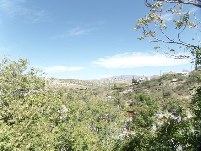
Looking for a trail, to get back in the groove, I followed Spur Cross Road, noticing a trail that hugged the road for about 1/2 mile, before veering off towards the mountains to the north of town.  I wasn’t going to take on a lengthy route, so on towards Spur Cross Ranch it was.

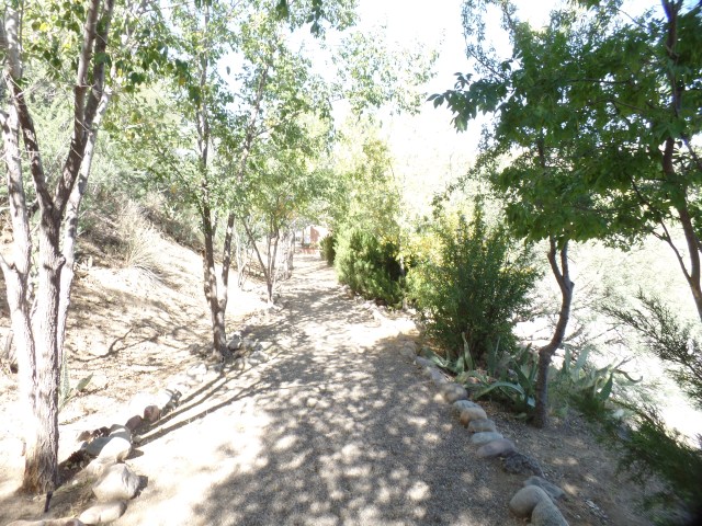
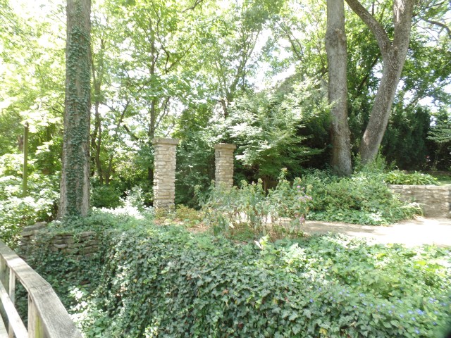
About 1/4 mile shy of the Ranch, I came upon Jewel of the Creek Preserve.  This 26-acre unit is owned by Desert Foothills Land Trust, which is dedicated to augmenting the conservation efforts of the State of Arizona and Maricopa County.

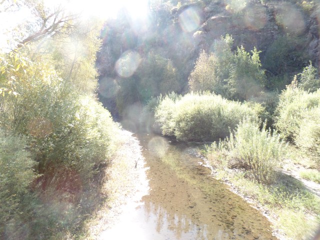
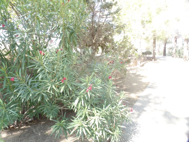
Dragonfly Loop turned out to be perfect, for what I wanted to accomplish.  I chose to stick with the eastern half of the Loop, and thus got some good vibes from the dry Cave Creek.  The trailhead is here, and I encountered a family of four, who were having a professional photo shoot, not far from here.

SAMSUNG CAMERA PICTURES

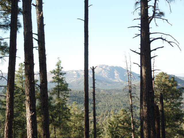
The mountains to the west are part of Cave Creek Regional Park, which also has Go John Trail, a moderate trail that introduced me to Cave Creek, two years ago.

SAMSUNG CAMERA PICTURES

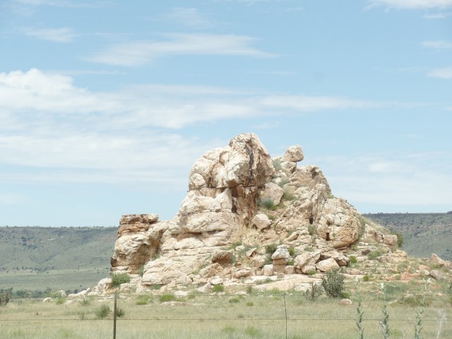
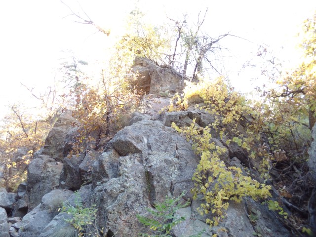
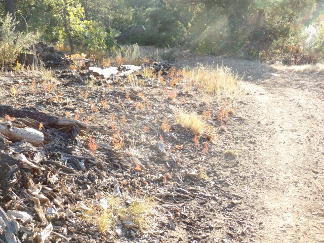
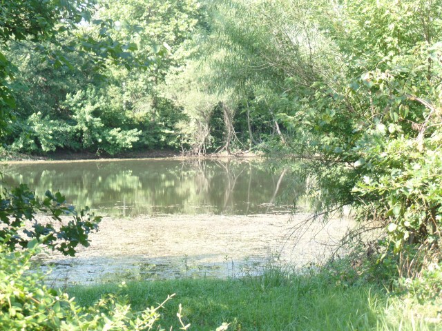
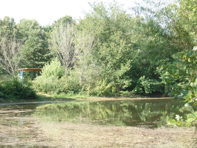
The area that is drained by Cave Creek features Gray Basalt steps and short walls.

SAMSUNG CAMERA PICTURES

SAMSUNG CAMERA PICTURES

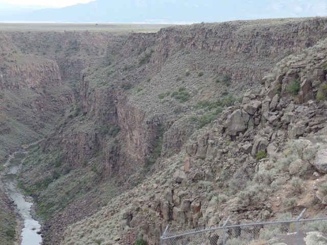
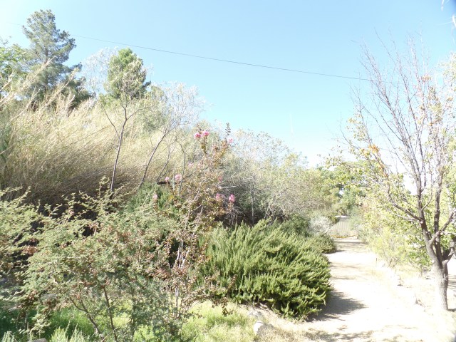
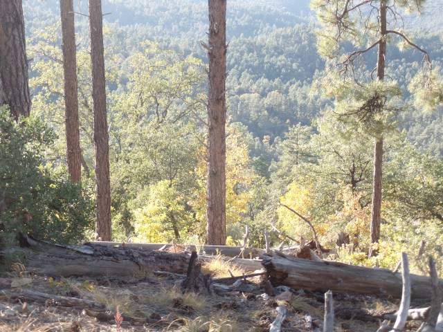
Here, the Dragonfly has a mild ascent, before going back down to Cave Creek, crossing the dry wash.  It’s not always so, but Aug-tober saw zero rainfall.SAMSUNG CAMERA PICTURES

SAMSUNG CAMERA PICTURES

Swallows and other desert-nesting songbirds have left for the season.  They left a couple of last season’s domiciles behind.

SAMSUNG CAMERA PICTURES

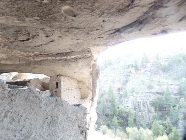
After passing by another hiker, who was reading passages from the Bible, I came upon this little cave, in the creek bed wall. No animal seemed to be using it as a den, but I didn’t examine the facility too closely.

SAMSUNG CAMERA PICTURES

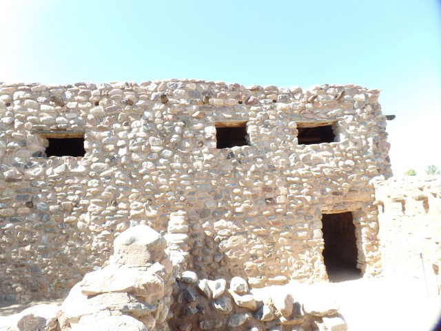
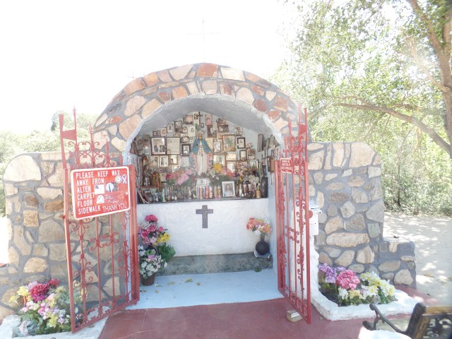
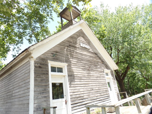
An abode of a different sort beckoned, just beyond the trailhead.   I believe this is the old Spur Cross Ranch House, now a caretaker’s residence.SAMSUNG CAMERA PICTURES

I will be back, over the next several months, to further explore the Preserves and Regional Park, as well as to give Local Jonny’s more business.  The slaw sliders, accompanied by mellow guitar tunes, were a perfect little ending to this exemplary Fall outing.

The Mogollon and Their Brief Haven

14

October 12, 2017, Gila Cliff Dwellings, NM- 

There are few places in the world that can claim a heritage that is chronologically brief, yet historically enduring.  I had the pleasure of being in such a place, this morning.

The Mogollon people lived in this rugged area for about 25 years, starting around 1200 AD.  Then, for reasons that may have ranged from drought to encroachment of other peoples, they left these cliff dwellings behind.

Here are several photos of the four inhabited high cliff caves, and the legacy of their only known inhabitants.  Note the charred ceilings and carefully built stone apartments.  I began by crossing this foot bridge, over a tributary of the Gila River.

SAMSUNG CAMERA PICTURES


SAMSUNG CAMERA PICTURES

The hike was 1/2 mile, up moderately steep switchbacks.  It took me about twelve minutes to get up to the dwellings.

SAMSUNG CAMERA PICTURES

SAMSUNG CAMERA PICTURES

Once on top, I passed by a cave that was never inhabited.

SAMSUNG CAMERA PICTURES

At cave 2, I was greeted by a volunteer docent, who explained that the community was organized into apartment units, with a common area for dining and religious gatherings.

SAMSUNG CAMERA PICTURES

Cave 3, the largest settled area, is accessible by ladder, as it was in the Mogollon’s time.

SAMSUNG CAMERA PICTURES

The curious T-shaped window afforded a broad view of the adjacent cliffs and a narrow enough egress, in times when cook fires were errant.

SAMSUNG CAMERA PICTURES

Note the remaining soot on the ceiling.  It is dated from the 13th Century.

SAMSUNG CAMERA PICTURES

This ladder is a Twentieth Century replacement for the log ladder, used by the Mogollon.

SAMSUNG CAMERA PICTURES

This is an example of the apartmental structure, in Cave 4.

SAMSUNG CAMERA PICTURES

The area below was a common gathering place, also in Cave 4.

SAMSUNG CAMERA PICTURES

Here is the eastward view that greeted the Mogollon.

SAMSUNG CAMERA PICTURES

SAMSUNG CAMERA PICTURES

SAMSUNG CAMERA PICTURES

Here is an apartment in cave 5, which is not accessible to the modern visitor.

SAMSUNG CAMERA PICTURES

Few pictographs remain, in the dwellings themselves, but here is one.

SAMSUNG CAMERA PICTURES

As with all parts of the mountain west, the Gila Wilderness has had its share of fire.  This is an area which burned in 2011. The gentleman at lower right, and his wife, are involved with the Everett, WA Botanical Garden, which I visited in 2015.

SAMSUNG CAMERA PICTURES

The Mogollon seem to have borrowed some construction techniques from the Ancient Puebloans, further northeast and from the Salado people, to the west.  Their ultimate fate remains unknown, though they seem to have made their way northward, after abandoning this site.

NEXT:  Silver City

Two Corners of Enchantment

9

October 24, 2017, Prescott- 

Whilst returning to this Home Base, in late July, I chose a route through the Oklahoma Panhandle, and into northeast New Mexico.  Bypassing the town of Clayton, I headed towards Folsom, a ghost town of sorts, whose approaches took me through some Badlands and the Cimarron Mountains, which eventually took me past Capulin Mountain- a National Monument where I hoped to stop for an hour or so.  Monsoon rains removed that possibility.

Here are a few views of the territory between Black Mesa, OK and Cimarron, NM.

SAMSUNG CAMERA PICTURES

The area south of Black Mesa is high desert, and full of rugged, little-traveled BLM roads. The rock formations, as elsewhere in the Southwest, seem to have petrified beings hanging about.

SAMSUNG CAMERA PICTURES

SAMSUNG CAMERA PICTURES

SAMSUNG CAMERA PICTURES

SAMSUNG CAMERA PICTURES

The pine-clad ridges took over, just northeast of Folsom.

SAMSUNG CAMERA PICTURES

So, too, did the monsoon rain.

SAMSUNG CAMERA PICTURES

I found Folsom not showing many signs of life, but several signs of history.

SAMSUNG CAMERA PICTURES

Below, is the former Folsom Hotel.

SAMSUNG CAMERA PICTURES

I briefly stopped in Cimarron, and later in Taos, which will each be places to revisit, in their own right, at a later date.

Here are two photos of each.

The St. James is Cimarron’s premier hotel.

SAMSUNG CAMERA PICTURES

SAMSUNG CAMERA PICTURES

Taos is known for its art and for upscale accommodations.  I like the down home aspects of the place.

SAMSUNG CAMERA PICTURES

SAMSUNG CAMERA PICTURES

My goal was to reach Prescott by the following morning, so I did not tarry in Taos, as tempting as it was.  I did briefly stop at another gem, not far from Taos:  Rio Grande Gorge.

SAMSUNG CAMERA PICTURES

Fast forward to October 11.  I passed the eastern Arizona towns of Safford and Duncan, heading towards AZ Rte 78 and US 180, which would lead me to Silver City, in New Mexico’s southwest region.

The Gila Wilderness lies between, and is every bit as rugged as the areas described above.

SAMSUNG CAMERA PICTURES

SAMSUNG CAMERA PICTURES

SAMSUNG CAMERA PICTURESSAMSUNG CAMERA PICTURES

I found my way, that night, to Tammy’s Cafe, in tiny Cliff, NM and a local man named Justin regaled me with stories of ranch life and the opportunities it availed, for random exploration of early American ruins, many on private land. Tammy’s had good food, as well, although the wait gave Justin nearly an hour to spin his yarns.

NEXT:  A continuation of this month’s trip to New Mexico:  Gila Cliff Dwellings

Besh Ba Gowah

8

October 11, 2017, Globe, AZ-

The Southwest is as abundant with remembrances of the past, as anywhere on Earth, and perhaps more than many places.  The various cultures and civilizations that came here, long before the Athapascans, the Comanches, the Utes, to say nothing of the Spanish and other Caucasians, will perhaps never be well understood.  I see, however, that in many ways, these distant ancestors of the Hopi, Zuni, Havasupai, Hualapai, Yavapai and Rio Grande Puebloans are mirrors of ourselves.  Visiting the Salado ruins at Besh Ba Gowah (Apache, for “Metal Camp”), I saw a carefully planned, apartment-based community, which relied on knowledge and cultivation of high desert plants, having drawn on the practices of the Huhugam and others who came here, well before the 11th and 12th Century heydays of the Salado people.

Here are a series of photos of the excavated and unexcavated ruins, the upper and lower gardens, of Besh Ba Gowah, lovingly restored and maintained by an appreciative City of Globe and its citizens.  I am not commenting on all of the individual photos, hoping that you may draw a sense of the vastness of this complex.

Entry to Excavated Ruins:

SAMSUNG CAMERA PICTURES

SAMSUNG CAMERA PICTURES

SAMSUNG CAMERA PICTURES

The Excavated Ruins:


SAMSUNG CAMERA PICTURES

SAMSUNG CAMERA PICTURES

SAMSUNG CAMERA PICTURES

SAMSUNG CAMERA PICTURES

SAMSUNG CAMERA PICTURES

SAMSUNG CAMERA PICTURES

Unexcavated Ruins:

SAMSUNG CAMERA PICTURES

SAMSUNG CAMERA PICTURES

Arizona Gray Squirrel, a bit mottled by the dryness.

SAMSUNG CAMERA PICTURES

Upper Ethnbotanical Garden:

SAMSUNG CAMERA PICTURES

Lower Ethnobotanical Garden:

SAMSUNG CAMERA PICTURES

SAMSUNG CAMERA PICTURES

SAMSUNG CAMERA PICTURES

Look closely, and spot a smiley face:

SAMSUNG CAMERA PICTURES

Besh Ba Gowah, and Globe as a whole, are nicely placed between Flagstaff, Phoenix and Tucson, making this stunning area a natural place, in which to enjoy a Fall day or three.

NEXT:  The Further Glories of the Gila Wilderness


Arizona’s Miami

6

October 11, 2017, Globe, AZ-

This old copper-mining community, near and in competition with, a town called Miami (pronounced my-AM-uh), was, in times long gone, a gathering place for foragers and for farmers.

I spent a fair amount of time in each town, today.  Starting at a small chapel in a canyon called Bloody Tanks, where a former professor of mine was born, some eighty years ago, I noted the fervour of the copper miners of Miami.  This chapel, dedicated to St. Mary, has the full protection of the townspeople, regardless of their individual faiths.SAMSUNG CAMERA PICTURES

Bloody Tanks has an interesting tributary of the Gila River, which itself figures prominently in my planned stops of the next day or so.  It’s dry here, as the big river is, around these parts.

SAMSUNG CAMERA PICTURES

SAMSUNG CAMERA PICTURES

Miami was very quiet in midweek.  It seems the majority of the town’s business, these days, is conducted along Highway 60, which runs clear across the Southwest.  Miami’s downtown, what there is of it, is largely a series of antique shops.  It would be a nice place to rejuvenate, but I prefer to see that revival run by locals- as is happening in Superior and Globe, on either side of the Cobre Valley.

A revival sparked by the Apache spirit would be a fine one.

SAMSUNG CAMERA PICTURES

SAMSUNG CAMERA PICTURES

The “can-do” spirit of people like Manuel Mendoza also does this town proud.  There are many who have carried on, based on his example.

SAMSUNG CAMERA PICTURES

SAMSUNG CAMERA PICTURES

SAMSUNG CAMERA PICTURES

After looking around downtown, I took a ride along the hill to the south of town.

SAMSUNG CAMERA PICTURES

From the south, one gets a good view of Miami’s extant copper mine,

SAMSUNG CAMERA PICTURES

as well as of ‘M” Mountain.

SAMSUNG CAMERA PICTURES

Our Lady of the Blessed Sacrament is the town’s most prominent church, highly visible from the south ridge.

SAMSUNG CAMERA PICTURES

Miami’s hills will, no doubt, draw me for further exploration.  It was time, though, to head on over to Globe’s tribute to its indigenous past:  Besh Ba Gowah.


Return to Wolverton Mountain

10

October 10, 2017, Prescott- 

I revised my Fall Break plans, a bit, so as to attend a gathering of Slow Food-Prescott, this evening.  it’s been a while since I’ve connected with that group, and missing two other meetings that I attend on a regular basis is an act of triage, so to speak.  So, Wednesday and Thursday will find me afield.

Getting back to the subject of the title, Prescott’s Wolverton Mountain lies about a mile south of Copper Basin Road, on the west side of town.  I passed by it, a year ago, whilst hiking the main part of Prescott Circle Trail, intending to come back and hike the spur trail, on an odd afternoon.

Sunday provided that odd afternoon.  I was just about done with the post-monsoon weed pulling, in my back yard, so it was high time to get back into the woods.  Up Copper Basin I went, and found the expanded parking area at Aspen Creek Trailhead.  The trail towards White Spar is across the road, taking the hiker to the junction with Wolverton Mountain Trail, 3/4 of a mile southward.

There is a smidgen of Fall foliage to be enjoyed, near a small rock outcropping and cave that lie along a tributary of Aspen Creek.SAMSUNG CAMERA PICTURES

Around a few corners and slight inclines, I located the spur trail leading to the south summit of Wolverton, after taking short bushwack to its trail-less north counterpart.  The north summit offers a fine view of Granite Mountain, always an inspiration.

SAMSUNG CAMERA PICTURES

You can see that Wolverton has been ravaged by bark beetles, in recent years.  Still, there was a stand of Fall colours, nearby.

SAMSUNG CAMERA PICTURES

The south summit proved a bit less impressive, but any mountain is worth exploring, at least once.  There is what appears to be a defunct watch station and water tank, carefully fenced-off.

SAMSUNG CAMERA PICTURES

It was a pleasant return to the trail, anyway, and the presence of a few late bloomers added to the sense of allure.

SAMSUNG CAMERA PICTURES

SAMSUNG CAMERA PICTURES

SAMSUNG CAMERA PICTURES

There are a few more local peaks, still on my radar- Hyde Peak and Pine Mountain being the most notable, and a return to Harquahala Peak, in La Paz County, beckons sometime this winter.

In the meantime, a two-day jaunt eastward will bring some treasures into view, followed by three weekends devoted to honouring the Creator and His Messengers.


There Is Perfection, In A Day

6

October 8, 2017, Prescott-

I am, in a manner of speaking,

taking the day off.

There was breakfast at the Legion,

this morning,

followed by laundry,

a phone conversation about

spiritual study, and

clearing this trusty laptop,

of old downloads.

It’s mid-afternoon

and the air is clear,

so I will, shortly,

head for a local trail

and indulge my legs,

my knees

and my back,

which have had

Planet Fitness,

the back yard,

the school gym and track

and little else,

to engage them,

these past few months.

Then, I will finish

my clearing the back yard

and pamper my back,

at Planet Fitness.

Be back, soon.


Polarities

2

September 10, 2017, Prescott-

I called my mother, to wish her a Happy Birthday.

She, to whom I was made to listen, for the first part of my life,

can now barely hear me, even when I am in full voice.

I pray her life will go on, for quite a few years yet,

and I will rely on the written word, to stay in contact.

The beaches of the Leeward Islands,

and the Florida Keys,

have taken quite a beating.

The emerging forests of Greenland,

just now rising from the Ice Cap,

are ablaze,

before they can even reproduce.

Disney World is closed,

and the lakes of The Villages

resemble mini-seas.

The Mediterranean, meanwhile,

is a lake surrounded by fire.

It’s being said that the Feds

are probing the ionosphere,

and that this may aggravate

climate change,

by pushing air currents

down into the stratosphere.

Meanwhile, we still

have relatively scant knowledge,

of our ocean depths.

These things cross my consciousness,

as I ponder whether

to go back outside,

and clear more weeds.

The Hollow Brings Fullness

15

July 25, 2017, Mooreland, OK-

I have a penchant for finding lush canyons and small forests, in places that are mostly noted for being “featureless”.  Nowhere is featureless.  The scoured and glaciated plains of Kansas are punctuated by riparian arroyos, which offer a pleasant break for the distance traveler, as well as a hangout spot for local youth.  One such is The Hollow, in Sedan, about which, more in a bit.

I decided, after breakfast with my cousin, Lisa, to forego the Oklahoma Turnpike and take US 166 across southern Kansas.    My first stop was in Baxter Springs, which celebrates its tie to the Mother Road.  Another shutterbug, a young lady, was quietly taking in the even quieter scenes of downtown Baxter, as I checked out “66”.

SAMSUNG CAMERA PICTURES

SAMSUNG CAMERA PICTURES

SAMSUNG CAMERA PICTURES

I had miles to go, as yet, so I left Baxter Springs, after about twenty minutes, continuing on through bustling Coffeyville.  Sedan, though, called out to me, to take the right turn into town, where I spotted a sign for “The Hollow”.  This town is known for its “Yellow Brick Road”.  A couple of teen girls, very much owning downtown, at this mid-day, sauntered down the yellow bricks, not long after I took this shot.

SAMSUNG CAMERA PICTURES

Sedan also is notable for a museum dedicated to Emmett Kelly,  a famed circus clown of the 1930’s-60’s.  Emmett was a native of Sedan, so his statue stands in The Hollow Park.

SAMSUNG CAMERA PICTURES

Some elements of The Hollow are vintage Great Plains:  There is the old St. Charles school house.

SAMSUNG CAMERA PICTURES

There is also the requisite gazebo, but with a pointed twist.

SAMSUNG CAMERA PICTURES

I can sit in gazebos for hours, but this time, forty minutes for lunch and contemplation were enough.  I wanted to have a few minutes with the hollow itself.  An iron ring, extracted from the creek, when the junkyard, which once occupied this land, was being cleaned up, is interposed between school house and gazebo.

SAMSUNG CAMERA PICTURES

The garden area of The Hollow is marked by ruins of the junk yard office, of all things. The boardwalk leads through the garden, and down to the arroyo, which has a waterfall, in times of heavy rain.  There was no waterfall today, though.

SAMSUNG CAMERA PICTURES

SAMSUNG CAMERA PICTURESSAMSUNG CAMERA PICTURES

SAMSUNG CAMERA PICTURES

SAMSUNG CAMERA PICTURES

This little spot reminded me of small crevices that I used to fancy my “caves”, when I was a little boy in Saugus.

SAMSUNG CAMERA PICTURES

Here, the official trail ends, but I am willing to bet that there are plenty of kids who have made their way quite a bit further north, along the creek bed.

SAMSUNG CAMERA PICTURES

My Sedan visit was capped by a salad bar and sandwich lunch, at Seasons Rotisserie, a solid little place, with a handful of regulars, three of whom had just returned to Sedan, from several years elsewhere.  Two sisters, from Ohio and Pennsylvania, were on a road trip as an homage to their late father, who grew up in a small Kansas town.  They were visiting several such towns, in Kansas and Oklahoma.  I was glad to be able to tell them about The Hollow.

This part of Kansas is favourable with hunters, as is illustrated by this acrylic painting, on Seasons’ wall.

SAMSUNG CAMERA PICTURES

I later learned that there is a sizable property, Red Buffalo Ranch, that caters to outdoorsmen.   If you happen by Sedan, the ranch is, no doubt,  also worth a visit. I might check it out, one of these trips.

Arkansas City (pronounced the way it looks), saw me pass through, without so much as a by-your-leave. It was getting late, and  I was concerned about checking in with my friend, J.E., in Enid, OK.  He is hanging in there.  I also wanted to stop in at Da Vinci Coffee Shop, as the owners were such welcoming hosts, the last time I was there.  I needn’t have bothered.  The owners weren’t there, and the baristas were a bit surly and suspicious of me and my out-of-state car.  You never know who will greet you.

After several minutes talking with John, I headed further west, to Mooreland, which is just shy of the northwest Oklahoma cow town of Woodward.  Mooreland Motel and Cafe is run by a tough, but gracious, grandma, who proudly showed me pictures of her “babies” and said she was closing for the night, so she could go be with them, and I would be the last guest to check in.

I think I like Mooreland, quite a bit.


A Tale of Two Campgrounds

2

July 23-25, 2017, Sarcoxie, MO- 

My summer’s journey is winding down, with one last family visit, before I am back in the Southwest.  I chose Ferne Clyffe State Park, in southwest Illinois, for the night’s stay, after Paducah.  I could have stayed at a campground in Kentucky, but the urge for closing the gap won out, and I moved along, to the precincts of Dixie National Forest.  Ferne Clyffe’s fee collector was gone home, by the time I arrived, but other campers assured me he’d be there, bright and early, Monday morning.

I had a nice night, sleeping under the stars, with few insect problems.  This was the scene, as I waited for Chief Ranger to arrive, for my payment.


SAMSUNG CAMERA PICTURES

I then got on the road, looking for a little cafe, at which I might grab some breakfast.  It turns out the the local farmers all eat at home, so the nearest spot was the Nu Diner, in Cairo- about twenty miles to the southwest.  I’ve been to Cairo, six years ago, and made a more extensive visit to the town, at the time.  Despite its location, at the confluence of the Ohio and Mississippi Rivers, Cairo is fading, and the mayor, popping into Nu Diner, to greet his constituents, had few words of encouragement, at this point in time.  He knows what everyone else knows:  Jobs aren’t coming back, anytime soon.  I like the little town, and hope that hydroelectric, or some new technology, can   keep it going.  Cairo is not in the middle of nowhere- Paducah and Sikeston are each a half-hour away, in opposite directions.  (The waitress at Nu Diner allowed as how she finds going to Paducah a headache.  I guess it’s all in how one looks at matters.  Then again, I was there on Sunday evening, so I can’t speak about workaday traffic.)

SAMSUNG CAMERA PICTURES

Speaking of Sikeston, the bustling little city, at the top of Missouri’s Boot Heel, has Lambert’s Cafe (Huge, but sorry, I’m still full from a Nu Diner breakfast) and Jerry James Melon Stand, with huge watermelons to be enjoyed.  I picked one up, for Cousin Lisa and her husband, Curt.SAMSUNG CAMERA PICTURES

Driving across southern Missouri, I opted for state highways, and experienced a bit of what the locals are enduring, with ‘slow or no’ wireless fidelity, from Poplar Bluff to very near Springfield, nearly 200 miles.  This, to me, is a sign of things to come, should Net Neutrality be removed, and Internet Service Providers be allowed to charge extra for service that is now fairly standard, in much of the country.

I got into Sarcoxie, close to where Lisa and Curt live, around 4:30, catching a decent dinner at Hungry House, right off the freeway.  Then it was setting up camp at Beagle Bay Campground, on the other side of I-44.  The owner was a bit flinty-eyed, and looked at me with suspicion for a few minutes, before her husband came in and said I could use one of the “primitive” camp sites (as tent sites are known, in these parts).  There isn’t much primitive, about Beagle Bay.  There are showers, a game room and a stocked fishing pond.  I carefully set up camp, and repaired to the game room, to hook up my lap top and catch up on e-mail and other doings.

This morning (Tuesday), I checked out some of the campground’s features.  An old atrium has been preserved, just east of the main campground.

SAMSUNG CAMERA PICTURES

The family that camped next to me headed for the fish pond, early on, and I followed suit, though skirting their fishing stand, and taking in a few scenes of the pond itself.

SAMSUNG CAMERA PICTURES

SAMSUNG CAMERA PICTURES

SAMSUNG CAMERA PICTURES

I connected with Lisa, who expressed frustration at, TA-DA, her phone being out of order.  Now it was back in service, and we met at Hungry House for breakfast and catching-up on Boivin family happenings.

SAMSUNG CAMERA PICTURES

I like having family here and there, in various parts of the country, and it’ll be all the more enjoyable, over the next few years, as I head back and forth, in summer.  Then again, I’m hardly ever isolated, with a network of reliable friends.  So, I think I will see what southern Kansas has to offer, before dropping down to Enid, and looking in on an old friend.

NEXT:  Baxter Springs and Sedan