The Road to 65, Mile 330: Prescott Circle Trail, Segment 8

10

October 24, 2015, Prescott- I spent a few hours walking the shortest segment of PC, from Willow Lake to Peavine Trail Head, alongside the north and west shores of Watson Lake.  This older and smaller of the twin reservoirs is bounded by  Granite Dells, to the north, Glassford Hill, to the east, and Granite Creek, to the south and west.

The first part of the segment follows Willow Lake Road, away from Willow Dells, to Highway 89, which I crossed, just north of a roundabout, when the near constant flow of traffic was abated, courtesy of traffic signals, some distance away, in either direction.  Highway 89 is a four-laner, and has crosswalks, so no overpass is needed.

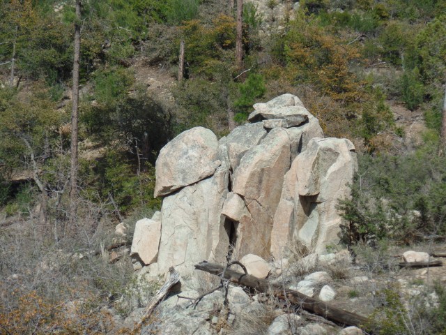
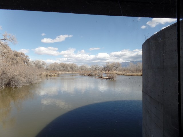
I then came to Watson Lake Park, one of my favourites here.  The Dells make it an especially otherworldly place.

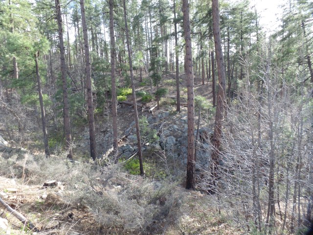
SAMSUNG CAMERA PICTURES

SAMSUNG CAMERA PICTURES

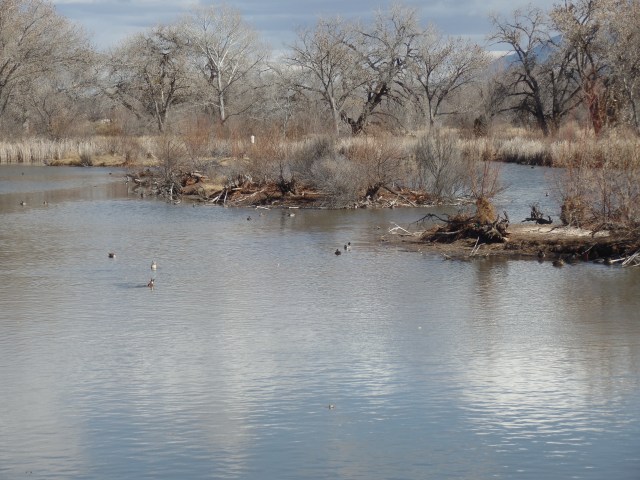
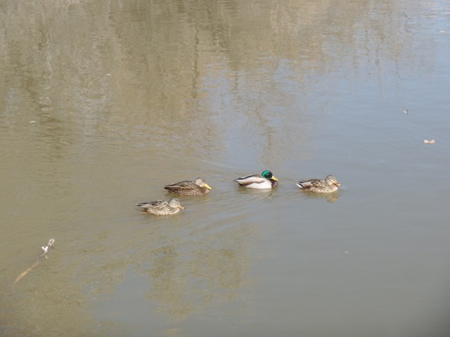
The trail took me away from the Dells, for a bit, along the west shore, where waterfowl were abundant.  Two Greater Sandhill Cranes were among the crowd.

SAMSUNG CAMERA PICTURES

SAMSUNG CAMERA PICTURES

SAMSUNG CAMERA PICTURES

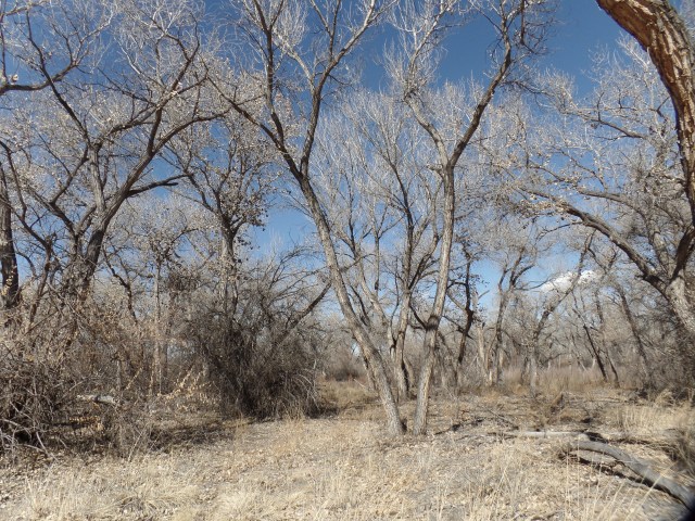
As you can see above, at first, the female was being rather coy.The riparian trail then went off into the marshy terrain near Granite Creek, which is rather paltry at present.

SAMSUNG CAMERA PICTURES

SAMSUNG CAMERA PICTURES

Upon coming to the rather mundane Peavine Trail Head, I resolved to return there and resume my hike, with segment 7.  Ambling back to Watson Lake, I spotted a lone kayaker.

The surreality of the Dells never gets old, so here we are again.

SAMSUNG CAMERA PICTURES

Next up:  The Peavine Trail Head to Highway 69. (First half of Segment 7).

The Road to 65, Mile 318: Prescott Circle, Segment 9.

6

October 11, 2015, Prescott- The air was a bit warmer and drier today- 82, in mid-afternoon.  I had two gallons of water with me, so after tending to chores and visiting with friends, I headed out for the second installment of Prescott Circle.  This jaunt took me from Pioneer Park Ballfield, through a stretch of Gambel’s oak and juniper pine forest, on the campus of Embry-Riddle Aeronautical University, to Willow Lake, a man-made reservoir that is lined by cottonwood trees.  The lake area used to be the site of a Sinagua settlement, when Willow Creek was freely-flowing and there was plentiful game in the nearby Willow Dells, a western extension of the granite boulders that abound in northeast Prescott.

Now, one must go underneath the busy thoroughfare of Willow Creek Road, and cross two dirt fill yards, to get from the Embry-Riddle Preserve to the marshland that is drying up, south of Willow Lake.  I have hiked out to the lake shore, and had to walk logs, in order to hike the 1 1/2 mile round trip on Cottonwood Peninsula Spur Trail.  Today, the lake was a shadow of itself.  Hopefully, late Fall and Winter will bring a wet change.

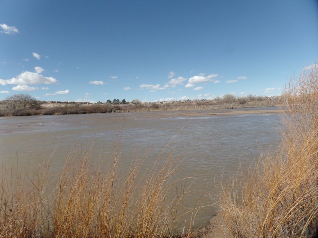
Here are some views of the scenes I encountered, going all the way to the Willow Dells parking area., a distance of 8.8 miles, round trip.

SAMSUNG CAMERA PICTURES

SAMSUNG CAMERA PICTURES

SAMSUNG CAMERA PICTURES

SAMSUNG CAMERA PICTURES

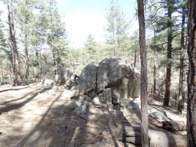
There are frequent maps, by which to chart one’s progress.  This one was at the turnaround point of my hike.
SAMSUNG CAMERA PICTURES

Here is the entrance to Cottonwood Peninsula Spur Trail.

SAMSUNG CAMERA PICTURES

Here is a shallower Willow Lake, at the Dells.

The Road to 65, Mile 317: Prescott Circle, Segment 10.

5

October 10, 2015, Prescott- I took three hours, this afternoon, to begin my series of hikes around Prescott Circle.  It is a 51-mile loop, that connects several of our area’s natural wonders.  As is my wont, I am doing the circuit in clockwise fashion.  So, I started with Segment 10, which takes in a very familiar stretch:  Pioneer Park.  This is a huge greenbelt in northeast Prescott, with a rim trail that looks down on a series of groves, comprised of juniper pine and scrub oak.  The park has 9 miles of hiking trails, in addition to Prescott Circle, which goes along the park’s northern edge, then dips down and passes through Pioneer’s ball field, before continuing on.

SAMSUNG CAMERA PICTURES

SAMSUNG CAMERA PICTURES

The surrounding mountain ranges, such as the Bradshaws, background left, are all visible from the rim trail.

I have hiked in this area several times, but looking at it as part of a whole gives Pioneer Park a fresher meaning.  The strength that comes from walking 9.6 miles round trip is an added benefit. Tomorrow, if my chores and acts of service are done, I will pursue the next segment, also in familiar areas:  The Embry-Riddle Forest Preserve and Willow Lake.

The Road to 65, Mile 313: Of Horses, Llamas and Bells

10

October 6, 2015, Sedona- After dealing with more computer work, regarding a legal matter, I headed out for a day’s respite, stopping first at Mortimer Family Farm, in Dewey.  The Fall is in full swing at this exhilarating place.  As you can see, the pumpkins,alone, will delight dozens of school children this season.

SAMSUNG CAMERA PICTURES

SAMSUNG CAMERA PICTURES

My other purpose was to pick up one of their delectable sandwiches, along with a piece of Pumpkin Pie Fudge and a mocha espresso, for a roadside picnic.  This ended up taking place at Crucifixion Point, a Forest Service Day-Use area, which was closed and locked.  Nothing prevented me from parking outside the gate and enjoying a pleasant meal, though.

Then, it was off to Sedona.  I stopped at the community college branch and inquired as to the road to Honanki, a Pueblo ruin on the West Side of town.  I was told that I was not to go in there unless riding in a commercial jeep.  I know this is a bunch of hooey, and figure the staff member must have some interest in the jeep outfit.  Rather than waste time, I headed to a tried and true hiking path: Little Horse Trail and Llama Trail.  Little Horse, which I last hiked three years ago, heads to Chicken Point (seen below) and Submarine Rock.

SAMSUNG CAMERA PICTURES

It also connects with a trail to the Chapel in the Red Rocks.

SAMSUNG CAMERA PICTURES

About 2/3 of the way to Chicken Point, I veered off Little Horse, and took Llama Trail.  This brings the hiker back around to the south, towards Courthhouse Butte and Bell Rock.  At one point, Llama Trail has one in a place that is equidistant from Cathedral Rock (west), Madonna and the Nuns (north), Courthouse Butte (east) and Bell Rock (south).  I chose that area to pray, take a drink from my water bottle and write reminiscences of my July trip to California.  Sedona has several vortices, and this felt like one of them.

While I was praying, I was greeted by some local residents.

SAMSUNG CAMERA PICTURES

Here are two shots of  Madonna and The Nuns.

SAMSUNG CAMERA PICTURES

SAMSUNG CAMERA PICTURES

Courthouse Butte is not to be outdone.

SAMSUNG CAMERA PICTURES

Nor are Bell Rock,

SAMSUNG CAMERA PICTURES

or Cathedral Rock.

SAMSUNG CAMERA PICTURES

Llama Trail ends at Courthouse Vista, about 1 1/2 miles south of where my car was.  So, in the interests of not being caught up in an approaching thunderstorm or out after dark, I took Bail Trail, a 1/4 mile connector, to Bell Rock Path, then back to Little Horse and my way home.

As it happened, I drove through the rain easily, and got home in time for another fine Arizona scene.

SAMSUNG CAMERA PICTURES

The Road to 65, Mile 305: Gran Forno

5

September 28, 2015, Prescott- One of my outwardly less successful endeavours, over the years, was my principalship at Chilchinbeto Community School, between Chinle and Kayenta, on the Navajo Nation, in northeast Arizona.  It was, in more ways than one, a matter of being in the wrong place at the wrong time.

One of the silver linings, in that dark academic year, 1998-99, was the presence of Youth Empowerment Services, and Tom Riggenbach, who was my second-in-command.  YES, led by Tom, has empowered the youth of the Navajo Nation, for nearly twenty years.  Their Chuska Challenge, a bicycle marathon, through some of the Nation’s wildest and most beautiful country, has brought people from the world over into contact with local youth, in a far more up-close manner than is provided by jeep tours through Monument Valley, or the purchase of a rug at Hubbell Trading Post.  The Dineh’s traditional love of running has also been rekindled, through efforts such as this.

Tom refers to the enterprise variously as Tour de Rez and Gran Forno (an Italian term for the type of bicycle marathon, typified by Tour de France.  The Chuska Range is not for the faint of heart, and Tom has never been in that category.  We didn’t always see eye-to-eye, in the tumultuous aforementioned year, but I always commanded his respect, and he, mine.  He has given a tremendous amount of his energy and drive to the betterment of thousands of Native American youth, and so it continues.

To the extent that I was able to encourage YES, and see the program expand throughout the Four Corners region, my time in Chilchinbeto was not misspent. I look forward to seeing many more years of Gran Forno in the Chuska.

The Road to 65, Mile 298: Equinox and Equity

4

September 21, 2015, Granite Dells-  I spent the evening of the Autumnal Equinox, observing the International Day of Peace, with a host of kindred spirits, enjoying the music of a local artist, Celia, and of our host, Johnny Light.

Heaven on Earth, where I find myself fairly frequently these days, is the home of John and his beloved, Happy Oasis, whose poetry is another draw to the blessed Dells- one of three “Rainforest”-type environments I have found in Arizona.  Johnny built the place himself, from the ground up, after their earlier home was leveled by a forest fire, little more than a year ago.

Celia was moved to thus dedicate a song to the victims of northern California’s ongoing wildfires, arguably the worst natural disaster we have had in this country, since Hurricane Katrina.  Over 23,000 people have now been displaced, with many living in tent cities.  Her song was simple:  “Rain”, chanted over and over, for about five minutes, with a Chilean rain stick furnishing the percussion.

John and Celia are each in superbly equitable relationships.  Many others in the assemblage, this evening, are in that situation, as well.  I enjoyed equity, in my marriage, and know that it is hard work.  It is also the most satisfying effort there is.  Yet, perhaps, Celia’s song, “Everyday Goddess”, puts the whole matter of gender and roles into perspective:  “It’s no big deal”.  If we just be, and not cast ourselves into untenable roles, then it seems that true equity will come about, as a matter of course.

I arrive at an exquisite realization, every time I set foot in Heaven on Earth.

The Road to 65, Mile 296: Where I Stand, Part 2

2

September 19, 2015, Prescott-  For the next several posts, I will be centering my comments on 16 principles, developed by Four Worlds International Institute, in Surrey, BC.  It is led by a man for whom I have a lot of respect:  Hereditary Chief Phil Lane, Jr., of the Blackfoot Nation.  All quotes herein are from the document, The Fourth Way:  An Indigenous Contribution to Building Sustainable and  Harmonious Prosperity in the Americas, Update, October 2008.

Nobody asked me to do this, but I share both genetic memories and spiritual values with the Aboriginal Peoples of the Americas, specifically with the Penobscot Nation, of central Maine.  There is no barrier between us, except those that people choose to put between each other.  So, let me begin.

Principle 1: “Human Beings Can Transform Their Worlds. The web of our relationships with others and the natural world, which has given rise to the problems we face as a human family, can be changed.” –  

The author, savant and change agent, Star Hawk, has written that, for Man to regard himself as divorced from nature, is an arrogant mindset.  In fact, we in our physical state are very much connected to the rest of Nature.  It’s pretty much a given, to me, that each and every thing we do in this life is a matter of choice.  Some choices are more difficult than others, but they still need to be made.  So, with regard to relationships with others, we can choose to respond to people, or to ignore them.  I have found that I can only ignore those who irritate or are disagreeable to me for just so long, before one or the other of us presses for a resolution. The converse is also true.

How much more is this true, with regard to nature.  One can, in the name of stockholder profits, order the spewing of poisons into the atmosphere, water and soil, for just so long, before the toxins find their way into the Web of Life- with cancer, dementia and neurological ills becoming pandemic.  One may, in the name of Science, release Genetically-Modified Organisms into the food chain, while demanding that the rest of the planet toe your line, or face crippling litigation.  Then, because living things are just not ready to digest your products and therefore, in the case of humans, RESIST purchasing them or, in the case of scavenging rodents, birds and insects, just IGNORE the stuff, you redouble your efforts, getting shills to write articles that ridicule those who won’t buy GMO’s, and prodding normally thoughtful, even-minded people to jump in the fray and try to analyze the case against your products, with a view towards “talking some sense into those who would starve humanity, for the sake of romanticism.”  Still, the illnesses, and the wreckage, pile up.

My plans, with regard to relationships, are these:

  1.  Accept all offers of friendship, unless and until such offers prove to be based on ulterior motives.
  2. Respect those, online and in real time, who indicate they wish me to not contact them, either for a time, or permanently.
  3. Be a trustworthy person, more than I have been towards some people in the past.
  4. Listen, listen, and listen some more.
  5. Own the mistakes I have made with people, and do better by them , and others.

My plans, with respect to Nature, are these:

1. Tend the seeds I have planted, in my back yard.

2.  Honour animal and plant life, wherever I encounter them.

3.  By all means, continue hiking and other acts of personal exploration, both in my home area and          further afield.

4.  Carry a trash bag in my pack, so that the unwarranted intrusion of the thoughtless may be mitigated.

5.  Recycle, as much as possible, while recognizing that not everyone regards this practice as truly beneficial to the Planet.

I have gone on longer than usual, but these matters are very basic to my human and natural states of being.

The Road to 65, Miles 246-7: The Spirit Has Many Homes

8

August 1-2, 2015, Hano Village-  By way of introduction, Hano is one of three villages atop the Hopi landmark known as First Mesa.  The twentieth-century town of Polacca, named for Chief Tom Polacca-ka, one of those who led the Hopi during the time of transition into a relationship with the U. S. Government, lies at the base of First Mesa, and is the locus of four schools, the Police Department,  the Tour Office, a post office,a small hospital, and an even smaller store.

I set out around mid-day on Saturday, and headed up to I-40, past Flagstaff and Winslow, to Holbrook, the seat of Navajo County.  Some long-time friends and collaborators, from my days as counselor at Jeddito School, live there.  I hadn’t seen them since they suffered a tragic loss, so a visit was well overdue.  After settling into Holbrook Inn, one of the town’s many cheap motels, I went over to visit with Bob and Jacque.  This is one of those times when, as an old Navajo medicine man once put it, “you put your watch away.”  Many recountings of the departed, stories of other aspects of our lives on the Reservation, a fine Tex-Mex chimichanga, and discussions of health-enhancing products, filled nearly five hours on Saturday afternoon and evening, before it was time for all good souls to wind down. So, it was back to the motel for me, with a good night to my friends.

Today, Sunday, came quickly enough.  I dreamed that I was tending to the needs of some close relations, who had been incarcerated.  This was probably a logical outgrowth of the part of the conversation that focused on my friends’ helping those who had found themselves in the County Jail, and some who are in a state prison.  We can’t, in good conscience, forget those among the fallen who have either committed “victimless” crimes, or who have been over-sentenced, which happens a lot in Tribal Courts, and other small-town judicial locales, in the name of “tough love”.

I headed northward, after an adequate breakfast of pancakes and sausage, at a small diner called Tom & Suzie’s.  Highway 77 is a familiar-enough road.  All of the highways between Flagstaff and Gallup are:  It’s what Penny, Aram and I did on weekends, for the seven years we were up this way- mostly to shop, in one or another of the “border towns”.

I stopped in a few spots along the way up the 77, to note some of the geologic gems in the areas known as Indian Wells and White Cone.  This small outcropping, about seven miles south of Indian Wells, looks a bit like the famous Ship Rock, northwest of Farmington, NM. So, I refer to it as “Little Ship Rock”.

SAMSUNG CAMERA PICTURES

The next four frames show the area known as the Hopi Buttes, though they lie somewhat south of the Hopi mesa-top homes.

SAMSUNG CAMERA PICTURES

SAMSUNG CAMERA PICTURES

The Dine, or Navajo, and the Hopi have alternately co-existed and clashed, as many neighbours around the world do, for hundreds of years now.  The two nations are in a co-existence mode again, which does my heart good, especially as I  worked with both peoples, simultaneously, for nearly eleven years.  So, it’s not odd that the Hopi Buttes should be populated, and used, mainly by Dine (pronounced di-NEH).

SAMSUNG CAMERA PICTURES

SAMSUNG CAMERA PICTURES

This large formation, near the settlement of Bidahochi, was given the sobriquet “Gorilla Rock” by some Dine whom I met when first visiting the area, in 1979.

SAMSUNG CAMERA PICTURES

The Twin Buttes, just south southeast, of Indian Wells, are most impressive  land forms in the eastern part of the Hopi Buttes area.

SAMSUNG CAMERA PICTURES

They all certainly invite climbing, but the Hopi Buttes are all on private land, so hiking without authorization, or a Dine guide, would invite trouble.  The Navajo Nation may look empty, but the majority of it, especially along the southern edge, is working ranch land.

Once I arrived in Polacca, a few minutes were spent at the home of a departed Hopi-Tewa grandmother, who was our friend for twenty-five years, until her passing. As her daughter was not home, I visited with two of her grandsons, until they had to tend to a family issue.

Then, it was time to go “up top” to Hano.  Parking at the lower lot, I walked up the two-lane road, taking care to stay out of the way of eastbound traffic, which was relatively light.  It took just a few minutes of being directed, and redirected, before I located my hosts’ residence. I was welcomed as if it had been only last week, since we’d seen each other.  That is the way of these villagers, once trust has been established.

Trust does not come easy here. Photography is officially not allowed, once on the mesa tops, and even photographing the mesas from Polacca, or Kykotsmovi (Third Mesa’s base town), is looked at with raised eyebrows.  I saw several people, both Native American and White, recording the social Rain Dances (as opposed to religious dances, which are usually closed to outsiders) on their devices.  One young man was doing so for the Village of Hano.  There’s no telling about the rest.

I was content, as always, to observe the dances attentively, enjoy my hosts’ fine meal and wide-ranging conversations and take-in the antics of the children, who will keep this small, but dignified, nation’s life going, for another generation, and, I’m sure, will turn the dances and songs over to another generation, and so forth, for as long as these sturdy mesa tops will have them.

The Rain Dance seems to have worked, though this being Arizona, there is always more such dancing to be done.  The little three-and-four year old girls were already practicing, alongside the big people, while I stood under the roof beams and took it all in. I will be back, most likely in September, for the Harvest Dance.  This is, after all, one of my spirit’s many homes.

I will close with two views of Winslow’s Little Painted Desert, one of the side perks of driving back to central Arizona.

SAMSUNG CAMERA PICTURES

SAMSUNG CAMERA PICTURES

The Road to 65, Mile 236: Back to California, Day 6, Part 3: A Resilient Queen

8

July 22, 2015, Santa Barbara- Mission Santa Barbara is the sixth  California mission I have visited, and only the second I have visited twice, along with San Diego de Alcala.  The first time scarcely counts, though, as the interior had closed.  The same is true of Mission San Luis Obispo de Tolosa, which was about to close when we got there, in 1997.

Yet, let’s get back to the splendidly restored Santa Barbara, “Queen of the Missions”, and another erstwhile casualty of the earthquake of 1925.  The community knew only one thing to do, afterwards, and that was to rebuild.

SAMSUNG CAMERA PICTURES

Even with its modern ambiance, Mission Santa Barbara exudes a strong spirituality, especially in its courtyard garden.

SAMSUNG CAMERA PICTURES

The Tower at Pisa has nothing on this olive tree.

SAMSUNG CAMERA PICTURES

SAMSUNG CAMERA PICTURES

This garden font was operating on trickle mode, enough to show the tenacity of the “Queen”, whilst also showing sensitivity to the overall situation in the State of California.

SAMSUNG CAMERA PICTURES

This Mission is one of several which has one public entrance, through the gift shop, where a cashier collects the $8 fee (for adults, 18-64).  The restoration work has all come from visitors’ fees, so they’ve been put to good use.

SAMSUNG CAMERA PICTURES

The bell tower, and much of the northern section of the Mission, are off limits to visitors.

SAMSUNG CAMERA PICTURES

As with other Spanish colonial structures, the walkways are shored up by exposed beams, in the ceilings.

SAMSUNG CAMERA PICTURES

Various small chapels are dedicated to Mother and Child, throughout the periphery of the Mission Church.

SAMSUNG CAMERA PICTURES

St. Peter is shown, honouring his suffering Lord.

SAMSUNG CAMERA PICTURES

The cemetery dates from the 1770’s.

SAMSUNG CAMERA PICTURES

Garden plots and funerary chapels are common here.

SAMSUNG CAMERA PICTURES

The doorway to the Mission Church is guarded by three skulls, so as to prevent malevolence from entering the sanctuary.

SAMSUNG CAMERA PICTURES

Silence is maintained here, as the church is an active parish’s place of worship, first and foremost.

SAMSUNG CAMERA PICTURES

The framed flat column is a unique feature of Mission Santa Barbara.  At least, I’ve not seen it in any other missions.  It is intended as a place to make offerings.

SAMSUNG CAMERA PICTURES

Chumash art is found throughout the Mission, as well.  This chandelier anchor also guards against demons.

SAMSUNG CAMERA PICTURES

The Chumash are among the first Indigenous nations to share their painting skills with Europeans.

SAMSUNG CAMERA PICTURES

In the museum rooms, details of daily mission life are made clear.  This is a depiction of the friary kitchen.  It reminds me of its counterpart at Mission San Luis, in Tallahassee.

SAMSUNG CAMERA PICTURES

Between the Mission Church and the museum, Christ is depicted as a man of strength and courage, comforting Mary Magdalene.

SAMSUNG CAMERA PICTURES

This aqueduct was the place where Chumash workers would bathe, and wash their garments.

SAMSUNG CAMERA PICTURES

Although La Huerta, the signature garden of Mission Santa Barbara, was off-limits, the Olive Trail Garden, as well as the Courtyard Garden shown aforehand, were open to visitors. I have become quite enamored of anything bright red, on this trip.

SAMSUNG CAMERA PICTURES

It was hot, being mid-afternoon, so I bid farewell to the Queen of Missions, with a nod to its place in the skyline.

SAMSUNG CAMERA PICTURES

Thus, my northward journey to the south-facing coastline began to wind down.  Eastward ho!  I drove to Santa Clarita, the recently incorporated (1987) conglomeration of San Fernando Valley communities, due east of Santa Barbara, and opted for the familiar format of Chili’s,in the Newhall section, as a dinner venue, foregoing a brief plan to head into the Saugus section of town, for a meal at Los Angeles County’s oldest restaurant.  It was getting too late,but next time out- Saugus, CA will be on the itinerary.

A few hours later, via Palmdale and Victorville, I made my evening destination of Barstow.  Motel 66 is a clean and eminently affordable Mom & Pop west side establishment, and I don’t need anything more. Tomorrow, I will head back to home base, through the familiar Mohave Desert and uplands of Yavapai County.

The Road to 65, Mile 235: Back to California, Day 5, Part 2- Point Mugu to Ojai

4

July 21, 2015, Ojai-  I was determined to arrive in Ojai, and to find a fairly inexpensive place in which to spend the night.  That meant bypassing Mission San Buenaventura, in- you guessed it, Ventura.  This seaside namesake of the LA area’s northern county, and its sister city, Oxnard, were full-up congested, as I passed through.  At one point, with a Ventura police officer behind me in traffic, a boy of about nine started to walk nonchalantly into traffic, with his little sister in tow.  He froze when he saw me, but I stopped, halfway through the intersection, and waved them on through.  The cop followed me for about 1 1/2 blocks, then determined I was of sound mind, and went on his way.  Crosswalks are there to be used.

Before that, though, I happened through an area not high on a lot of people’s to visit list: Point Mugu.  It used to be a major naval station, though it, and nearby Port Hueneme, have been downsized.  The rock, though, did attract about a dozen bathers and sun-worshippers.

SAMSUNG CAMERA PICTURES

SAMSUNG CAMERA PICTURES

SAMSUNG CAMERA PICTURES

SAMSUNG CAMERA PICTURES

This rock, south of the signature Point, was partly occupied by three off-duty sailors, who declined to be photographed.  So, I made do with the western edge.

SAMSUNG CAMERA PICTURES

The drive to Ojai, once through the Ventura County beach towns, was serene and lovely.  I chose Oakridge Inn, in Oak View, as my resting place for the night.  It is close enough to Ojai, for a quick jaunt to that mountain town, and near to the junction which leads to Carpinteria and Santa Barbara.

Ojai has just the right mix of generations and balance of artistic and business-oriented people.  It’s also one of the cleanest towns I’ve seen in southern California. The downtown mall is a mix of Spanish and Old West influences.

SAMSUNG CAMERA PICTURES

The Post Office has an Andalusian ambiance.

SAMSUNG CAMERA PICTURES

This is the courtyard behind Feast Bistro.  Many people use this area to walk their dogs in the evening.  It reminds me of some shopping minmalls in the town of Sedona, near Prescott.

SAMSUNG CAMERA PICTURES

SAMSUNG CAMERA PICTURES

This fountain has been turned off, due to California’s paltry water supply.

SAMSUNG CAMERA PICTURES

Here is another class act: Feast Bistro.  It’s a local favourite, and everyone there that night seemed to be a regular.  Dogs are welcome on the patio, and are given water bowls, so long as they are leashed and well-behaved.

SAMSUNG CAMERA PICTURES

It’s no wonder my West LA friend, Kate, recommended Ojai so highly.