The Road to 65, Mile 26: Homage to a Chief, and Hail to the Heathens

4

December 24, 2014, Vail, AZ-  Growing up, and especially in my teens and twenties, Christmas Eve almost achieved a holiday status all its own.  As a young adult, it almost became a not-so-dry run for its sister Eve, a week later.  This morning, I scouted around for a breakfast place in Lordsburg.  The Pilot Truck Stop store turned out to be the closest thing to such an establishment, since I swore off fast food chains, a while back.  (Well, I do go in Subway, now and then, but you get the picture.)  Armed with a blueberry muffin and high test coffee, I checked out of Holiday Motel and headed west.

Cochise, the famed Apache warrior chief, was a complex man.  His thoughts on the state in which he found himself and his people were summed up by his observation to General Crook that the common enemy of both Apache and American was the Spaniard, who had long since disappeared from these lands, to be replaced by the Mexican, whom Cochise neither understood, nor trusted.  He didn’t particularly like Crook, but he did see the General as a man of his word.  The feeling was mutual.

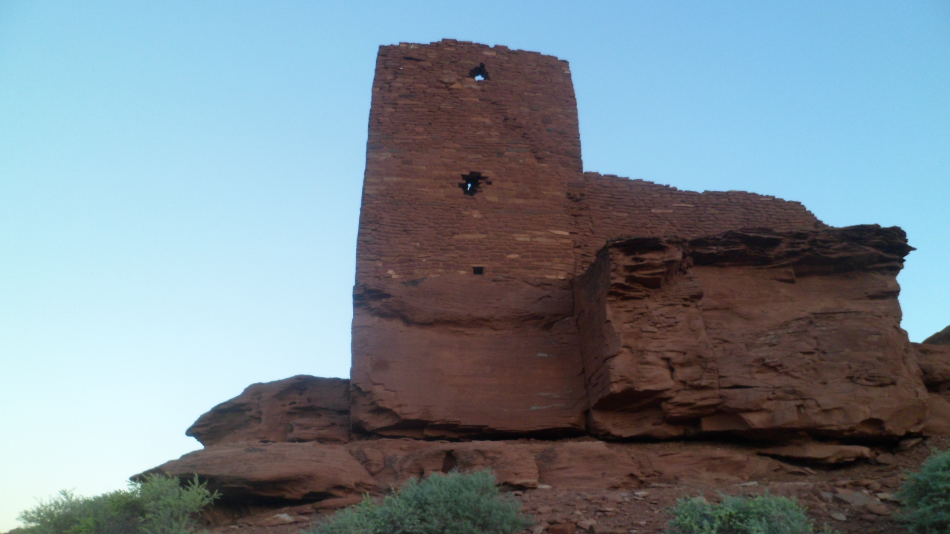
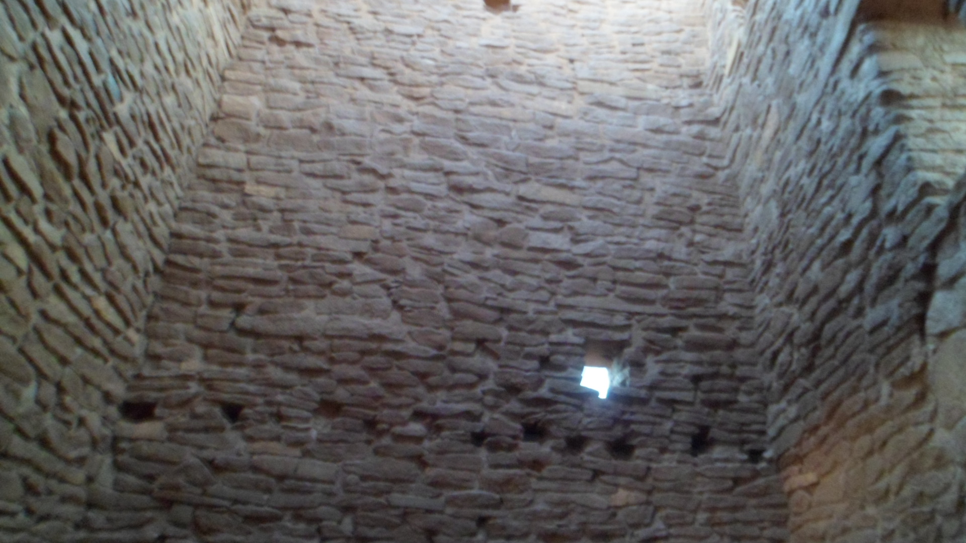
Cochise would probably like the way in which his old redoubt, the Stronghold that bears his name, has been kept largely wild.  There are horse camps and vacation cottages nearby, but the campsites that are set aside, for those who come to pay their respects to him, are primitive.  Pack it in, pack it out, just as the Chiricahua people did.

I walked a short distance, from the Day Use trailhead, to the base of the Dragoons, and said quiet prayers to the Father of us all.  Like Quanah Parker did, at the Sipapu in Palo Duro Canyon, nearly three years ago, Cochise communicated with me:  “You are ever welcome at this place.  Return, at length, when you are able, my son.  For now, go in peace and harmony, and above all else, keep your word.”

SAM_3498 SAM_3502 SAM_3504 
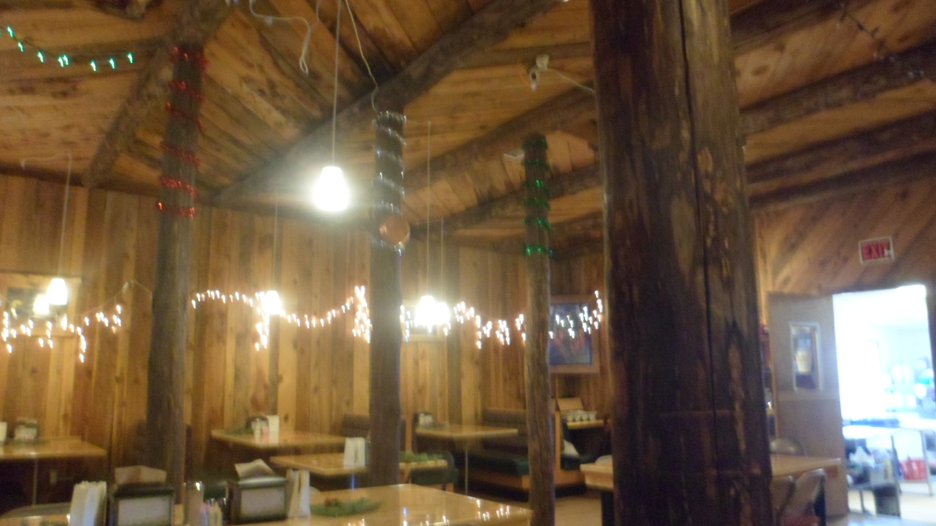
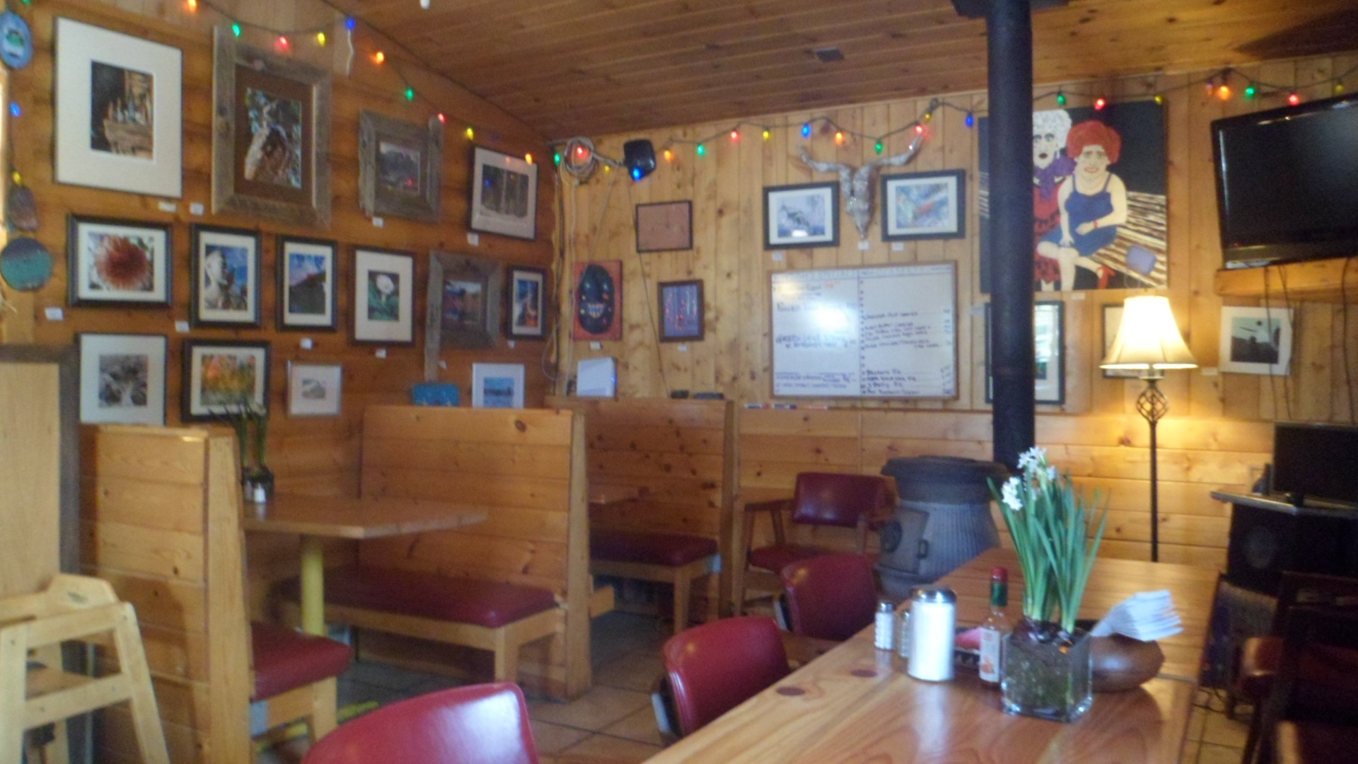
The ruggedness of Cochise Stronghold was soon replaced by the wild yapping of those whose owners call them the Heathen Hounds.  Hacienda Ranch lies a fair stretch down towards the road from Vail Steak House, one of my homes away from hom, when I’m down this way.  The Heathens and their people came this way, from Oklahoma, about six months ago.  These are hounds (chihuahuas) that like all such little critters, would gladly enjoy me as their breakfast.  Bob and Tamy are of a different opinion regarding yours truly, and so I was given a fine lunch and a nice little guest room.  So, I hailed the Heathens from the other room, and went off with Bob, exploring the low country, and a winding hill.

SAM_3505 
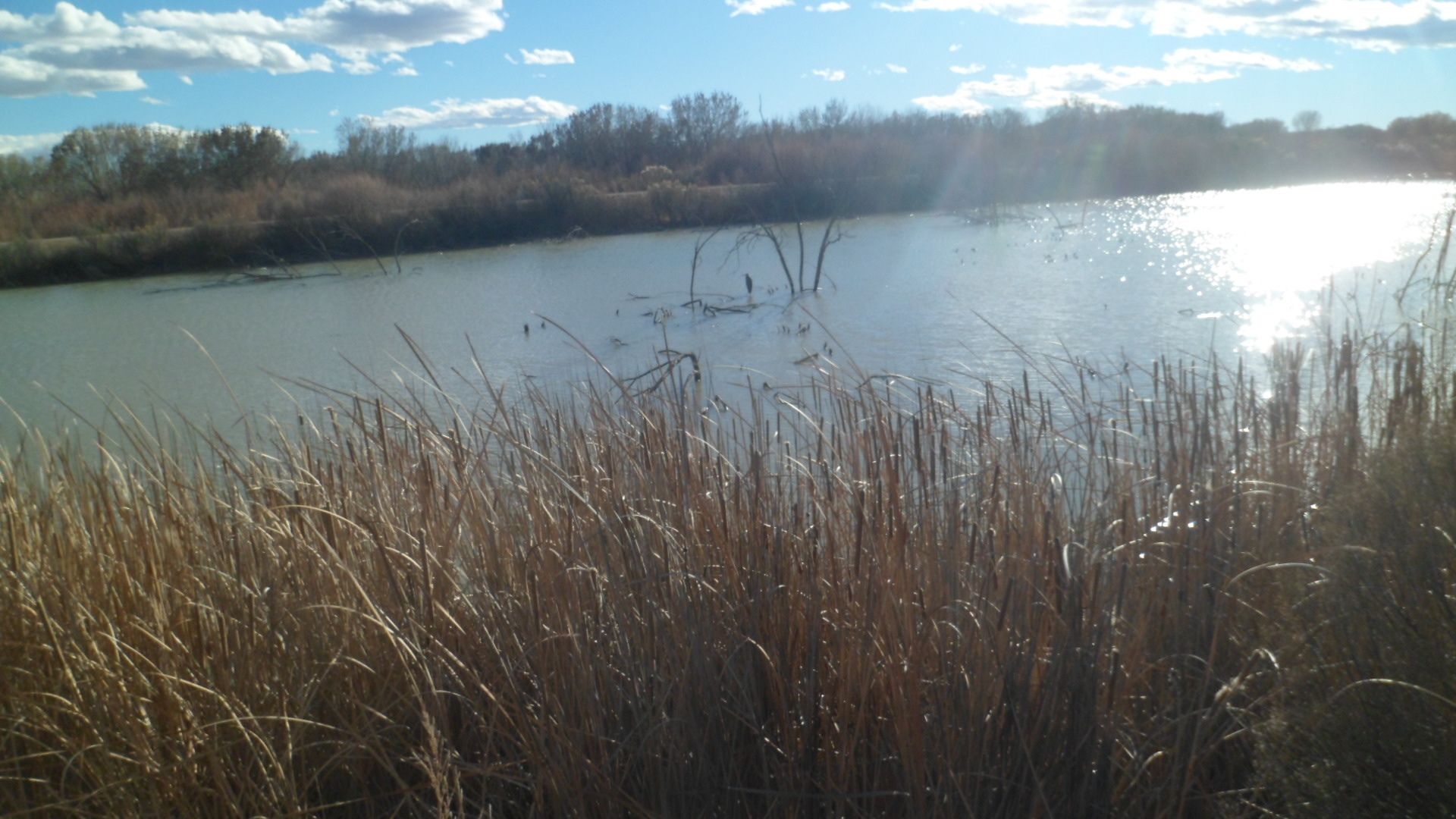
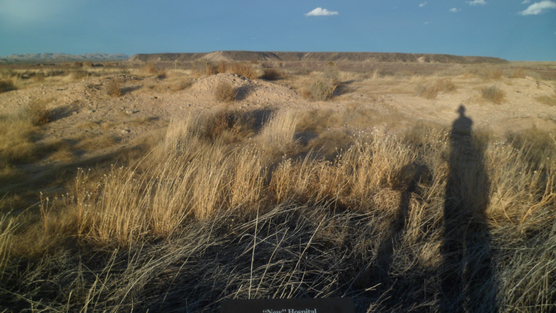
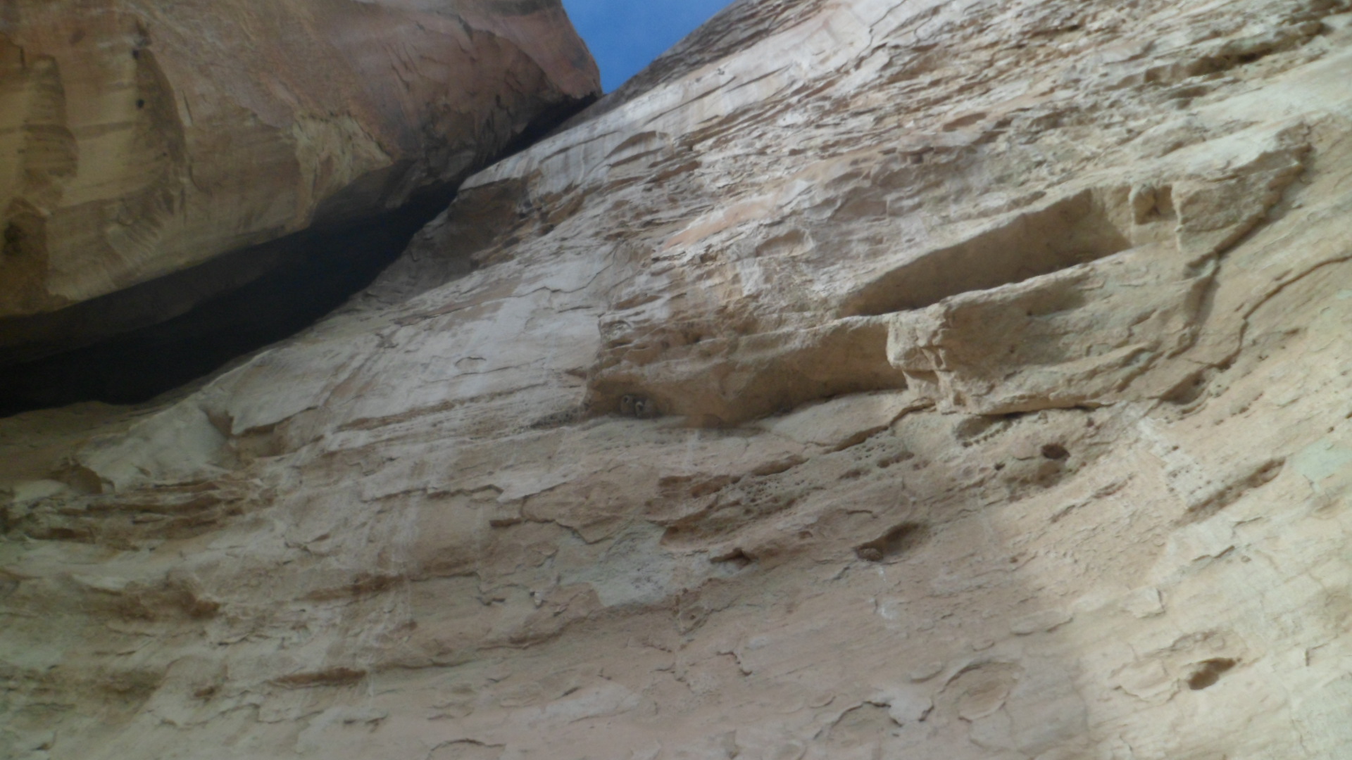
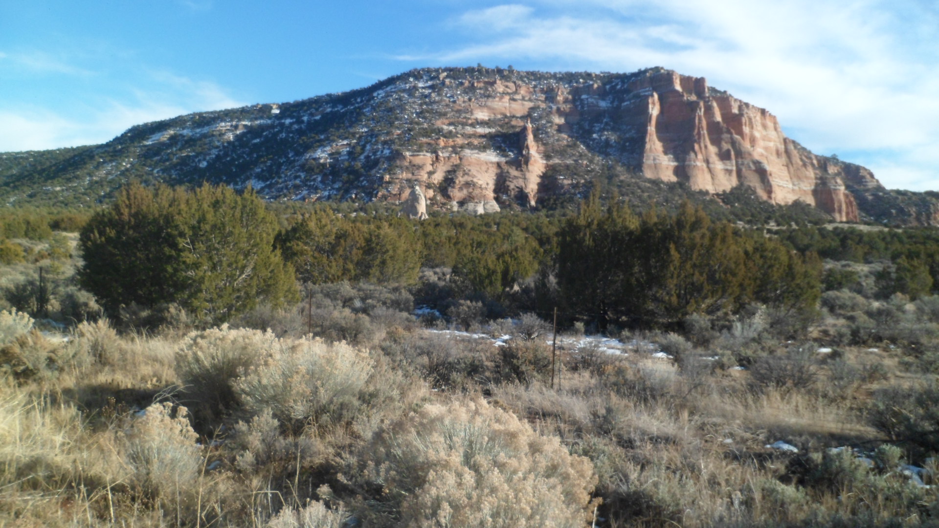
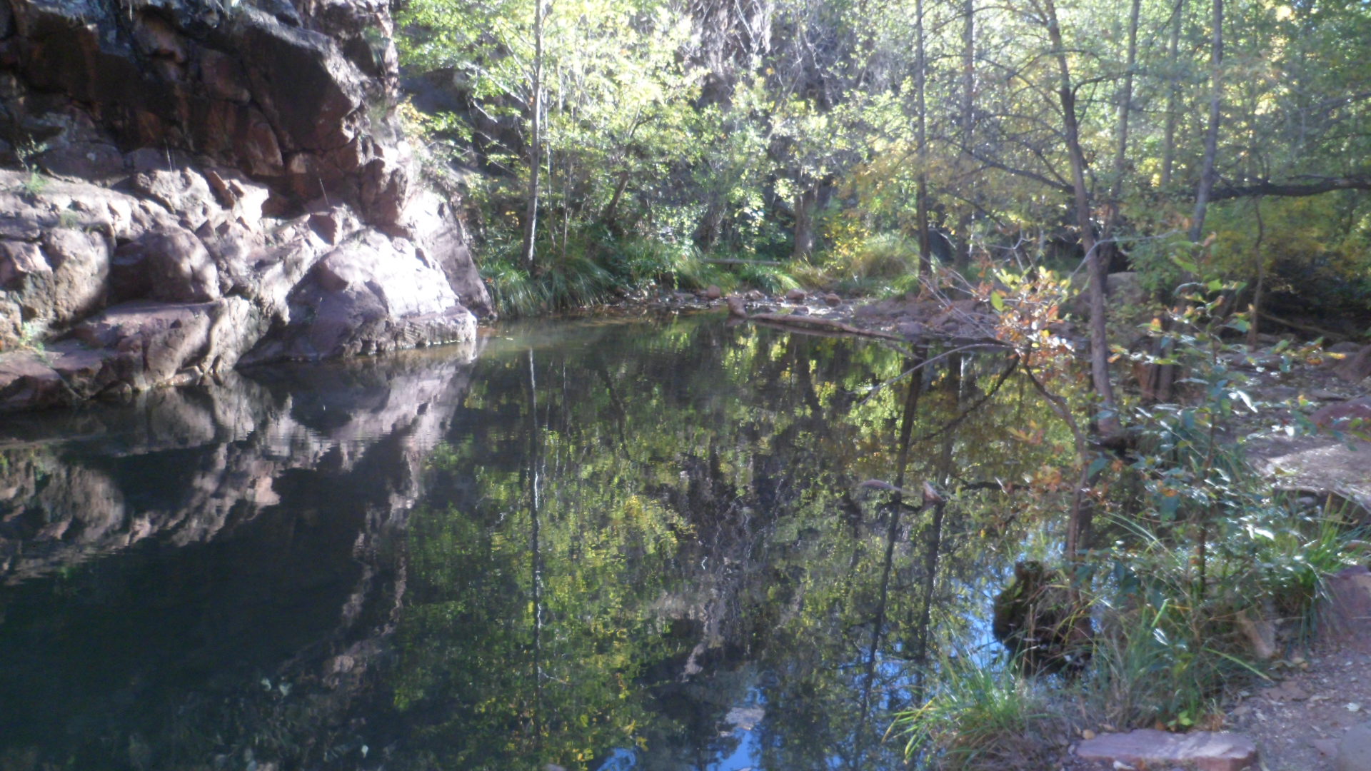
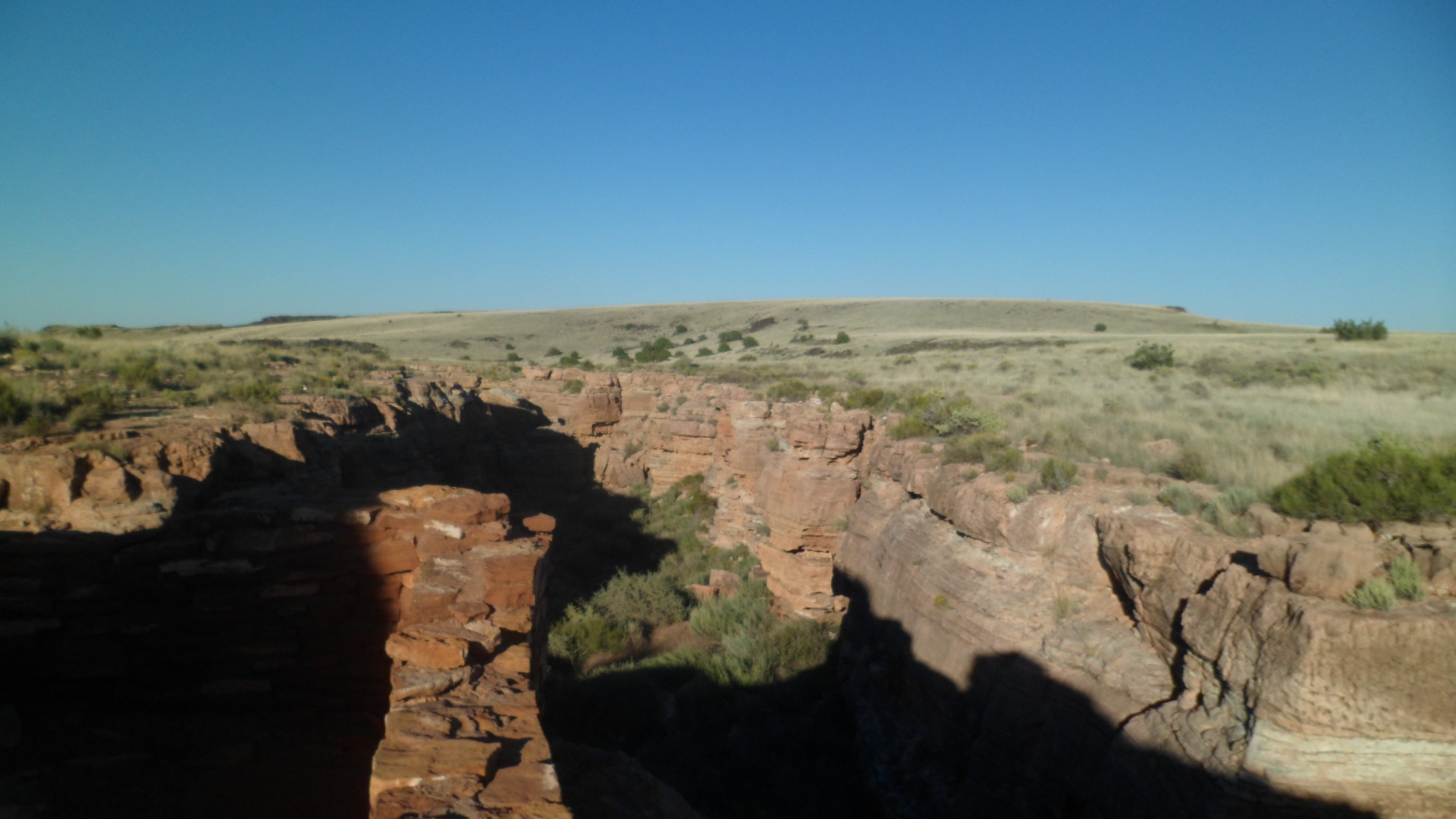
After such a repast, the confluence of the Chihuahua and Sonoran Deserts called out pretty loudly.  There are no sahuaro, or yucca, in this transition zone, but everything else is here, including the javelina and coyotes.

SAM_3508 
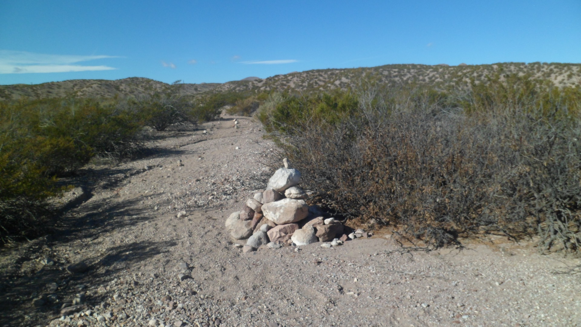
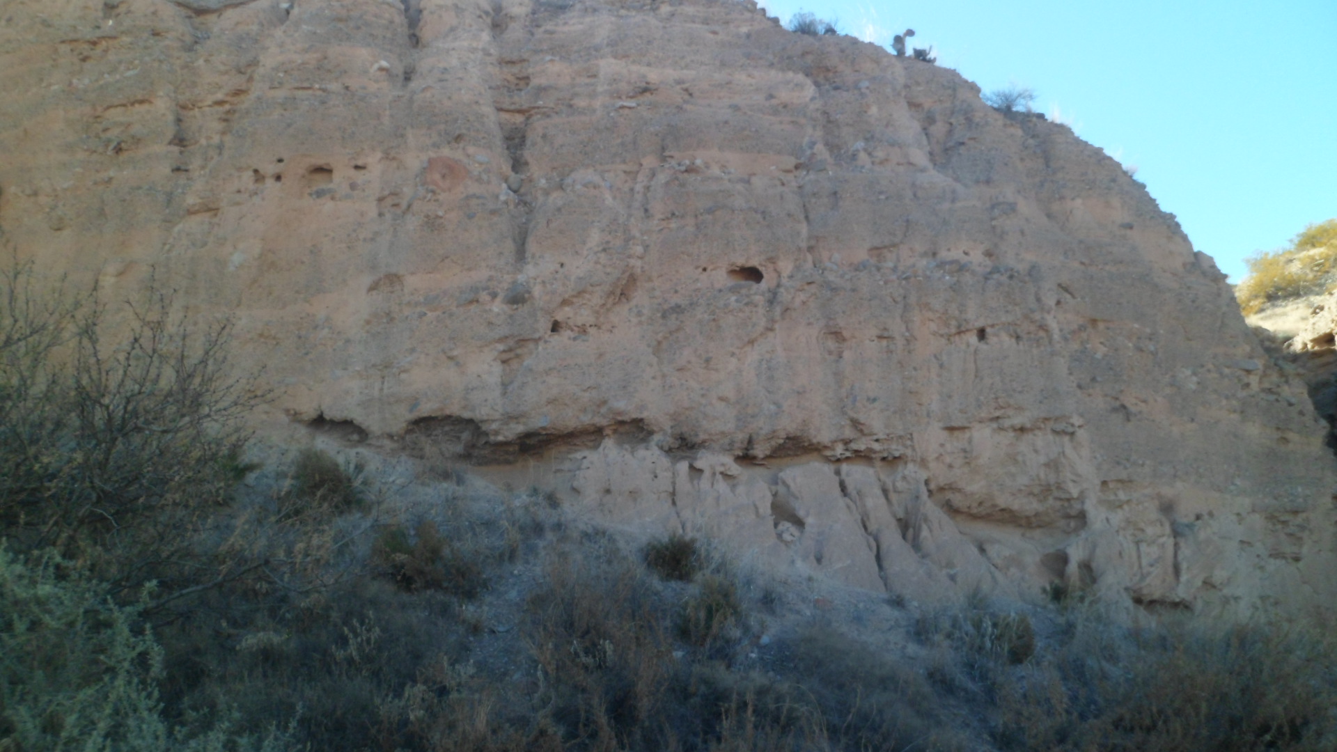
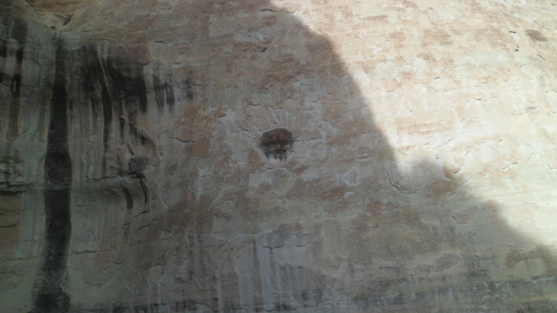
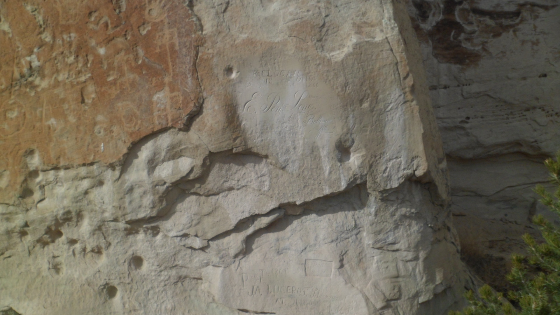
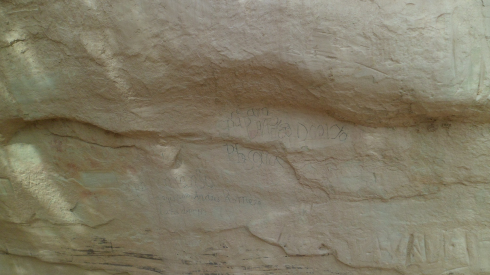
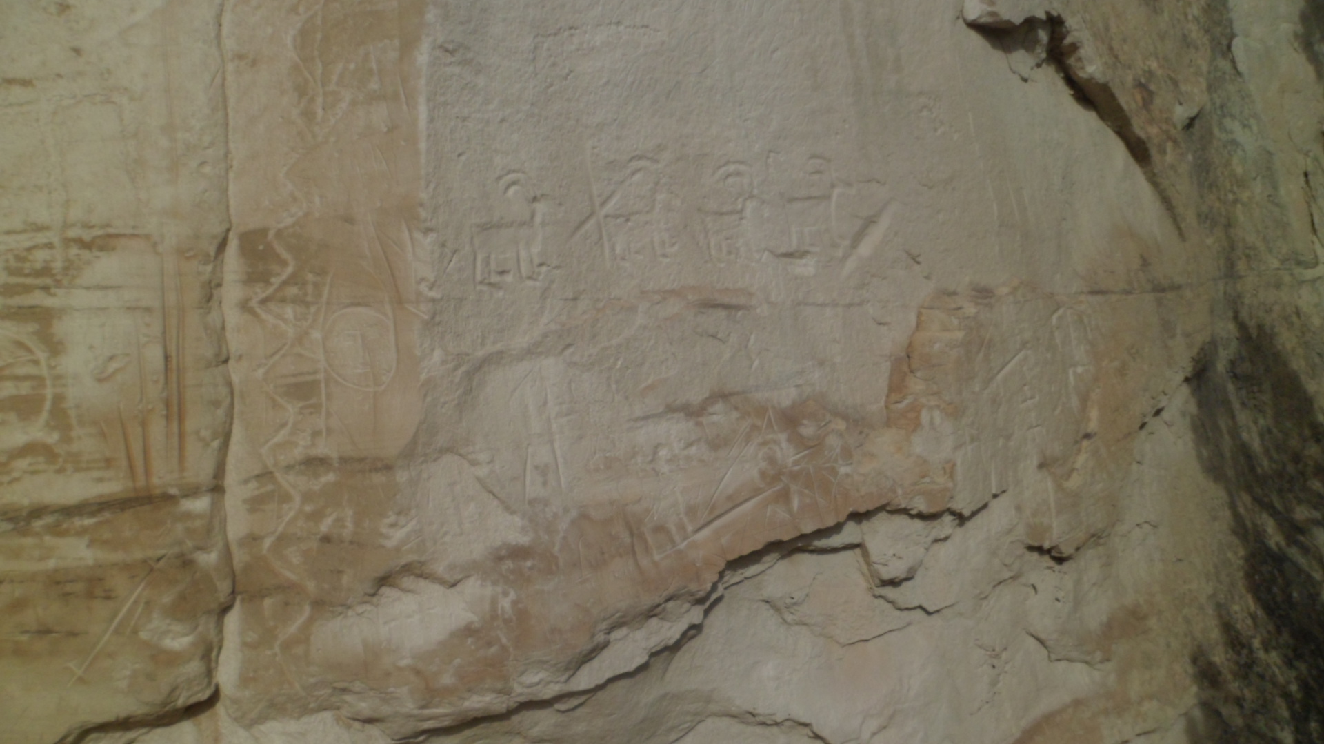
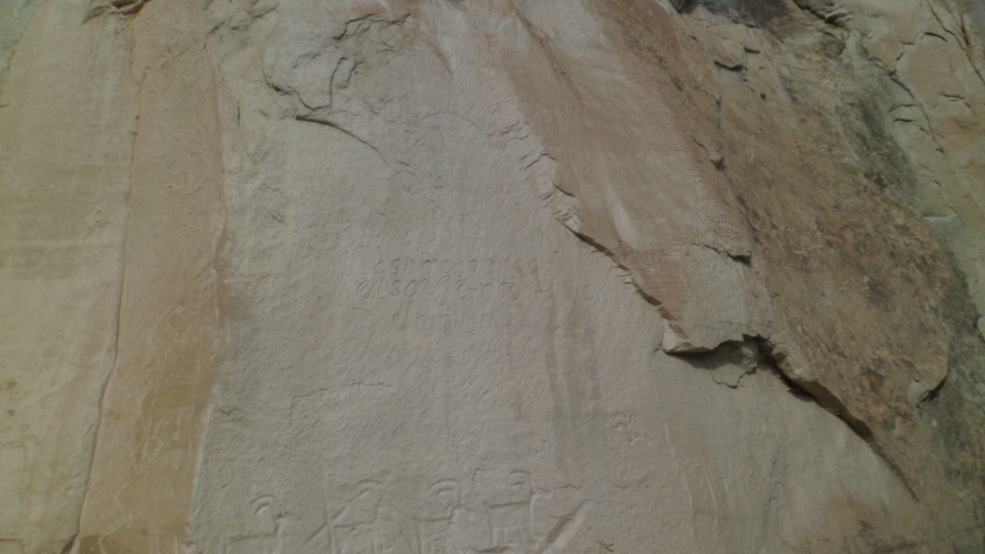
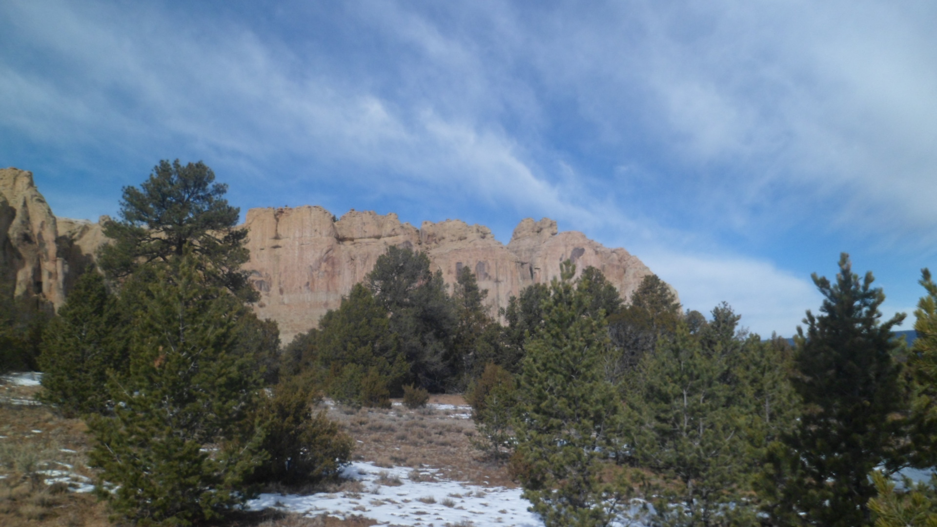
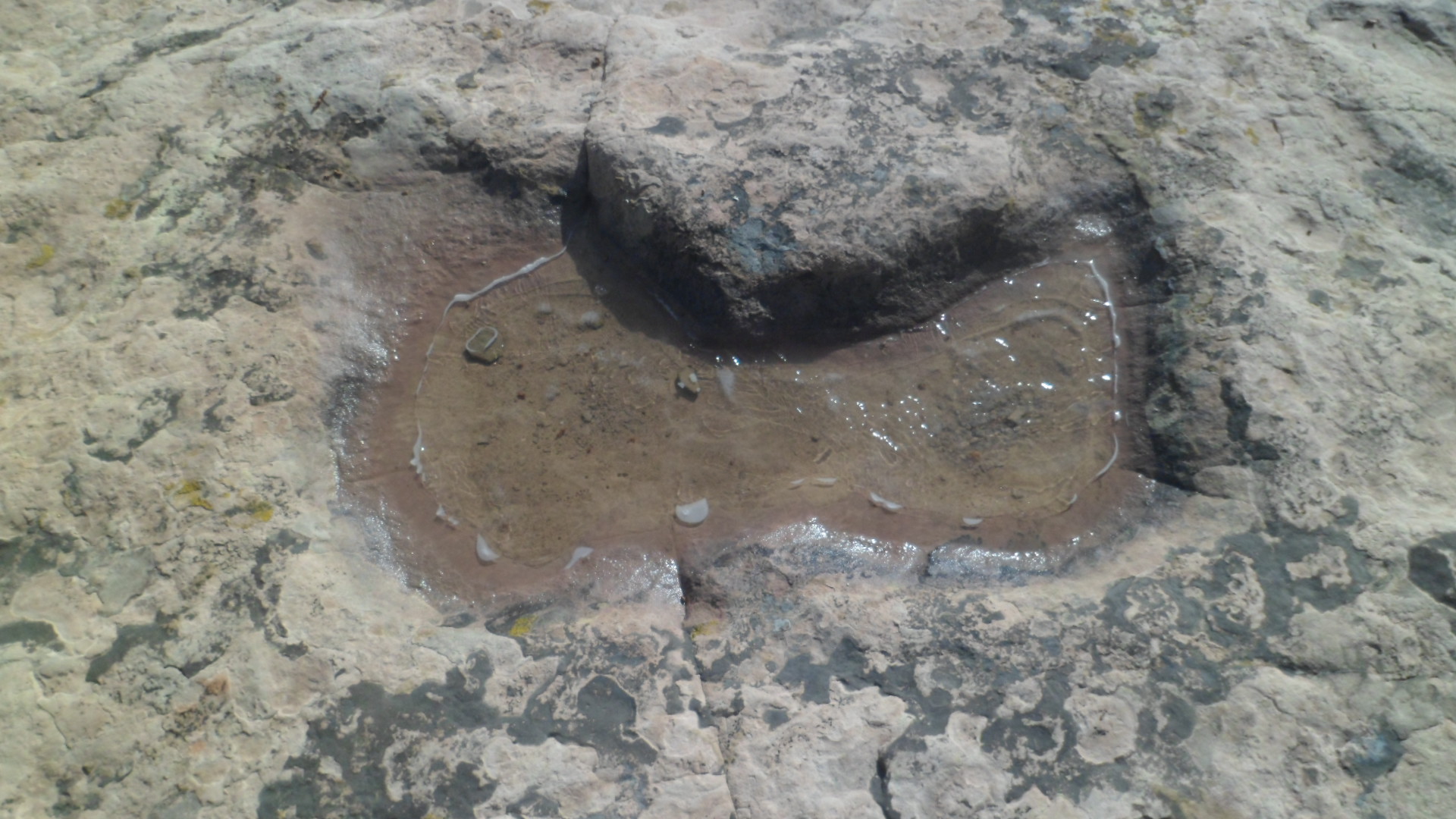
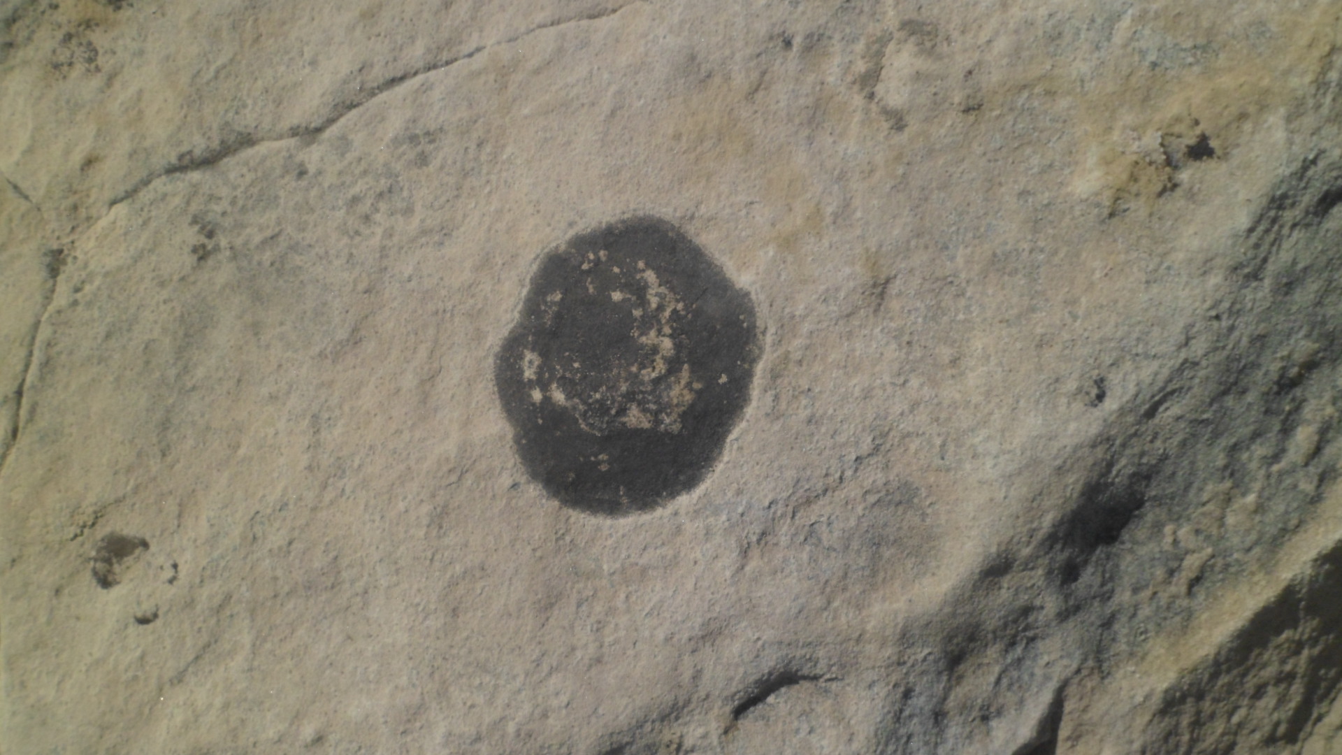
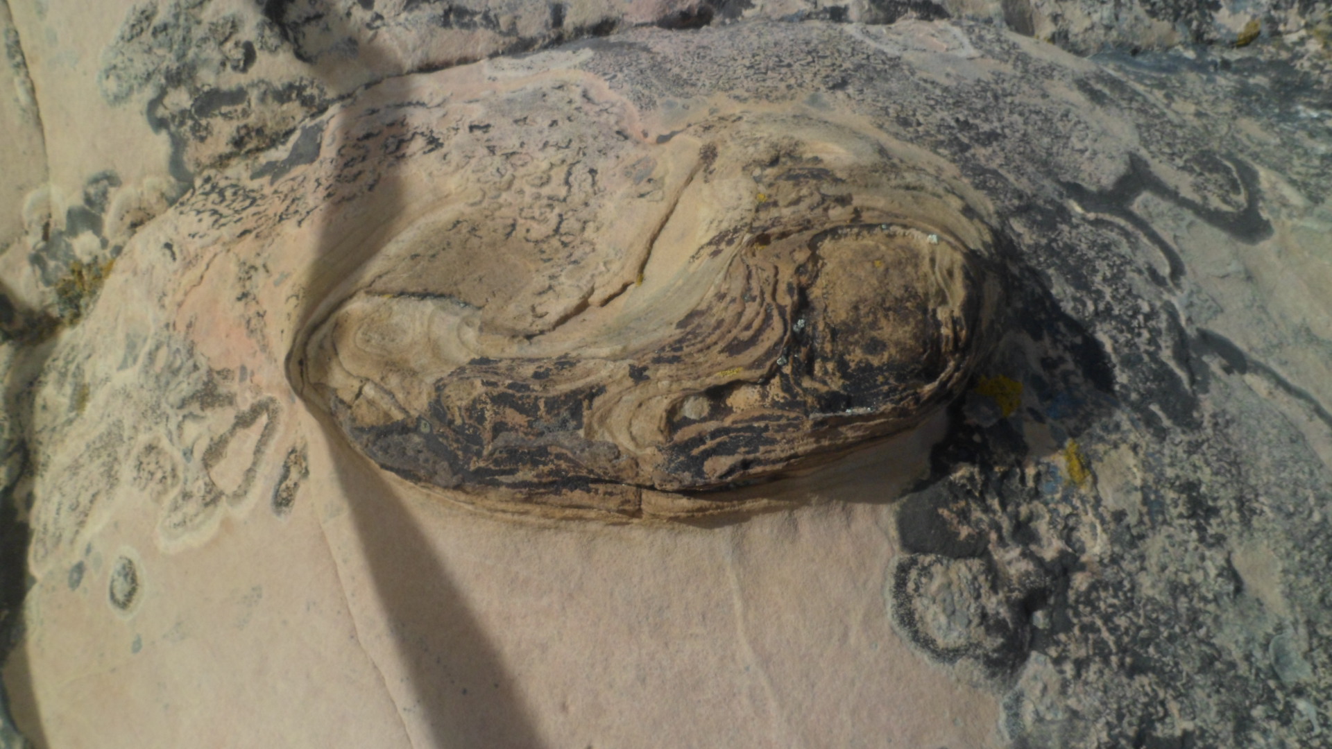
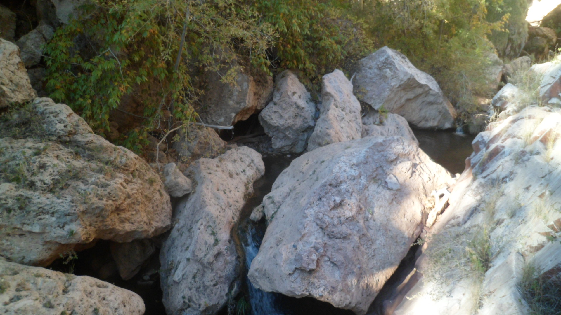
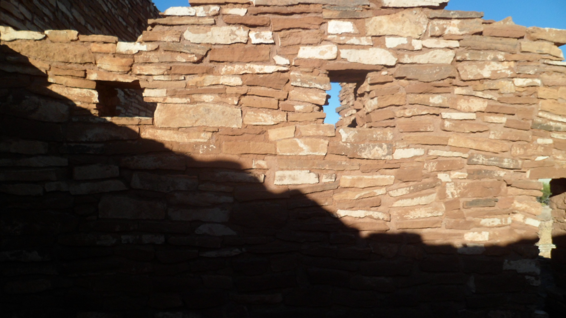
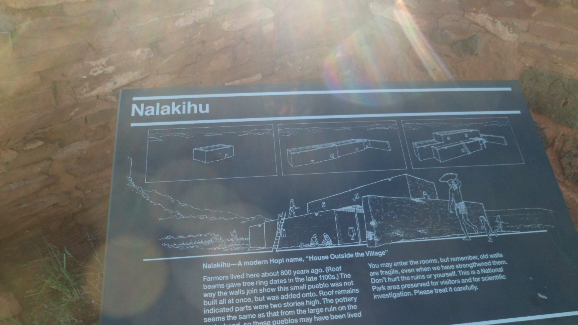
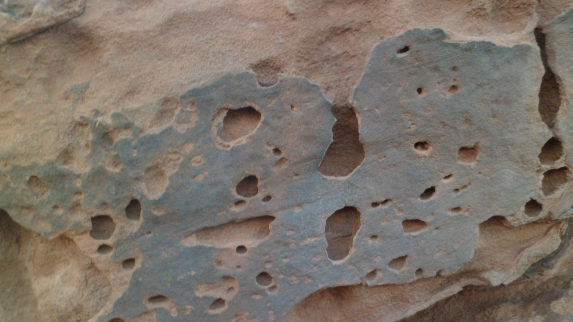
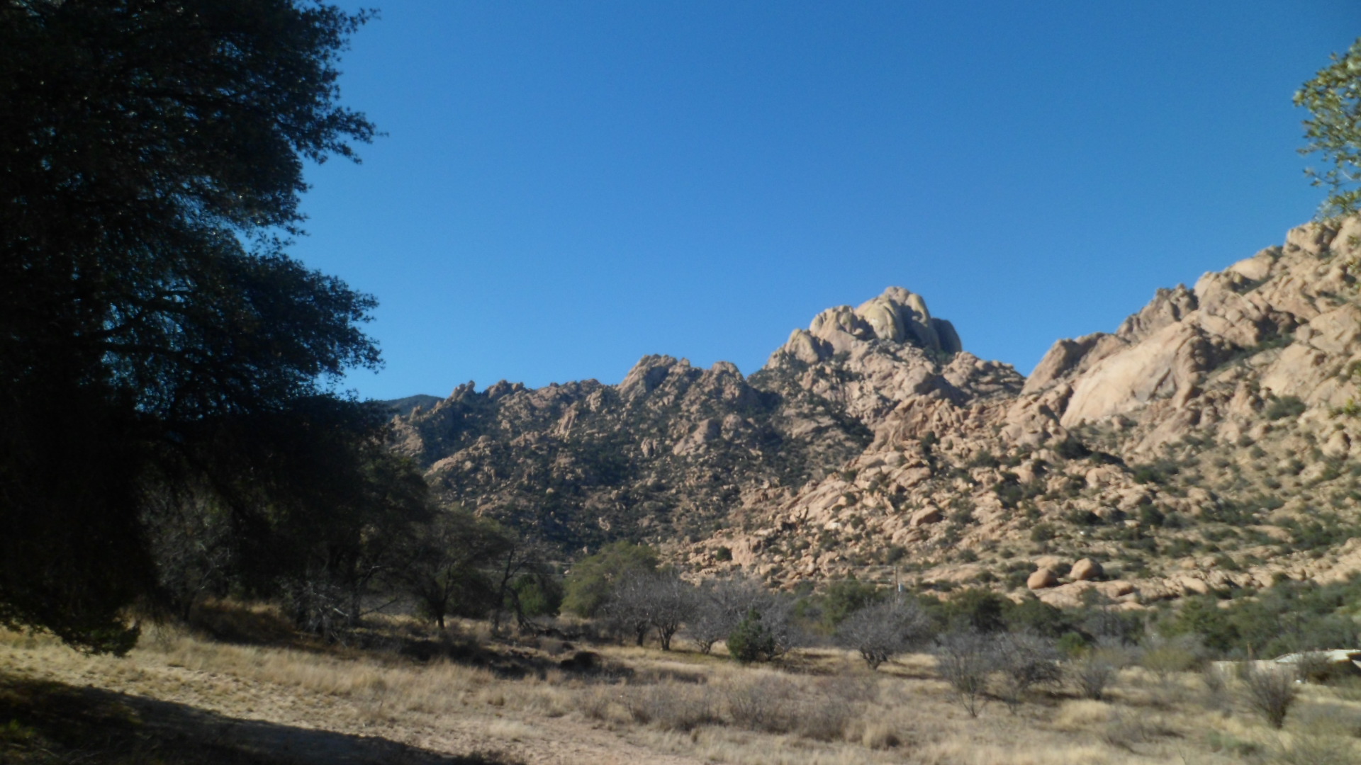
These ancient rocks are found along a wash, just southwest of Hacienda.SAM_3509 SAM_3511 SAM_3512 
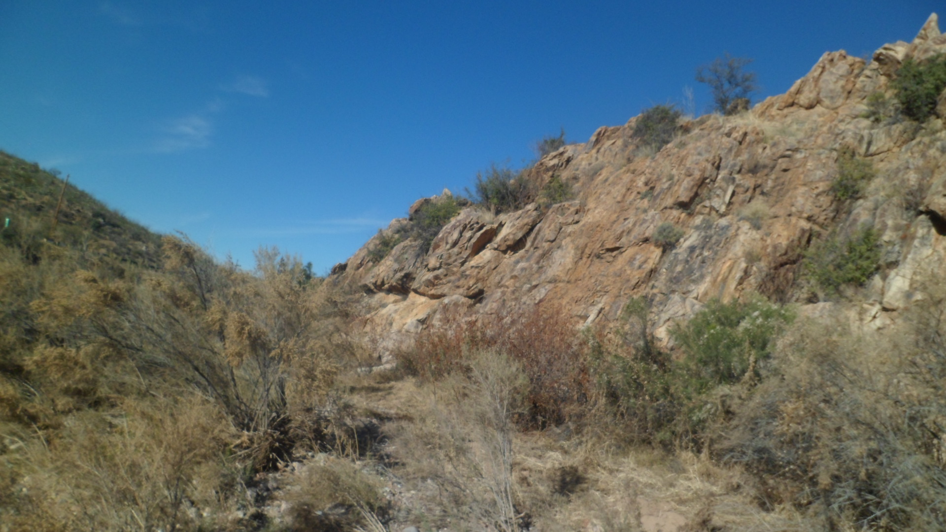
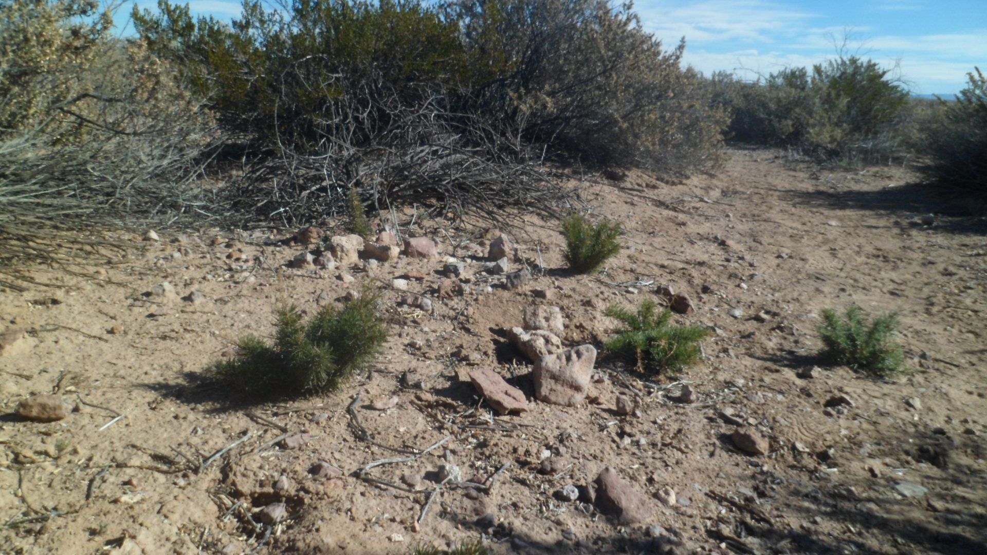
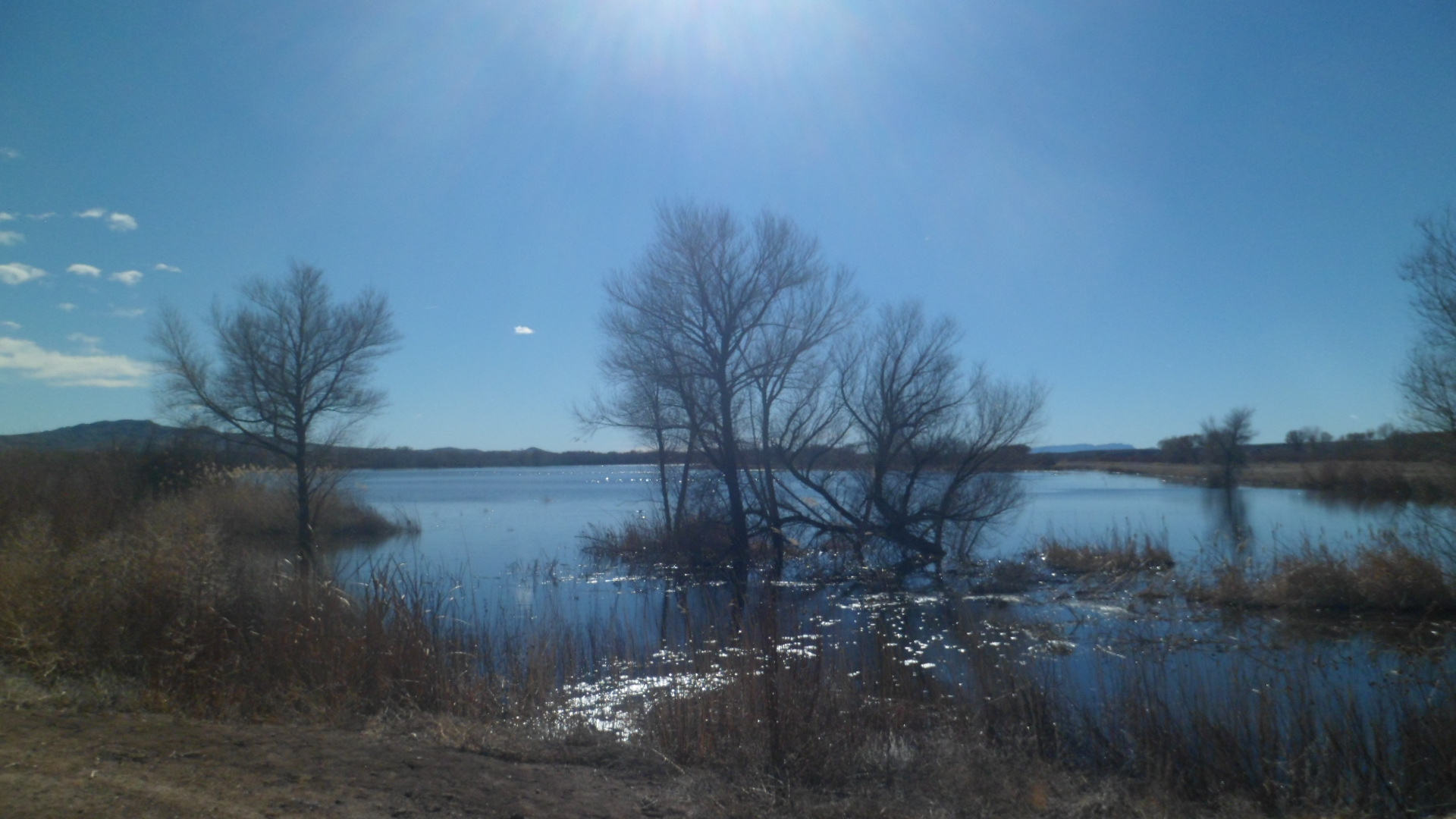
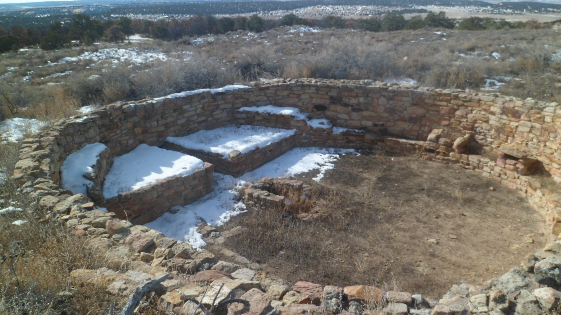
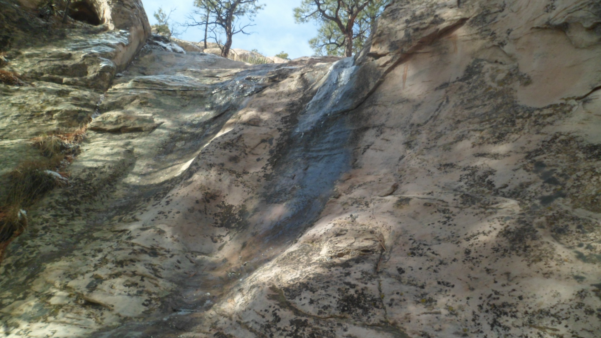
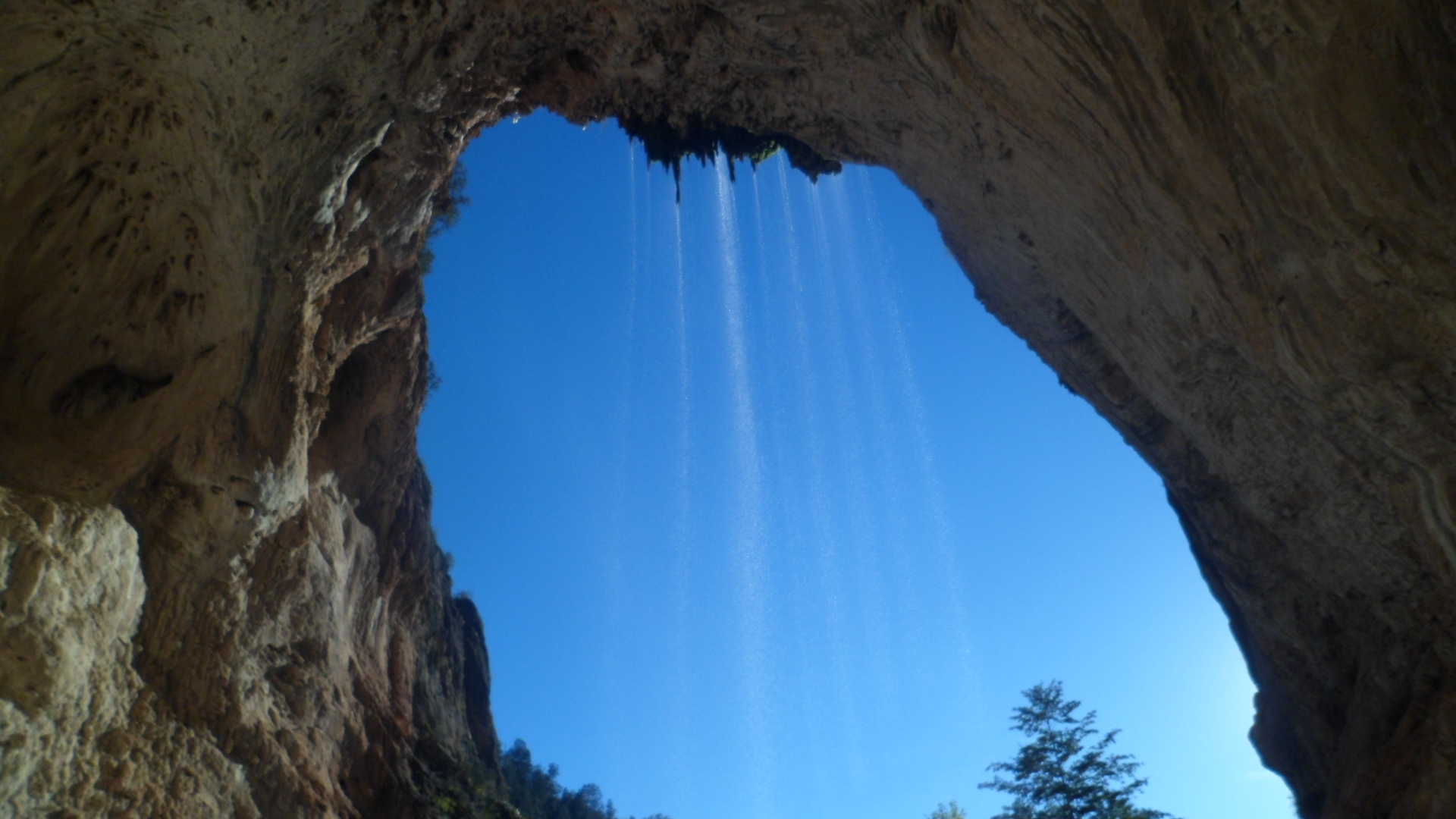
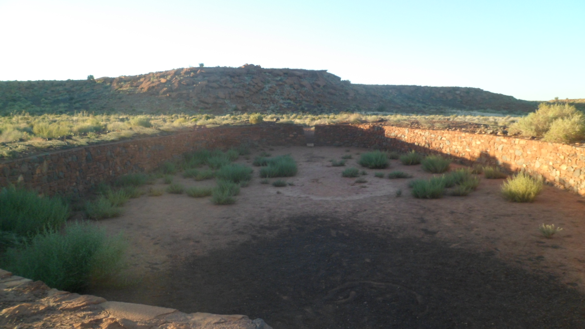
Bob and i went a bushwackin’ through the scrub, and found this seasonal tank.  He thinks a larger one lies just to the west of this one.  Maybe on a future jaunt, one or both of us will find it.SAM_3513 Th scene is recorded for posterity.SAM_3514 
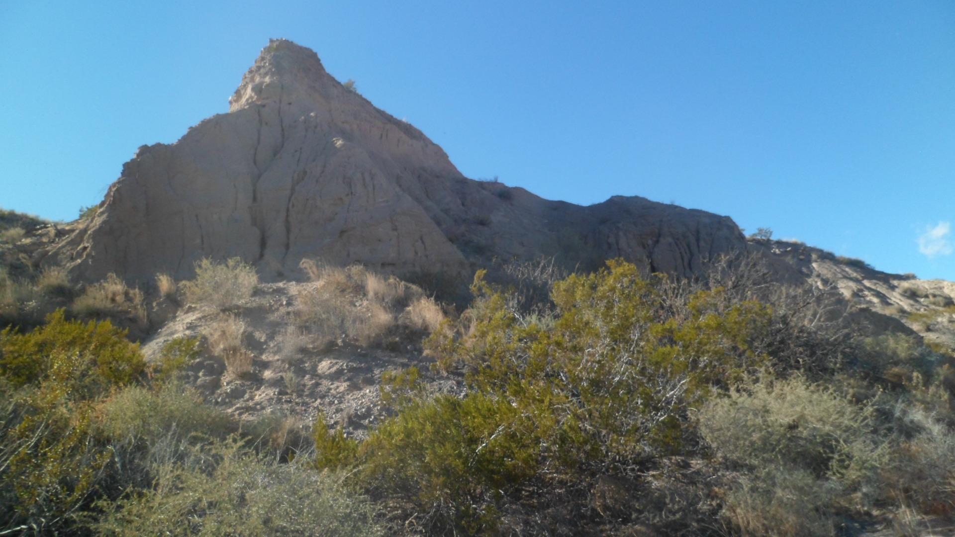
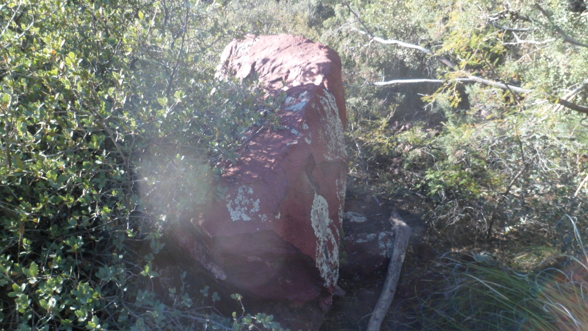
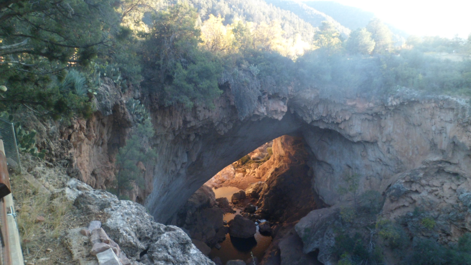
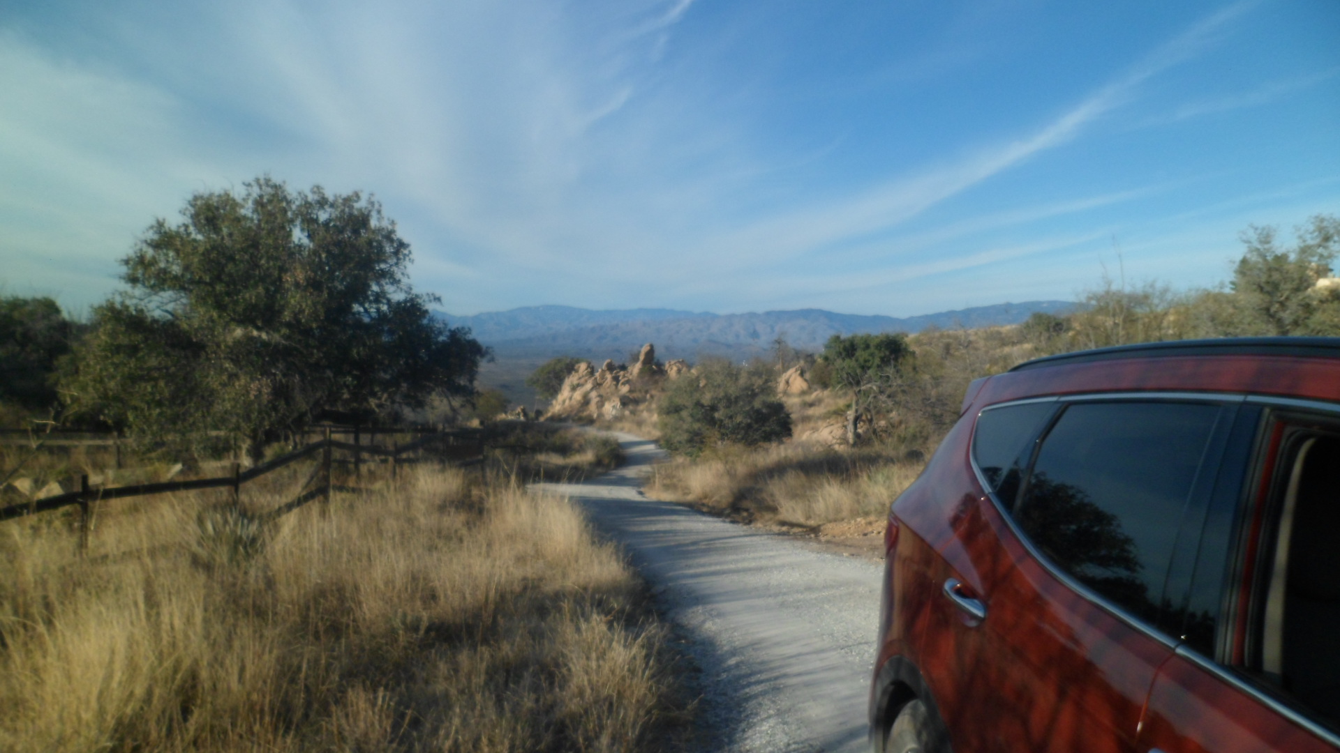
These next scenes are from the winding road up a nearby hill.SAM_3516 SAM_3519SAM_3517 SAM_3521 
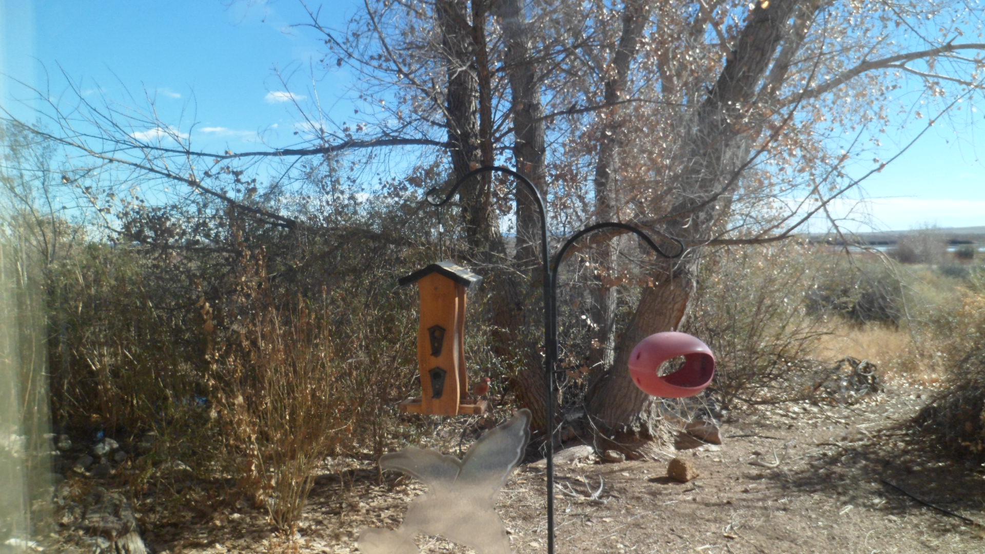
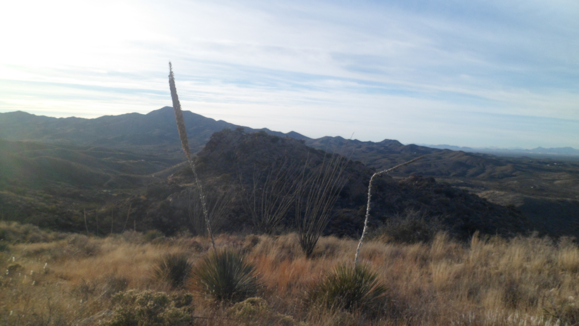
In the absence of sahuaro, the ocotillo take full advantage.  The dogs didn’t take advantage of me, but even if they tried, I’d have loved to death.

This Christmas Eve was spent watching a rebroadcast of A Christmas Story 2″, which bored me to tears, and . another, of “Pearl Harbor”, which delivered the full horror of that awful day.   One element of surprise, though, led to another, and as Admiral Yamamoto said, the sleeping giant had been awoken.

The Road to 65, Mile 25: Truth, Consequences and Delayed Gratification

3

December 23, 2014, Lordsburg-  When I was a very young child, about 4 or 5, my maternal grandmother would occasionally babysit us, so both our parents could work.  Grama would sometimes have the radio broadcasting something about truth or consequences.  I could barely say the second name, but I knew what truth meant, and figured consequences were some kind of lies.

In March, 1950, shortly after i would have been conceived, the game show host Ralph Edwards, celebrating ten years of his successful radio show, “Truth or Consequences”, took an idea from a couple of staff members- to name an American town after the show.  The town selected was Hot Springs, New Mexico, which had the advantage of already being a prime tourist destination, due to its eponymous mineral baths and nearby Elephant Butte Lake, a man-made reservoir of the Rio Grande.  On April 1, Mr. Edwards, his wife and several crew members went to Hot Springs, for the official renaming, and the City of Truth or Consequences, “TRC”, was born.

I spent Monday night and Tuesday morning, enjoying the hospitality and vibrant civic spirit of this remarkable little community.  Here are some scenes from the Hot Springs Historic District and Geronimo Springs Historical Museum, Sierra County’s place of record.  The painted water tower and some brightly coloured homes reminded me of Bisbee, AZ.

SAM_3437

The San Andres Mountains rise to the southeast.SAM_3439 Quirky shops and eateries are scattered throughout the town.SAM_3447 Geronimo Springs Museum is a well-ordered and delightful place in which to learn of west central New Mexico.SAM_3441 A display of coloured glass and ceramic greets the visitor, outside.SAM_3443 So, too, does a log cabin.

SAM_3442 SAM_3465 Inside the museum are many features of paleontology, anthropology, local culture and history.  I started with Pleistocene relics, a mammoth skull, and one of a mastodon.

SAM_3455SAM_3456 Going backwards in time, here is a Devonian coral.SAM_3459 Next, are some fern fossils.

SAM_3460 This is the tale of a chair, brought from the original Sierra County Courthouse, in nearby Hillsboro.  The two towns disputed which would be county seat, and the State of New Mexico ruled in favour of Hot Springs.SAM_3463 The historical exhibits showed portraits of Geronimo, Don Juan de Onate, and cowboy author Eugene Rhodes.  This local hero outshines them all, in my opinion.SAM_3468 I left “TRC” a bit later than I had planned, but some serendipity is worth delayed gratification elsewhere.  I would end up putting off a visit to Gila Cliff Dwellings National Monument and a walk around Silver City, but along the way to that area, I encountered several little gems.

Hillsboro, the aforementioned rival, was mostly closed up for the holidays.

SAM_3470  Not far up the road is Percha Creek, with a truss bridge and adjacent walkway/overlook.

SAM_3479 Emory Pass, at 8230 feet, is the highest point along this exquisite highway.  Here, I encountered a writer from Martha’s Vineyard, who is looking to relocate to warmer climes.  I gave him a few possible sites to explore, in that regard.  Emory was definitely not one of them- but it is a place of splendour.

SAM_3485 I stopped for lunch at La Tienda del Sol, in San Lorenzo, before visiting the Mimbres Ranger Station, which confirmed my suspicions about Gila Cliff Dwellings closing at 4 PM.  This delightful little place was full into the holiday spirit, as was Sunset Grill, in TRC, last night and this morning.

SAM_3487 I headed to Silver City, in the end, spent a short time at Fort Bayard National Cemetery, then continued down to Lordsburg.  The dusty desert town has its own gems, among them the comfortable and inexpensive Holiday Motel (NOT “Inn”) and Kranberry’s Family Restaurant, open for lunch and dinner.  I was treated like royalty in both places.  Days like this will bring me back to this area in the Spring, and then we’ll see about Gila Cliff Dwellings and vicinity.

The Road to 65, Mile 24: A Refuge and A Fortress

4

December 22, 2014, Truth or Consequences- It was a mild day, which I started with a lovely breakfast of Strawberry Pancakes and sausage patties, at Socorro’s El Camino Family Restaurant.  Once again, all the regulars were present; nobody named Strawberry, though.

I set out for my first visit to Bosque del Apache (Apache Woods), since Penny and I came here in 1983.  It made an impression then, and did so now.  There were more sandhill cranes back then, and one of the docents gave a reason for the relative decline in their numbers.  The cranes have become dependent on corn that is grown by a farmer, who is employed by the Refuge.  The farmer they had, left and so, if anyone is interested in growing corn, specifically to feed birds, and be part of an upbeat crew of wildlife managers- contact Bosque del Apache National Wildlife Refuge, US Fish and Wildlife Service.

I began my drive down El Camino Real (New Mexico Highway 1), with a stop at this defunct Catholic church, in San Antonio, NM.  This little village has few remaining residents,but it is still worth remembering.  Each small settlement along the Royal Road was once a major stop, for those on foot or on horseback.

SAM_3347 I was greeted, upon my entrance into the Wildlife Refuge, by a Greater Sandhill Crane, perched on a branch.  Of course, he flew off immediately as I got my camera ready to shoot.  Continuing on, I walked a 3-mile loop of Chupadera National Recreational Trail.  The whole trail, up Chupadera Peak and back, would’ve been 9 miles.  I had more on my agenda, so that can be done another time.  The cairns mark each length of the trail.SAM_3355 Watch out!  The snakes and scorpions may be hibernating.  Not so, the thorny bushes.SAM_3358 Out in the distance, lie the San Andres Mountains.SAM_3360 Ann Young was an avid birder, who has since passed on.  To make up for the relative lack of wintering birds this year, here is a video of one of her last visits to Bosque: https://www.youtube.com/watch?v=KyecyGVWrto.SAM_3361 New growth is taking its place, all over Bosque del Apache.SAM_3363 From the window of the Visitor Center, one can sit for hours, just watching the various finches, wrens and hummingbirds eat their fill.  Many, though, prefer the findings on the ground and in the brush.SAM_3367 Believe it or not, a bald eagle is perched in the cottonwood tree on the right.SAM_3369 Trees growing up out of the sandbars create a safe haven for aquatic life, but also are a convenient place for raptors to sit and enjoy the view.SAM_3372 I walked this berm, around a marsh that is full, seasonally.  This is not the season of its fullness, but I got a sense of what it could be.  A Cooper’s hawk followed me around the loop, screeching, but never quite finding its favourite meal.SAM_3376 Raptors, cliff swallows and barn swallows make their nests in these sandstone cliffs.SAM_3383 SAM_3386 Here is an overlook, above the Marsh Trail.SAM_3389 When I climbed the path, this was my view.  Some say the Chihuahua Desert is more barren than the Sonoran.  Right now, I’d say they are correct.

SAM_3390 This is an oxbow of the Rio Grande, and trends towards dry, even when the river itself is full.SAM_3395 As you can see in Ann Young’s video, sometimes the bed under this boardwalk is full of water.  Not today.SAM_3396 SAM_3399 It is good enough for cattails, though.SAM_3400 My spirit friend was on the job.SAM_3401 Once back along the main flow of the Rio Grande, I spotted a Lesser Sandhill Crane, by its lonesome.SAM_3412 From the Eagle Scout Deck, more evidence of past drynesses and flows could be seen.SAM_3415 On my next visit to Bosque, I will focus more on the North Loop and the Canyon Trail.  It’ll also mean taking in a Fly-In, at sunset.

Continuing down El Camino Real, I came to a dirt road, which led me to Fort Craig, five miles eastward.  This National Historic Site is comprised of ruins, and figures in three sorry episodes of our nation’s history:  The Mexican War, which was its raison d’etre; the Civil War, during which Confederates from Texas tried to use New Mexico as a steppingstone to Colorado’s gold fields; and the Trans- Mississippi Indian Wars, which just led to more suffering and misunderstandings, on both sides.  That its ruins stand at all, however, show just how formidable Fort Craig was.  Walking these paths brought me back to the ramparts and walls of France, Belgium and Luxembourg.  The pilings below support the earthworks, which defended the fort against the Confederate force.

SAM_3416 This is what’s left of the Guard House and Jail.  Prisoners were segregated by race, as were the soldiers.SAM_3418 These are the remains of the Commanding Officer’s Quarters.SAM_3420 SAM_3421 The perimeter walls were more formidable than they look now.SAM_3425SAM_3426 Here is the Magazine Storage, where ammunition was kept safe and dry.SAM_3431 The Battle of Valverde, near Socorro, was a Pyrrhic victory for the Confederates.  They lost so much in materiel that they were unable to capture Fort Craig and hobbled on to Albuquerque, never gaining control of New Mexico.SAM_3435 I don’t believe I have ever cast such a long shadow.  Being tired by now, my course of action was to stop in the unique town of Truth or Consequences.  The story has been told by someone on my Facebook wall, but I will discuss it at length in “Mile 25.”

SAM_3436

The Road to 65, Mile 23, A Very Full Solstice, Part II: Passed by This Place

7

December 21, 2014, Socorro- I encountered two sets of people, atop Atsinna Pueblo, on El Morro.  One was a worldly, sophisticated couple, who showed mild interest in my observations, before  heading off to more intriguing things.  The others were grandparents and grandson, who had several questions about the nature of the settlement, and whether the Zuni were related to the Puebloans who lived in Atsinna, before the Spanish came.

These chance encounters set me to thinking;  What message, in picture and word, was each person who left his/her signature on Inscription Rock, trying to convey?  How has each been received by those who have seen these messages since?

Before addressing that issue further, let’s have a look at what we found yesterday, at Atsinna.

SAM_3293
SAM_3296

SAM_3294SAM_3299  The area that was once farmed, below, is now home to junipers and a few Ponderosa pines.

SAM_3300

Snow and ice have given the Headland Trail a rest for several months.

SAM_3302

I turned around and headed to Inscription Rock, for a new look at some old friends, from thirty-one years ago.  Here some of the better examples of each period’s messages to posterity.  Can you see any resemblance to Mount Rushmore, above the lichen-created heart?SAM_3308

The next three frames show the natural pool, created by runoff and preserved by an artificial dam, and the striation caused by mineral absorption.SAM_3311

SAM_3312

SAM_3314  Next, are inscriptions by Puebloan peoples, Spanish explorers, and Americans headed west.

SAM_3318
SAM_3319
SAM_3320

A pair of Cliff Swallows also leave their mark, in the form of nests, barely visible under the slight overhang.SAM_3322SAM_3325SAM_3328   SAM_3329SAM_3330 SAM_3334SAM_3339 How many signatures and petroglyphs can you discern?

I spent a few minutes driving around Zuni Pueblo, but with all shops closed on Sunday, and my own practice of not taking photos inside a Pueblo village, I leave you with these two views of nearby mesas, which are sacred to the Zuni.

SAM_3344

SAM_3346  I continued on to dinner, in Magdalena and a restful sleep, in Socorro.  NEXT UP:  Mile 24- Bosque del Apache National Wildlife Refuge and Fort Craig National Historic Site.

The Road to 65, Mile 23: A Very Full Solstice, Part 1

4

December 21, 2014, El Morro, NM- I don’t think I’ve made such a big deal about the December Solstice before.    Penny and I would have chai and watch the moon rise, with a group of Phoenix- area or Prescott- area Wiccans, but since her passing, it took me until this year to include the occasion in my life, in a meaningful way.  (I use the term December Solstice, because the longest day is a great celebration for the indigenous people across the Southern Hemisphere, and I tire of seeing them left out of the celebratory messages.)

Today started with a marvelous shower and gradual wakening, by 7:30 AM, in my comfortable cabin, “Deer Cabin”.  I was informed that breakfast would be served from 9-12, so there was plenty of time for me to take a few winter photos and pray for many people and situations.  I posted a few of these on FB, but here are some scenes of the El Morro Lodge and Ancient Way Cafe.

First, here is the interior of Deer Cabin.

SAM_3255

Here’s the exterior.SAM_3257

Ancient Way Cafe was founded by a spiritual mentor who is known as Red Wulf.  He paid us a visit at breakfast, but stressed “I’m not here”, as he is officially on sabbatical, until April, 2015.  Several other local characters also gathered for breakfast.  I selected “Donald’s Breakfast”, a hearty farmer’s breakfast ,which is fitting, since Donald is a self-sufficient organic farmer.  He was present this morning, at the table next to mine, along with several members of Red Wulf’s spiritual circle, Wave Riders of the Ancient Way.  They’ve been here since the 1970’s, as have many counterculture groups, around the Southwest.

SAM_3262

SAM_3259

SAM_3261Hanging chilis are a symbol of welcome in New Mexico, and I certainly felt welcome.  The Wave Riders did not wish to be photographed.  Many of them were quite exhausted from having attended an event at a gallery across the highway, until 2 AM. Our cook was one of them but fortunately he was rested enough to do a good job.

I checked out at 10:30, and headed up the road to El Morro National Monument.  The place is distinctive in three aspects:  Geologically, archaeologically and graphically. I will show photos of the geological aspect first. El Morro, Spanish for “The Headland”, is made of largely striated sandstone.  Wind, water and lichen are breaking the sandstone down.  Many, like the NPS film’s narrator, the actor, Edward James Olmos, bemoan this process.  The National Park Service is trying to shore up the ruins, as we’ll see.  The big picture, though, is that nature was here first, and will fulfill her mission, one way or another.  Notice that there are pinon pines, and one-seed junipers, mixed throughout the park.  A smattering of Ponderosa pines have grown on top of El Morro Mesa.  The trees also break down the rock, by sending out roots.

SAM_3267

SAM_3269

SAM_3273

SAM_3279SAM_3285SAM_3286SAM_3290 So, you can see the majesty of the sandstone massif,  plus the effects of  wind, water, lichen and tree roots, on the great structure.  In the next post, “Mile 23.5”, I will address the human legacy of El Morro.

The Road to 65, Mile 20: Now, Then

2

December 18, 2014, Prescott-   I found out, early this morning, that someone had pushed the wrong button, in the course of my last financial transaction.  The deposit which should have been posted yesterday, never made it.  This will slightly alter my spiritual journey to western New Mexico, which I had planned on starting Friday night.  No matter, I will get a good night’s sleep here, and most likely be able to set out on Saturday morning.

Zuni, where Penny and I first met, in December, 1980, is first on my itinerary. El Morro National Monument, near there, is next, and I will head, in succession, to Bosque del Apache National Wildlife Refuge, where we went crane watching, Gila Cliff Dwellings National Monument and Silver City, which we wanted to visit, but never did, Cochise Stronghold (one of my favourite meditation spots), and Tucson, where a few friends await.

Christmas weekend will find me at the Grand Canyon Baha’i Conference, where I have spent each of the past twenty-two years, save 1997.  It is a good place for spiritual regeneration, and coming on the heals of my time in the forests of western New Mexico and the serene desert near Vail and Avra Valley, it represents a double dose.  Of course, the crowds at GCBC are large, but I draw energy from the youth, and regard many of them as friends.  I have watched so many grow up from infancy, in the time I’ve been back in Arizona.  Now, they are taking on the world, on their own terms.

I sat down this morning with several of the Red Cross Disaster Response Team members, with whom I would be working, if chosen for the position mentioned earlier.  There is a plethora of detail to be worked out, each time a disaster happens.  Good thing there is no ‘I’ in team.  I have had a lot of practice, these past two years, both here and in Europe, in being an effective member of a team handling somewhat chaotic emergencies.  There is a reason for everything.

This evening gave me an hour’s worth of study on Essential Oils, vis-a-vis women’s health issues.  It is also going to come in handy, and this area was not something with which I had much familiarity, until now. That goes to show, in this day and age, an old dog had best learn new tricks, and skills, without hesitation.

A Rim Country Saturday, Part 3: Mr. Gowan’s Haven.

13

November 8, 2014, Strawberry, AZ- Like many new arrivals in the American West, in the mid-19th Century, David Gowan, a native of Scotland, headed to California, to take part in the “Gold Rush”.  As the California lodes played themselves out, he headed to Arizona, in the hope of finding more.  As mentioned earlier in this series, Payson, where Mr. Gowan ended up, had scant offerings in terms of rich ore. To make matters worse, he was pursued by angry Apaches in the area.  He managed to escape northward, and in the process of navigating Pine Canyon, found a natural bridge.  There, he hid in a cave for three days.

David found a small, but profitable, lode of gold ore, along the East Verde River, west of the natural bridge, and homesteaded atop the bridge itself.  The rich soil allowed him to farm successfully, and the place became a comfortable home for his family, some of whom later turned the farm into a tourist site.  The home built by David Goodfellow, Mr. Gowan’s nephew, is still there today, and is the lodge for Tonto Natural Bridge State Park.

Here are several photos of the rim and canyon, into which I hiked in the afternoon of this splendid day.  The granite and rhyolite made for some slick hiking, especially where Tonto Creek was flowing, and the mist dripping off the natural bridge gave those of us below a refreshing shower, of sorts.  First, is the terrain of the canyon rim.

SAM_3174

Rhyolite is quite common, throughout the park.

SAM_3177

I made my way quickly down a narrow path, to the canyon floor.

SAM_3179

A view of the natural bridge was not long in coming.  It is recognized as the longest travertine (slick limestone) natural bridge in the world.

SAM_3181

Here are a couple of close-ups of the porous granite.  In the second frame, you can see an observation deck.

SAM_3183

SAM_3185

A lovely pool below the bridge, lends a grotto-like effect to the scene.

SAM_3186

SAM_3189

Boulder-hopping was necessary, in order to explore the length of the canyon bottom.  A bit past this area, I found the trail became obscure.  A ranger who was there said that the trail was a series of hand and foot holds, which were probably better done on day when there was more time.  Seeing that I only had twenty minutes to get back up top, I turned around, and left the rough climb out, for another day.

SAM_3187

In the meantime, here are some views of the sky, from underneath Tonto Natural Bridge.

SAM_3192

SAM_3195

A look downward, as I was climbing out in the late afternoon glow, had its own magic.

SAM_3199

Finally, here is a look at the Natural Bridge’s ceiling.  Lichen is abundant, in the crevices of the granite.

SAM_3196

A Small Time Mariner’s Voyage, Days 2 &3, Part One: Amid Spouting Waters

5

October 12 & 13, Honolulu-  In five hours’ time, I found myself having left behind the measured bustle and polyglot ambiance of San Diego for- the measured relaxation and polyglot ambiance of Honolulu.  Seated beside me on the flight was a quiet, demure and mildly cordial Native Hawaiian woman, headed home.  This brought to mind the warnings I had gotten from some in Arizona, that “Locals in Oahu don’t like haoles (Caucasians).”  I didn’t get the vibes from her, or any other person in Honolulu, that I was particularly disliked; then again, I rarely have gotten those vibes from any person of colour- save the occasional drunk.   I take each person as I would have him or her take me.  It works, by and large. Hawai’i ought to be seen, first and foremost, as the sacred land of a deeply cultured and spiritual people- just like anywhere in the Americas.

I met my son, Aram, at Honolulu International Airport.  We took a Honolulu city bus to my hotel in Waikiki, sharing stories with a Brazilian man who was in the midst of a round-the-world journey.  He had much to say about Korea, India, Turkey and the Iberian Peninsula, in particular, the last being an exercise in “whose Portuguese is the true language?” I checked into Hokele Suites, two blocks north of the beach and an equal distance south of Ala Wai Channel.  The medium high rise has all the amenities needed by a modest sojourner like myself, and is near enough to the beach that I could don a swimsuit and a pair of reef runners- and get my fill of sand and surf.  Watching out for me was this composed wahine.

SAM_2913

Aram and I headed out to Kimukatsu, a restaurant specializing in Japanese-style cutlet, usually pork.  The Japanese tend to regard veal as a waste of  a good animal that is better used to provide mature beef.  So, the hog is a useful substitute.  Katsu  (cutlets) establishments abound in Japan, and in Korea, Guam, Hawai’i and anywhere else with large Japanese communities.    Kimu offered gourmet toppings, such as those shown in the second photo below.

SAM_2914

SAM_2915

We then walked about the Ala Wai area, along the south bank of the channel, taking in Honolulu’s encroaching dusk.

SAM_2916

SAM_2918

Waikiki is inundated with high rises, both condominium and hotel, but the spirit of the place still reflects the spouting waters for which it is named.  Ala Wai is not the stinking mess I was told it had been in the ’80’s and 90’s.  It reminds me more of Riverwalk in San Antonio, or the paths along the Seine.  True, those places face the challenges of  being treasured by the masses, and I probably wouldn’t swim in Ala Wai, even if it were legal to do so.  There is, however, a growing civic sense that this is an area that is as much for year-round residents as it is for those who come and go.

The next morning, I saw the channel at sunrise.

SAM_2922

SAM_2923

After joining a fair number of locals in an IHOP, for a breakfast of Belgian waffles and coffee, I headed for Pauahi Garden, near the Sheraton Waikiki.  (Sushi, the alternative, somehow escapes me as a breakfast item, though it is common enough fare for the Asian communities here.)  Bernice Pauhi Bishop was of the royalty of Maui and Moloka’i.  She was highly educated and was an astute businesswoman, eventually owning 9 % of the island of O’ahu.  She died at age 52, of breast cancer, and left no heirs.  The small gardens in the hotel district of Waikiki Beach,though, were established in her honour.

SAM_2924

The hearts I invariably encounter on my journeys were in abundance here, in the form of leaves.

SAM_2925

No visit to Honolulu is complete without time in the sand, and at least a nod to Diamond Head.

SAM_2932

Helumoa, the midst of Waikiki (“Spouting Waters”, in Hawaiian), was the favoured relaxation site of Kamehameha I and his successors.  When  American businessmen took control of Hawai’i in 1898, they, too, saw the salubrious nature of the spot.  Being entrepreneurs, they set in motion the process which gave us the Waikiki shorefront of today.  Hawaiians revered the shark, yet somehow I don’t think they were quite prepared for the human sharks who descended on them in the lattter third of the 19th Century.  Waikiki today is in the process of balancing itself, to be more in tune with the natural beauty it once had in abundance.

SAM_2933

We have reached the stage in Honolulu’s legacy where the first hotel in Waikiki, the Surfrider, is a genuine historic site.

SAM_2994

Later in the afternoon, before I headed to Pearl Harbor, and my son’s ship, another walk along the strand was in order.  The Wizard Stones, near Waikiki Police Substation, are held to have healing powers.  At the very least, they are reminders of nature’s power, having been sent here in a volcanic outburst, ages ago.  Lava also is used in the various breakwaters that line children’s pools and the boundaries of hotel properties along the strand.

SAM_2995

SAM_2997

SAM_2998

SAM_3003

Sand, though, is the prime real estate.  Below, King David Kalakaua, who succeeded the Kamehameha line in an election, of all things, continued the royal promotion of  education for all Hawaiian children.

SAM_2935

Those who promote Hawaiian culture to the world are also honoured.  Don Ho is remembered for pop  and lounge renditions of Hawaiian songs, and is revered by many here on O’ahu.,

SAM_2993

With limited time in Honolulu, I chose to focus much of the rest of my day on the true legacy of the Native Hawaiian people, and one of its treasure troves:  Iolani Palace.

Trailheads and Trails, Volume 1, Issue 22: Sunset Crater

10

September 28, 2014-  Flagstaff has always been friendly to me.  So, on a Sunday afternoon, I drove up for a brief visit with some Hopis who were in town for a Native American Arts and Crafts Fair, which the Hopi Tribe was sponsoring.  Flag has worked at being more welcoming to Native Americans, over the past twenty years or so, and the mural seen across the street is one small example of the change in attitude.

SAM_2855

There had been a terrific downpour, from Casa Grande to Tuba City, the day before, and Flagstaff had seen its share of the threat of flood waters.  It looked, on that Sunday however, that all was well, in the end. The sandbags were still in place, in front of the municipal courthouse.

SAM_2856

After a latte at Macy’s, one of my favourites in Flagstaff, I headed out to Sunset Crater.  It’s near Wupatki, which I had visited a few weeks earlier.  Sunset is the remnant of a much larger volcano, which erupted full-blast in the 1060’s. The Lava Beds extend for ten miles or so.  Here is a Lava Flow trail, with a view of the San Francisco Peaks in the background.

SAM_2857

From the same trail, Strawberry Crater, five miles to the northeast, is visible.

SAM_2859

The scenery in volcanic parks tends to like like something straight out of JRR Tolkien’s Mordor.  It is an object lesson in the lingering power of volcanic activity.  In the long run, though, the soil is renewed.  That’s important to remember, when encountering scenes like this.  In fact, I learned that the Sinagua people chose Wupatki as a place to build angular pueblos, as a symbol of persistence, in the wake of the Sunset Crater eruptions.  The Hopi believe their Kana-a kachinas (spirits) are associated with the crater and its eruptions.  Navajos and Zuni also revere this peak, as well as all the mountains nearby. Settlers cherished the volcano as well, and actively thwarted a film company’s attempt to blow up the crater in 1929, during the making of “Avalanche”.  As a result, President Herbert Hoover set aside 3,000 acres for the present Sunset Crater National Monument.

The trails in Sunset Crater National Monument tend to be benign and flat. The exception is the cardiopulmonary fitness experience known as Lenox Crater Trail- 300 feet straight up.  The Ponderosa pine regrowth is about 30 years old.

SAM_2865

From the top of Lenox, Sunset Crater is visible, to the east.

SAM_2874

Much more in the way of igneous rock is visible, along the Long Trail, which is less than a mile in length, actually.

SAM_2876

This little crater comes with a “No playing inside” warning.  It is actually quite fragile.

SAM_2878

Some iron deposit is visible, in this broken-off piece of lava.

SAM_2880

Here is a long pit, on the west side of Long Trail.

SAM_2881

Lightning had hit the cracked rock below.

SAM_2885

From Cinder Hills overlook, at the eastern end of the Monument, copper and iron-inflected soil is visible, atop the cones for which the overlook is named.

SAM_2891

With its eponym on the way, I got one last shot of Sunset Crater.  The peak cannot be hiked, due to its sensitive condition.  This is true of a great many volcanoes, both active and dormant.  The danger to peak and climber alike is just too real.  DO HEED THE RANGERS’ INSTRUCTIONS!SAM_2893

Trailheads and Trails, Volume 1, Issue 21: Wupatki of the Valley

12

August 31, 2014, Flagstaff-  Wupatki National Monument, centered on the “Tall House”, for which the Hopi gave this series of ruins its name, sprawls across a wide high desert valley, just north  of the San Francisco Peaks.  It is administered jointly with Sunset Crater National Monument, which lies 18 miles to the southeast, but is a worthy destination all its own, for those seeking to understand the predecessors of today’s Hopi, and other Pueblo dwellers.  The volcano known as Sunset Crater erupted in 1240 AD, and was thus responsible for the emptying out of settlements both here and in Walnut Canyon, the subject of my previous post.

I will start this account at Lomaki Pueblo, the northwesternmost of the ruins, and proceed southeastward.

Lomaki and Box Canyon- This is a small, rough area, and was probably a way station for traders heading towards, or way from, the Little Colorado valley and salt gathering locations in the Grand Canyon.  Box Canyon was the gardening area for the fifty or so residents who maintained Lomaki.

SAM_2686

SAM_2689

SAM_2690

SAM_2691

SAM_2692

Nalakihu and The Citadel- This hillock, just south of Lomaki, provided the Wupatki settlers with a vantage point to both signal distant villages and to observe those approaching from the north and west.  Nalakihu, halfway up the hill, served as a farming enclave and a sort of suburb to the small, crowded Citadel.

SAM_2693

The Citadel lived up to its name.  I can envision the guards keeping watch on those headed along the trail which preceded the present-day road that leads to the ruins of the main settlement.

SAM_2695

SAM_2696

SAM_2697

SAM_2704

Wupatki Pueblo-  This is the grand settlement, closest to the main water source, and the relative safety of Woodhouse Mesa.  Runoff from the Doney Cliffs, two miles west, gave the settlers plenty of water.  There were large farm fields around the dwellings and common rooms.  Then, as now, corn (maize) was a staple, in various colours.  The modern Puebloans, including the Hopi, have preserved these varieties, and blue corn is the most famous and popular of the breeds.  I was delighted with the company of a family from India, who had settled in Phoenix, recently.  I started at one of the outlying houses, going clockwise around the settlement, as is my preference.

SAM_2715

The people would patch holes in the square, chimney-like structures, with solid applications of thick, gooey mud, which was almost impermeable, once dry.

SAM_2717

The native stone of the area is porous sandstone, but was useful for shoring up the mud brick, and for walkways to the fields and to the trading route.

SAM_2720

All major buildings had strategic portals, to the east, for praying and to the west, for observation of anyone who might be approaching.SAM_2721

Physical exercise was often communal, and the men would engage in a ball game, not unlike soccer, or lacrosse, though it seemed to have been played with a small, handball-type implement.  Ball courts were common in settlements around the Southwest.SAM_2725

A blowhole, which produces cool air in times of dry heat above, and sucks air down, when the outside air is wet and moist.  It was blowing nice and cold, when I went up to take this photo.  The father of the Indian family had never experienced such a thing, and wondered if a cave was underneath.  The Hopi call this site Naapontsa, or “Wind Spirit”.

SAM_2727

Below, is the Community Room of Wupatki Pueblo, where spiritual meetings and important community forums were held.

SAM_2731

The father of the family who were with me, graciously took some photos of me, in front of Great House.

SAM_2733

No, I was not turned into Jabba the Hutt!

SAM_2739

Here is a more extensive view of Great House.

SAM_2740

Sunset is always magnificent.  Here, it had a particularly auspicious ambiance.

SAM_2742

Wukoki- This settlement was the easternmost of the outposts in Wupatki Pueblo.  It also looked down on the valley, but was not quite as prominent as The Citadel.  It most likely received visitors from the Walnut Canyon and Homolovi settlements, to the south and east, as well as traders from further afield.  As the sun continue dto set, Wukoki also offered some eerie views.

SAM_2747

SAM_2749

The rocks have character, as they do throughout the Southwest.  They also gave Wukoki an added layer of protection.

SAM_2752

SAM_2754

The watch tower was especially sophisticated for its day.  Bear in mind that this square building style pre-dated European contact.  Squares and rectangles provided the means to protect against wind and water erosion.

SAM_2756

SAM_2761

SAM_2763

This sort of building style is actually the more common, among even later Pueblo groups.  The round structures, also associated with the indigenous peoples of the Southwest, arrived with Athapascan groups, such as the Dineh (Navajo) and Indeh (Apache), later in the pre-Columbian era. I will continue to visit the sites of those who have gone before, over the course of the next several months.  Next, though, is a look at the cause of their diaspora:  Sunset Crater