The Road to 65, Mile 20: Now, Then

2

December 18, 2014, Prescott-   I found out, early this morning, that someone had pushed the wrong button, in the course of my last financial transaction.  The deposit which should have been posted yesterday, never made it.  This will slightly alter my spiritual journey to western New Mexico, which I had planned on starting Friday night.  No matter, I will get a good night’s sleep here, and most likely be able to set out on Saturday morning.

Zuni, where Penny and I first met, in December, 1980, is first on my itinerary. El Morro National Monument, near there, is next, and I will head, in succession, to Bosque del Apache National Wildlife Refuge, where we went crane watching, Gila Cliff Dwellings National Monument and Silver City, which we wanted to visit, but never did, Cochise Stronghold (one of my favourite meditation spots), and Tucson, where a few friends await.

Christmas weekend will find me at the Grand Canyon Baha’i Conference, where I have spent each of the past twenty-two years, save 1997.  It is a good place for spiritual regeneration, and coming on the heals of my time in the forests of western New Mexico and the serene desert near Vail and Avra Valley, it represents a double dose.  Of course, the crowds at GCBC are large, but I draw energy from the youth, and regard many of them as friends.  I have watched so many grow up from infancy, in the time I’ve been back in Arizona.  Now, they are taking on the world, on their own terms.

I sat down this morning with several of the Red Cross Disaster Response Team members, with whom I would be working, if chosen for the position mentioned earlier.  There is a plethora of detail to be worked out, each time a disaster happens.  Good thing there is no ‘I’ in team.  I have had a lot of practice, these past two years, both here and in Europe, in being an effective member of a team handling somewhat chaotic emergencies.  There is a reason for everything.

This evening gave me an hour’s worth of study on Essential Oils, vis-a-vis women’s health issues.  It is also going to come in handy, and this area was not something with which I had much familiarity, until now. That goes to show, in this day and age, an old dog had best learn new tricks, and skills, without hesitation.

A Rim Country Saturday, Part 3: Mr. Gowan’s Haven.

13

November 8, 2014, Strawberry, AZ- Like many new arrivals in the American West, in the mid-19th Century, David Gowan, a native of Scotland, headed to California, to take part in the “Gold Rush”.  As the California lodes played themselves out, he headed to Arizona, in the hope of finding more.  As mentioned earlier in this series, Payson, where Mr. Gowan ended up, had scant offerings in terms of rich ore. To make matters worse, he was pursued by angry Apaches in the area.  He managed to escape northward, and in the process of navigating Pine Canyon, found a natural bridge.  There, he hid in a cave for three days.

David found a small, but profitable, lode of gold ore, along the East Verde River, west of the natural bridge, and homesteaded atop the bridge itself.  The rich soil allowed him to farm successfully, and the place became a comfortable home for his family, some of whom later turned the farm into a tourist site.  The home built by David Goodfellow, Mr. Gowan’s nephew, is still there today, and is the lodge for Tonto Natural Bridge State Park.

Here are several photos of the rim and canyon, into which I hiked in the afternoon of this splendid day.  The granite and rhyolite made for some slick hiking, especially where Tonto Creek was flowing, and the mist dripping off the natural bridge gave those of us below a refreshing shower, of sorts.  First, is the terrain of the canyon rim.

SAM_3174

Rhyolite is quite common, throughout the park.

SAM_3177

I made my way quickly down a narrow path, to the canyon floor.

SAM_3179

A view of the natural bridge was not long in coming.  It is recognized as the longest travertine (slick limestone) natural bridge in the world.

SAM_3181

Here are a couple of close-ups of the porous granite.  In the second frame, you can see an observation deck.

SAM_3183

SAM_3185

A lovely pool below the bridge, lends a grotto-like effect to the scene.

SAM_3186

SAM_3189

Boulder-hopping was necessary, in order to explore the length of the canyon bottom.  A bit past this area, I found the trail became obscure.  A ranger who was there said that the trail was a series of hand and foot holds, which were probably better done on day when there was more time.  Seeing that I only had twenty minutes to get back up top, I turned around, and left the rough climb out, for another day.

SAM_3187

In the meantime, here are some views of the sky, from underneath Tonto Natural Bridge.

SAM_3192

SAM_3195

A look downward, as I was climbing out in the late afternoon glow, had its own magic.

SAM_3199

Finally, here is a look at the Natural Bridge’s ceiling.  Lichen is abundant, in the crevices of the granite.

SAM_3196

A Small Time Mariner’s Voyage, Days 2 &3, Part One: Amid Spouting Waters

5

October 12 & 13, Honolulu-  In five hours’ time, I found myself having left behind the measured bustle and polyglot ambiance of San Diego for- the measured relaxation and polyglot ambiance of Honolulu.  Seated beside me on the flight was a quiet, demure and mildly cordial Native Hawaiian woman, headed home.  This brought to mind the warnings I had gotten from some in Arizona, that “Locals in Oahu don’t like haoles (Caucasians).”  I didn’t get the vibes from her, or any other person in Honolulu, that I was particularly disliked; then again, I rarely have gotten those vibes from any person of colour- save the occasional drunk.   I take each person as I would have him or her take me.  It works, by and large. Hawai’i ought to be seen, first and foremost, as the sacred land of a deeply cultured and spiritual people- just like anywhere in the Americas.

I met my son, Aram, at Honolulu International Airport.  We took a Honolulu city bus to my hotel in Waikiki, sharing stories with a Brazilian man who was in the midst of a round-the-world journey.  He had much to say about Korea, India, Turkey and the Iberian Peninsula, in particular, the last being an exercise in “whose Portuguese is the true language?” I checked into Hokele Suites, two blocks north of the beach and an equal distance south of Ala Wai Channel.  The medium high rise has all the amenities needed by a modest sojourner like myself, and is near enough to the beach that I could don a swimsuit and a pair of reef runners- and get my fill of sand and surf.  Watching out for me was this composed wahine.

SAM_2913

Aram and I headed out to Kimukatsu, a restaurant specializing in Japanese-style cutlet, usually pork.  The Japanese tend to regard veal as a waste of  a good animal that is better used to provide mature beef.  So, the hog is a useful substitute.  Katsu  (cutlets) establishments abound in Japan, and in Korea, Guam, Hawai’i and anywhere else with large Japanese communities.    Kimu offered gourmet toppings, such as those shown in the second photo below.

SAM_2914

SAM_2915

We then walked about the Ala Wai area, along the south bank of the channel, taking in Honolulu’s encroaching dusk.

SAM_2916

SAM_2918

Waikiki is inundated with high rises, both condominium and hotel, but the spirit of the place still reflects the spouting waters for which it is named.  Ala Wai is not the stinking mess I was told it had been in the ’80’s and 90’s.  It reminds me more of Riverwalk in San Antonio, or the paths along the Seine.  True, those places face the challenges of  being treasured by the masses, and I probably wouldn’t swim in Ala Wai, even if it were legal to do so.  There is, however, a growing civic sense that this is an area that is as much for year-round residents as it is for those who come and go.

The next morning, I saw the channel at sunrise.

SAM_2922

SAM_2923

After joining a fair number of locals in an IHOP, for a breakfast of Belgian waffles and coffee, I headed for Pauahi Garden, near the Sheraton Waikiki.  (Sushi, the alternative, somehow escapes me as a breakfast item, though it is common enough fare for the Asian communities here.)  Bernice Pauhi Bishop was of the royalty of Maui and Moloka’i.  She was highly educated and was an astute businesswoman, eventually owning 9 % of the island of O’ahu.  She died at age 52, of breast cancer, and left no heirs.  The small gardens in the hotel district of Waikiki Beach,though, were established in her honour.

SAM_2924

The hearts I invariably encounter on my journeys were in abundance here, in the form of leaves.

SAM_2925

No visit to Honolulu is complete without time in the sand, and at least a nod to Diamond Head.

SAM_2932

Helumoa, the midst of Waikiki (“Spouting Waters”, in Hawaiian), was the favoured relaxation site of Kamehameha I and his successors.  When  American businessmen took control of Hawai’i in 1898, they, too, saw the salubrious nature of the spot.  Being entrepreneurs, they set in motion the process which gave us the Waikiki shorefront of today.  Hawaiians revered the shark, yet somehow I don’t think they were quite prepared for the human sharks who descended on them in the lattter third of the 19th Century.  Waikiki today is in the process of balancing itself, to be more in tune with the natural beauty it once had in abundance.

SAM_2933

We have reached the stage in Honolulu’s legacy where the first hotel in Waikiki, the Surfrider, is a genuine historic site.

SAM_2994

Later in the afternoon, before I headed to Pearl Harbor, and my son’s ship, another walk along the strand was in order.  The Wizard Stones, near Waikiki Police Substation, are held to have healing powers.  At the very least, they are reminders of nature’s power, having been sent here in a volcanic outburst, ages ago.  Lava also is used in the various breakwaters that line children’s pools and the boundaries of hotel properties along the strand.

SAM_2995

SAM_2997

SAM_2998

SAM_3003

Sand, though, is the prime real estate.  Below, King David Kalakaua, who succeeded the Kamehameha line in an election, of all things, continued the royal promotion of  education for all Hawaiian children.

SAM_2935

Those who promote Hawaiian culture to the world are also honoured.  Don Ho is remembered for pop  and lounge renditions of Hawaiian songs, and is revered by many here on O’ahu.,

SAM_2993

With limited time in Honolulu, I chose to focus much of the rest of my day on the true legacy of the Native Hawaiian people, and one of its treasure troves:  Iolani Palace.

Trailheads and Trails, Volume 1, Issue 22: Sunset Crater

10

September 28, 2014-  Flagstaff has always been friendly to me.  So, on a Sunday afternoon, I drove up for a brief visit with some Hopis who were in town for a Native American Arts and Crafts Fair, which the Hopi Tribe was sponsoring.  Flag has worked at being more welcoming to Native Americans, over the past twenty years or so, and the mural seen across the street is one small example of the change in attitude.

SAM_2855

There had been a terrific downpour, from Casa Grande to Tuba City, the day before, and Flagstaff had seen its share of the threat of flood waters.  It looked, on that Sunday however, that all was well, in the end. The sandbags were still in place, in front of the municipal courthouse.

SAM_2856

After a latte at Macy’s, one of my favourites in Flagstaff, I headed out to Sunset Crater.  It’s near Wupatki, which I had visited a few weeks earlier.  Sunset is the remnant of a much larger volcano, which erupted full-blast in the 1060’s. The Lava Beds extend for ten miles or so.  Here is a Lava Flow trail, with a view of the San Francisco Peaks in the background.

SAM_2857

From the same trail, Strawberry Crater, five miles to the northeast, is visible.

SAM_2859

The scenery in volcanic parks tends to like like something straight out of JRR Tolkien’s Mordor.  It is an object lesson in the lingering power of volcanic activity.  In the long run, though, the soil is renewed.  That’s important to remember, when encountering scenes like this.  In fact, I learned that the Sinagua people chose Wupatki as a place to build angular pueblos, as a symbol of persistence, in the wake of the Sunset Crater eruptions.  The Hopi believe their Kana-a kachinas (spirits) are associated with the crater and its eruptions.  Navajos and Zuni also revere this peak, as well as all the mountains nearby. Settlers cherished the volcano as well, and actively thwarted a film company’s attempt to blow up the crater in 1929, during the making of “Avalanche”.  As a result, President Herbert Hoover set aside 3,000 acres for the present Sunset Crater National Monument.

The trails in Sunset Crater National Monument tend to be benign and flat. The exception is the cardiopulmonary fitness experience known as Lenox Crater Trail- 300 feet straight up.  The Ponderosa pine regrowth is about 30 years old.

SAM_2865

From the top of Lenox, Sunset Crater is visible, to the east.

SAM_2874

Much more in the way of igneous rock is visible, along the Long Trail, which is less than a mile in length, actually.

SAM_2876

This little crater comes with a “No playing inside” warning.  It is actually quite fragile.

SAM_2878

Some iron deposit is visible, in this broken-off piece of lava.

SAM_2880

Here is a long pit, on the west side of Long Trail.

SAM_2881

Lightning had hit the cracked rock below.

SAM_2885

From Cinder Hills overlook, at the eastern end of the Monument, copper and iron-inflected soil is visible, atop the cones for which the overlook is named.

SAM_2891

With its eponym on the way, I got one last shot of Sunset Crater.  The peak cannot be hiked, due to its sensitive condition.  This is true of a great many volcanoes, both active and dormant.  The danger to peak and climber alike is just too real.  DO HEED THE RANGERS’ INSTRUCTIONS!SAM_2893

Trailheads and Trails, Volume 1, Issue 21: Wupatki of the Valley

12

August 31, 2014, Flagstaff-  Wupatki National Monument, centered on the “Tall House”, for which the Hopi gave this series of ruins its name, sprawls across a wide high desert valley, just north  of the San Francisco Peaks.  It is administered jointly with Sunset Crater National Monument, which lies 18 miles to the southeast, but is a worthy destination all its own, for those seeking to understand the predecessors of today’s Hopi, and other Pueblo dwellers.  The volcano known as Sunset Crater erupted in 1240 AD, and was thus responsible for the emptying out of settlements both here and in Walnut Canyon, the subject of my previous post.

I will start this account at Lomaki Pueblo, the northwesternmost of the ruins, and proceed southeastward.

Lomaki and Box Canyon- This is a small, rough area, and was probably a way station for traders heading towards, or way from, the Little Colorado valley and salt gathering locations in the Grand Canyon.  Box Canyon was the gardening area for the fifty or so residents who maintained Lomaki.

SAM_2686

SAM_2689

SAM_2690

SAM_2691

SAM_2692

Nalakihu and The Citadel- This hillock, just south of Lomaki, provided the Wupatki settlers with a vantage point to both signal distant villages and to observe those approaching from the north and west.  Nalakihu, halfway up the hill, served as a farming enclave and a sort of suburb to the small, crowded Citadel.

SAM_2693

The Citadel lived up to its name.  I can envision the guards keeping watch on those headed along the trail which preceded the present-day road that leads to the ruins of the main settlement.

SAM_2695

SAM_2696

SAM_2697

SAM_2704

Wupatki Pueblo-  This is the grand settlement, closest to the main water source, and the relative safety of Woodhouse Mesa.  Runoff from the Doney Cliffs, two miles west, gave the settlers plenty of water.  There were large farm fields around the dwellings and common rooms.  Then, as now, corn (maize) was a staple, in various colours.  The modern Puebloans, including the Hopi, have preserved these varieties, and blue corn is the most famous and popular of the breeds.  I was delighted with the company of a family from India, who had settled in Phoenix, recently.  I started at one of the outlying houses, going clockwise around the settlement, as is my preference.

SAM_2715

The people would patch holes in the square, chimney-like structures, with solid applications of thick, gooey mud, which was almost impermeable, once dry.

SAM_2717

The native stone of the area is porous sandstone, but was useful for shoring up the mud brick, and for walkways to the fields and to the trading route.

SAM_2720

All major buildings had strategic portals, to the east, for praying and to the west, for observation of anyone who might be approaching.SAM_2721

Physical exercise was often communal, and the men would engage in a ball game, not unlike soccer, or lacrosse, though it seemed to have been played with a small, handball-type implement.  Ball courts were common in settlements around the Southwest.SAM_2725

A blowhole, which produces cool air in times of dry heat above, and sucks air down, when the outside air is wet and moist.  It was blowing nice and cold, when I went up to take this photo.  The father of the Indian family had never experienced such a thing, and wondered if a cave was underneath.  The Hopi call this site Naapontsa, or “Wind Spirit”.

SAM_2727

Below, is the Community Room of Wupatki Pueblo, where spiritual meetings and important community forums were held.

SAM_2731

The father of the family who were with me, graciously took some photos of me, in front of Great House.

SAM_2733

No, I was not turned into Jabba the Hutt!

SAM_2739

Here is a more extensive view of Great House.

SAM_2740

Sunset is always magnificent.  Here, it had a particularly auspicious ambiance.

SAM_2742

Wukoki- This settlement was the easternmost of the outposts in Wupatki Pueblo.  It also looked down on the valley, but was not quite as prominent as The Citadel.  It most likely received visitors from the Walnut Canyon and Homolovi settlements, to the south and east, as well as traders from further afield.  As the sun continue dto set, Wukoki also offered some eerie views.

SAM_2747

SAM_2749

The rocks have character, as they do throughout the Southwest.  They also gave Wukoki an added layer of protection.

SAM_2752

SAM_2754

The watch tower was especially sophisticated for its day.  Bear in mind that this square building style pre-dated European contact.  Squares and rectangles provided the means to protect against wind and water erosion.

SAM_2756

SAM_2761

SAM_2763

This sort of building style is actually the more common, among even later Pueblo groups.  The round structures, also associated with the indigenous peoples of the Southwest, arrived with Athapascan groups, such as the Dineh (Navajo) and Indeh (Apache), later in the pre-Columbian era. I will continue to visit the sites of those who have gone before, over the course of the next several months.  Next, though, is a look at the cause of their diaspora:  Sunset Crater

Trailheads and Trails, Volume 1, Issue 20: Walnut Canyon, Flagstaff

14

August 31, 2014, Flagstaff- I spent Sunday of Labor Day weekend, nearly a month ago, walking and re-acquainting myself with two Flagstaff-area National Monuments that pertain to the Sinagua people, who were ancestors of the Hopi, Zuni and Tewa people of today.  I have been to both Walnut Canyon and Wupatki National Monuments, several times, but not since Penny passed on.  It was time to make another visit.

I went to Walnut Canyon first, as it is the more archaeologically-sensitive and needs to be shuttered and locked up, each night.  The centerpiece is the Island Trail, which takes visitors to a “sky island”, separate from the Colorado Plateau.  It is there that most of the Sinagua ruins are to be found.  The rest, in cliffs, to the east and

west of the sky island, can be easily seen from there, but are not accessible to the public.  First, is the view of the canyon, from the Visitors’ Center.

SAM_2641

The next several shots are of the Sky Island and its ruins.  It is my practice to walk around an area clockwise.  Most people prefer to go counterclockwise, so I find myself coming across more folks coming from the other direction.

SAM_2646

SAM_2650

SAM_2652

The overhangs made natural places of refuge, and many were used as open-air kitchens, hence the soot marks that are visible in some scenes.

SAM_2654

SAM_2657

SAM_2661

SAM_2664

SAM_2668

SAM_2670

SAM_2675

This informational sign describes the snowberry, a medicinal plant, used by the Sinagua for treating gastrointestinal ailments.

SAM_2679

Now for some views across the canyon, to the dwellings outside Sky Island.

SAM_2648

SAM_2651

SAM_2678

Lastly, Mother Nature throws in some rock formations that just seem to have personality.

SAM_2683

Walnut Canyon may be said to have been one of the safer spots for the Sinagua, given its relative inaccessibility in pre-Columbian days.

SAM_2682

NEXT:  Wupatki

An Eastward Homage, Day 26: An Old City Stands and Cheers

8

June 21, 2014, Luxembourg-  It was the Solstice!  How to ring in the Summer?  For me, there was no better way than to walk down to the Alzette River, passing the three segments of the old fortress district of Luxembourg-Ville along the way. The path to these magnificent sites passes along Rue Marche des Herbes.

14993102801_082c2a9077_b

The walker passes Luxembourg’s Palais de Justice.

14809657277_36069037a1_n

Around the corner is L’Eglise Saint-Michel, honouring the Archangel.

14809496219_4160c069b8_n

14973199926_a93a64a424_n

Then comes Rocher de Bock.  This is the oldest area of Luxmbourg-Ville, having been built  by Count Sigefroy, on the site of an old Roman castellum, in 963 AD.

14996177765_cdf4b41d13_n

This is a view of a casement, under the Bock.

14809535210_fbf4313b24_n

From the Bock, a viaduct, built first by the Romans, then restored by the Spanish, still shows usefulness.

14993094051_c44cc4eb6e_h

The “new Luxembourg” of the Europe Center is visible in the distance.14973198366_6339fe710b_n

14995810842_62384a8886_n

Ville-Basse, the lower city, has its vibrance and trendiness, much as do the city centre and Quartier Gare, both in Ville- Haute.

14993094701_d1ca0807d3_n

14814540568_d7c7b24c08_n

Maybe Not Bob’s is an eatery that has been open for 21 years.  The name comes from a compromise between the two owners.  One wanted to call it Maybe’s and the other, Bob’s.  So they disagreed in the middle, but continued to serve good food, or so I’m told.  I saved my appetite for New Color’s, later that evening.

14809570808_bd872795ef_n

On I went, past the confluence of the tiny Pertrusse with the moderately-flowing Alzette, towards Wenceslas Wall.

14809527600_353dd7c096_h

14809486009_e3a860affc_n

The Alzette offers a short, but tranquil, walk in shady woods.

14809484769_3703e5165c_h

Then, the woods clear, and the Spanish Turrets (Tres Tours) of Wenceslas Wall let us know why this city was called Gibraltar of the North.14809568318_d709ced914_h

Wenceslas was an early Duke of Luxembourg, allied with the Spanish, during the days when Spain was ruled by the Hapsburgs.  His wall was intended to keep out the French.  This worked until the War of the Reunions, which I mentioned in the previous post.  Vauban, who led the French to victory, left his own fortress.

14809481769_f6ace5f136_h

There is a third fortress, Thungen, in the Kirschberg District, but I did not get over that way, this time.

Instead, I circled around and took in Ville-Basse’s small but scintillating garden.

14814447469_d3e06d8557_h

14978157146_281863ea08_n

15001143315_bdfa42016d_n

After this brief respite, it was back up to Ville-Haute, past the area where the Wenceslas and Vauban strongholds blend.14814493190_a95ea58ebe_h

15000776502_f7b1506a1e_n

14978383866_f774a16b3c_n14998264931_319d17c90b_n

New Color’s is a brasserie, built by some of the employees of Color’s, a now defunct eatery, which ruled the Luxembourg dining scene for several years, or again, so I’m told.  All I know is that this new establishment provided a delectable five-course meal, and has one of the most energetic staffs I’ve seen anywhere.  I was the first dinner guest, and by the time I left, there was zero room on the patio.  Hugo became a friend, and I gave my payment standing up, so that he and his wife would not lose four guests, for whom mine was the closest table to being available.

Then, the show was about to start.  Luxembourg Philharmonic presented an evening of Disney and movie themes.

14814835467_d5facf1e74_n

15001360995_dcf80c690d_n

The Orchestra ended its performance at 10 PM.  In Place d’Armes, however, Dany Kohll and Maxim were just getting started.

14978372336_3149ab9359_h

14814659149_2c0a1cd825_n

Graceful Mme. Kohll and her troupe, which includes her husband, Felix Schaber, a horn virtuoso, kept everyone gleeful, with a mix of pop, show, blues and rock anthems.  We all got to join in for “Silly Sally” and Phil Collins’ “Take Me Home”, with which Dany sent everyone home, right at Midnight.

This was the most eclectic day of my journey, certainly, and what an honour to have been able to take part in the little nation’s big weekend.  By the way, the Duke whose birthday is the basis for this celebration was the first Grand Duke of an independent Luxembourg:  Adolphe I.

NEXT:  Morning in Luxembourg, Evening in Metz.

( I must let everyone know, all the photos taken during the last week of my time in Europe were lost yesterday, in a computer mishap.  I am looking into long-shot possibilities for restoring the SIM card, or extracting the photos, but Best Buy says its impossible.  The remaining posts, therefore, will have accredited photos by other sources.)

An Eastward Homage, Day 15, Part IV: Carnac, Looking to the Sky

2

June 10, 2014-  Depending on who is digging where, the megaliths of Carnac were first erected in 4500 BC, 3300 BC, or somewhere in between.  There is an equal diversity of opinion as to the WHY of these magnificent fields of stone.  Some say they are astronomical indicators.  There are others whose take is that they are strictly for religious ceremonies.  Another group postulates that Merlin turned the Roman legions here into stone.  These are, of course, the same people who say that a Nineteen-Foot Tall Giant is going to land in Antarctica, next week, and take us all to Planet Pneumonococcus.

I had a nice bus ride from Vannes to Carnac-Plage, on that afternoon.  The town drunk of Carnac was on board, and while he had been yelling about the bus to Paris being late, prior to this bus’s arrival, he promptly fell asleep, once we got rolling.  We went through nice little towns along the way.  One of these was Auray, which has the Cathedral of St. Goustan.SAM_0208

I would return to Auray later that night, but more about that later.

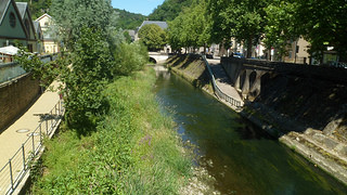
When we arrived at Carnac-Plage, the resort end of town, I learned that most of my fellow riders were more interested in the beach, than in the rows of rocks.  The town imbiber, of course, still wanted to go to Paris, but figured he’d make do with his own flat for the time being.  I took a quick look at the shore.

SAM_0209

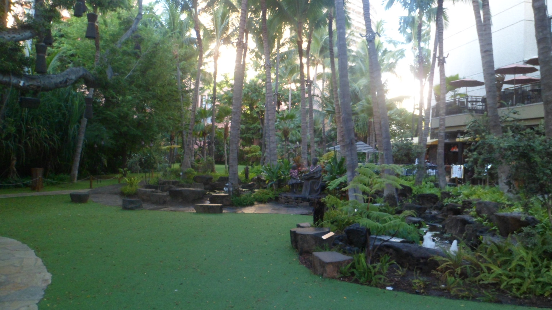
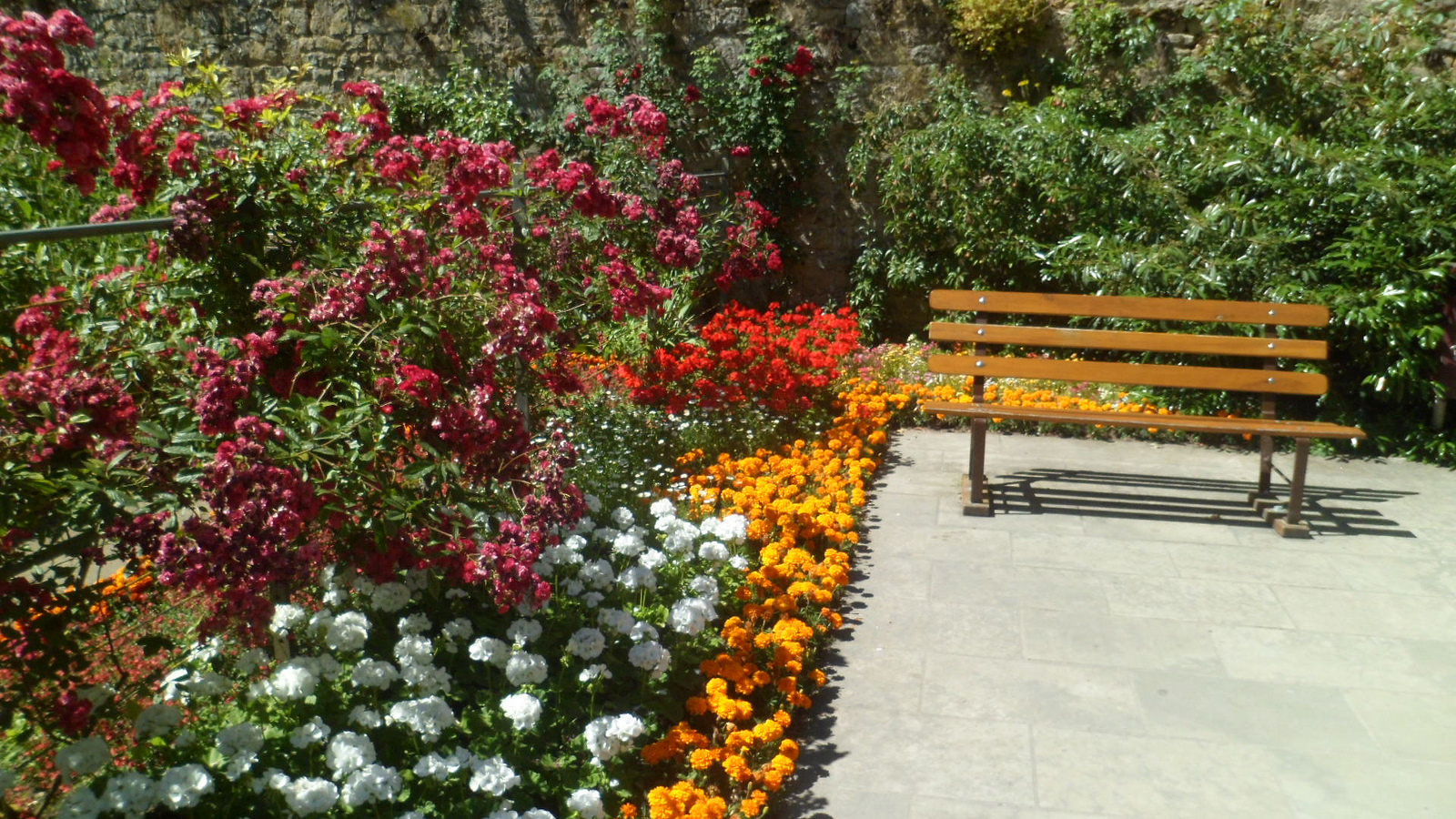
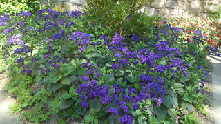
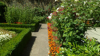
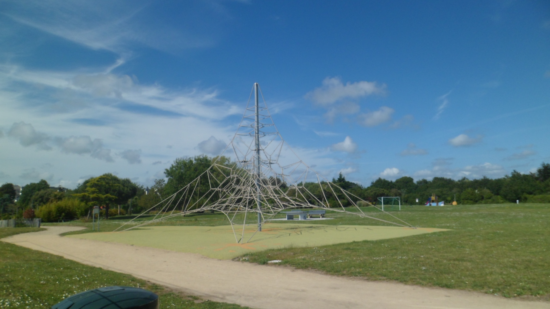
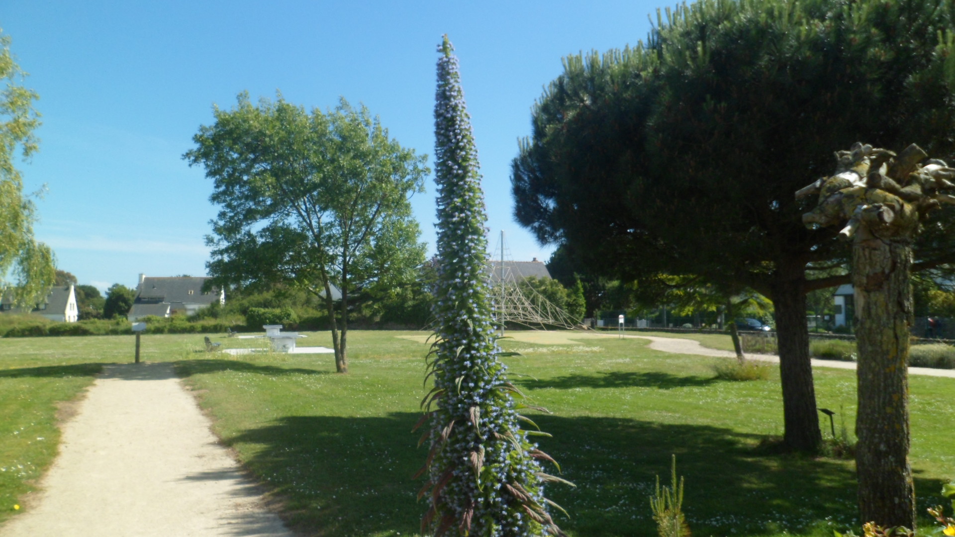
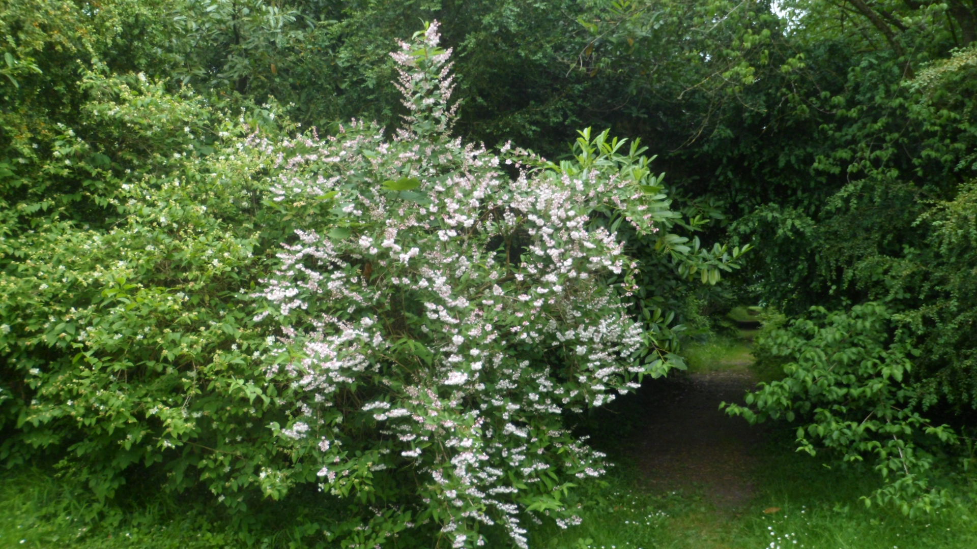
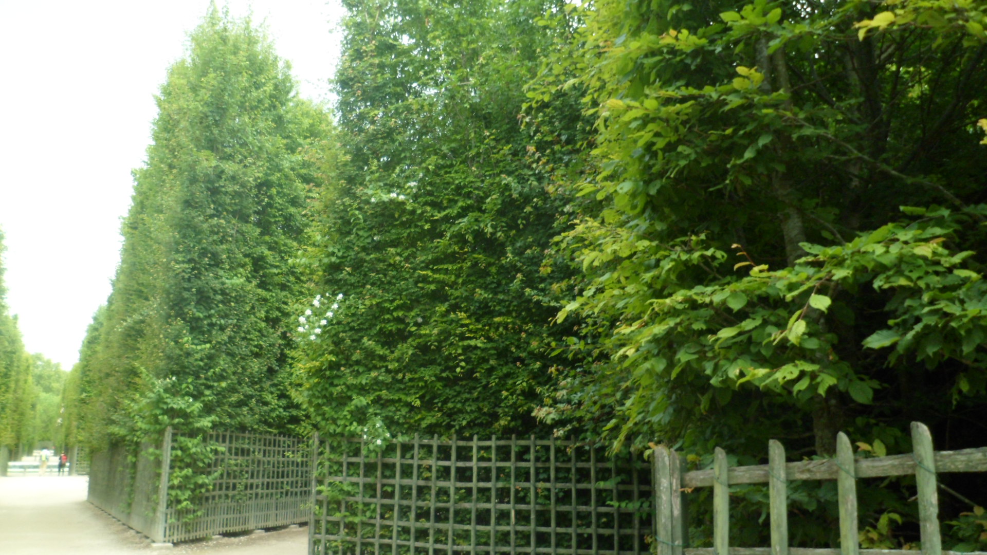
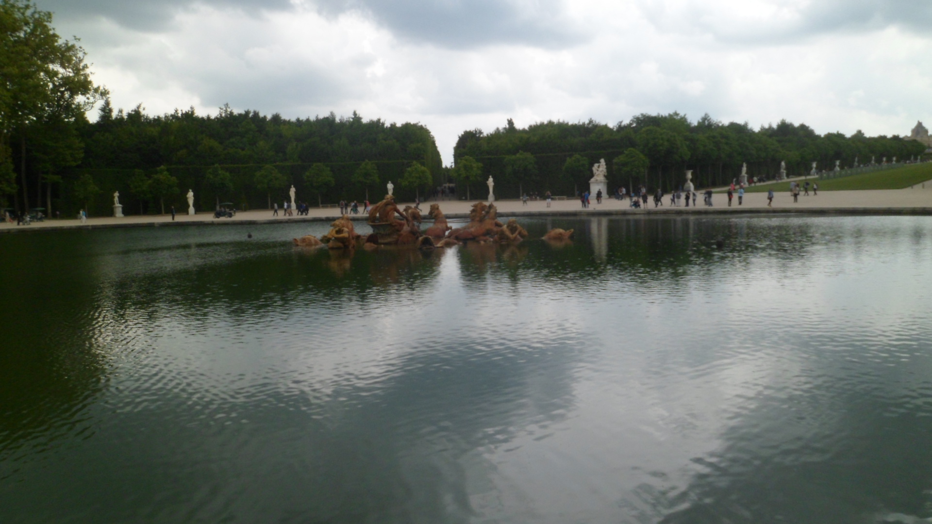
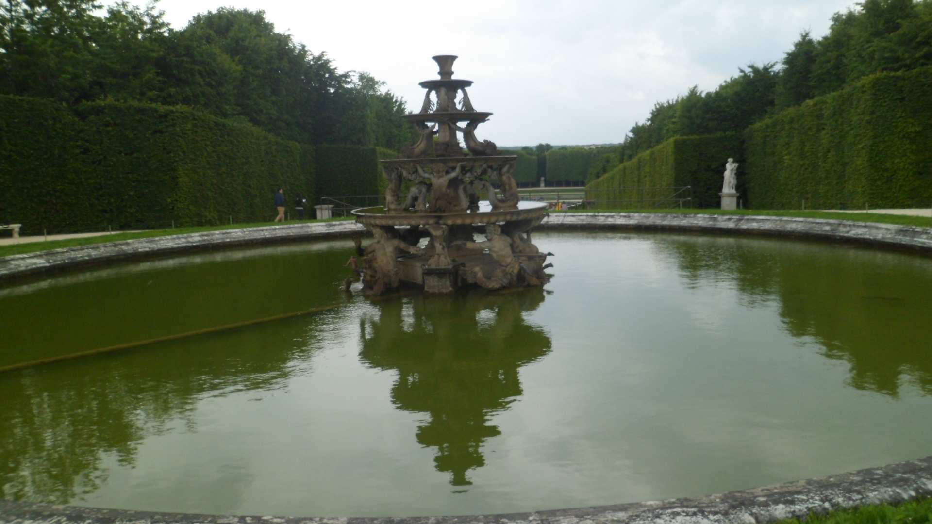
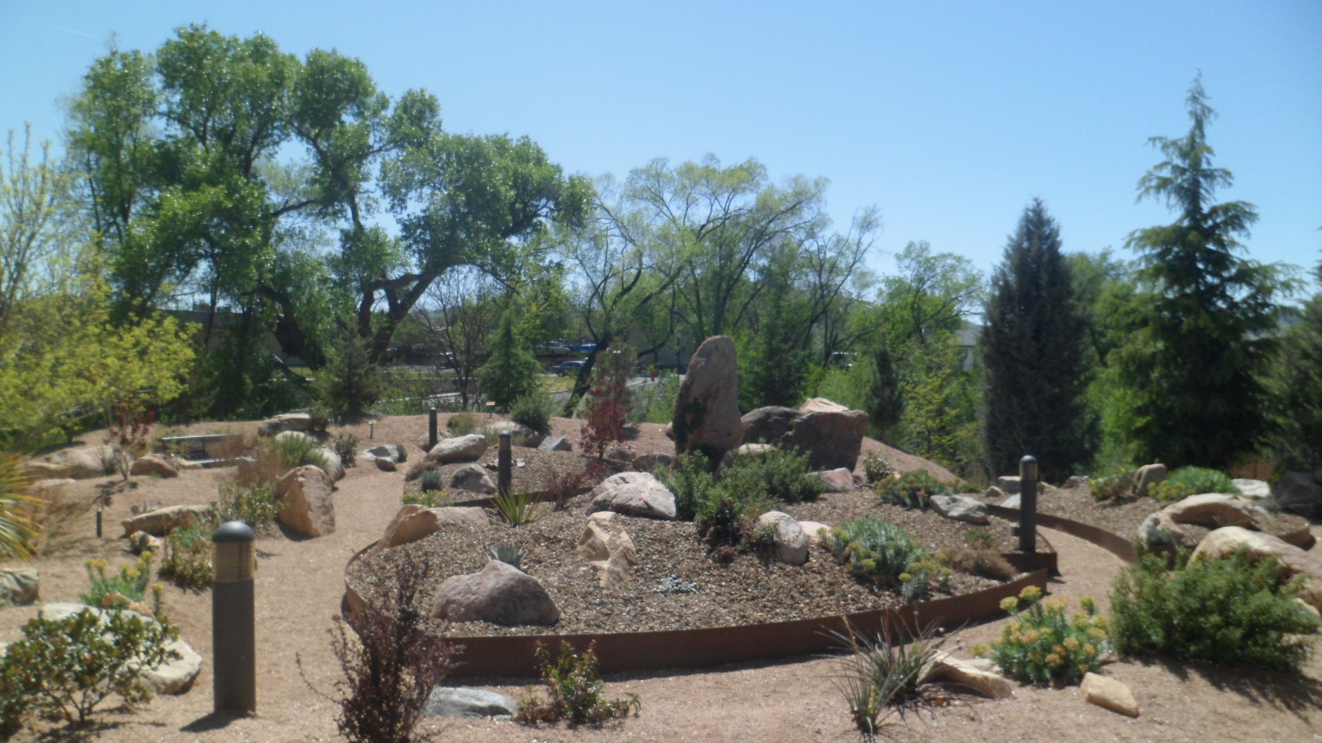
The modern gem of Carnac, though, is Jardin Cesarine.  The town park has an imaginative rope course.

SAM_0211

The garden itself held my attention, happily, for twenty minutes, or so.

SAM_0213

SAM_0217

SAM_0218

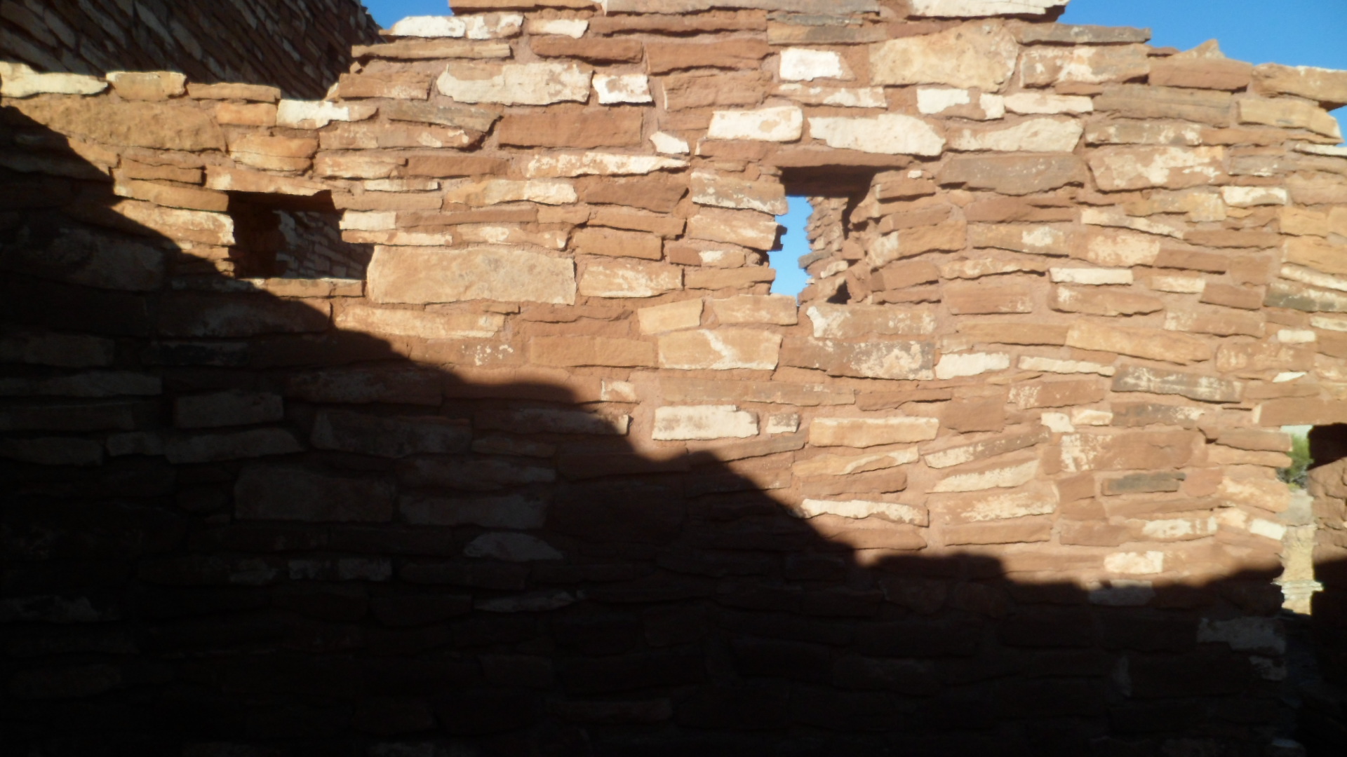
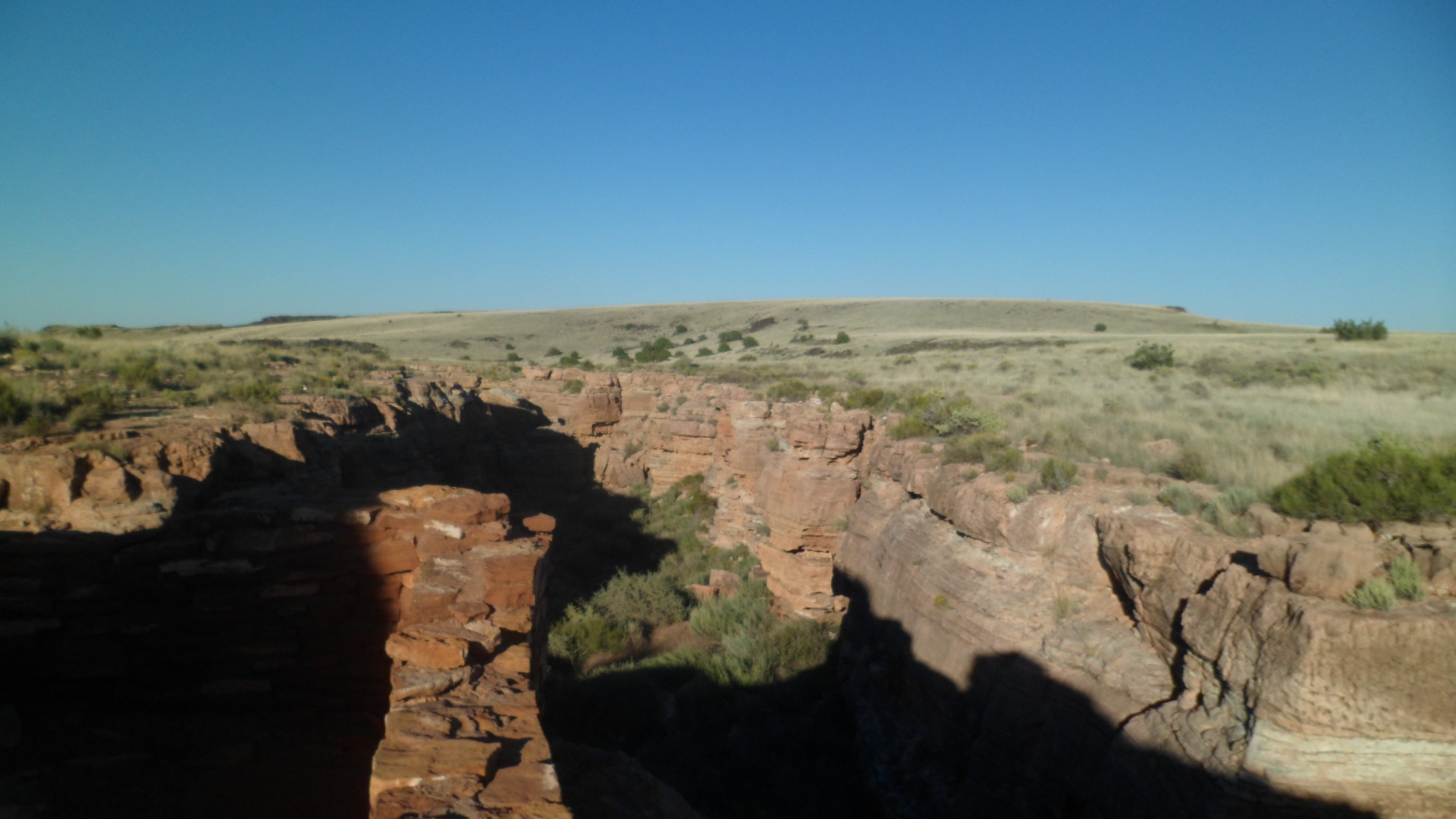
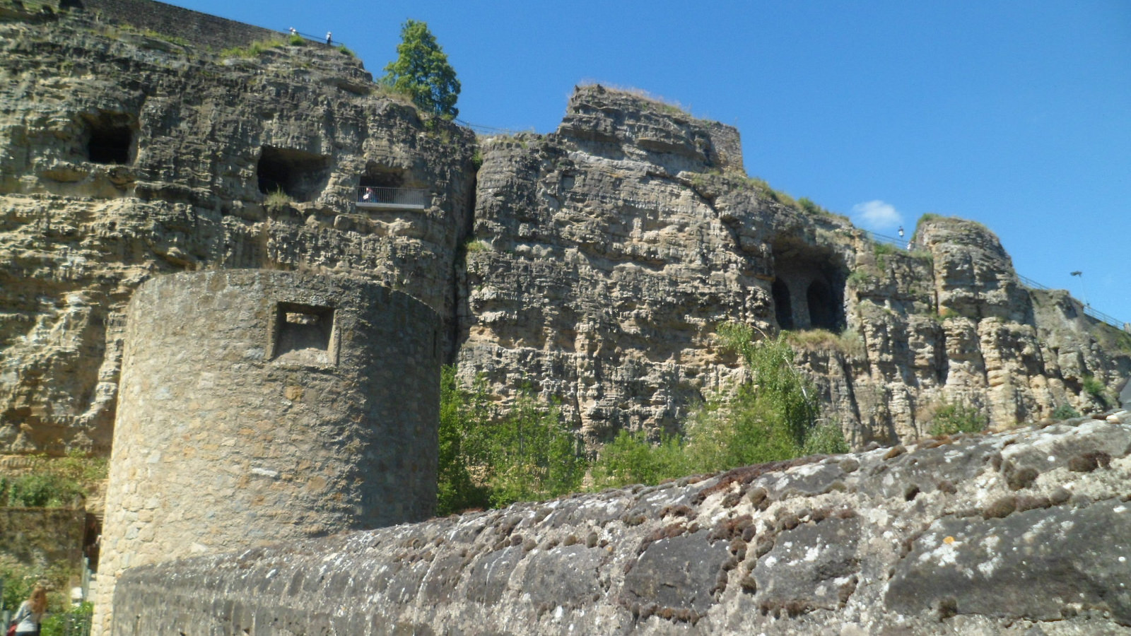
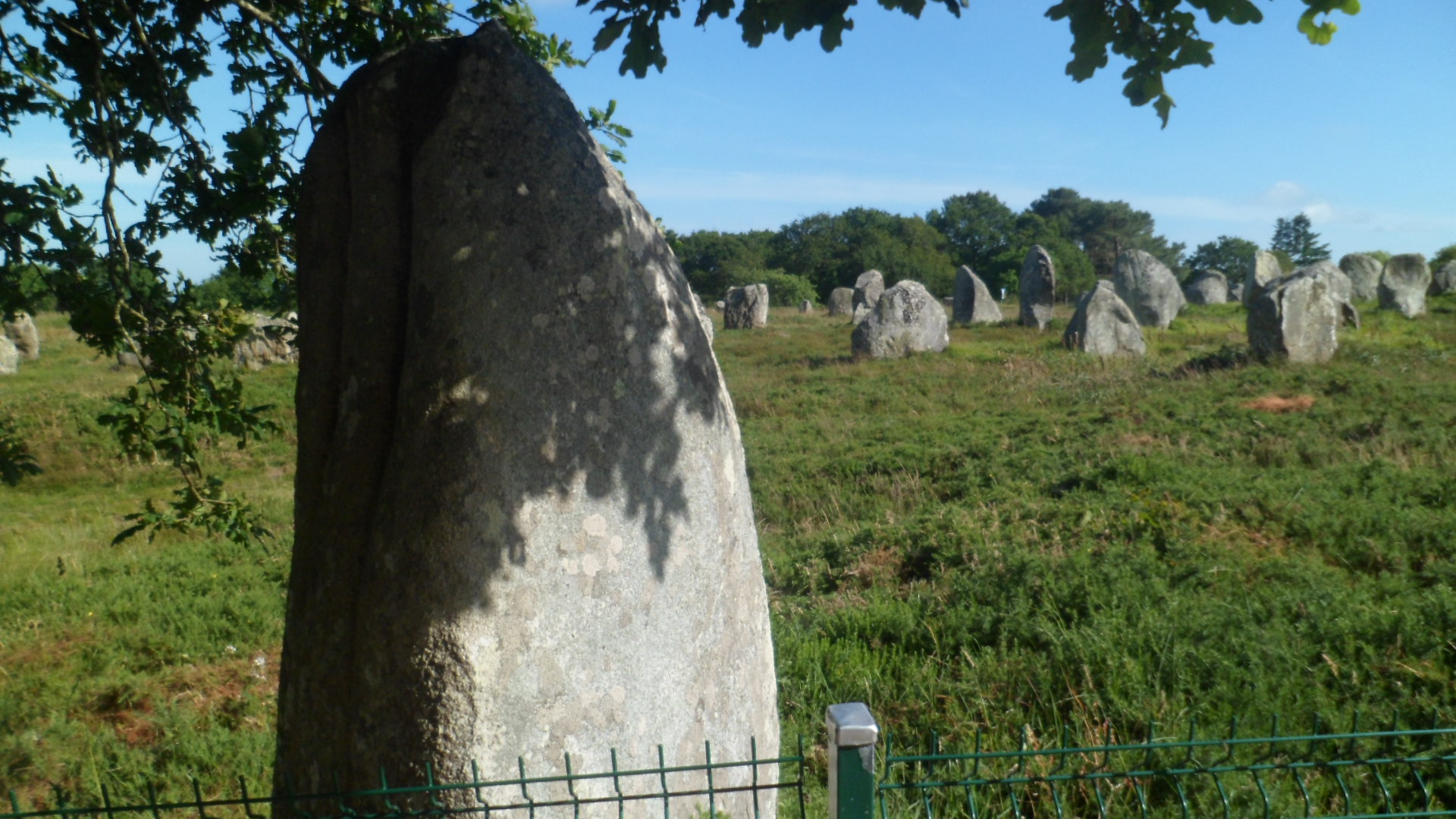
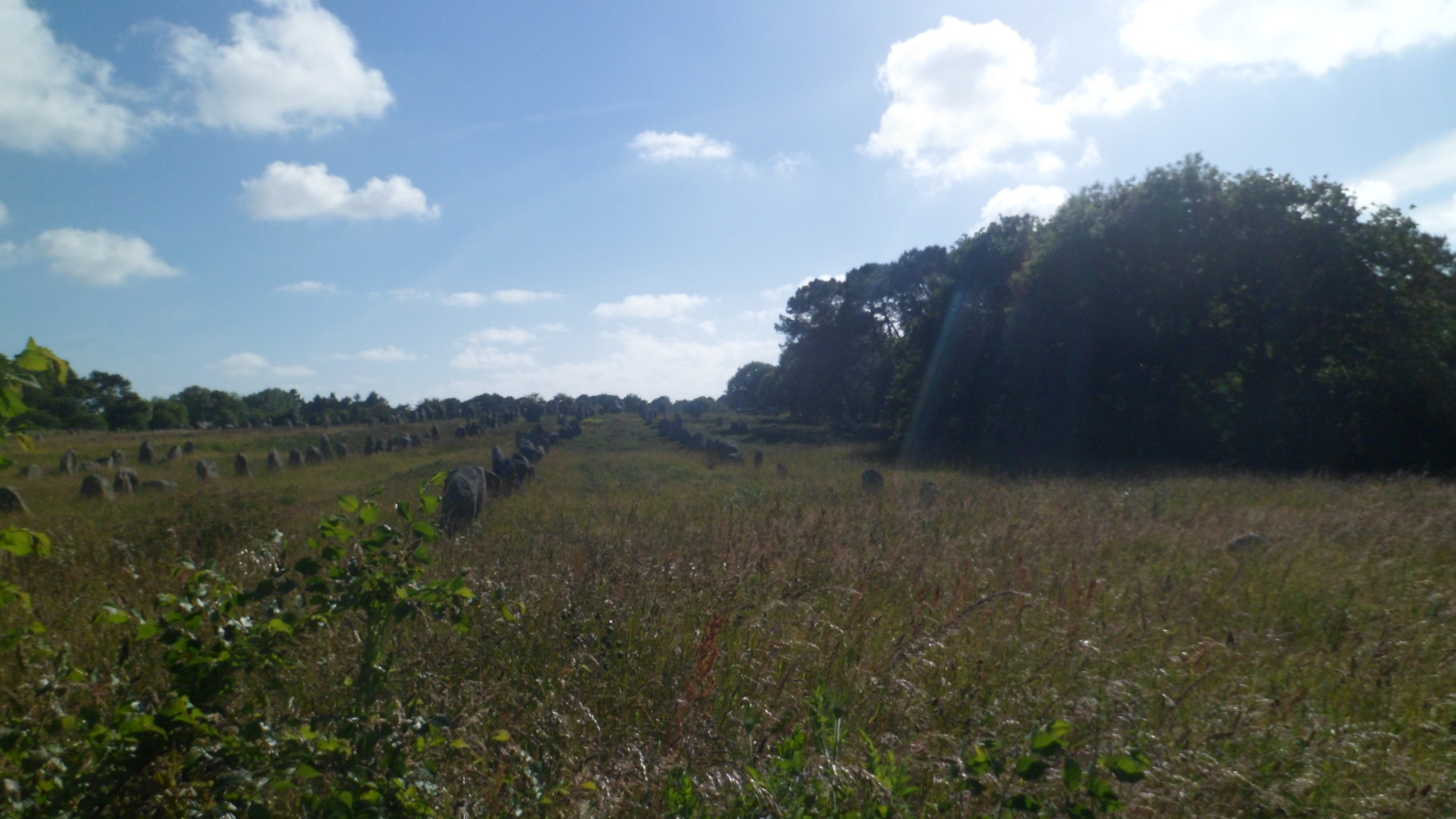
It was the Parc des Megaliths, which stayed in my head, and drew me in short order.  There are three large sections of the park:  Menec, Kemerio (House of the Dead) and Kerlescan, and a smaller area, Petit-Menec.

Here are some scenes of Menec, the western, and largest, segment of alignments, with a few single menehir (Stones that are partly buried), in between.

SAM_0224

SAM_0234

SAM_0237

SAM_0260

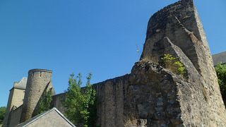
At this fence, and road, I left Menec and came to Kemerio- the House of the Dead.  To be sure, parts of this area looked like a cemetery, and it is here that the Merlin Theory got started.  There was a busload of Italian senior citizens with me, for part  of the time.  Their chatter was constant, but it was actually quite refreshing.  Looking at rows of stones for two hours does get a bit lonesome- unless one believes they are actually Roman soldiers.

SAM_0262

The farm house in the background is occupied, and there is a herd of Brittany sheep doing landscaping duty.  These sheep are a Heritage Food Source, so are prized by Slow Food France and other people concerned with the diversity of our diet.  I am a member of Slow Food USA, so the sheep captured my interest.

SAM_0269

SAM_0270

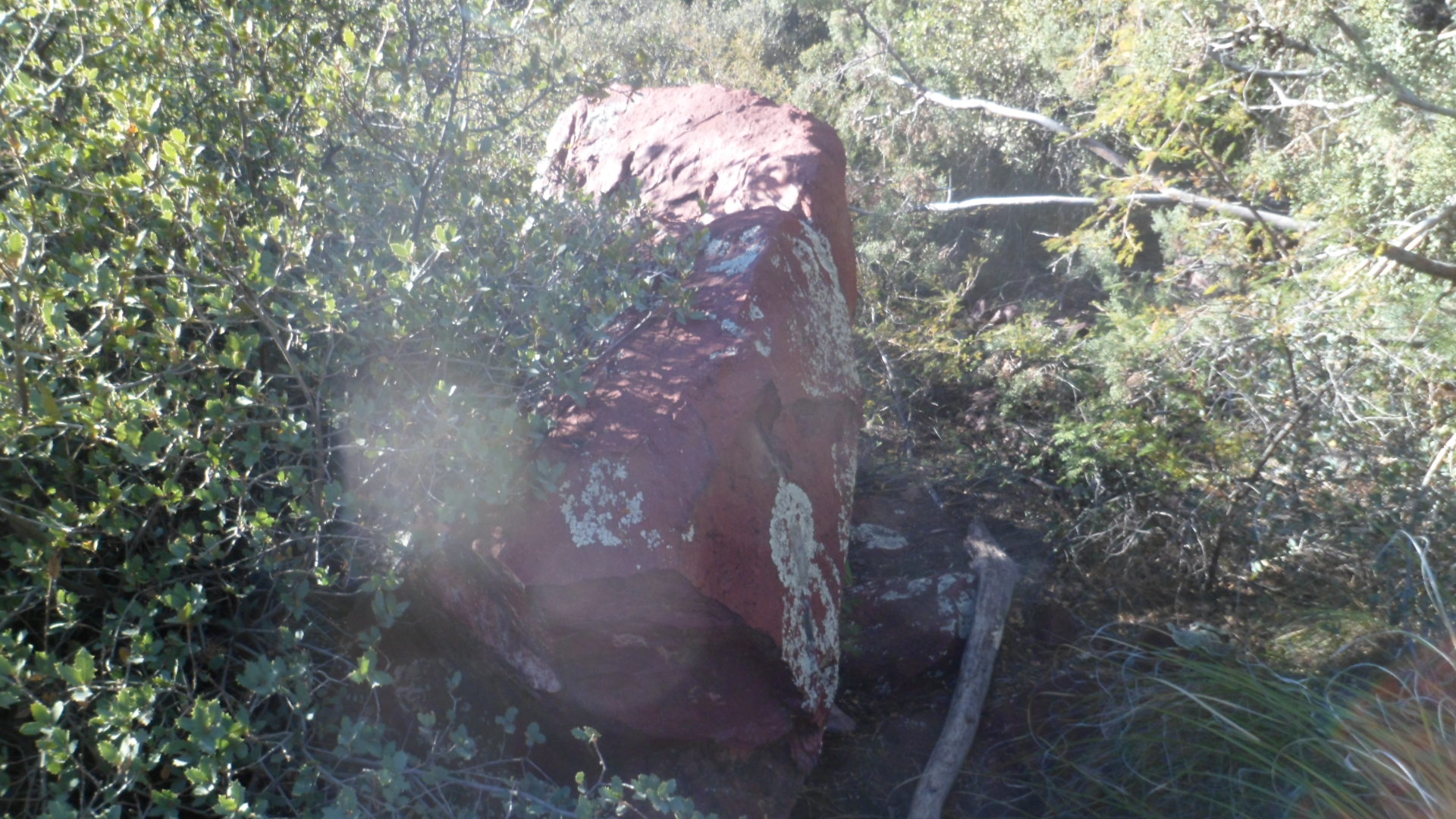
There were lonely menihir in this section, as in Menec.

SAM_0306

This horizontal piece looked like a beached whale.SAM_0320

This piece reminded me of the donkey at Block Island Petting Zoo, last year, who came up to the fence and couldn’t get enough food

.SAM_0328

The Kerlescan section is smaller than the other two main sections, and rounds out the park, at the east end.

SAM_0340

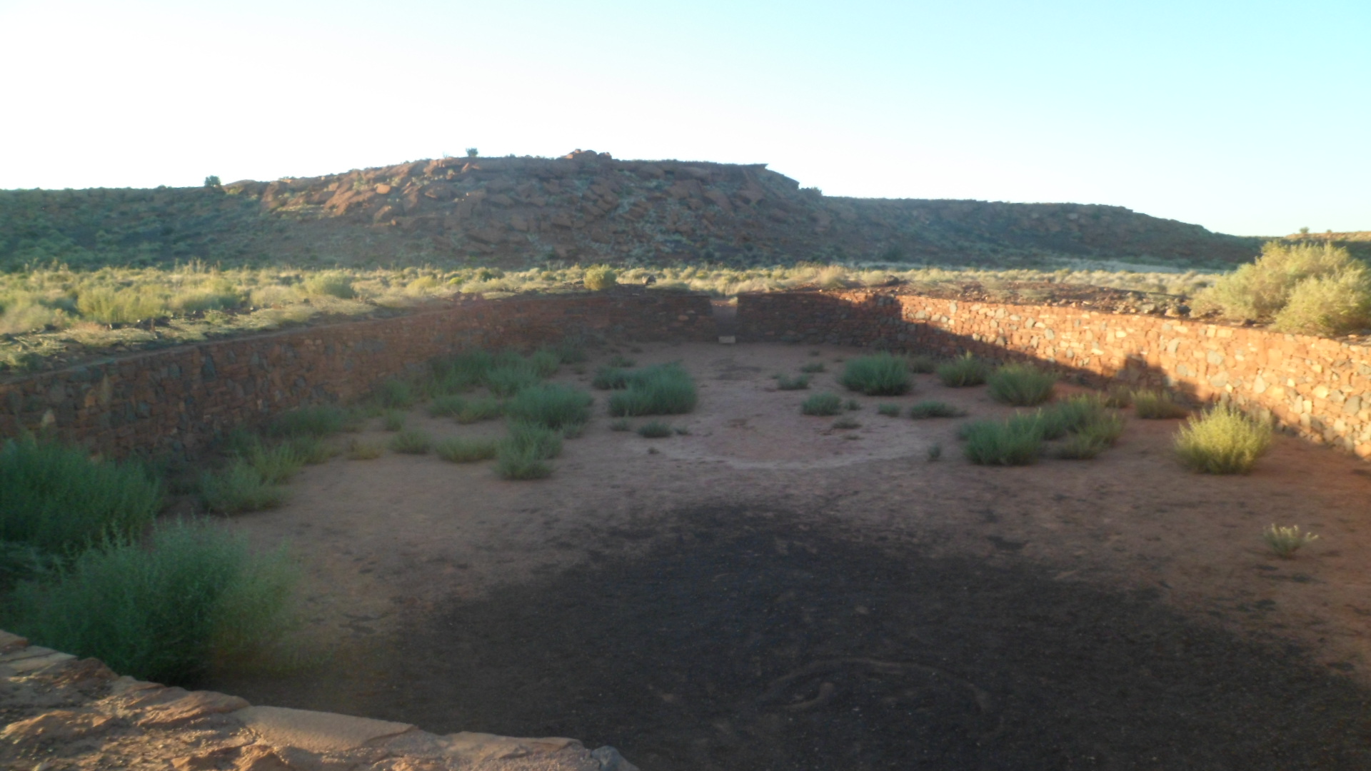
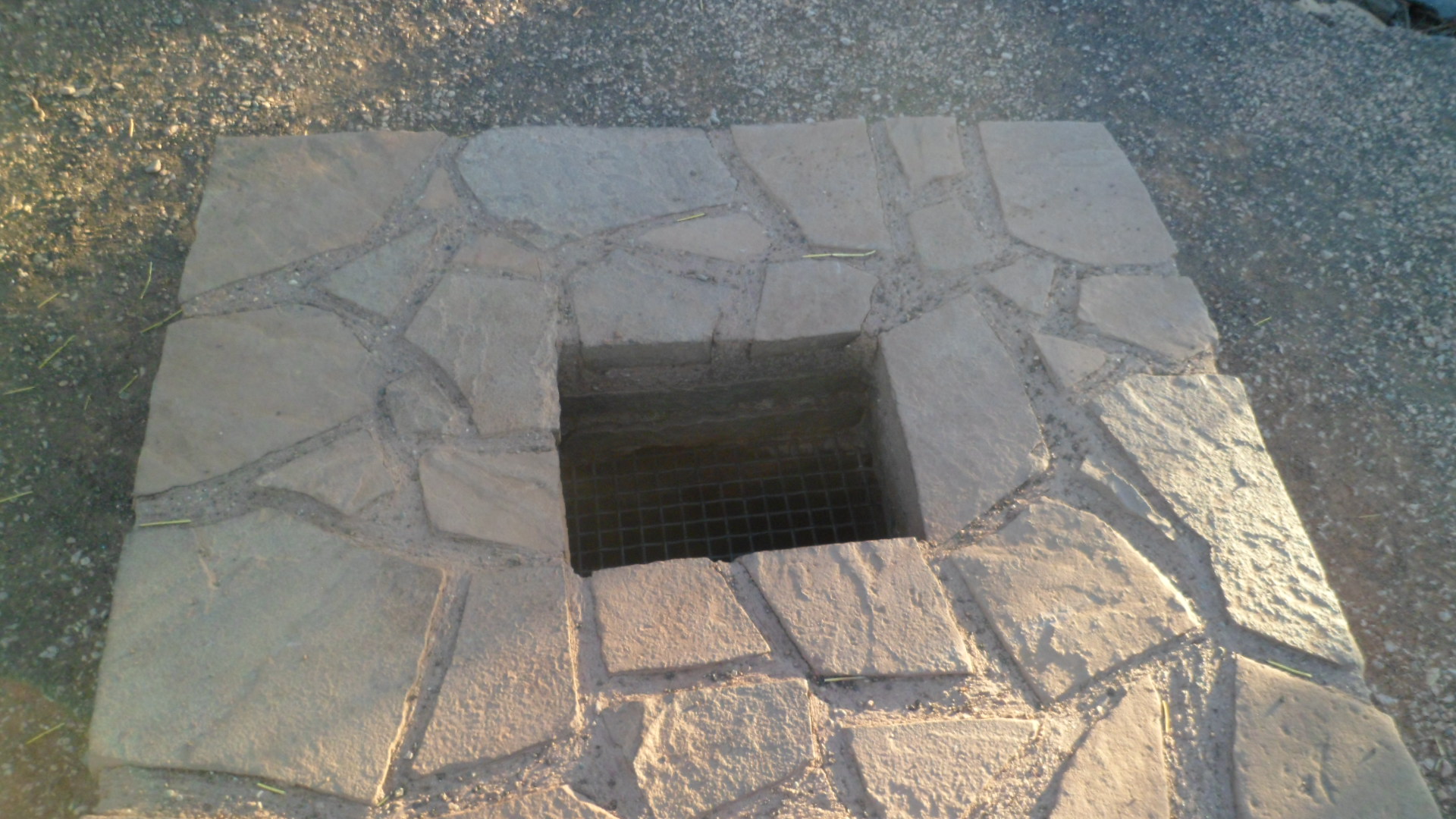
Kerlescan was also more of interest to local farmers, as a source of stone and water.  This abandoned cistern bears witness to their efforts.SAM_0349

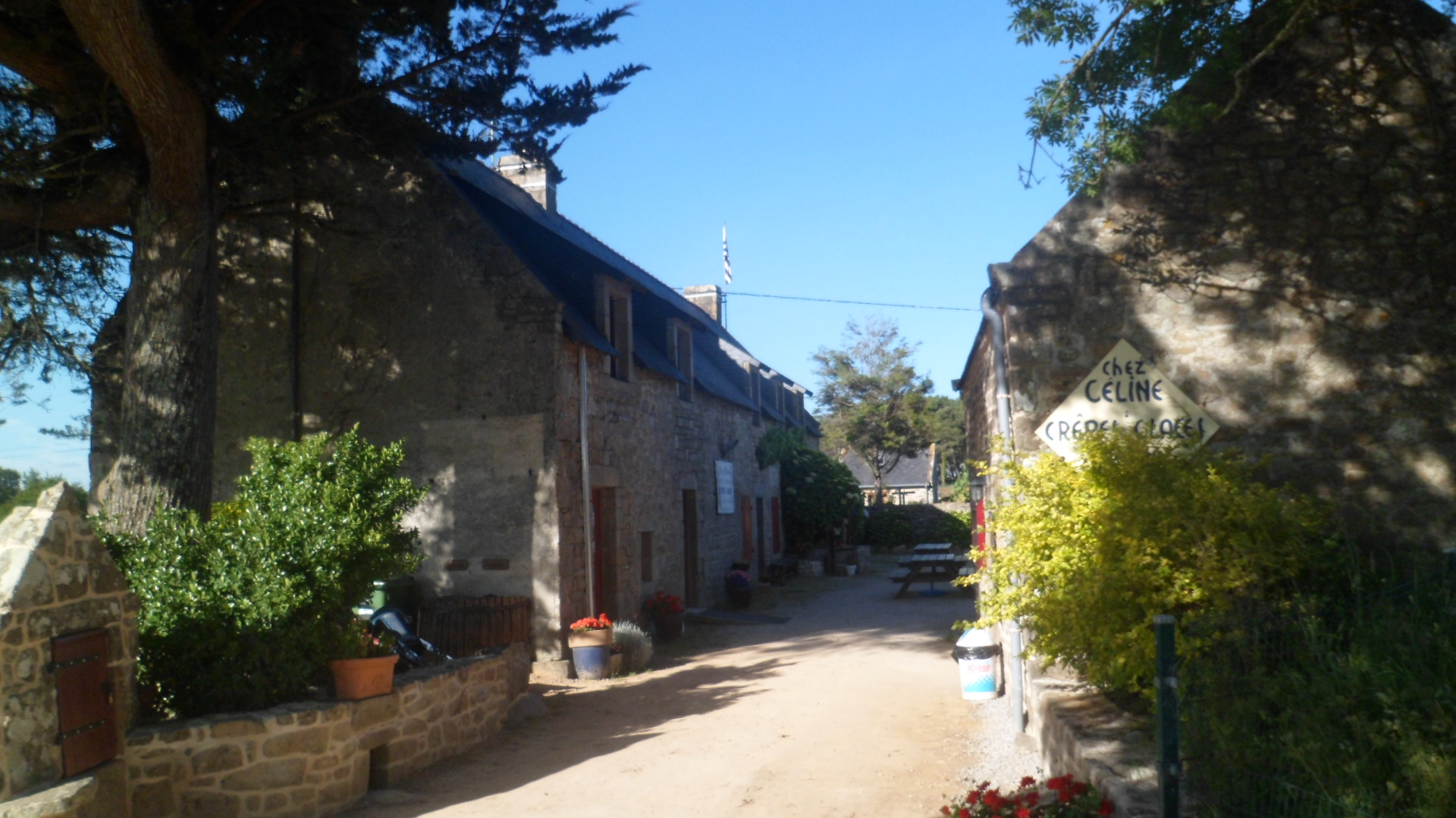
One enterprising pair of sisters is making a go of serving up fine food and beverages:  Chez Celine, where I enjoyed one very filling crepe- the only meal I would have on that evening. Since it was chocolate, with orange marmalade, who’s to complain?

SAM_0354

I was the only American who had been there in quite some time, so the ladies took to giggling to themselves, amusing me and a German gentleman who was enjoying a glass of wine.

Across the road from Chez Celine is Petit- Menec, the baby brother of the Big Three.

SAM_0352

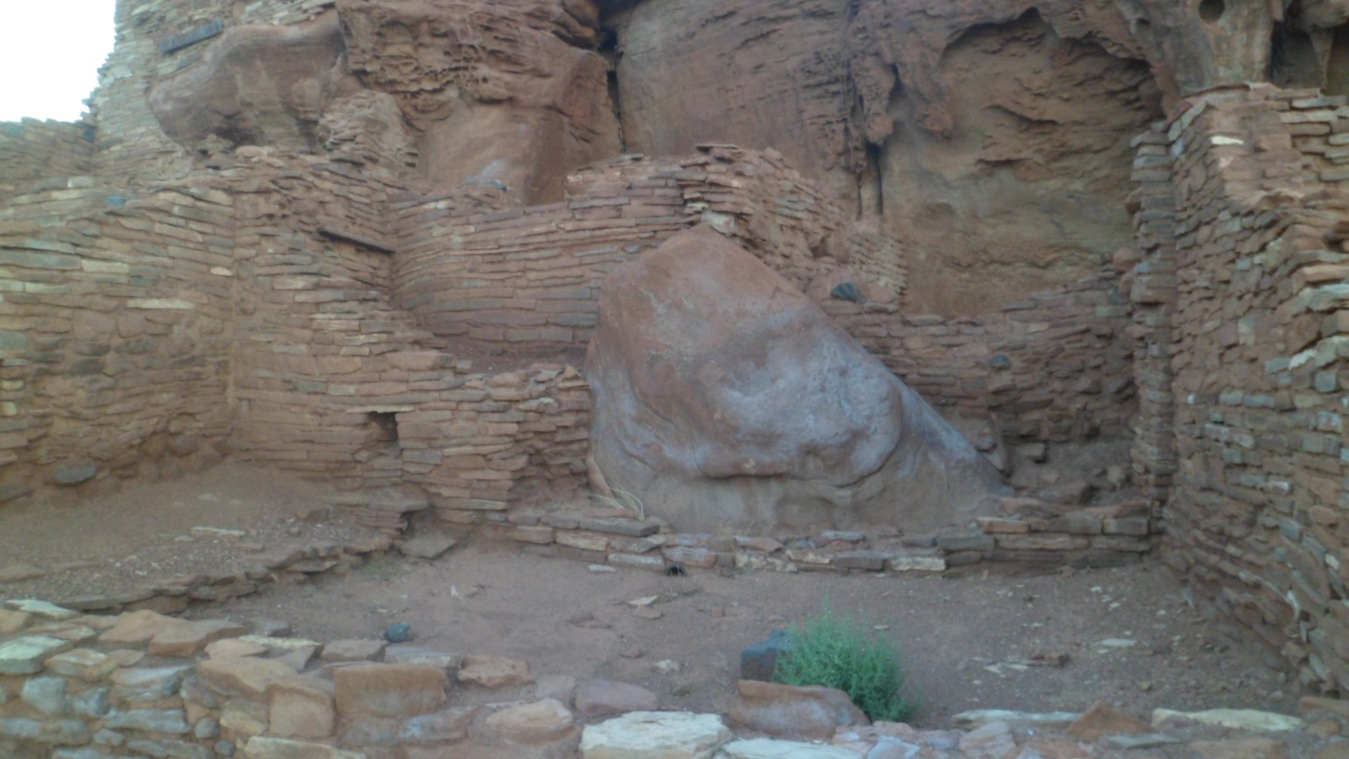
Crucino Dolmen was once a tomb, but acid in Brittany’s soil has worn away the bones.

SAM_0357

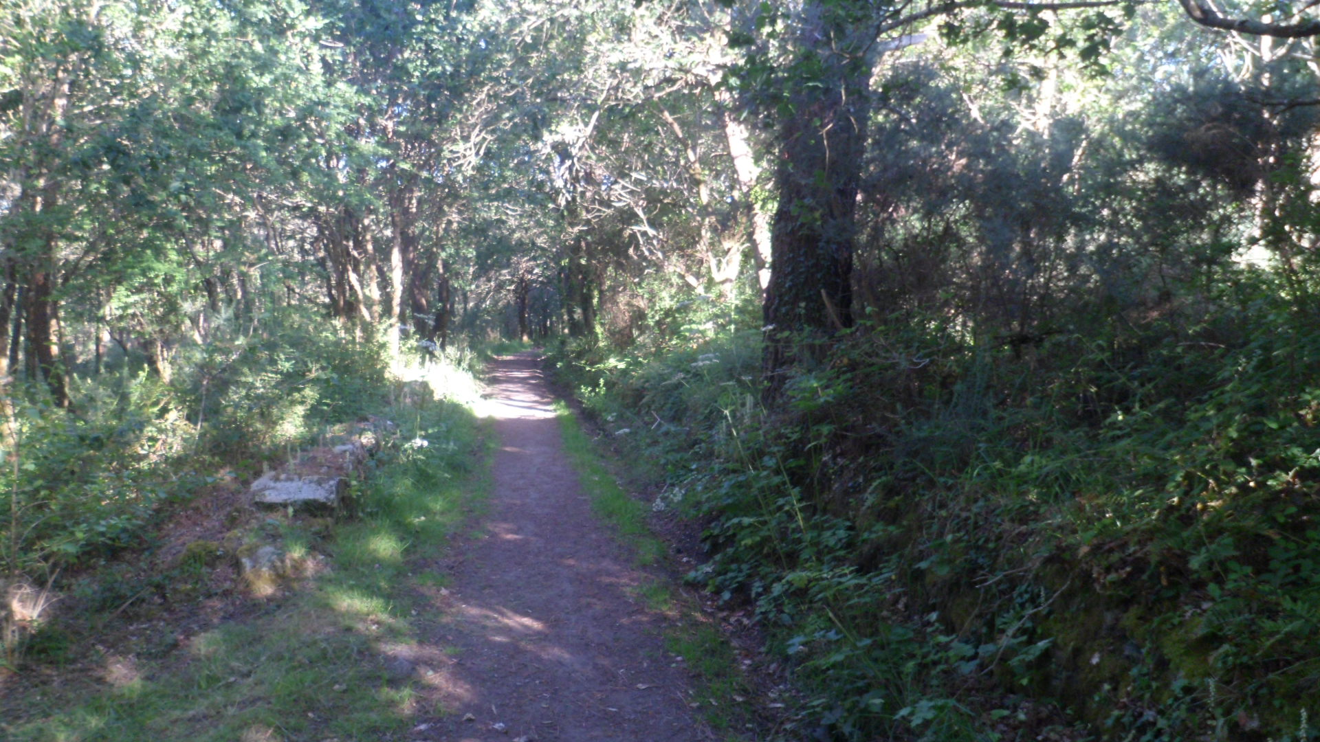
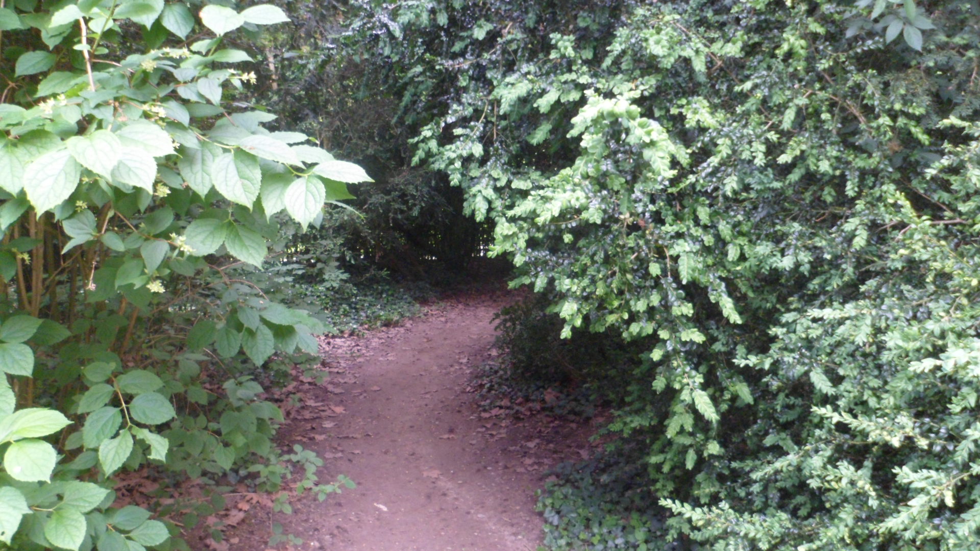
To the east of the Dolmen, I entered Bois Saint-Michel, a hiking trail which a honeymooning couple had taken, an hour or so earlier.  It would lead me back to Carnac-Plage.

SAM_0358

There are two landmarks associated with St. Michael (the man, not the Archangel), on this path.  First, I came upon his fountain.

SAM_0361

The tomb of this French patron saint is at the northern edge of Carnac-Ville.

SAM_0365

I saw a similarity between the tumulus, and Mont St. Michel.

The “cone” turned out to be Chapel St. Yves.

SAM_0367

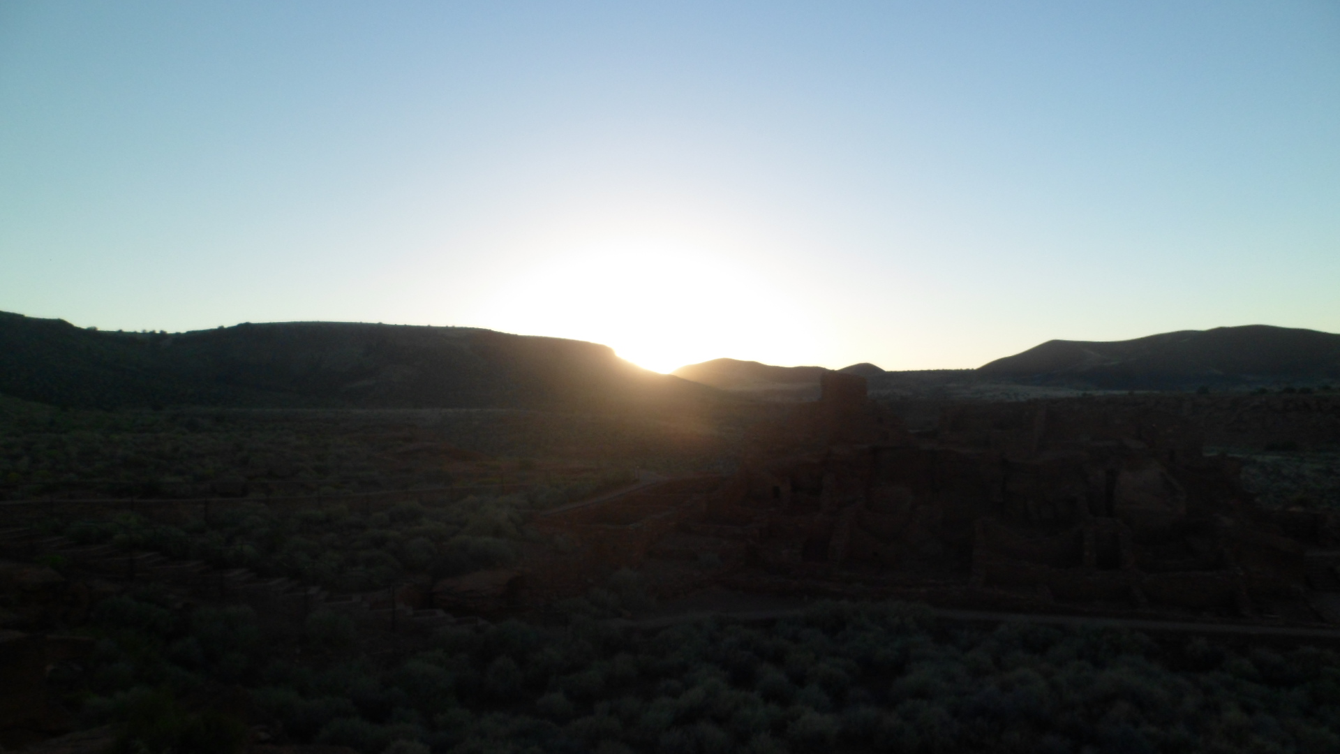
It was late, but still light, so I was fooled a bit.  My arrival back in town left only one mode of transport available.  A kind boulangere called the first taxi, which got me to Auray. After I used the ATM,  a gentleman on business in Auray called the second one, which brought me to Place Verlanne, from which I was able to use my legs to get to the hotel.  All’s fair in love, war and an extended evening at a remote place of interest.  Carnac shows that we indeed come from highly intelligent, imaginative stock.

An Eastward Homage, Day 8: Versailles, Part 2- The Grand Gardens

13

Everyone needs a place in nature, where one may recover one’s senses and restore equilibrium.  The Bourbon royalty were no different from the rest of us, in that regard.  After taking in the Great Chateau, and all its opulence, I also needed some time in nature.

So, here are some scenes of the King’s Grove, the Queen’s Grove, the Dauphin’s Grove, and bosques set aside for just about anyone who lived at the Chateau.  Just outside the Chateau, there are small, well-manicured gardens and a great fountain, en route to the Ballustrade which itself overlooks Les Bois Royaux.

SAM_9254   SAM_9255.

Here is a long view of Allee Royale:

SAM_9262

Once I made my way down the stairs, and into the King’s and Dauphin’s Groves, I found myself in the company of several school children, engaged in a fabulous game of Hide  and Seek, in the Dauphin’s Labyrinth.  To me, one of the great tragedies of the French Revolution was that no one gave thought to the three children of Louis and Marie Antoinette.  They died in childhood, in prisons, and the Labyrinth sat silent.  Thankfully, it was not silent on Tuesday, June 3.

.

SAM_9264      SAM_9269

Those who ventured forth saw scenes such as these:

SAM_9271    SAM_9273

SAM_9270     SAM_9265

SAM_9268     SAM_9302

Eventually, I made my way back to more manicured scenes, near the Queen’s Grove, and the restoration area- not the Restoration of the Bourbons, but that of the forest.

SAM_9283   SAM_9292

SAM_9291   SAM_9285

I walked on down to the Grand Canal’s edge, and enjoyed Les Parterres, L’Orangerie, and their water-borne sculptures, including  the Apollo  Fountain,

SAM_9304

and Bassin de Latone (Latona Fountain).

SAM_9305

Here is a final nod to the man who got this all started.

SAM_9306

At this point of decision, I elected to forego Les Trianons (Marie Antoinette’s private estate) and spend some time in the city of Versailles.  That marvelous counterpart to the Palace will be featured next.

Trailheads and Paths, Issue 16: Sculpture Garden and An Old Fort

9

Last Thursday was an exquisitely beautiful day, and I sensed it would be not good for my spirit to just sit inside and ruminate.  There was one walking path I had not established as yet- a pedestrian route to Yavapai College and the VA Hospital.  So, there was my Thursday afternoon plan!

The “single-step” in this jaunt was a walk along North Arizona Avenue, past the Arizona Softball Hall of Fame, and the Smoki Museum, which has, as its mission, the preservation of Native American culture.  As such, the buildings are constructed of native stone, with extended beams, in the Pueblo style of construction.

SAM_8571

SAM_8569

The first photo is of the Smoki; the second, of the Hall of Fame.

I crossed Sheldon Street a few minutes later, and entered the Yavapai College Sculpture Garden.  The community college has grown mightily over the past several years, but the Garden remains a focal point for meditation and serenity.

SAM_8574

Here is “Community Gothic”, by Richard Marcusen.

SAM_8575

SAM_8576

Water is a key element in the garden’s central piece, “The Gathering”, by Gary Slater.

SAM_8581

Alternative energy gets a pitch here, with these avant-garde windmills.

SAM_8580

The north side of the college Library has been tapped for this interesting panel.

SAM_8583

Across the dry creek bed, the roof tops of old Fort Whipple peek out.

SAM_8585

Having reached the northern edge of the College grounds, I continued on into Rough Rider Park, where there is a short bike and hike trail, leading to the grounds of Prescott Veterans Administration Hospital.  This is a good trail for me, as I visit the patients of the Community Living Center there, once a month.  Now, I won’t need to drive there every time.

On the way, an old rail bridge caught my eye, at the edge of Prescott-Yavapai Indian Reservation.

SAM_8586

An extra feature of the Hospital is the preservation of Fort Whipple, an old Army post of Prescott’s formative years.  I first went in the Museum, which is open Thursday, Friday and Saturday, from 10-4.

SAM_8588

Below, is the chair used by General George Crook, one of the more successful commanders at maintaining a semblance of peace in the Southwest, during the period of unrest among the Apache.

SAM_8591

After looking about the museum for about an hour, I walked past the preserved old barracks.  The row of old houses, some still occupied by VA workers, cries out for restoration.

SAM_8593

SAM_8596

Having come full circle, I walked back to Yavapai College, which along with some parts of the Yavapai Reservation, and Rough Rider Park, was taken from land occupied by Fort Whipple.  The trailhead to Rough Rider greeted me, as I walked through the gate.

SAM_8599

So, knowing three or four more spots to walk and meditate on a slow day- or a rough one, I am that much more settled into my near-downtown neighbourhood.